 COUNTYCOUNTY
|
|
||||||||
| EXISTING STATIONS | ||||||||
|---|---|---|---|---|---|---|---|---|
| Station Name |
Original Railroad | Current Location |
Type | Date Built |
Current Use |
Track Status |
Building Material |
More Info |
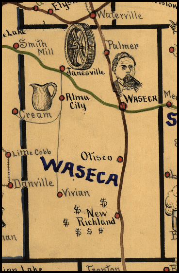
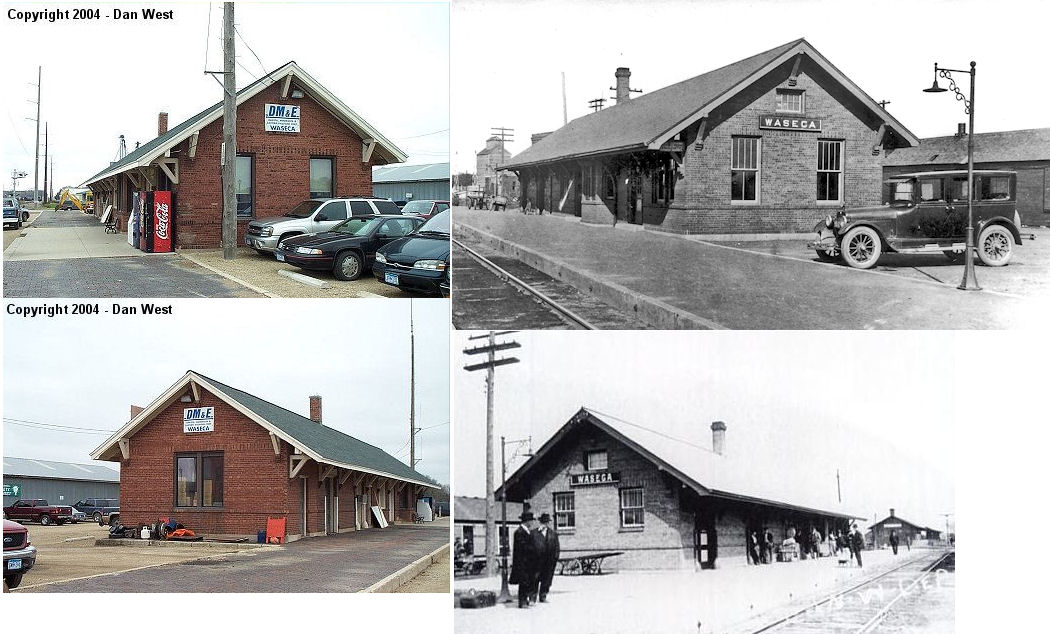
| waseca |
 |
308 South State Street (GPS: 44.075966, -93.508130) |
C | 1912 | Railroad | In Use | Brick | |
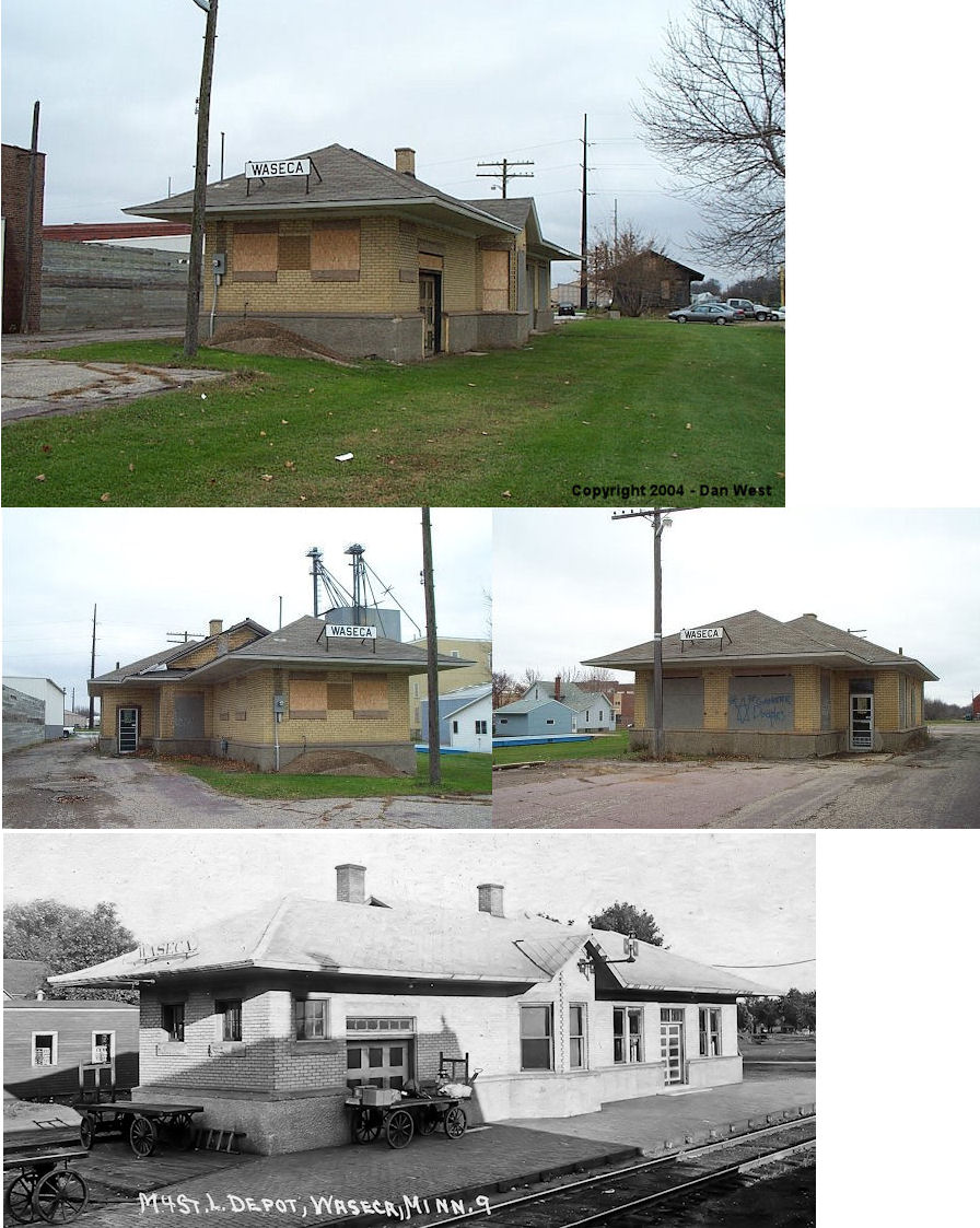
| waseca |
 |
South side of Elm Avenue (Old US-14) between 2nd and 4th
Streets SW (GPS: 44.077185, -93.510290) |
C | 1912 | Vacant | Gone | Brick | |
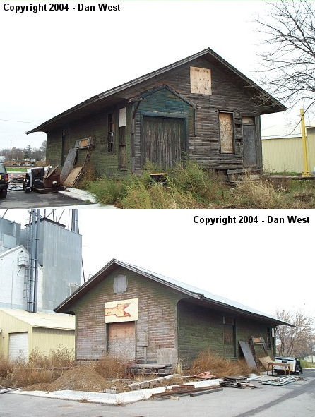
| waseca |
|
2nd Avenue SW, just south of the passenger station. (GPS: 44.076597, -93.510364) |
F | ???? | Storage | Gone | Wood |
|
| STATIONS OF THE PAST | ||||||||
| Station Name |
Original Railroad |
Notes | ||||||
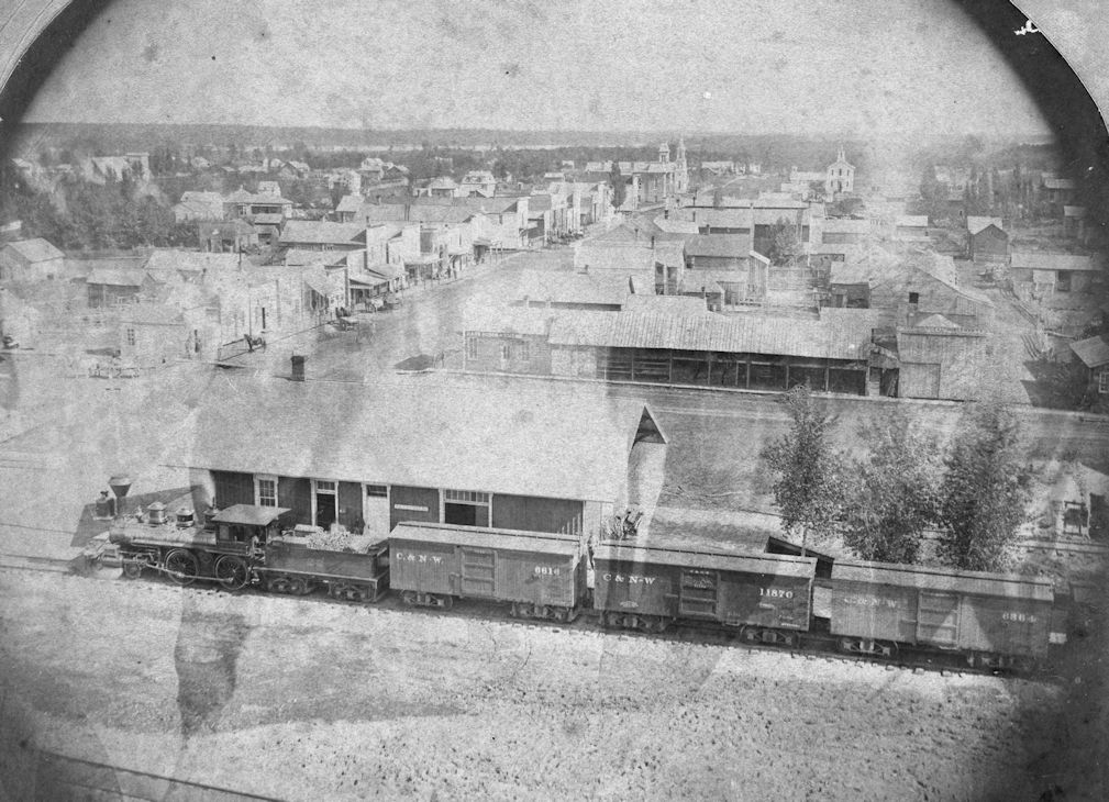
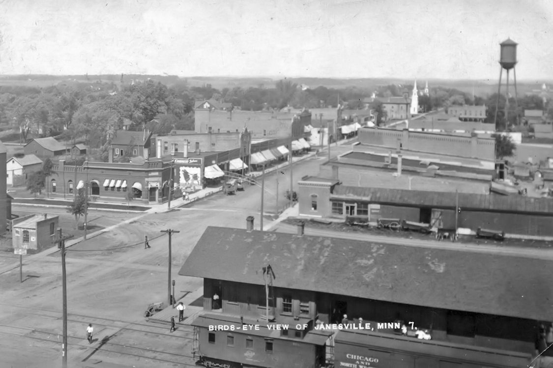
| Janesville (Empire) |
|
This was the first station on the east side of Main Street. | ||||||
| janesville |
|
This was the second station at the same location as the station listed above. | ||||||
| Maplewood Park |
|
There was a spur off the mainline that ran north to Maplewood Park on Clear Lake. | ||||||
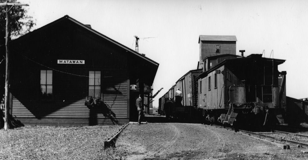
| Matawan |
 |
|||||||
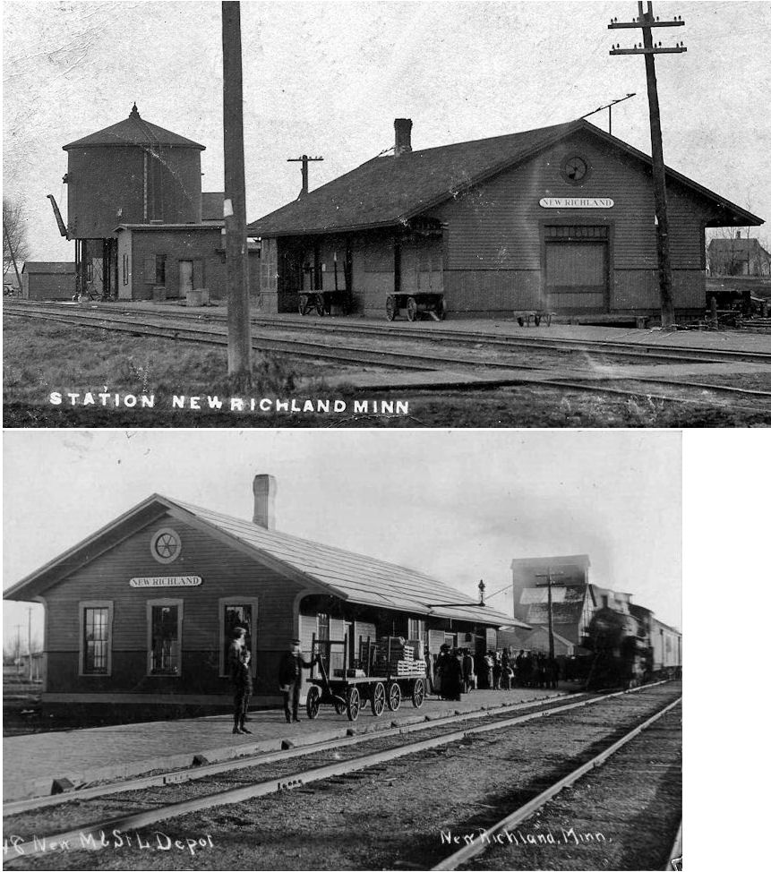
| New Richland |
|
This station was on the north side of 1st Street NW (Formerly Welles Street). | ||||||
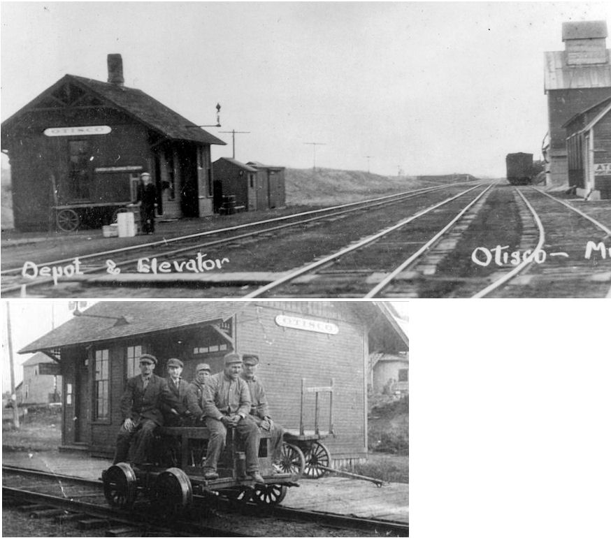
| Otisco |
|
This station was on the south side of 290th Avenue, on the east side of the tracks. | ||||||
| Palmer |
|
This station was on the south side of CR-22 (410th Street) at the extreme SE corner of town. This town is now essentially gone. | ||||||
| Ross (Ross Siding) |
|
|||||||
| Smith Mill |
|
The station and old post office were either in the same building or right next to each other (according to the 1937 map). | ||||||
| Waldorf |
|
This station was on the west side of Main Street, on the SW side of the tracks. | ||||||
| Waseca |
AND |
There was a union depot here that sat in the NE corner of the diamond where the two RRs crossed between 2nd and 4th Streets at GPS: 44.076327, -93.510302. The station burned down on February 26, 1912 and the railroads then constructed separate stations (both still standing). By the time it burned, the station was dilapidated and considered a "rattletrap" by the citizens of Waseca who celebrated its demise (The Albert Lea Tribune 2-27-1912). | ||||||
| Waseca |
|
There was a freight station here that was built in 1895. It was on the west side of 2nd Street at GPS: 44.076079, -93.509094. There was a slightly smaller freight station on the same site before that (shown on the 1884 map). | ||||||
| 1898 WASECA COUNTY RAILROAD MAP | ||||||||
 |
||||||||
|
Notes About Existing Stations... Waseca (M&St.L Freight) - This freight station is shown on Sanborn maps as early as 1884. This station has been moved twice. It originall was on the east side of the tracks around where the passenger station is. It was moved across the tracks and to the north at bit when the passenger station was built. It was on the west side of the tracks on the south side of Old U.S. 14 at GPS: 44.077416, -93.510658. At some point the station was then moved south of its original location and back to the east side of the tracks (where it sits today). |
||||||||