|
|
||||||||
| EXISTING STATIONS | ||||||||
|---|---|---|---|---|---|---|---|---|
| Station Name |
Original Railroad |
Current Location |
Type | Current Use |
Date Built |
Track Status |
Building Material |
More Info |
| Dushore |  |
Railroad Street (GPS: 41.527377, -76.398262) |
C | Museum | 1871 | Gone | Wood | |
| Sonestown |
 AND EAGLES MERE RR |
42 Pecks Road (GPS: 41.352173, -76.552702) |
C | Private | 1892 | Gone | Wood | |
| Nordmont |
|
28 Cox Road (N. of Nordmont Road/ Elklick Run Road intersection) (GPS: 41.380315, -76.475081) |
C | Private | 1894 | Gone | Wood |
|
| STATIONS OF THE PAST | ||||||||
| Station Name |
Original Railroad |
Notes | ||||||
| Bernice | |
Also known as Birch Creek at some point during its history. The station was moved about 1/4 mile from its original location in 1910 (Republican News Item, 12-16-1910). The station closed in 1954 and burned down in October 1955.. | ||||||
| Eagles Mere |
EAGLES MERE RR |
This was the original Eagles Mere RR station that served from 1892 until the W&NB merger in 1902. It was on the NW side of Lakewood Avenue in the vicinity of GPS: 41.411141, -76.575932. |
||||||
| Eagles Mere |
|
The 1902 station was on the north side of Eagles Mere Avenue (PA42) in the vicinity of GPS: 41.409985, -76.574923. When the EMRR line was extended in 1902 to what is now Eagles Mere Park at the north end of the lake, the RR would have needed to build a bridge over the water from the original depot site. Instead, the RR moved the depot site and the track to the other side of the pond where no bridge was needed. The WNBRR was abandoned in 1938. | ||||||
| Ganoga Lake |
|
This station was west of present day Rickets Glen State Park at na elevation of 1900+ ft. Station was built of logs and mill work by Trexler and Turrell Lumber company sometime around 1892-3. This was on the Ganoga Lake Branch of the LV. | ||||||
| Laporte (Lake Mokoma) |
|
This was the original station. It was built in 1893 (Sullivan Republican, 10-13-1893). It was near the Lake Mokoma Beach House in the vicinity of GPS: 41.420632, -76.487852. However, the beach house has moved over the years, so it may have been more to the south of this location. In 1894 the station or the platform (it's not clear in the article) was enlarged to better accomodate freight (Sullivan Republican 10-26-1894). This was the main station for the town of Laporte. | ||||||
| Laporte (Tannery) |
|
This station serviced the Laporte Tannery and was primarily a freight station. It was north of town off of US-220 near Cole Road in the vicinity of GPS: 41.431498, -76.489424. There is an old section house near there that has been restored. | ||||||
| Lopez (Stroud) |
|
|||||||
| Mildred | |
|||||||
| Muncy Valley |
|
|||||||
| Newell | |
May have also been called Cabin Run and Worth earlier. | ||||||
| Nordmont | |
The original station here was a passenger coach. It was replaced by the new station which was completed in early 1894 (Sullivan Republican, 1-5-1894). | ||||||
| Ricketts | |
May have been called "Lee Road Station" previously. Ricketts was right on the Sullivan/Wyoming county line; it's not clear which county the station was in. | ||||||
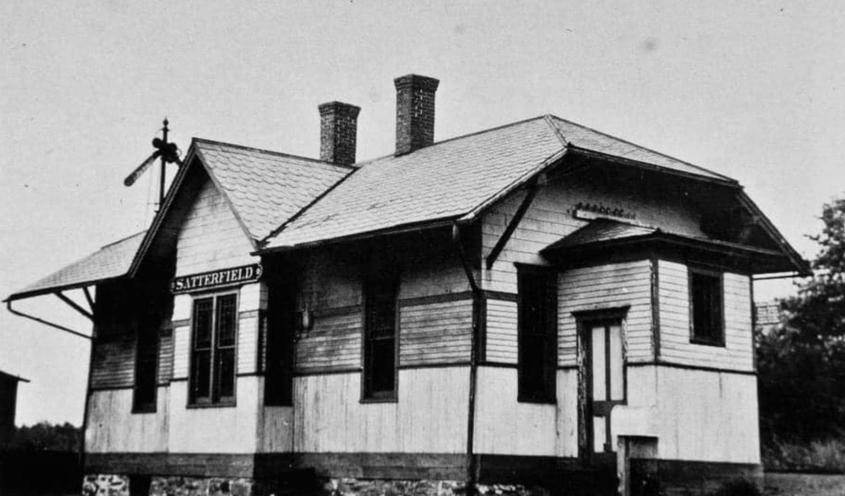
| Satterfield Junction |
AND |
This station was built in 1894 (Sullivan Republican, 4-4-1894). | ||||||
| Sonestown | EAGLES MERE RR |
This is the first EMRR station before it merged with the W&NB in 1902. |
||||||
| Wheelerville |  |
This Susquehanna & New York station was on the north side of the intersection of PA154 and Schrader Creek Road at GPS: 41.574780, -76.785830. | ||||||
| 1895 SULLIVAN COUNTY RAILROAD MAP | ||||||||
 |
||||||||
| Notes About Existing
Stations... Nordmont (W&NB) - 28 Cox Road is the official address listed for this property in the Sullivan County records. Not sure if this "road" (more like the driveway to the station) is marked at the intersection. GPS coordiates show exact location. |
||||||||