 COUNTY COUNTY
|
|
||||||||
| EXISTING STATIONS | ||||||||
|---|---|---|---|---|---|---|---|---|
| Station Name |
Original Railroad |
Current Location |
Type | Current Use |
Date Built |
Track Status |
Building Material |
More Info |
| Adair |
 |
Hilight Road (SR-26) at Paine Road (GPS: 39.836914, -81.082225) |
P | Private | 1916 | None | Wood |
|
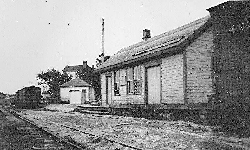
| Brister |
|
Zanesville (See Notes) |
P | Storage | 1916 | None | Wood |
|
| Brister |
 |
South side of SR-78 about .4 mile west of St. Joseph Catholic Church (GPS: 39.792487, -81.270062) |
C | Vacant | 1883 | Gone | Wood |
|
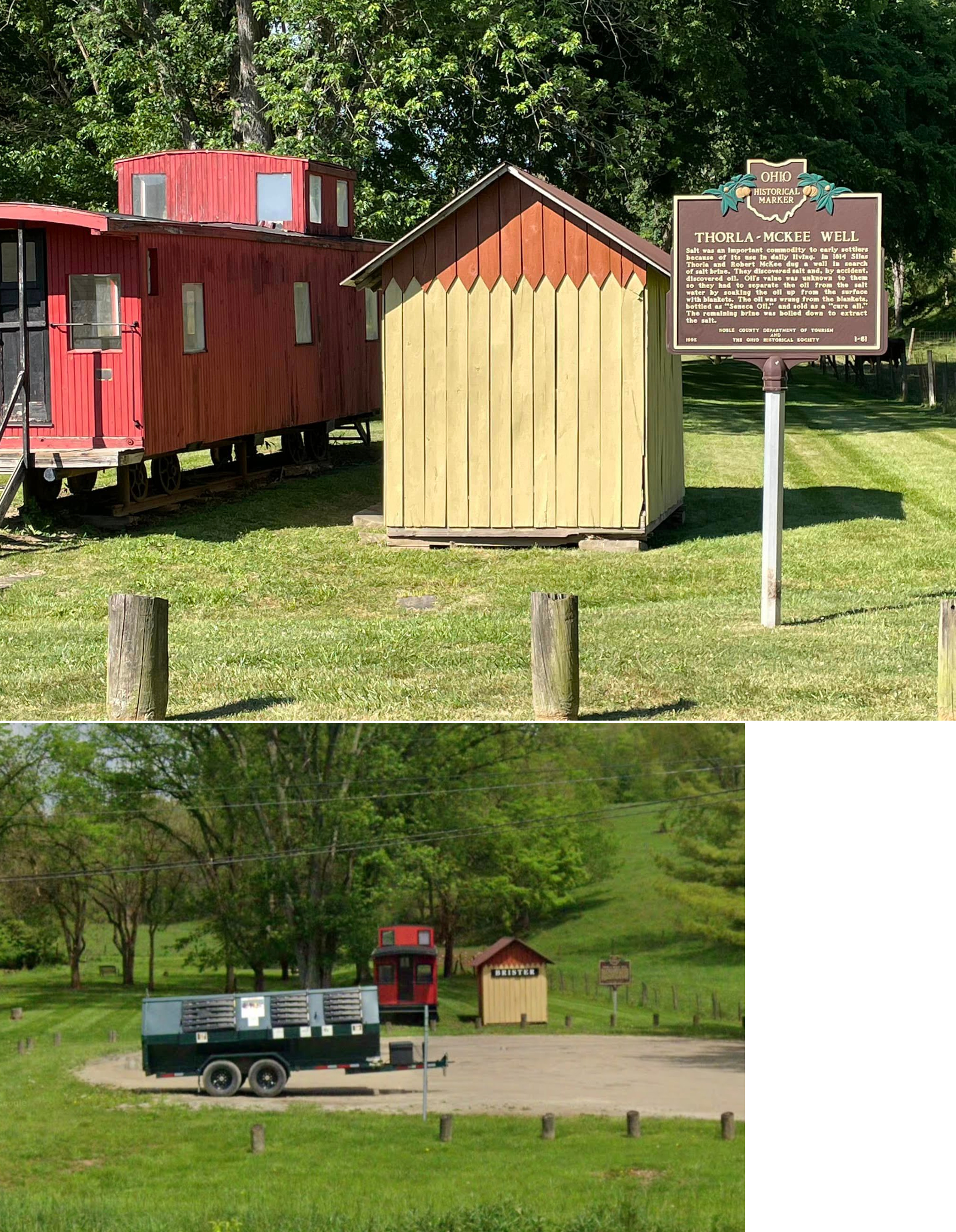
| Brister |
 |
Thorla-McKee Well Park (Noble Co.) 18448-18490 Frostyville Road, Caldwell (GPS: 39.739610, -81.498091) |
C | Civic | 1993 | None | Wood |
|
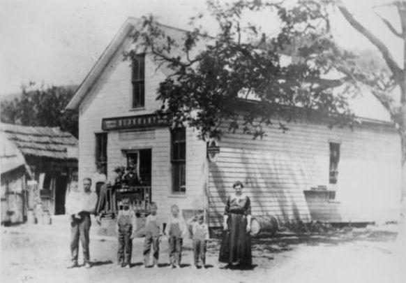
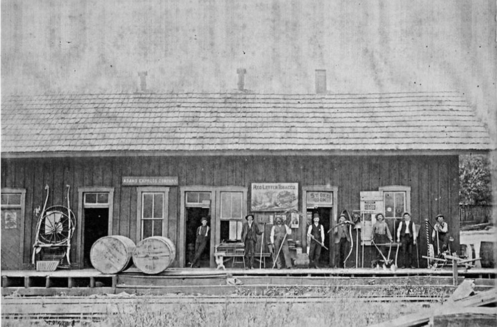
| Burkhart |
|
Intersection of SR-78 and Summit Township Road 70 (GPS: 39.785183, -81.259406) |
C | Private | 1883 | Gone | Wood |
|
| STATIONS OF THE PAST | ||||||||
| Station Name |
Original Railroad |
Notes | ||||||
| Beallsville |
|
This was the first station here which was a waiting platform added onto Miller's General Store. | ||||||
| Beallsville |
|
After Miller's General Store closed, the OR&W built this station in 1924 according to PRR design (as the PRR owned the OR&W by then). | ||||||
| Buchanan |
|
A shelter-type station was built here in 1912. | ||||||
| Cedar Creek |
|
A shelter-type station was built here in 1912. | ||||||
| Clarington Station |
 |
The B&O station for Clarington was across the river in West Virginia. | ||||||
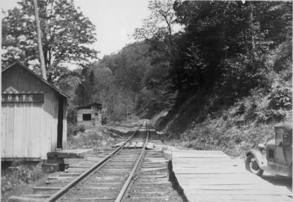
| Coats |
|
This shelter-type station was built here in 1915. | ||||||
| Decker |
|
A shelter-type station was built here in 1905. | ||||||
| Doherty |
|
A general store/private residence served as the station here. | ||||||
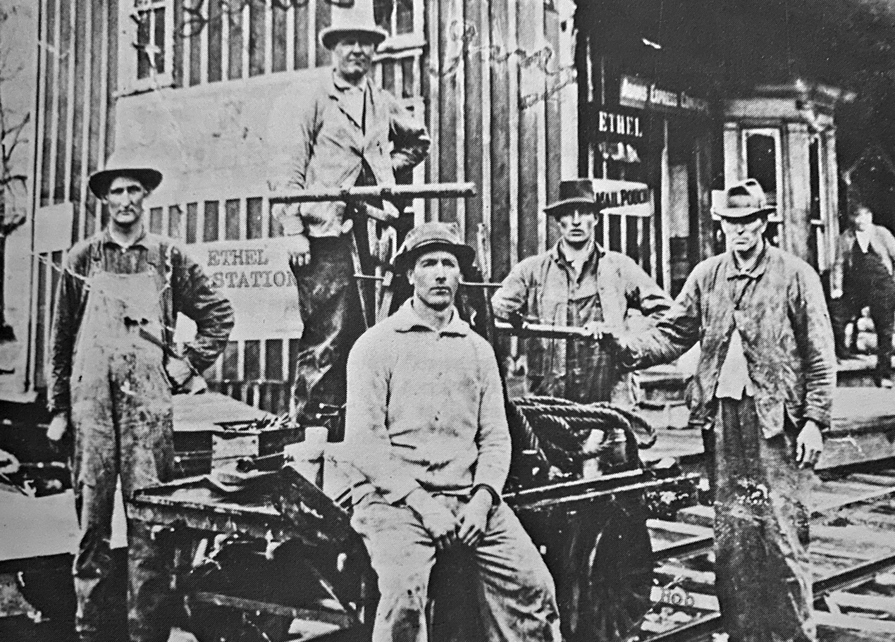
|
Ethel (Pryor) |
|
A general store/private residence served as the station here. It was near the intersection of SR-78 and Swazey Road. | ||||||
| Herlan |
|
A shelter-type station was built here in 1916 next to the general store/private residence that served as the station. | ||||||
| Hutchinson |
|
A shelter-type station was built here in 1912. | ||||||
| Kerr |
|
A shelter-type station was built here in 1912. | ||||||
| Jerusalem |
|
This was a privately-owned general store that also served as the station. | ||||||
| Lewisville |
|
The first station here burned down in 1891 after being struck by lightning. Prior to this railroad-built station, a general store served as the station. | ||||||
| Lewisville |
|
The second station was a rebuild of the original station. It burned down in 1899 | ||||||
| Lewisville |
|
This Ohio River & Western station was between Railroad Street and what is now SR-78 just east of Back Street (GPS: 39.764882,-81.216608). This station was built in 1899. It was gone by 1949. | ||||||
| Lupton |
|
A shelter-type station was built here in 1916. | ||||||
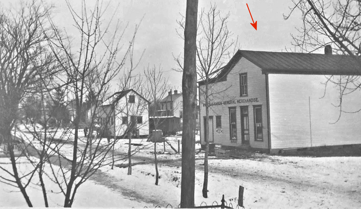
| Ozark |
|
This station was on the east side of SR-26 at approximately GPS: 39.827103, -81.081311. The station was at milepost MP 34.1 and was built in 1882. It served as a residence, post office, and combination station. Around the turn of the 20th Century, Wilcox and Harens General Merchandise Store moved in to the building and expanded it by adding a false front. The tracks with a 7-car siding were behind the building as seen in the photo. It served as a general store into the 1970s, after which time it became vacant, run down and eventually demolished. | ||||||
| Starkey |
|
A shelter-type station was built here in 1915. | ||||||
| Tunnel Hill |
|
A shelter-type station was built here in 1916. | ||||||
| Wise |
|
A shelter-type station was built here in 1916. | ||||||
| Woodsfield |
|
This station, built in 1879, was at the intersection of East Marietta and First Streets at Mill Street (GPS: 38.942688,-83.654537). | ||||||
| 1898 MONROE COUNTY RAILROAD MAP | ||||||||
 |
||||||||
| Notes About Existing
Stations...
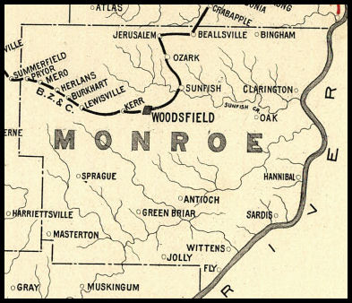
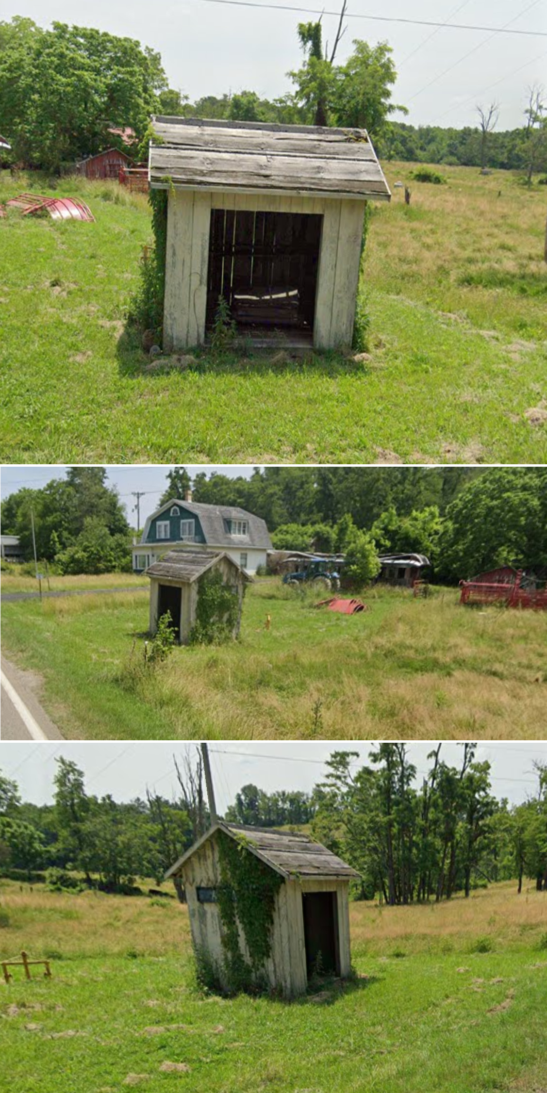
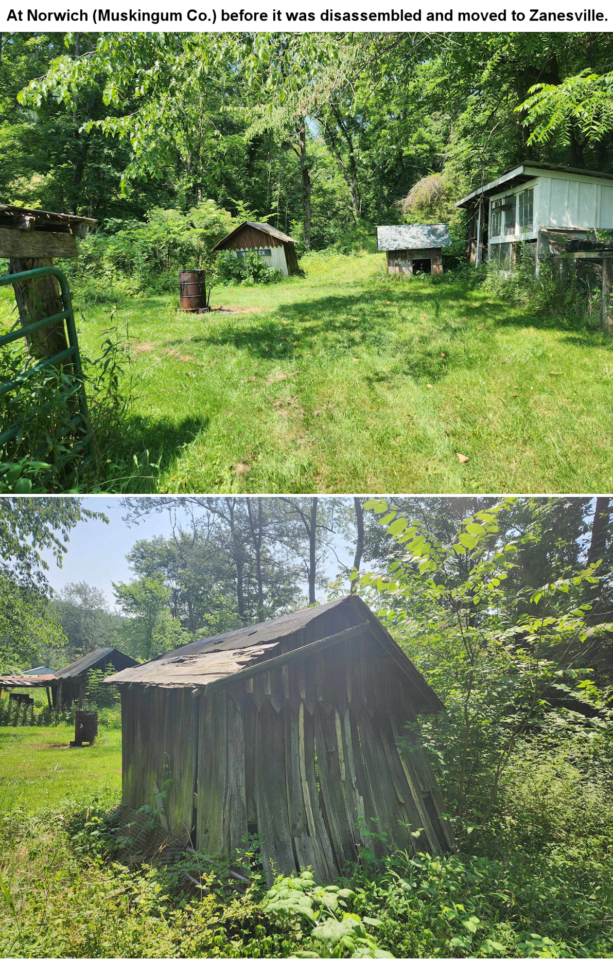
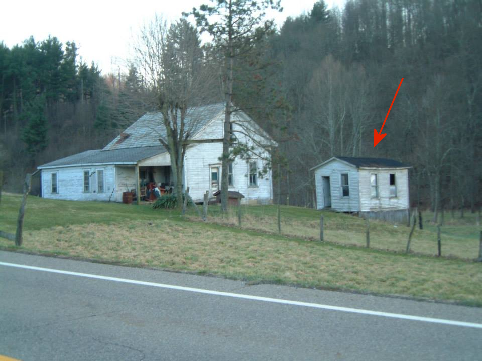
Adair (OR&W)- This shelter shed's original location was to the north about 100' across Paine Road (Township Road 126) at approximately GPS: 39.837191, -81.082068. The Friends of the Ohio River and Western Railway Historical Society has now restored it (in 2025). Brister (OR&W/BZ&C)- Two separate structures comprised Brister Station. There was a passenger/freight waiting structure referred to as a sheltershed which was built during the years that the PRR operated the OR&W. It was moved to Norwich (Muskingum County) and resided on a private farm where it eventually collapsed. In July of 2024 the remnants were disassembled and taken to a private residence in Zanesville where the new owner hopes to rahabilitate it. The station building adjacent to the sheltershed, dating from the BZ&C years, was also general store, post office, ticketing agent location. It also still exists, but has been abandoned at its original location. Brister (Replica)- This replica of the Brister shelter shed was built in 1993, but became quite weathered over the years. It was restored in 2024 by the The Friends of the Ohio River and Western Railway Historical Society. Burkhart (BZ&C)- This was a general store that also served as the station. |
||||||||