 COUNTYCOUNTY
|
|
||||||||
| EXISTING STATIONS | ||||||||
|---|---|---|---|---|---|---|---|---|
| Station Name |
Original Railroad | Current Location |
Type | Date Built |
Current Use |
Track Status |
Building Material |
More Info |
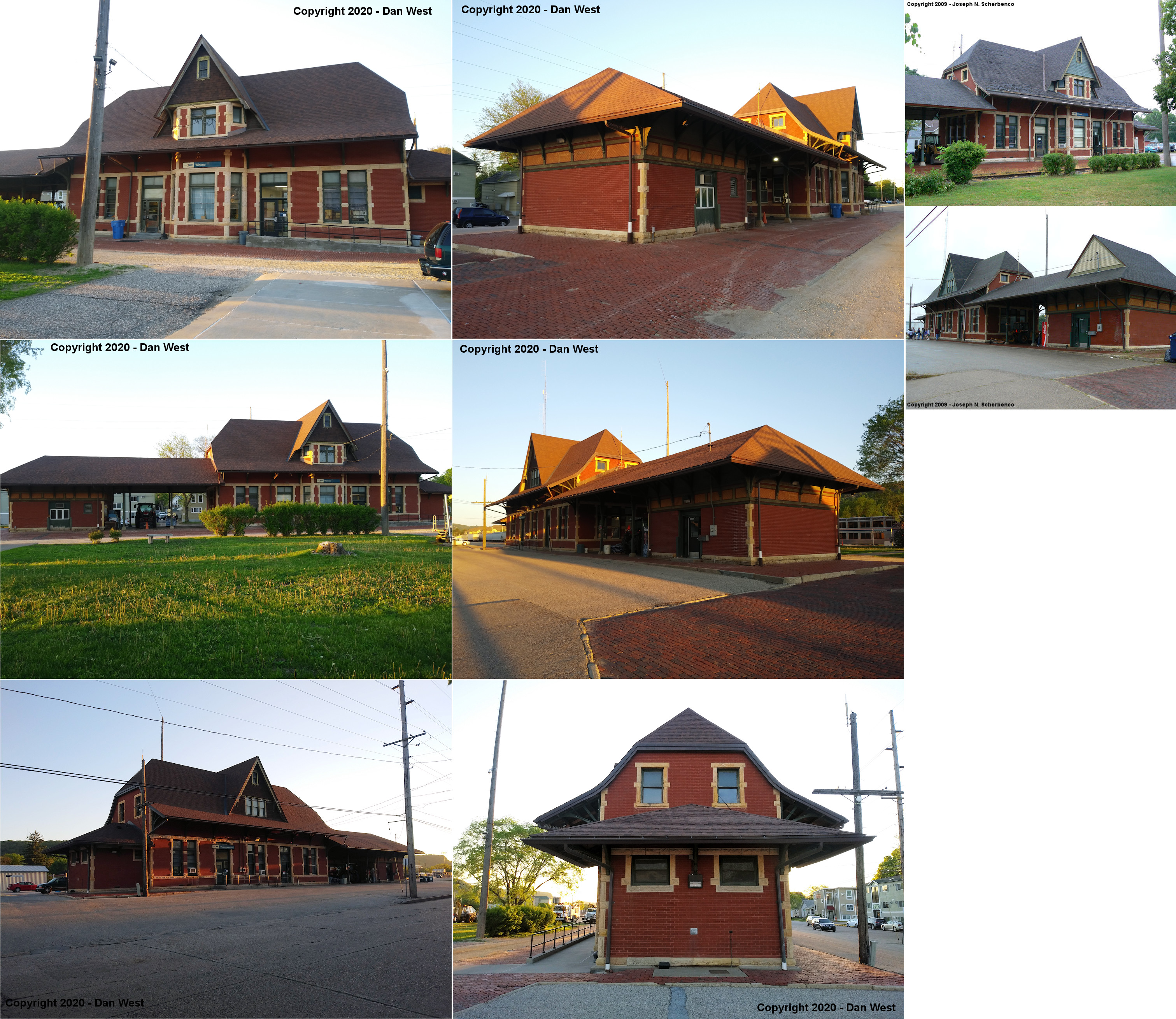
| winona |
 |
65 East Mark Street (East 11th at Center Street) (GPS: 44.044322, -91.640110) |
P | 1888 | Railroad | In Use | Brick | |
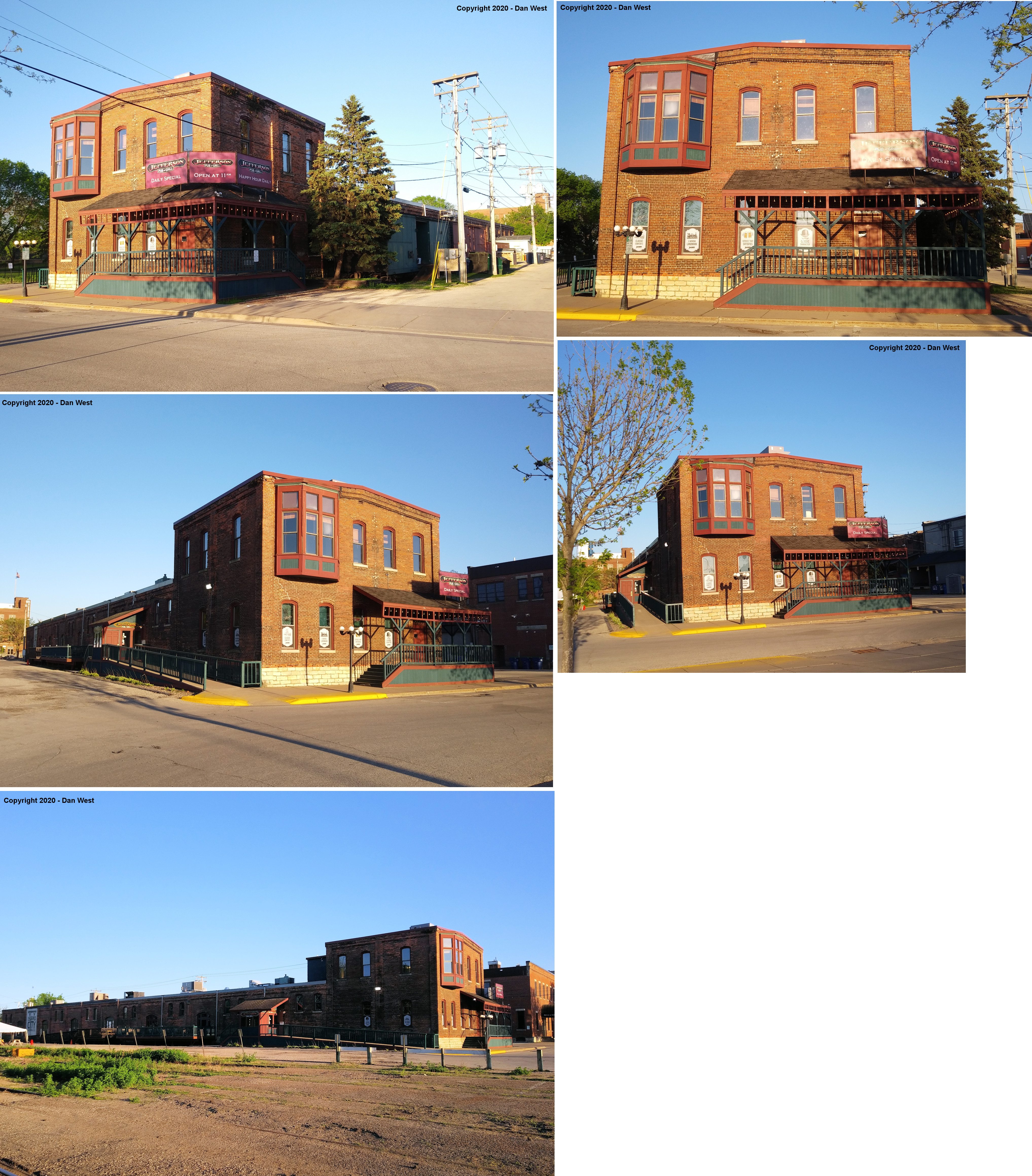
| winona |
 |
58 Center Street (north of 2nd Street) (GPS: 44.053875, -91.635201) |
F | 1883 | Restaurant | In Use | Brick | |
| STATIONS OF THE PAST | ||||||||
| Station Name |
Original Railroad |
Notes | ||||||
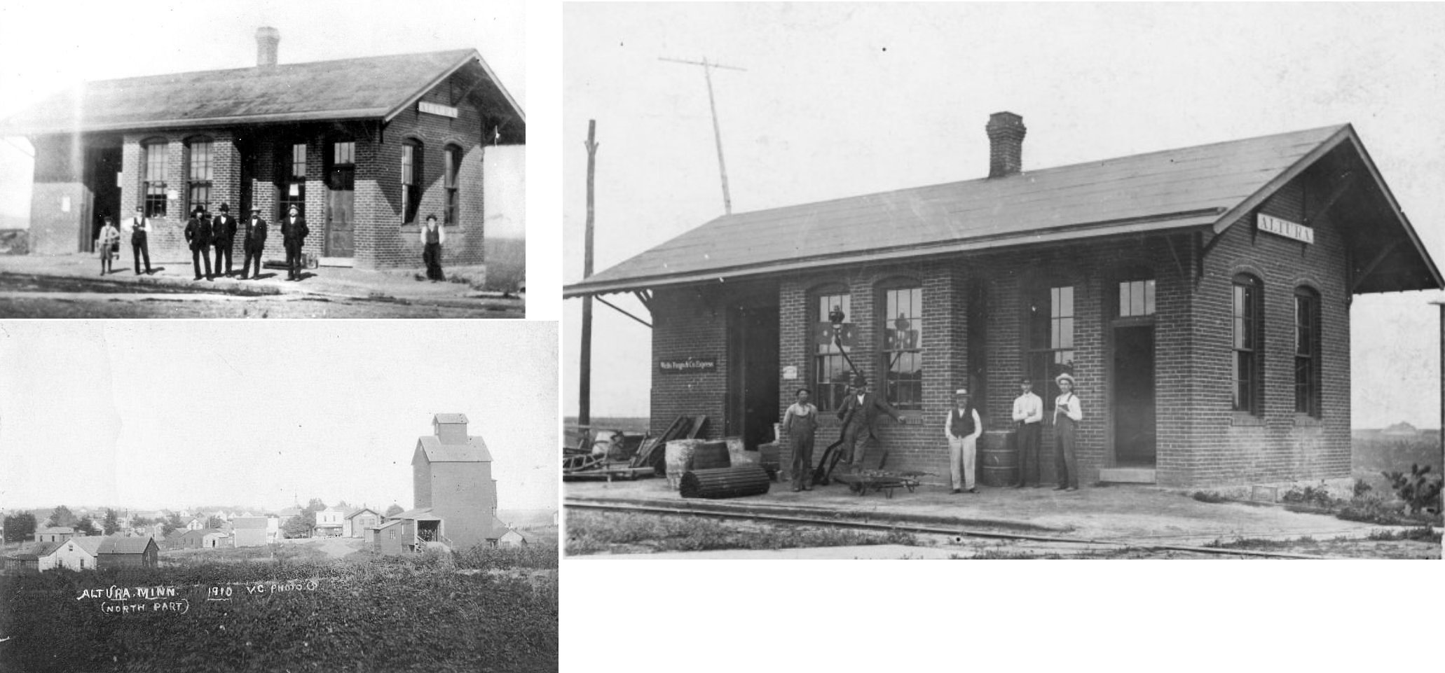
| Altura |
 |
The W&SW later became part of Winona & Western in 1894 which became part of the Wisconsin, Minnesota & Pacific in 1901 which became part of the CGW in 1901. The first station here was a wood frame building that was built in 1890 and burned down in 1904 (The Winona Daily News 10-31-1976). | ||||||
| altura |
 |
This brick station was built in 1904-05 to replace the wood station that burned down. It was closed in 1962 and torn down around 1966. | ||||||
| Bear Creek |
|
There was a small shelter here. | ||||||
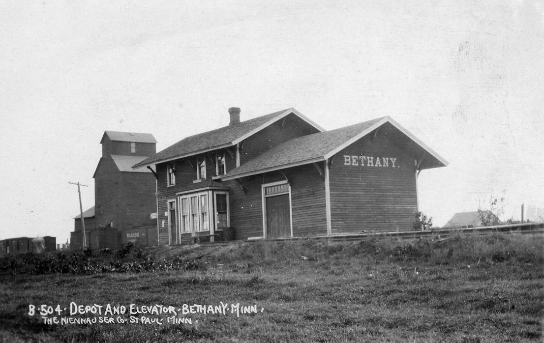
| Bethany |
|
This station was built in 1890, closed in 1947, and torn down in 1948. | ||||||
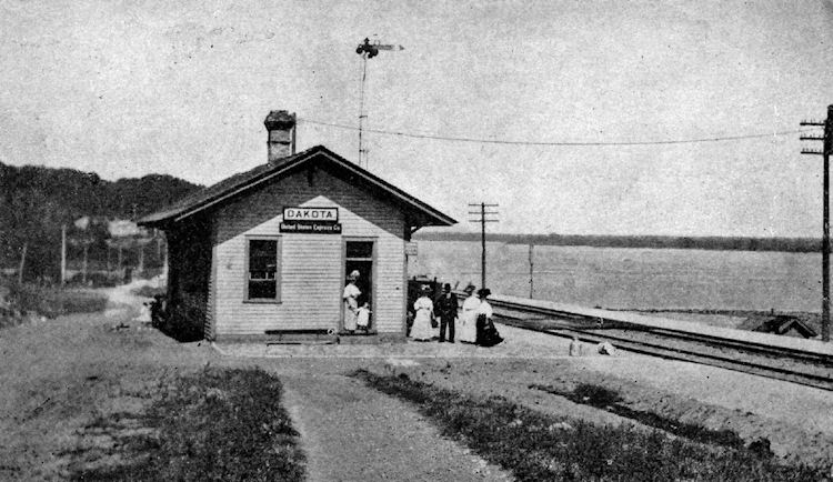
| Dakota |
|
|||||||
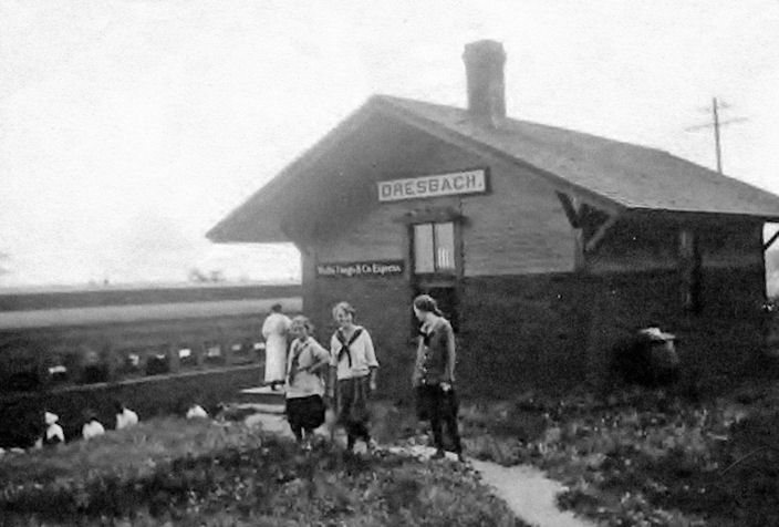
| Dresbach |
|
|||||||
| East Richmond |
|
|||||||
| Homer |
|
|||||||
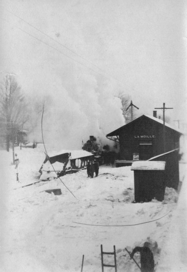
| Lamoille |
|
|||||||
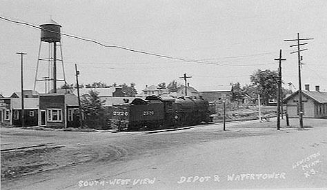
| Lewiston (New Boston) |
 |
Was known as New Boston until 1885. The station was on the south side of West Main Street on the north side of the tracks just west of Fremaont Street at GPS: 43.984275, -91.869603. | ||||||
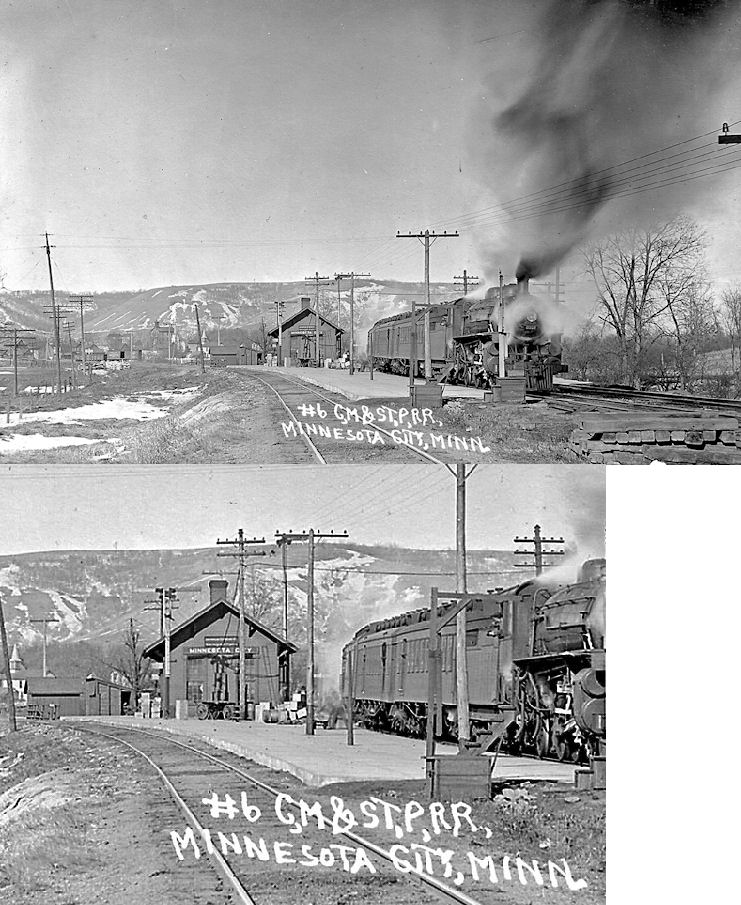
| Minnesota City |
AND |
This joint station was built in 1883. It was between the tracks south of what is now the Wenonah Road Crossing at GPS: 44.089333, -91.744500. | ||||||
| Minnesota City |
|
|||||||
| Richmond (Donehower) |
|
|||||||
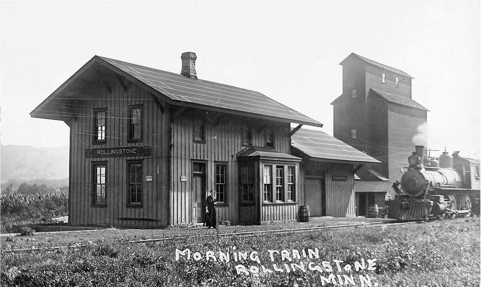
| RollingStone |
|
This station may have been of Winona & Southwestern vinatge. The tracks ran south of town and the station was south of MN-248 on the west side of CR-25 at approximately GPS: 44.093732, -91.808069. | ||||||
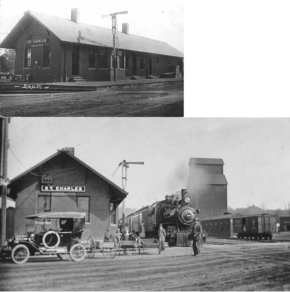
| St. Charles |
|
The W&SW station here was a frame depot located between St. Charles and Whitewater Streets on the north side of the tracks at GPS: 43.967848, -92.065684. It was destroyed by a cyclone on October 3, 1903. | ||||||
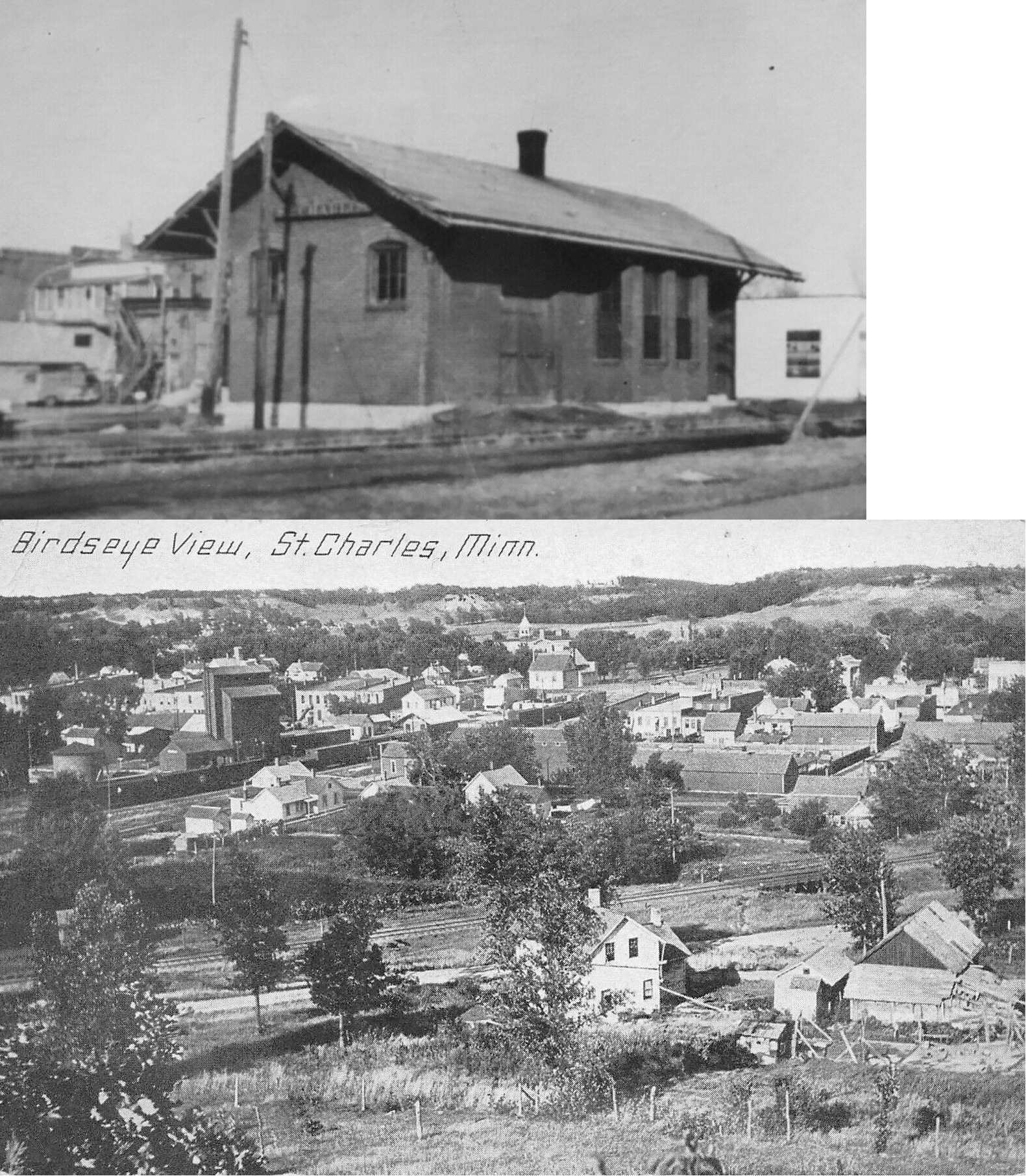
| St. Charles |
|
The replacement for the station listed above was made of brick (as shown in the photo) and built in 1904. It was in the same location as the first station. The CGW tracks were pulled up through St. Charles in 1935, but the depot was maintained on a spur track off the C&NW. Surprisingly, the CGW station was still standing, and providing freight service, as of 1968 when the C&NW depot was demolished. The CGW used the C&NW tracks from here to near Eyota where it reconnected with its own tracks (Winona Daily News, 5-19-1968). | ||||||
| St. Charles |
|
The first station here was a wood frame depot on the east side of Whitewater Avenue on the north side of the tracks at GPS: 43.965714, -92.064758. It burned down, along with the nearby grain elevator in March, 1895 (The Winona Daily Republican, 3-22-1895). | ||||||
| St. Charles |
|
Built in 1895 to replace the depot listed above, this brick station was closed in January 1967 (Winona Daily News, 1-30-1967) and demolished in 1968 (Winona Daily News, 5-19-1968). It was in the same location as the depot listed above (east side of Whitewater Street). | ||||||
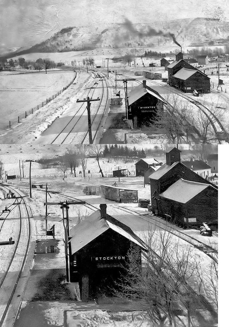
| Stockton |
|
Built in 1875. | ||||||
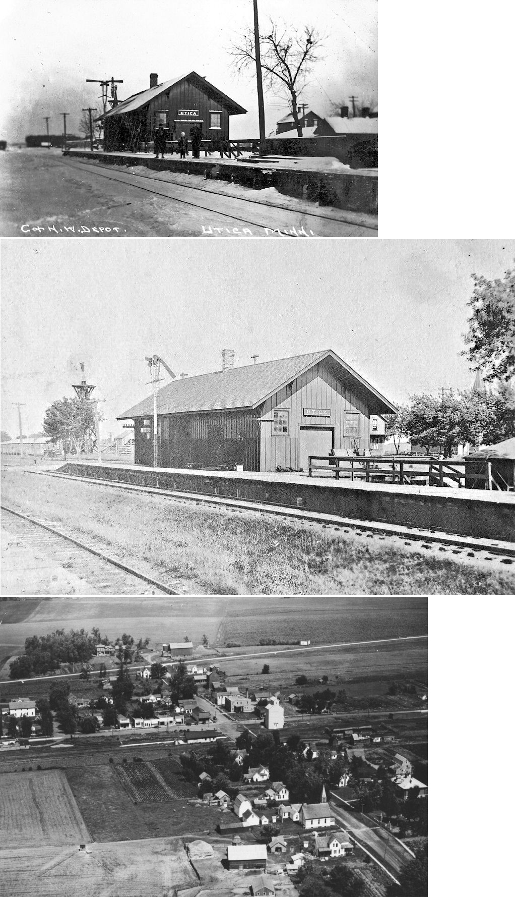
| Utica |
|
The original depot here was built by the W&SW (later CGW) in 1890. | ||||||
| Utica |
|
A new brick station was built here in 1904. | ||||||
| Utica |
|
Built in 1879. | ||||||
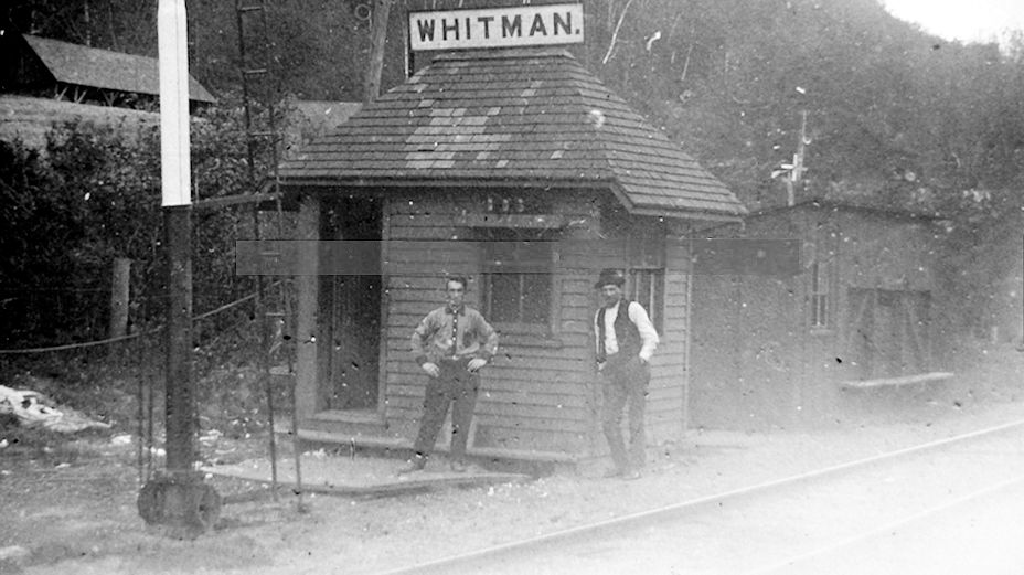
| Whitman |
|
|||||||
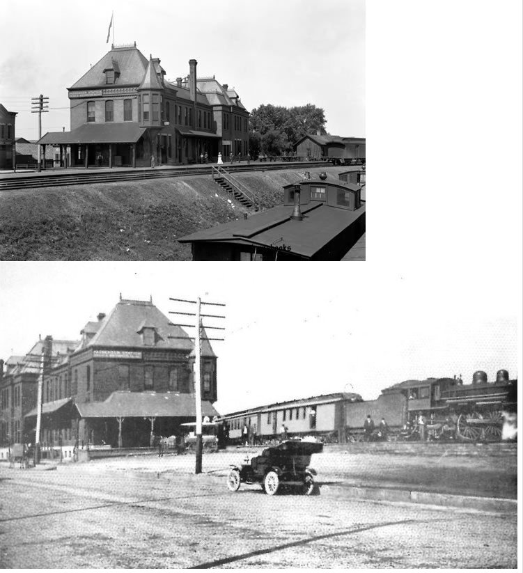
| Winona |
|
This station was on the north side of 2nd Street at the end of Huff Street at GPS: 44.055295, -91.642607. The station was right in the middle of what is now Riverview Drive. It was built in 1880 and torn down in 1980. | ||||||
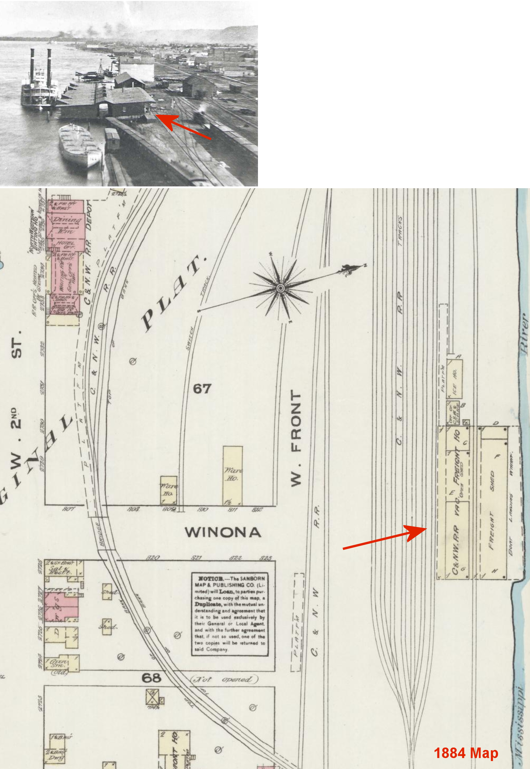
| Winona |
|
The original freight house was on the riverbank at Front and Winona Streets at GPS: 44.056324, -91.640785. It was replaced by the 1883 freight house which is still standing. It is shown on the 1884 Sanborn map as vacant. | ||||||
| Winona |
|
This freight house was on Mark Street (11th Street), next to the passenger station at GPS: 44.044654, -91.641177. It was demolished in February 2025. | ||||||
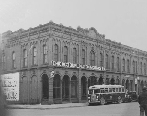
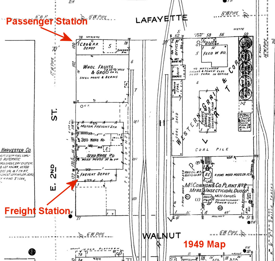
| Winona |
 AND |
This station was on the NE corner of 2nd and Lafayette Streets at GPS: 44.053057, -91.634395. The W&SW/CGW and the Winona & Western used this station from 1888-1900. The W&W and CGW then used the CM&St.P station from 1900-1932 (when passenger service ended on the CGW). | ||||||
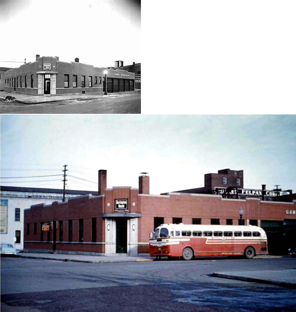
| Winona |
|
This later-generation station, which opened on November 30, 1938 (The Winona Daily News 11-29-1938) was at 102 2nd Street East. Passengers were bussed from here across the river to the CB&Q station at Winona Junction, WI. | ||||||
| Winona |
AND |
The freight station, which opened in 1938 along with the station listed above, was on the NW corner of 2nd and Walnut Streets at GPS: 44.052739, -91.633487. This may have been in the end of the building that is still standing there (The Latsch & Sons Building), but it's hard to say for sure. | ||||||
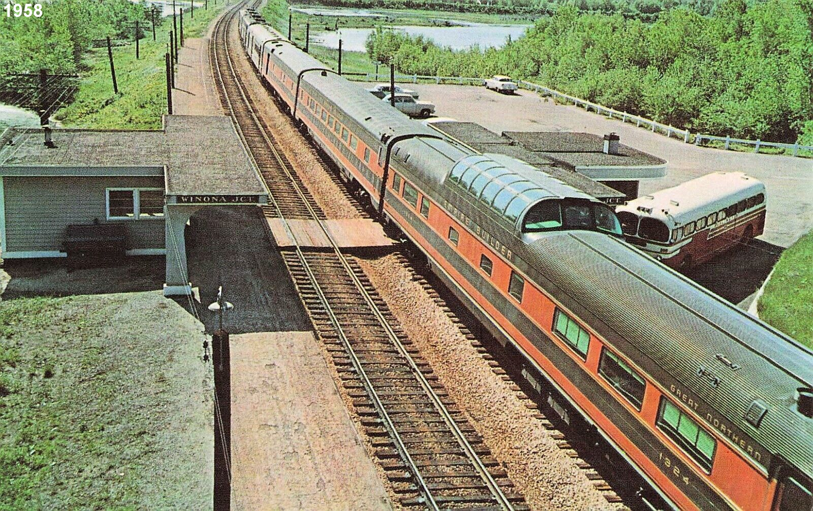
| Winona (East Winona) (Winona Jct.) |
|
This station was across the river in East Winona, WI. It was at the end of Depot Road on the south side of the tracks just east of the WI-54 overpass at GPS: 44.071608, -91.631597. This station was also known as Winona Junction. | ||||||
| 1898 WINONA COUNTY RAILROAD MAP | ||||||||
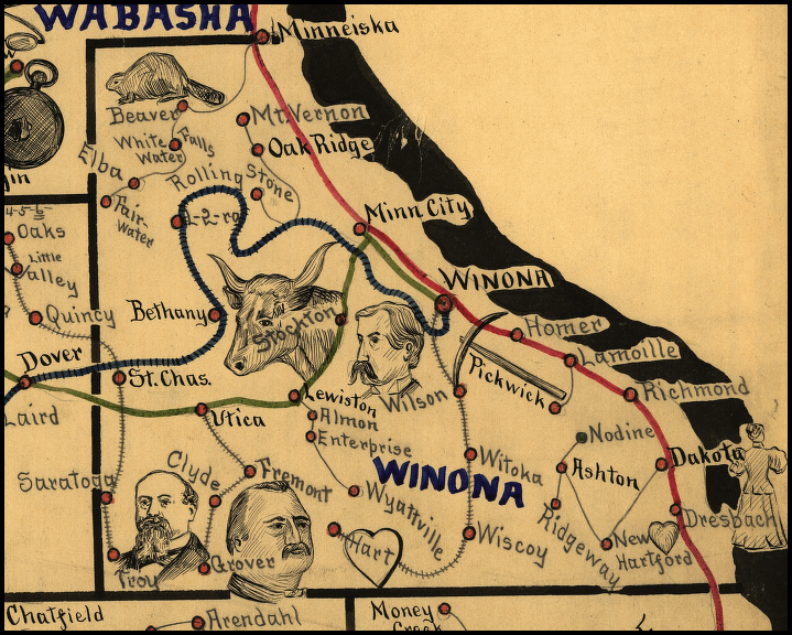 |
||||||||
|
Notes About Existing Stations... Winona (CM&St.P) - This station was also used by the W&W and CGW from 1900-1932 (when passenger service ended on the CGW). |
||||||||