 COUNTYCOUNTY
|
|
||||||||
| EXISTING STATIONS | ||||||||
|---|---|---|---|---|---|---|---|---|
| Station Name |
Original Railroad | Current Location |
Type | Date Built |
Current Use |
Track Status |
Building Material |
More Info |
| new prague |
 |
311 Main Street West (GPS: 44.544242, -93.582683) |
C | ???? | ???? | In Use | Wood | |
| Savage (Hamilton) |
 |
4800 West 123rd Street (GPS: 44.778682, -93.340415) |
C | 1880 | Business | None | Wood |
|
| Shakopee |
AND  |
333 2nd Avenue West (GPS: 44.797201, -93.530475) |
P | 1909 | Business | In Use | Brick |
|
| Valley Park |
|
West side of Stagecoach Road (GPS: 44.787472, -93.410853) |
C | ???? | Railroad | In Use | Wood | |
| STATIONS OF THE PAST | ||||||||
| Station Name |
Original Railroad |
Notes | ||||||
| Barden (Long Lake) (Sibley) |
|
This station was in the vicinity of
Stagecoach Road at approximately GPS:
44.787474, -93.410392. This location is now known as Valley Park. "Barden, a settlement in section 12, Eagle Creek Township, was first named Sibley for Henry H. Sibley and had a Sibley station of the Sioux City and St. Paul Railroad under that name; it was then named Long Lake for a nearby lake; it received its present name in 1885 in honor of J. W. Barden, who was largely interested in grain elevators and other business enterprises here and hereabouts" (Stennett, Place Names of the Chicago and Northwestern Railways, 1908). |
||||||
| Belle Plaine |
|
Built in 1901, this station was near the north end of Market Street (when the street went through to the tracks) at approximately GPS: 44.628665, -93.770799). The 1898 map shows a previous station in approximately the same location. | ||||||
| Blakeley |
|
Built in 1867, this station was between Elm Way and Oak Way at approximately GPS: 44.610816, -93.854249. | ||||||
| Brentwood |
|
|||||||
| Credit River (Keatings) |
|
Also known as Keating's Crossing, this station was on the border of Sections 8 and 17 in Credit River Township. The station was at GPS: 44.688178, -93.369366 along MN-21. MN-21 was built over the grade on this portion of the line. | ||||||
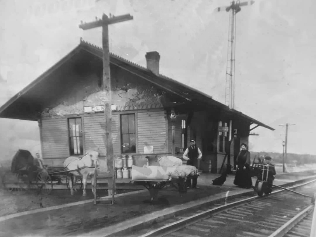
| Elko |
|
This station was on Beard Avenue in the vicinity of GPS: 44.564916, -93.324120. | ||||||
| Grainwood |
|
This station was between Prior and Long Lakes. See photo for location. | ||||||
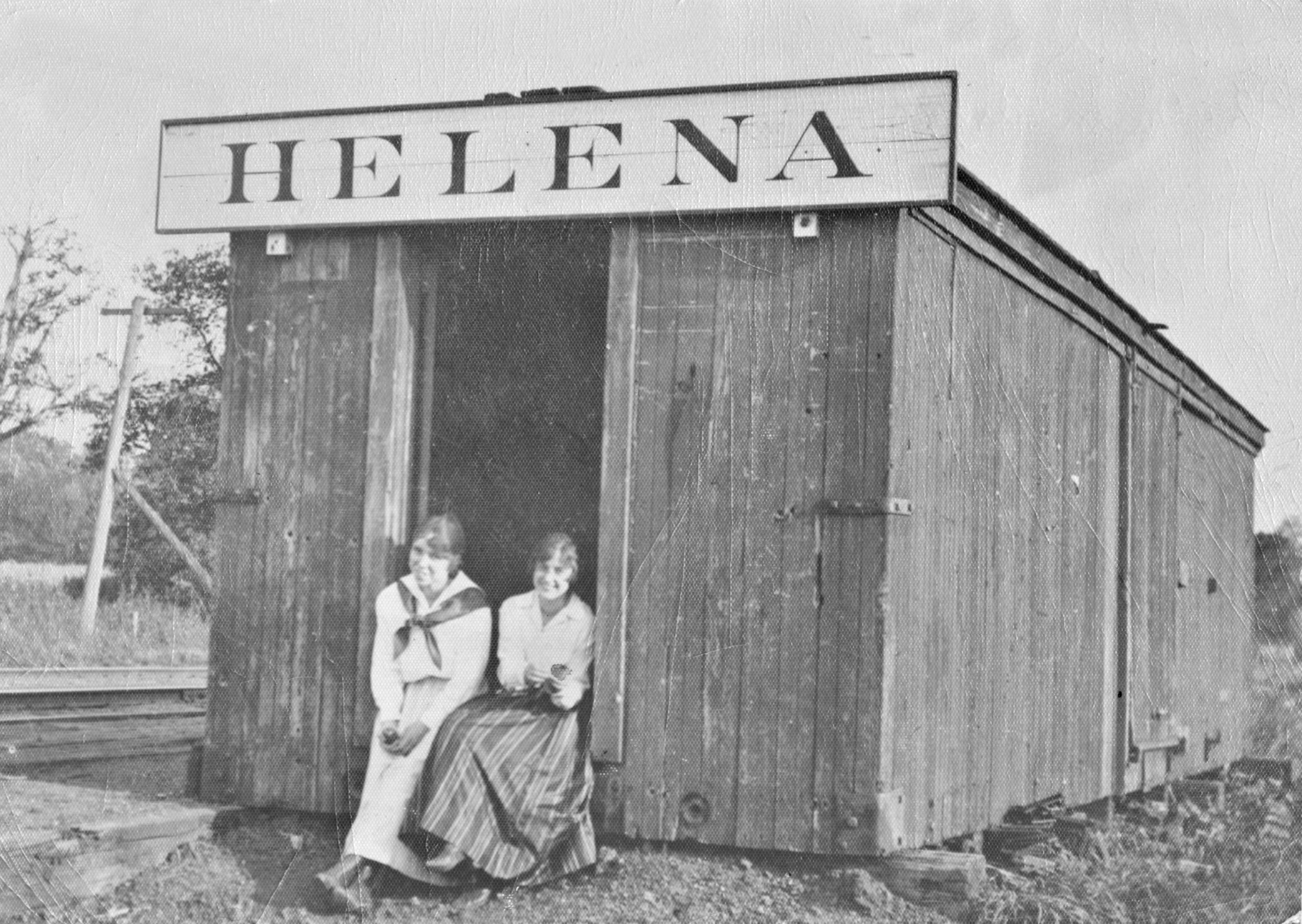
| Helena Station |
|
This station was a converted boxcar. | ||||||
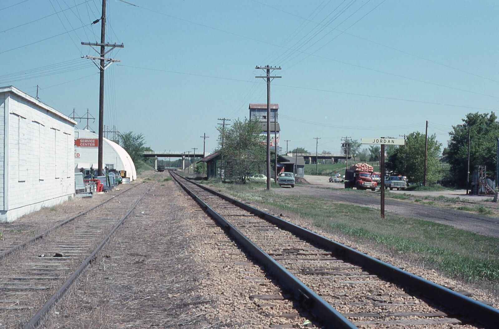
| Jordan |
|
This station was on Rice Street just north of 5th Street on the east side of the tracks at GPS: 44.670953, -93.627444. | ||||||
| Jordan |
|
This station was on the SE side of the tracks along what is now Valley View Drive (formerly Railroad Avenue) at approximately GPS: 44.677553, -93.635594. | ||||||
| Keating's Crossing |
|
See listing above for Credit River. | ||||||
| Lawrence |
|
|||||||
|
Merriam Junction (Sioux City Junction) |
|
The original 1860s station was moved to this location in 1871, south from Section 16 to Section 28. The original plan for Merriam was to be in Section 16, but only the depot and agent's quarters were ever built there, so the station was moved a couple miles south to the jucntion. That original St. Paul & Sioux City station burned down in 1878 (History of the Minnesota Valley Including the Explorers and Pioneers of Minnesota by Edward Duffield Neill, 1882). The replacement station was also destroyed by fire (from a spark from a passing locomotive) in June 1918. After that, the two railroads shared the new 1918 station (see listing below). | ||||||
| Merriam Junction |
|
The M&St.L had its own station prior to 1918. | ||||||
| Merriam Junction |
AND |
This station was built following the fire of 1918 that destroyed the Omaha depot. | ||||||
| Mudbaden |
|
|||||||
| New Prague |
|
There was a smaller station here in the 1800s. Sometime between 1892 and 1899 the new (still standing) station was built or the original station, which was half the size of the exisiting station was enlarged. The two stations were at the same location on Main Street. | ||||||
| Prior Lake |
|
See map with photo for location. | ||||||
| Prior Lake |
|
A smaller replacement station in later years. | ||||||
| shakopee |
AND |
This is the original CSt.PM&O station (later shared by the Milwaukee Road) and later was moved across Scott Street and served as a freight station after the brick station was built in 1909. It was originally on the same site as the existing brick station. The passenger and freight stations shared by the two railroads. | ||||||
| St. Lawrence |
|
This village was in the NW corner of Section 26 in St. Lawrence Township. | ||||||
| 1898 SCOTT COUNTY RAILROAD MAP | ||||||||
 |
||||||||
|
Notes About Existing Stations... Savage (CSt.PM&O) - This station has been moved twice from its original location. In 1973 it was moved to Murphy's Landing in Shakopee and then it was moved back to Savage in 2006. The book "The Chicago And Northwestern In Minnesota" (Luecke, 1990) claims this station was built in 1883. The original name of the station was "Hamilton," but was changed in 1903 to "Savage." Shakopee (CSt.PM&O/CM&St.P) - The passenger and freight stations were shared by the two railroads. The freight station was the original CM&St.P combination station before being used as a freight station when the new brick joint station was built in 1909. |
||||||||