|
|
||||||||
| EXISTING STATIONS | ||||||||
|---|---|---|---|---|---|---|---|---|
| Station Name |
Original Railroad |
Current Location |
Type | Current Use |
Date Built |
Track Status |
Building Material |
More Info |
| Akeley |  |
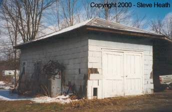
???? | P | Garage | ???? | Gone | Wood | |
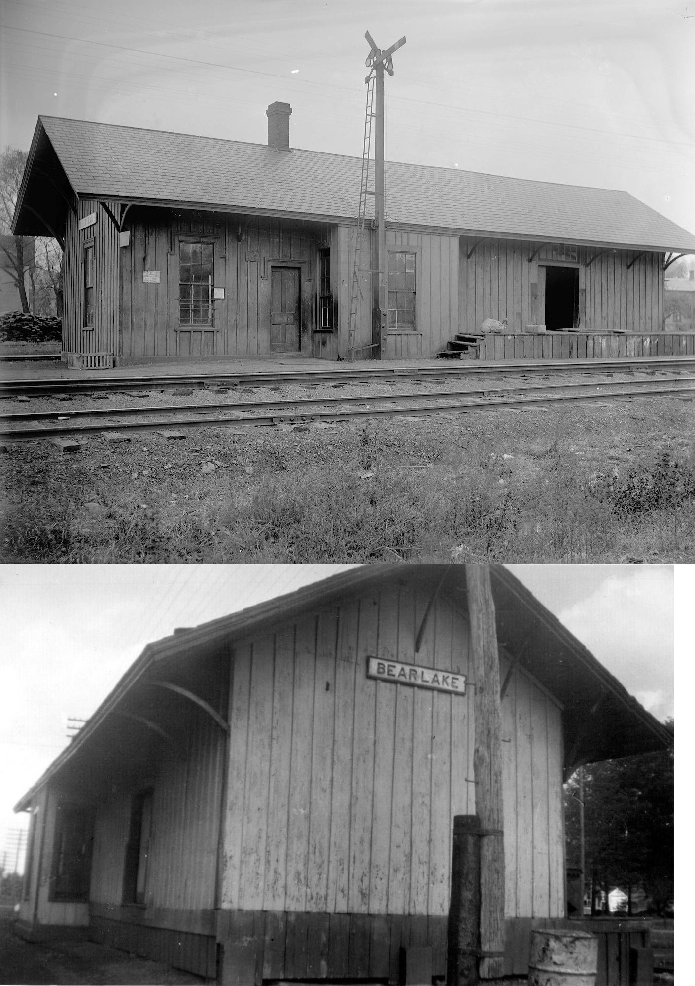
| Bear Lake |  |
North side of Greeley Street between Pine Valley Road and Center Street (GPS: 41.992057, -79.506132) |
C | Vacant | ???? | Gone | Wood | |
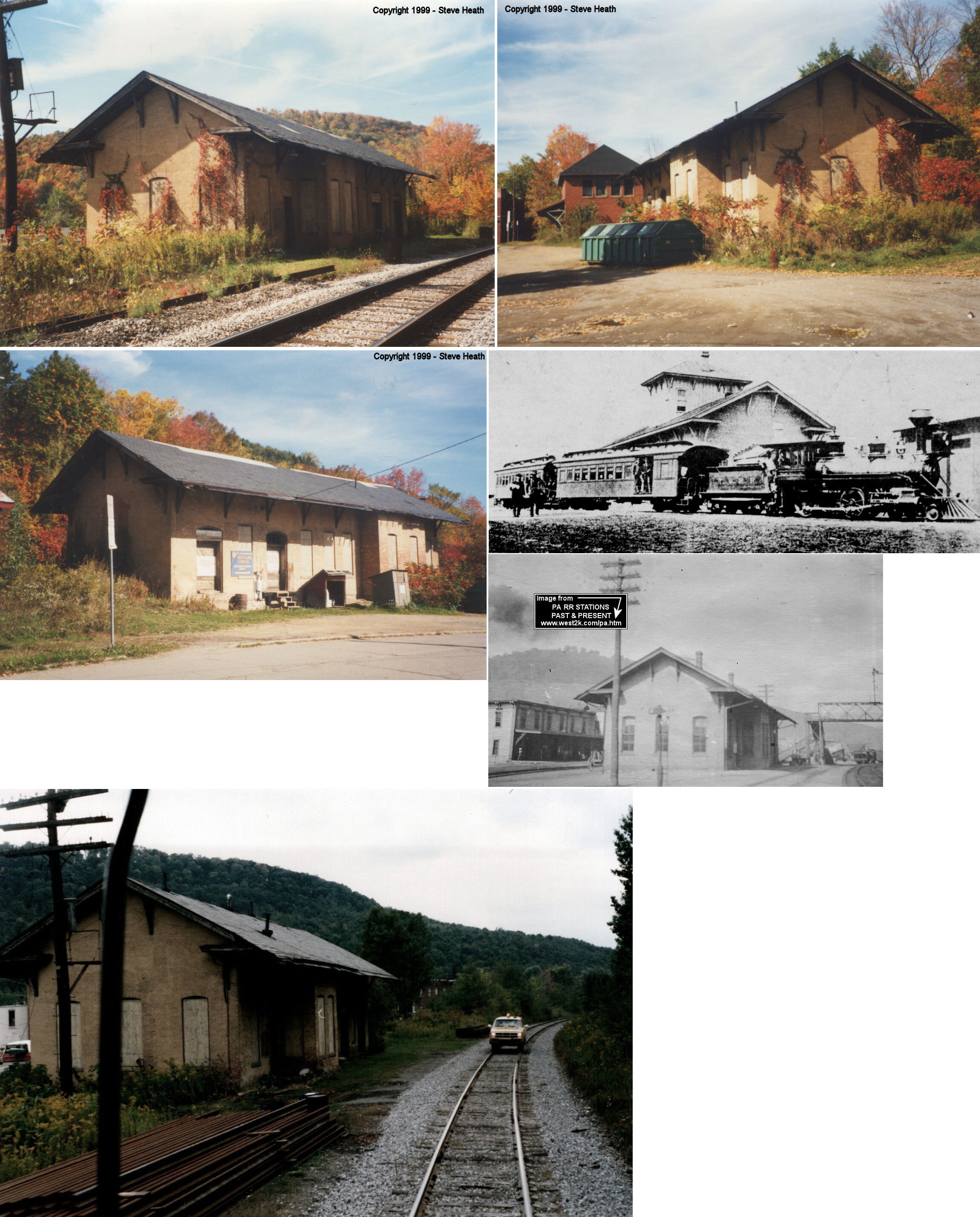
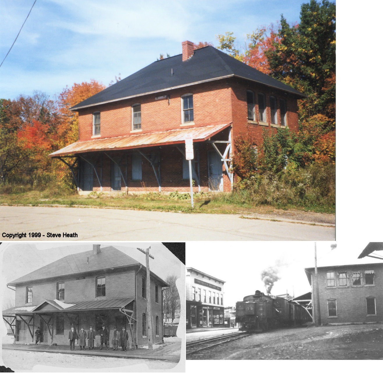
| Sheffield |
 AND  |
75 Center Street (GPS: 41.702991, -79.032224) |
C | Museum | 1880 | In Use | Brick |
|
| Sheffield |
|
65 Center Street (GPS: 41.702963, -79.032569) |
P | Museum | 1907 | Gone | Brick | |
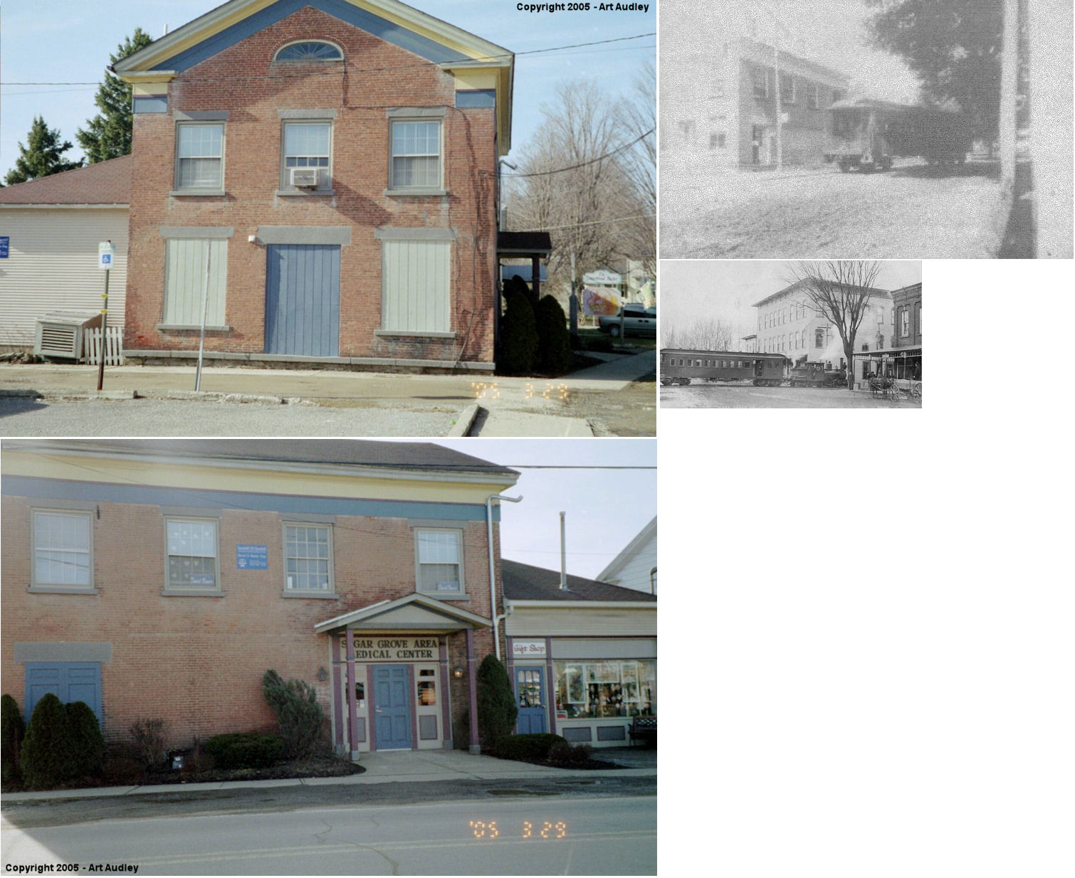
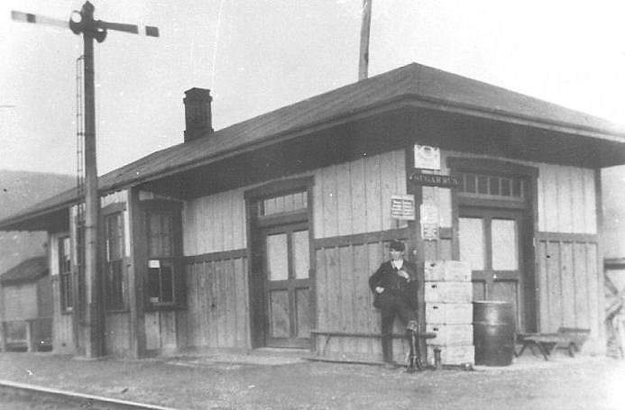
| Sugar Grove |
 |
West side of Forest Street between Race and East Mill Streets. (GPS: 41.98281,-79.341459) |
P | Business | ???? | None | Wood |
|
| North Warren | |
1 Railroad Street. East side of US-62 between Vine Street and Jackson
Run Road (GPS: 41.874736, -79.151938) |
P | Business | ???? | Gone | Wood | |
| Warren | |
West 4th Avenue near Beech Street (GPS: 41.845892, -79.159014) |
F | Storage | ???? | In Use | Wood |
|
| STATIONS OF THE PAST | ||||||||
| Station Name |
Original Railroad |
Notes | ||||||
| Althom |
 |
This station is listed on the 1923 PRR List of Stations & Sidings. It was 2.5 miles from the station at Cobham. | ||||||
| Barnes |
|
A station is shown here on the 1912 county map, however by 1922 the timetable lists this as a flagstop. | ||||||
| Big Bend |
|
|||||||
| Cherry Run |
|
|||||||
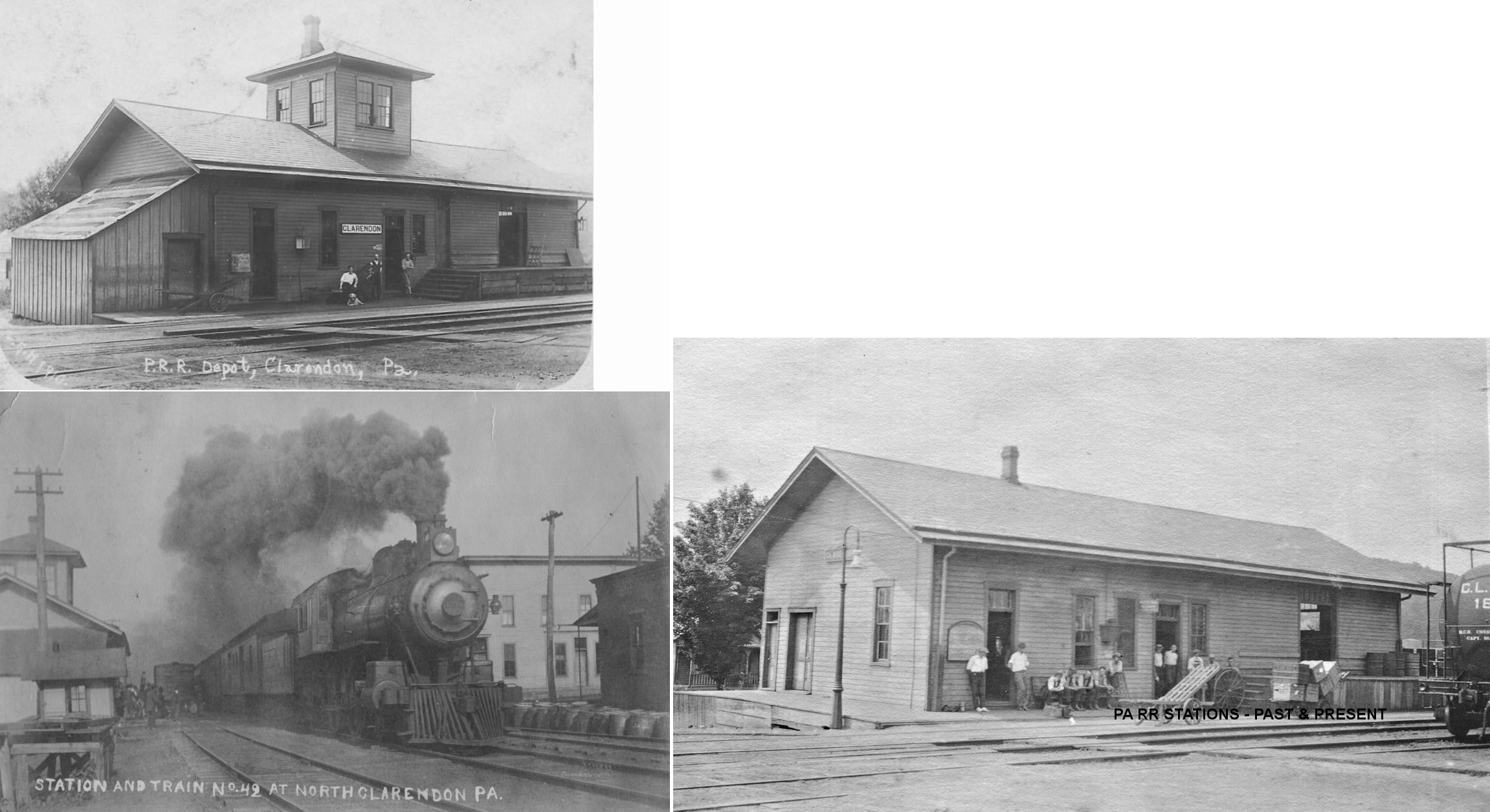
| Clarendon |
|
See listing below for North Clarendon. | ||||||
| Cobham Station |
|
|||||||
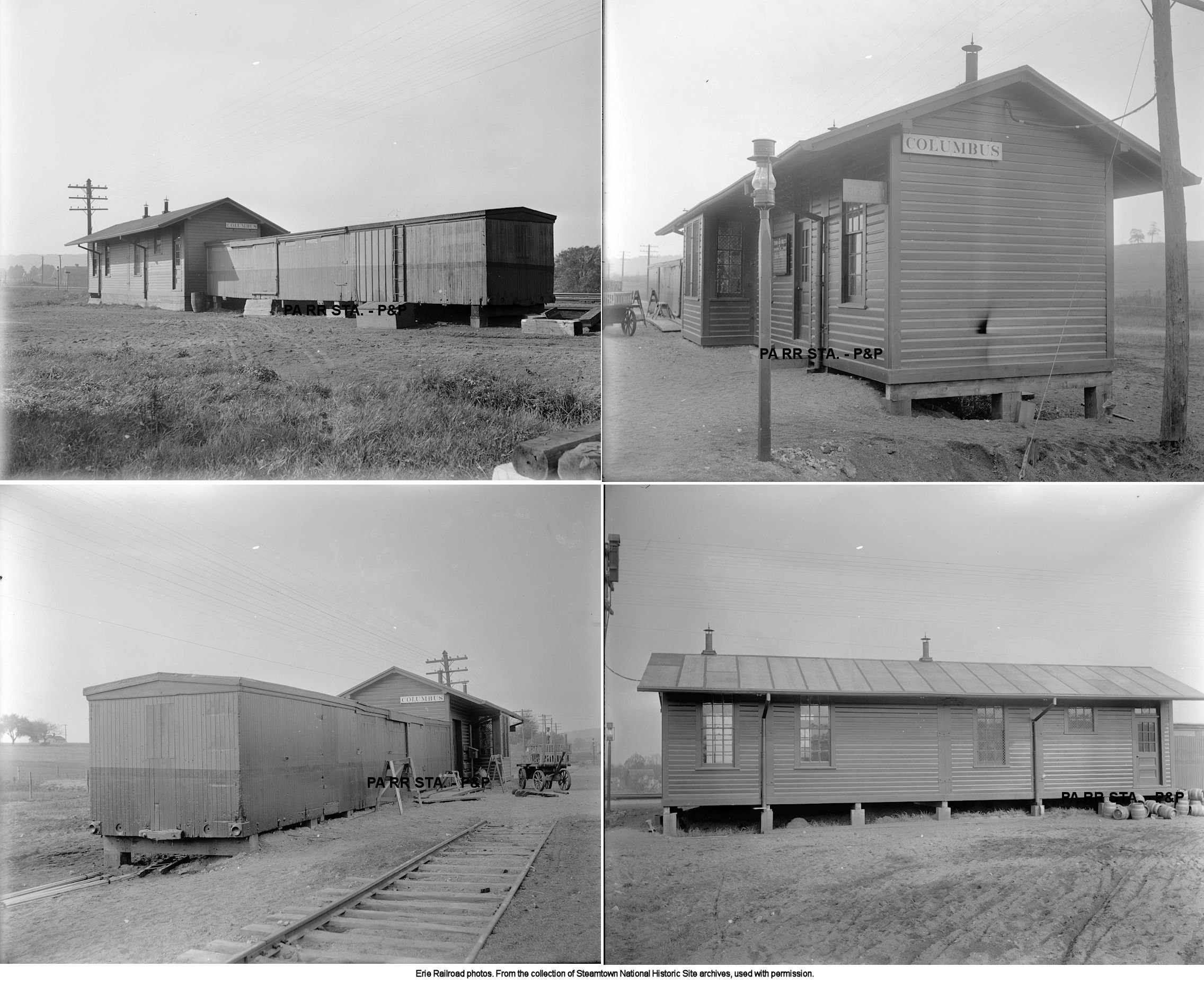
| Columbus |
|
This station was built in 1908. | ||||||
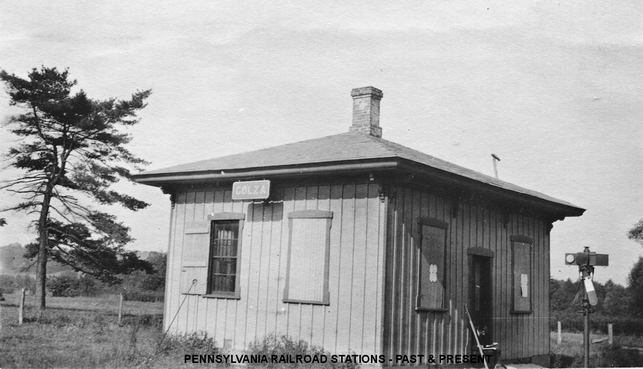
| Colza |
|
This station was two miles east of the Corry P&E station on Sample Flats Road. It was built in 1878 according to PRR valuation records. | ||||||
| Corydon |
|
This town was flooded for the Allegheny Reservoir. | ||||||
| Dewdrop |
|
|||||||
| Donaldson Station |
|
|||||||
| Dotyville |
|
|||||||
| Garcelon |
|
This station was at MP 49.8 (distance from the Kane P&E passenger station) between Horn and Spring Creek. It appears on the 1900 PRR timetable. | ||||||
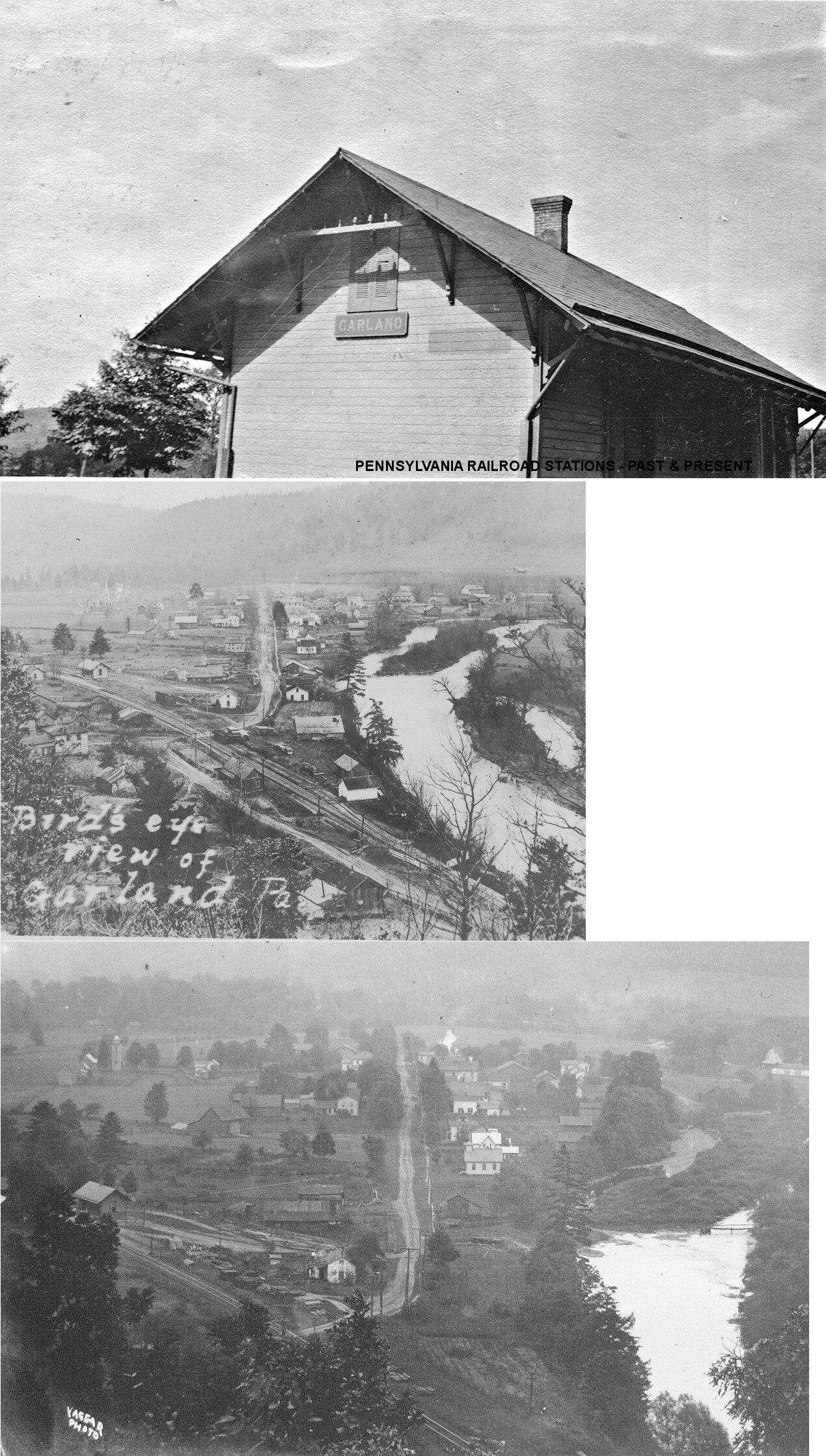
| Garland |
|
This station was near the north end of Main Street in 1878. A new station was built here in 1887 replacing the previous station that burned down. | ||||||
| GarlanD Station |
|
|||||||
| Gawango |
|
This station was near the SE corner of the Cornplanter Indian Rservation. The area, including the reservation, was flooded for the Allegheny Reservoir. | ||||||
| Glade (Glade Run) |
|
This station was built in 1899. Prior to that there was only a small passenger shed here (Warren Evening Democrat, 4-29-1899). | ||||||
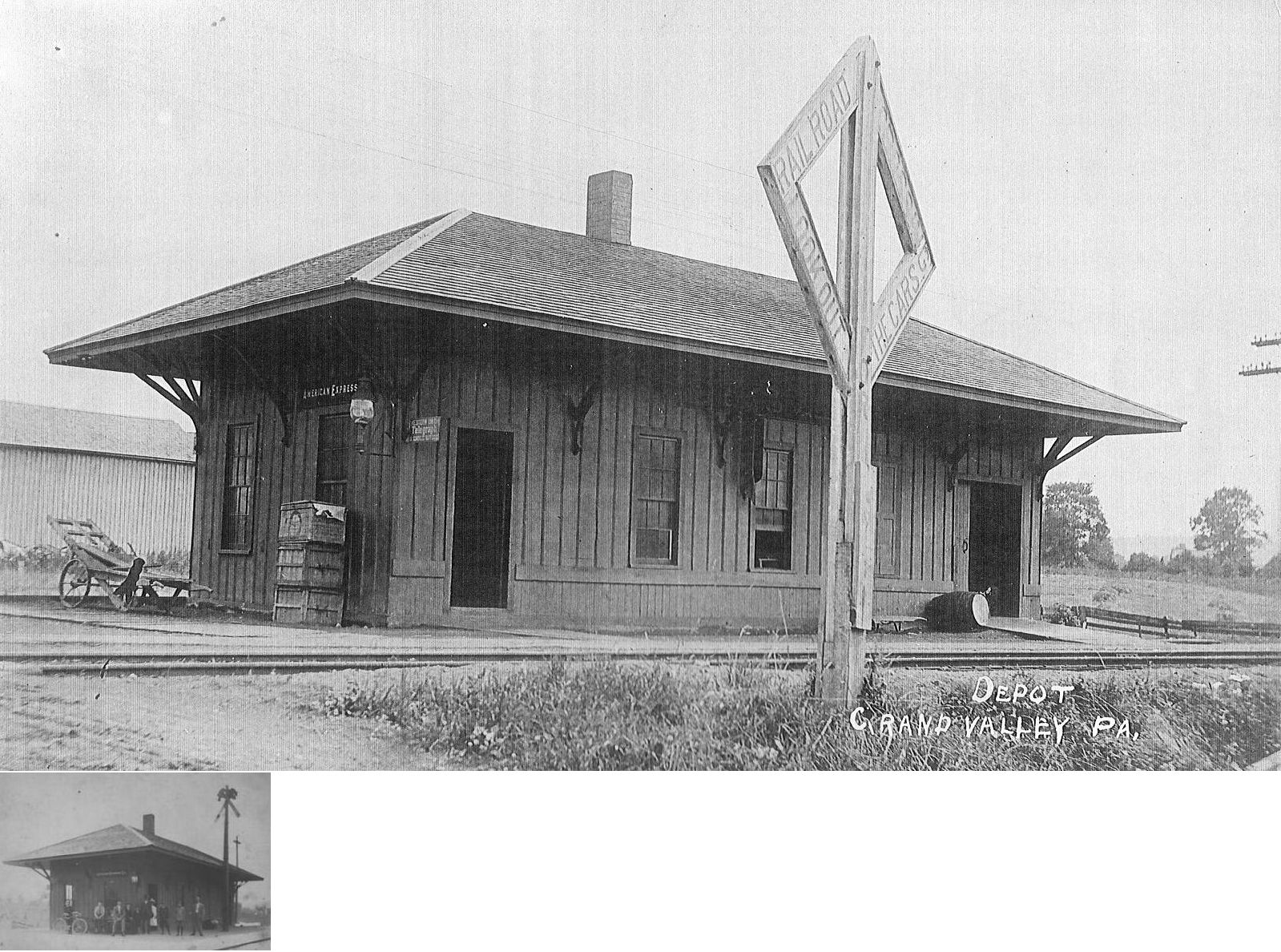
| Grand Valley | |
|||||||
| Hemlock |
|
|||||||
|
Horn (Horne) |
|
This station was at MP 47.4 (distance from the Kane P&E passenger station) between Colza and Spring Creek. It appears on the 1900 PRR timetable. According to PRR valuation records, there was only a wooden platform here in 1918. | ||||||
| Hovers Station |
|
|||||||
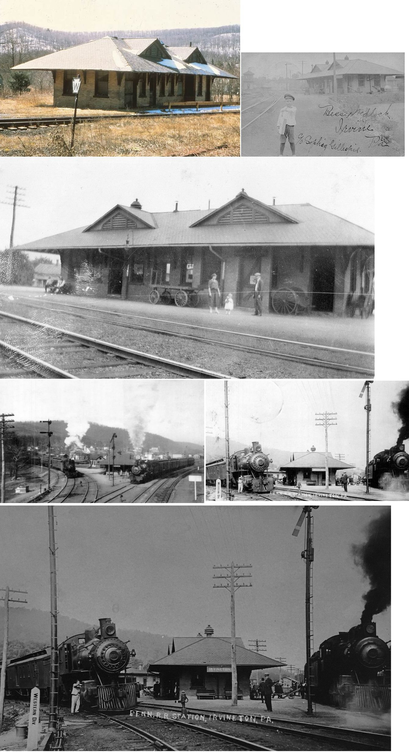
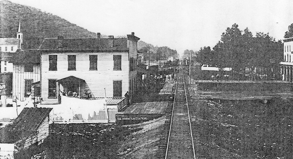
|
Irvineton (Irvine) |
|
The first railroad station was on the northeast corner of Brokenstraw Creek crossing, just across from the Cornplanter Hotel. In 1880 the depot received a new tin roof (Kane Weekly Blade, 5-20-1880). The station burned down in 1886 and a new station was planned (The Forest Republican, 8-25-1886), but it is not clear if was built until the new brick station was erected in 1903. | ||||||
|
Irvineton (Irvine) |
AND |
This brick station was built in 1903 after the town was without a station for many years after the previous station burned (The Forest Republican, 11-25-1903). It opened on April 1, 1904. | ||||||
|
Irvineton (Irvine) |
|
Freight station. | ||||||
| IRVINETON (Irvine) |
|
This was the first station in Irvineton. It was between Main Street and Jackson Valley Street. The DAV&P ticket office was in the front part of the Junction Hotel on the north side of the tracks between what is now Johnson and Depot Streets.” That ticket office was destroyed by fire in 1893. | ||||||
| Irvineton (Irvine) |
|
This was the second DAV&P station in Irvineton. | ||||||
| Irvineton (Irvine) |
|
The third station here was a modified railroad car that was moved to the north side of the tracks at Depot Street where it served as a station until passenger service was discontinued in the 1930s. | ||||||
| Johnny Cake (Gowango) |
|
|||||||
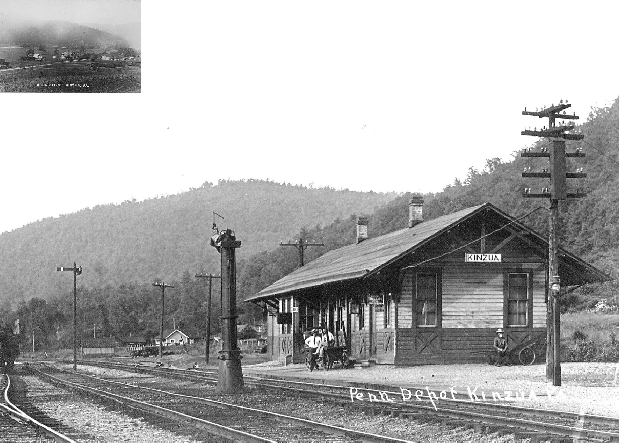
| Kinzua | |
May have also been used for MT Jewett & Kinzua and/or Olean Bradford & Warren RR. According to the Warren Times-Mirror on January 21, 1960, the station was slated to be torn down to increase visibility for traffic at the RR crossing there. To accomplished this goal, it appears that the station subsequently burned down on Feb. 16, 1960. This area has been underwater since the completion of the Kinzua Dam in 1965. At that time rail line was abandoned from Warren to Olean, NY. | ||||||
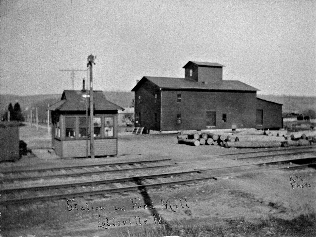
| Lottsville | |
|||||||
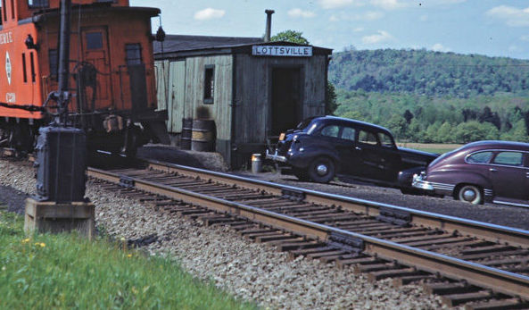
| Lottsville | |
Later a converted boxcar was used as a station here. | ||||||
| Magee Station |
|
This station was where Magee Run empties into the Allegheny River in Deerfield Township. | ||||||
| Martin Station |
|
|||||||
| Newton Station | |
Was converted into a residence after it went out of service. Final disposition unknown. | ||||||
|
North
Clarendon (Clarendon) |
|
Known as Clarendon Station on the 1878 map. In the early days, Old Carlendon and North Clarendon were two seperate towns, but the oil boom in the area cause them to grow into each other with the just the name Clarendon sticking to the merger. The first station here was probably built when the railroad was new to the area in the mid-1860s. | ||||||
| North Clarendon | |
The second station here was built in 1880-1881 (PRR valuation records say 1878), but the frame of the building became unstable and virtually collapsed, so construction had to begin again (Kane Weekly Blade, April 28, 1881). This station was damaged in a fire that burned much of the town - in all, 106 buildings were destroyed. Although the station did catch fire, it was the only structure of consequence to be saved (Wilkes-Barre Record, July 8, 1887). It was on the north side of Railroad Avenue at GPS: 41.778864, -79.095082. In 1926 a new foundation was laid about 25 feet to the north and the depot was moved to this new foundation so that passenger trains could stop at the depot without blocking the intersection (Warren Tribune, Oct. 21, 1926). | ||||||
|
North Warren (State Hospital) |
|
There was a small freight station that served the state hospital. It was just north of Hospital Drive on the east side of the tracks at GPS: 41.879490, -79.149834. | ||||||
|
Pennsylvania House Station |
|
This station is shown ont he 1912 county map. It was in the SE corner of Broken Straw township. | ||||||
| Pine Valley |
|
A station is shown here on the 1912 county map. | ||||||
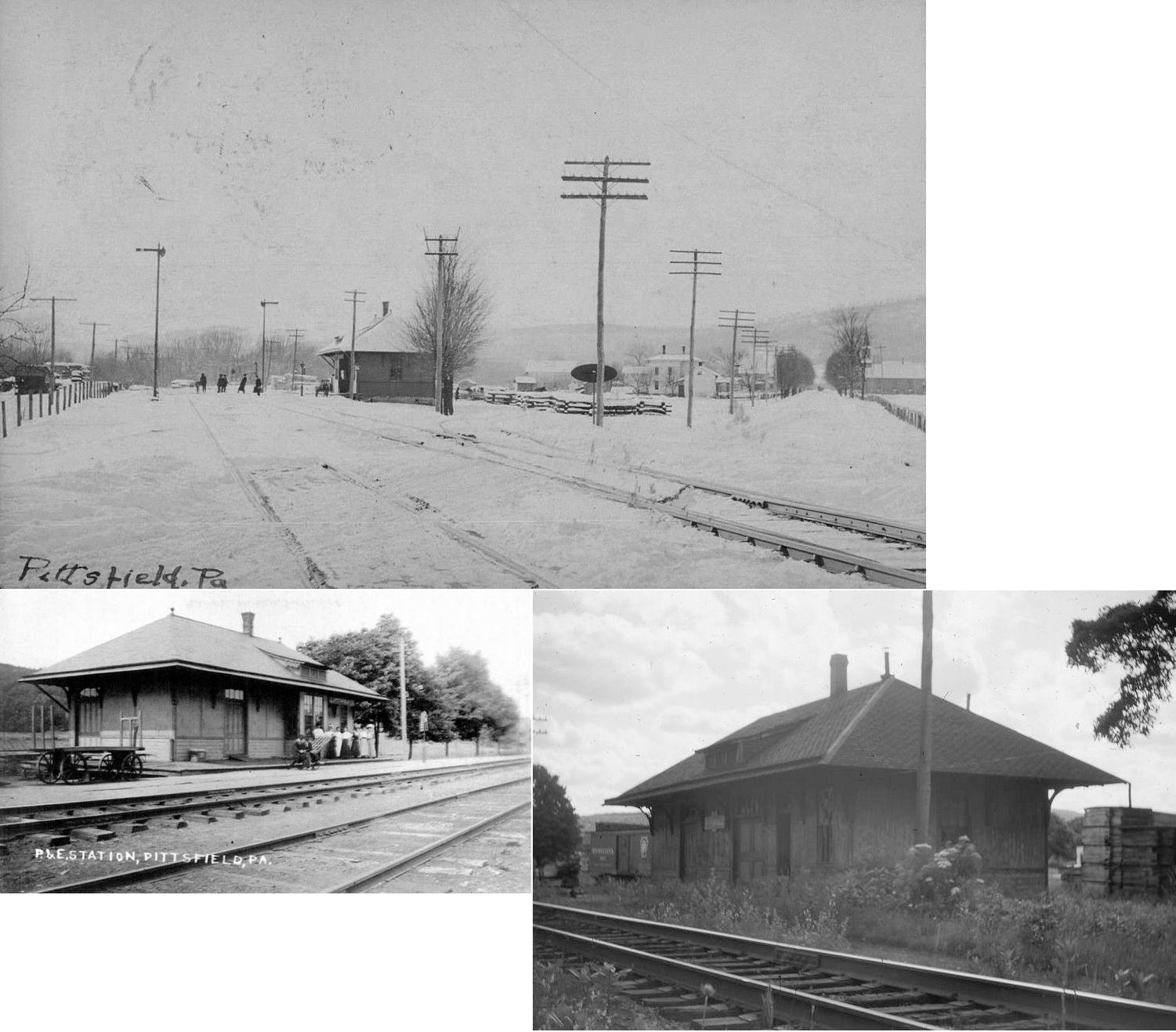
| Pittsfield |
|
The station was on the south side of Main Street (Old Pittsfield Road). A new station was built here in 1897 (according to PRR valuation records). | ||||||
| Pittsfield Station |
|
|||||||
| Roach |
|
This station was at MP 53.8 (distance from the Kane P&E passenger station) between Colza and Spring Creek. It appears on the 1900 PRR timetable. | ||||||
| Roystone |
|
According to PRR valuation records, a new station was built here in 1914. | ||||||
| Russell (Russellsburg) |
|
In 1878 the station was on what is now Cider Mill Hill Road on the south side of the tracks. | ||||||
| Saybrook |
|
|||||||
| Selkirk Station |
|
|||||||
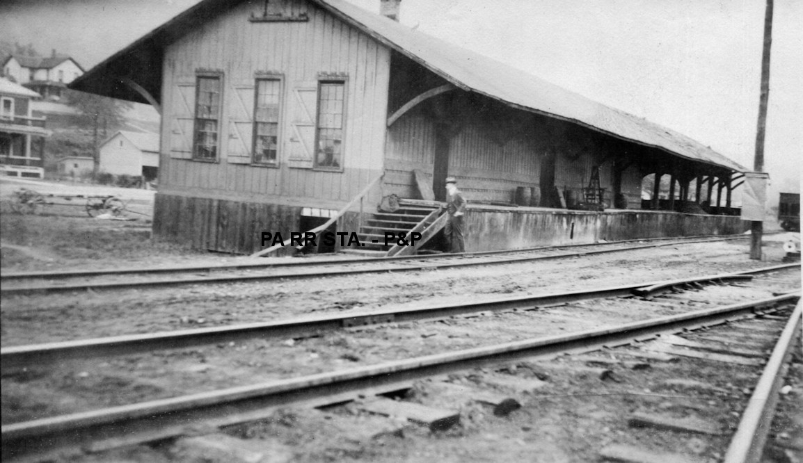
| Sheffield |
|
This appears to be the pre-1907 station. | ||||||
| Sheffield |
 |
|||||||
| Sheffield |
|
This freight station was east of the passenger station in the vicinity of GPS: 41.703099, -79.030219. It was built in 1908 according to PRR valuation records. Due to competition from trucks hauling freight, the station closed in 1932 and freight operations were returned to the passenger station (where they had been before this freight station was built) (Warren Times Mirror, 5-2-1932). | ||||||
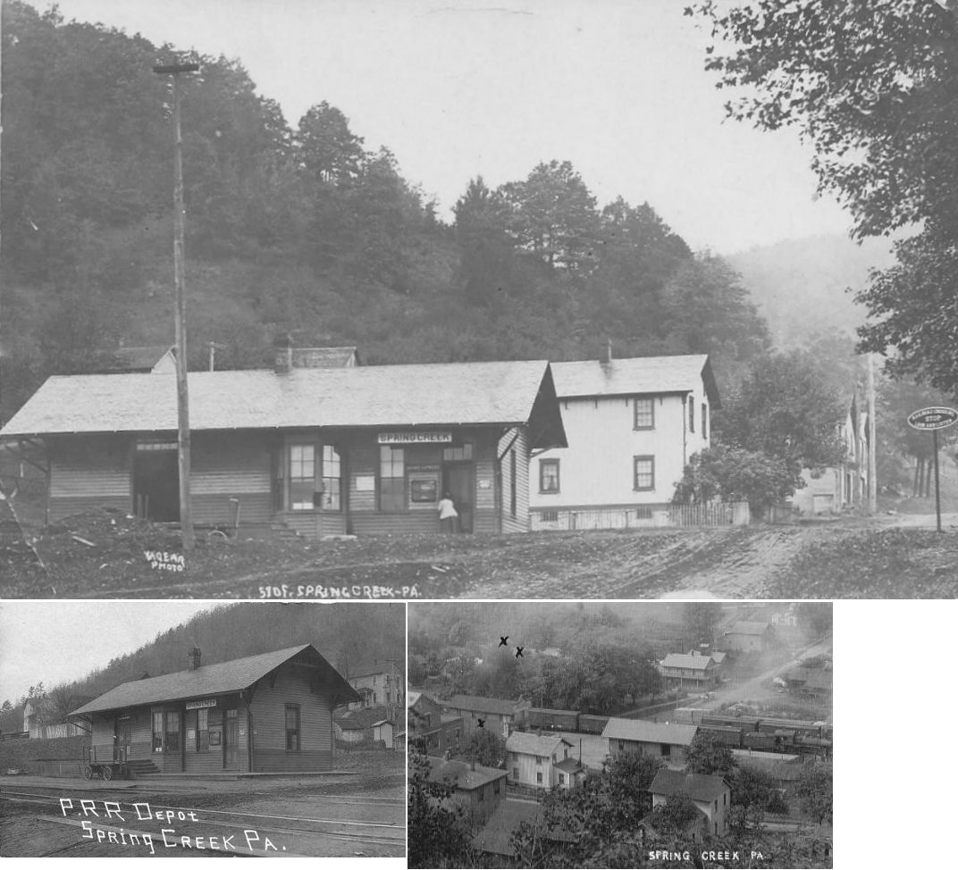
| Spring Creek |
|
This station was on the NW side of Old Route 77 (Blue Eye Road) on the NE side of the tracks at GPS: 41.875823, -79.525928. A station is shown here on the 1878 map. A new station was built here in 1882 (according to PRR valuation records, it was built in 1888). | ||||||
| Starbrick |
|
|||||||
| Starbrick |
|
According to PRR valuation records, there was a shelter here that was built in 1910. | ||||||
| Starr |
|
|||||||
| Stoneham (Otts) |
|
A new station was built here in 1881 (Kane Weekly Blade, 12-01-1881). | ||||||
| Struthers |
|
See the listing for Warren below. | ||||||
| Sugar Run |
|
The first station here burned down on January 24, 1898 (Warren Evening Democrat, 2-1-1898). It was replaced temporarily with a narrow-gague passenger coach until the new station was built. | ||||||
| Sugar Run (Cornplanter) |
|
|||||||
| Thompson Station |
|
|||||||
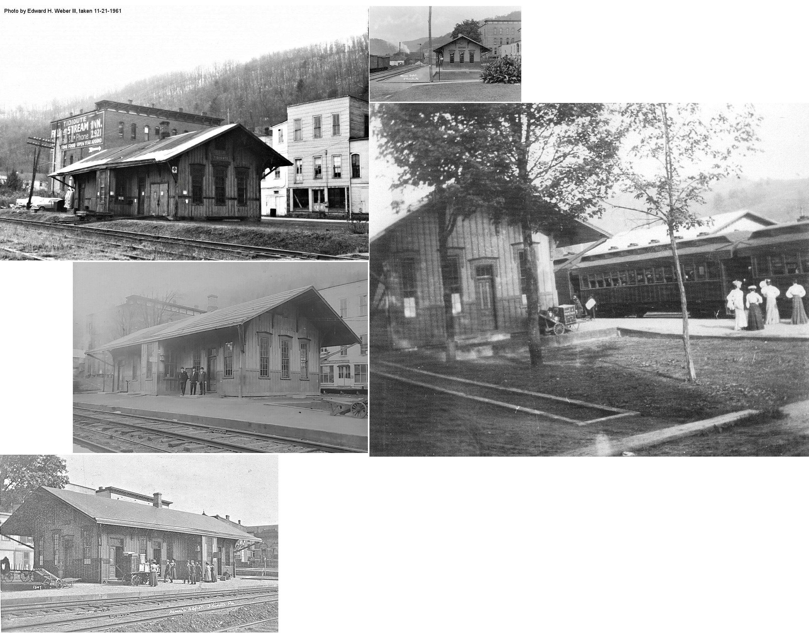
| Tidioute |
|
The station was on the west side of Buckingham Street (formerly Depot Street) on the north side of the tracks at GPS: 41.682539, -79.413302. The station was torn down around 1970 to make room for a parking lot. There was a freight station on the south side of the tracks at GPS: 41.682367, -79.413060. | ||||||
| Tiona |
|
A station is shown here on the 1878 map. A new station opened here in 1883. The last station here (possibly the 1883 station) was torn down in 1915 after having been closed for serveral years prior (Warren Times Mirror, Aug. 20, 1915), however, according to PRR valuation records, a new passenger shelter was built here in 1916. | ||||||
| Torpedo |
|
|||||||
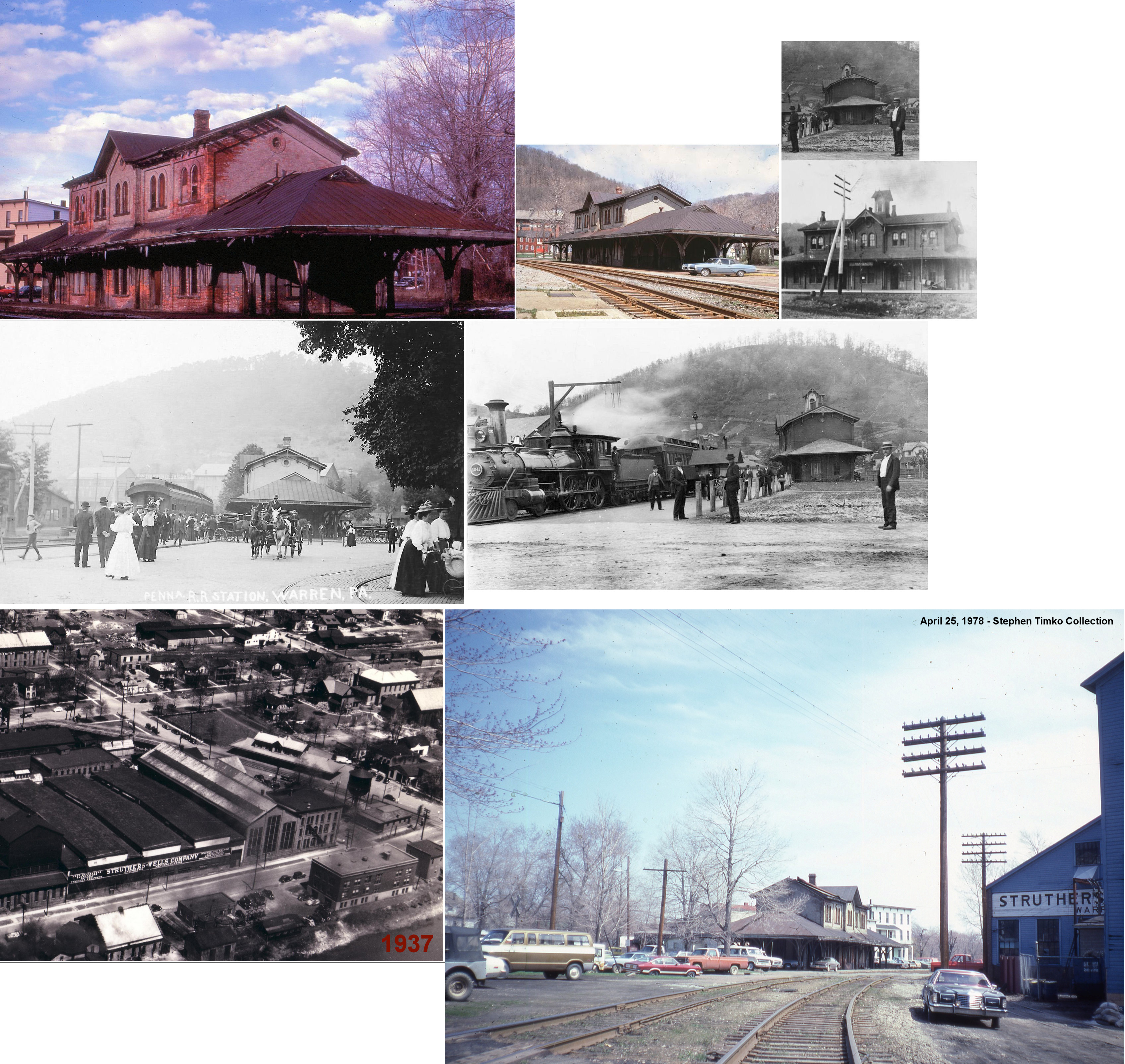
| Warren |
|
The first station here was at 4th Avenue and Beech Street. | ||||||
| Warren | |
This station, built in 1893, sat at the NW corner of Laurel Street and 4th Avenue at GPS: 41.846904, -79.155858. It was torn down around 1938. It was the second DAV&P depot, replacing the one at 4th Avenue and Beech Street which became a freight house until it was replaced with the larger freight house that still exists. | ||||||
| Warren | |
This station was at 316 Chestnut Street on the NE side of Chestnut Street between Pennsylvania Avenue and 4th Avenue at GPS: 41.844192, -79.160302. One of the photos shows the station before modifications were made around 1900. The station was built in 1868 according NRHP documents (but 1878 according to PRR valuation records). Despite being listed on the National Register of Historic Places in 1974, it was torn down by Conrail on March 4, 1986. | ||||||
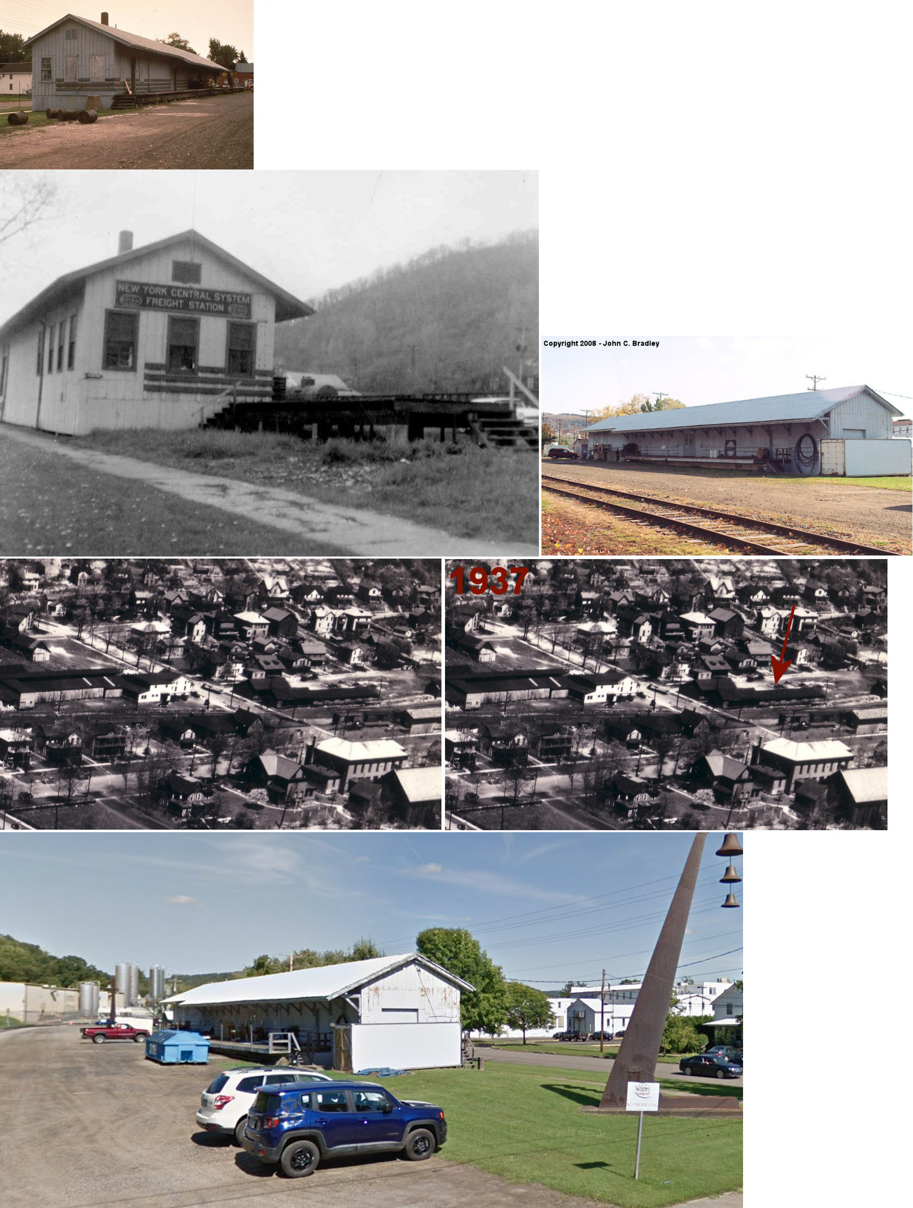
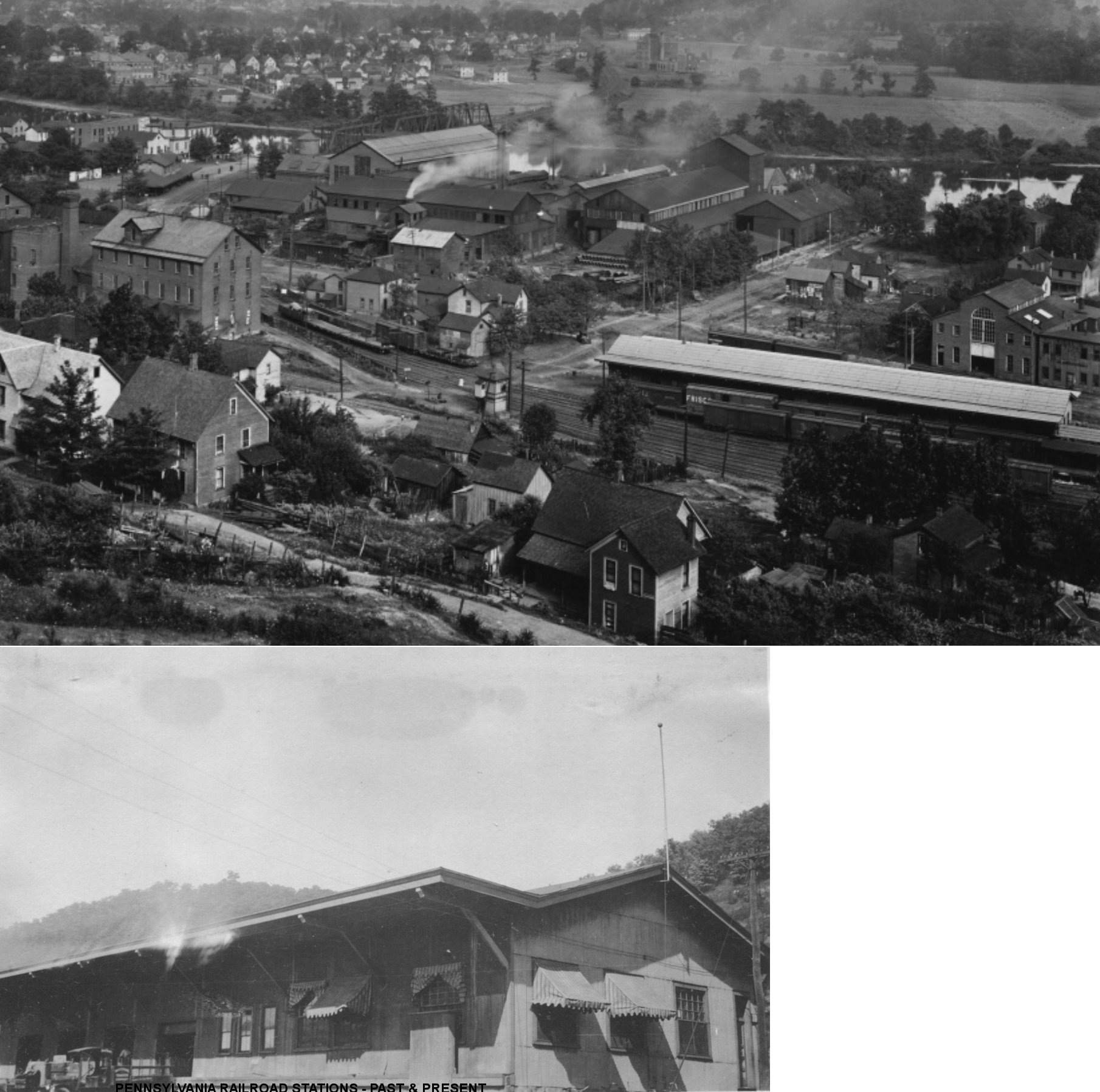
| Warren | |
There was a large freight house on the north side of 4th Avenue at Public Way at GPS: 41.843816, -79.162936. According to PRR valuation records, it was built in 1903 after the earlier freight house here burned down in 1902. | ||||||
| Warren (Struthers) |
|
This combination passenger and freight station was on the SE side of Carver Street on the NE side of the tracks at GPS: 41.837866, -79.137533. It was built about 1895 (Warren Evening Democrat, 8-16-1895). | ||||||
| Weldbank | |
This station was just SE of Clarendon. | ||||||
| Whitestown | |
|||||||
| Youngsville | |
A new station was built here in 1889, although according to PRR valuation records, it was built in 1883. The station was on the east side of Railroad Street at GPS: 41.848982, -79.317783. | ||||||
| Youngsville | |
This depot was on Oak Street from 1902 through 1920. | ||||||
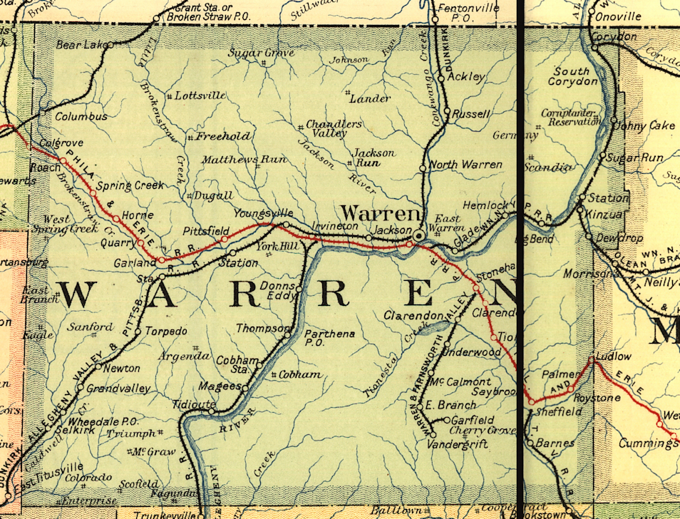
| 1895 WARREN COUNTY RAILROAD MAP | ||||||||
 |
||||||||
|
Notes About Existing
Stations...
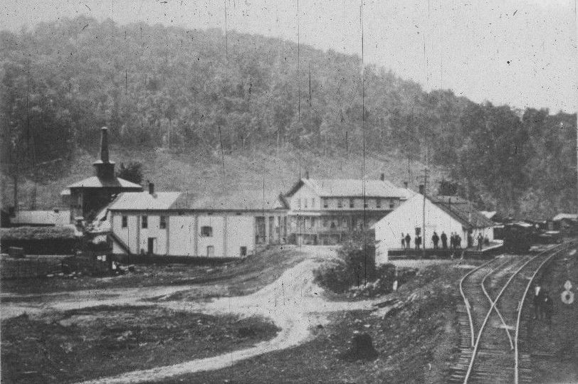
Sheffield (P&E) - This station was also used by the Tionesta Valley RR for 25 years prior to that line opening its own station. PRR valutation records list the station as having been built in 1883. Sugar Grove (Y&SG) - This station was on the Youngsville & Sugar Grove RR , which was incorporated around 1902 to build an 11-mile line between the two towns. The RR used ex-NY Elevated RR equipment as shown in the photo. It connected with the NYC (DAV&P) in Youngsville. Originally it was intended to be a traction line, but it was never electrified. Operated 1919 open White 20-passenger bus on rails for a while. The Y&SG Street Railway was charted in 1902, operation commenced in Nov. 1903. Taken over by Warren County Traction Company 1909, Panama Traction Company in 1916. Line went to sherrif's sale in spring 1920. During the 1950s and 1960s the building served as borough offices and public library, now houses law offices (2nd floor) and a doctor's office. Warren (DAV&P) - Part of this building was the original DAV&P passenger station. Later, the building was enlarged to serve as the NYC freight house. |
||||||||