|
|
||||||||
| EXISTING STATIONS | ||||||||
|---|---|---|---|---|---|---|---|---|
| Station Name |
Original Railroad | Current Location |
Type | Date Built |
Current Use |
Track Status |
Building Material |
More Info |
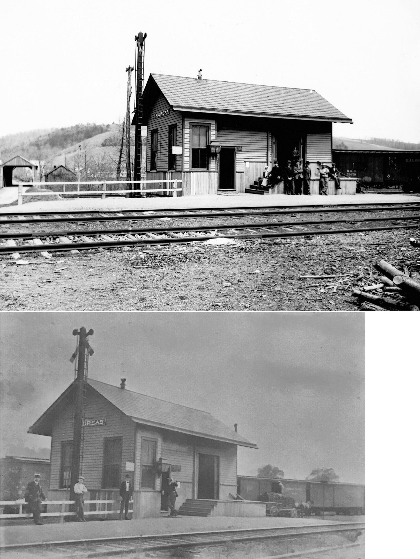
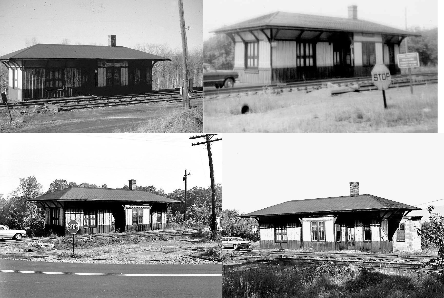
| Andreas |
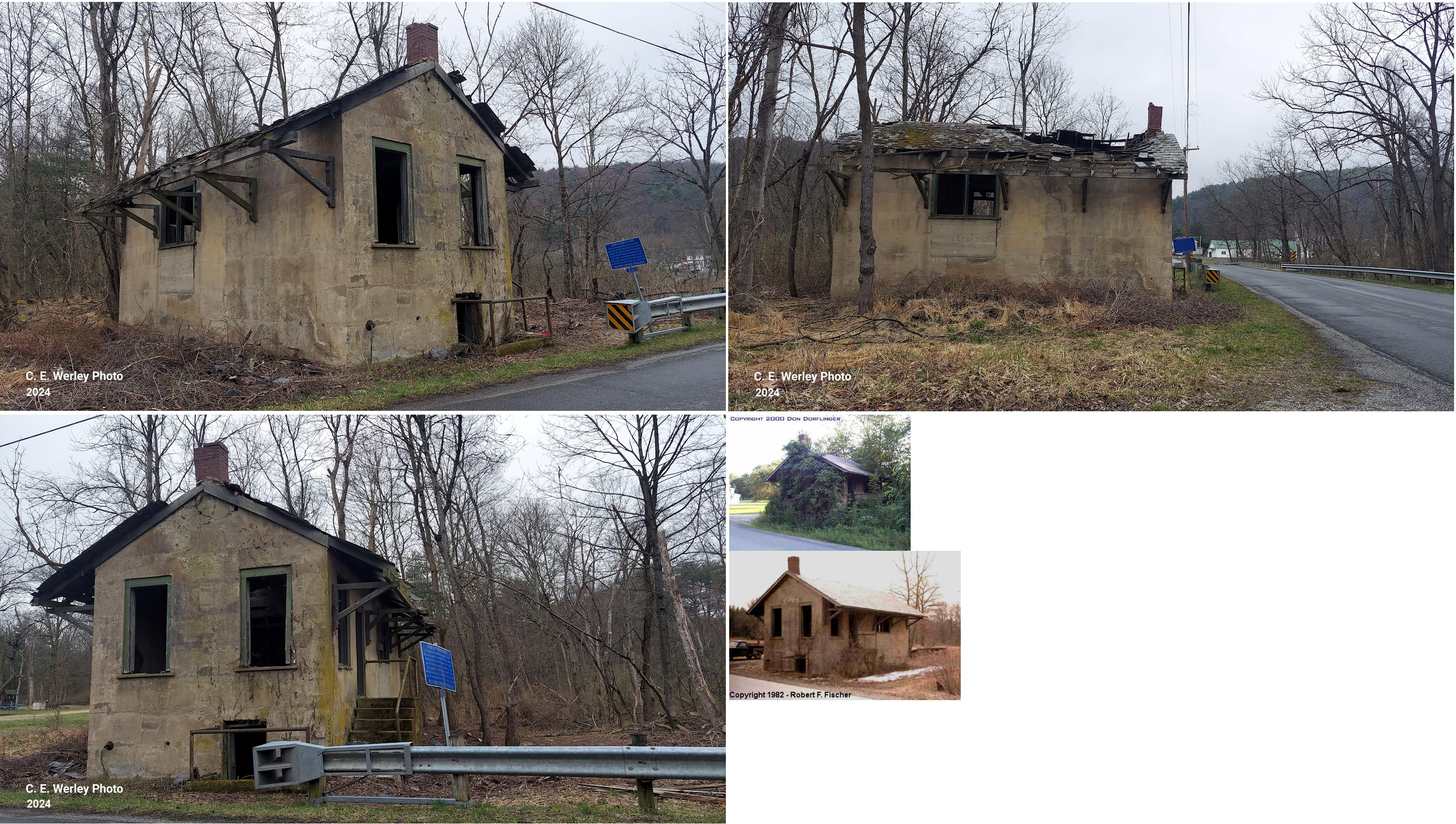
 |
West side of Andreas Road just south of Lizard Creek (40.748958, -75.791538) |
C | 1912 | Vacant | Gone | Concrete | |
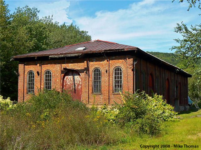
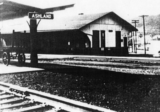
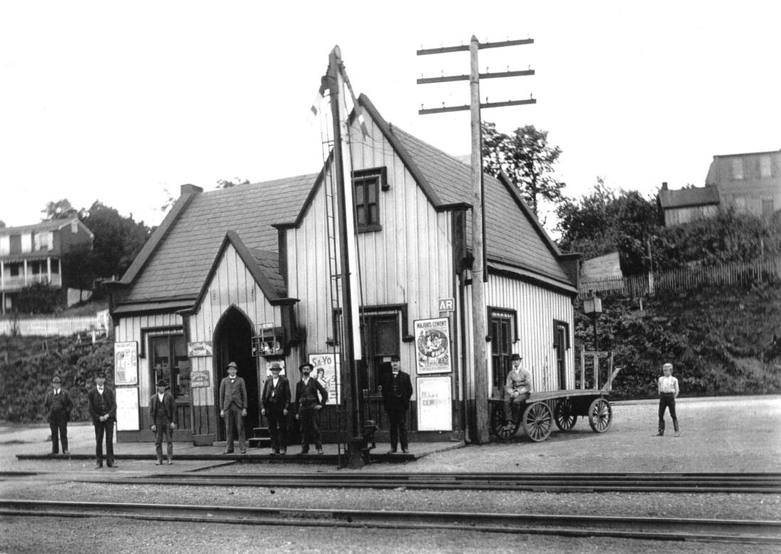
| Ashland |
 |
Behind Boyer's Food Market off Railroad Street and Lehigh Avenue (GPS: 40.782611, -76.330995) |
F | 1900 | Business | In Use | Brick |
|
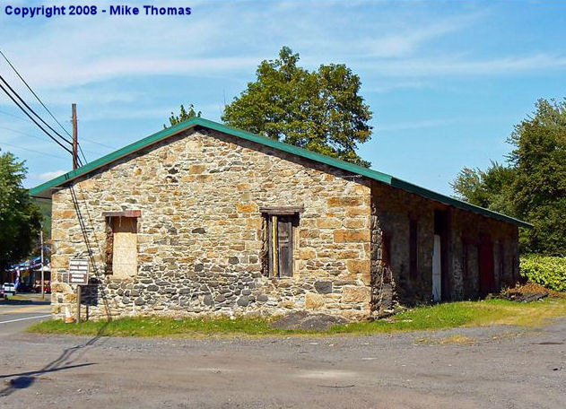
| Ashland |
 |
South Hoffman Boulevard (GPS: 40.779673, -76.336929) |
C | 1855 | Vacant | In Use | Stone |
|
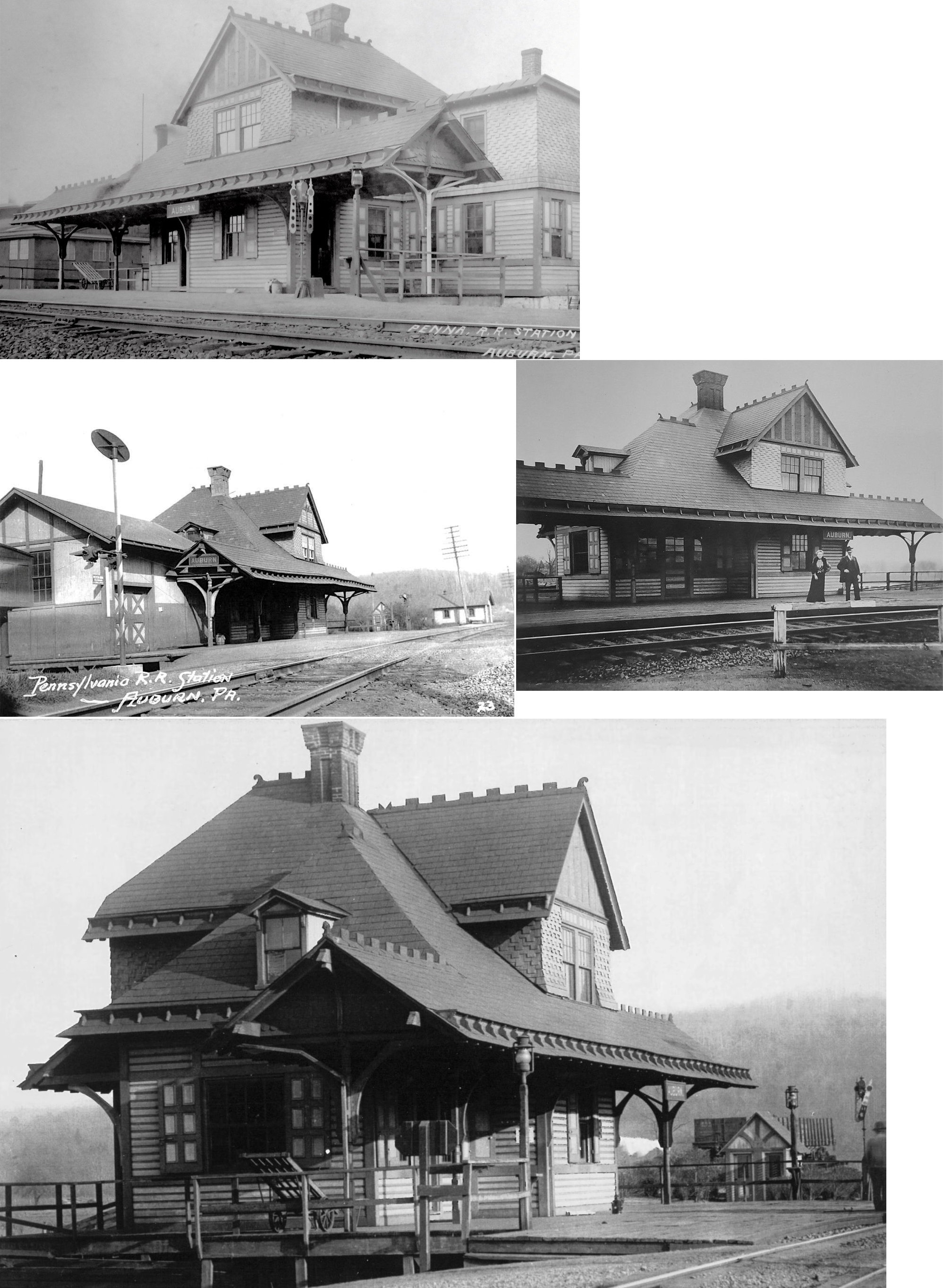
| Auburn |
|
Front Street | P | 1903 | Residence | In Use | Brick | |
| Aucheys Station |
|
???? | P | ???? | ???? | None | Wood | |
| BRANCH DALE |
|
PA 209 | P | ???? | Residence | Gone | Wood |
|
| Cressona |
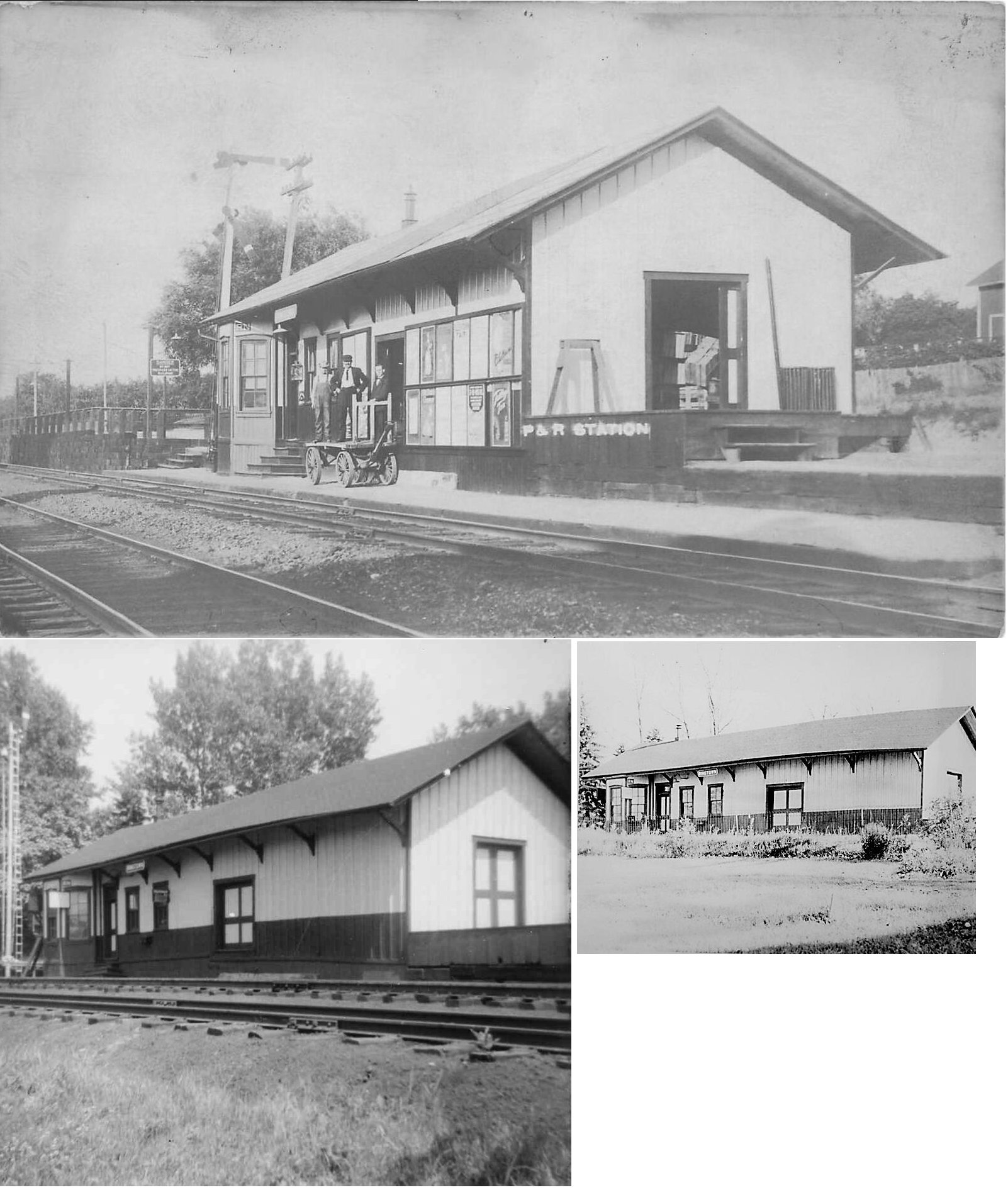
|
Front Street next to overpass | P | 1911 | Storage | In Use | Brick | |
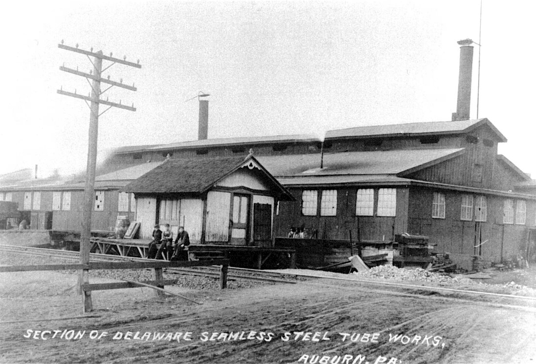
| East Mahanoy Junction |
|
Off State Rd.(Township Rd. #891) | C | 1917 | Residence | In Use | Wood |
|
|
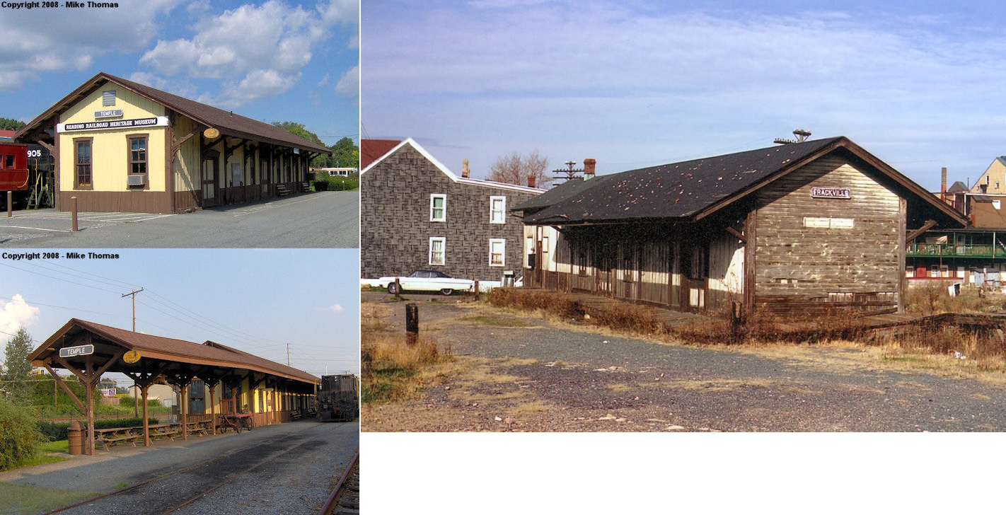
Frackville (Temple) |
|
Tuckerton Road in Temple (Berks Co.) | F | Railroad | 1905 | In Use | Wood |
|
| Gilberton |
|
Main Street east of Shaft Street (GPS: 40.801106, -76.208380) |
C | 1880 | Business | In Use | Wood |
|
| Hecksherville |
|
Located in a field opposite 793 Valley Road, Pottsville, PA. | F | ???? | Vacant | Gone | Wood |
|
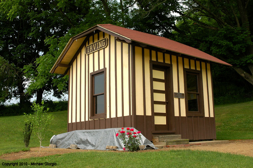
| Irving |
|
Pine Grove Historical Society, 205 North Tulpehocken Street, Pine Grove | C | ???? | Museum | None | Wood | |
| mCaDOO |
 |
Rear of 535 South Kennedy Drive (GPS: 40.895762, -75.994363) |
C | 1908 | Residence | In Use | Wood |
|
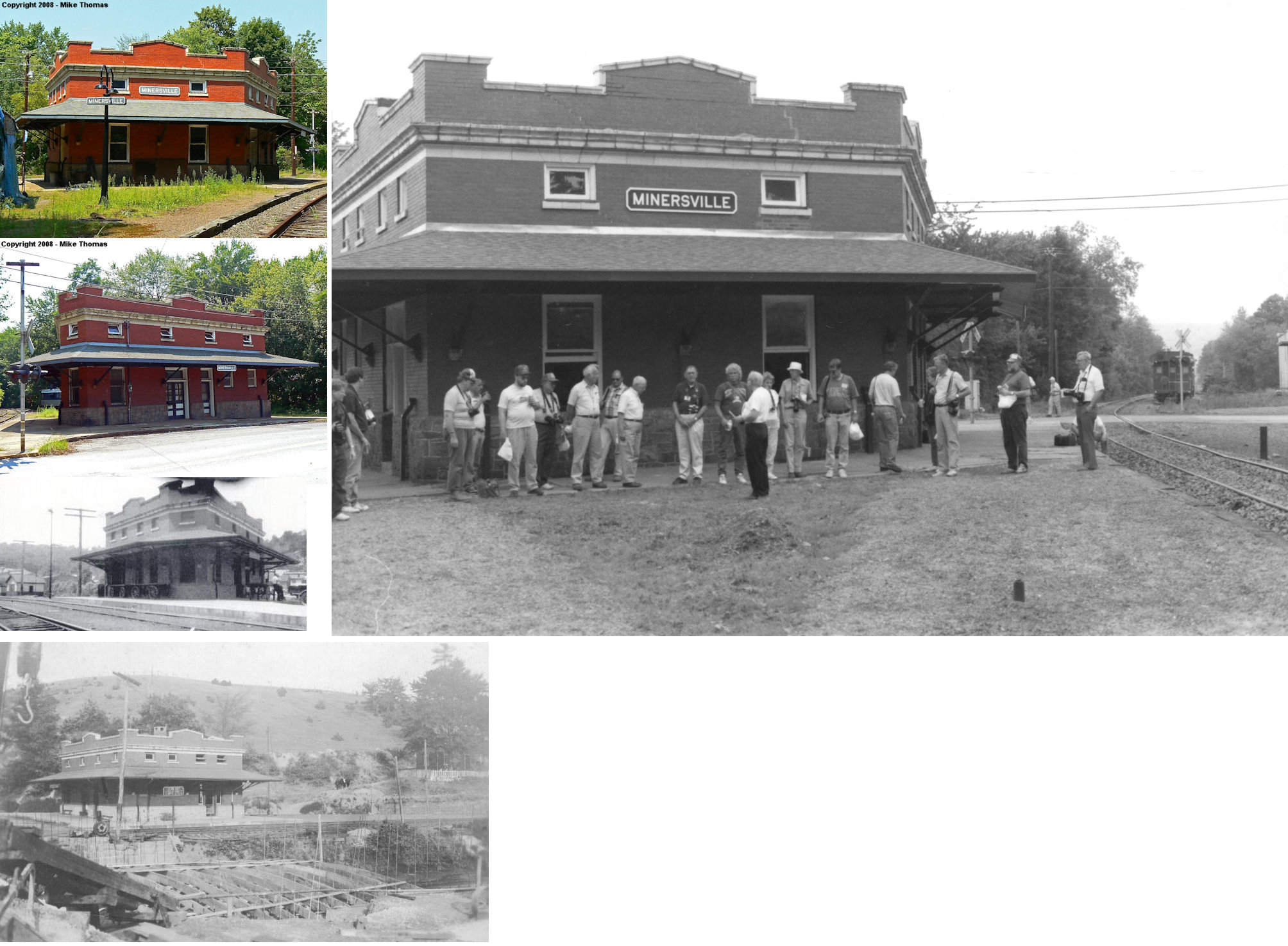
| Minersville |
|
East Sunbury Street between River Street and Teaberry Hill Road (GPS: 40.690295, -76.256014) |
C | 1913 | Civic | In Use | Brick/ Stone |
|
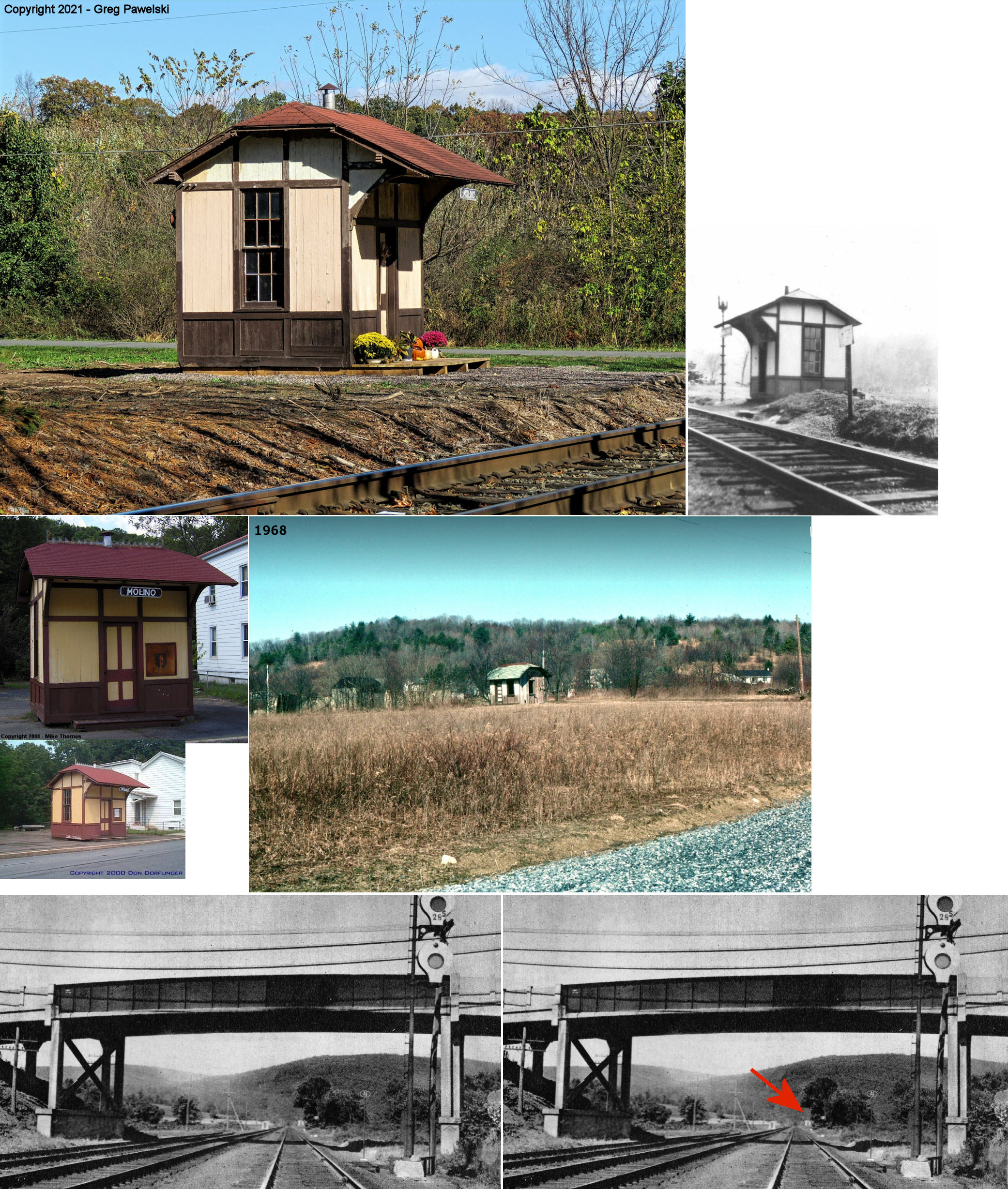
| Molino |
|
Penn Street at Clinton Street in Port Clinton (GPS: 40.582491,-76.025535) |
P | 1875 | Museum | None | Wood |
|
| Moyers |
|
Moyers Station Road south of PA895 (GPS: 40.552093, -76.250104) |
C | 1887 | Residence | Gone | Wood |
|
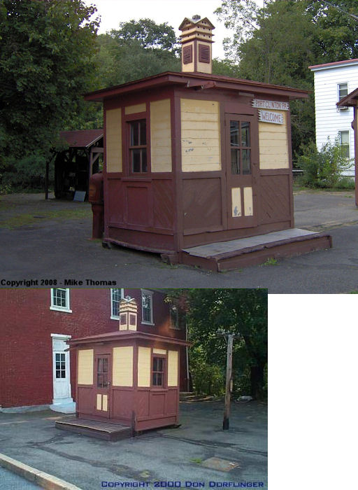
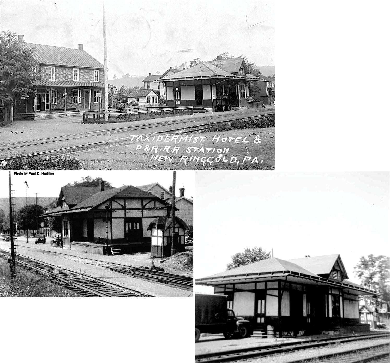
| New Ringgold |
|
Penn Street at Clinton Street in Port Clinton (GPS: 40.582491,-76.025535) |
P | 1875 | Museum | None | Wood |
|
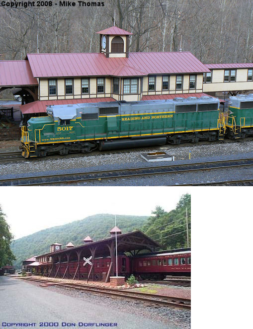
| Port Clinton |
 |
Railroad Avenue (GPS: 40.576323,-76.024822) |
C | 1990s | Railroad | In Use | Wood |
|
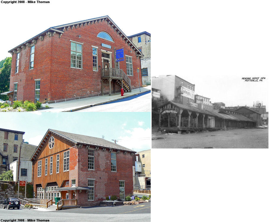
| Pottsville |
|
101 East Union Street (GPS: 40.683364,-76.193072) |
P | 1851 | Offices | None | Brick |
|
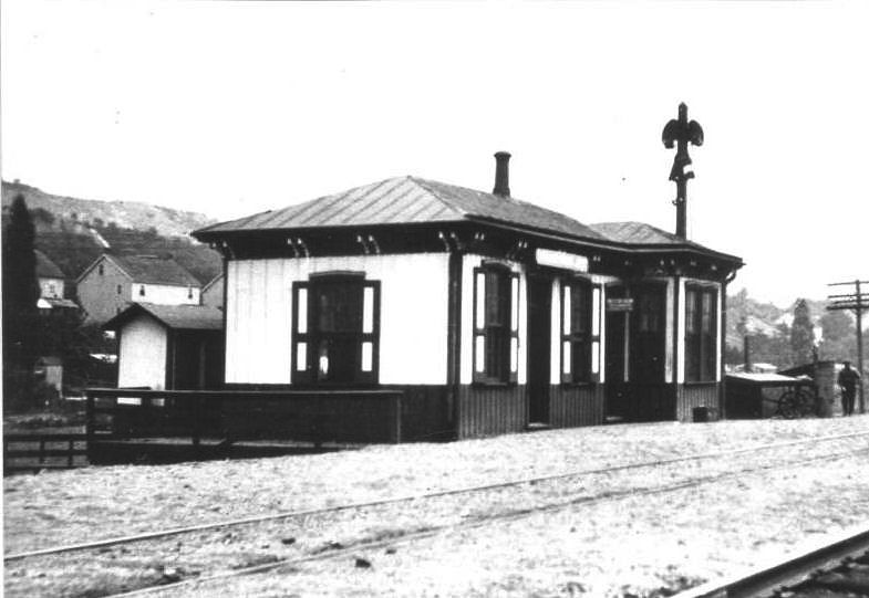
| rock |
|
Covered Bridge Road (first house on the right south of 895 - Rock Rd.) | C | 1900 | Residence | Gone | Wood |
|
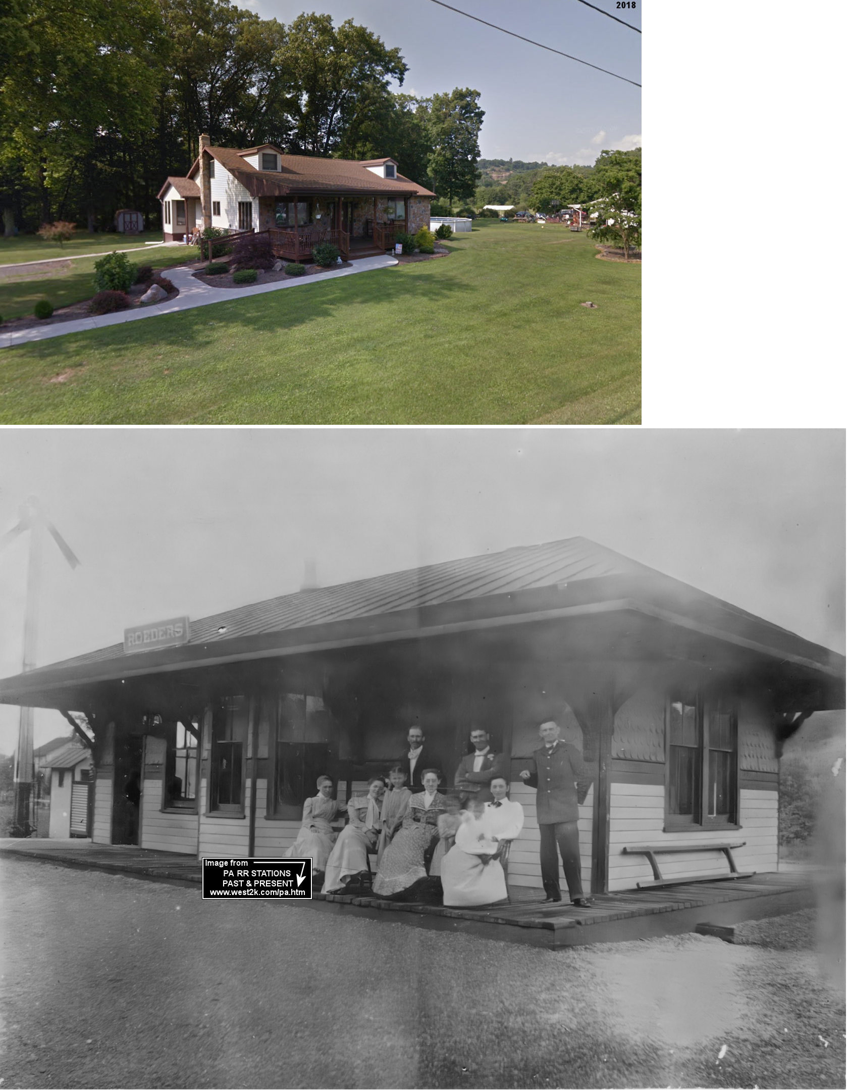
| Roeders |
|
2155 Fair Road (PA895) (GPS: 40.567665, -76.192685) |
C | 1892 | Residence | Gone | Wood |
|
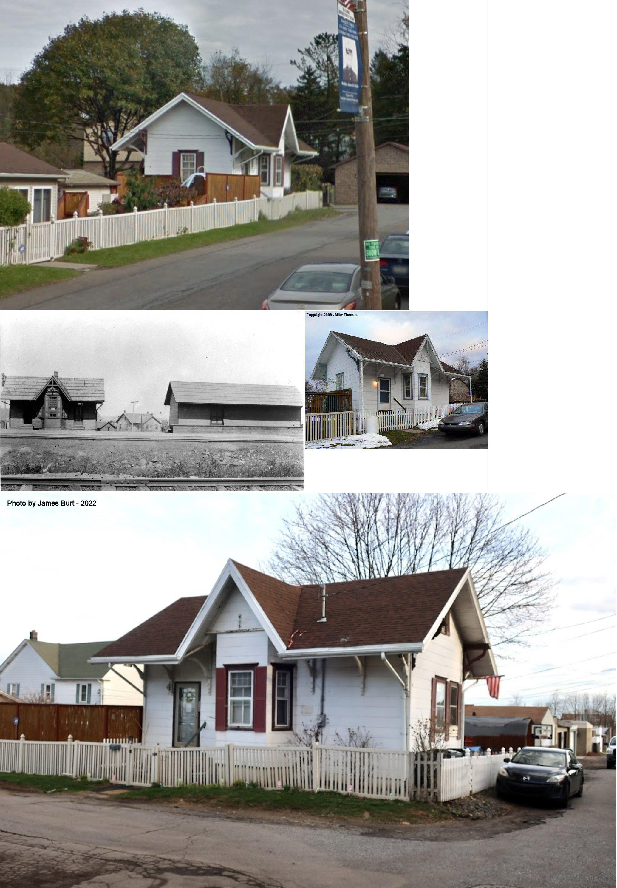
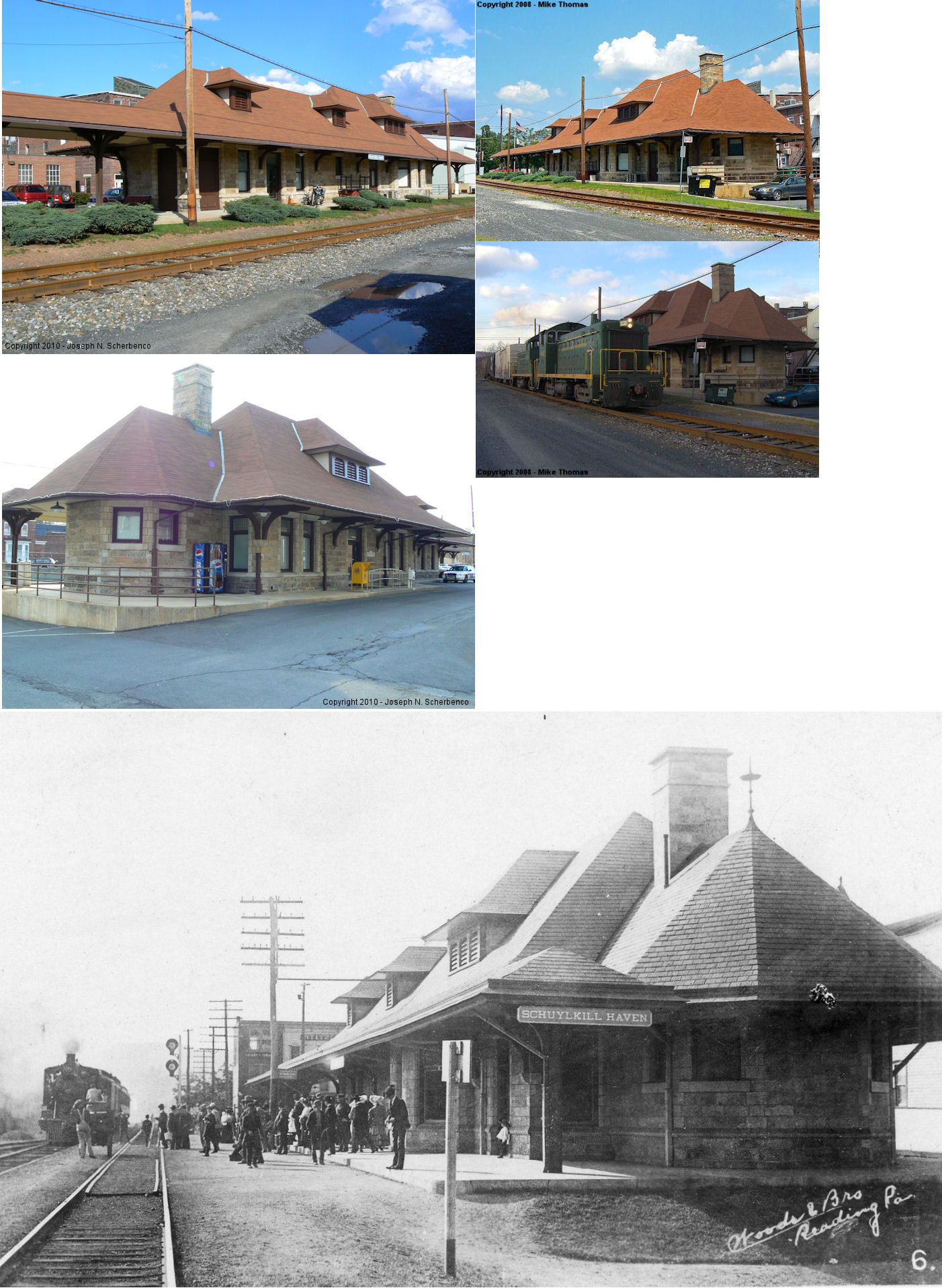
| Schuylkill Haven |
|
West Main Street (GPS: 40.628684,-76.172848). |
P | 1901 | Civic | In Use | Stone |
|
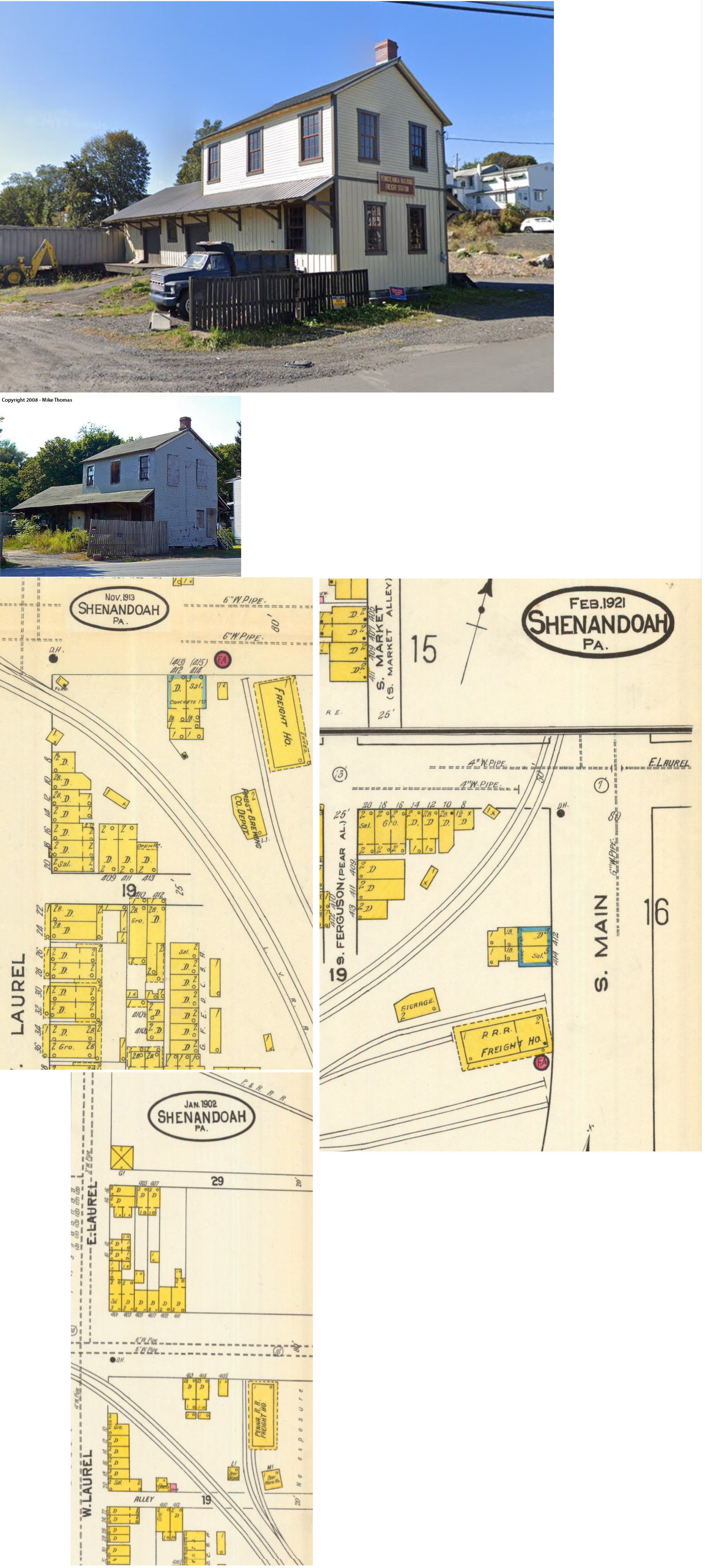
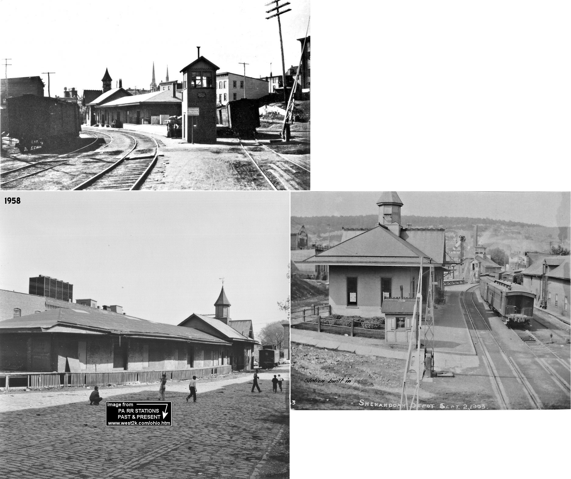
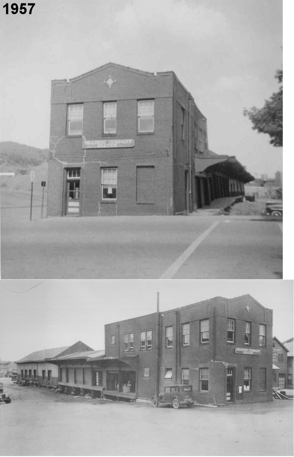
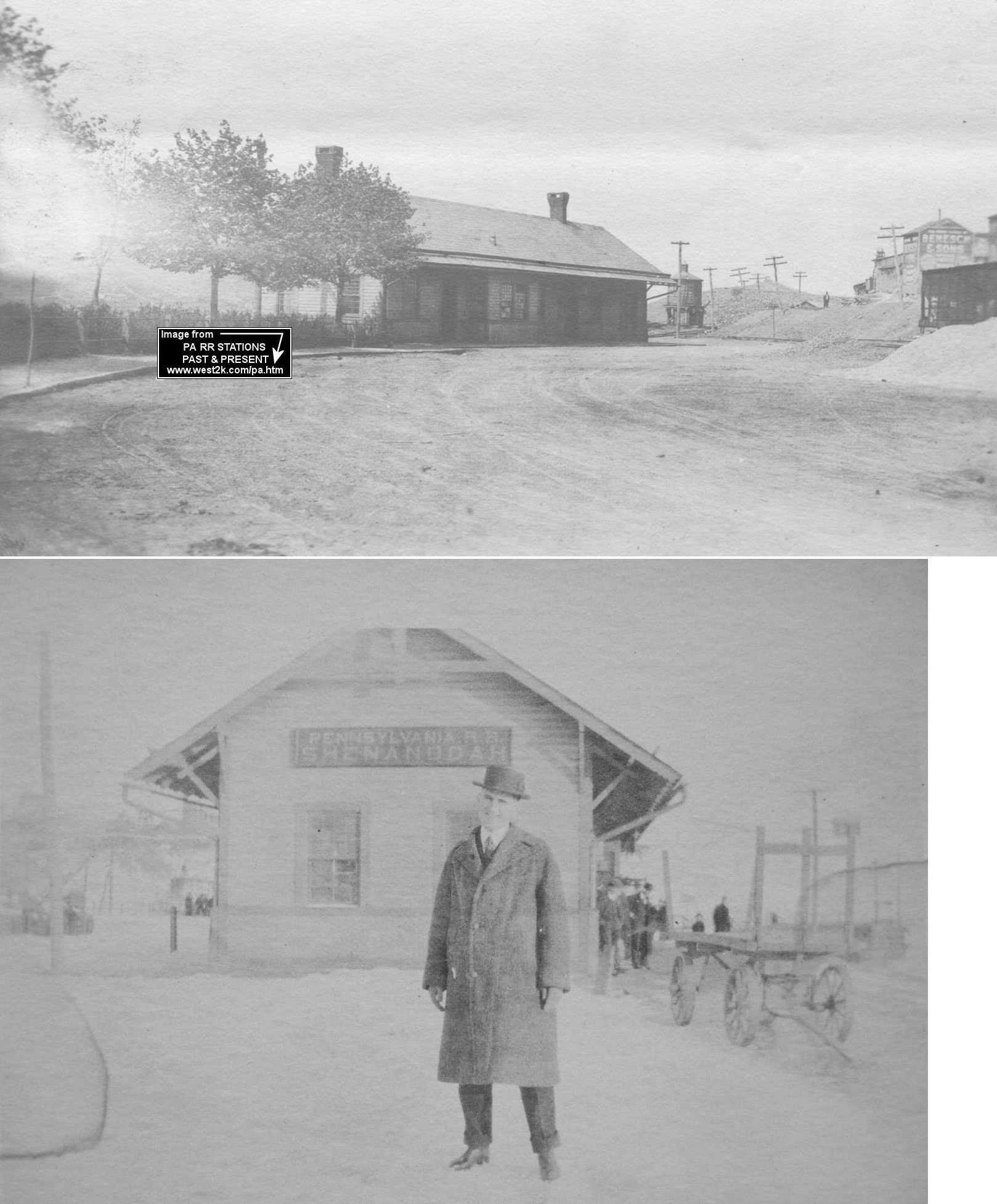
| Shenandoah |
 |
43 South Main Street (GPS: 40.816053, -76.200321) |
F | ???? | Storage | Gone | Wood | |
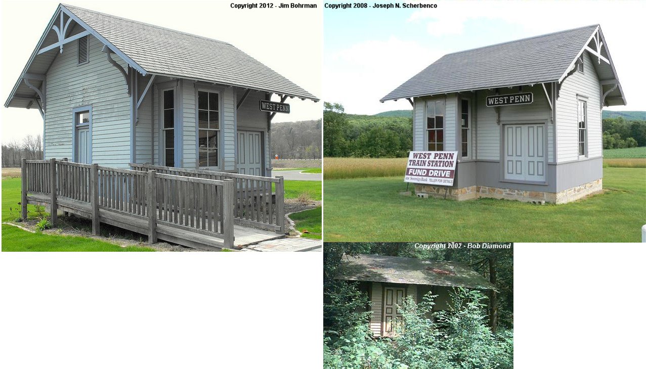
| Snyders (West PEnn) |
|
South corner of PA309 and PA895 in Snyders. (GPS: 40.720185, -75.858418) |
C | 1912 | Vacant | Gone | Wood |
|
| Stanhope |
|
???? | P | ???? | ???? | None | Wood | |
| Swatara |
|
Off US 209 | P | 1918 | Hunting Shack | In Use | Wood | |
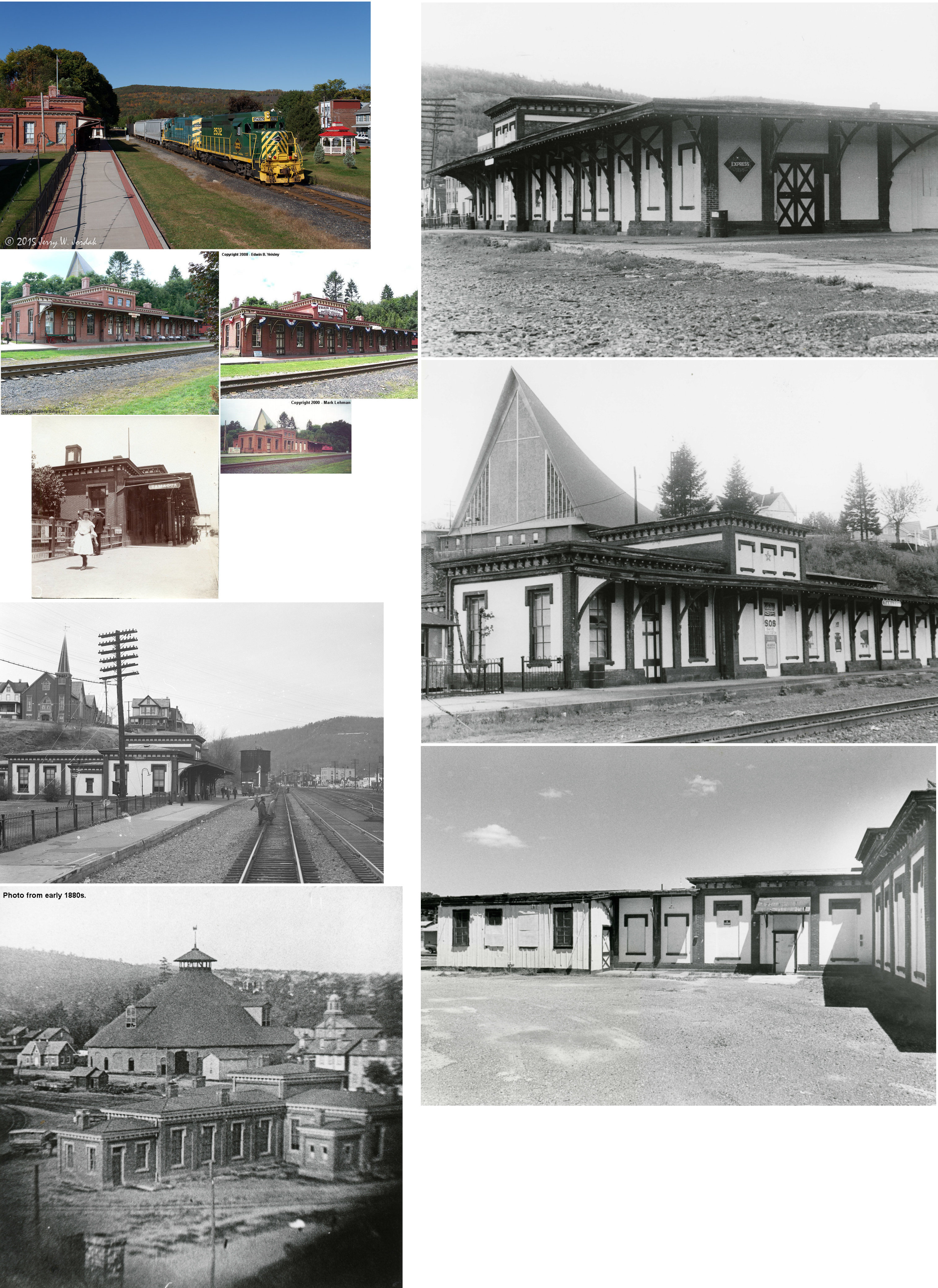
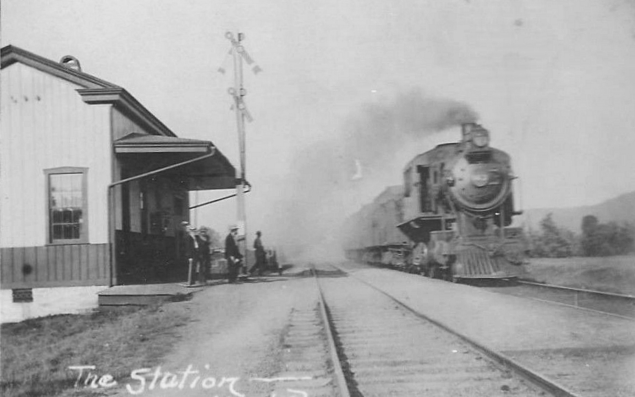
| Tamaqua |
|
Mauch Chunk Street (PA 309) and Broad Street | P | 1874 | Civic | In Use | Brick/ Stucco |
|
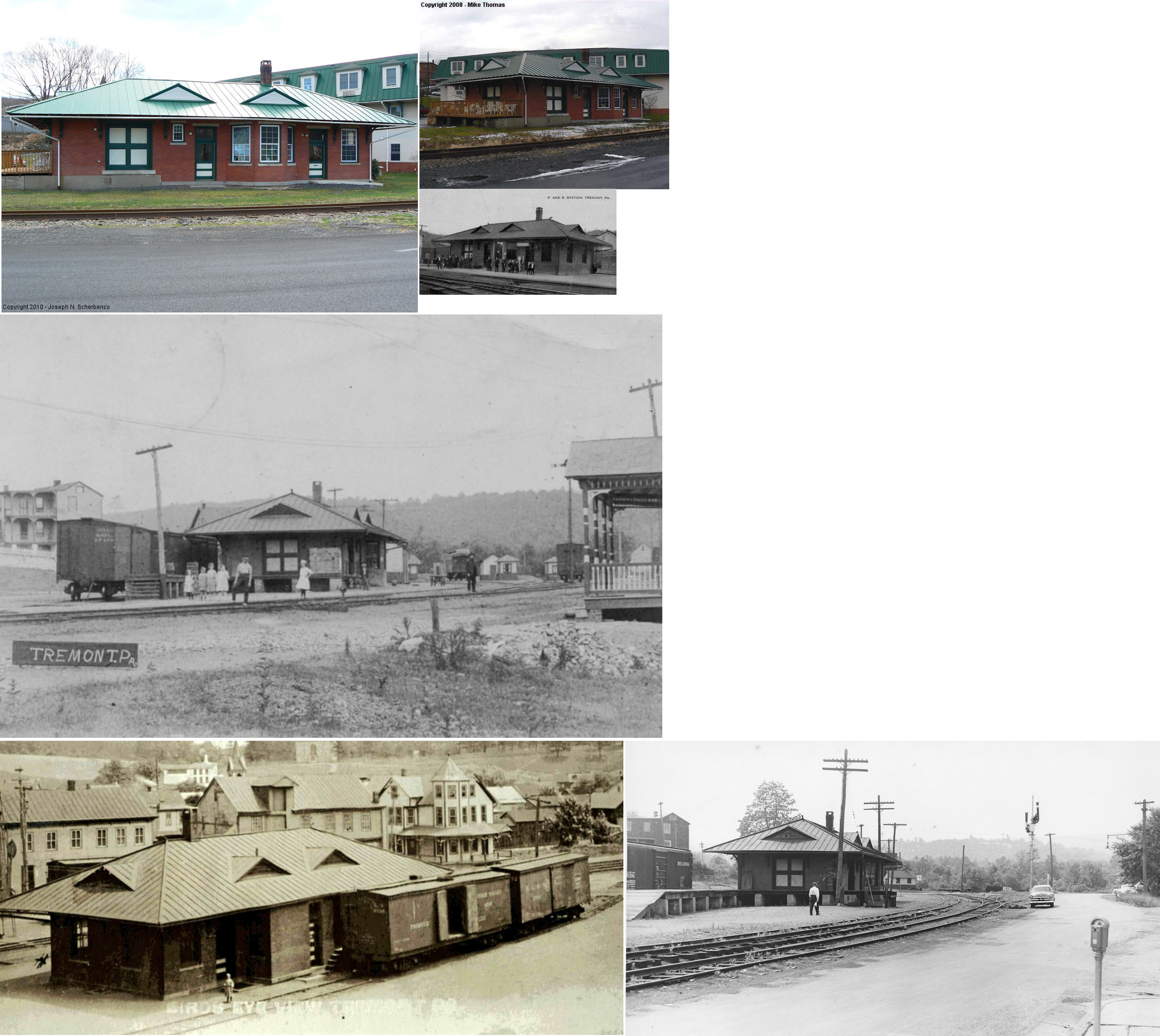
| Tremont |
|
Pine Street and North Crescent Street (GPS: 40.629979,-76.39015) |
C | 1924 | Business | In Use | Brick |
|
| STATIONS OF THE PAST | ||||||||
| Station Name |
Original Railroad |
Notes | ||||||
| Adamsdale |
|
Built by the Pennsylvania & Schuylkill Valley Railroad which was leased by the PRR starting in 1885. Originally called "Adams Station," the name was changed to "Adamsdale" in 1892. | ||||||
| Andreas |
|
This station was on the east side of Andreas Road on the north side of the tracks (GPS: 40.748817, -75.791253). The station was closed in 1935. | ||||||
| Ashland |
|
This station was built in 1879. It was on the north side of East Centre Street east of Mahanoy Creek at GPS: 40.783992, -76.332122. | ||||||
| Ashland |
|
This combination station was located at the end of South Railroad Street at GPS: 40.783306, -76.329832. It was built in 1867 (Sunbury Gazette, 11-2-1867). | ||||||
| Ashland (Miners Depot) |
|
The 1908-1921 maps show a station on the NE corner of Market and North 17th Street at GPS: 40.782155, -76.350947. It is labeled "Miners Depot" on the 1913 and 1921 maps. | ||||||
| Ashland |
|
There was a stone or concrete freight house at what was formerly the north end of 7th Street at approximately GPS: 40.784059, -76.341564. It later served as a lumber warehouse, but was gone by 1921. | ||||||
| Auburn |
|
The first station here was between the tracks of the Schuylkill & Susquehanna RR and the P&R. It was NE of Deiter Snyder Street (see 1875 county map). There was a freight house to the SE. This was the old Schuylkill & Susquehanna station. This railroad would be taken over by the P&R and would then become the Schuylkill & Susquehanna Branch of the P&R. | ||||||
| Auburn |
|
Passenger station. | ||||||
| Auburn |
|
Freight station. | ||||||
| Barnesville |
|
The station shown here on the 1875 map is labeled as a store/post office/ticket office. | ||||||
| Barnesville |
|
Built in 1928, this station was at intersection of PA54 and CR-1018 (GPS: 40.814766, -76.030928). It was torn down in 2015. | ||||||
| Barry |
|
There was an runaway train accident near the station on March 28, 1891 in which three men were killed and four were seriously injured. | ||||||
| Bear Run Junction |
|
|||||||
| Beckton |
|
|||||||
| Blackwood |
|
A shelter-type station was built here in 1889. It went out of service around 1900. | ||||||
| Blackwood |
|
|||||||
| Blackwood Junction |
|
|||||||
| Boston Run (Wiggan) |
|
Boston Run was formerly called Wiggan and this was probably the first station there, a simple shelter. | ||||||
| Brandonville |
|
The station was on what is now Main Boulevard just south of Brandonville. On the 1875 county atlas it is labeled "Mahanoy Station." Brandonville station was opened in 1854 as "Mahanoy Station" since (at that time) it was the closest station to Mahanoy City. The tracks finally reached Mahanoy City in 1862, but it remained on the maps as "Mahanoy Station." | ||||||
| Broad Mountain |
|
|||||||
| Brockton (Patterson) |
|
This station was on the south side US-209 at approximately GPS: 40.74781,-76.065227. | ||||||
| Brookside |
|
When business trailed off here, this station was moved to West End (see below). | ||||||
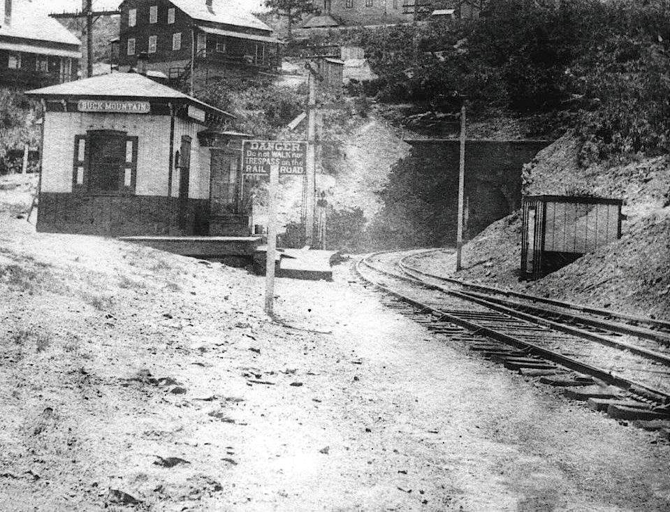
| Buck Mountain |
|
|||||||
| Buck Mountain |
|
This station was located about 100 yards from the north portal of the Mahanoy Tunnel. | ||||||
| Centerville |
|
|||||||
| Coaldale |
 |
This combination station was at the northern end of 1st Street on the south side of the tracks at GPS: 40.827276, -75.904403. | Coaldale |
|
A freight station was built here in the 1870s and torn down in 1939 (The Morning Call, 3-27-1939). | |||
| Colorado |
|
There were two stations here in 1875. One was near Colorado Colliery #1, and the other was east on the line where a branch went north to Colorado Colliery #2. | ||||||
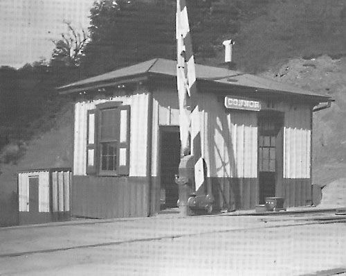
| Connor |
|
This station, located on the NE side of Cressona near where the LV trestle crossed over the Reading, was built around 1882. | ||||||
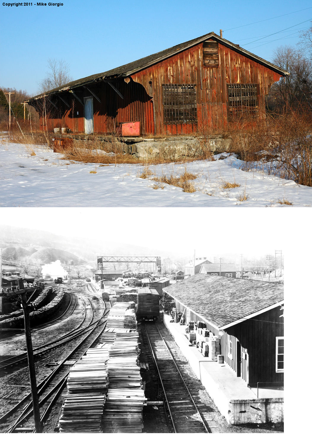
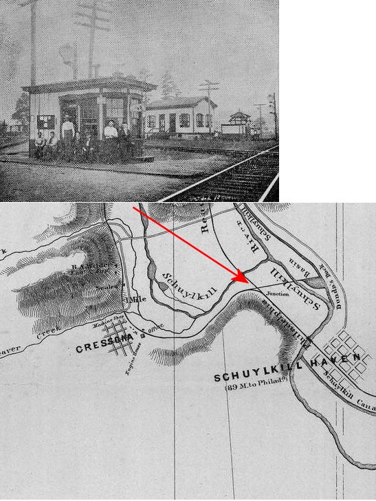
| Cressona |
|
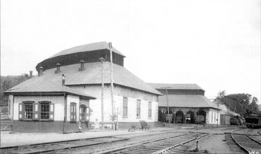
The original freight station was built here in the 1860s followed by the first passenger station some time later. The passenger station was next to the old roundhouse as shown in the photo. | ||||||
| Cressona |
|
Second Cressona station. Was on the line between Schuylkill Haven and Pottsville south of Pottsville Street. This stop may have been known as "Fairgrounds" or may be the same station listed as "Connor." Served the site of the Schuylkill County Fairgrounds pre WWII. ALCOA later bought the Fairgrounds site for their plant. | ||||||
| Cressona |
|
This station was also the weigh master's office. | ||||||
| Cumbola |
|
This station was on the south side of the tracks (and river). A foot bridge over the river was used for access to the station from the town. | ||||||
| Darkwater |
|
|||||||
| Delano |
|
The original station here was on the north side of the tracks on the NW side of Hazle Street. | ||||||
| Delano |
|
The second passenger station here was on the SE side of Hazle Street on the NE side of the tracks (GPS: 40.839135,-76.071203) across the tracks from the LV divisional office. | ||||||
| Delano Junction |
|
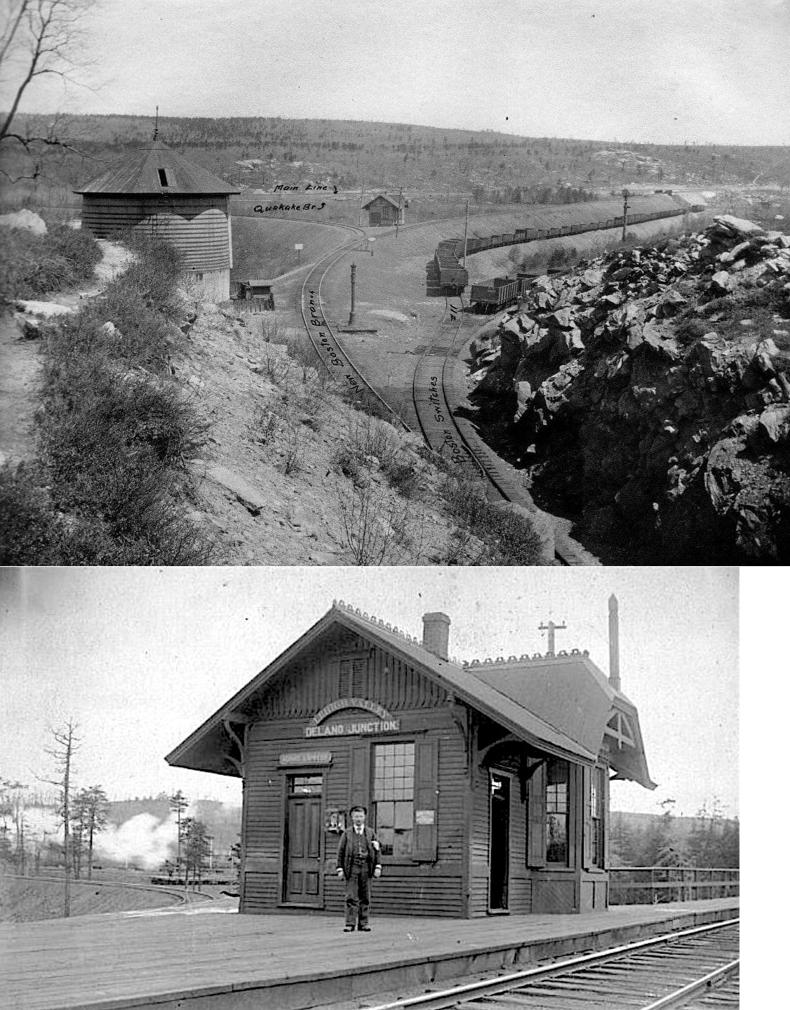
This station was at the junction of the mainline, Quakake Branch and the New Boston Branch. It was located at approximately GPS: 40.838699, -76.065220. | ||||||
| DONALDSON |
|
Although several people have claimed otherwise, the existing building next to the tracks on Martin Street is NOT a railroad station. It is a warehouse that was built in 1970. Does anyone have an old photo of the station? According to the 1889 atlas, the station was located at the southeast corner of the Lomison Street crossing. | ||||||
| Dorset |
|
|||||||
| Drehersville |
|
An original Little Schuylkill RR station is shown here on the 1875 map. | ||||||
| Exmoor |
|
This combination station was built around 1902. | ||||||
| Fowlers Station |
|
This was the first station east of Shenandoah. | ||||||
| Frackville Junction |
|
This station was built in 1887 when the Shenandoah Branch of the Pennsylvania-Schuylkill Valley Railroad opened. | ||||||
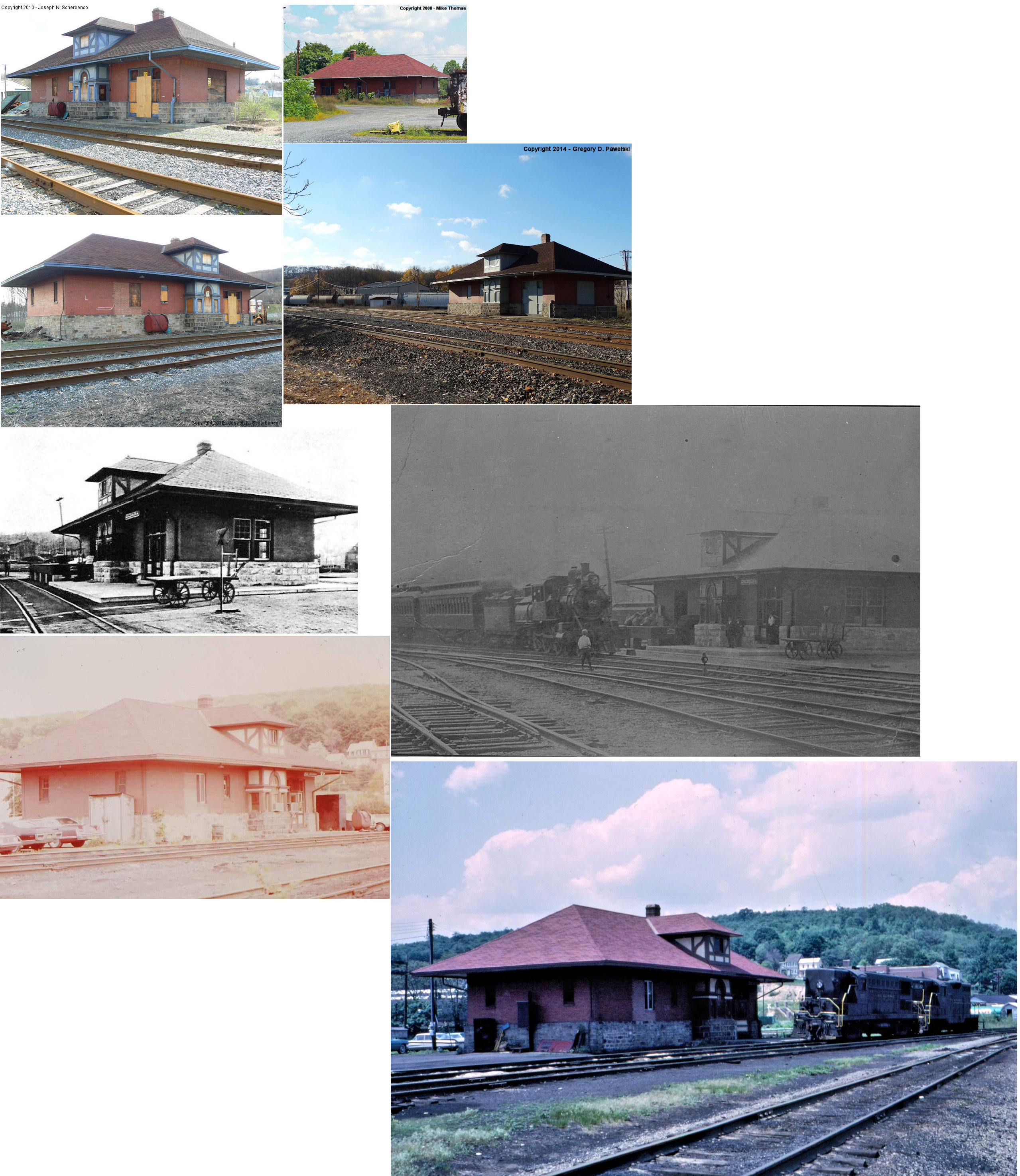
| Frackville |
|
This station was on the north side of East Frack Street on the west side of the tracks (GPS: 40.785448,-76.230193). It is shown on maps as early as 1875. | ||||||
| Frisbie |
|
|||||||
| Gilberton |
|
This station was built in 1887 when the Shenandoah Branch of the Pennsylvania-Schuylkill Valley Railroad opened. A new station was built here in 1899. | ||||||
| Girard Manor |
|
A station is shown here on the 1875 map when this was the Catawissa RR. | ||||||
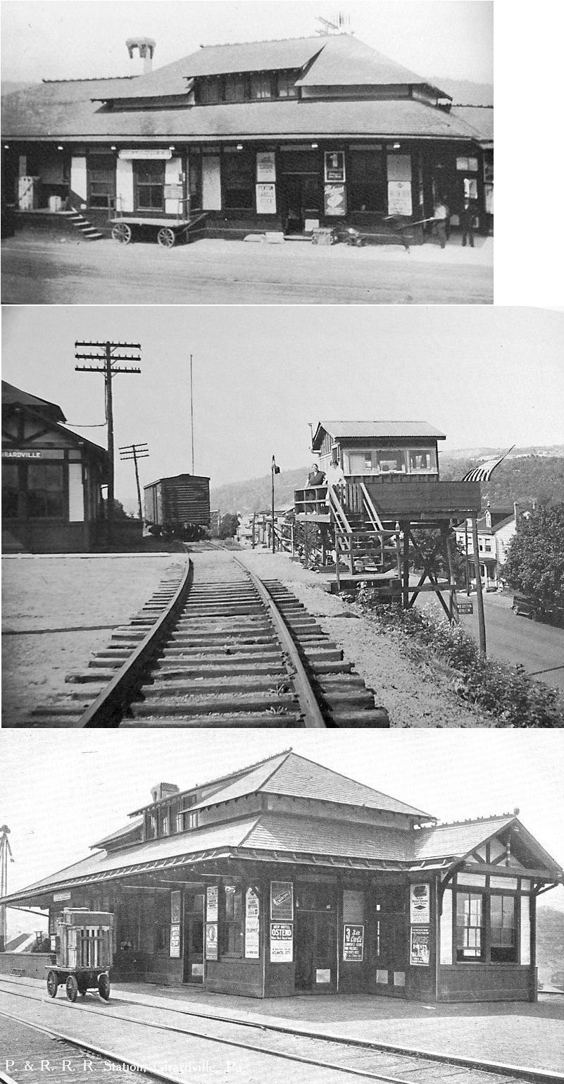
| Girardville |
Mahanoy & Broad Mtn. RR |
According to the 1875 map, this station was on the west side of 3rd Street south of Girard Street (now Main St.) (GPS: 40.791372, -76.281334). This original station would later be replaced with a Reading station. | ||||||
| Girardville |
|
Built in 1880, this station was south of Main Street at GPS: 40.791372, -76.281334. There was a long staircase (still exists) from Main Street up the side of the hill to the station. | ||||||
| Girardville |
|
Built in 1897 (some sources have said 1878), this station was on the south side of Ogden Street between Vine (formerly 3rd) and 3rd (formerly 4th) Streets at GPS: 40.793155, -76.281876. The tracks were in the middle of Ogden Street here. The station was closed sometime between 1913 and 1921. The 1921 and 1928 maps show it as "closed and vacant." | ||||||
| Glen Carbon |
|
|||||||
| Good Spring |
|
Built in 1890 | ||||||
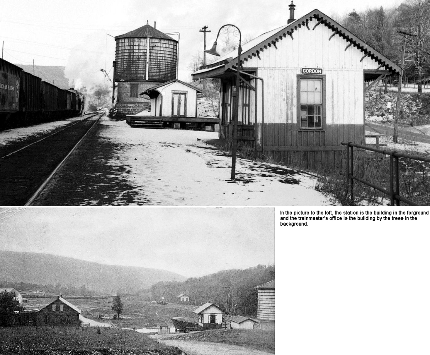
| Gordon |
|
In 1875, this station was located at GPS: 40.752816,-76.344219. | ||||||
| Gordon |
|
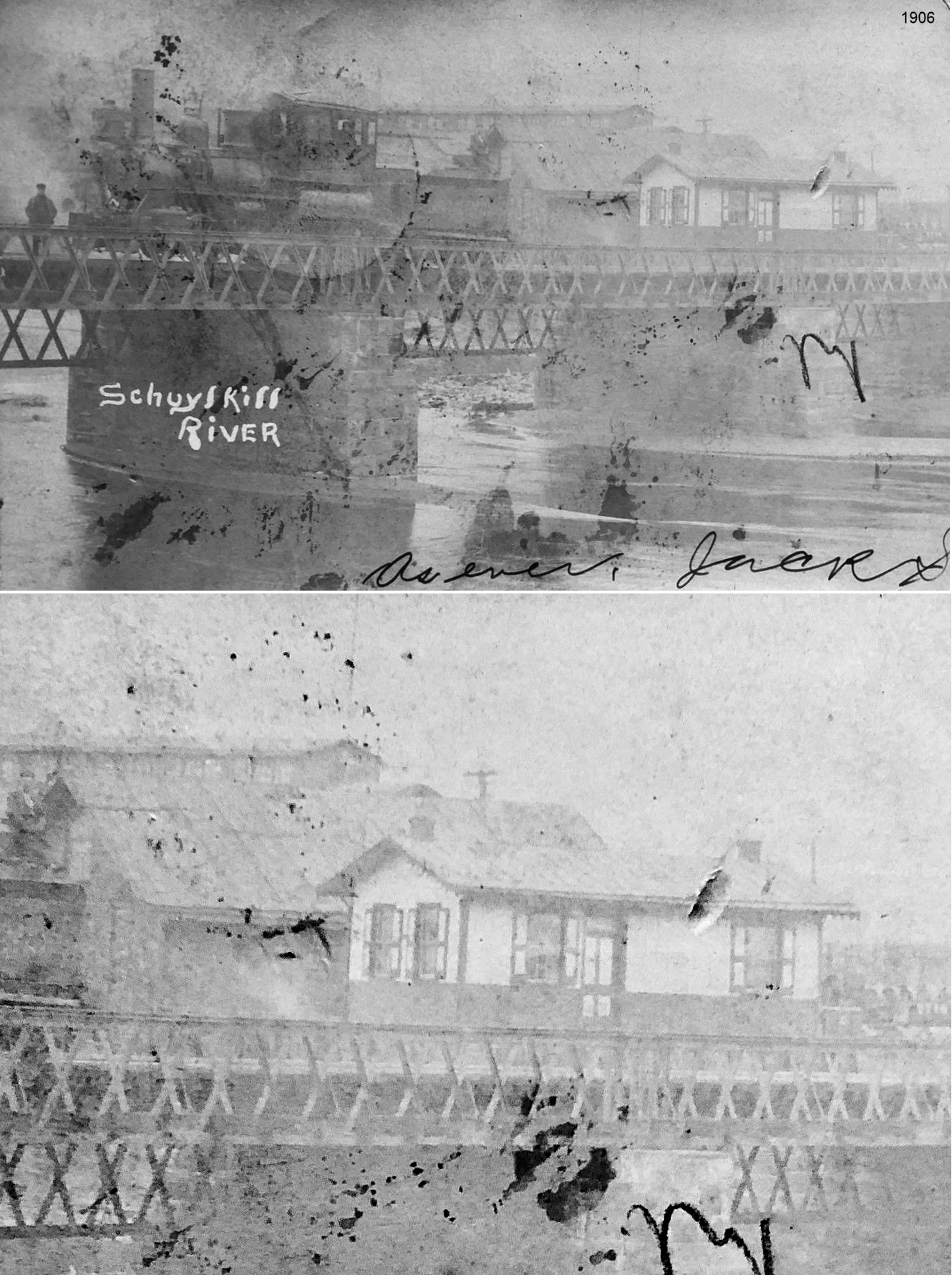
The passenger and freight stations were on the NW side of McKnight Street just NE of the bridge over Mahanoy Creek. The passenger station was at GPS: 40.754677, -76.342597 and the freight station was next to it to the northeast. Smaller photo shows P&R yards and depot looking west. | ||||||
| Haucks |
|
This station was on the south side of the intersection of Church Road and Fairview Street (GPS: 40.831127,-76.029221). | ||||||
| Haucks |
|
Not sure if this was station also or just a tower. | ||||||
| Hazleton Junction |
|
May have originally been called Summit Station (not to be confused with the other Summit Station in Wayne Township). | ||||||
| Hecla |
|
Originally a station on the Little Schuylkill RR. | ||||||
| Jefferson Station |
|
|||||||
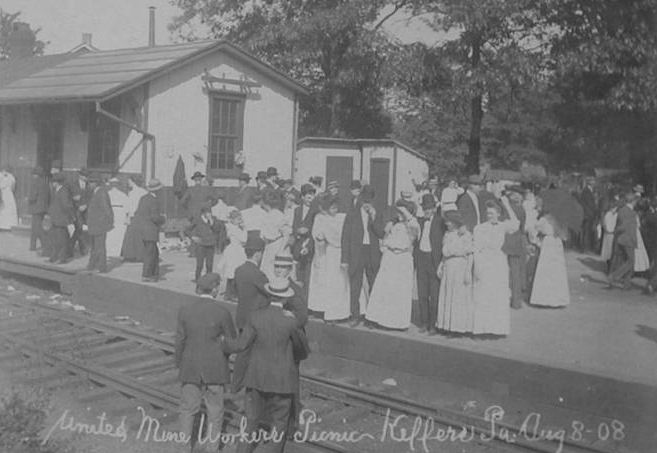
| Keffers Station |
|
Built 1879. | ||||||
| Kepner |
|
|||||||
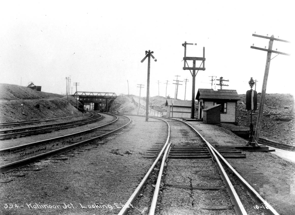
| Kohinoor Junction |
|
|||||||
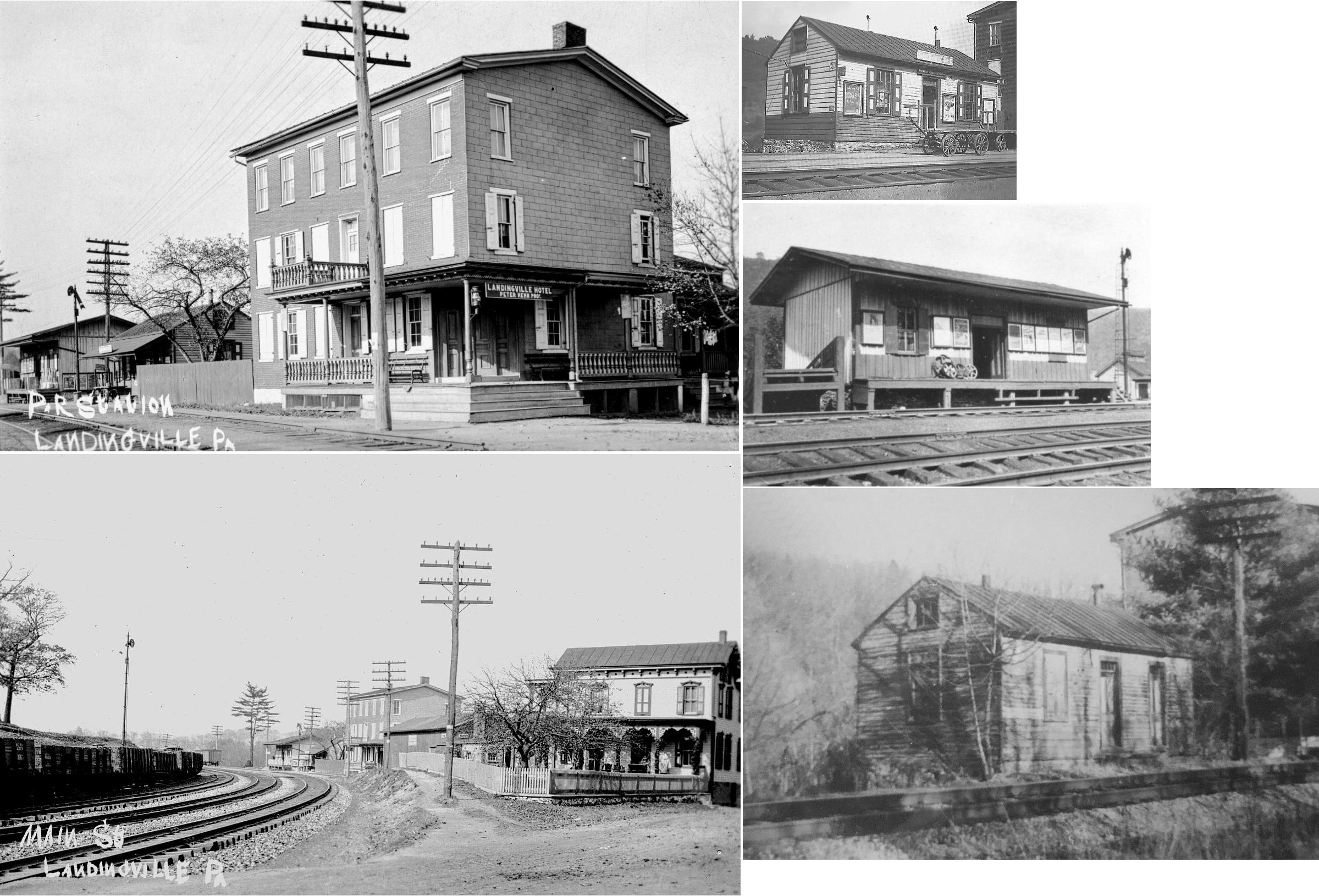
| Landingville |
|
Both passenger and freight stations are shown on the 1875 map. The stations were northwest of where Main Street crosses the tracks at GPS: 40.627273, -76.124524. | ||||||
| Landingville |
|
|||||||
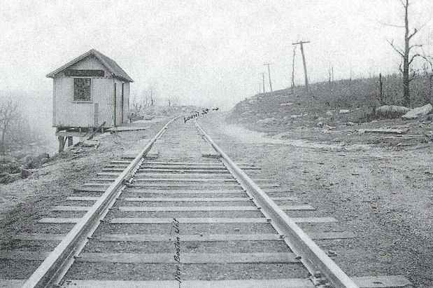
| Locustdale |
|
This station was built in 1860 and retired around 1940. It was south of Main Street on the north side of the tracks at GPS: 40.776746, -76.375735. | ||||||
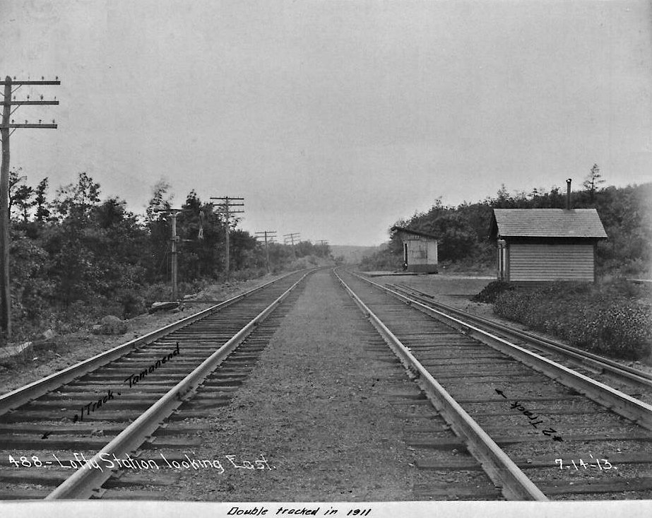
| Lofty |
|
|||||||
| Lofty |
|
|||||||
| Longacre |
|
|||||||
| Lorberry Junction |
|
In 1875 the depot here was right at the Pine Grove/Tremont township line. A.K.A. just "Junction Station." | ||||||
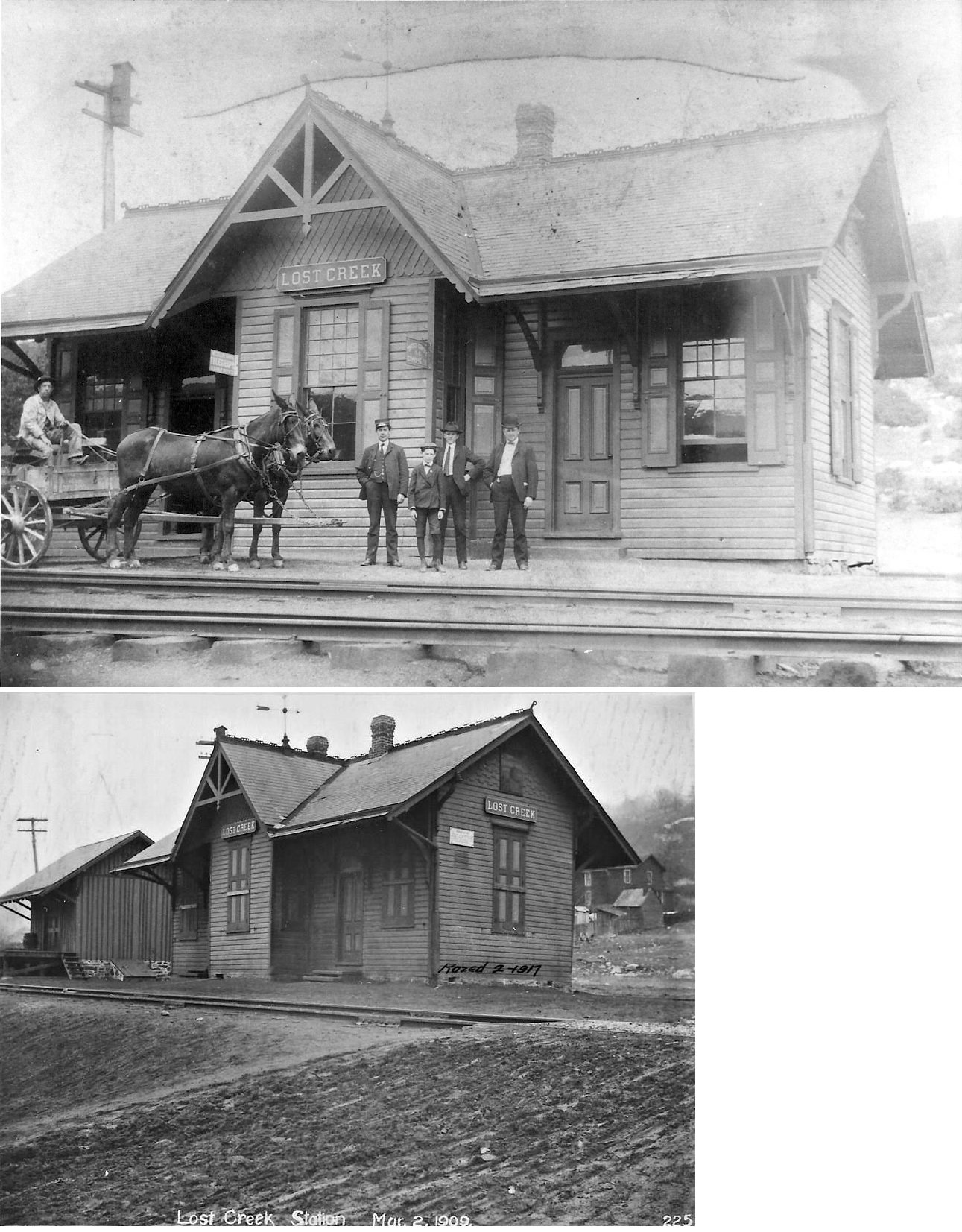
| Lost Creek |
|
This station was on the west side of PA54 (Mt. Olive Boulevard, formerly Church Street) on the north side of the tracks at GPS: 40.809401, -76.247546. There was also a small freight station just west of the passenger station. Both were razed in 1917. | ||||||
| Lost Creek |
|
The original station here was demolished in a derailment on December 2, 1877 according to a report in the Carbon Advocate (12-8-1877). | ||||||
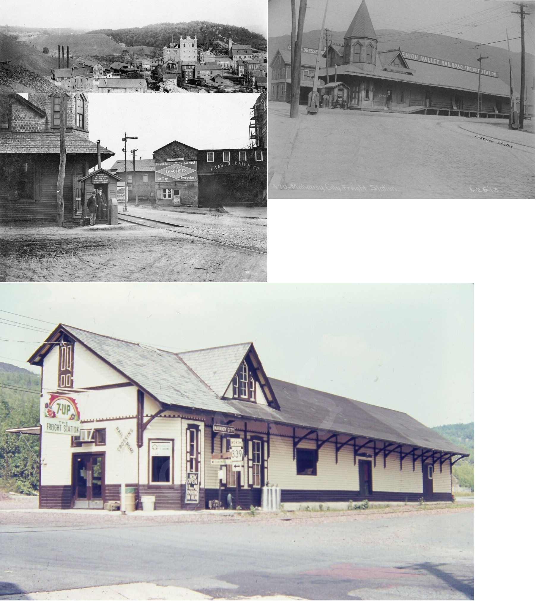
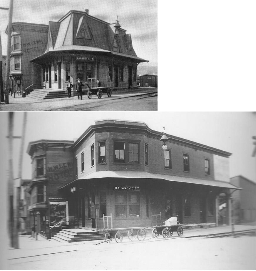
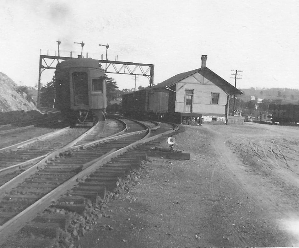
| Mahanoy City |
|
The first station here was a wood frame combination station that was on North Main Street at Brandonville Road (GPS: 40.814978,-76.14241). After the brick station was built this became the freight station. | ||||||
| Mahanoy City |
|
This brick station was built sometime between 1885 and 1891. It was on the west side of North Main Street at GPS: 40.814716, -76.142570. | ||||||
| Mahanoy City |
|
The first station here was on East Railroad Street near Third Street on the north side of the tracks at GPS: 40.814097, -76.138626. | ||||||
| Mahanoy City |
|
This second-generation station was on the east side of North Main Street at Vine Street at GPS: 40.813597, -76.141460. | ||||||
| Mahanoy City |
|
This freight station was built sometime between 1902 and 1907. It was just a bit west of where the original combination station was. The freight station was on the north side of the tracks at the end of Third Street at GPS: 40.814105, -76.138905. | ||||||
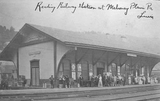
| Mahanoy Plane |
|
The first station here was east of Bridge Street at GPS: 40.793311,-76.240954. | ||||||
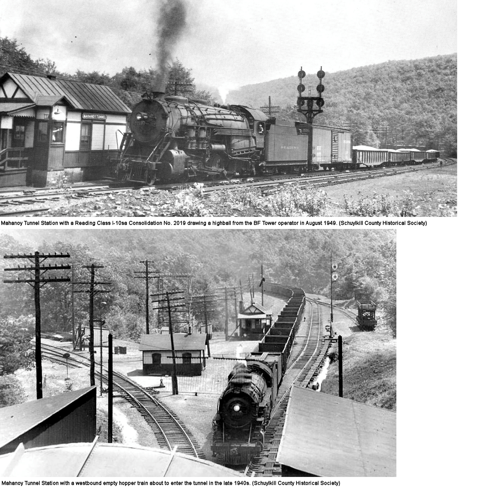
| Mahanoy Tunnel |
|
This station was off PA-54 (Barnesville Drive) at GPS: 40.813525,-76.090204. The original station here burned in December 1875 and this new station was quickly constructed by the railroad in about a week (Shenandoah Herald, 12-23-1875). | ||||||
| Maizeville |
|
In 1875 the station was on the east side of McKinley Avenue on the south side of the tracks (GPS: 40.79695,-76.225934). | ||||||
| Malvin |
|
A station is shown here near the Malvin Colliery in 1875. This was NE of Mahanoy City and slightly SW of Shoemakers at GPS: 40.829658,-76.132636. | ||||||
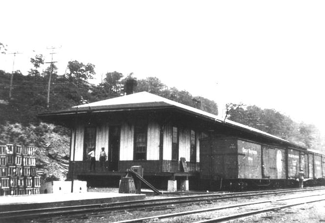
| McAdoo |
|
There was a freight station here just northeast of the passenger station at GPS: 40.895907, -75.993830. | ||||||
| McKeansburg |
|
|||||||
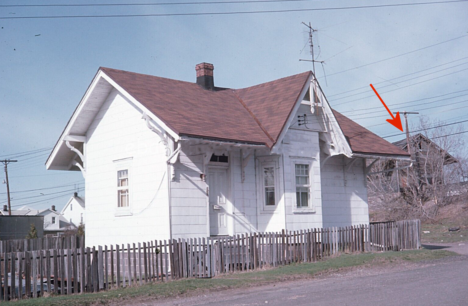
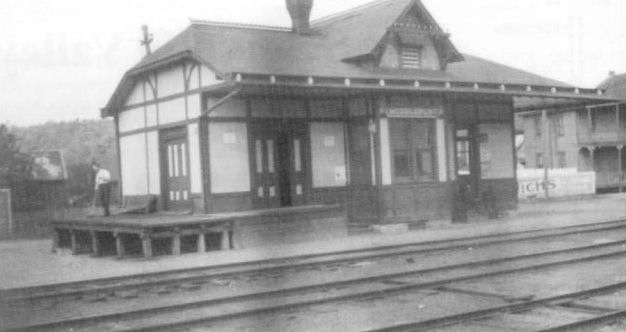
| Middleport |
|
This appears to be the first station here. | ||||||
| Middleport |
|
This combination station was on Union Street (PA209) between Washington and St. Clair Streets. | ||||||
| Middle Station |
|
This was an early station on the Little Schuylkill RR. It was north of Port Clinton. | ||||||
| Millers Station |
|
|||||||
| Mine Hill Crossing |
AND |
|||||||
| Minersville |
|
In 1875 this station was on the north side of Seltzer Road (at Penn Street) on the east side of the tracks (GPS: 40.691418,-76.255041). | ||||||
| Minersville |
|
|||||||
| Minersville |
|
On the Minersville Branch. | ||||||
| Mintzers |
|
A frame shelter was constructed here in 1894 and went out of service in 1936. | ||||||
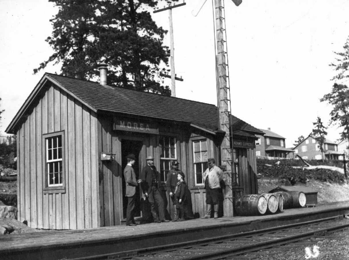
| Morea |
|
A station was built here in 1889 with a new station built in 1892. | ||||||
| Morea |
|
This was likely the new station that was built in 1892. Photo is from around 1915. | ||||||
| Morea |
|
|||||||
| Mount Carbon |
|
|||||||
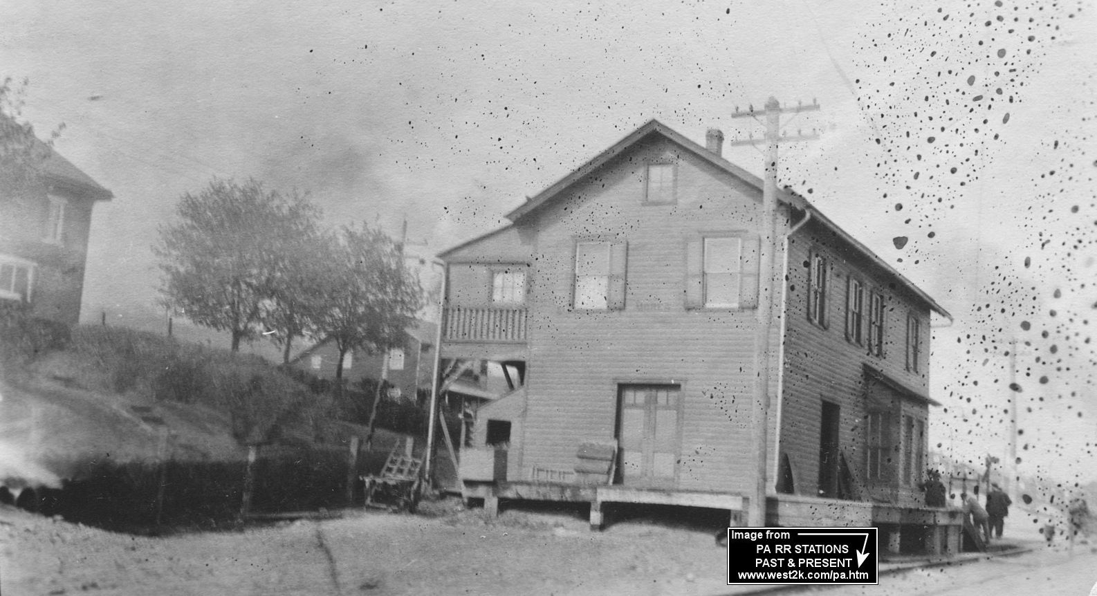
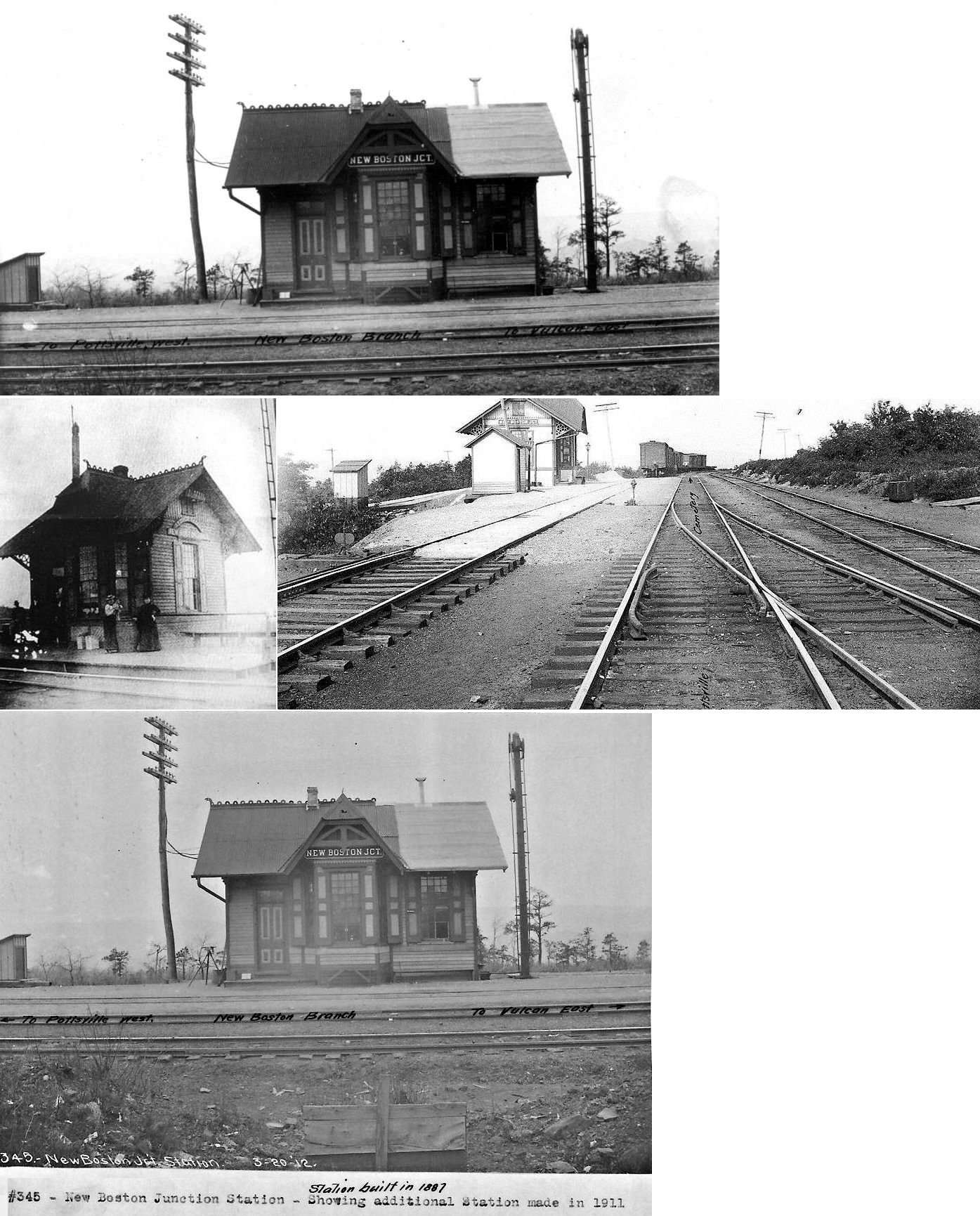
| New BostoN Junction |
|
This station was on Water Company Road. It was built in 1887. | ||||||
| New Boston |
|
A new station was built here in 1893. | ||||||
| New Castle Station |
Mill Creek Railroad |
The station was on the west side of the tracks. Shown on 1875 map. | ||||||
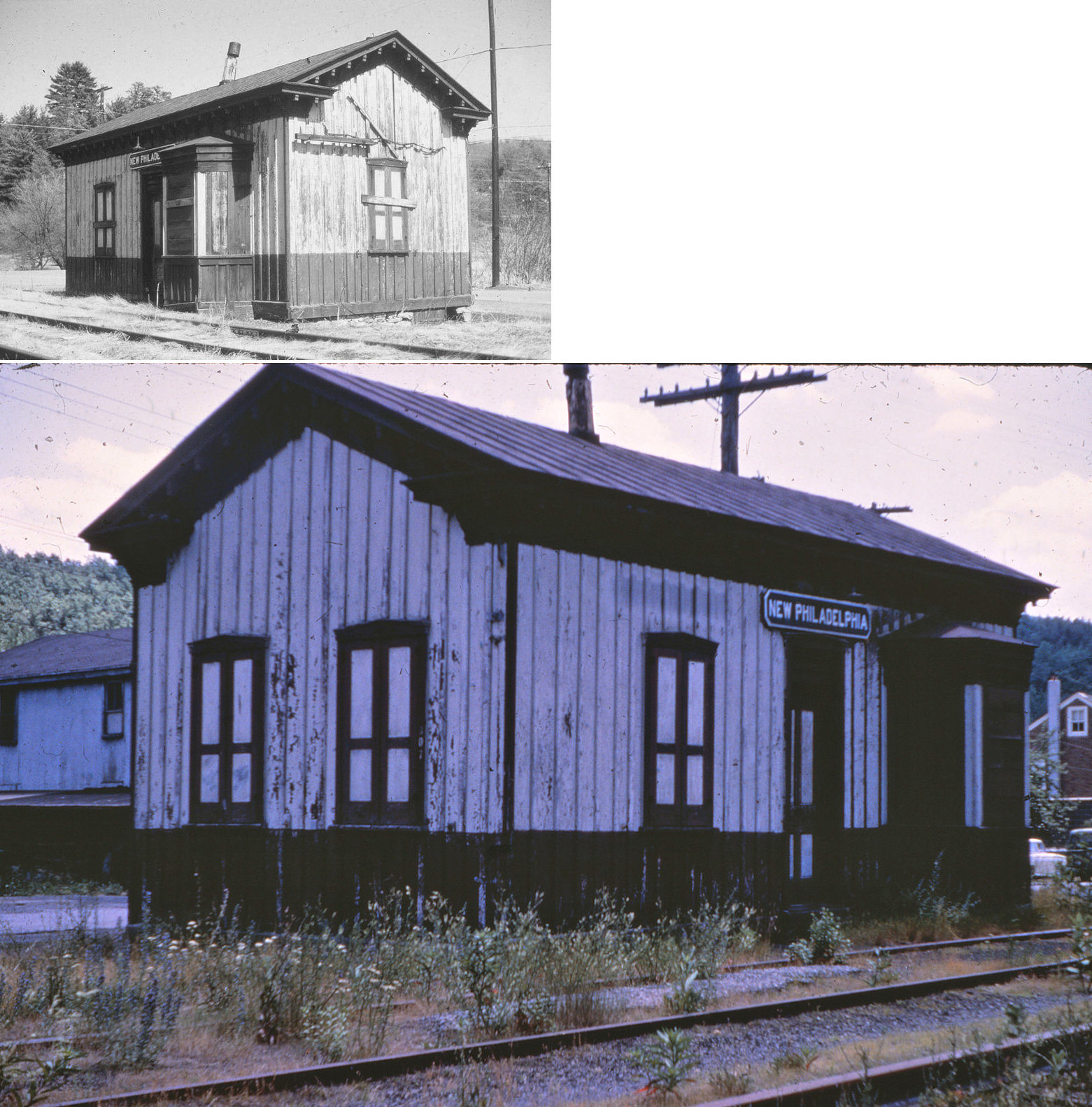
| New Philadelphia |
|
The original Schuylkill Valley RR depot here was on the SW side of SR-2003 (Water Street) on the SE side of the tracks (GPS: 40.719168,-76.115127). Was the later P&R station at this location as well? | ||||||
| New Ringgold |
|
|||||||
| Newkirk |
|
|||||||
| North Pine Grove |
|
|||||||
| Oneida |
|
|||||||
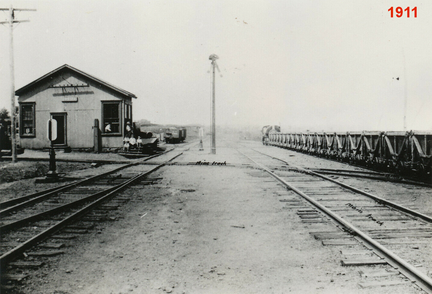
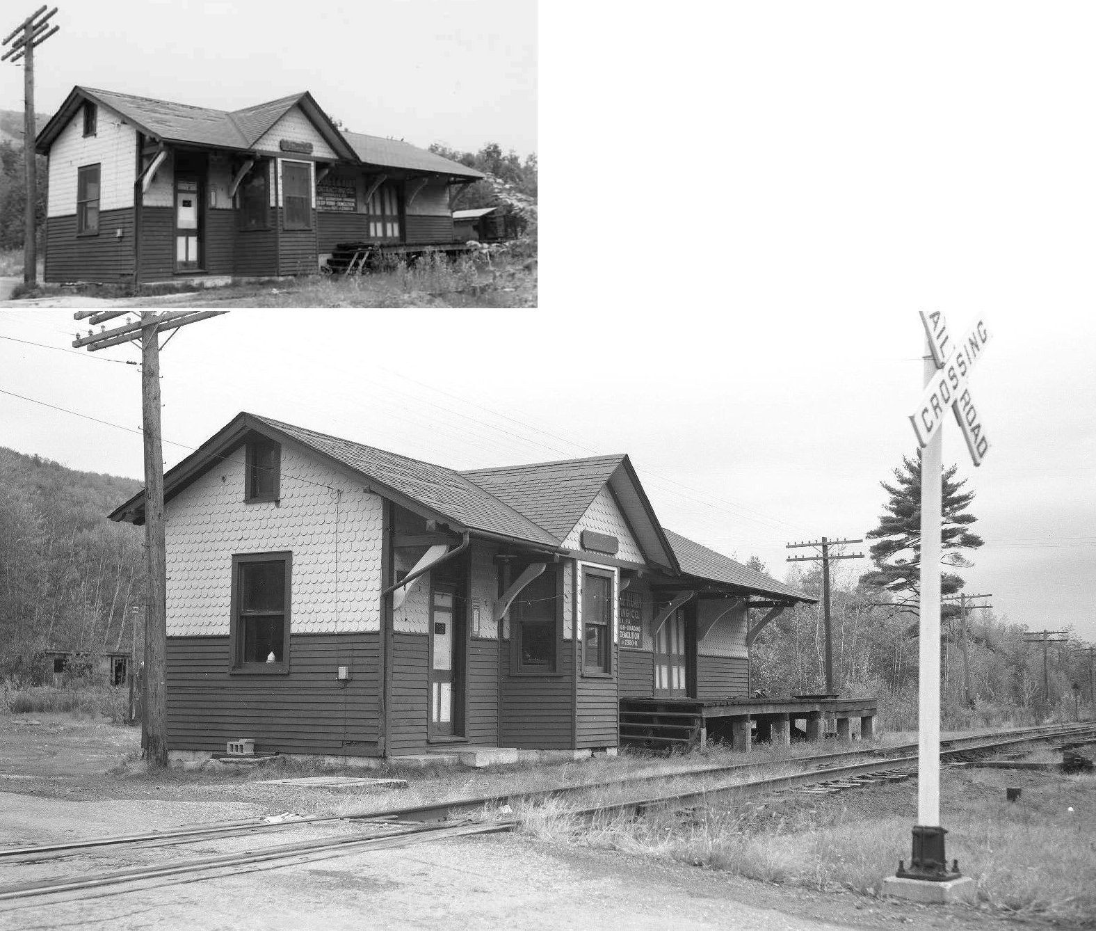
| Orwigsburg |
|
The passenger and freight stations were on the west side of Station Road. This station was on the Lizard Creek Branch which opened in 1890. Passenger service ended in 1925 and freight service ended in 1953. | ||||||
| Outwood |
|
This was on the Reading's Schuylkill & Susquehanna Branch. There was a siding track here for coal delivery for the nearby Swatara Iron Furnace. | ||||||
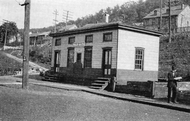
| Palo Alto |
|
|||||||
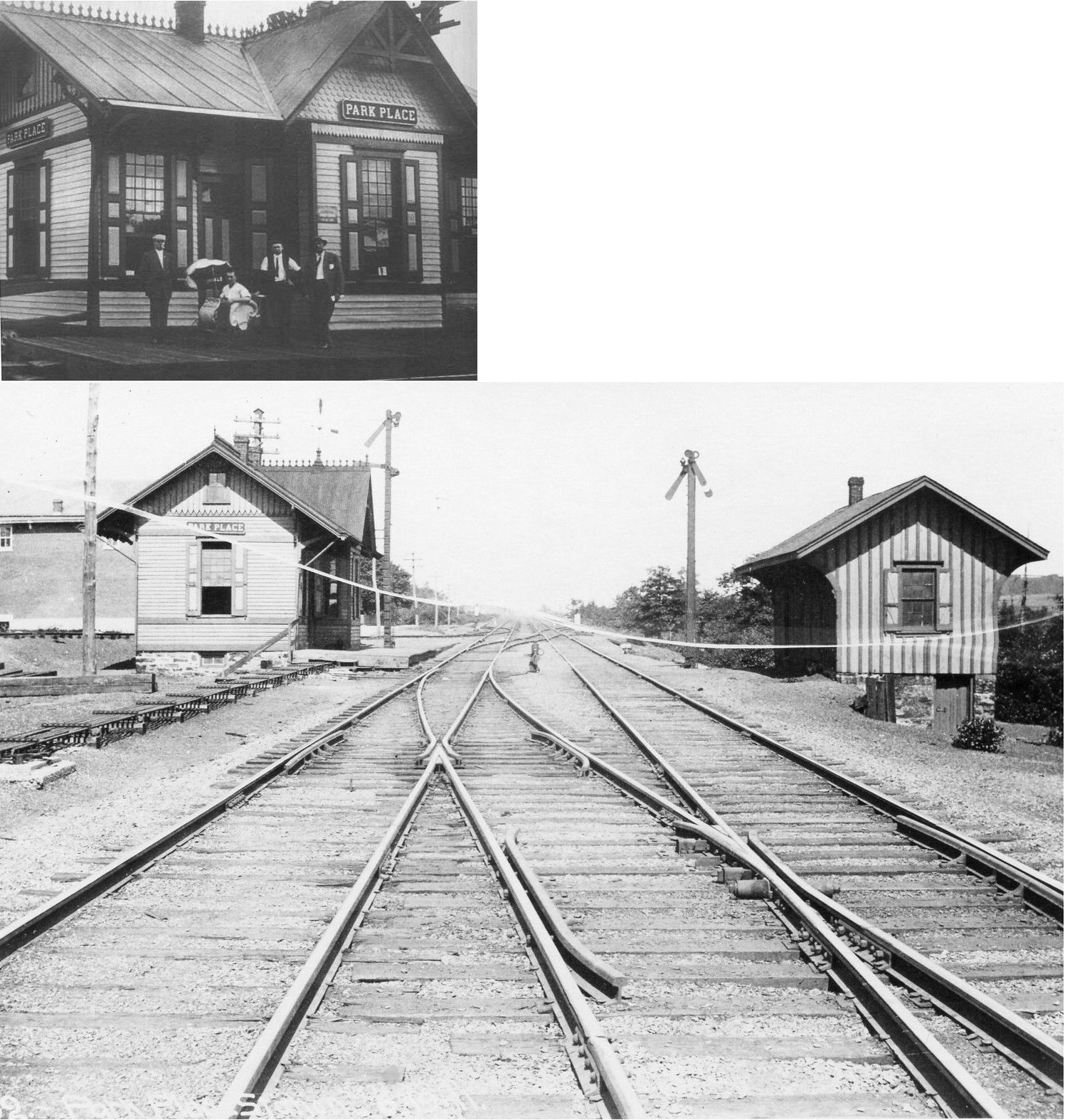
| Park Place |
|
This station was built in 1882. | ||||||
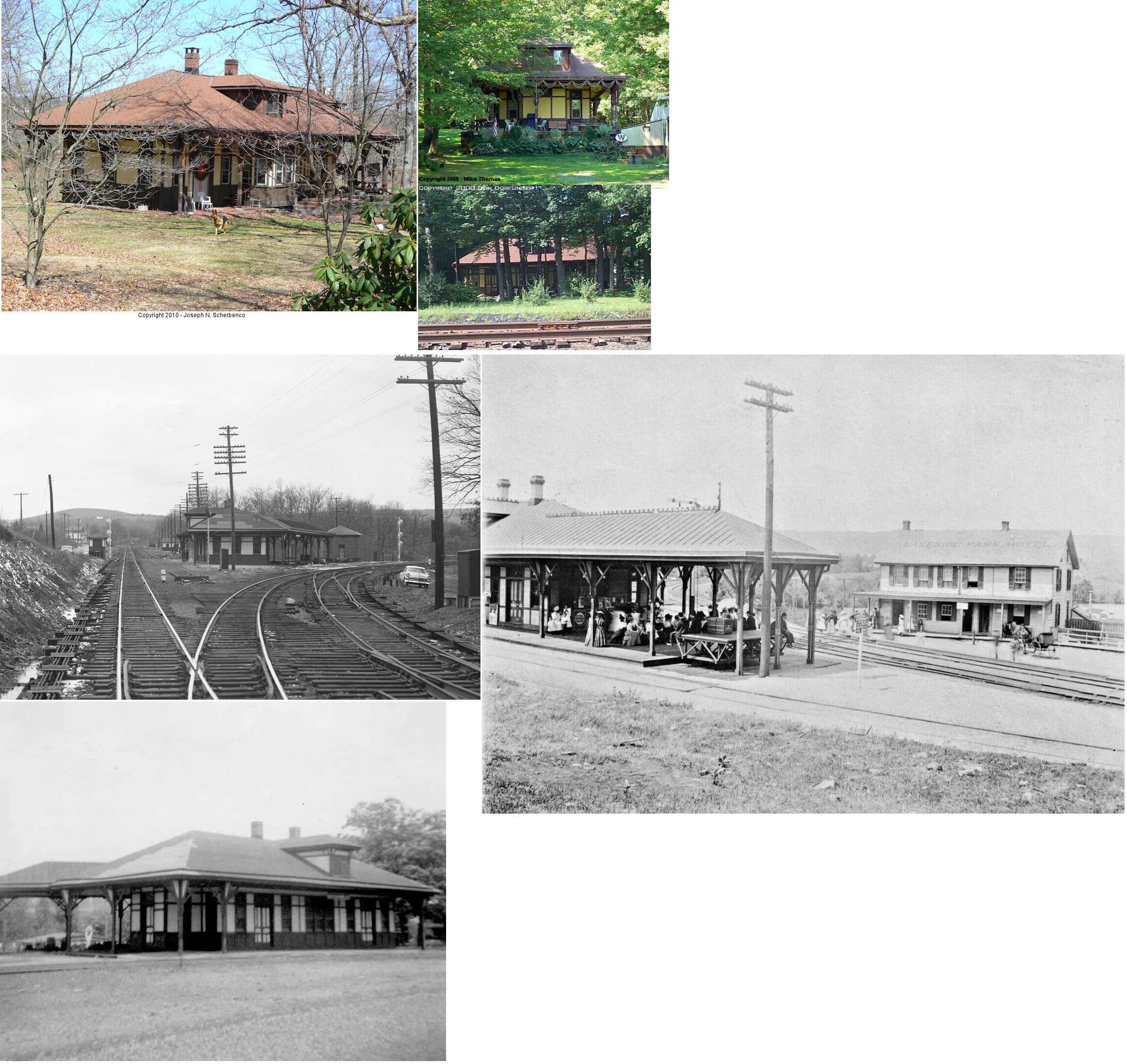
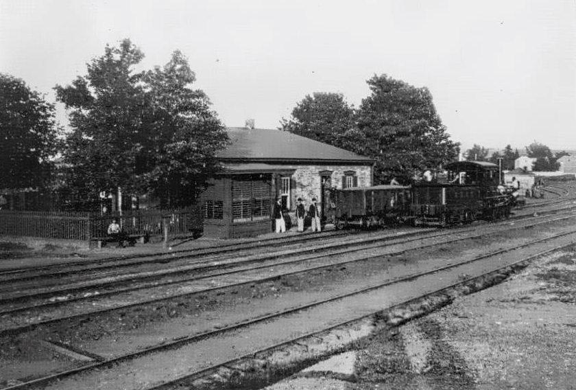
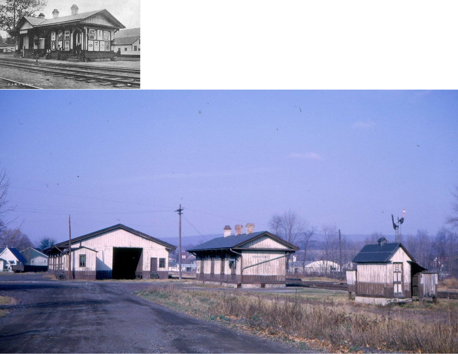
| Pine Grove |
|
Built in 1854, this combination station was acquired from the Schuylkill & Susquehanna RR. The freight station (pictured in the larger color image) was likely built later. These stations were south of Snyder Avenue in the vicinity of GPS: 40.549812, -76.383756. | ||||||
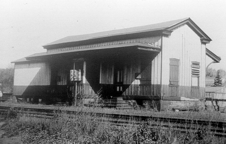
| Port Carbon |
Mill Creek Railroad |
According to the 1875 map, the station here was on the NE side of Commerce Street just north of Hickory Street (GPS: 40.694712,-76.170809). | ||||||
| Port Carbon |
|
In 1875 this station was at the east end of Main Street at Conrad Street on the north side of the tracks (GPS: 40.69542,-76.157184). | ||||||
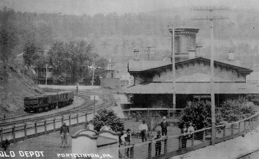
| Port Clinton |
|
The first station here was built in 1873. | ||||||
| Port Clinton |
|
This passenger station was located approximately where the current Reading & Northern station is south of town (GPS: 40.576323,-76.024822). It was built in 1899 to replace the station listed above. The freight station was on the south side of Broad Street on the west side of the tracks (GPS: 40.579851,-76.026882). | ||||||
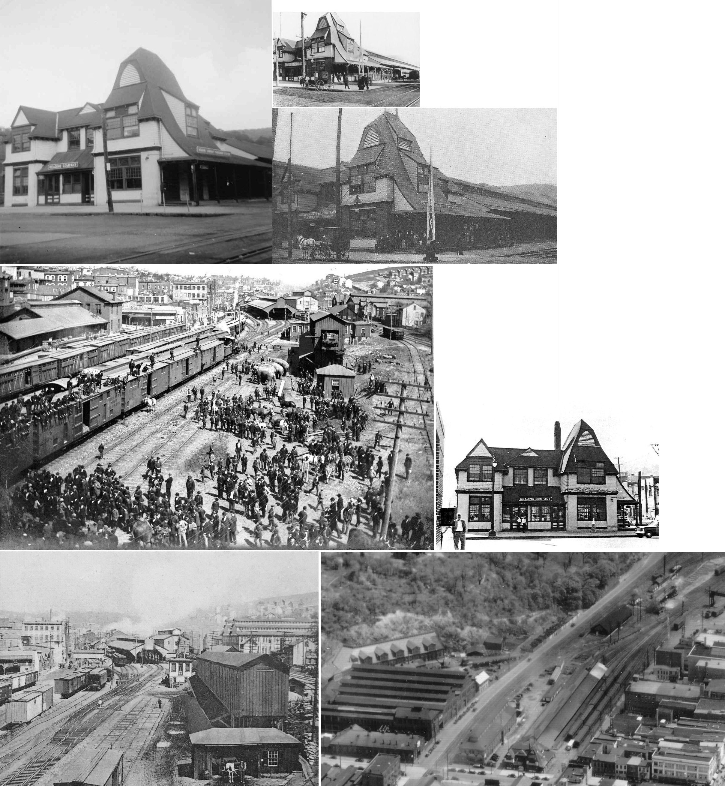
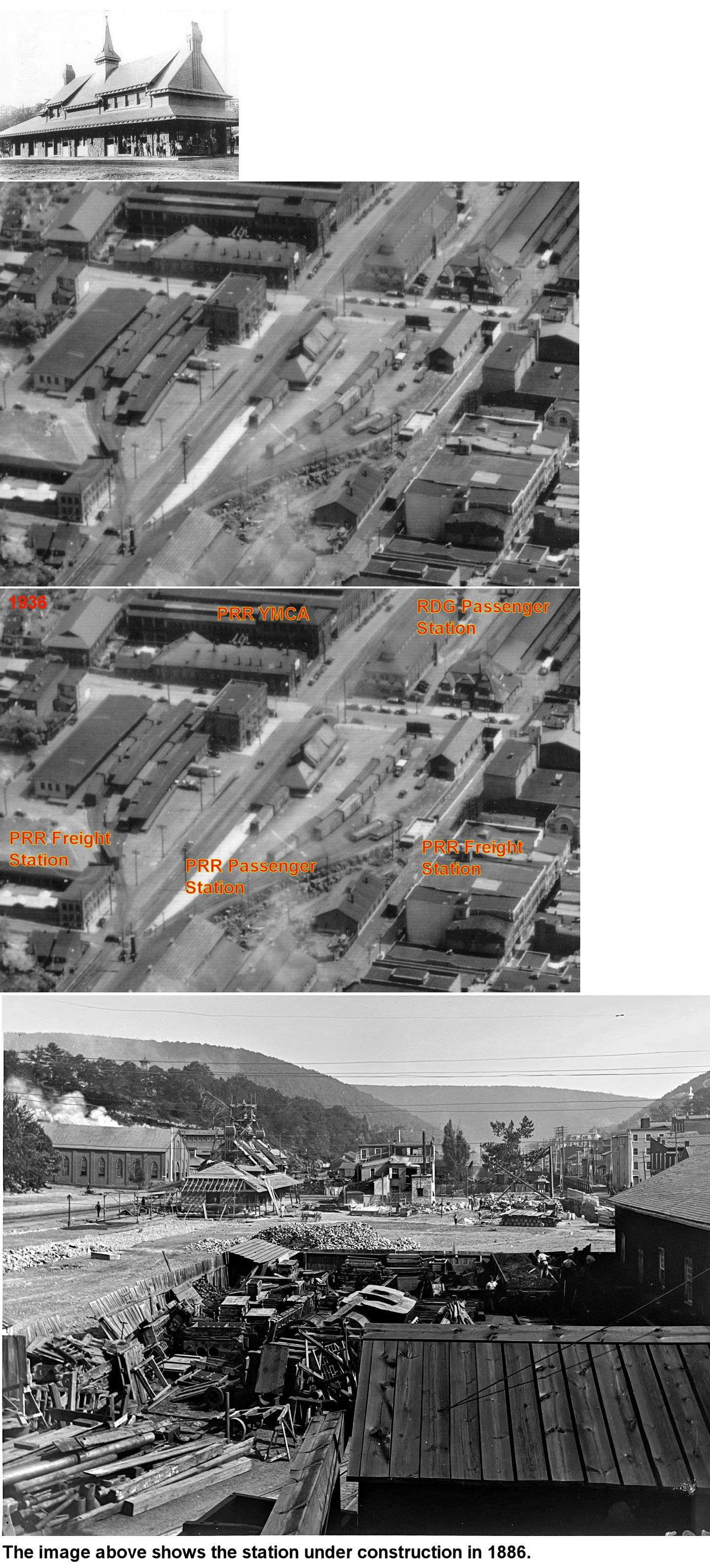
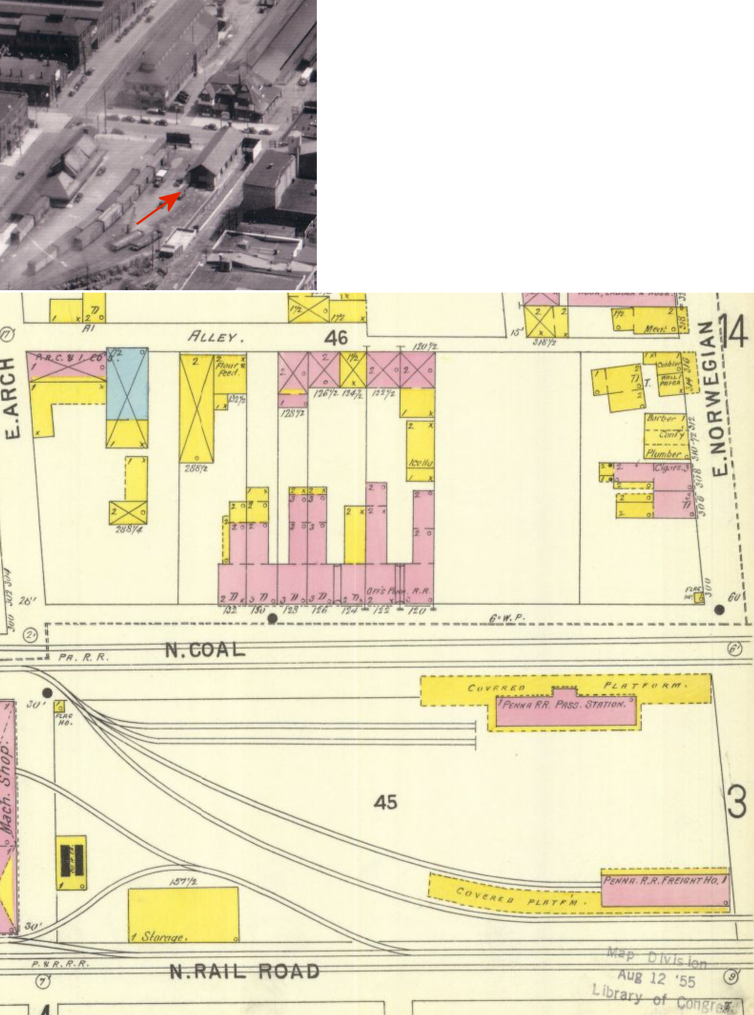
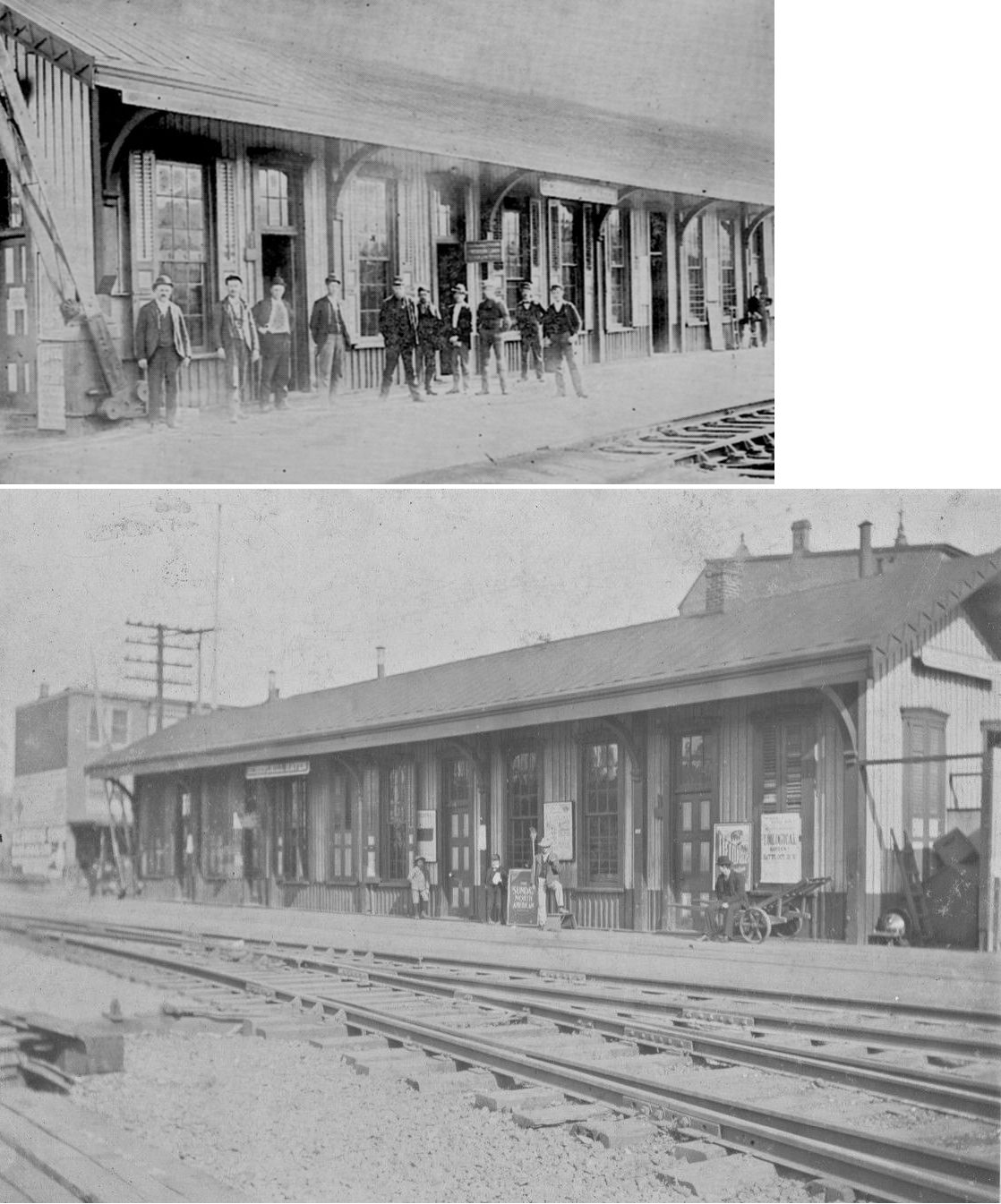
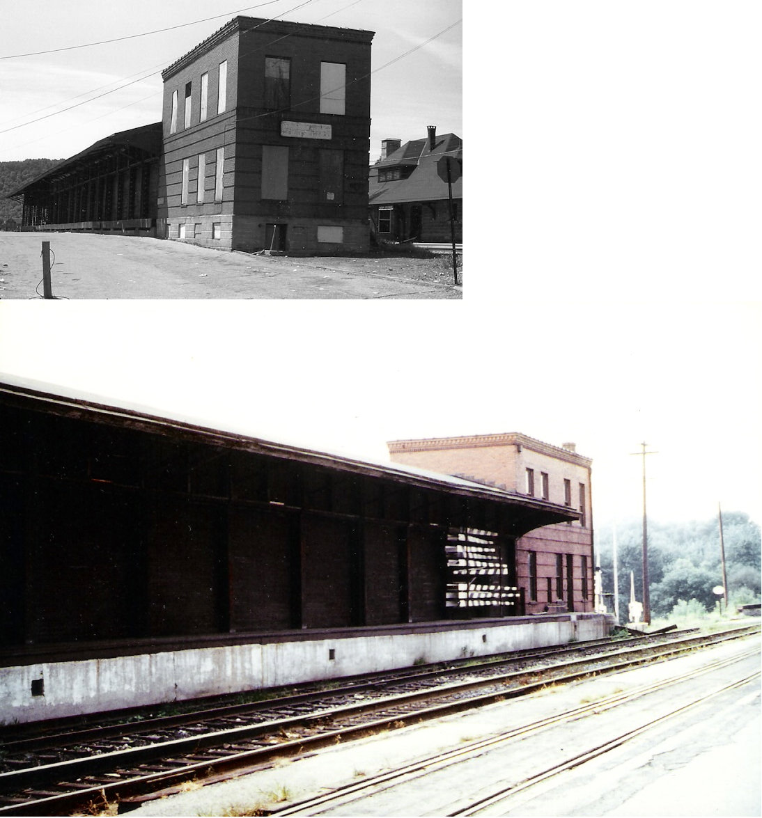
| Pottsville |
|
This station was built in 1887 and sat on south side of East Norwegian at Progress (formerly Railroad) Streets at GPS: 40.685513, -76.193883. It was demolished in 1963 to make room for a parking lot. | ||||||
| Pottsville |
|
The original freight station here was near where Washington street used to cross what is now Progress Street (both roads no longer go through here) (GPS: 40.682143,-76.192052). This station is shown on the map from 1875. | ||||||
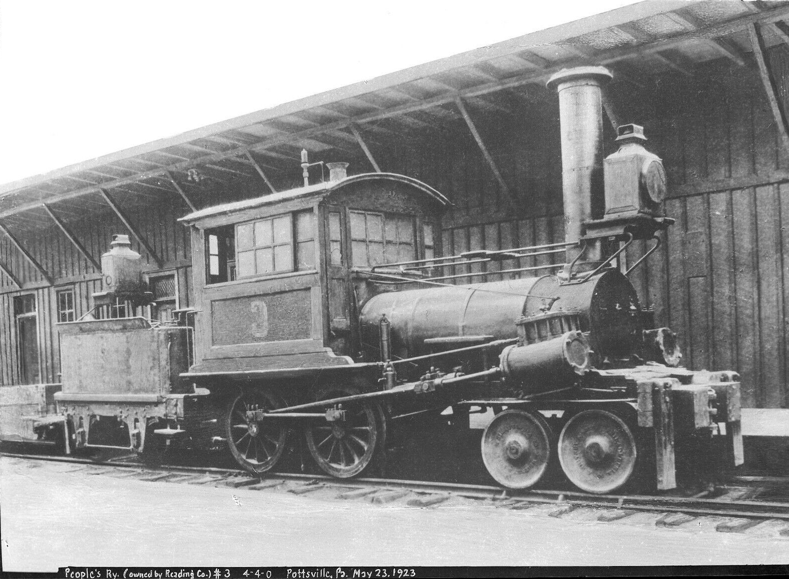
| Pottsville |
|
This Peoples' Railway station was on the west side of 12th Street between West Race and West Arch Streets (GPS: 40.683128,-76.206107). This railway later became part of the P&R. The station is shown on the 1875 map of the city. | ||||||
| Pottsville |
|
Built in 1886, this station was on the corner of East Norweigan Street and what is now Claude A. Lord Boulevard at GPS: 40.686049, -76.193828. | ||||||
| Pottsville |
|
This freight station was next to the passenger station (on the west side) at the corner of East Norweigan Street and what is now Progress Avenue at GPS: 40.685775, -76.194177. | ||||||
| Pottsville |
|
There was a larger freight station on the east side of the passenger station on the corner of East Norweigan and Line Street at GPS: 40.686402, -76.193226. | ||||||
| Pottsville |
AND |
This station was in the vicinity of West Laurel and North 16th Street (now Lengel Middle School site). Shared with Lehigh Valley, this station was on a stub branch that entered Pottsvile from the line to Minersville. The branch shows on Google Map serving Honeywell Films between Westwood and Woodglen Roads. | ||||||
| Pottsville |
|
The CNJ may have used the P&R station here. | ||||||
| Primrose |
|
This station was on the Minersville Branch as indicated on the 1900 PRR List of Stations & Sidings. | ||||||
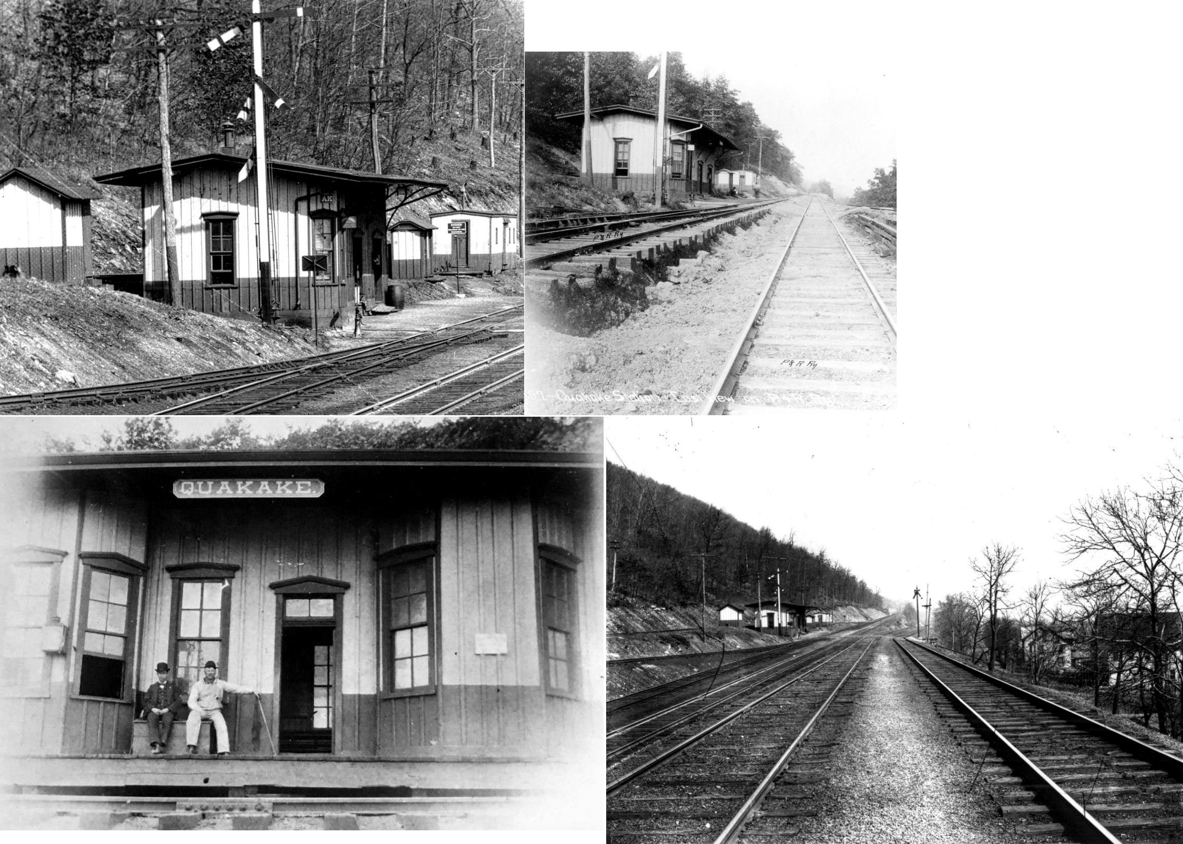
| Quakake |
|
This station was built in 1871 and was at the west end of Main Street at the curve. This station was also likely used by the Lehigh Valley. | ||||||
| Quakake Junction |
 |
|||||||
| Rauschs |
|
|||||||
| Rauschs |
|
|||||||
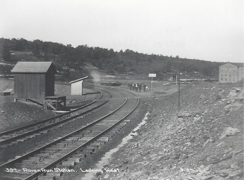
| Raven Run |
|
|||||||
| Reevesdale |
|
This station was on the north side of US-209 on the south side of the tracks at (GPS: 40.782897,-76.008375). | ||||||
| Reiner |
|
A passenger shelter was built here in 1900. This was on the Williams Valley RR. | ||||||
| Rene Mont |
|
|||||||
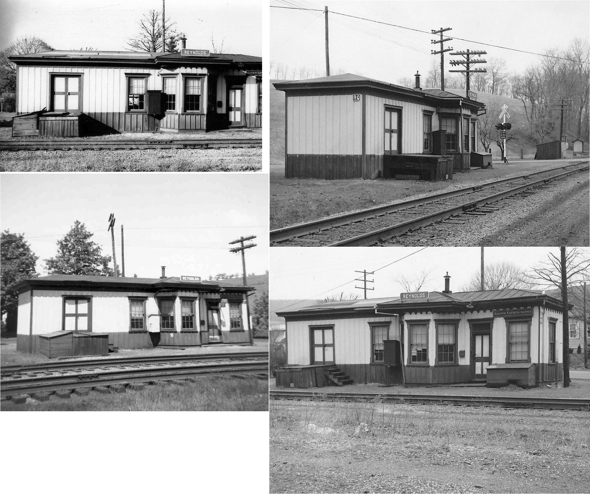
| Reynolds (Centerville) |
|
I believe the original name for this station was Centerville as shown on the 1875 map. | ||||||
| Ringtown |
|
|||||||
| Rock (Whitehorse Station) |
|
There was a Schuylkill and Susquehanna station here in 1875. It was on what is now Loop Road just south of Rock Road (PA895) on the south side of the tracks (GPS:40.541257,-76.301379). | ||||||
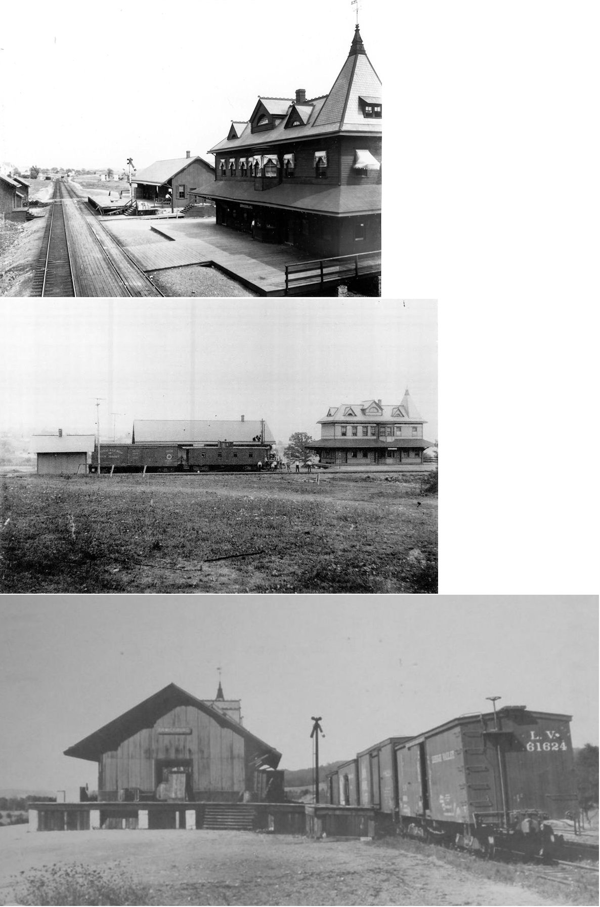
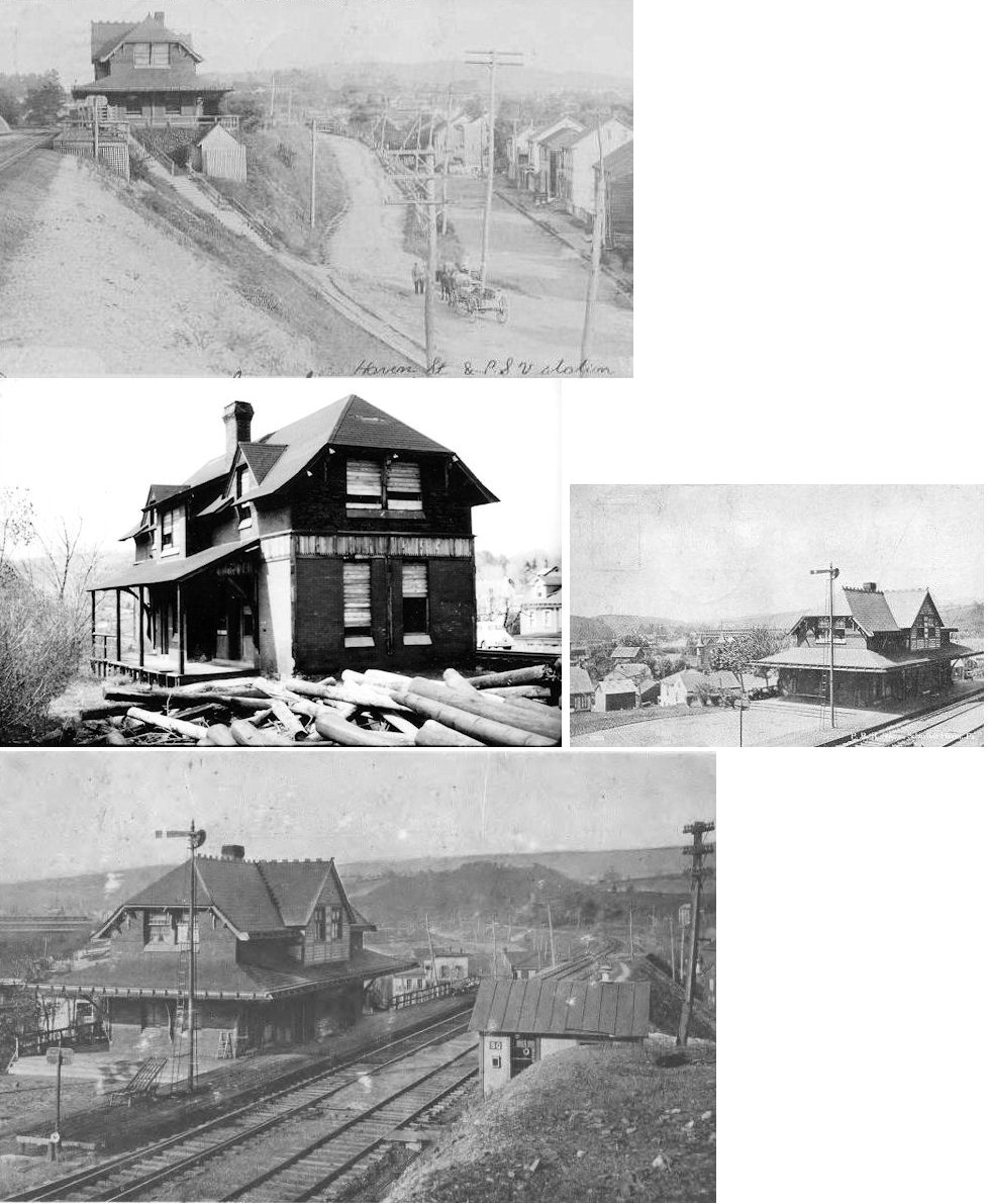
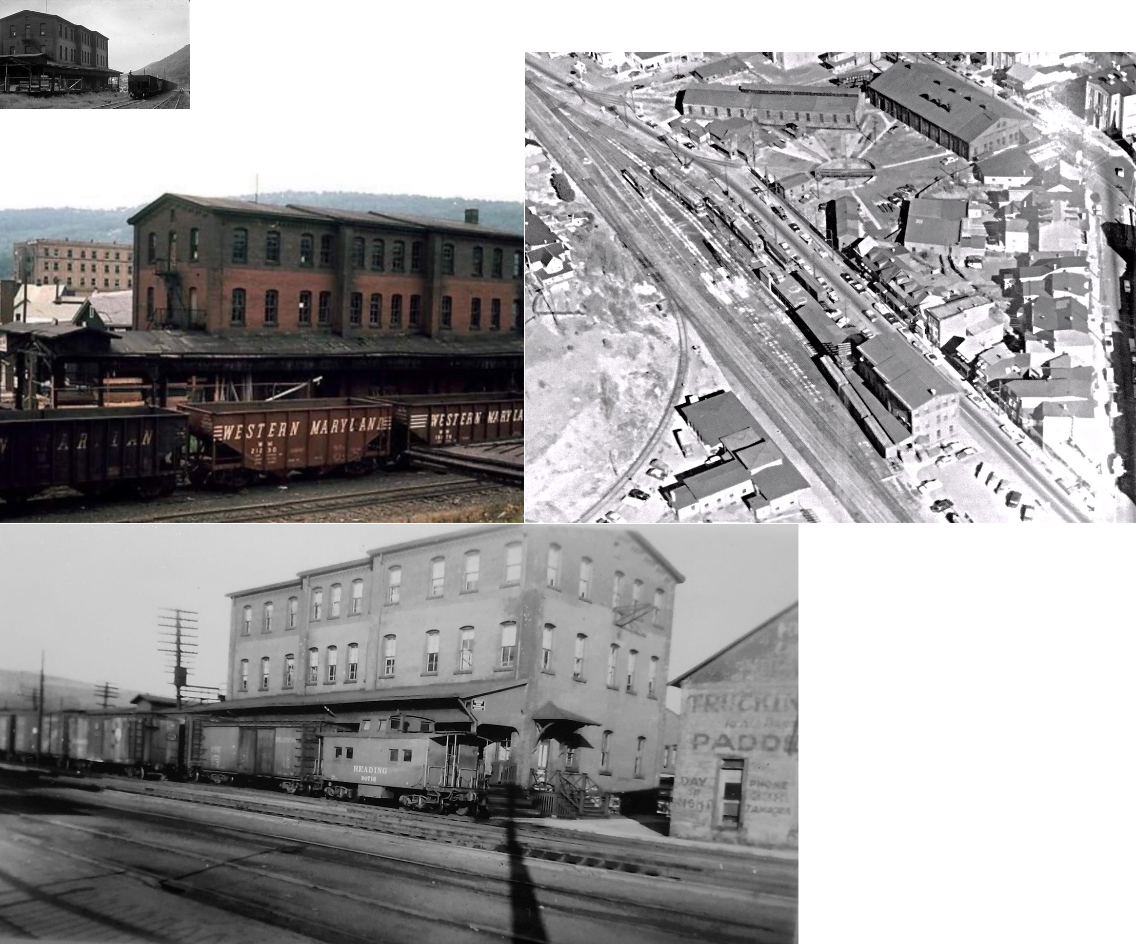
| Schuylkill Haven |
|
Built by the Pennsylvania Schuylkill Valley Railroad which was leased by the PRR starting in 1885. The station was near the intersection of Dock Street and Haven Street. There was also a freight station about 100 yards south of the passenger station. | ||||||
| Schuylkill Haven |
|
There was a freight station about 100 yards south of the passenger station. | ||||||
| Schuylkill Haven |
|
The first station here was built around 1842 and sat on the SW side of the tracks on the SE side of Main Street at GPS: 40.628658, -76.172995. When a new passenger station was built (see listing below), this original station was moved down the tracks to the SE at GPS: 40.628351, -76.172530 and became a freight station (Schuylkill Haven Call, May 8, 1925). | ||||||
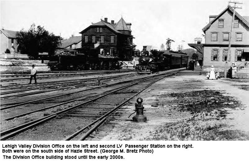
| Schuylkill Haven |
|
This was the second RDG station which sat on the same site as the existing 1901 station on the SE side of Main Street on the NE side of the tracks (40.628684,-76.172848). It was torn down when the new station was built. | ||||||
| Schuylkill Haven |
|
This freight station was across the tracks from the passenger station at the corner of Railroad Street and Main Street at GPS: 40.628526, -76.173019. It was built in 1914. | ||||||
|
Schuylkill Haven Reading Shops |
|
This appears to be a station that was at the Reading RR shops in Schuylkill Haven. It may have been a station for the workers there, or it may have been a shop building that was designed with station blueprints. The location was likely at GPS: 40.633920, -76.179874. | ||||||
| Shenandoah |
|
This station was located near the corner of Lloyd & Lehigh Streets (GPS: 40.821596,-76.199069). It was built in 1884 and demolished in the late 1950s or early 60s. | ||||||
| Shenandoah |
|
The passenger station was on the corner of East Center and Union Streets (GPS: 40.821182,-76.195947). | ||||||
| Shenandoah |
|
The freight station was on the south side of East Washington Street between North White Street and North Main Street at GPS: 40.823381, -76.201184. | ||||||
| Shenandoah |
|
The passenger station was at the south end of South Jardin Street at GPS: 40.815742, -76.201044. | ||||||
| Sheppton |
|
This station was moved by rail on November 22, 1908 to Sheppton. It originally stood at Roan Junction. | ||||||
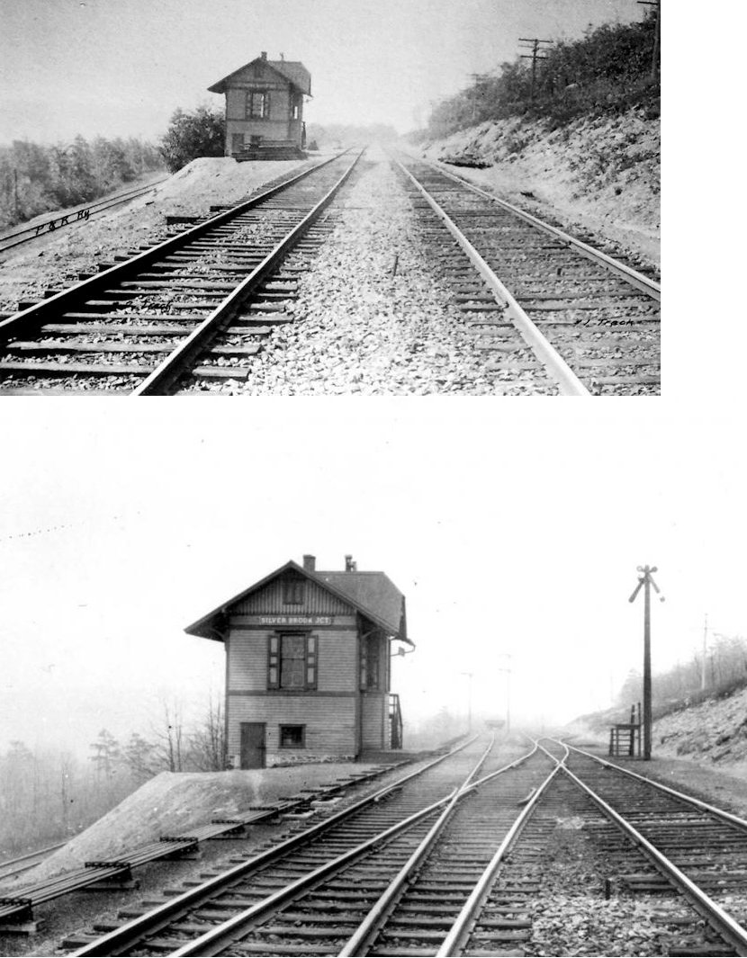
| Silverbrook Junction |
|
|||||||
| South Good Spring |
|
Built in 1890. | ||||||
| Spring Garden |
|
|||||||
| Spring Garden Junction |
|
|||||||
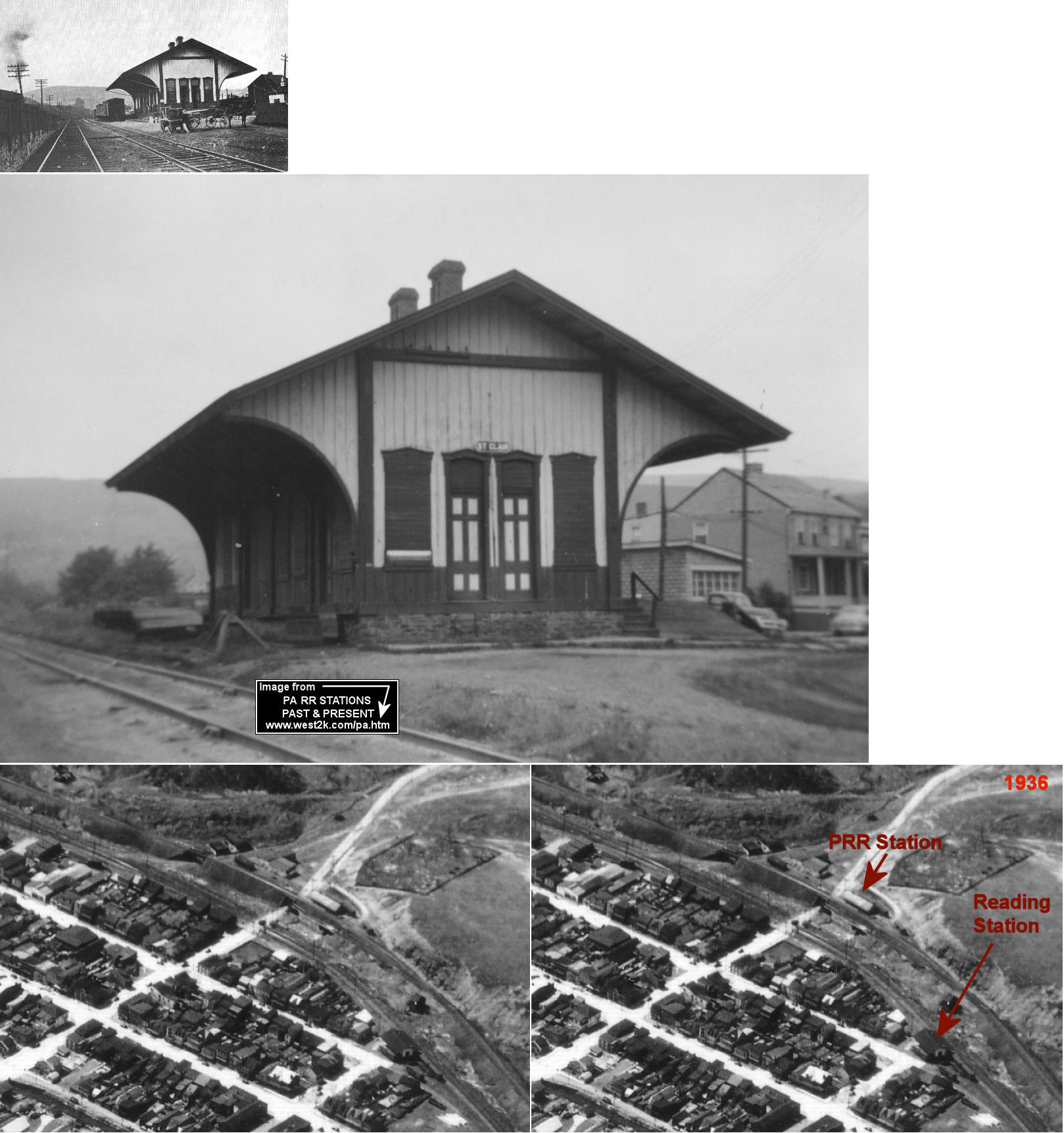
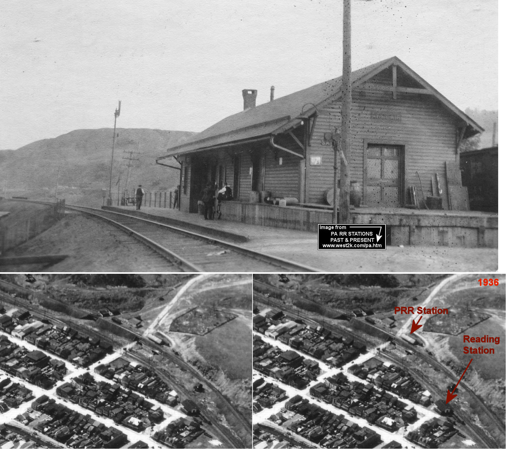
| St. Clair |
|
There were two stations in St. Clair only a half mile apart (and a third in the southern part of town). Both stations are shown on the 1925 Sanborn map. This main station was located on the north end of Third Street at West Franklin Street at GPS: 40.721621, -76.193139. | ||||||
| St. Clair (Hancock Street) |
|
The other station was located on the north side of West Hancock Street next to the St. Clair elevator at GPS: 40.720250, -76.193140. | ||||||
| St. Clair (Patterson St.) |
|
This P&R station was located on the west end of Patterson Street in the vicinity of GPS: 40.715337, -76.189275. It saw fewer stops than the main station on the Third Street. | ||||||
| St. Clair |
|
|||||||
| St. Clair |
|
A new station was built here in 1881. It was on the north side of West Hancock Street/Wade Road at approximetly GPS: 40.719991, -76.193689. | ||||||
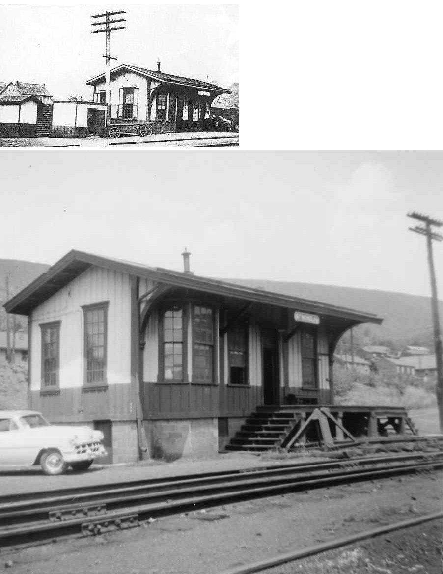
| St. Nicholas |
|
Built around 1880, this station was located off PA54. There was a Mahonoy & Broad Mountain RR station here before that as shown on the 1875 map. | ||||||
| Stanhope Station |
|
In 1875 there was a short spur here that went north from the depot to the Stanhope Furnace and Star Iron Company. | ||||||
| Stony Creek |
|
|||||||
| Stony Creek |
|
|||||||
| Suedburg (Mifflin P.O.) |
|
Built around 1870, this station was just east of Swopes Valley Road. | ||||||
| Summit Station (Hammon) |
|
There was a flag stop shelter here called the Hammon Flag Stop. It was near the Rhine Road bridge across the S&S tracks. Although Summit Station proper did not have a railroad station, passengers boarded here and walked a staircase to and from street level to the flag stop shed. | ||||||
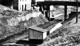
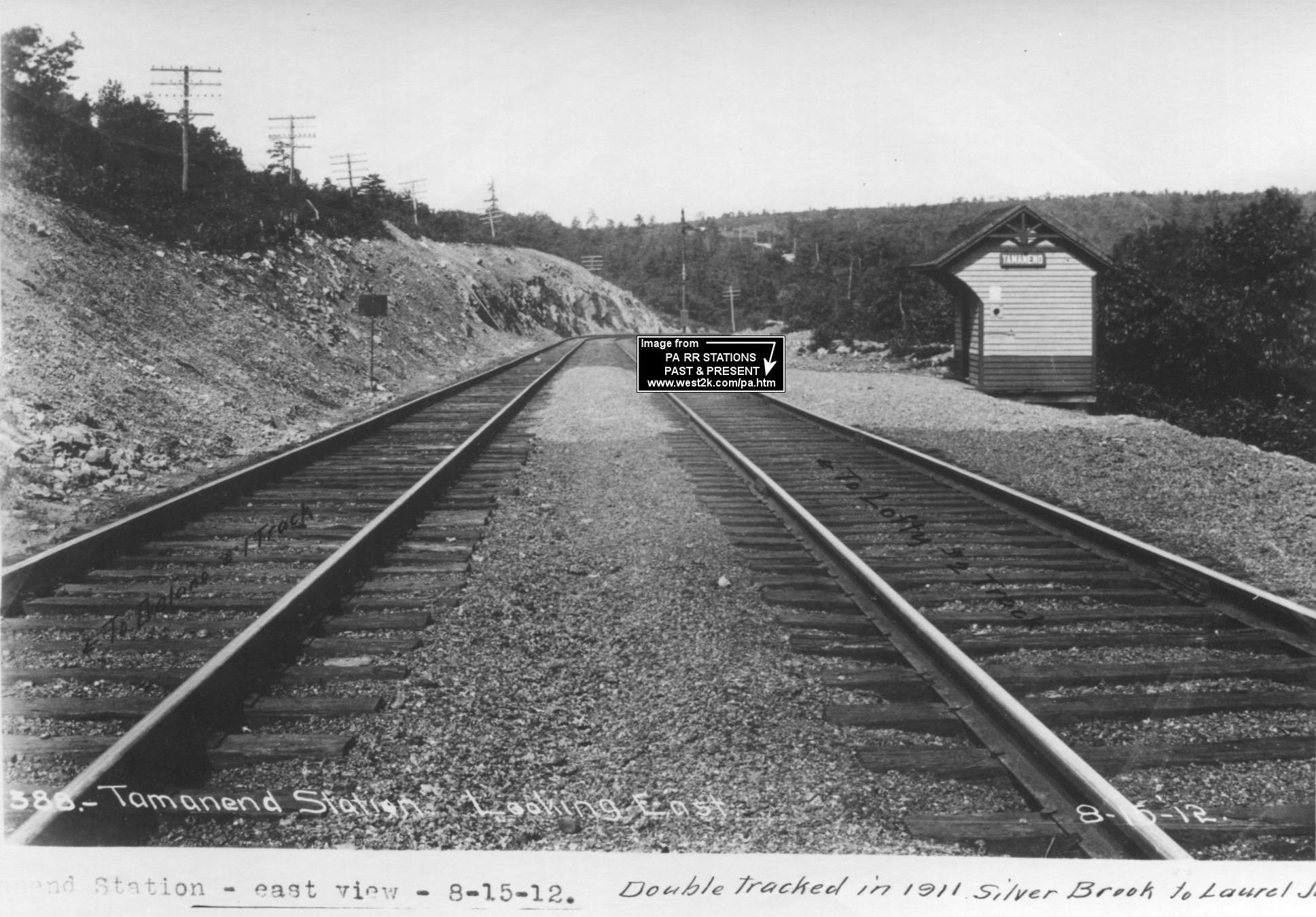
| Tamanend Junction |
|
Also known as Little Schuylkill Junction. | ||||||
| Tamanend Junction |
|
The 1875 map shows the location of a "proposed station" on the west side of the tracks. | ||||||
| Tamanend Junction |
|
The 1875 map shows a station here on the east side of the tracks. | ||||||
| Tamaqua |
|
The original passenger station (pre-1874) was on the south side of Broad Street on the west side of the tracks at GPS: 40.797087, -75.969956. There is a small RR office at that location today (as of 2023). | ||||||
| Tamaqua |
|
There was an early one-story, stone or concrete freight house across the tracks from the passenger station at GPS: 40.798073, -75.969623. This is shown on the 1891-1896 Sanborn maps. It was replaced by the two-story brick station listed below sometime between 1896-1902. | ||||||
| Tamaqua |
|
This brick freight station was only two stories when built between 1896-1902. The third floor was added sometime between 1908-1915. | ||||||
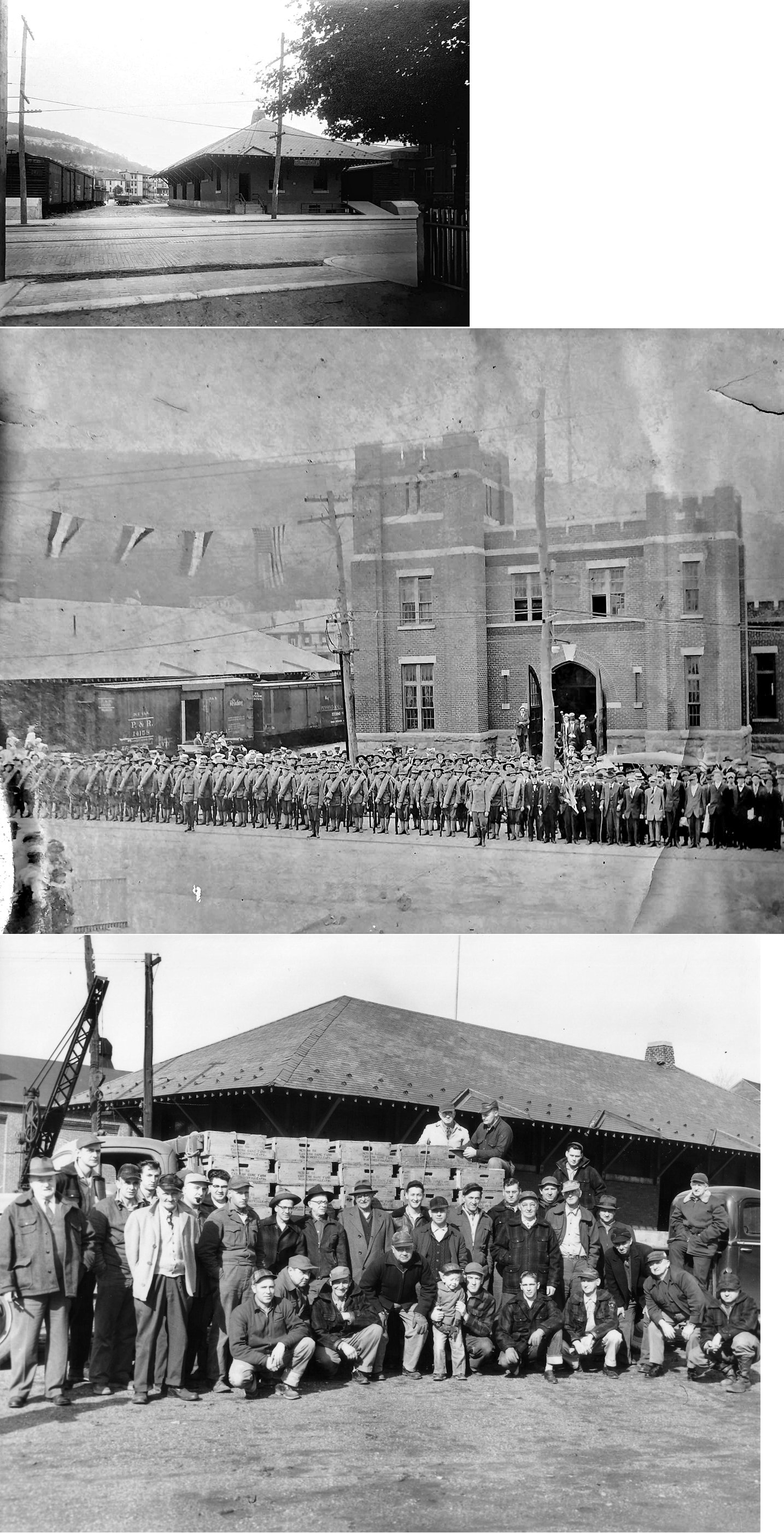
| Tamaqua |
|
This freight station was built in 1912. It was located on the south side of East Broad Street next to the armory at GPS: 40.797344, -75.964563. It was torn down in the 1980s. | ||||||
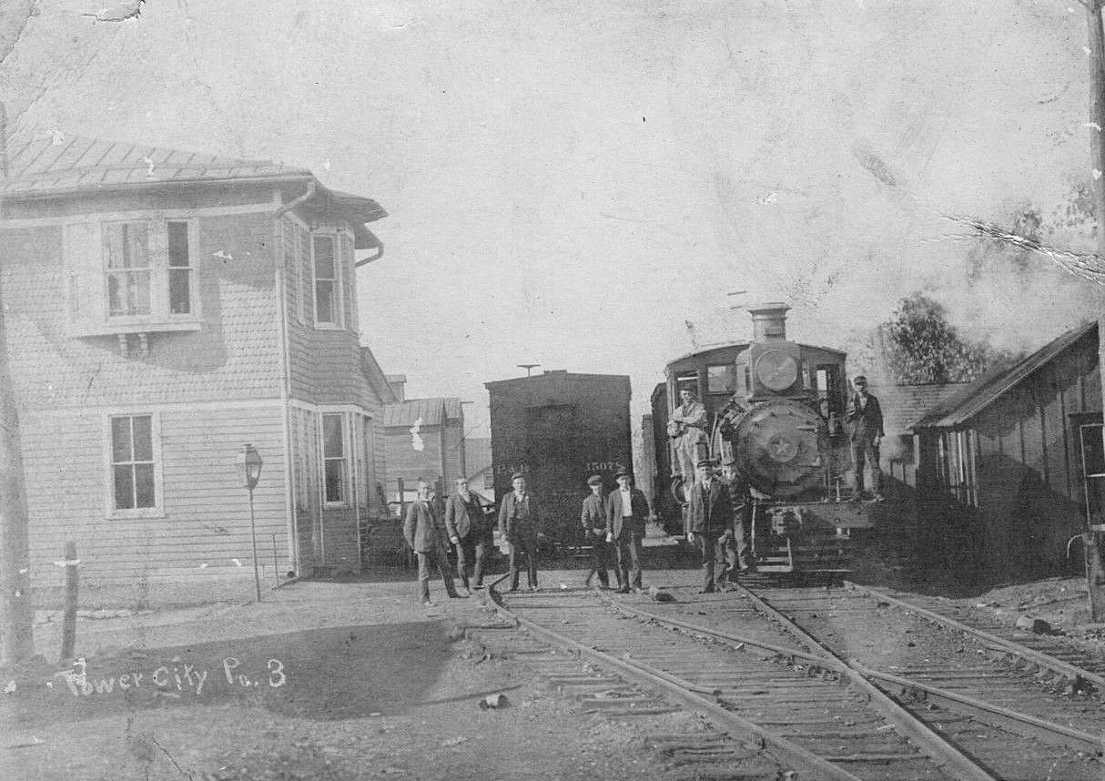
| Tower City |
|
This station was on the west side of North 4th Street on the south side of the tracks at GPS: 40.590422, -76.554868. This was originally built by the Williams Valley RR. | ||||||
| Tremont |
|
The original combination station here was a two-story wood frame building located at approximately the current location of the existing RDG station at Pine Street and North Crescent Street (GPS: 40.629979,-76.39015). It burned down in January, 1904. | ||||||
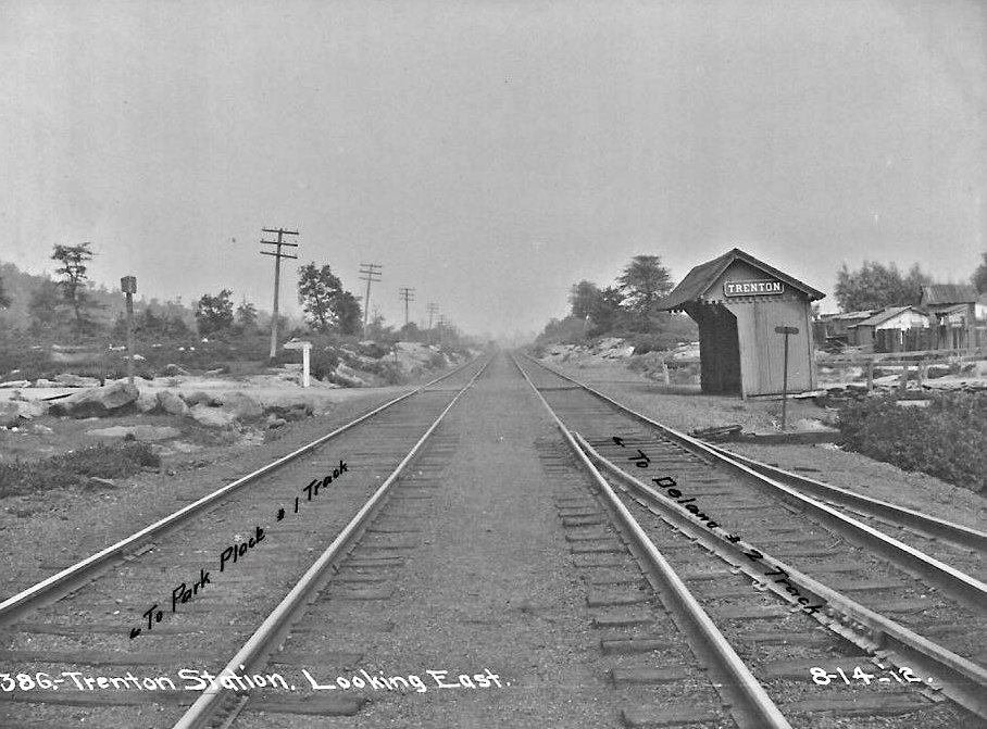
| Trenton |
|
|||||||
| Tuscarora |
|
This station was on the east side of Broad Street at Cedar Street (now gone). | ||||||
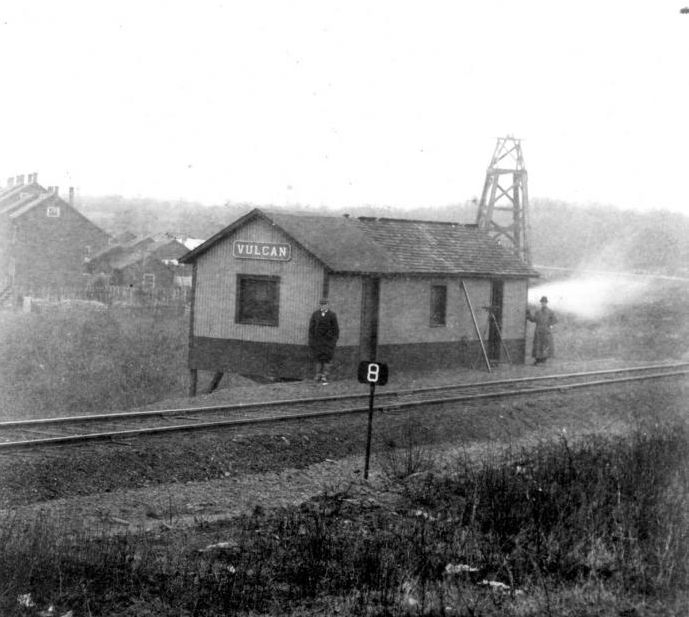
| Vulcan |
|
This station was on the New Boston Branch. | ||||||
| West End |
|
This station was originally at Brookside, but moved to West End when business at Brookside subsided. | ||||||
| West Penn |
|
|||||||
| Wetherill Junction |
|
|||||||
| Wiggan |
|
This station was built in 1887 when the Shenandoah Branch of the Pennsylvania-Schuylkill Valley Railroad opened. | ||||||
| Wiggan |
|
See listing for Boston Run above. | ||||||
| William Penn |
|
|||||||
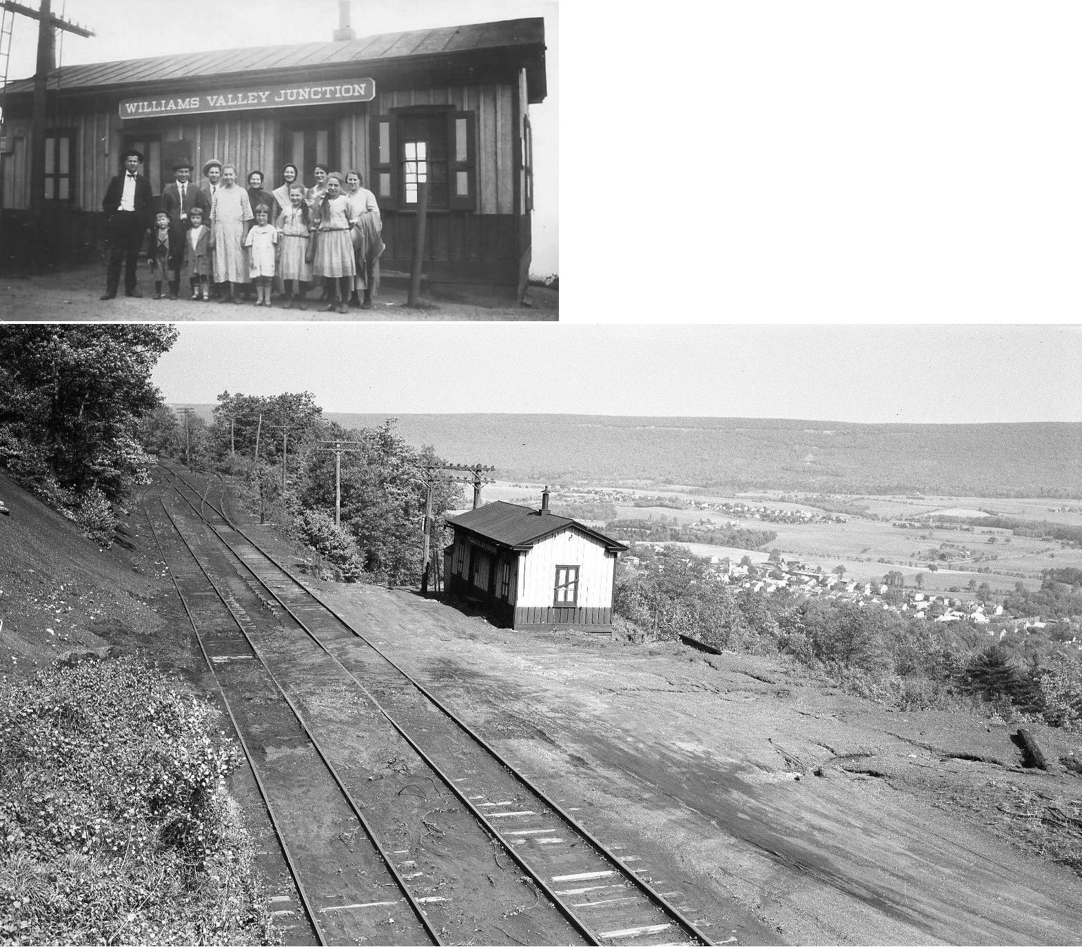
| Williams Valley Junction |
|
Built around 1880. | ||||||
| Yatesville |
|
Not to be confused with the Yatesville in Luzerne County. | ||||||
| York Farm Junction |
|
|||||||
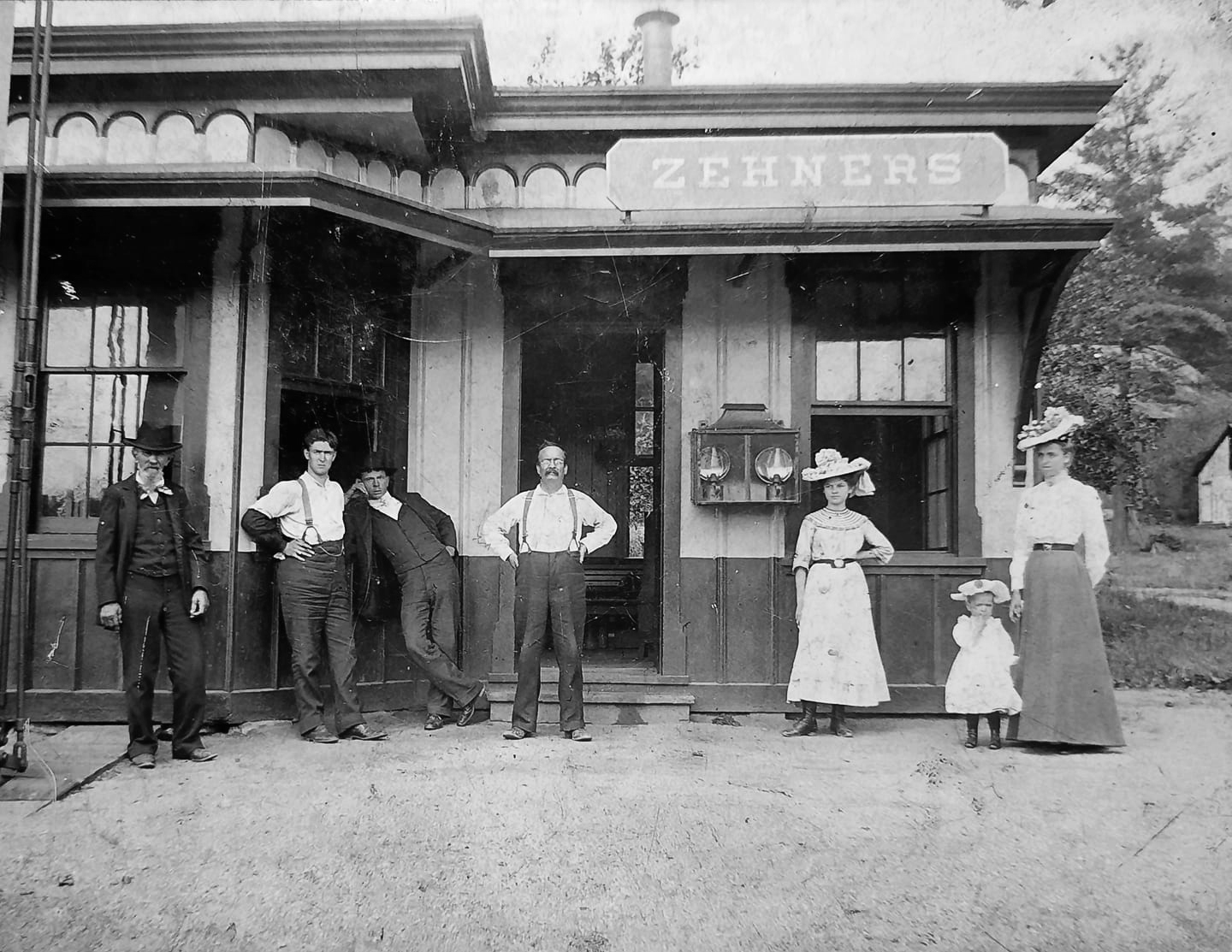
| Zehners |
|
|||||||
| 1895 Schuylkill County Railroad Map | ||||||||
 |
||||||||
|
Notes About Existing Stations... Ashland (RDG Freight) - This brick building is not marked as a freight station on any of the Sanborn maps from 1896 through 1928. Rather it is marked "Storage of Hardware and Oils." So, this may not have been an actual P&R freight station. Can anyone confirm that? The P&R station that was nearby was a combination station with a freight and passenger side. Ashland (Mine Hill & Schuylkill Haven) - The 1913 Sanborn Map, the first one this building appears on is listed as "Hooven Mercantile Company, General Storage." It could be that the station was repurposed after going out of service following the absorption of the MH&SH into the Reading Railroad. Branchdale (MH&SH) - Currently use as a post office and residence. Can anyone confirm that this is in fact a MH&SH station and provide more info? Donaldson (RDG) - Used as a workshop for a trucking company. East Mahanoy Junction (RDG) - RR water tower nearby. Frackville (RDG) - Moved from Frackville to Temple (Berks Co.) in 1984 by the Blue Mountain & Reading Railroad. Its original location in Frackville was on the east side of South Mahanoy Street between Frack and Oak Streets at GPS: 40.784707, -76.229909. Gilberton (RDG) - Now a scale house at the Gilberton Coal Co. Moved in 1955 from trackside. It's original location was on the west side of Quality Hill Road (formerly known as Washington Street and Gilbert Street). Hecksherville (RDG) - There was also an engine house on this site a few hundred yards west of the station, but as of 2018 is was gone. McAdoo (LV) - Moved about 100 feet away from it original location. Minersville (RDG) - This station has been restored. Molino (RDG) - Moved in 1968. At the Northern Berks/Southern Schuylkill Historical Association Transportation Museum in Port Clinton. Moyers (RDG) - The tracks were removed here in 1944. New Ringgold (RDG) - Moved in 1973. At the Northern Berks/Southern Schuylkill Historical Association Transportation Museum in Port Clinton. Port Clinton (R&N) - This replica station was built by the Reading & Northern and is used for its headquarters. Pottsville (RDG) - Only restored headhouse remains of this station which was the original RDG passenger station. After the new station was built on East Norwegian Street, this station served as a freight depot. Rock (RDG) - This building served as ticket office, express office, post office and general store. Roeders (RDG) - This station is now part of a residence, however it is unrecognizable as a station from the exterior. A local expert says that when the owners tore out one of the walls for remodeling, they came across the old ticket window. On the front lawn, there is a disc implanted in the ground designating it an historic landmark. Schuylkill Haven (RDG) - Architect was Alex Smith of Reading. Station is now used as the borough hall. Shenandoah (PRR) - PRR right of way from Frackville to St Nicholas (original line to Shenandoah) was obtained from the P&R in a trade. The PRR received the remainder of the P&R (S&S) line to Rockville along the Susquehanna. Shenandoah (PRR Freight) - This started out as a one-story station, but the two-story head end was added on sometime between 1913 and 1921. The 1913 map shows a Pabst beer depot across the tracks from the freight station. A freight station is shown at this location as early as 1891. Snyders (LV) - West Penn was located near the village of Snyders. The station was moved to Mountain Road in the mid-1950's. It was moved a second time to its current location. Tamaqua (RDG) - Restoration completed. Now houses a museum and restaurant. Tremont (RDG) - Now houses the Tremont Nursing Home office. |
||||||||