|
|
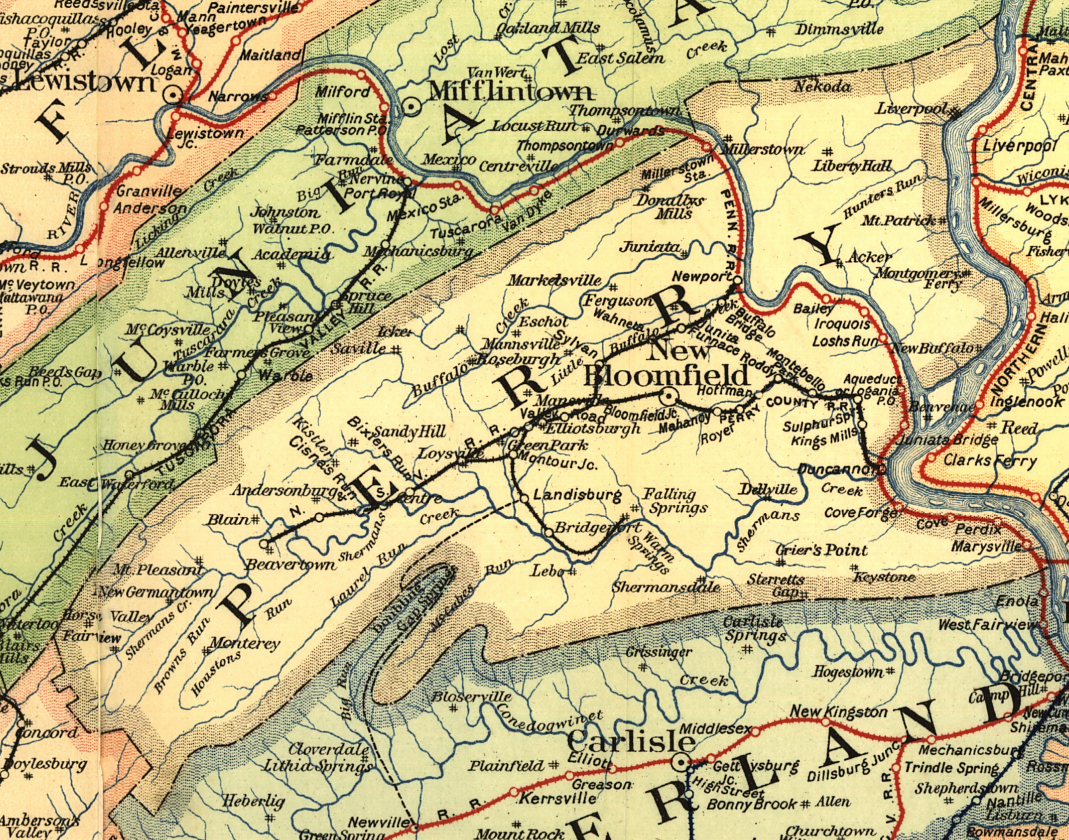
||||||||
| EXISTING STATIONS | ||||||||
|---|---|---|---|---|---|---|---|---|
| Station Name |
Original Railroad |
Current Location |
Type | Current Use |
Date Built |
Track Status |
Building Material |
More Info |
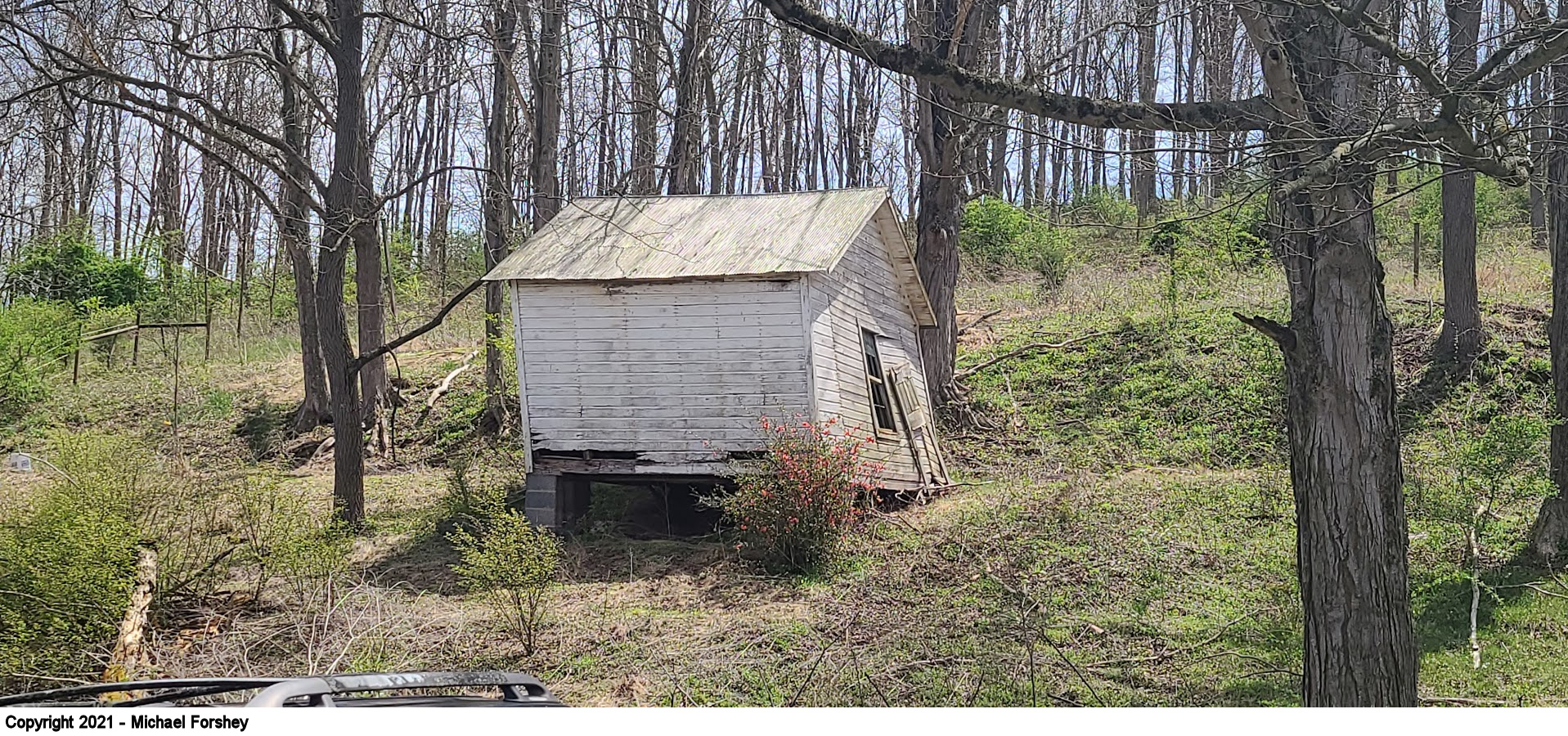
| Blain |
 |
South end of Chruch Road at Mill Road (GPS: 40.334066, -77.509317) |
C | Museum | ???? | Gone | Wood |
|
| Centre |
|
South side of Shermans Valley Road just west of the intersection with
Iron Bridge Road (GPS: 40.3558194, -77.4065010) |
C | Private | ???? | Gone | Wood |
|
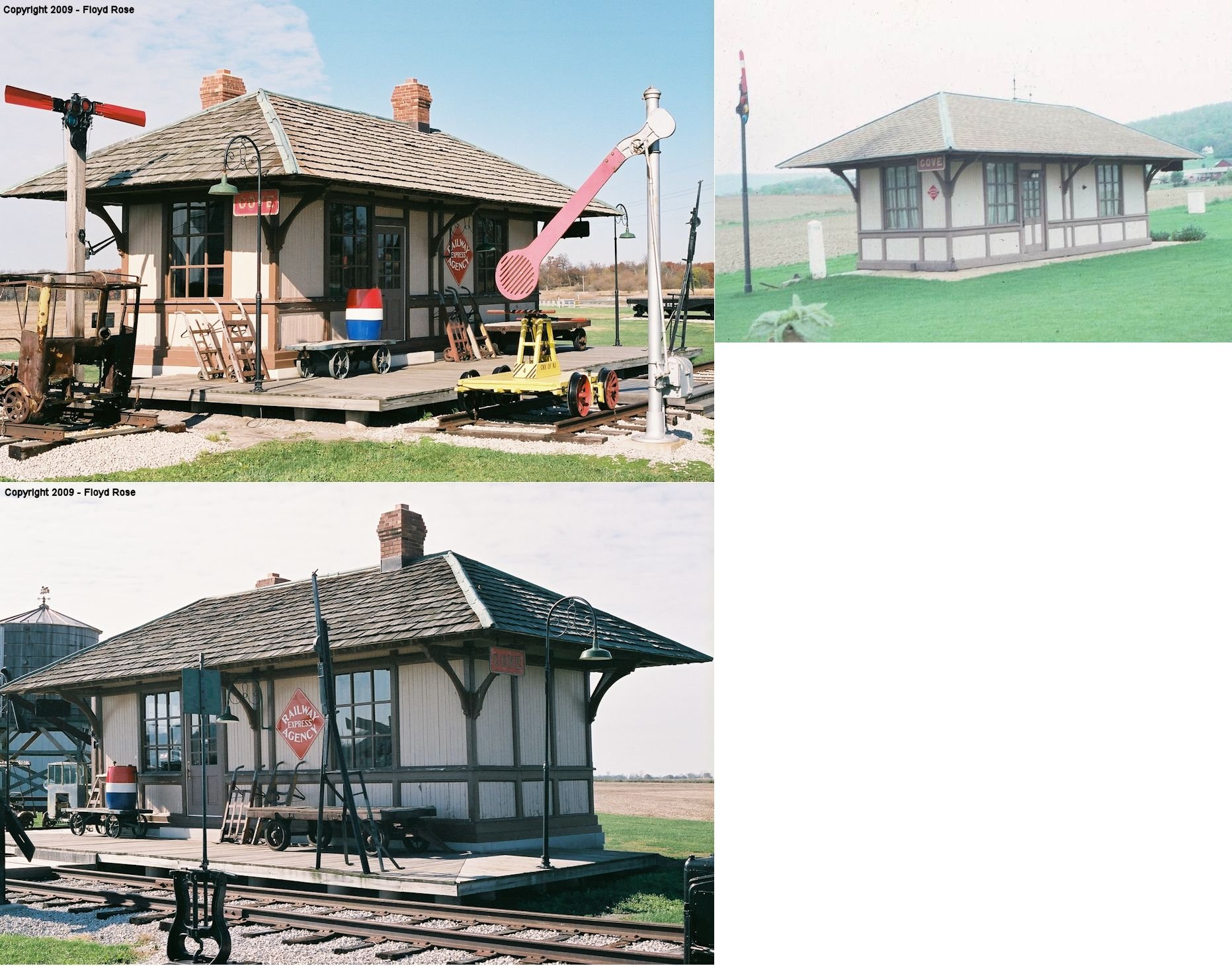
| COVE |
 |
10012 Hwy 421 North, Monon, Indiana (GPS: 40.898729, -86.880131) |
C | Museum | 1893 | None | Wood |
|
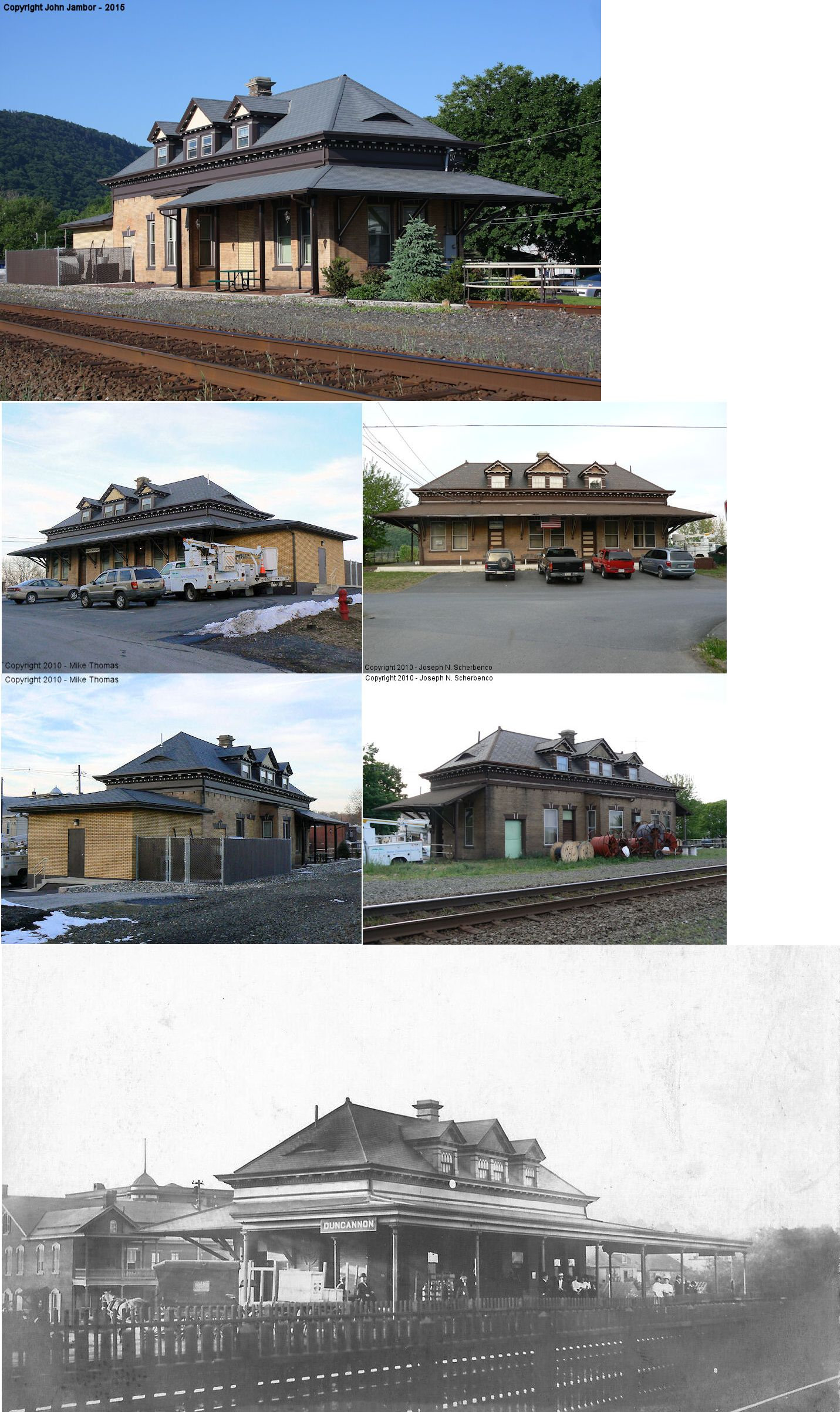
| Duncannon | |
Water Street and Cumberland Street (GPS: 40.389680, -77.029663) |
C | Business | 1902 | In Use | Brick |
|
| Duncannon | |
High Street & Cherry Street (GPS: 40.394742, -77.028283) |
F | Private | ???? | Gone | Brick | |
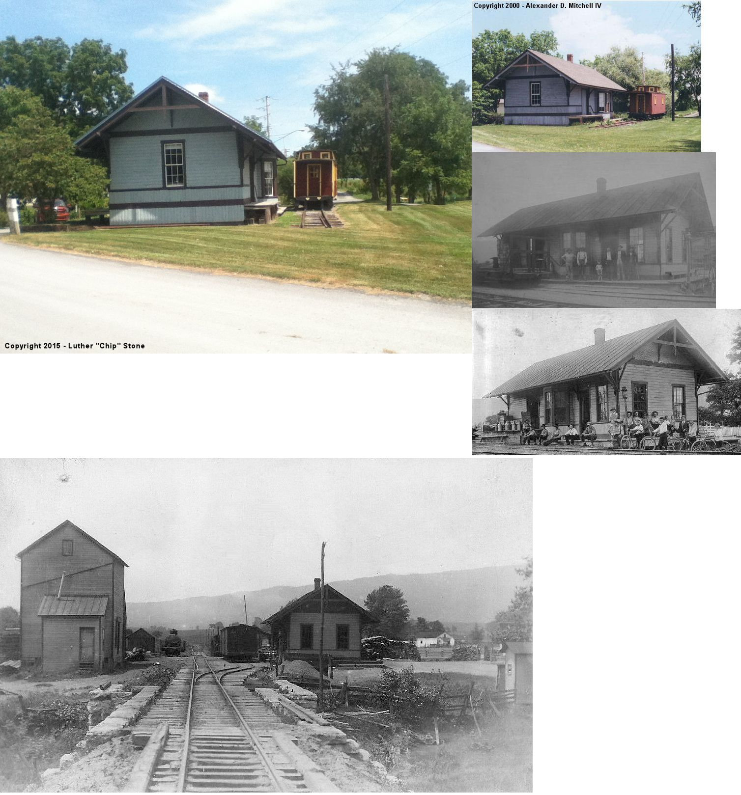
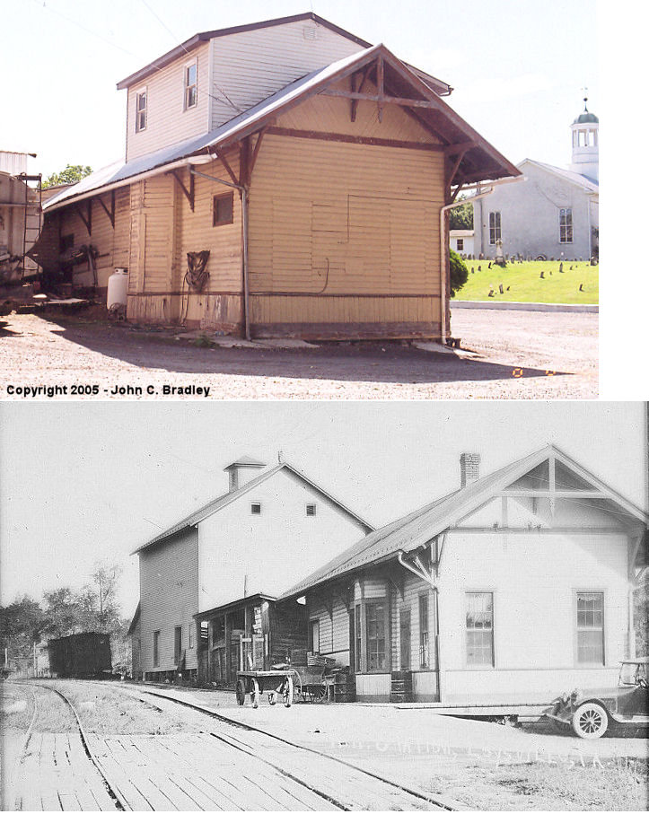
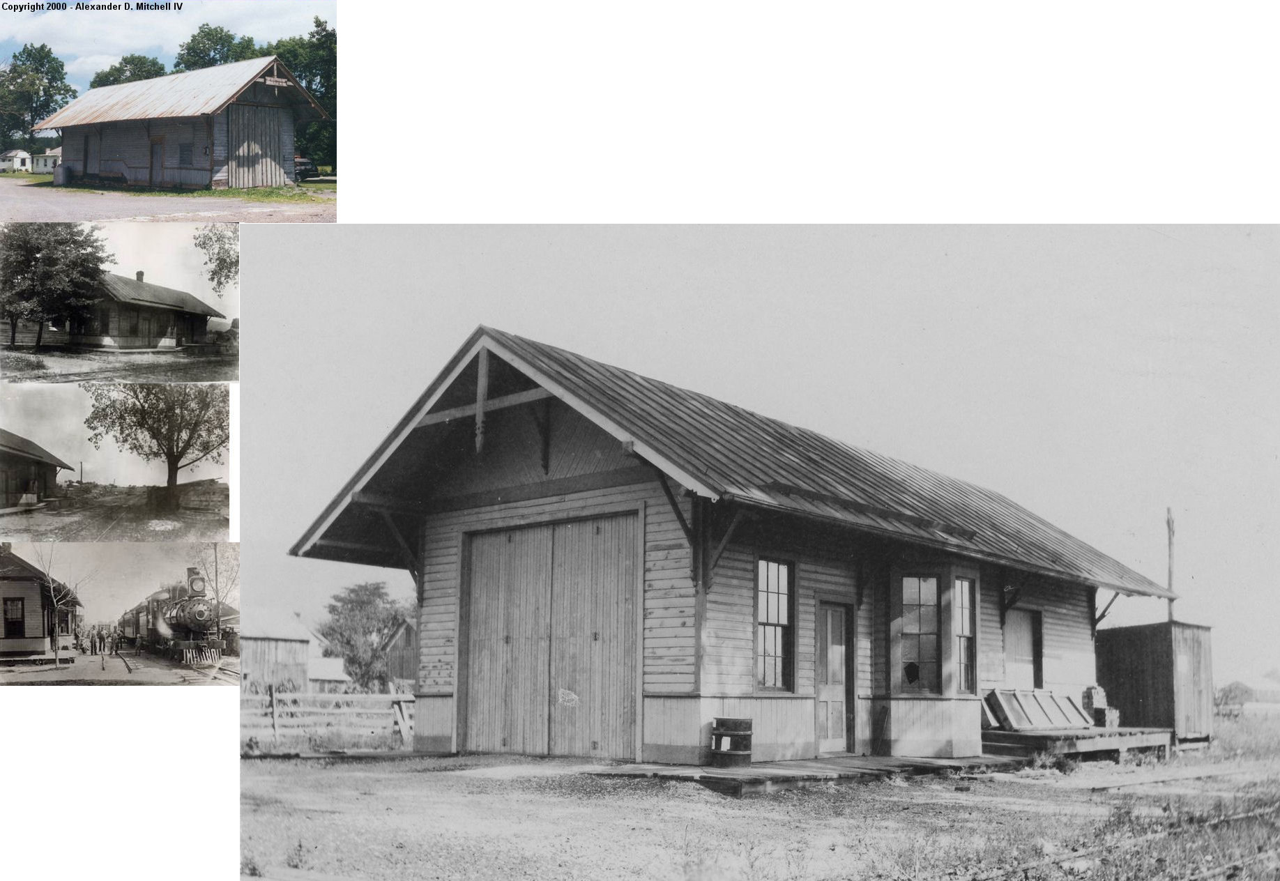
| Loysville |
|
21 Tressler Road (GPS: 40.366750, -77.345222) |
C | Business | ???? | Gone | Wood |
|
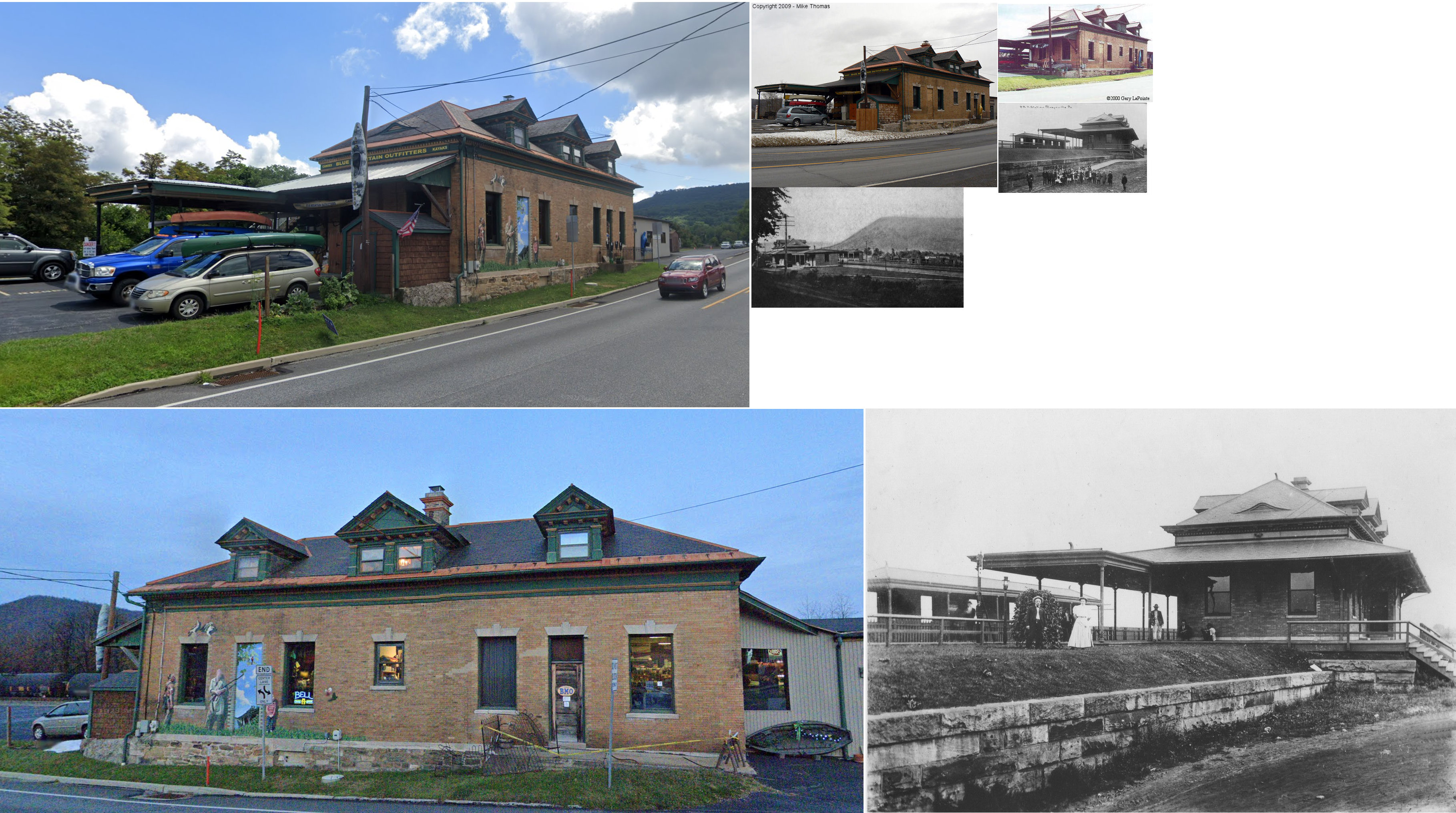
| Marysville | |
103 South State Road (GPS: 40.342481, -76.929448) |
C | Business | 1902 | In Use | Brick | |
| New Germantown |
|
East side of Lower Buck Ridge Road (GPS: 40.308210, -77.568769) |
C | Storage | ???? | Gone | Wood |
|
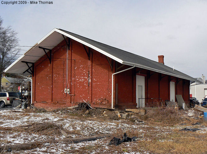
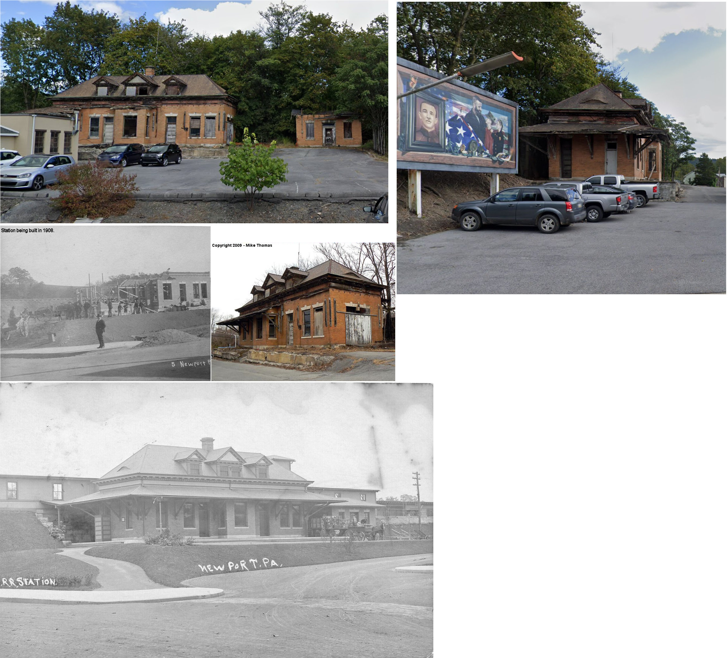
| Newport | |
Southeast of the intersection of Market Street (PA34) and North Front
Street, behind Kauffman's Service Center. (GPS: 40.477973, -77.129356) |
C | Storage | 1908 | In Use | Brick | |
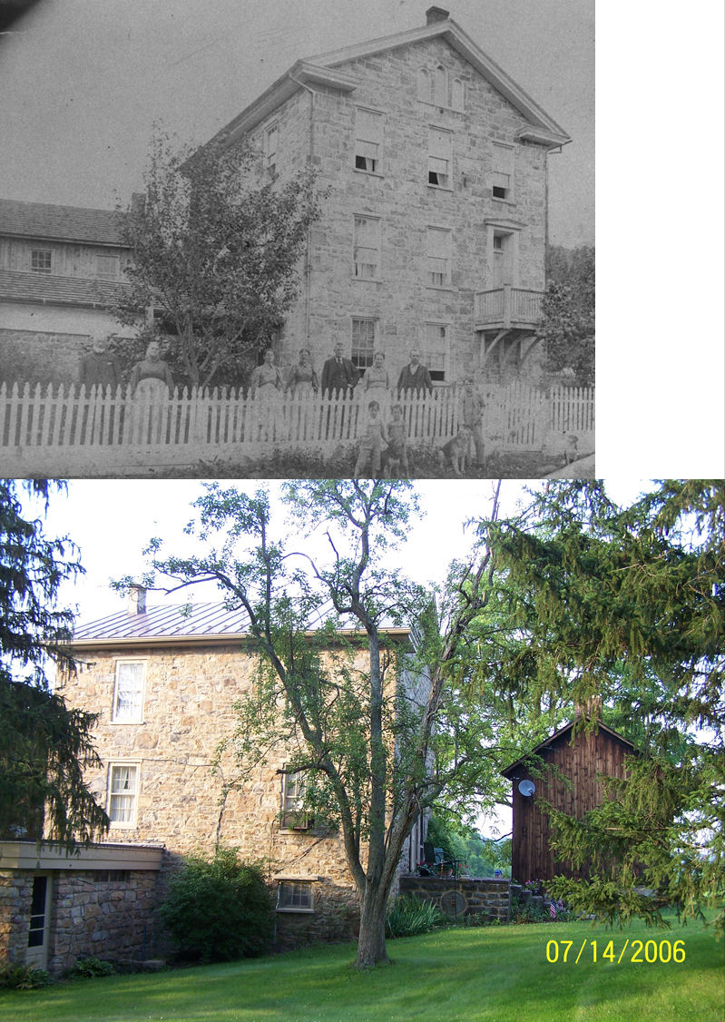
| Water Plug |
|
3025 Little Buffalo Road, Newport | P | Residence | 1860s | None | Stone |
|
| STATIONS OF THE PAST | ||||||||
| Station Name |
Original Railroad |
Notes | ||||||
| Aqueduct |
|
On the 1877 map, this was the northern most PRR station in Penn Township. | ||||||
| Bailey |
|
Bailey Station was named for U.S. Representative Joseph Bailey. It was located at the intersection of Upper and Lower Bailey Roads. The foundation of the station remained as of 2012. | ||||||
| Cove Forge |
|
|||||||
| Dums Station |
Perry County RR |
This station was on Germany Ridge Road. | ||||||
| Duncannon |
|
The first station here was a two-story dwelling/combination station that was on the SW corner of South Main (formerly Susquehanna Street) and Fisher Street at GPS: 40.386664, -77.031771. It is shown as the station on the 1888-1899 maps. After it went out of service after the line was relocated closer to the river, it is shown on the subsequent maps as a residence. | ||||||
| Duncannon |
Perry County RR |
This Perry County RR (later Susquehanna River & Western RR) station was near the old intersection of High Street and Market Street which is now near the intersection of Market Street and Main Street at GPS: 40.388231, -77.031910. It is shown on the 1911 Sanborn map of the town. This small station was the terminus of the 22-mile PCRR which ran west from Duncannon to Loysville. The tracks continued past the station where they connected to the PRR. | ||||||
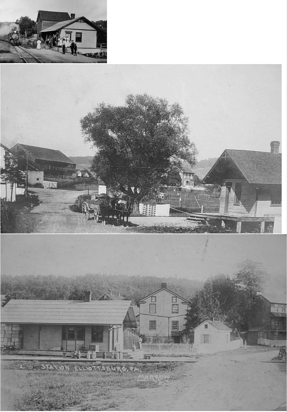
| Elliotsburg |
|
|||||||
| Green Park |
|
|||||||
| Hoffman |
Perry County RR |
This station was south of the intersection of Okefenoke Road and Royer Road. There are no roads to this location now, but the station was in the vicinity of GPS: 40.425003, -77.129169. | ||||||
| Iriquios |
|
|||||||
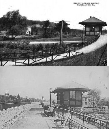
| Juniata Bridge | |
|||||||
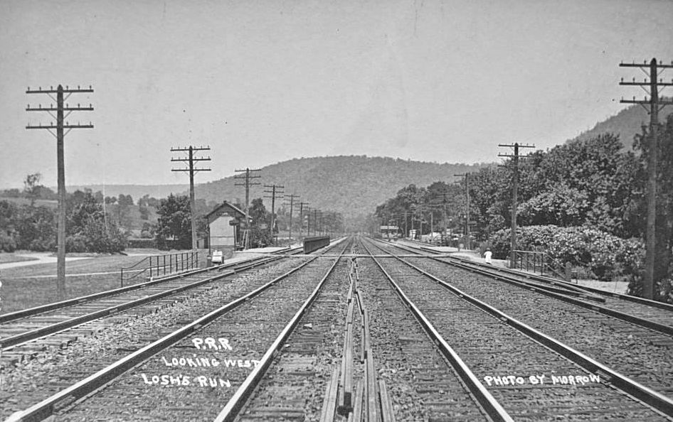
| Losh Run (Losh's Run) |
|
|||||||
| Mahanoy Station | Perry County RR |
This station was on Dix Hill Road. | ||||||
| Marysville | |
An earlier station was built here in 1888. | ||||||
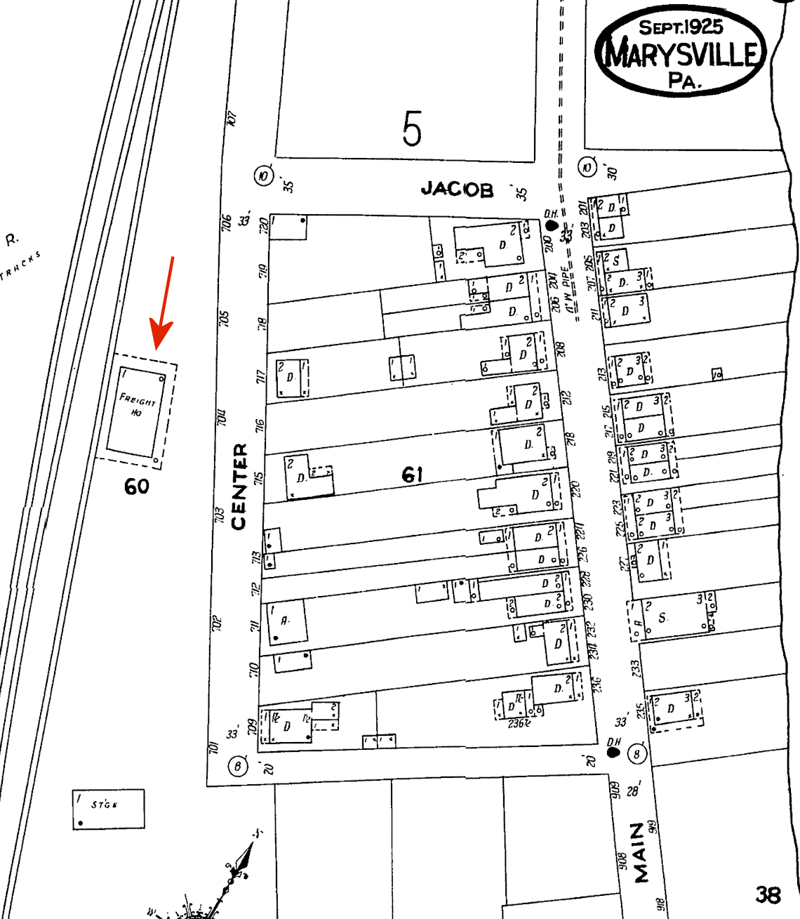
| Marysville | |
There was a freight station off Center Street south of Jacob Street at approximately GPS: 40.340330, -76.927507. | ||||||
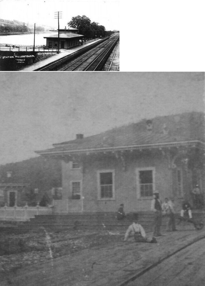
| Millerstown | |
|||||||
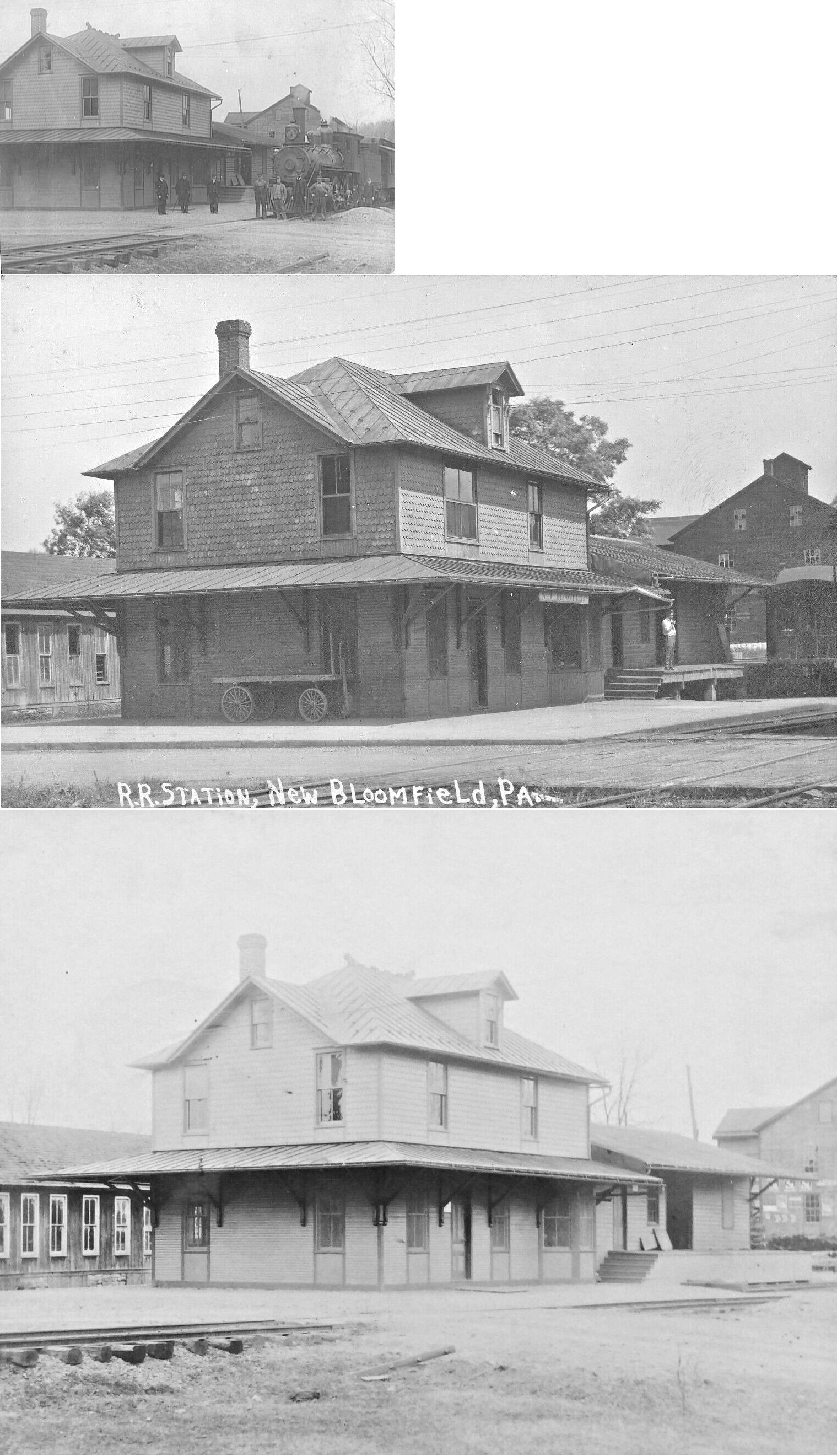
| New Bloomfield |
Perry County RR |
The original station was on the east side of South Carlisle Street at Farmers Alley at GPS: 40.417324, -77.185317. It was a single-story station that predated to one listed below. | ||||||
| New Bloomfield |
SR&W RR |
The Perry County Railroad was acquired by the newly formed Susquehanna River & Western in 1903. A new station was built here by the SR&W sometime between 1904-1911. The new station was a two-story depot with a single-story freight section. It was essentialy on the same spot as the previous station. The former E.C. Barnett Bending Factory can be seen in the background of the photo behind the depot. | ||||||
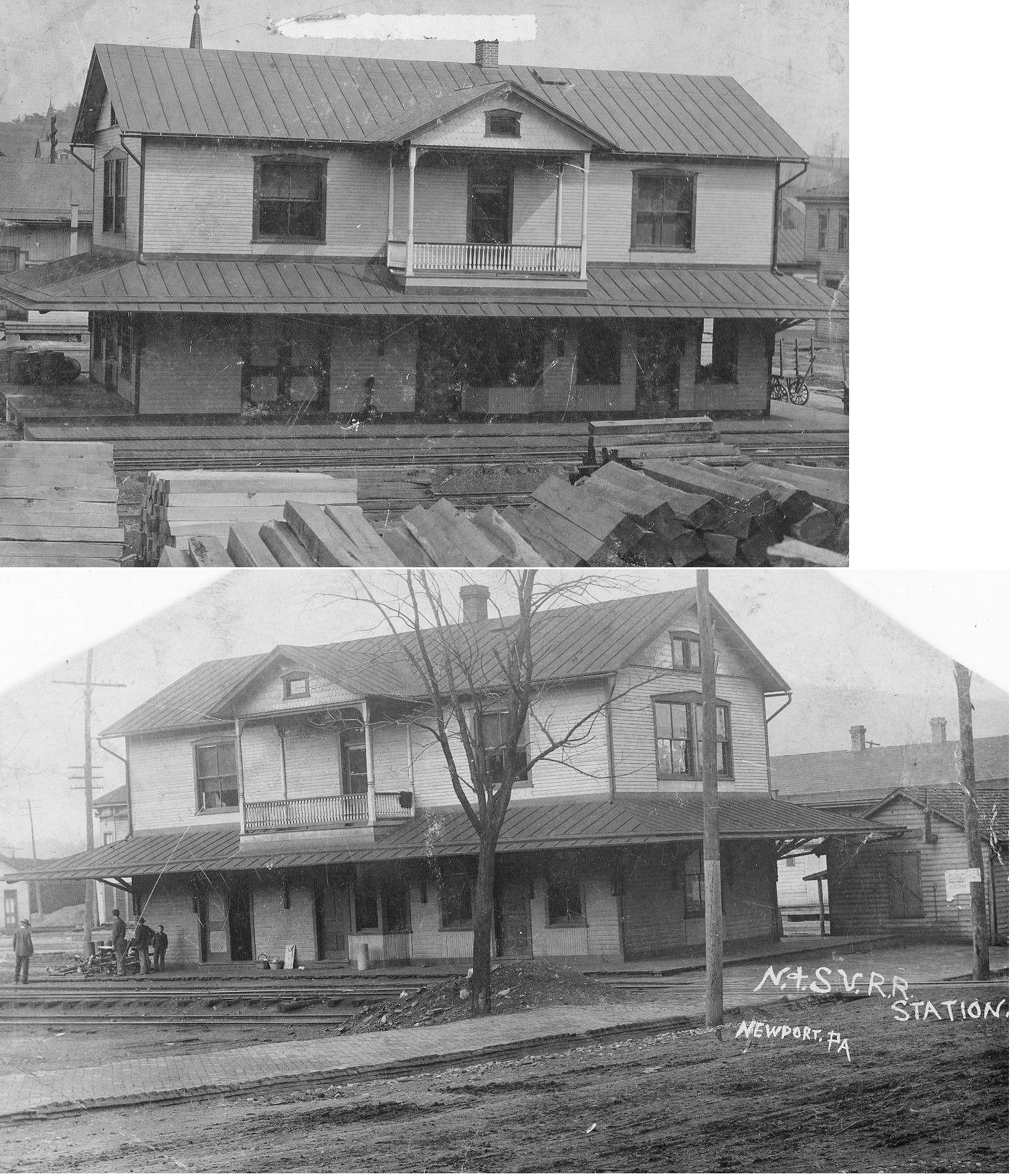
| Newport |
|
The original PRR combination station was on the north side of Walnut Street at 3rd Street at GPS: 40.478468, -77.132974. The old main line used to run down the middle of 3rd Street through town. After the new passenger station was built in 1908 on the new main line (which was built in 1905) along the river, this station became a dedicated freight station. | ||||||
| Newport |
|
This combination station was on the north side of Walnut Street at Peach Street at GPS: 40.478254, -77.133297. The old right of way ran down the middle of Peach Street through town. By 1925 the station was gone and the narrow-guage tracks pulled up through town. | ||||||
| Old Ferry |
|
|||||||
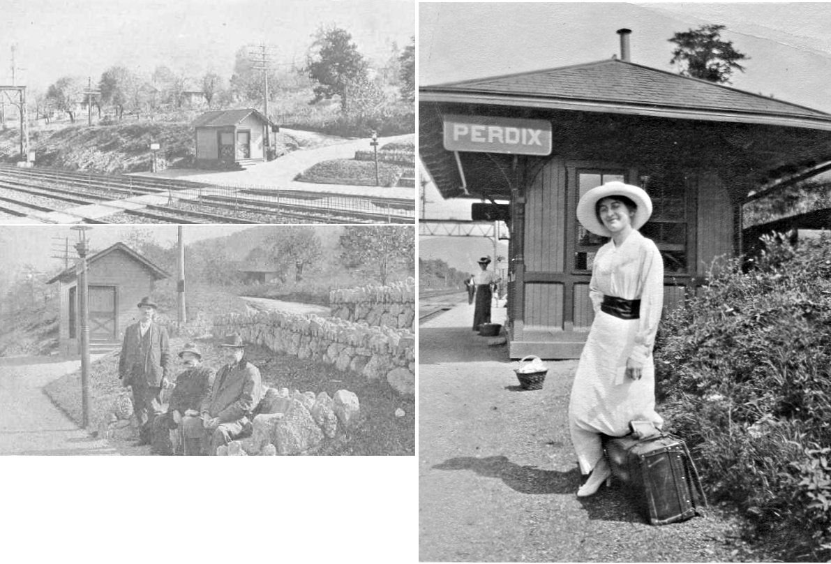
| Perdix | |
|||||||
| Roddy | Perry County RR |
This station was south of Narrows Road at approximately GPS: 40.431420, -77.101285. Although there are no roads to this location today, there appears to be a driveway that leads to it. | ||||||
| Royer | Perry County RR |
This station was SE of the intersection of Royer Road and Brady Road. There are no roads to the location of the station today. It was at approximately GPS: 40.422916, -77.137894. | ||||||
| 1895 PERRY COUNTY RAILROAD MAP | ||||||||
 |
||||||||
| Notes About Existing
Stations... Blain (N&SV) - Station has been restored to use as a museum. Also, track had been laid for the display of a locally home-built caboose. Tours are given on an "on-call basis." Centre (N&SV) - Station is still standing, except it is beginning to lean to one side. It has the victorian cross structure setup common on the Newport and Shermans Valley Railroad stations. Cove (PRR) - This station was originally moved from Cove to Hollidaysburg where it was part of a museum/private collection owned by Chuck Hazlett in the 1970s. The collection of artifacts, including the station were eventually auctioned/sold. The station now resides at the Monon Connection Museum in Indiana. Does anyone know what year the depot was originally moved to Hollidaysburg? It was subsequently moved to Indiana in 2002. Not to be confused with the Cove in Bedford County which had a Cove station on the H&BTM RR. Duncannon (PRR) - The building was commissioned in 1900 and completed in 1902. Blue Ridge Communications, a cable company, purchased the building in 2005. After totally remodeling the building and trying to keep it as original as possible, but still making it functional, the building had a grand re-opening in 2009. Loysville (N&SV) - Building is part of Kreider's Mill. New Germantown (N&SV) - Station is now used by Toboyne Township for storage. Had been modified in the 1930s to accomodate a bus garage. Water Plug (N&SV) - During the late 1800's, the Newport and Shermans Valley railroad crossed behind the house. Due to a never failing spring on the property, a dam was constructed and water supplied to the steam engines. Thus, Water Plug Station (as it was known on the N&SV timetable as well). To this day, the spring is used to fill and top off the 20x40 ft. in ground swimming pool on the property. The dam can still be seen but has since been breached. |
||||||||