|
|
||||||||
| EXISTING STATIONS | ||||||||
|---|---|---|---|---|---|---|---|---|
| Station Name |
Original Railroad |
Current Location |
Type | Current Use |
Date Built |
Track Status |
Building Material |
More Info |
| Bangor |  |
215 South Chestnut (GPS: 40.864565, -75.206302) |
F | Businesses | 1902 | Gone | Brick | |
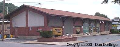
| Bangor |  |
46 Main Street (GPS: 40.867914, -75.205102) |
F | Business | 1909 | Gone | Brick | |
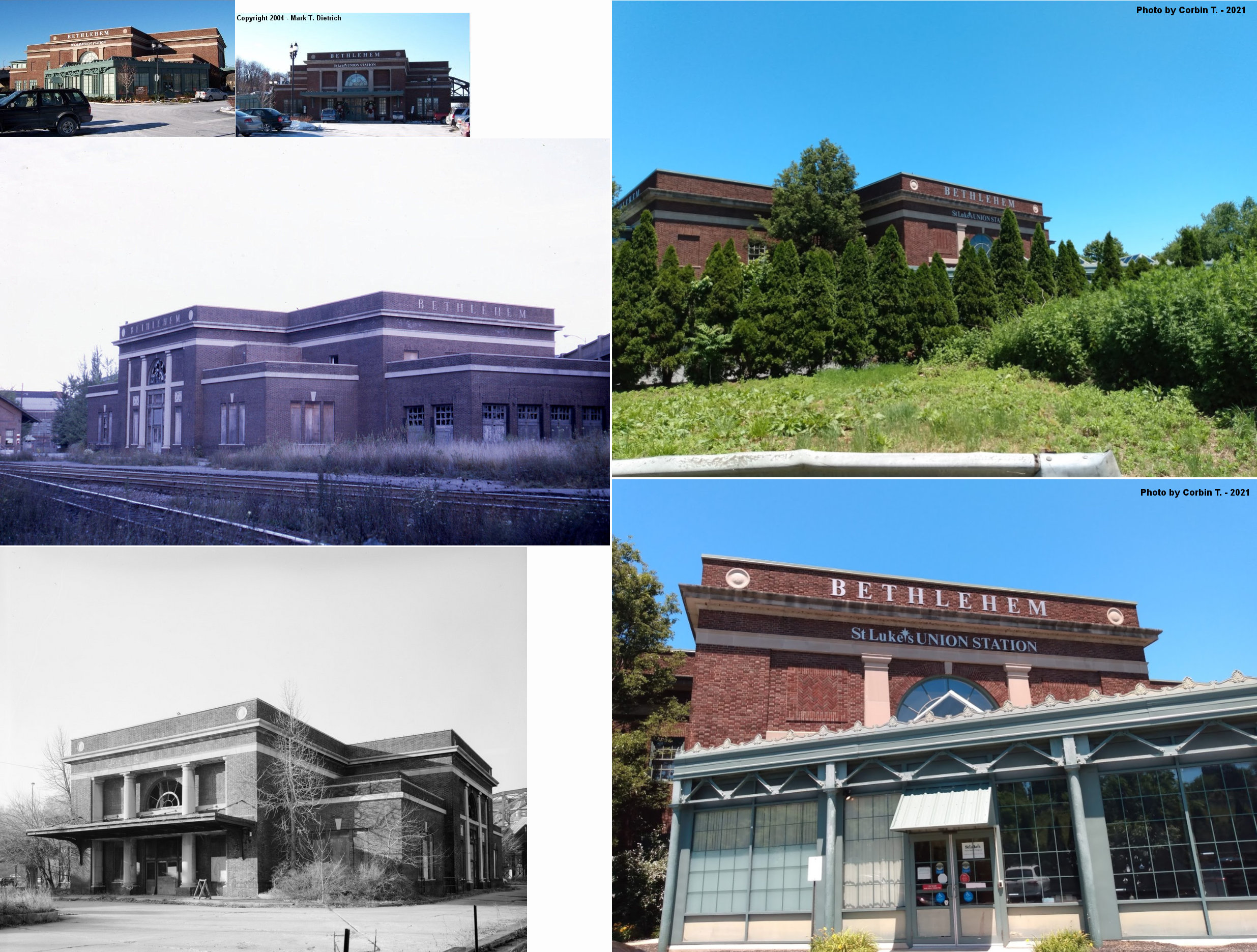
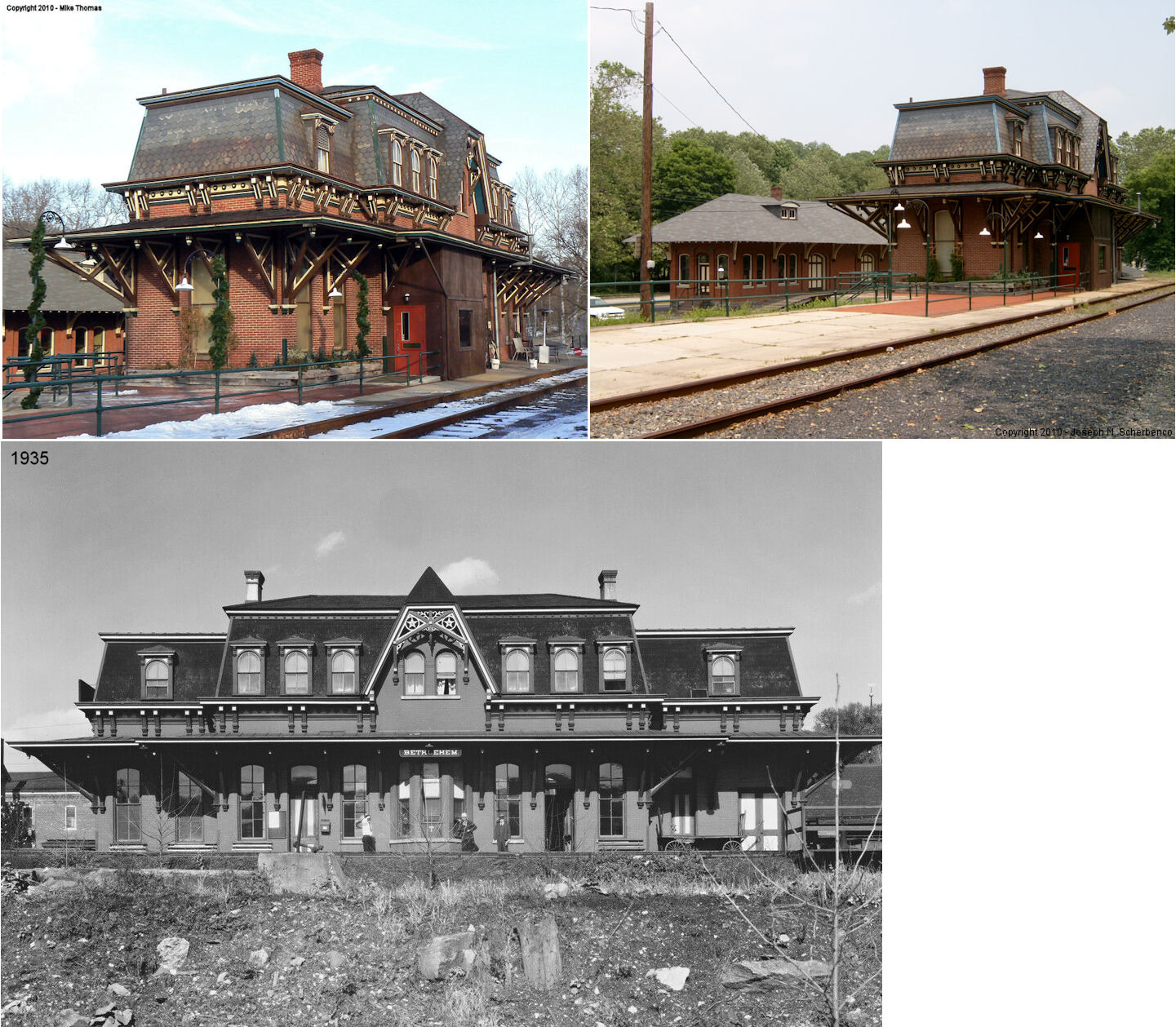
| Bethlehem |  AND  |
240 Union Station Plaza (GPS: 40.613814,-75.3832) |
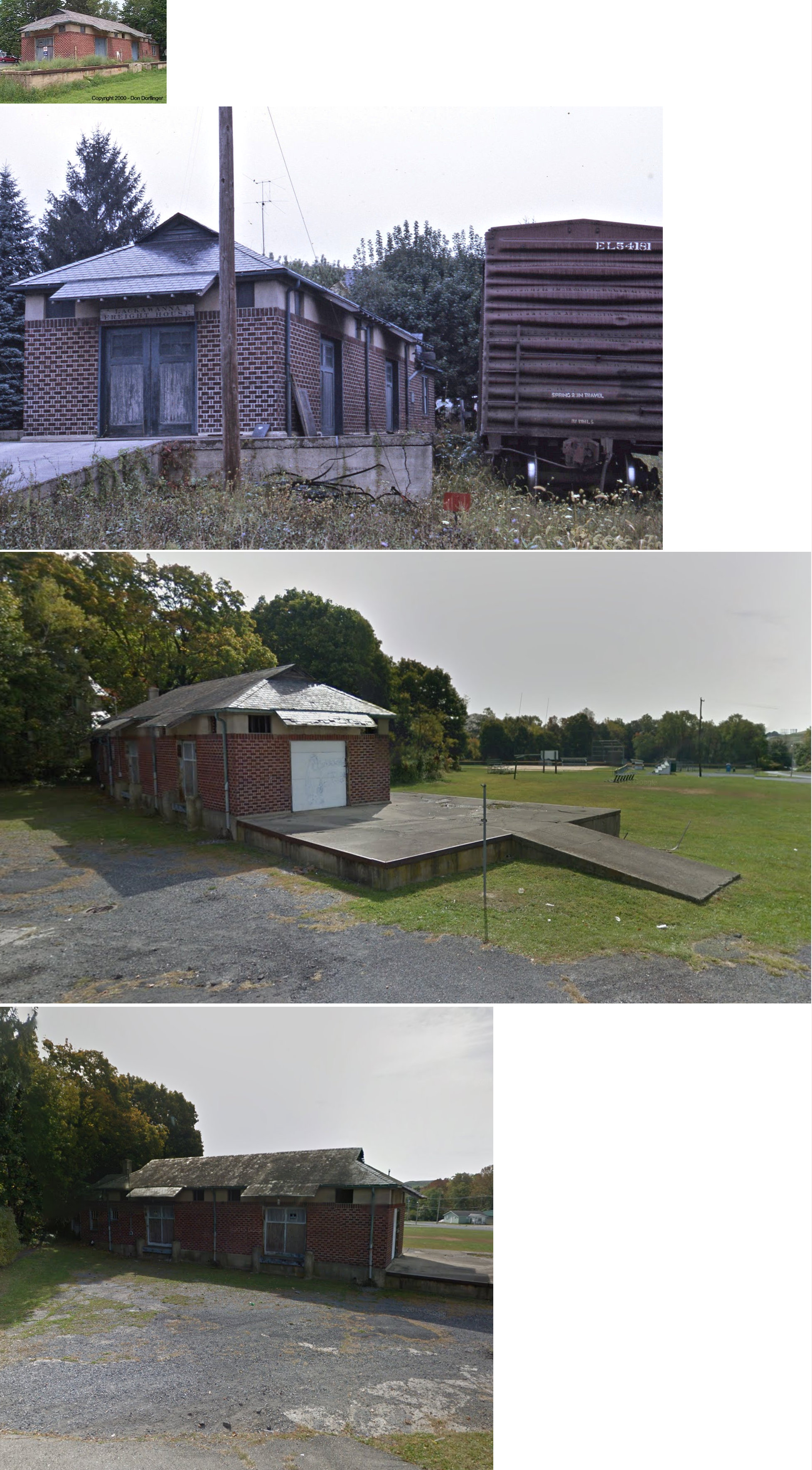
P | Health Clinic | 1924 | In Use | Brick | |
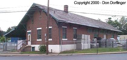
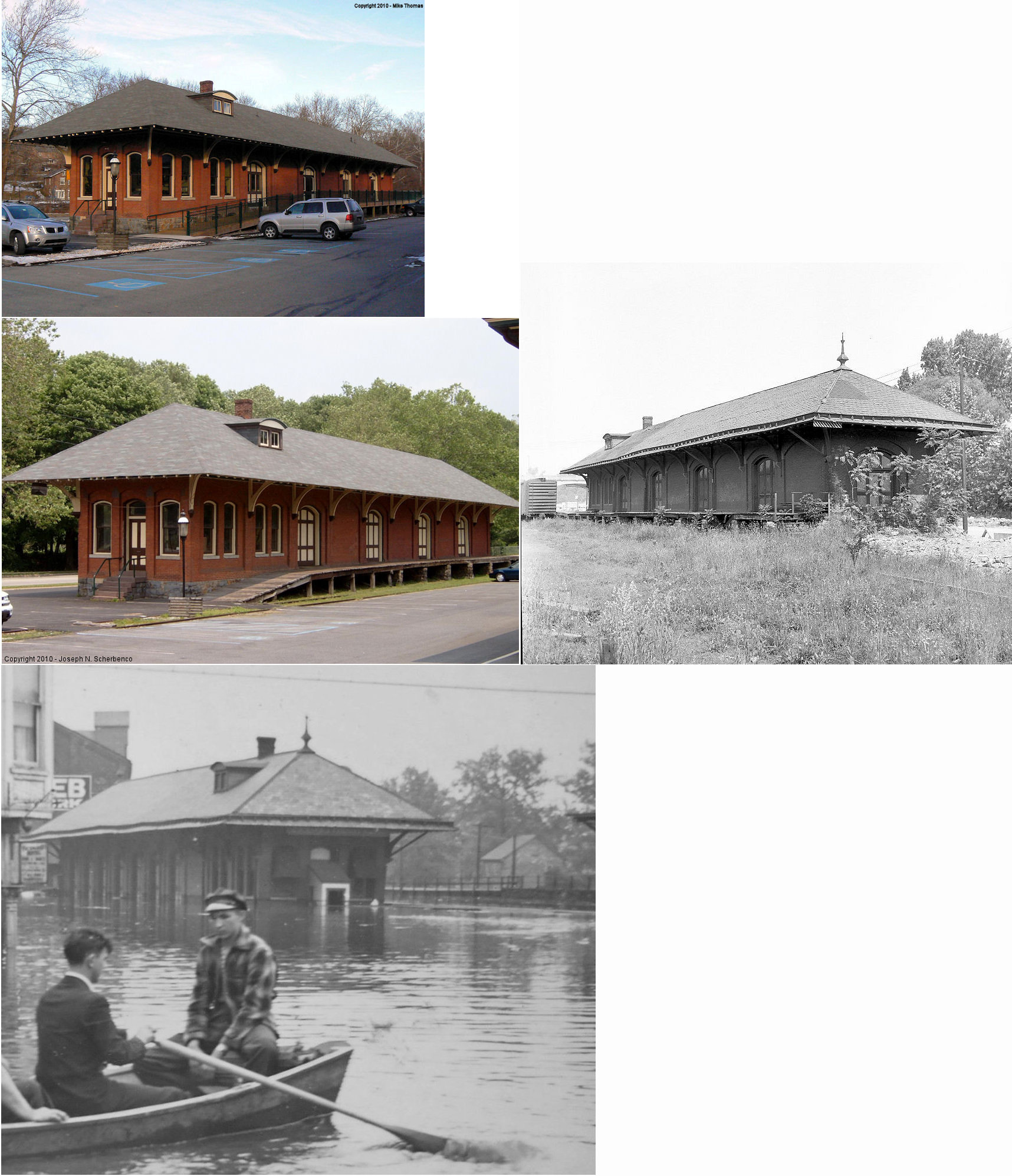
| Behtlehem |
|
231 Union Station Plaza (GPS: 40.614106, -75.380726) |
F | Railroad | ???? | In Use | Brick | |
| Bethlehem |  |
61 West Lehigh Street (GPS: 40.616526, -75.382461) |
P | Restaurant | 1873 | In Use | Brick |
|
| Bethlehem | |
55 West Lehigh Street (GPS: 40.616776, -75.382265) |
F | Storage | 1910 | Gone | Brick | |
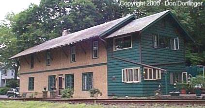
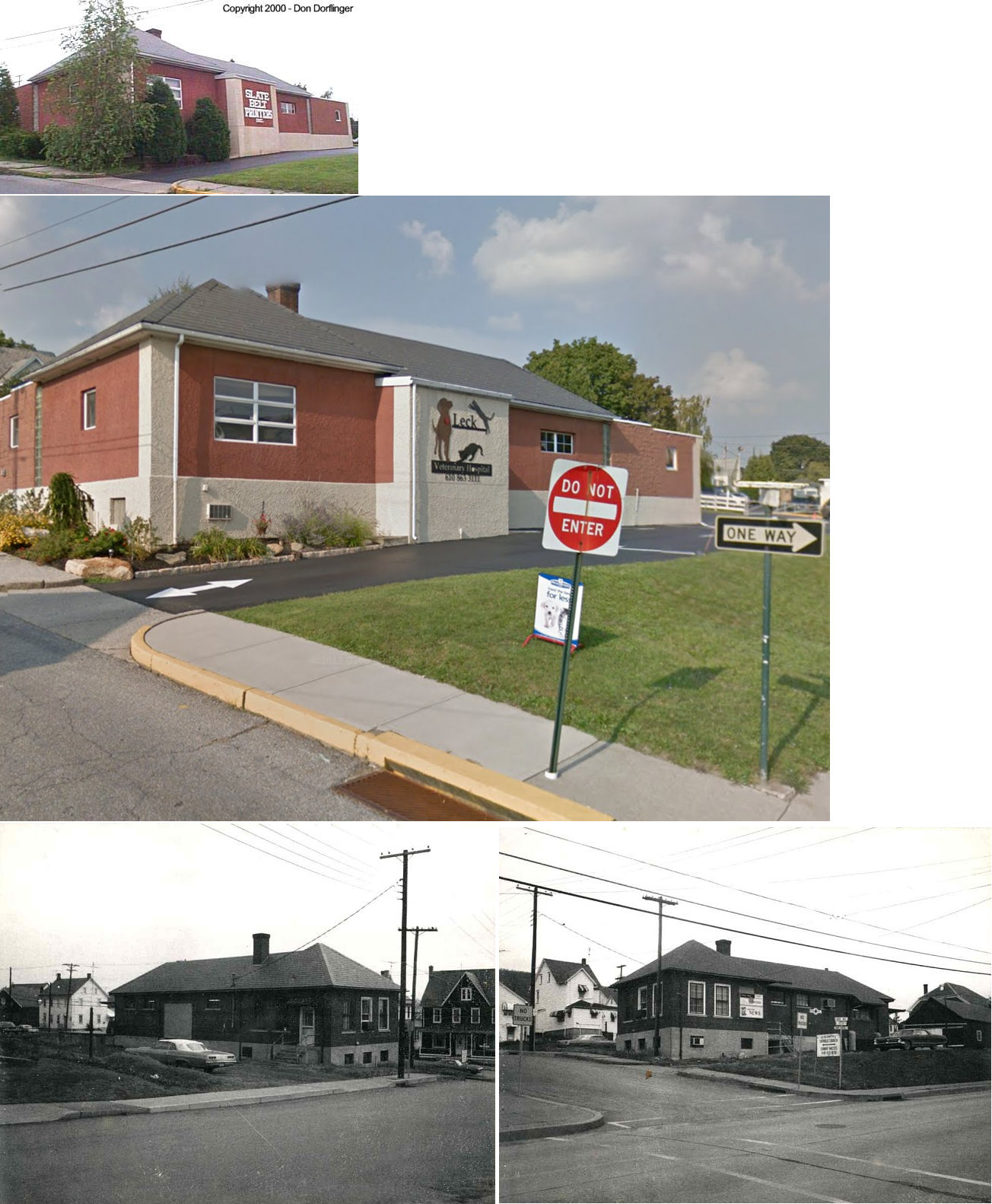
| Danielsville | |
PA 946 (Mountain View Drive) | C | Business | ???? | Gone | Combo | |
| Delabole | |
Delabole Road | P | Business | 1893 | Gone | Wood |
|
| Easton | |
Canal Street & Smith Avenue at Third Street Bridge (GPS: 40.685775, -75.208833) |
C | Vacant | 1927 | In Use | Brick |
|
| Mt. Bethel | |
Jacoby Creek Road and Railroad Avenue | C | Residence | 1878 | In Use | Stucco |
|
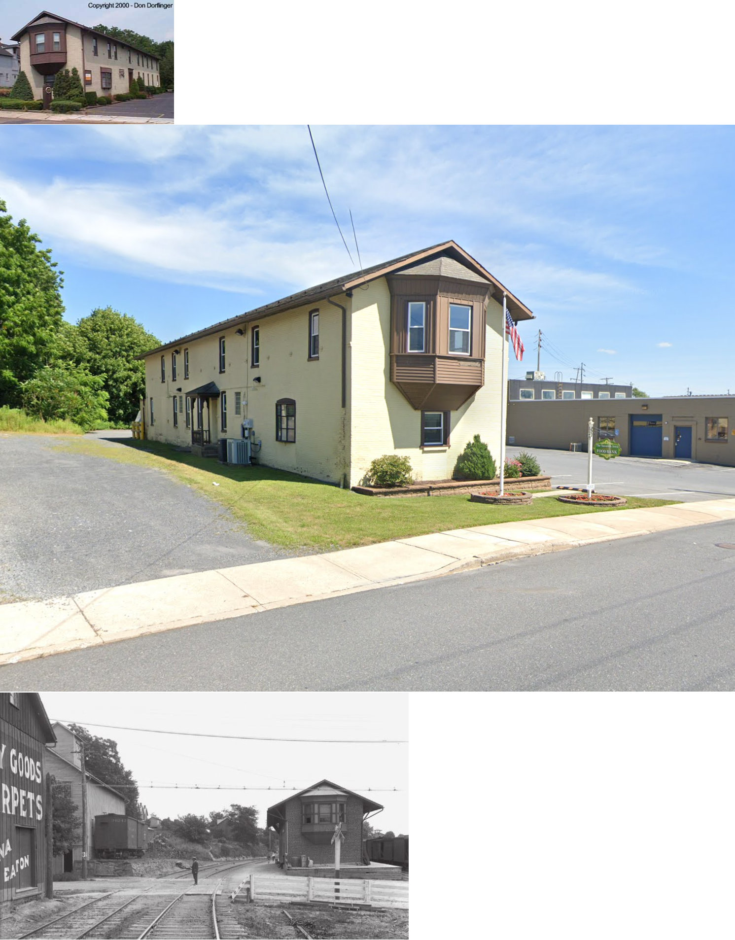
| Nazareth | |
529 South Main Street (GPS: 40.734567, -75.311587) |
C | Business | 1890 | Gone | Brick |
|
| Nazareth | |
565 South Main Street (GPS: 40.733361, -75.311016) |
F | Business | ???? | In Use | Brick/ Wood |
|
| Northampton | |
Main Street at Laubach Street, behind the VFW Hall (GPS: 40.679017, -75.490552) |
C | Vacant | ???? | In Use | Wood | |
| Pen Argyl | |
115 West Pennsylvania at Lobb Avenue (GPS: 40.868441, -75.256557) |
F | Business | ???? | Gone | Brick | |
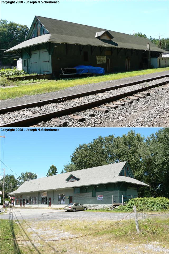
| Portland | |
428 Delaware Avenue (GPS: 40.922803, -75.096421) |
P | Business | 1897 | In Use | Wood | |
| Portland | |
208 Northampton Street (GPS: 40.921871, -75.100890) |
P | Business | ???? | Gone | Wood | |
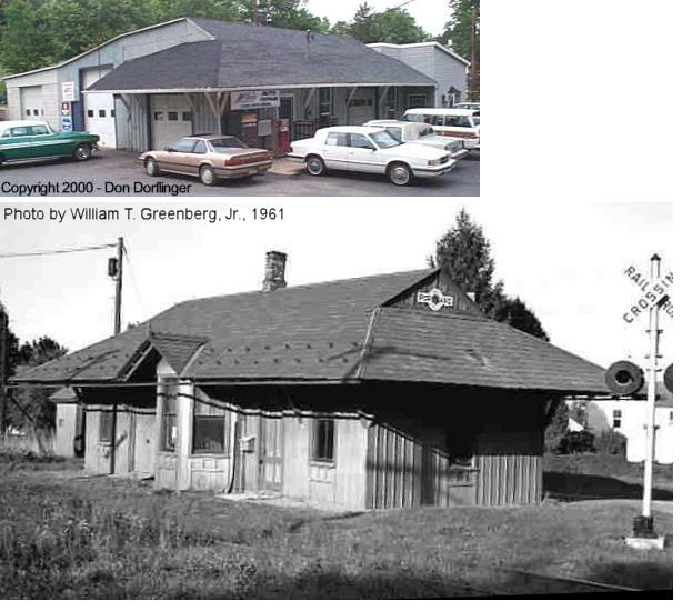
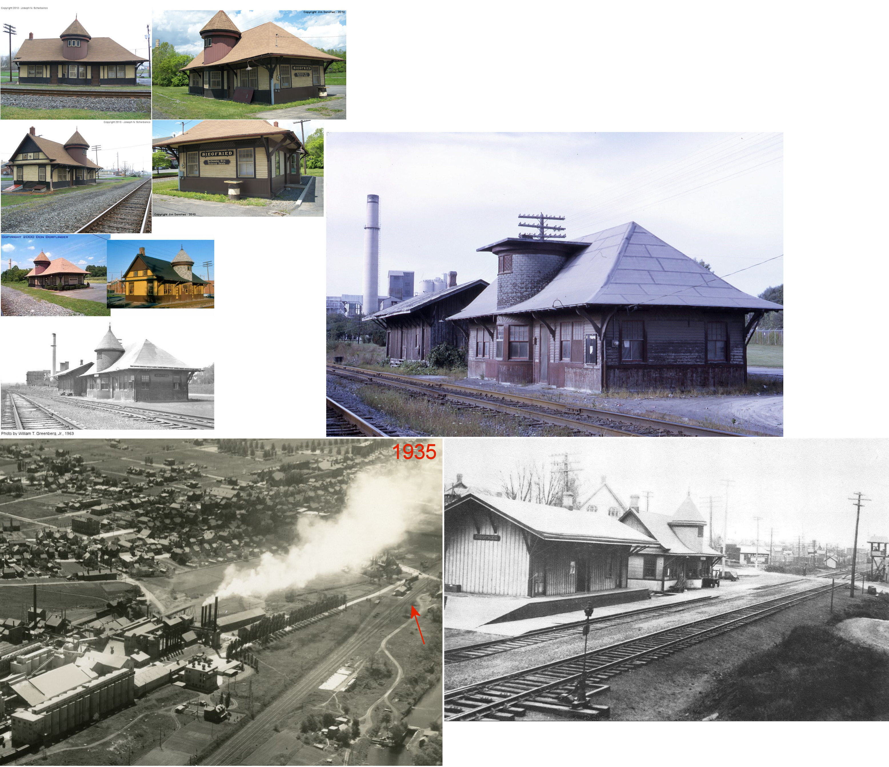
| Siegfried | |
PA329 (East 21st Street) & Station Avenue, Northampton (GPS: 40.690908, -75.502272) |
C | Museum | ???? | In Use | Wood |
|
| Steel City |
 |
Riverside Drive | R | Private | ???? | None | Wood |
|
| STATIONS OF THE PAST | ||||||||
| Station Name |
Original Railroad |
Notes | ||||||
| Ackermanville | |
According to ICC valuation records, there was a shelter station here that was built in 1903 that 14' X 12' X 13.5'. | ||||||
| Arndts | |
|||||||
| Bangor | |
Built in 1878 by the Bangor and Portland RR, this station was on the east side of the tracks at the intersection of East High Street and Erdman Avenue (formerly Washington Avenue) at GPS: 40.866223, -75.203846. The passenger office was in the southern part of the building with the freight office in the northern part. | ||||||
| Bangor | |
The passenger station was on Main Street at the current site of the brick Lehigh & New England freight station (GPS: 40.867914, -75.205102). It was torn down sometime between 1904-1909. | ||||||
| Bangor | |
The freight station was to the NW of the passenger station off Main Street and was connected to it by a long platform. It as at approximately GPS: 40.868172, -75.205476. In the early years there was one small freight station here. Later, another freight building was erected next to it for more space. | ||||||
| Bangor Junction | |
This station appears to have been on Country Lane in the vicinity of GPS: 40.892826, -75.220141. | ||||||
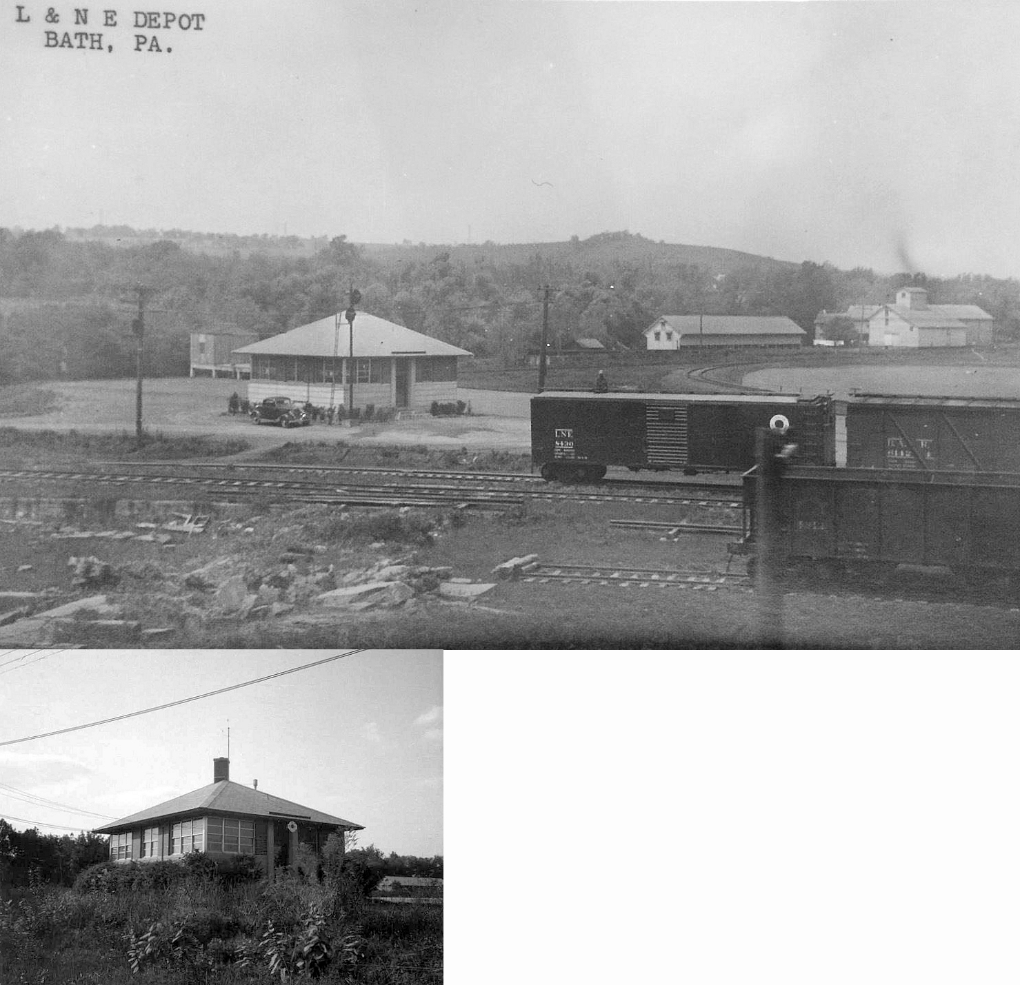
| Bath | |
A 15' X 30' X 16.5' shelterhouse was built in 1903. | ||||||
| Bath | |
|||||||
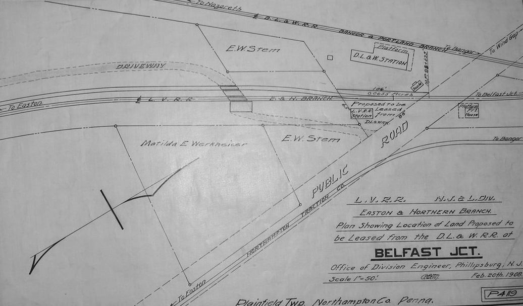
| Belfast Junction | |
This passenger station/dwelling was built in 1878. | ||||||
| Belfast Junction |
|
|||||||
| Benders Junction | |
|||||||
| Berlinsville | |
|||||||
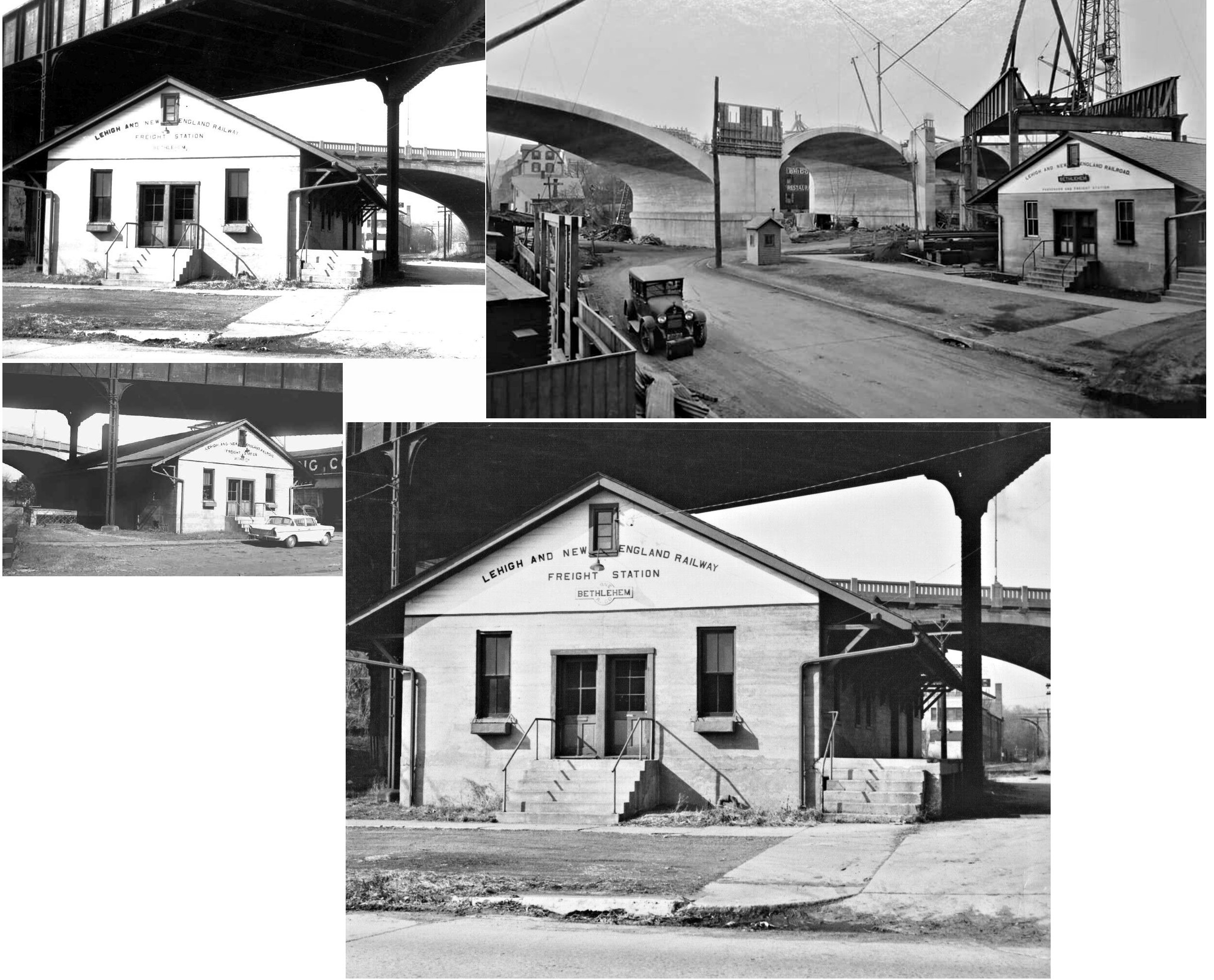
| Bethlehem | |
This combination passenger and freight station sat under the old Main Street access ramp on the north side of Spring Street (formerly Vineyard) at GPS: 40.618027, -75.384190. One of the bridge's support piers was in the middle of the station and protruded through the roof. The station was just over the border in Lehigh County. This was primarily known as a freight station, but in the one older photo, the building is labeled as "passenger and freight station." | ||||||
| Bethlehem (Union Street) |
|
|||||||
| Bethlehem |
 AND |
The photo of this old union station was taken in 1879. It was built in 1867 and was in the smae location as the extant Union Station at GPS: 40.613797, -75.383159. | ||||||
| Bethlehem |
|
There was a freight station west of the north end of Brodhead Avenue (this section gone, now Union Station Plaza) on the south side of the tracks next to Union Station at GPS: 40.613993, -75.382461. | ||||||
| Bethlehem |
|
There was a large freight house on the NW corner of West 2nd Street and Northampton Street at 40.612266, -75.379641. | ||||||
| Bethlehem |
|
There was a freight station on the south side of West 2nd between Brodhead Avenue and Northampton Street at GPS: 40.612576, -75.380748. 1892 | ||||||
| Bethlehem Junction |
AND |
This station served both the CNJ (likely built by the CNJ, and maybe from the Lehigh & Susquehanna era) and RDG with platforms extending along both tracks at the junction. It was west of the Hill To Hill Bridge and south of West Lehigh Street at GPS: 40.615889, -75.386889 and was actually just over the border in Lehigh County. It is shown on the 1912 Sanborn Insurance Map. | ||||||
| Bingen | |
|||||||
| Broadhead | |
|||||||
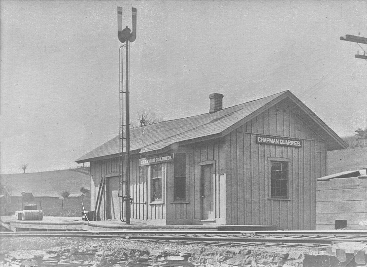
| Chapman Quarries | |
|||||||
| Clyde | |
|||||||
| Delps | |
|||||||
| East Bangor | |
Built in 1878 by the Bangor and Portland RR. | ||||||
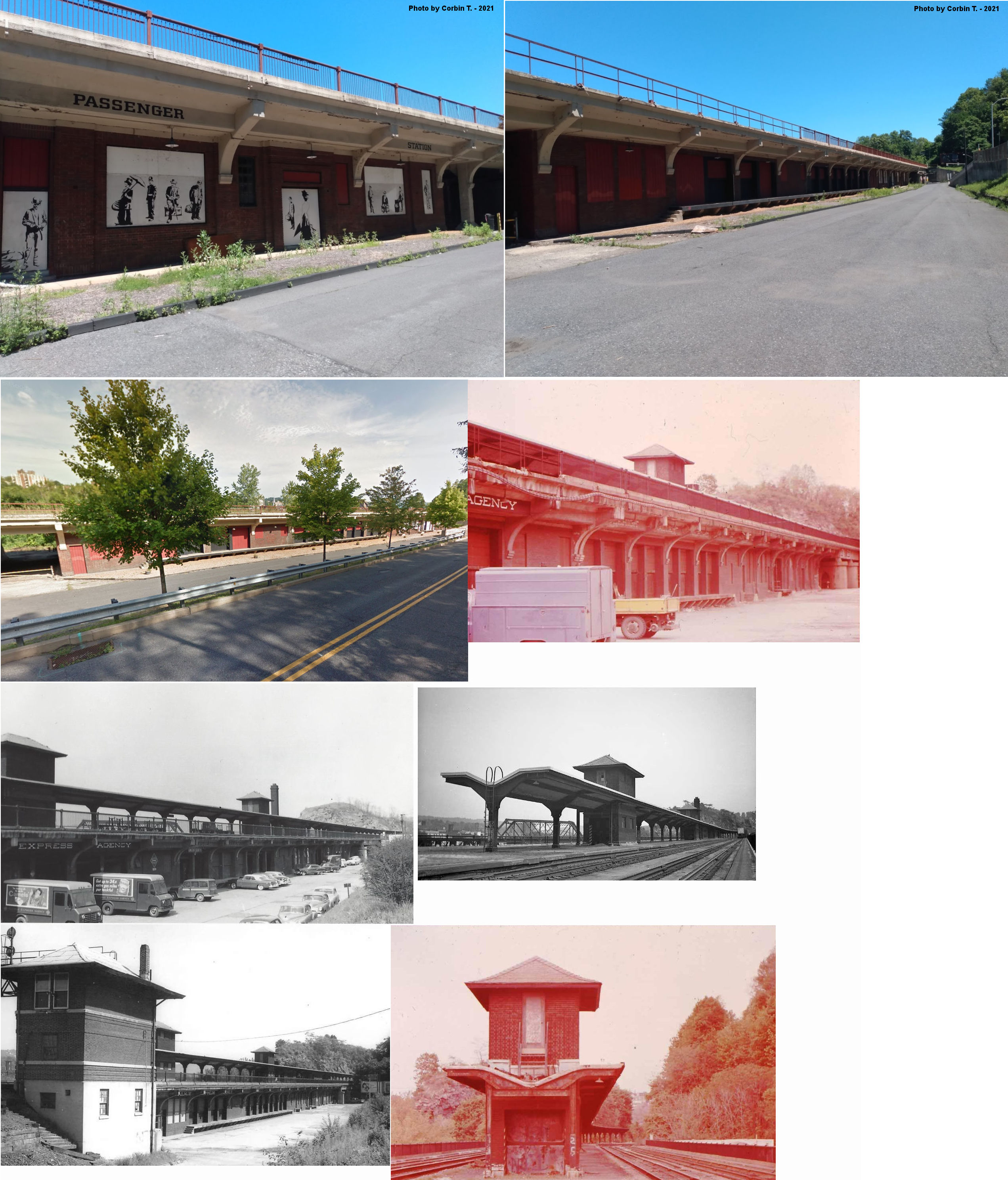
| Easton | |
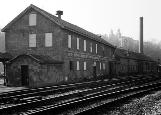
This freight station was on the south side of Washington Street west of South 4th Street at GPS: 40.687260, -75.211252. It was just to the NW of the passenger station. The depot, last used as a warehouse by the Lehigh Furniture Company, burned in June of 1977. The pictures are of the ruin a few days after the fire. | ||||||
| Easton | |
This station was built over 4th Street (now Lehigh Drive) and supported by columns. it was located at GPS: 40.686781, -75.210828. | ||||||
| Easton | |
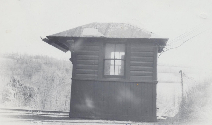
The 13th Street Junction station was in the NE section of the C.K. Williams Paint Mills (now Huntsman) where the E&N and Bushkill branches of the LV meet. It was at approximately GPS: 40.698256, -75.231857. Not sure if the photo is of part of the station there or the switchman's shanty. | ||||||
| Easton | |
There was a small station on the east side of 13th Street at GPS: 40.696140, -75.227937. It was just to the NE of the old three-story F.C. Williams flour and grain warehouse which is still standing (as of 2017). On the 1904 map it is just marked "station" and on the 1914 map it is marked "freight station." | ||||||
| Easton | |
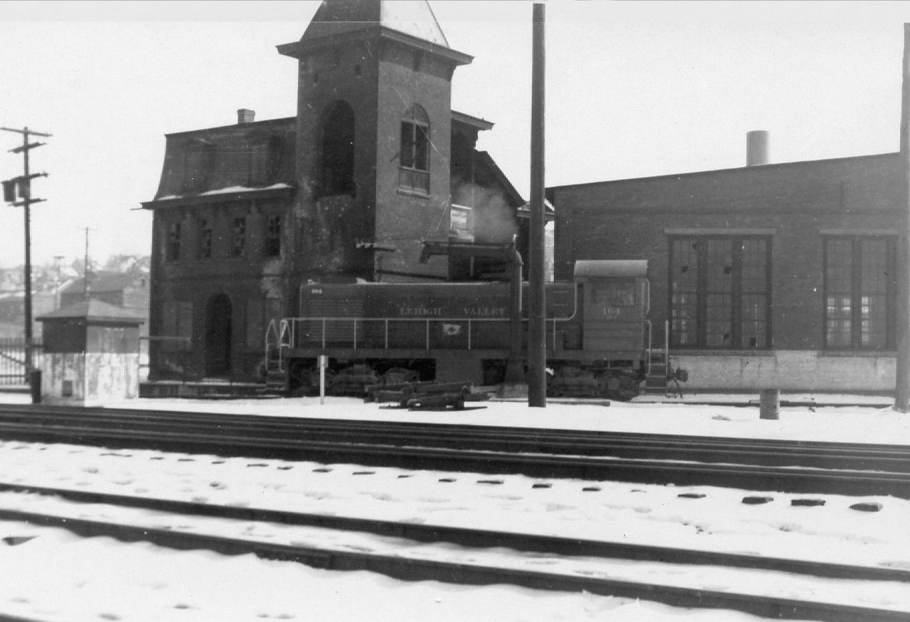
The second LV station here was a large brick building built in 1868 that was used as a dining car supply station and steam laundry after it went out of service as a station in 1891. It was along Canal Street at GPS: 40.684654, -75.210366. | ||||||
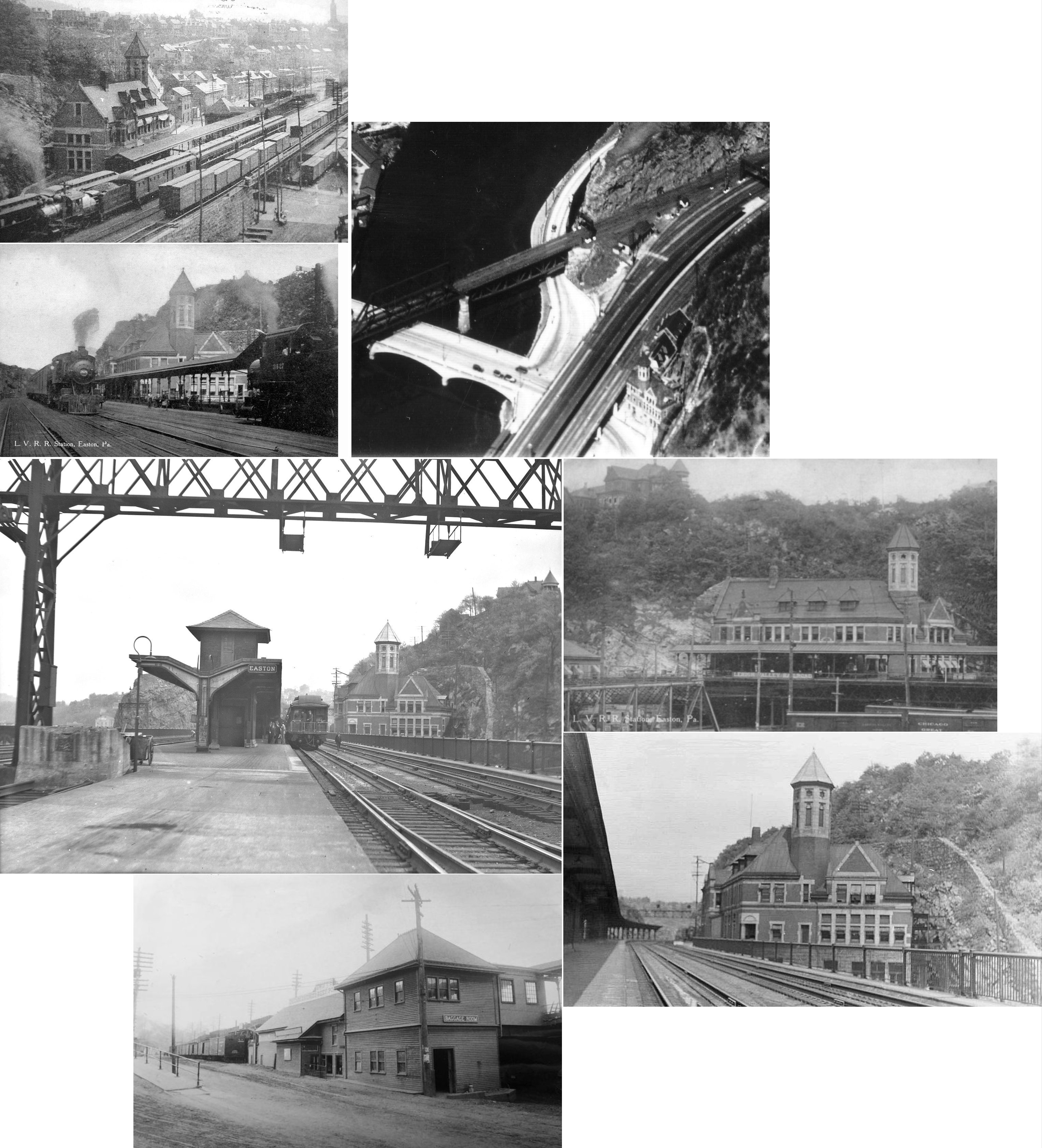
| Easton | |
This large passenger station was built in 1890 (opened in early 1891) and demolished in 1945. It was at the intersection of South 3rd, Canal and Smith Streets at GPS: 40.686109, -75.207861. | ||||||
| Easton | |
There was a freight station under the tracks in the same location that the 1929 passenger station was built. It is shown on the Sanborn maps as early as 1885 and predated the 1890 passneger station that was on the south side of the tracks. It may have been incorportaed into the newer structure. | ||||||
| Easton | |
There was a freight house north of Canal Street on the south side of the tracks closest to the river at GPS: 40.684938, -75.211478. On the 1927 map, the building is marked "Old Frieght House." The foundation can still be seen as of 2017. | ||||||
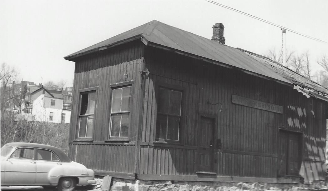
| Easton | |
There were a couple of small freight stations off Bushkill Drive near Stair Street in the vicinity of GPS: 40.694432, -75.215919. There may have also been a passenger station here in earlier years. | ||||||
| Easton (South Easton) |
|
The South Easton passenger station was on the northeast side of the LV shops on Canal Street at GPS: 40.682004, -75.222590. It was torn down in 1951. | ||||||
| Flicksville | |
Built in 1878 by the Bangor and Portland RR. | ||||||
| Florence | |
The station was near the New Jersey Zinc plant here. | ||||||
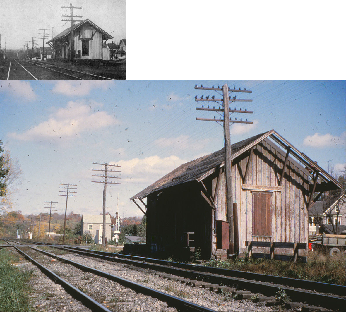
| Freemansburg | |
This station was on the south side of Madison Street on the east side of the tracks at GPS: 40.627181, -75.335737. It was demolished in 1966. | ||||||
| Freemansburg | |
This station was across the river just south of the Freemansburg Bridge off Shrinersville Road on the east side of the tracks at GPS: 40.621675, -75.333565. | ||||||
| Glendon Station (Wilson) |
|
This small station was along the CNJ tracks between Glendon Hill Road and Lehigh Drive. It was in the vicinity of GPS: 40.671594, -75.237540. There was an access road to it from Lehigh Drive. It is shown on the 1914 map, but is gone by 1927. | ||||||
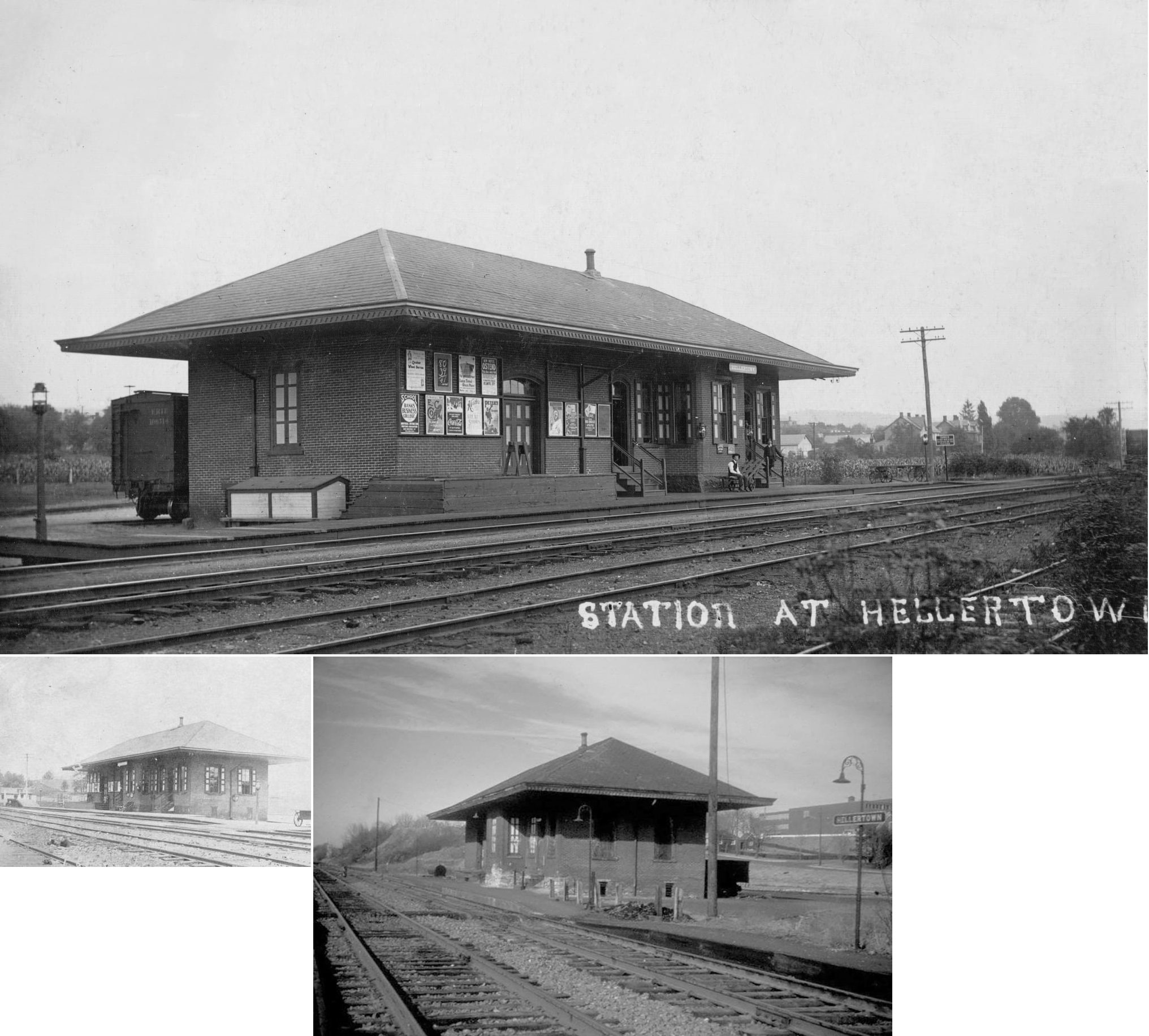
| Hellertown | |
This station was on the north side of Depot Street on the east side of the tracks at GPS: 40.581937, -75.343553. It was built in 1868 and demolished in 1982. | ||||||
| Horn Spring Station | |
May have also been known as Rismillers Station. | ||||||
| Katellen | |
|||||||
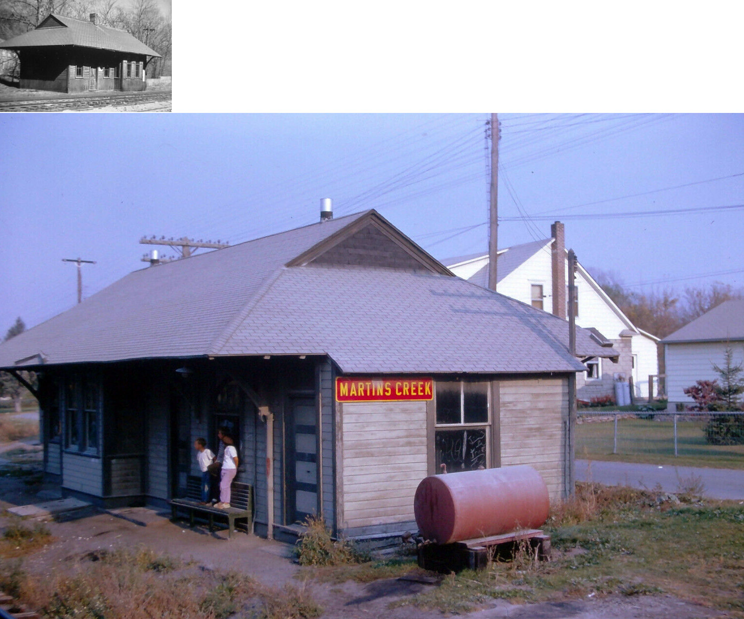
| Martin's Creek | |
This combination station was built in 1903. | ||||||
| Martin's Creek | |
This building was the L&NE yard office, but not the station. | ||||||
| Martin's Creek Junction | |
According to ICC valuation records, there was a shelter station here that was built in 1903 that 14.5' X 16.5' X 14.5'. | ||||||
| Mount Bethel | |
|||||||
| Nazareth | |
Built 1878. | ||||||
| North Bangor | |
According to the 1914 county map, this station appears to have been on Lake Minsi Drive at approximately GPS: 40.905346, -75.194412. | ||||||
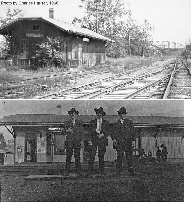
| Northampton | |
The two CNJ stations in Northampton Borough were about a mile apart with a passing siding on eastbound No. 1 track (the No. 1 Track diverted southward in effect making the passing siding a middle track with cross over switches to and from the westbound No. 2. track) starting between the two and running beyond Northampton Station to a point near the junctions of the Northampton & Bath Railroad. | ||||||
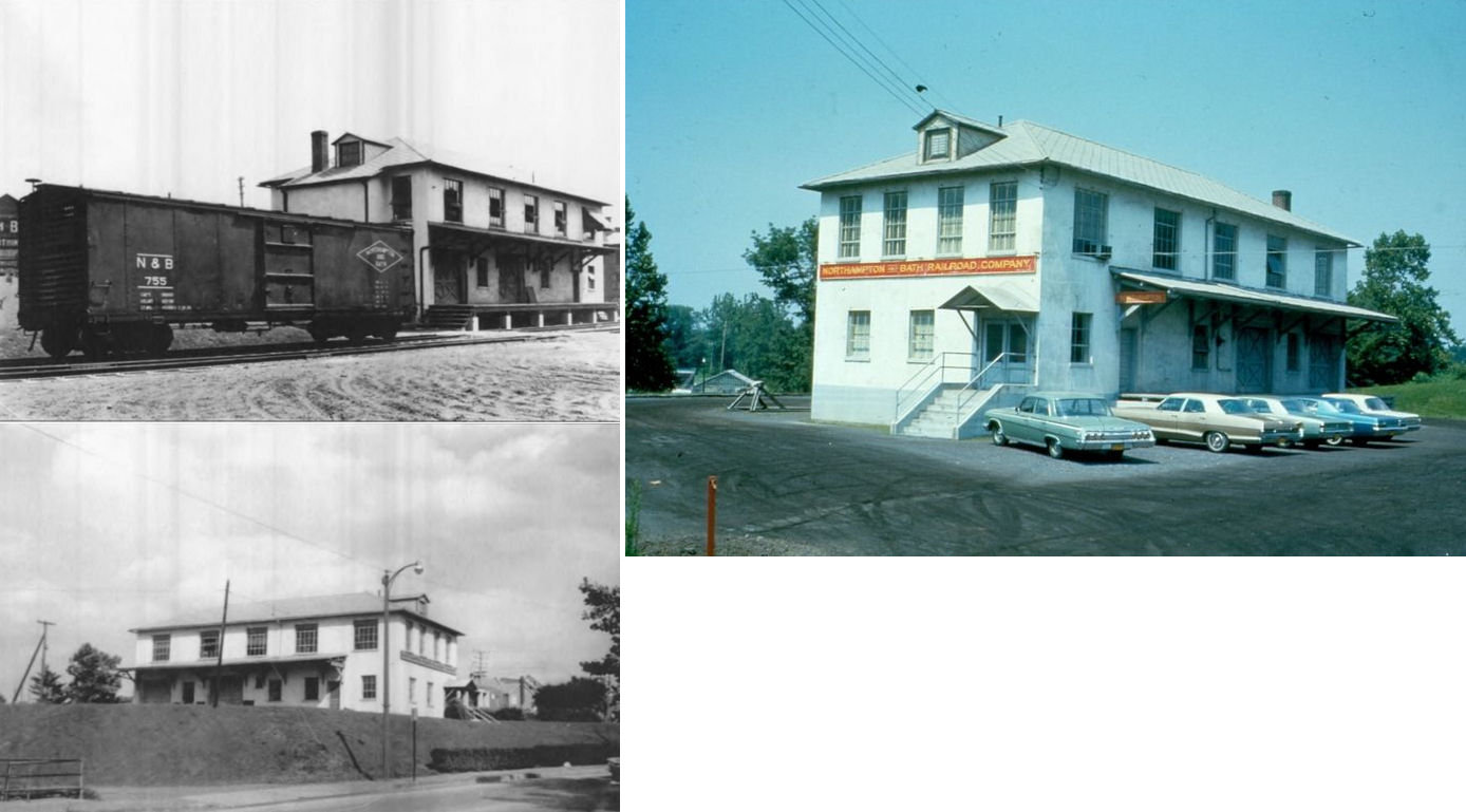
| Northampton | N&B |
The Northampton & Bath RR station was ont he NE side of Main Street between Lerchenmiller Drive and East 10th Street at GPS: 40.679245, -75.488317. It was demolished in 1974. | ||||||
| Pen Argyl | |
The passenger station was on the NE corner of East Pennsylvania Avenue and North Robinson Avenue at GPS: 40.868794, -75.254857. | ||||||
| Pen Argyl | |
The original wood frame freight station was on the NE corner of West Pennsylvania Avenue and North Harding Avenue at GPS: 40.868544, -75.255740. | ||||||
| Pen Argyl | |
This passenger station was built in 1888 and was combination station/residence. It was on Main Street between B and C Streets at GPS: 40.864840, -75.257454. | ||||||
| Pen Argyl | |
This brick freight station was built in 1926. It was located at 408 West Main Street (GPS: 40.864813, -75.257071). It was demolished in September, 2014. | ||||||
| Point Phillip | |
|||||||
| Santee | |
This station may have also been known as Ritters or Reiters. | ||||||
| Saylorsburg Juction |
|
This junction was the start of the 6-mile Saylorsburg Branch. It was about a mile west of Wind Gap. | ||||||
| Siegfried | |
There was a freight station here just to the north of the passenger station at GPS: 40.691096, -75.502421. | ||||||
| Snyder | |
|||||||
| South Bethlehem | AND |
This station burned down on January 1, 1904 (Mt. Carmel Item, 1-2-1904). | ||||||
| Steuben | |
|||||||
| Stier | |
Built 1878. | ||||||
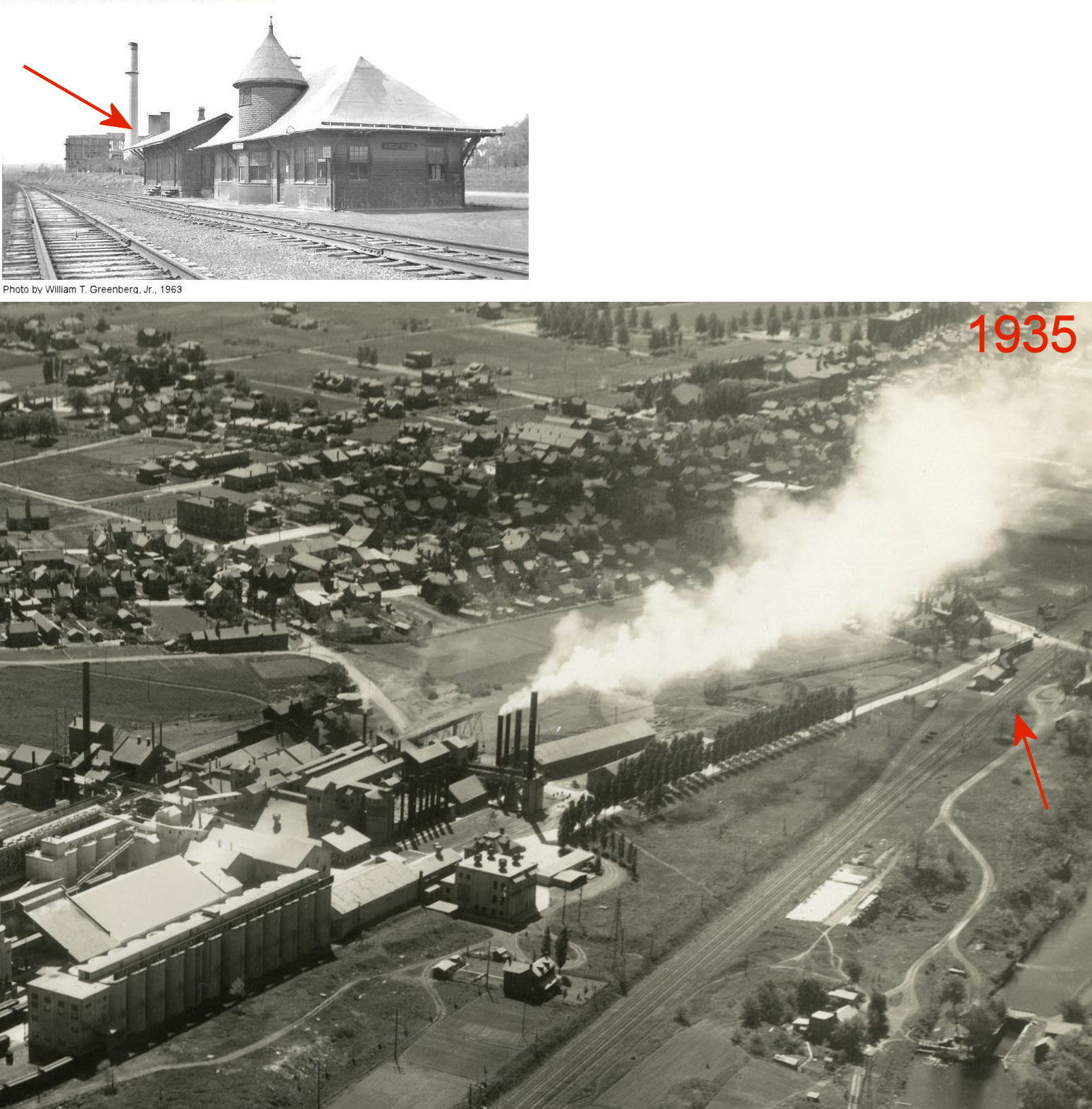
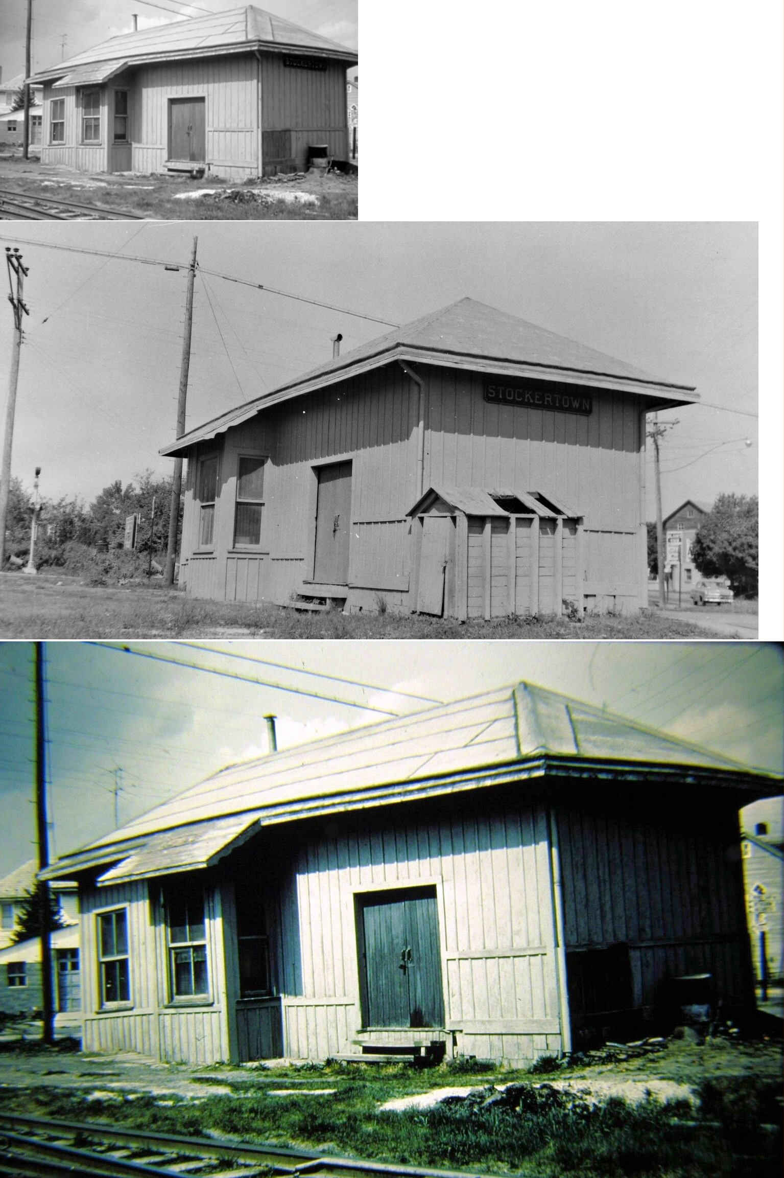
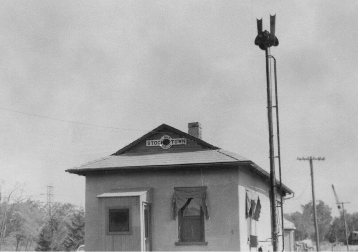
| Stockertown |
|
|||||||
| Stockertown |
|
|||||||
| Stoke park |
|
|||||||
| Summit |
|
|||||||
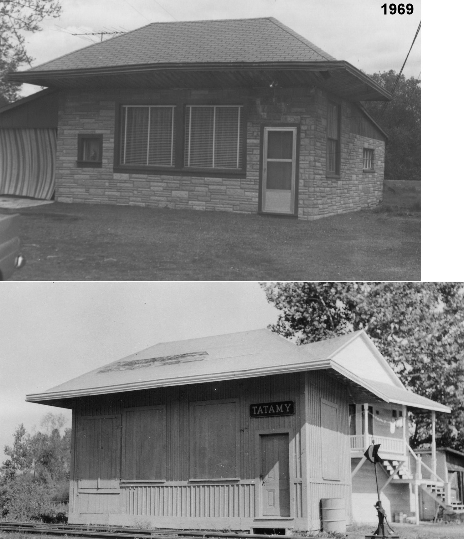
| Tatamy |
|
This station was moved from trackside and then used as a residence. Does anyone know if it is still standing? | ||||||
| Township Line |
|
|||||||
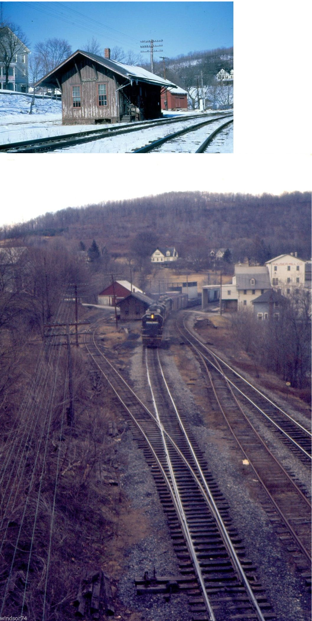
| Treichlers | |
The station was on the south side of East Breadfruit Drive at GPS: 40.735216, -75.542616. | ||||||
| Treichlers |
|
This station was near the end of Cove Road in the vicinity of GPS: 40.734038, -75.539330. It was across the river in Lehigh County. | ||||||
| Walnutport | |
This station was on Carbon Street between Main Street and Thrid Avenue on the east side of the tracks at GPS: 40.753217, -75.599528. | ||||||
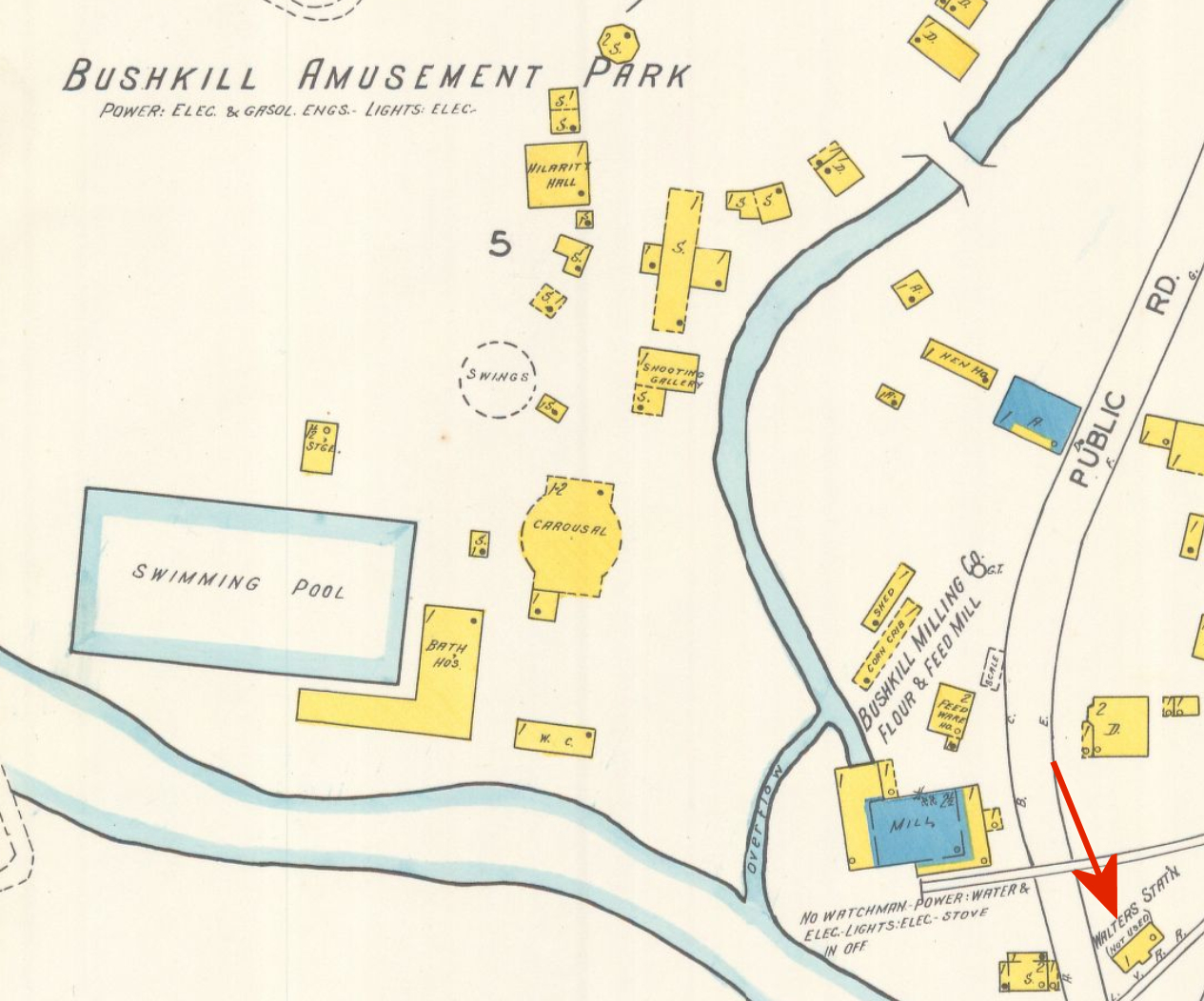
| Walters Station (Bushkill Park) |
|
This station served Bushkill Amusement Park. It was on the north side of Bushkill Park Drive on the SE side of the tracks at GPS: 40.703318, -75.249832. The 1927 Sanborn map (of Easton) shows the station as "not used." | ||||||
| Wind Gap | |
This station was built in 1911. | ||||||
| Wind gap Summit |
|
This station was at MP 25.4 on the Saylorsburg Branch. | ||||||
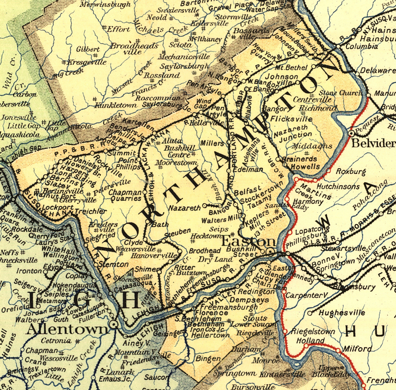
| 1895 NORTHAMPTON COUNTY RAILROAD MAP | ||||||||
 |
||||||||
| Notes About Existing
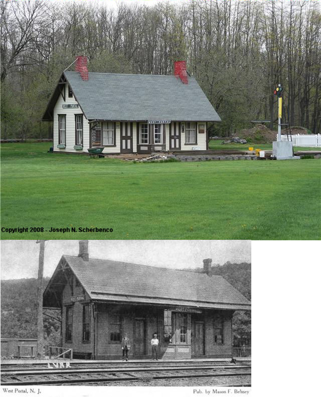
Stations... Berlinsville (L&NE) - Can anyone confirm that this is actually a station? Is it still there? Bethlehem (CNJ) - Both CNJ stations are actually in Lehigh County abut 100 yards across the line. Delabole (DL&W) - Bed now a trail. Moved 1/4 mile north or original location. Easton (LV) - The elevator and stairwell kiosks and trainsheds have been removed. The passenger and freight stations as well as the Railway Express facility themselves are still there, located enclosed under the tracks, and unused for years. Mt. Bethel (DL&W) - Modified into a private house with some addition that may or may not have been done by the railroad. This was an original Bangor & Portland RR station and according to ICC valuation records was built in 1878. Nazareth (DL&W) - County property records indicate a build date of 1890 which would make the station of Bangor & Portland vintage. The freight section of this building was the end with frontage on Main Street, whereas the rear of the building was the passenger end. Nazareth (L&NE) - Sanborn maps through 1928 show this as a brick freight station with a wood frame exterior. Northampton (CNJ) - This was one of two CNJ stations in Northampton. The station that currently stands in Northampton was previously called: Northampton Station, Laubach (circa 1870), then Stemton (circa 1880), then Alliance (1902), and finally just Northampton (1909). The two stations in Northampton Borough were about a mile apart with a passing siding on eastbound No. 1 track (the No. 1 Track diverted southward in effect making the passing siding a middle track with cross over switches to and from the westbound No. 2. track) starting between the two and running beyond Northampton Station to a point near the junctions of the Northampton & Bath Railroad. Pen Argyl (L&NE) - Has housed a vet hospital since 2012. Portland (DL&W) - The current building is the second DL&W station at Portland, and was built about 1897. Donna Zalepa writes (9/3/00): My family has owned the Portland Railroad Station since purchasing it from the Railroad approximately in 1963. It has had only one owner since, that being my family, the Dahlmans. I am anticipating sale of the building and land next fall. I would like to see it remain and or be 'railway' oriented. It is zoned commercial and has 300 or so foot of Route 611 frontage and is in sound shape. Contrary to the information above, ICC valuation records from 1926 list the date built for this station as 1900. Portland (L&NE) - Heavily modified into automobile shop. Street side facade still has the original appearance. Siegfried (CNJ) - Town is part of Northampton now. Steel City (Replica) - This station is reportedly a replica of the West Portal, NJ (Hunterdon Co.) Lehigh Valley station. |
||||||||