|
|
||||||||
| EXISTING STATIONS | ||||||||
|---|---|---|---|---|---|---|---|---|
| Station Name |
Original Railroad |
Current Location |
Type | Current Use |
Date Built |
Track Status |
Building Material |
More Info |
| Allentown |
 AND  |
Race & Hamilton Streets (GPS: 40.604609, -75.462410) |
P | Restaurant | 1890 | Gone | Stone/ Brick |
|
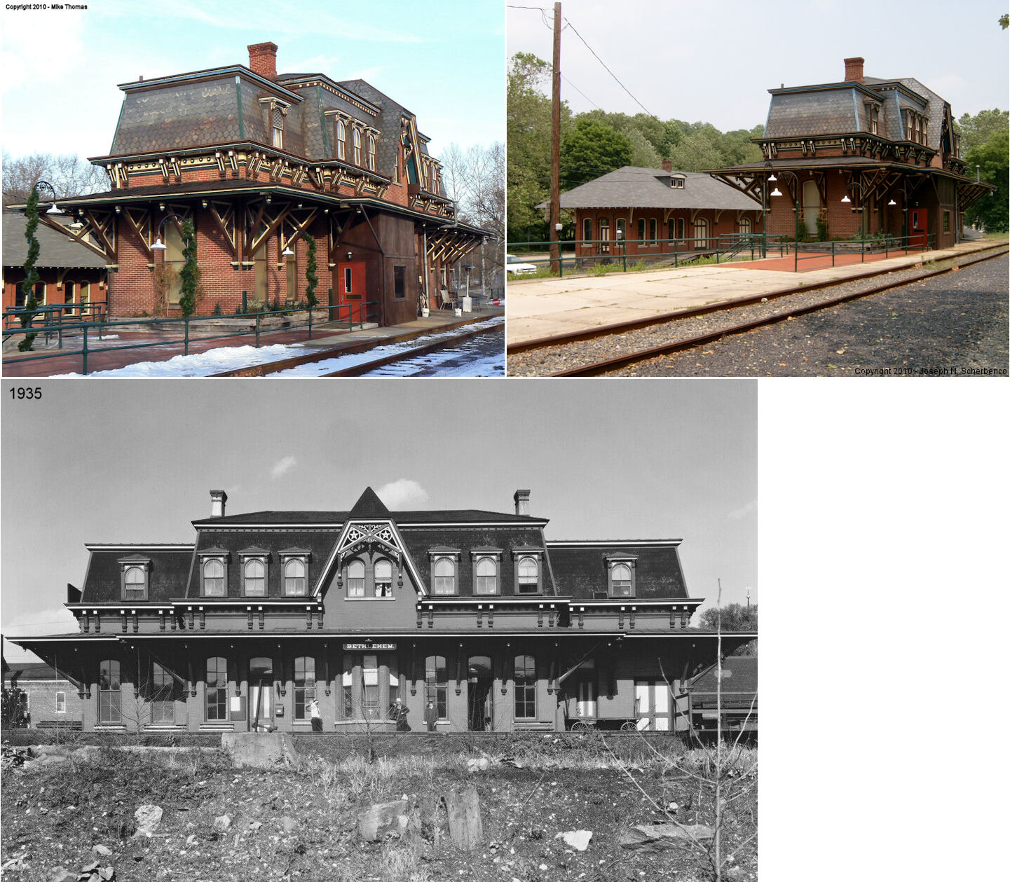
| Bethlehem | |
61 West Lehigh Street (GPS: 40.616526, -75.382461) |
P | Restaurant | 1873 | In Use | Brick |
|
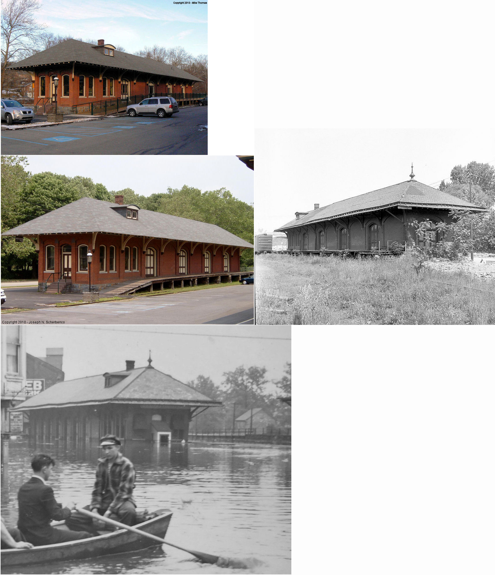
| Bethlehem | |
55 West Lehigh Street (GPS: 40.616776, -75.382265) |
F | Storage | 1910 | Gone | Brick | |
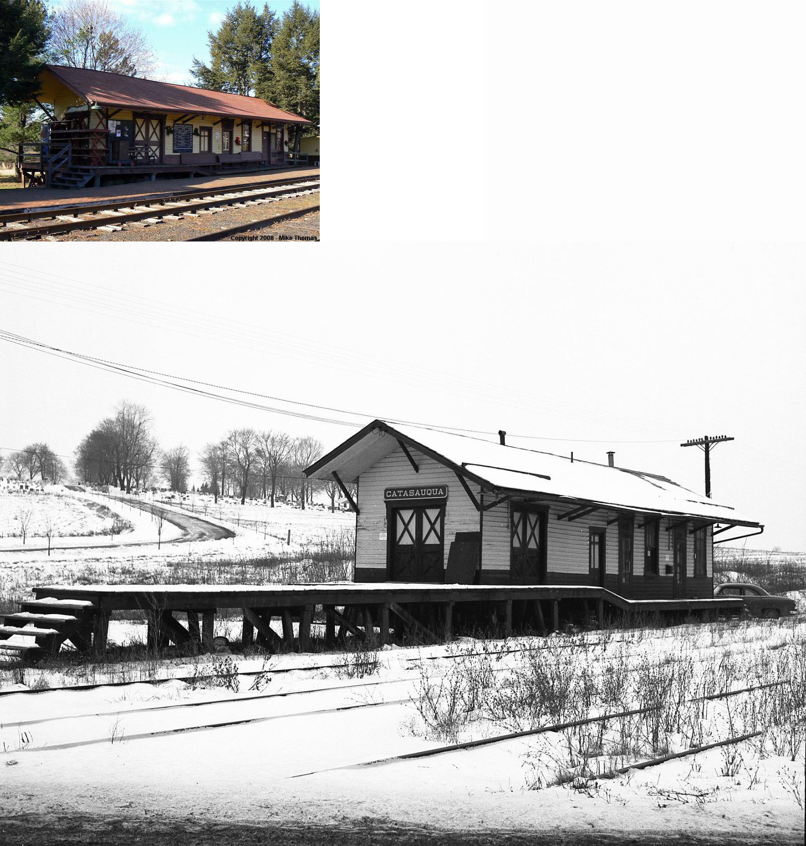
| Catasauqua (W. Catasauqua) |
|
Off PA143 at Kistler Valley Road
and Creek Road, Kempton in Berks County |
C | Railroad | ???? | In Use | Wood |
|
| Catasauqua |
 |
South corner of Pine and Front Streets (GPS: 40.653820, -75.475901) |
F | Unknown | ???? | Gone | Brick | |
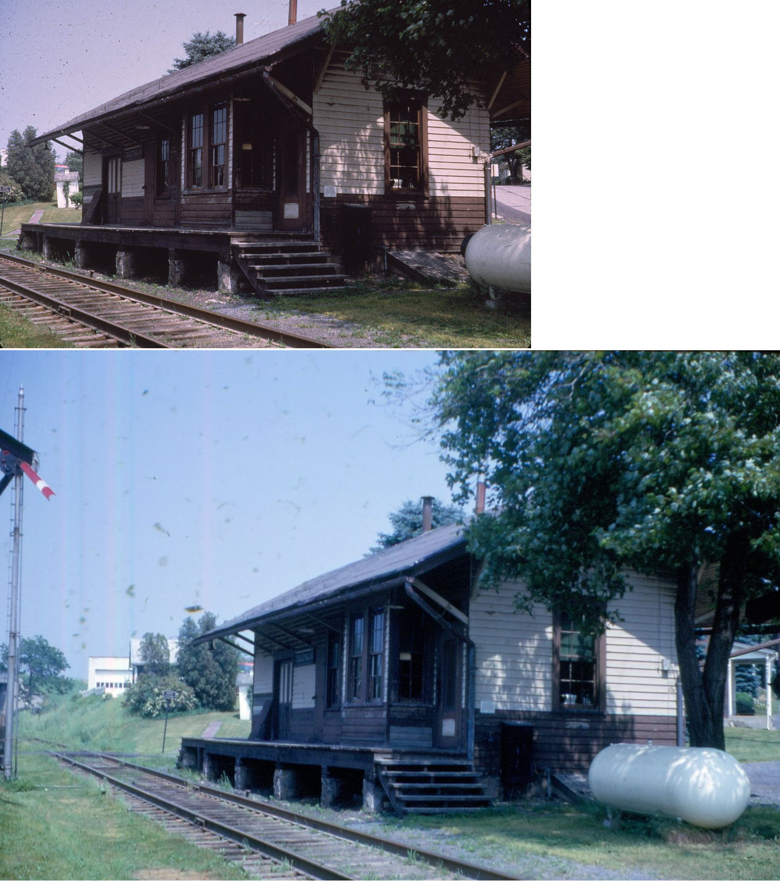
| Chapman |
|
North side of Memorial Road, east of Farm Bureau Road (GPS: 40.589271, -75.599014) |
F | Business | ???? | Gone | Wood | |
| East Allentown |
|
455 Hanover Avenue (GPS: 40.613182, -75.448106) |
F | Business | ???? | Gone | Brick | |
| Emmaus |
|
525 West Jubilee Street (GPS: 40.533165, -75.493569) |
P | Business | ???? | In Use | Wood |
|
| Haines |
|
SE of the intersection of Route 100 and Schantz Road in Fogelsville |
P | ???? | ???? | ???? | Wood | |
| Jacksonville |
|
Donats Peak Road (County Route 4037) | P | Residence | ???? | Gone | Wood |
|
| Trexlertown |
|
Adjacent to Route 100 | F | Business | ???? | Gone | Wood | |
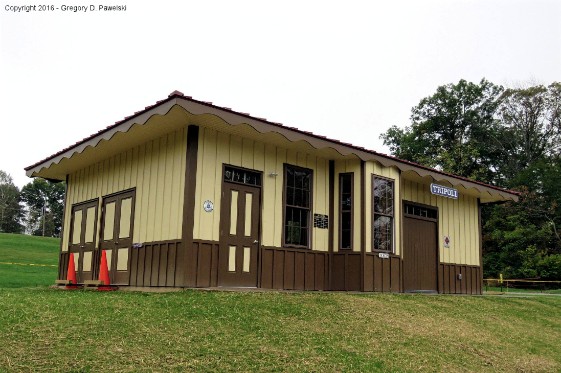
| Tripoli (NEW TRIPOLI) |
 |
Ontelaunee Park off King's Highway (PA143) (GPS: 40.680037, -75.761094) |
C | Civic | ???? | None | Wood | |
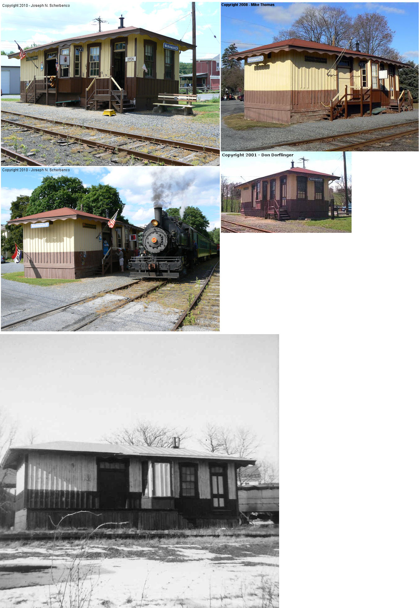
| Wanamaker |
|
Levan Street | C | Business/ Museum |
1874 | In Use | Wood | |
| STATIONS OF THE PAST | ||||||||
| Station Name |
Original Railroad |
Notes | ||||||
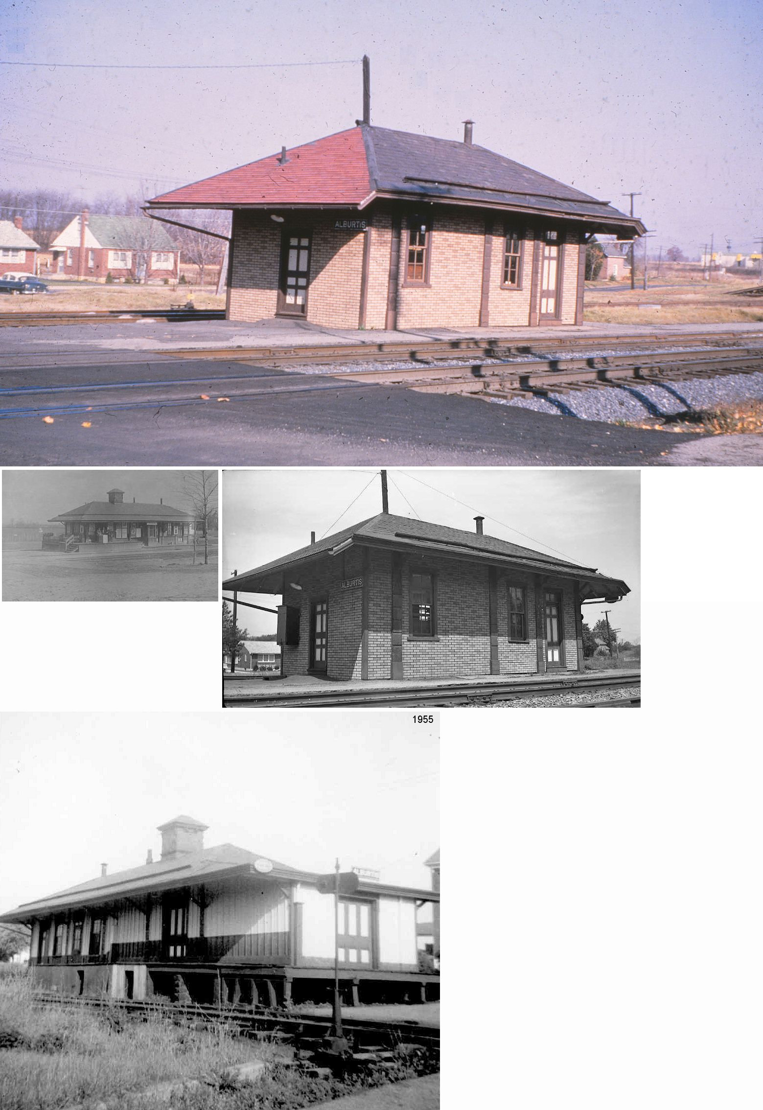
| Alburtis |
|
Built in 1859, the station was modified in later years. It was on the east side of Main Street at GPS: 40.511814, -75.603778. | ||||||
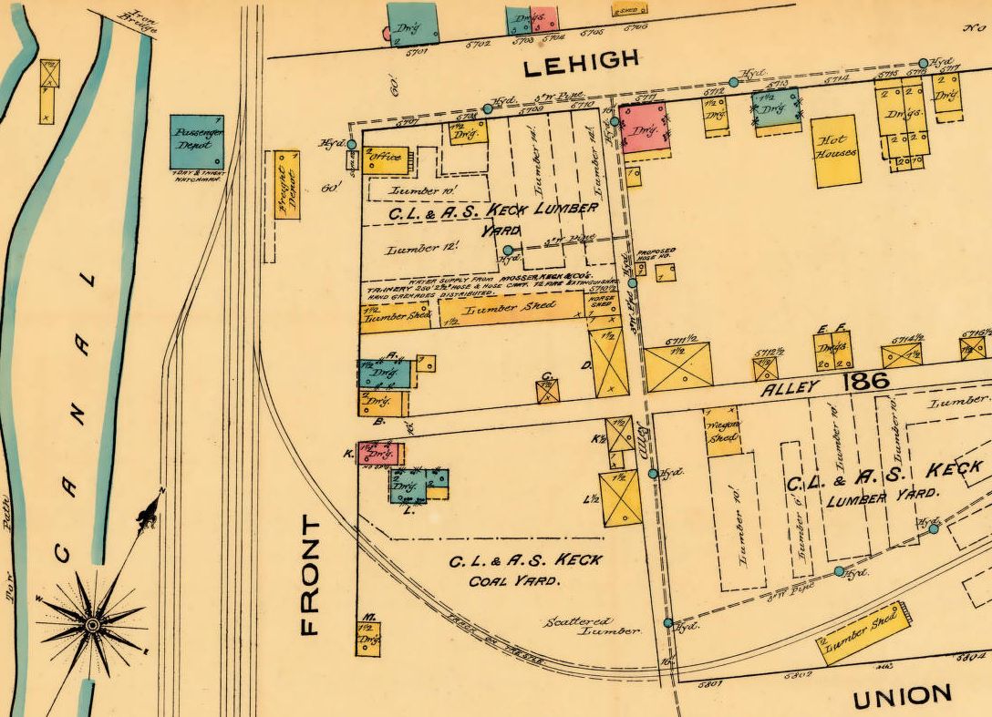
| Allentown (E. Allentown) |
|
The original passenger station (GPS: 40.606474, -75.453175) and freight station (GPS: 40.606548, -75.452888) here was at the corner of Lehigh (now East Hamilton) and Front Street (now Albert Street). See this 1885 map section for location. The freight station is still shown standing as of the 1911 Sanborn map. | ||||||
| Allentown |
AND |
There was a large joint freight house on the SE corner of Race and Linden Streets (GPS: 40.606199, -75.462635) diagonally across the intersection from the LV freight house. | ||||||
| Allentown (Gordon St.) |
|
There was a passenger station on the south side of West Gordon Street on the east side of the tracks (what is now American Parkway) (GPS: 40.610341, -75.464423). The station is shown on the 1891, 1897, and 1911 maps. | ||||||
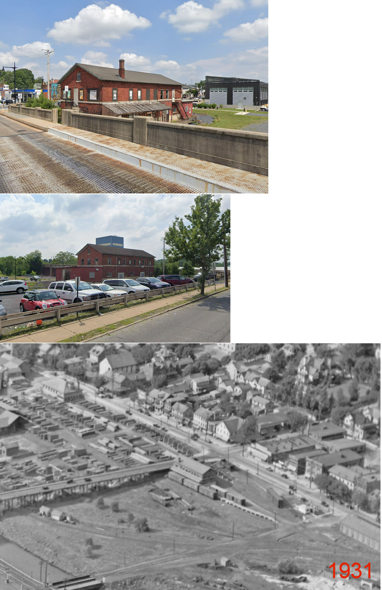
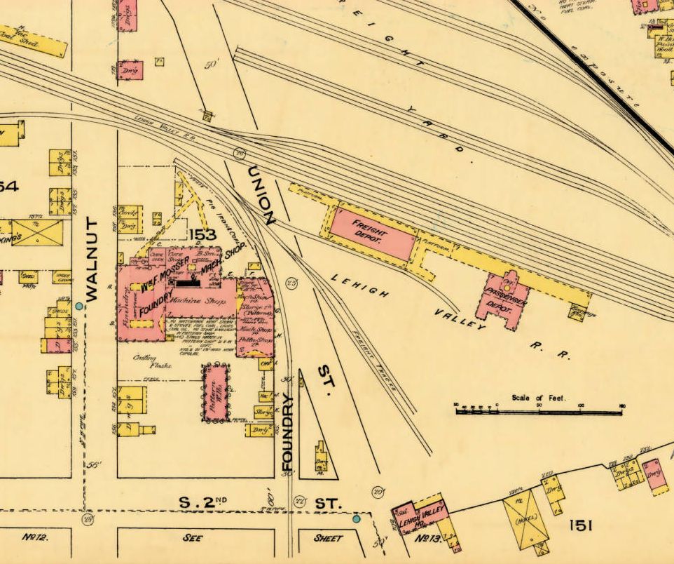
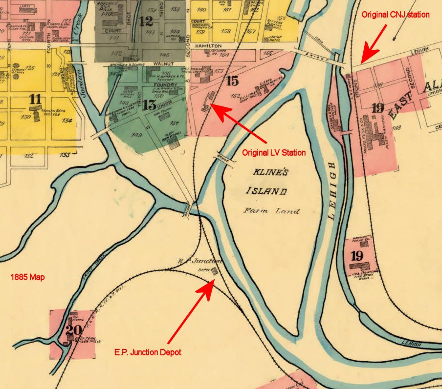
| Allentown |
 |
The first LV passenger (GPS: 40.604073, -75.458168) and freight stations (GPS: 40.604563, -75.458122) were on the south side of Union Street. See this 1885 map segment for details. The Union Street station served as a freight station for a time after the new station was built on Hamilton Street in 1889 and survived until it was demolished in 1942 after being used for storage and then sitting vacant for many years. Photo is of station being demolished in 1942. | ||||||
| Allentown |
|
Built in 1899, this station was located at the Hamilton Street bridge over Jordan Creek (GPS: 40.604036, -75.464336). Passenger service to this station ended in 1961. It was subsequently torn down in 1972. This was the second LV passenger station in Allentown with the first being on Union Street. | ||||||
| Allentown (Linden St.) |
|
There was a freight house on the NW corner of Linden and Race Streets (GPS: 40.606415, -75.463253). | ||||||
| Allentown (Gordon St.) |
|
There was a passenger station on the south side of West Gordon Street between North Jordan Street and the bridge over Jordan Creek (GPS: 40.609767, -75.465898). It was on the east side of the tracks. The station is shown on the 1891, 1897, and 1911 maps. | ||||||
| Allentown (E.P. Junction) |
|
See this map segment from 1885 for the location of this station. | ||||||
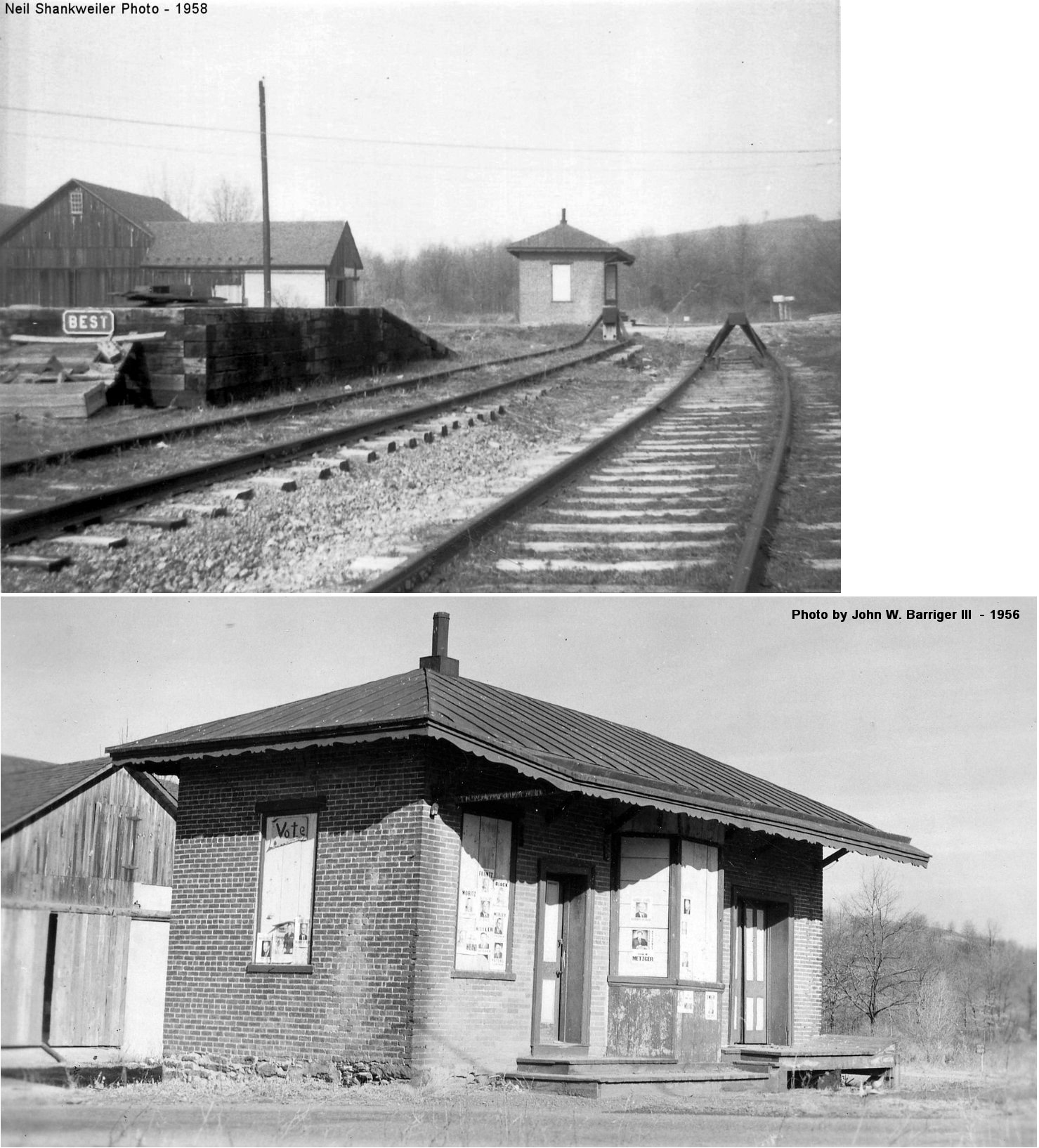
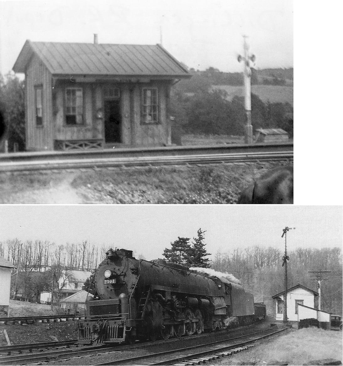
| Best |
|
This station was at the corner of Best Station Road and County Bridge Road at GPS: 40.724795, -75.653627. As of 2022, the barn in the photo was still standing. | ||||||
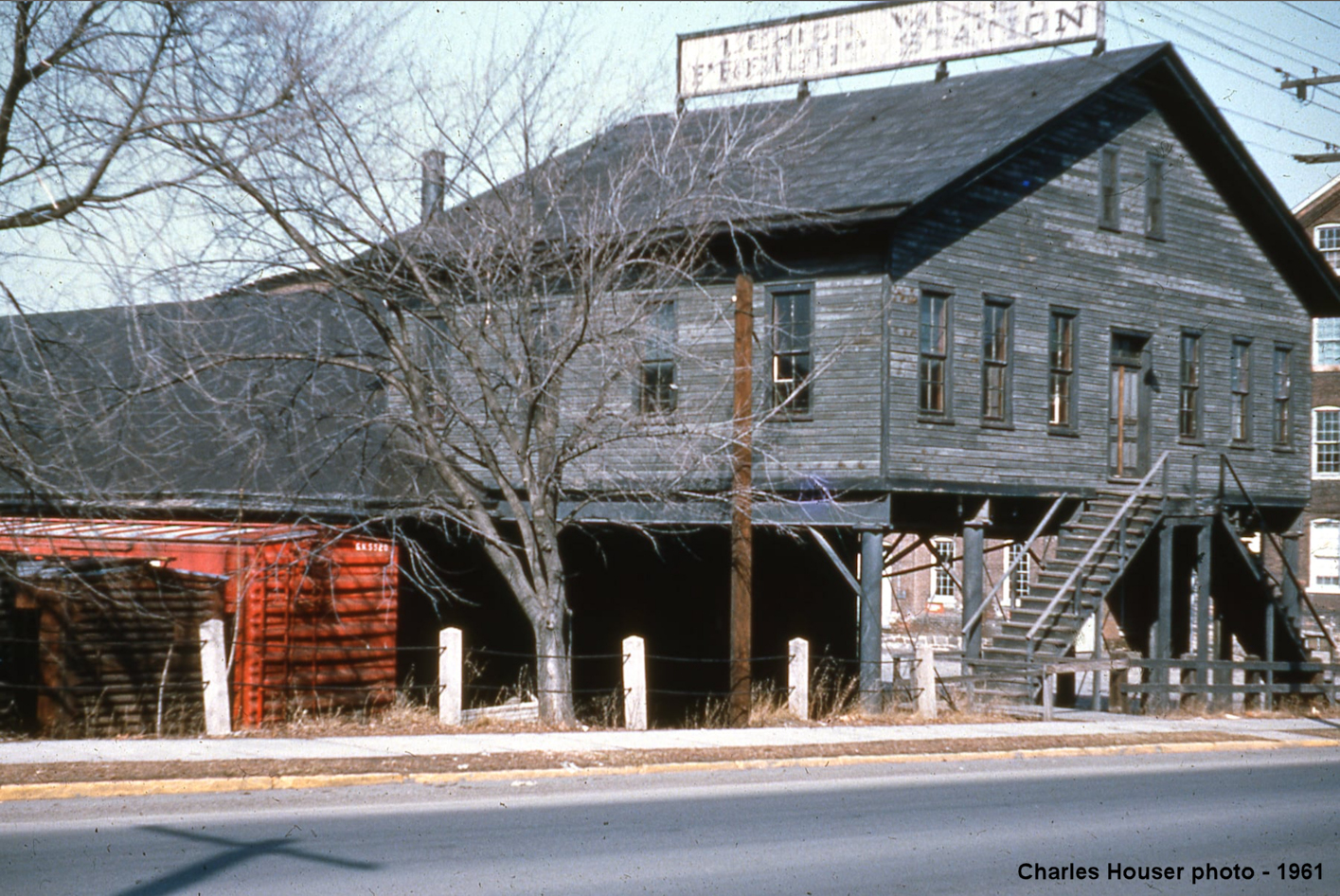
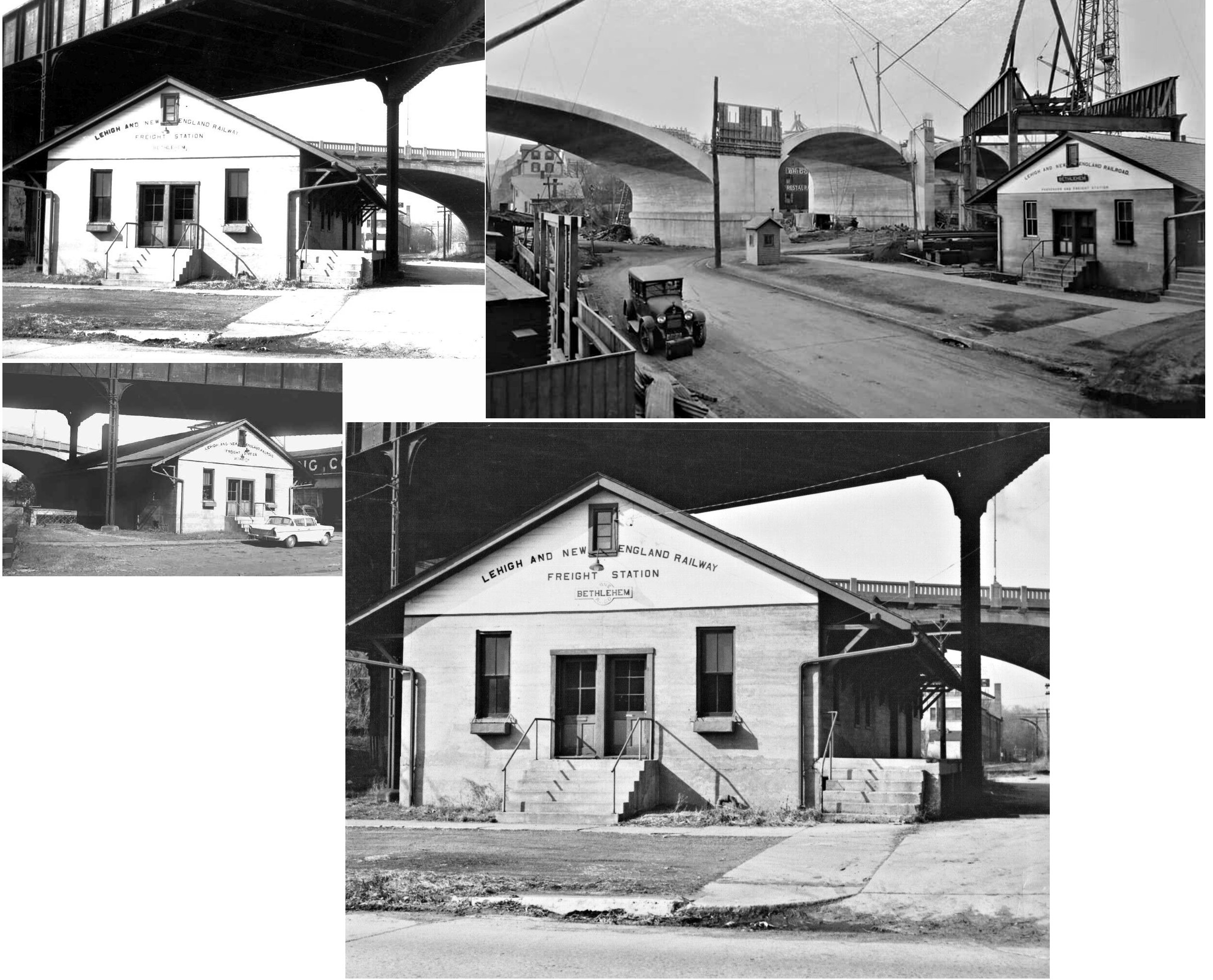
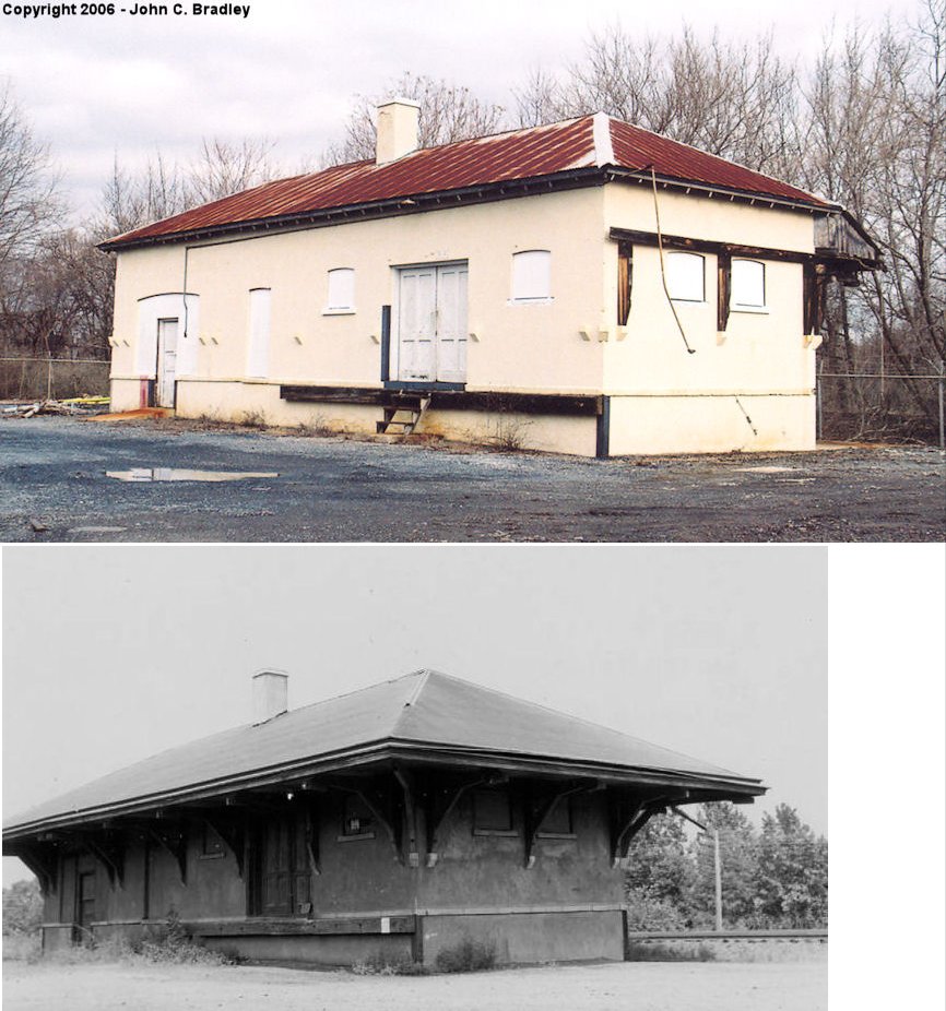
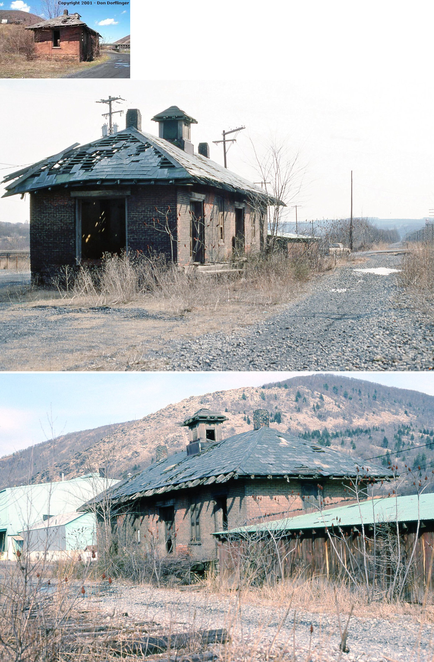
| Bethlehem | |
This combination passenger and freight station sat under the old Main Street access ramp on the north side of Spring Street (formerly Vineyard) at GPS: 40.618027, -75.384190. One of the bridge's support piers was in the middle of the station and protruded through the roof. The station was just over the border in Lehigh County. This was primarily known as a freight station, but in the one older photo, the building is labeled as "passenger and freight station." | ||||||
| Bethlehem Junction | AND |
This station served both the CNJ (likely built by the CNJ, and maybe from the Lehigh & Susquehanna era) and RDG with platforms extending along both tracks at the junction. It was west of the Hill To Hill Bridge and south of West Lehigh Street at GPS: 40.615889, -75.386889. It is shown on the 1912 Sanborn Insurance Map. | ||||||
| Breinigsville |
|
Bulit in 1860. | ||||||
|
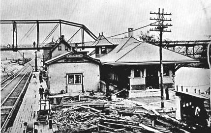
Catasauqua (W. Catasauqua) |
|
The first station here was near the river just SE of the Pine Street bridge at GPS: 40.651904, -75.478327. It was torn down in 1907. | ||||||
|
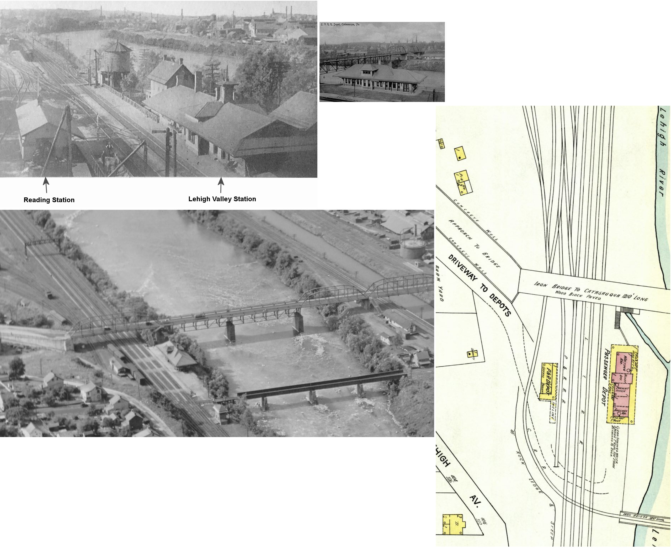
Catasauqua (W. Catasauqua) |
|
This station, built in 1907, was essentially in the same location as the original station, just a bit closer to the river. Both stations stood next to each other for a short time as the old station was in service while the new one was being built. The Reading station was across the tracks as can be seen in one of the photos. The 1907 LV station was closed in 1938 and torn down in 1941 after serving for a mere 31 years. | ||||||
|
Catasauqua (W. Catasauqua) |
 |
There was an LCL freight station here. | ||||||
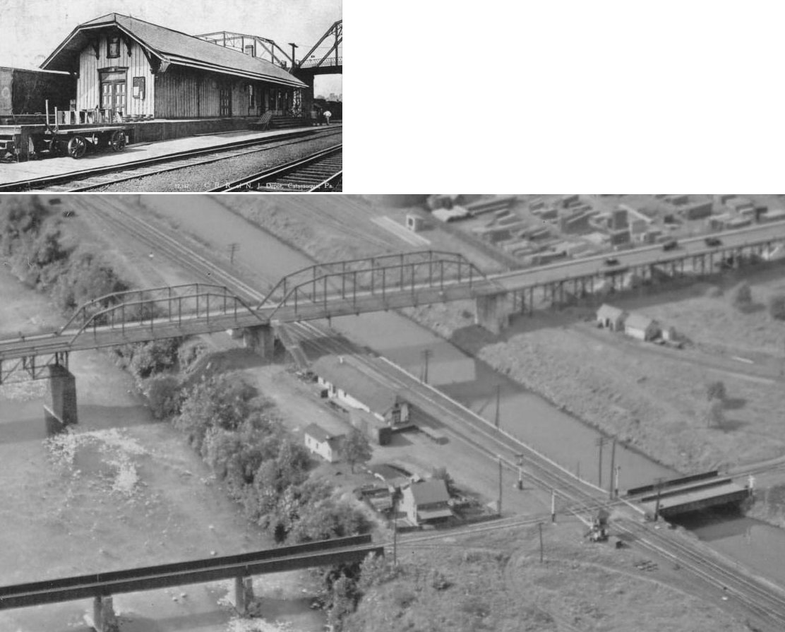
| Catasauqua | |
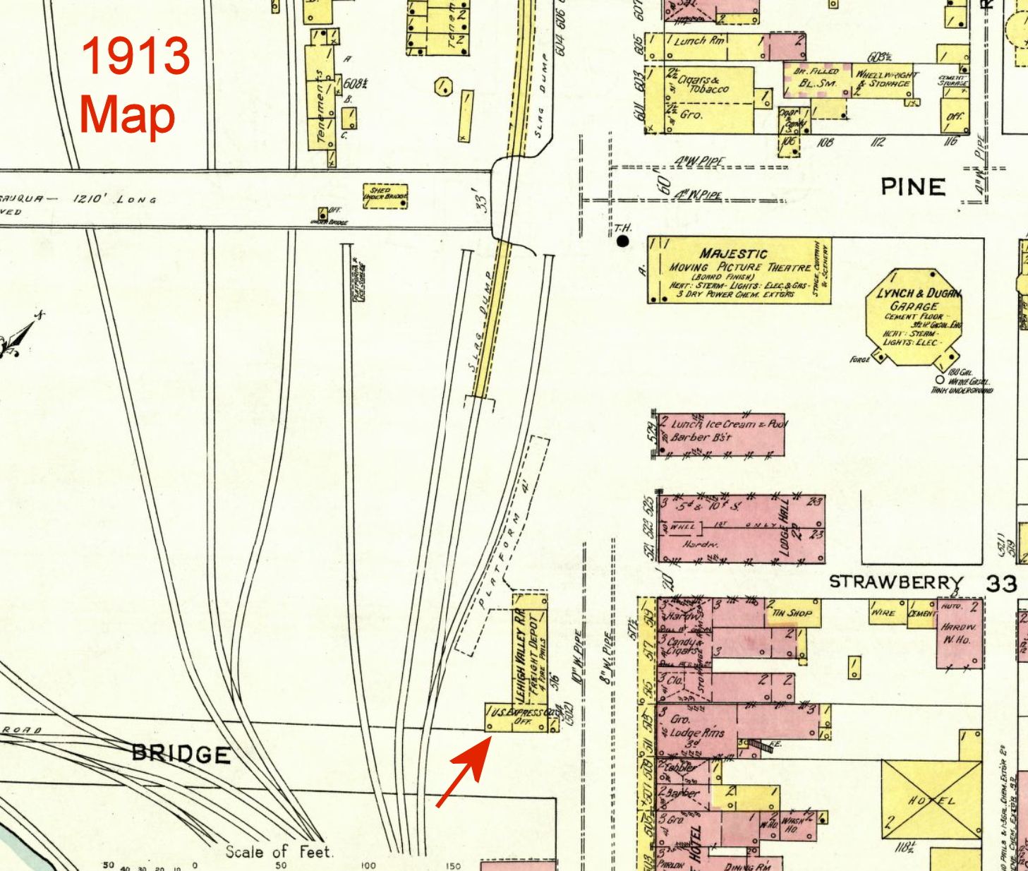
The freight station was on the SW side of Front Street just SE of Strawberry Street at GPS: 40.653603, -75.475150. The original building on this site was a Temperance Hall which was later converted into a U.S. Express office. Sometime between 1902-1908 that building was either modified into the LV freight station or the LV freight station was built on the same site. The old and new buildings on the site have similar profiles on the old maps. The building was gone by 1931. | ||||||
| Catasauqua |
|
This combination station sat just to the south of Pine Street on the SW side of the tracks at GPS: 40.652791, -75.477181. It was closed for passenger service in 1948, closed for freight service in 1952, and demolished in 1955. | ||||||
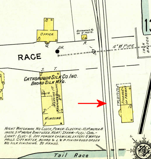
| Catasauqua |
|
The 1913 Sanborn map shows what appears to be (at the time) a freight station on the SE side of Race Street on the NE side of the tracks at GPS: 40.647960, -75.469043. | ||||||
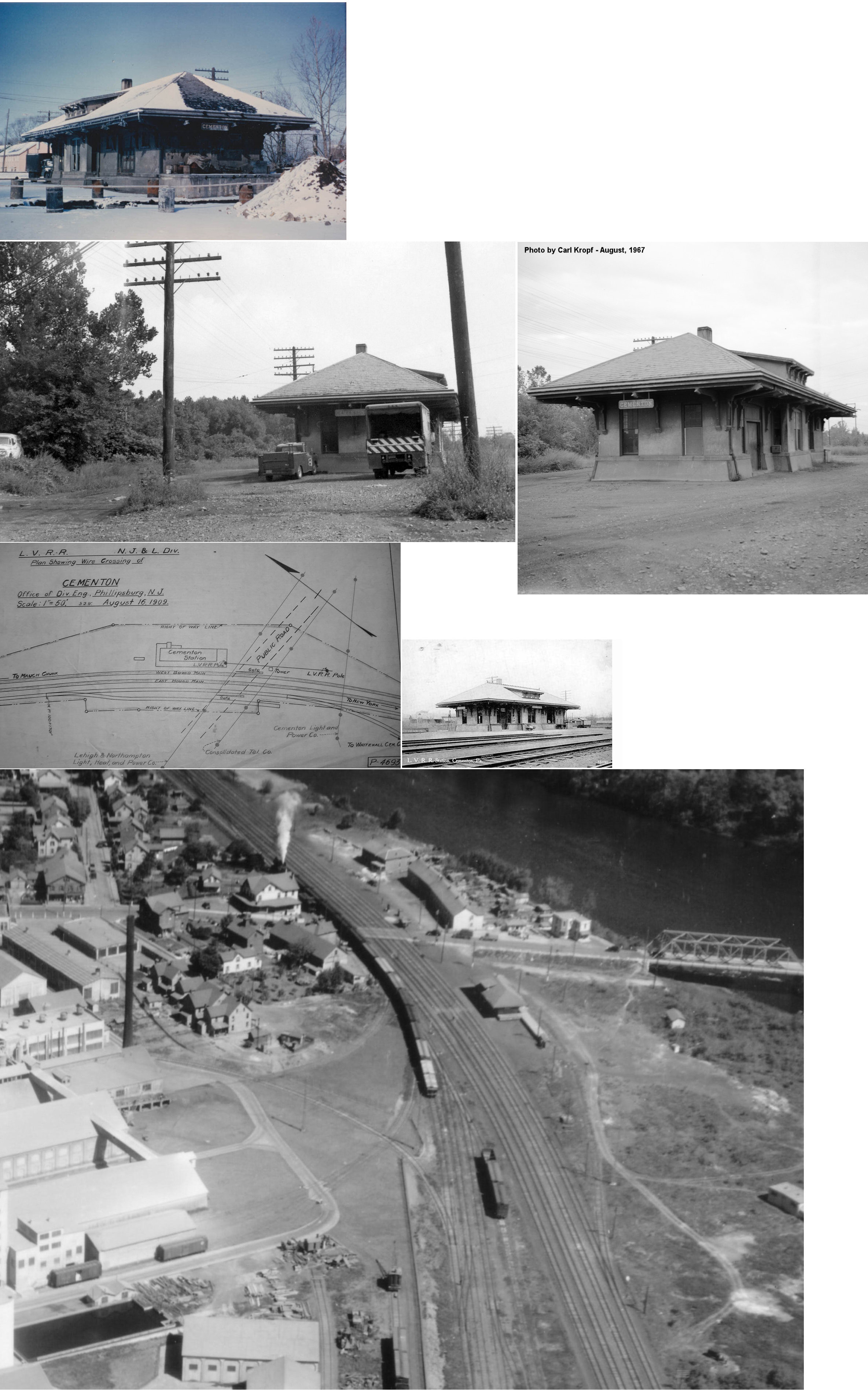
| Cementon |
|
This station was on the north side of Main Street on the east side of the tracks at GPS: 40.690156, -75.505844. It was built in 1911. | ||||||
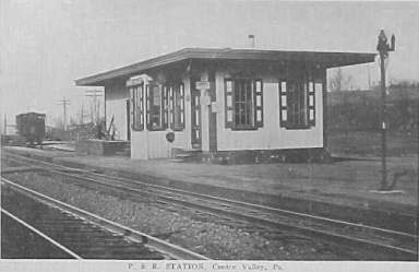
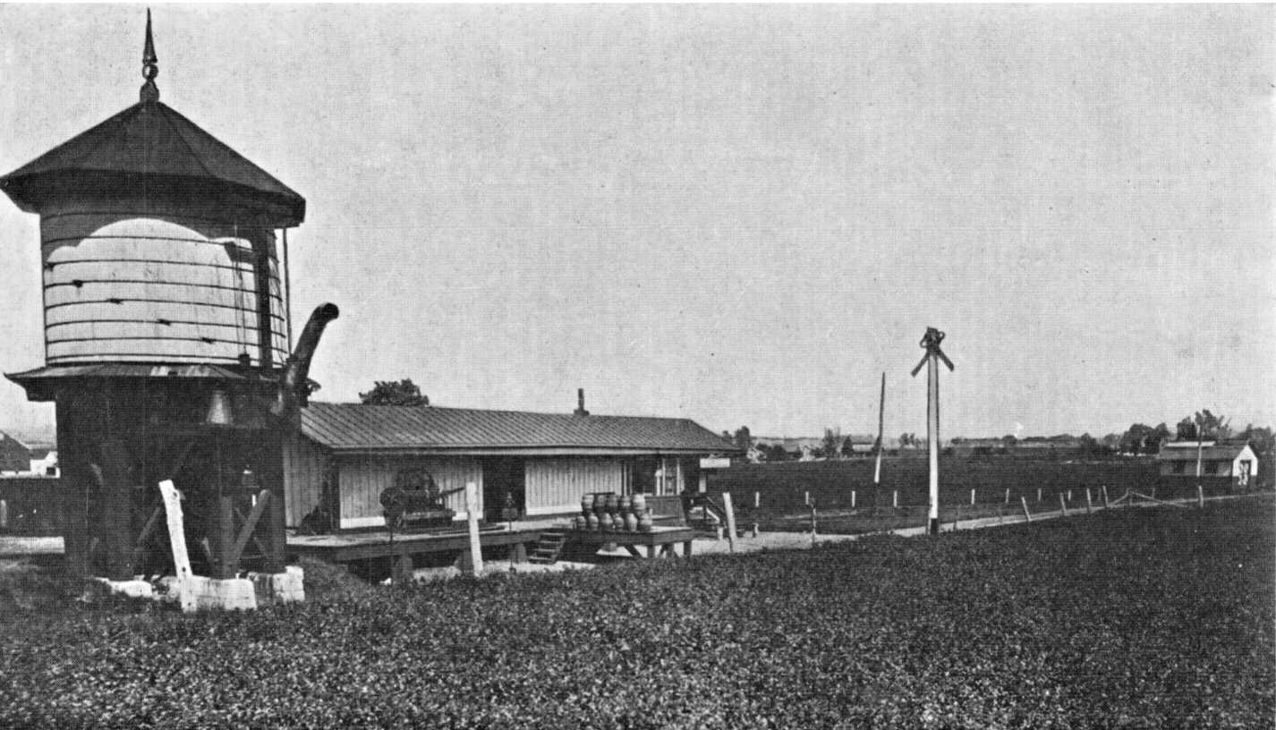
| Centre Valley |
|
|||||||
| Chapman |
|
The station was built in 1860 and enlarged in 1907. | ||||||
| Coopersburg |
|
Built in 1867. | ||||||
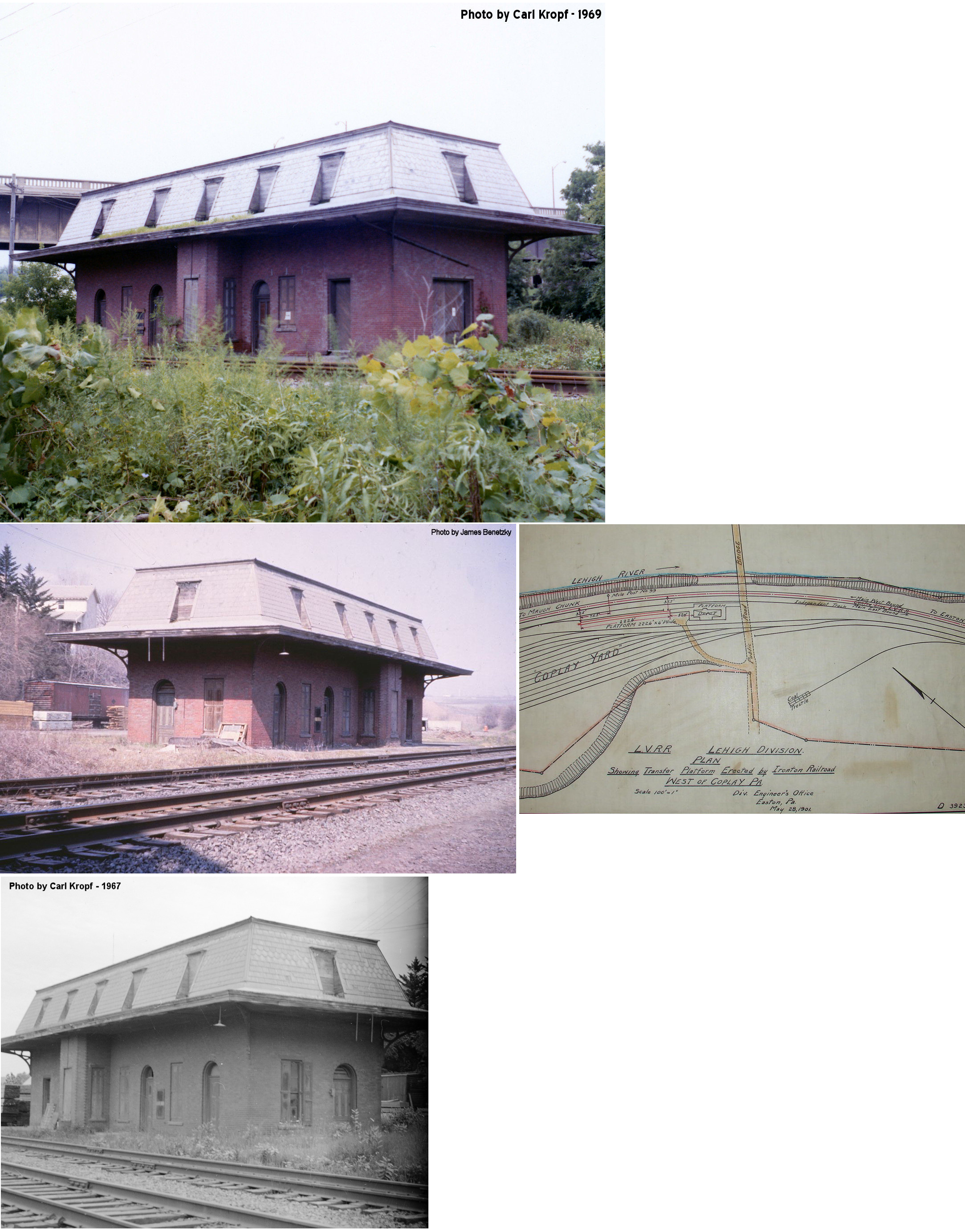
| Coplay |
|
This station was north of the Chestnut Street bridge ramp at GPS: 40.676041, -75.490944. This station also served the Ironton Railroad. Also see listing below. | ||||||
| Coplay |
|
Richard Back writes: "In my research and history, published in 2013 on the Ironton Railroad Co., I found no depot structures on the Ironton RR. I always thought that maybe the railroad built shelters quickly at busier points and maybe they are shown on old valuation reports, but never found anything. There is a 1911 and 1919 property map. On the 1919 map, the Ironton Railroad had scheduled or flag stops at 19 sites along its 12 mile line, but none of these sites had physical buildings shown built by the Ironton railroad for passenger service. The 1919 map of the railroad shows no such stations, but does show all other types of extant structures, water towers, conductor offices, section houses, freight sheds, engine house, office, coal docks, weight scales, etc. The railroad's passenger train did stop between the company office building and the Hokendauqua Lehigh Valley Railroad Station and then Ironton trains made connections at Lehigh Valley Coplay Station. It is the only physical train station I've found that Ironton stopped at. The railroad had tiny freight sheds located at Siegersville and Ironton and is rumored to have used the basement of its general office at Hokendauqua as a freight area. Ironton did have a less than a car load freight station at West Catasauqua village in Whitehall Township. The Passenger service was an afterthought, from 1898 until 1920 and was mainly a working-mans shuttle. | ||||||
| Coplay |
|
|||||||
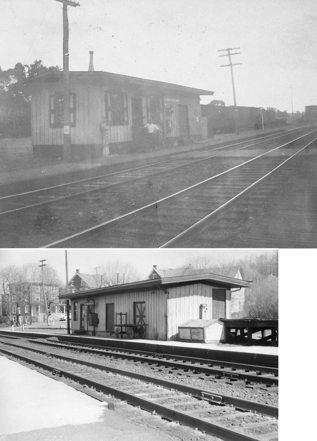
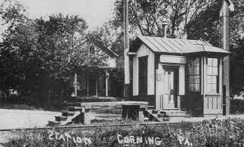
| Corning |
|
|||||||
| Crane |
|
|||||||
| Dillinger |
|
Built in 1875. | ||||||
| Egypt |
|
There was a small freight shed here. | ||||||
| Emmaus |
|
The freight station was across the tracks to the north of the existing passenger station. It was at GPS: 40.533479, -75.493479. | ||||||
| Emmaus |
 |
This station was on the SW side of 5th Street on the north side of the tracks at GPS: 40.531380, -75.491239. | ||||||
| Emaus Junction |
|
|||||||
| Fullerton |
|
This station was torn down sometime between 2006-2009. It was located on Lehigh Avenue across from "Jazz Circle" (Cody Way). There is a parking lot at the location now (2009). If the station's last location was there, it had been moved as old maps show that its original location was on the east side of Lehigh Avenue north of Franklin Street at GPS: 40.639527, -75.465992. The 1913 map marks the building as "formerly RR depot, vacant." | ||||||
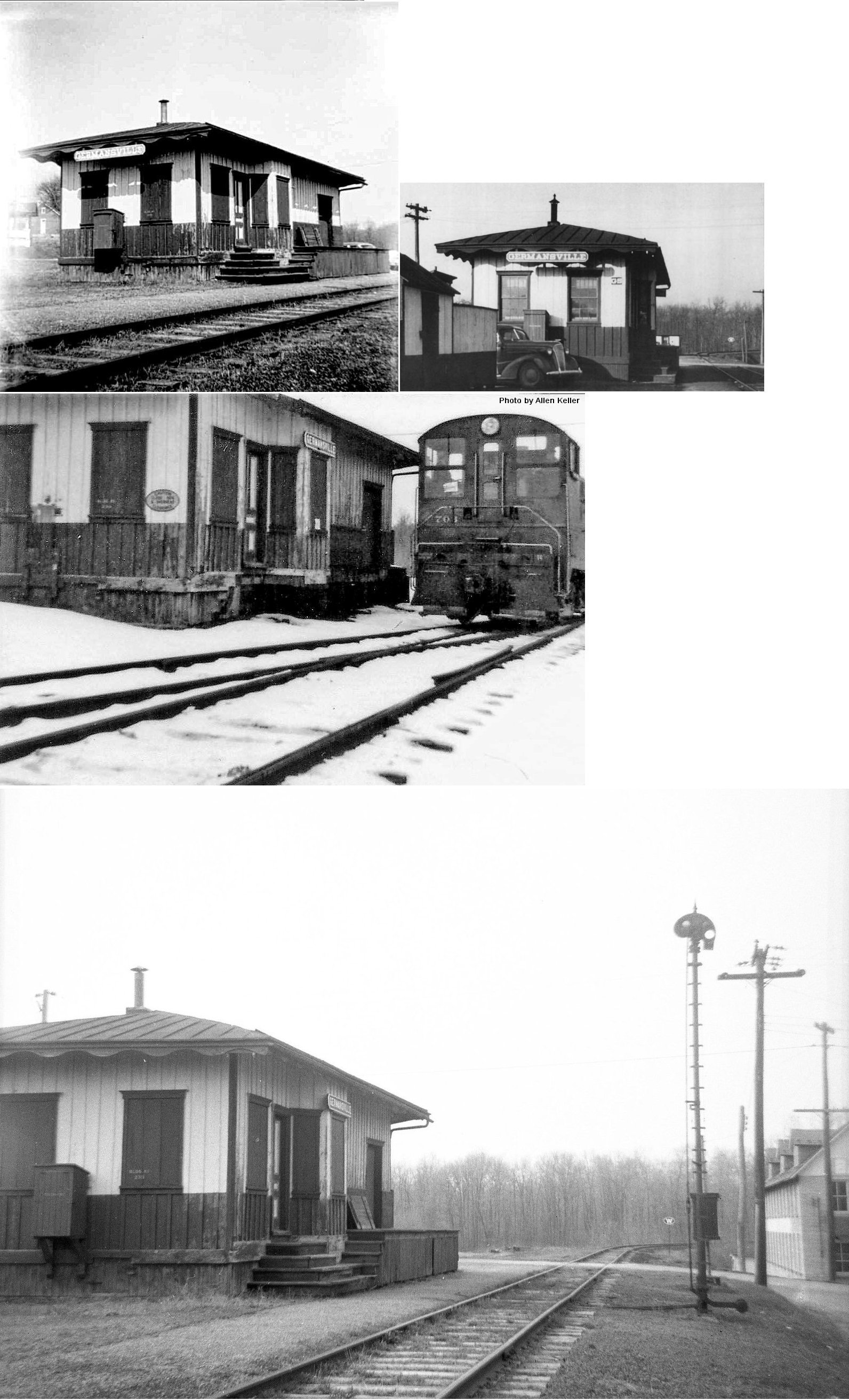
| Germansville |
|
In the early years, this station was known as Lehigh Exchange. | ||||||
| Guth |
|
Built in 1959. | ||||||
| Hokendauqua |
|
This station was built in 1883. | ||||||
| Hokendauqua |
|
The railroad may have used the basement of its offices here as a freight area. | ||||||
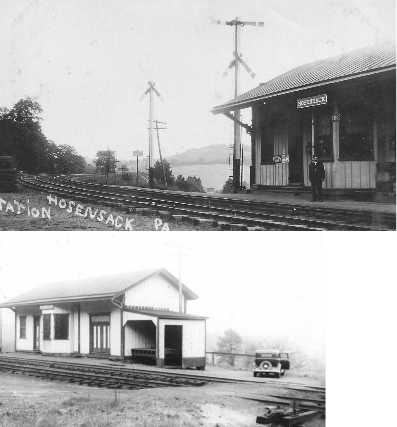
| Hosensack Station |
|
|||||||
| Ironton |
|
The railroad had only a small freight shed here. | ||||||
| Laros |
|
On a branch off the Catasauqua & Fogelsville RR. | ||||||
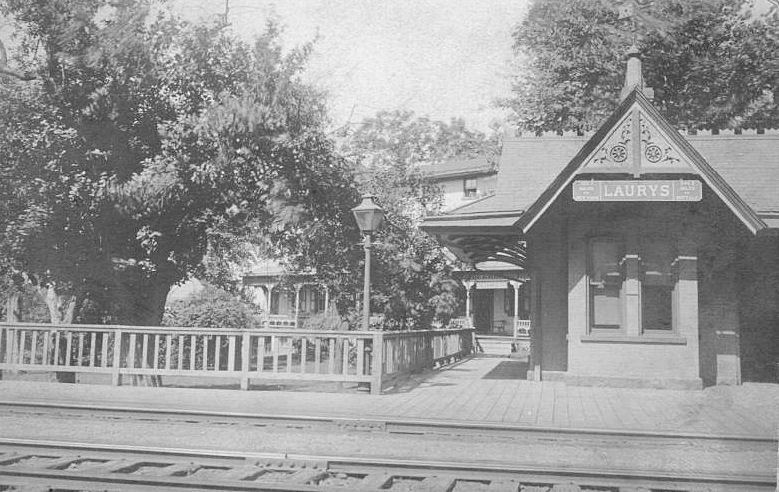
| Laurys Station |
|
This station was built in 1855. It was off Mauser Street at approximately GPS: 40.721739, -75.527334. | ||||||
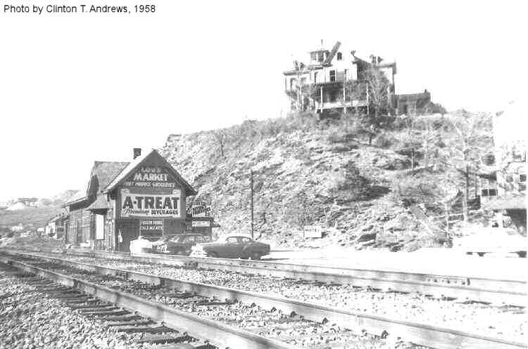
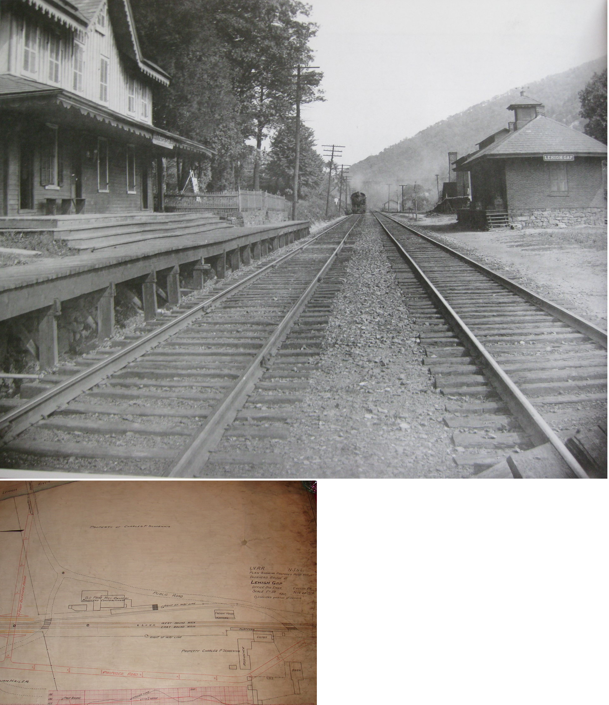
| Lehigh Gap |
|
Torn down in 1960 after serving as Lou's Market for several years. | ||||||
| Lehigh Gap |
|
This was the original LV station. It was attached to a residence. | ||||||
| Lehigh Gap |
|
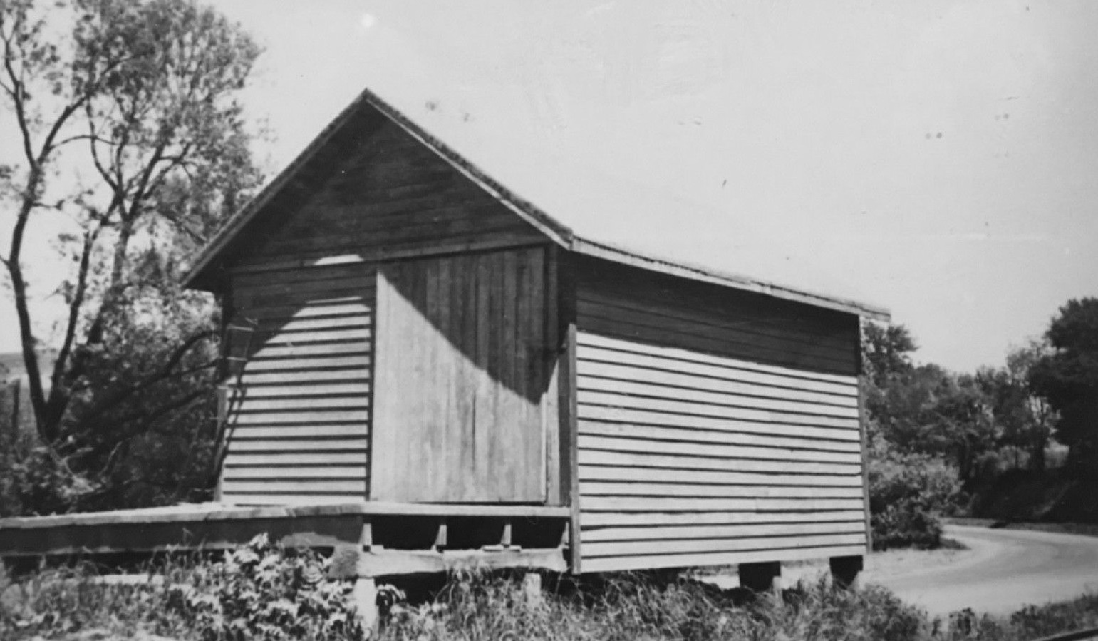
This freight station sat on the east side of Paint Mill Road at GPS: 40.779754, -75.607957. It was in poor condition and torn/fell down sometime between 2002-2004. | ||||||
| Lochland |
|
This station was between New Tripoli and Germansville. | ||||||
| Lynnport |
|
This passenger station was built in 1878. It was on the east side of PA863 at GPS: 40.674734, -75.804929. | ||||||
| Lynnport |
|
The freight station was on the west side of PA863 at GPS: 40.674421, -75.805224. | ||||||
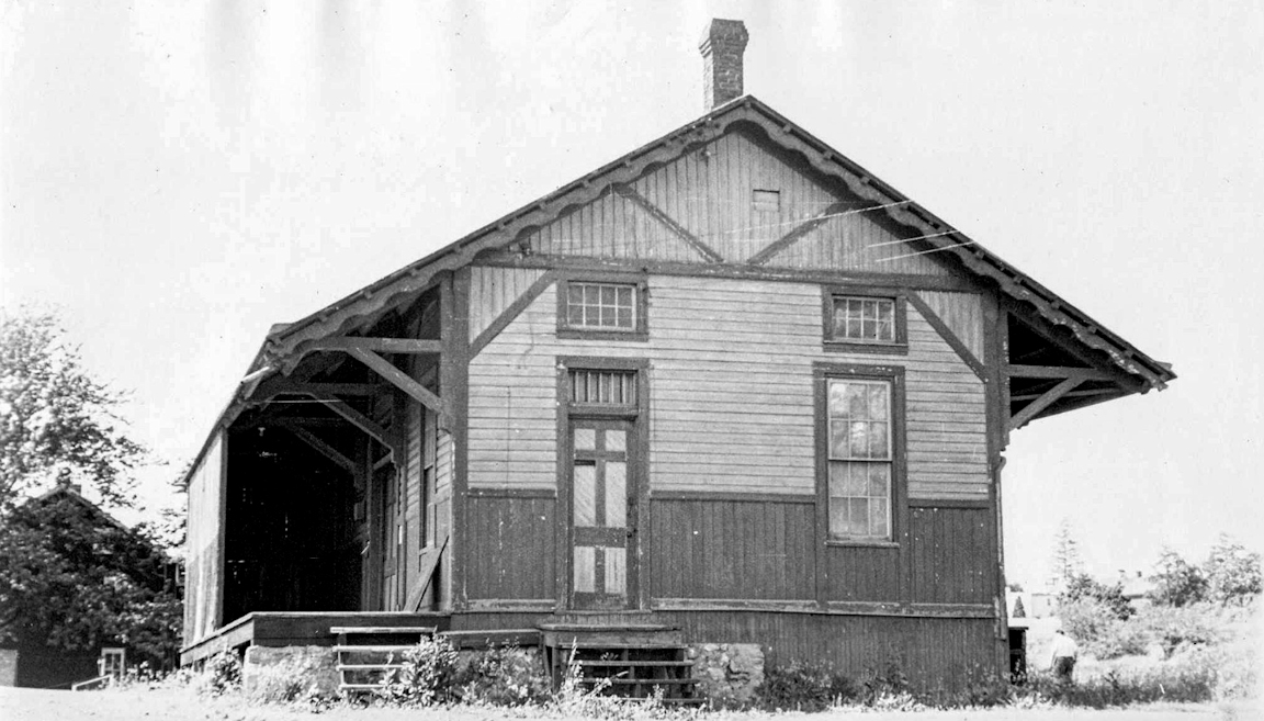
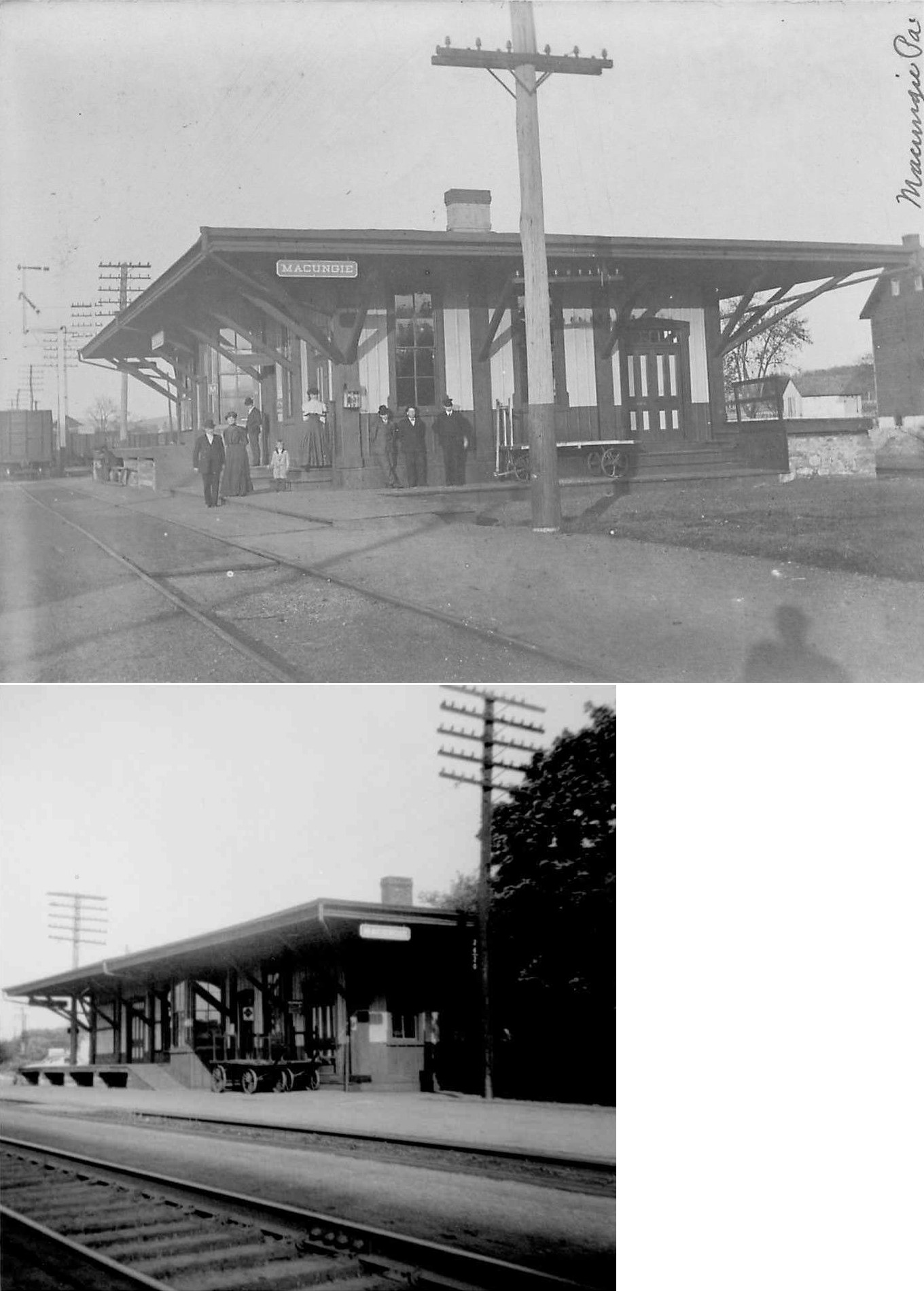
| Macungie |
|
This station was ont he south side of the tracks at the intersection of North Chruch Street and Mill Street at GPS: 40.517274, -75.556134. | ||||||
| Mickley's |
|
A shelter was built here in 1911. | ||||||
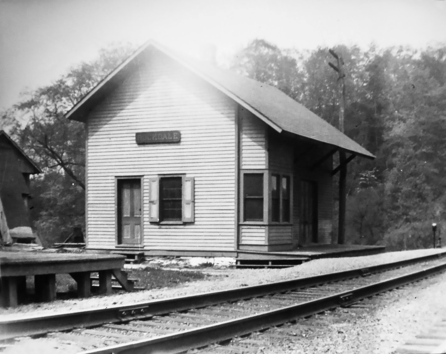
| Rockdale |
|
|||||||
| Saucon |
|
|||||||
| Seiple |
|
|||||||
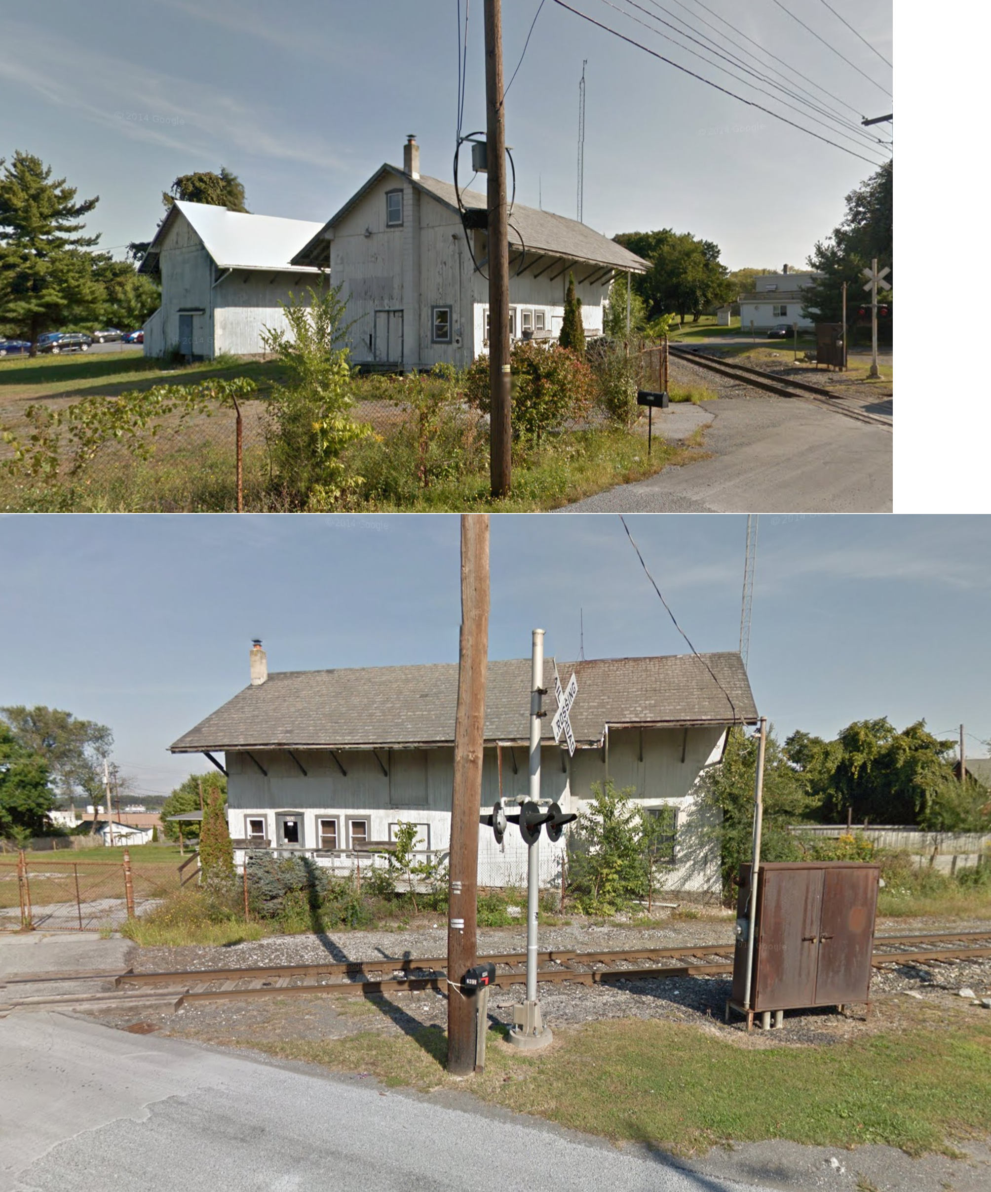
| Siegersville (Orefield) |
|
The station was on the NE side of PA309 at GPS: 40.634424, -75.583775. It was built in 1862 and demolished around 1980. The building was shared with a lumber, coal, and grain dealer. In the photo, the stairs on the left lead to the loading platform. The coal piles on the right were in bunkers where an overhead siding trestle was located. The Siegersville Branch line terminated approximately a half mile south of the station at iron ore mine in the village of Orefield. It connected at Coplay with the Lehigh Valley. The Siegersville Branch was abandoned and tracks removed when the PA turnpike was built in the early 50s. | ||||||
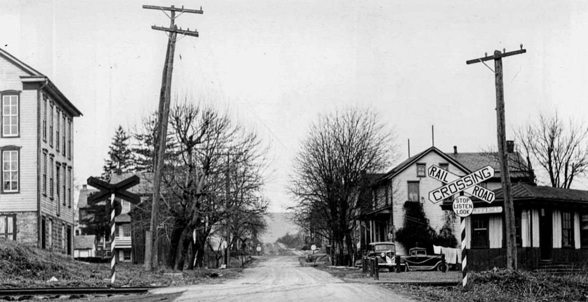
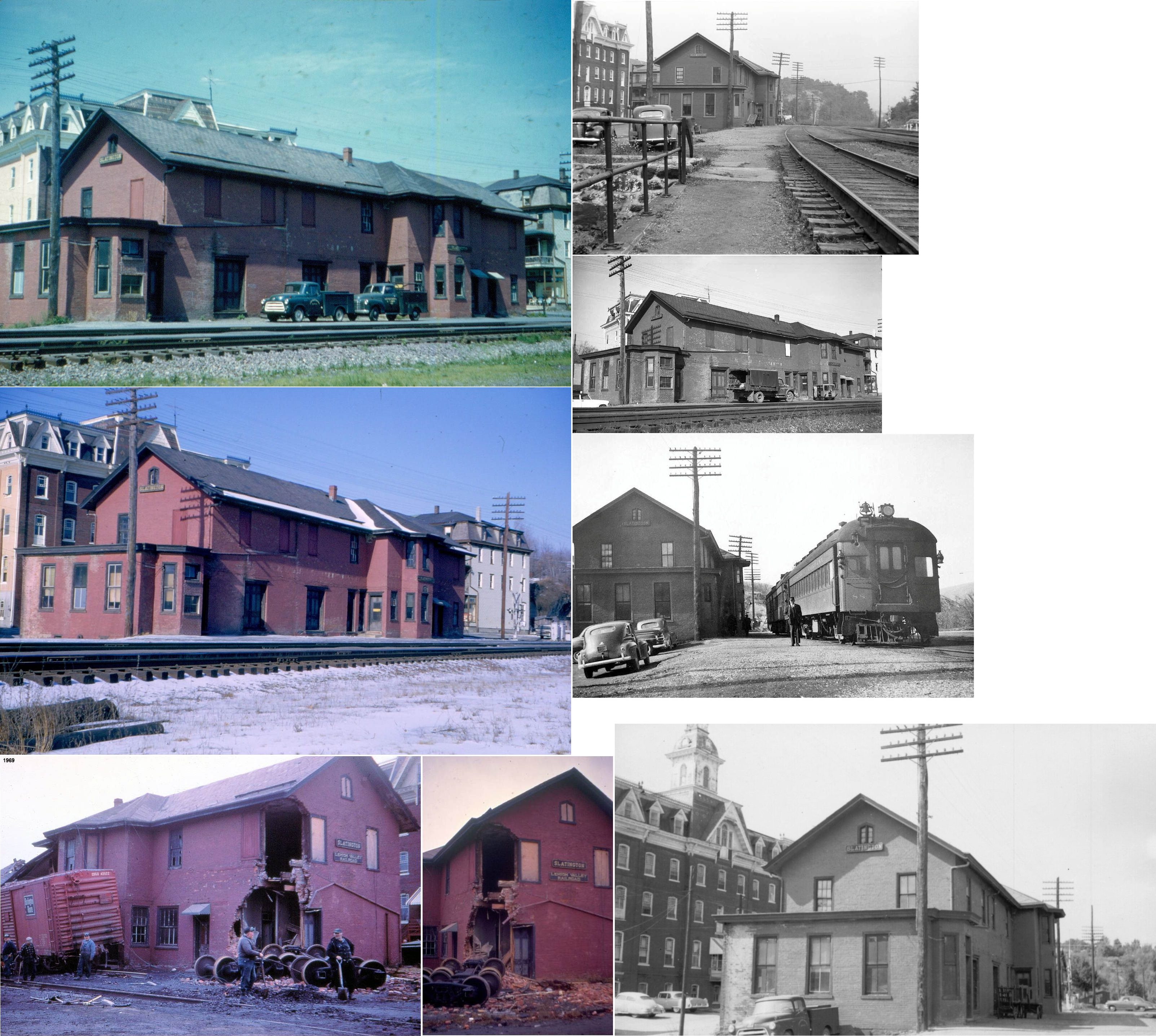
| Slatington |
AND AND |
The station was built in 1862 and was destroyed in a derailment in 1969. It also sevred the RDG Lehigh & Schuylkill Branch and sat at the corner of Main and Railroad Streets (GPS: 40.752574, -75.604861). | ||||||
| Slatington |
|
There was a small Reading freight house on the north side of the tracks next to Trout Creek at GPS: 40.751725, -75.605083. This is shown on the 1913 Sanborn map. | ||||||
| Spring Creek (Merkle) |
|
|||||||
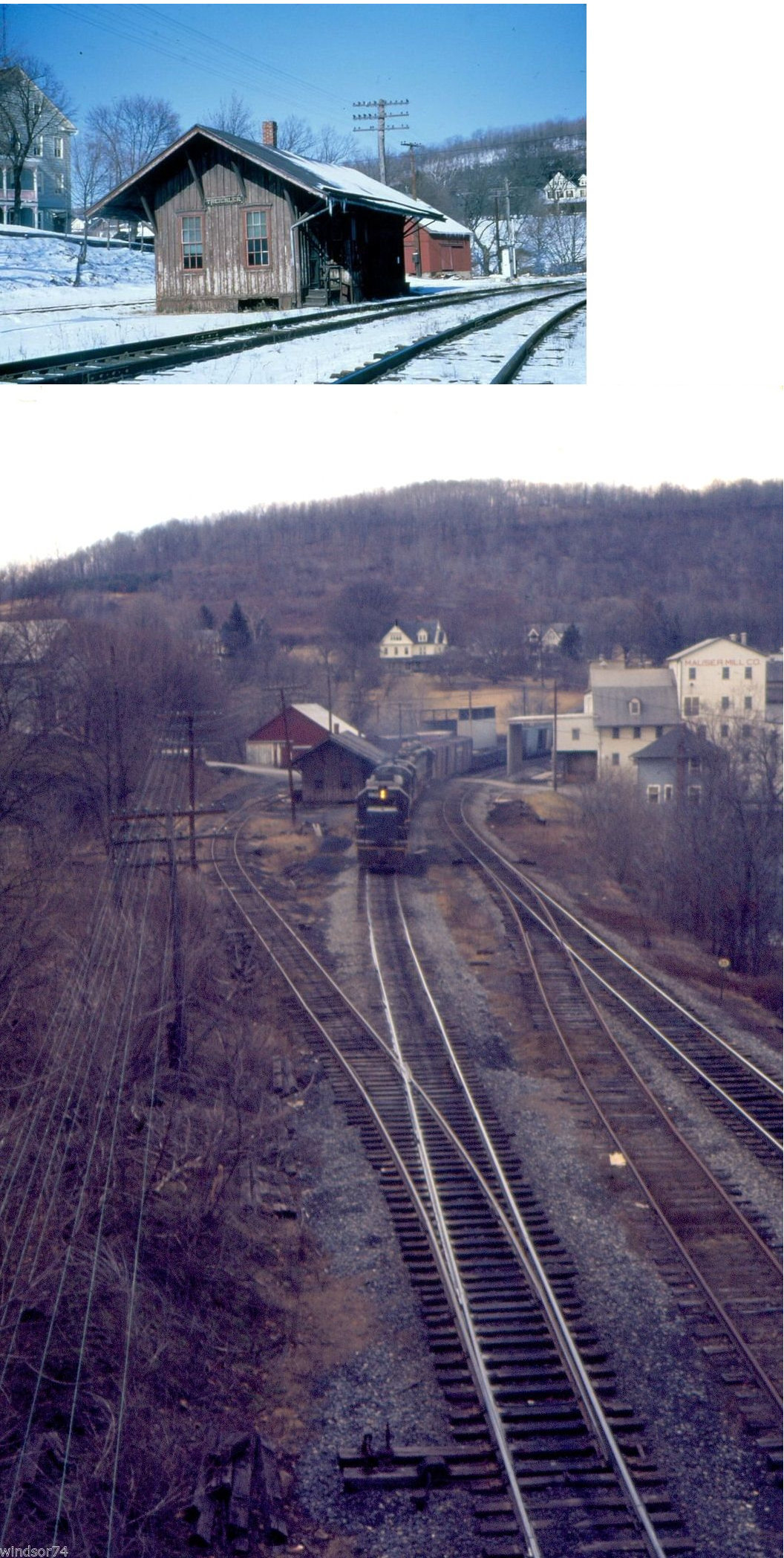
| Treichlers |
|
This station was near the end of Cove Road in the vicinity of GPS: 40.734038, -75.539330. | ||||||
| Treichlers | |
The station was on the south side of East Breadfruit Drive at GPS: 40.735216, -75.542616. It was across the river in Northampton County. | ||||||
| Trexlertown |
|
|||||||
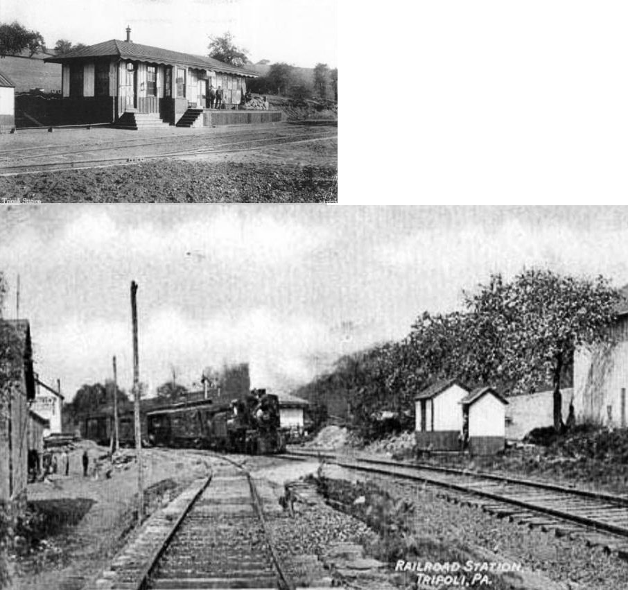
| Tripoli (New Tripoli) |
|
The original station here was destroyed in March, 1898 when a shipment of dynamite exploded during the night. | ||||||
| Tripoli (New Tripoli) |
|
This was the station that replaced the station listed above. It was built in the same location as the original station in 1898. | ||||||
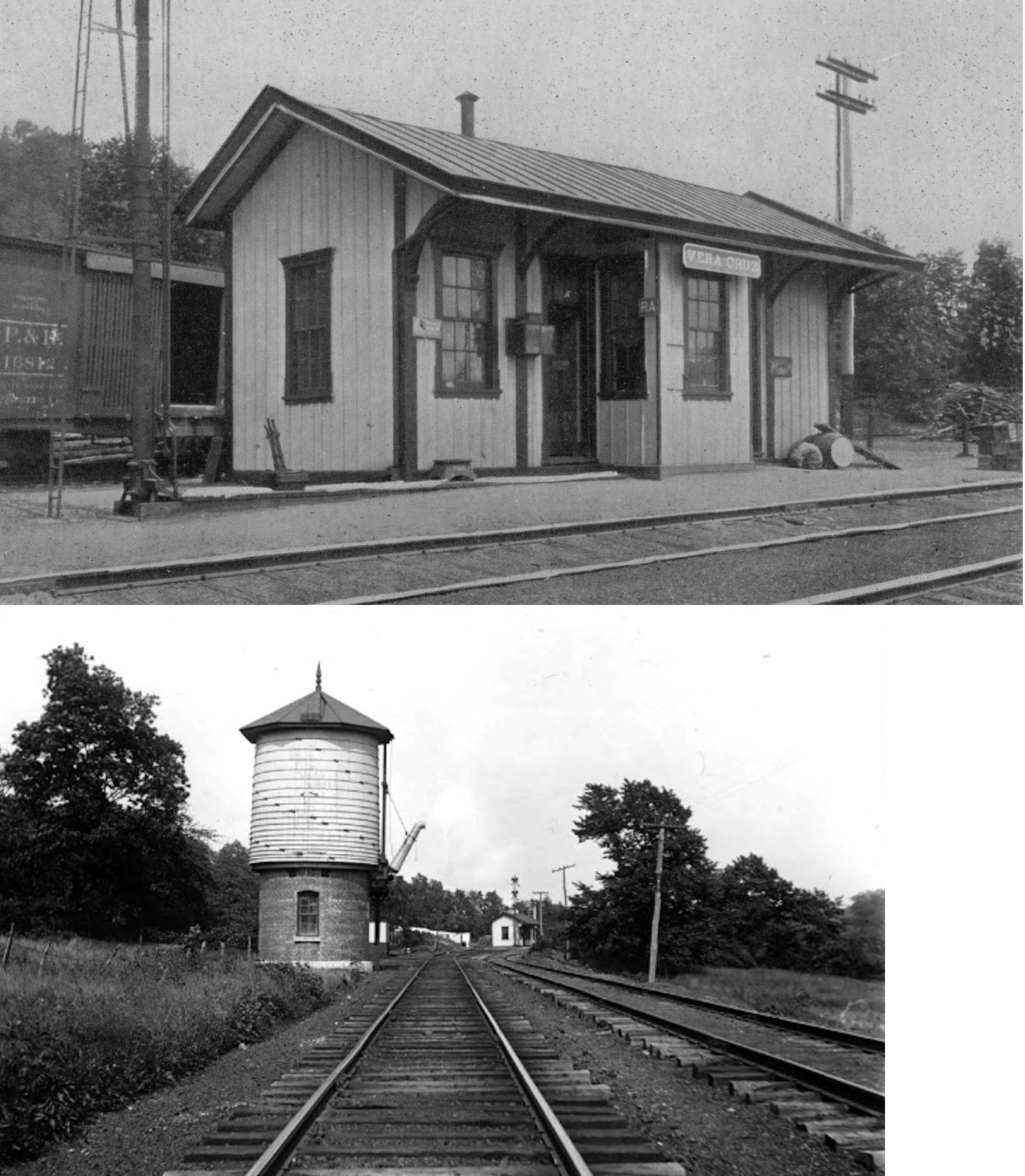
| Vera Cruz |
|
This station closed in 1932. | ||||||
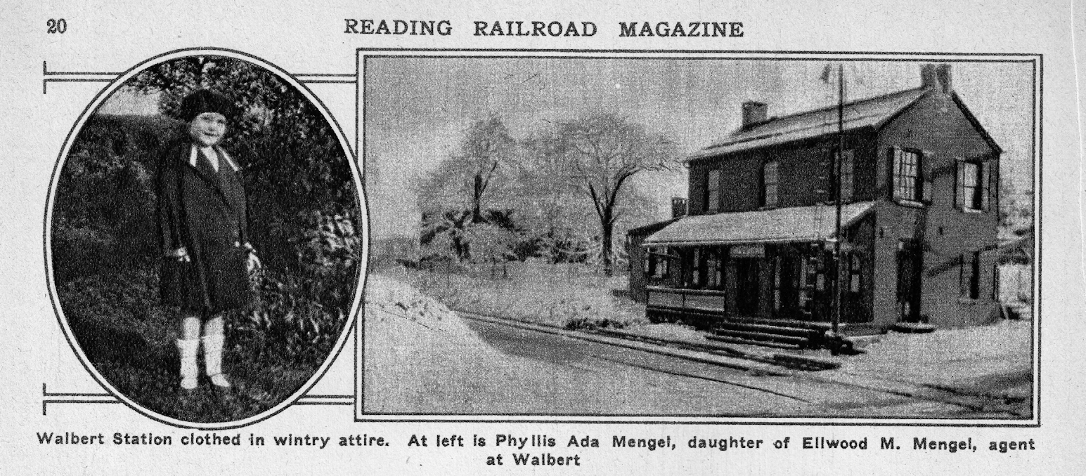
| Walbert |
|
|||||||
| Wallner |
|
On a branch off the Catasauqua & Fogelsville RR. | ||||||
| Zionsville |
|
|||||||
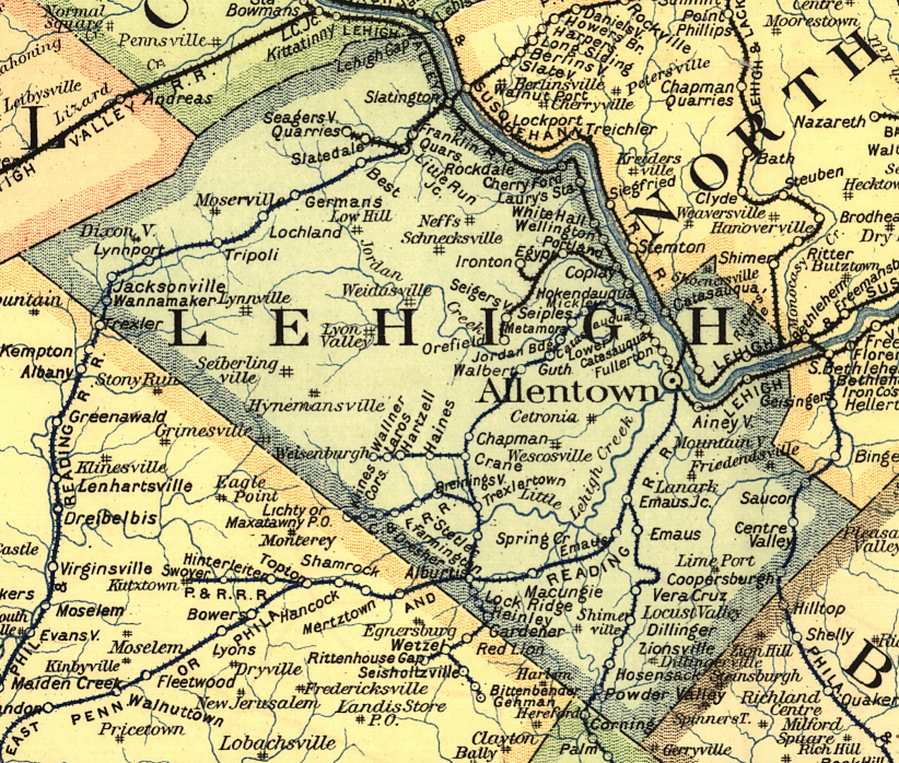
| 1895 LEHIGH COUNTY RAILROAD MAP | ||||||||
 |
||||||||
| Notes About Existing
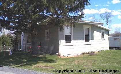
Stations... Allentown (CNJ/RDG) - Station opened March 17, 1890. Addition to the building was completed in 1915 and the station was sold by the RR in 1979. Bethlehem (CNJ) - Both CNJ stations are in Lehigh County abut 100 yards across Northampton/Lehigh line. Catasauqua (RDG) - Moved to Kempton (Berks County) for the WK&SRR in the mid 1960s. Its original location was just SE of the pine Street Bridge at GPS: 40.651742, -75.478635. This station dates to 1876 and the Catasauqua & Fogelsville RR days. Although it likely served as a freight station in later years, it probably was a combination station in the early years. See this photo for original location. Emmaus (RDG) - The appearance of this station has been heavily altered since its railroad days. Jacksonville (RDG) - Blue portion of house is station. The front trim matches Wanamaker station. Addition built on rear and another on east end. |
||||||||