|
|
||||||||
| EXISTING STATIONS | ||||||||
|---|---|---|---|---|---|---|---|---|
| Station Name |
Original Railroad |
Current Location |
Type | Current Use |
Date Built |
Track Status |
Building Material |
More Info |
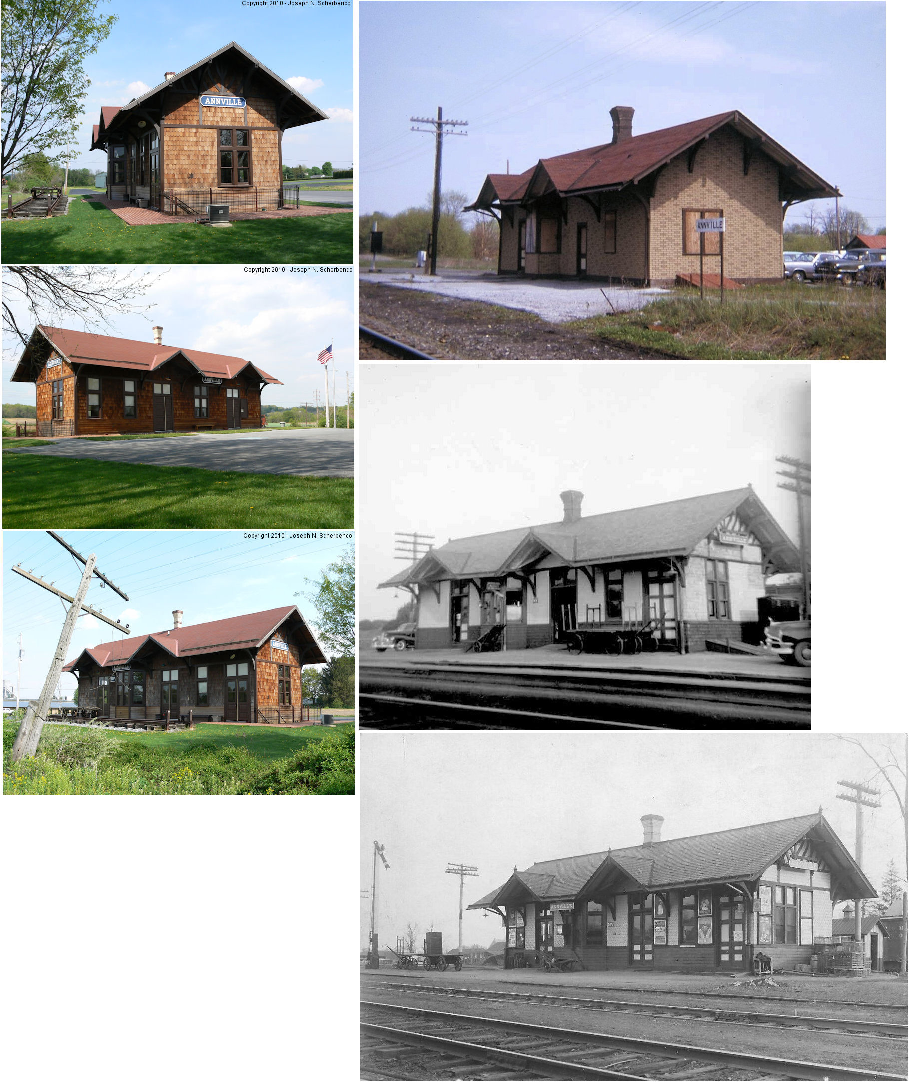
| Annville |
 |
North Moyer Street (GPS: 40.335014, -76.503078) |
P | Civic | ???? | In use | Wood |
|
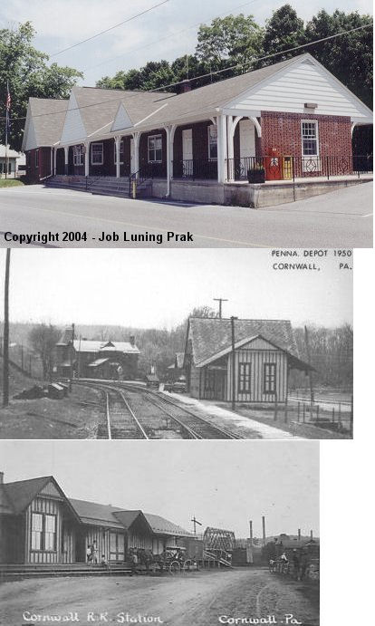
| Cornwall |
 |
36 Burd Coleman Road (GPS: 40.275442, -76.413311) |
C | Civic | ???? | Gone | Brick |
|
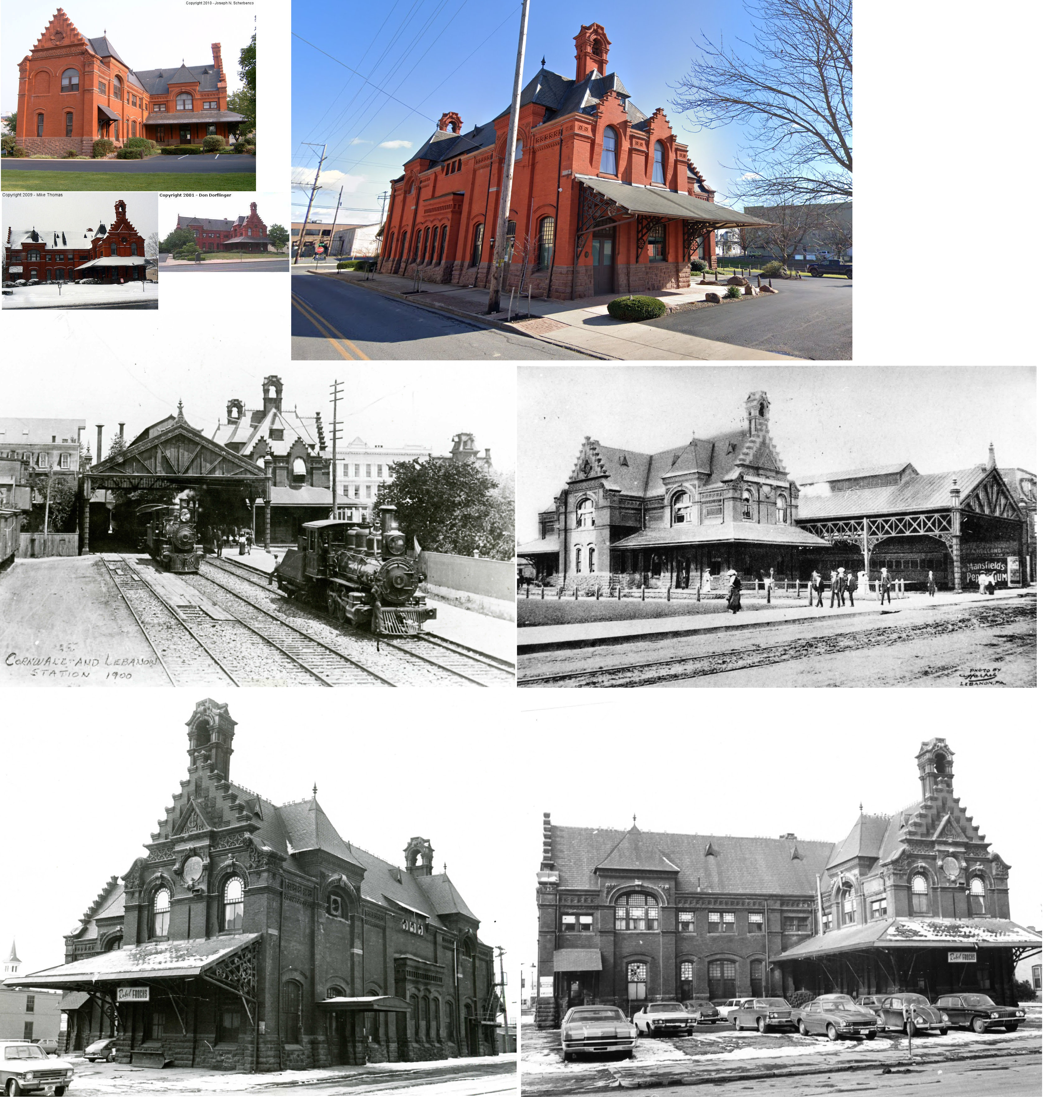
| Lebanon |
 |
8th Street and C&L Street (GPS: 40.342323, -76.425393) |
P | Business | 1885 | Gone | Brick | |
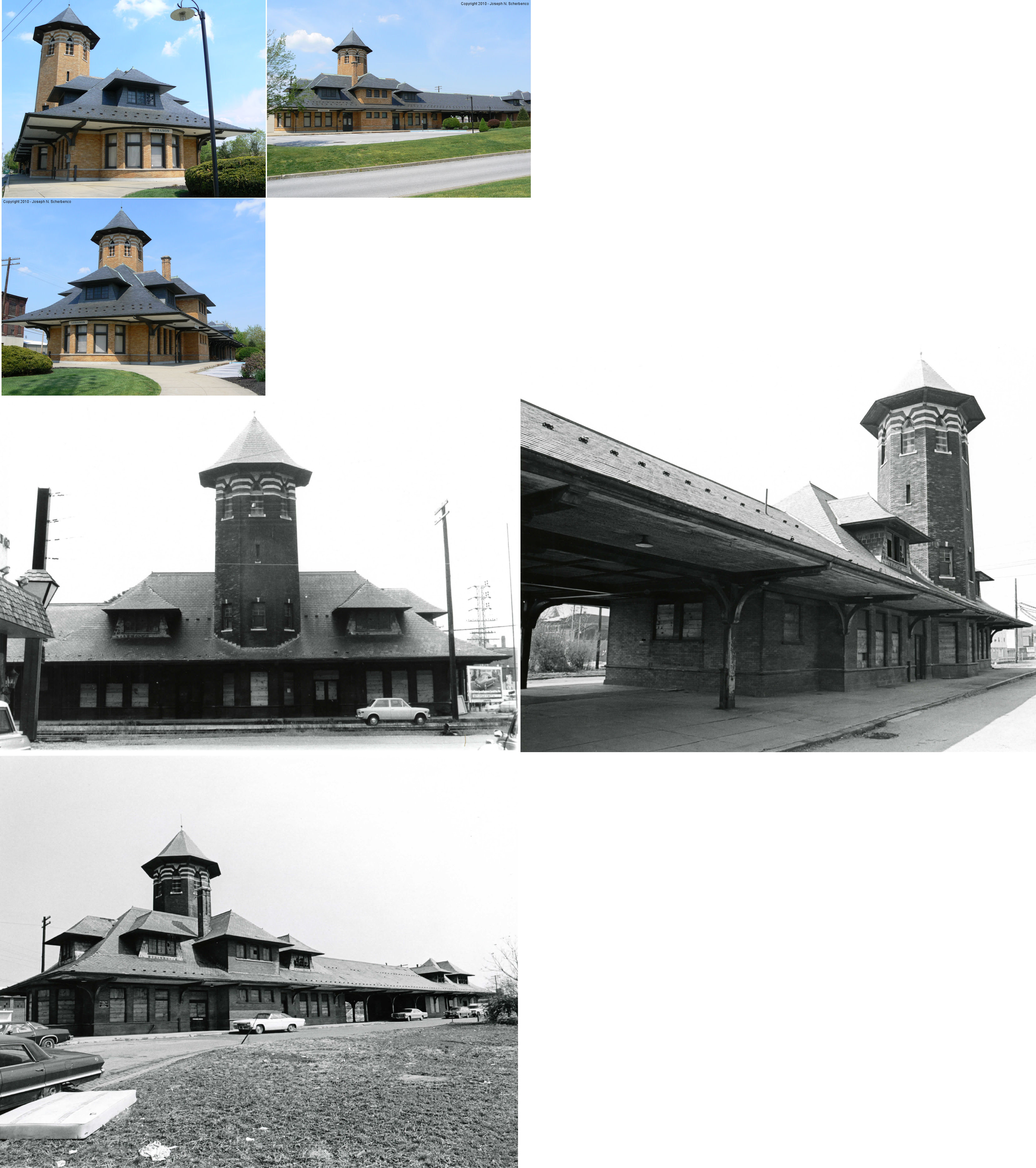
| Lebanon |
AND |
250 North 8th Street at Scull Street (GPS: 40.343188, -76.424260) |
P | Business | 1901 | In Use | Brick | |
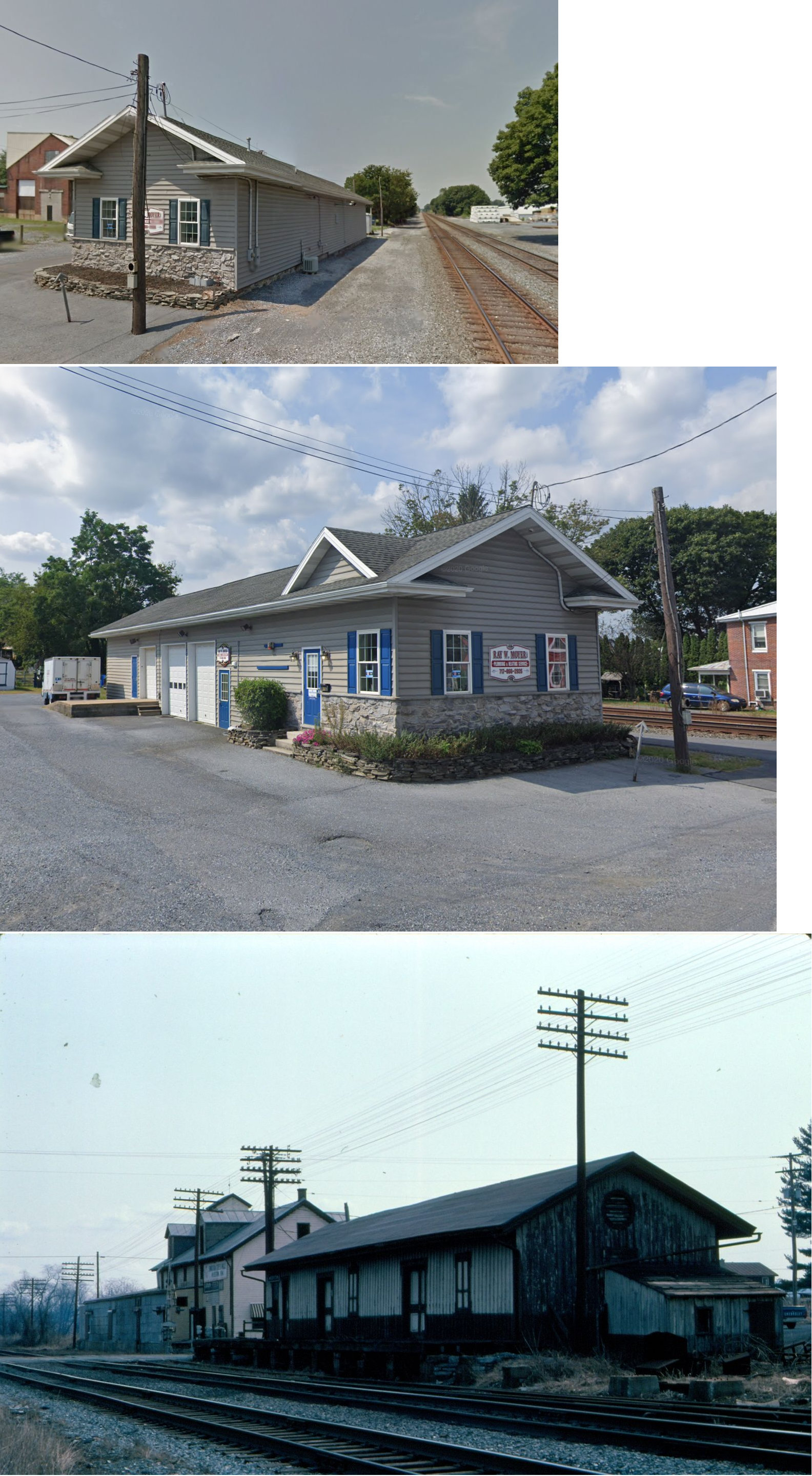
| Myerstown |
|
819 South Railroad Street (GPS: 440.364745, -76.302730) |
F | Business | ???? | in Use | Wood |
|
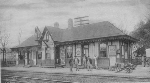
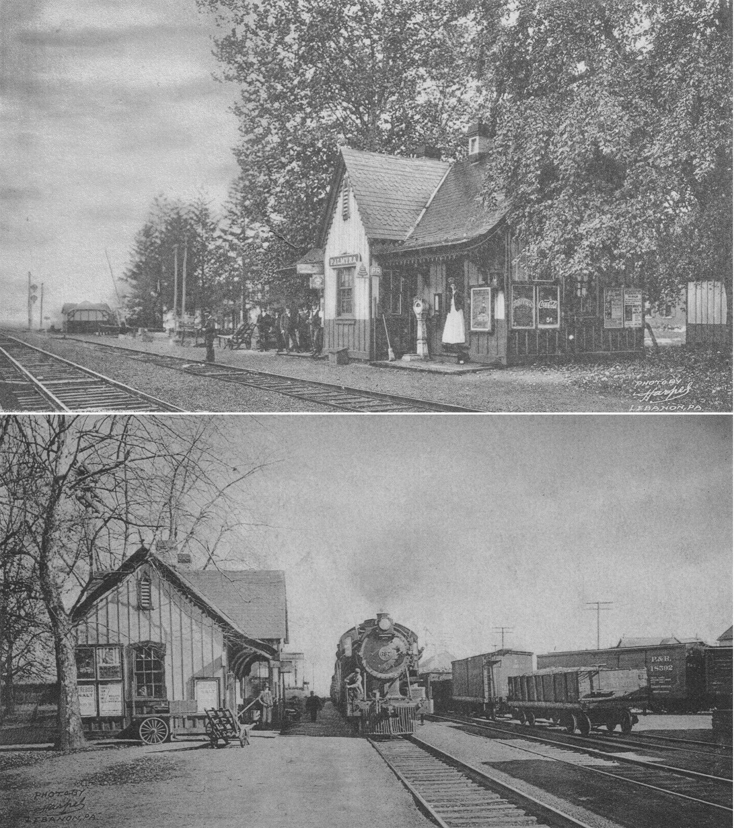
| Palmyra |
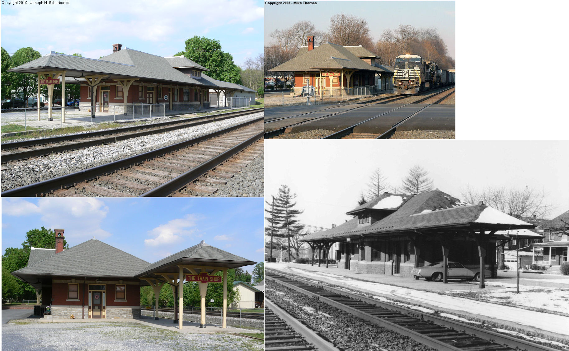
|
20 East Willow Street (GPS: 40.312688, -76.599333) |
P | Business | 1910 | In Use | Brick |
|
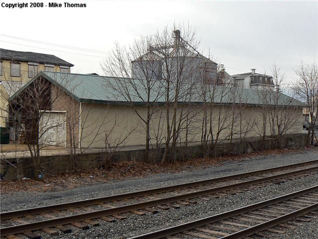
| Palmyra |
|
Near the corner of East Front Street near North Chestnut Street (GPS: 40.312545, -76.598758) |
F | Storage | ???? | In Use | Wood |
|
| STATIONS OF THE PAST | ||||||||
| Station Name |
Original Railroad |
Notes | ||||||
| Annville |
|
There was a freight station between North Ulrich and North Railroad Streets at GPS: 40.333798, -76.511453. | ||||||
| Avon |
|
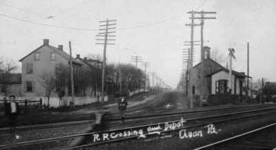
The station was on the north side of Kimmerling Road. | ||||||
| Avon |
|
Freight station. | ||||||
| Bunker Hill |
|
The original station here burned in 1876. This station was on the Lebanon & Tremont Branch. | ||||||
| Bunker Hill |
|
A replacement station was constructed in 1876. | ||||||
| Bunker Hill |
|
A third generation station was built here in 1912. | ||||||
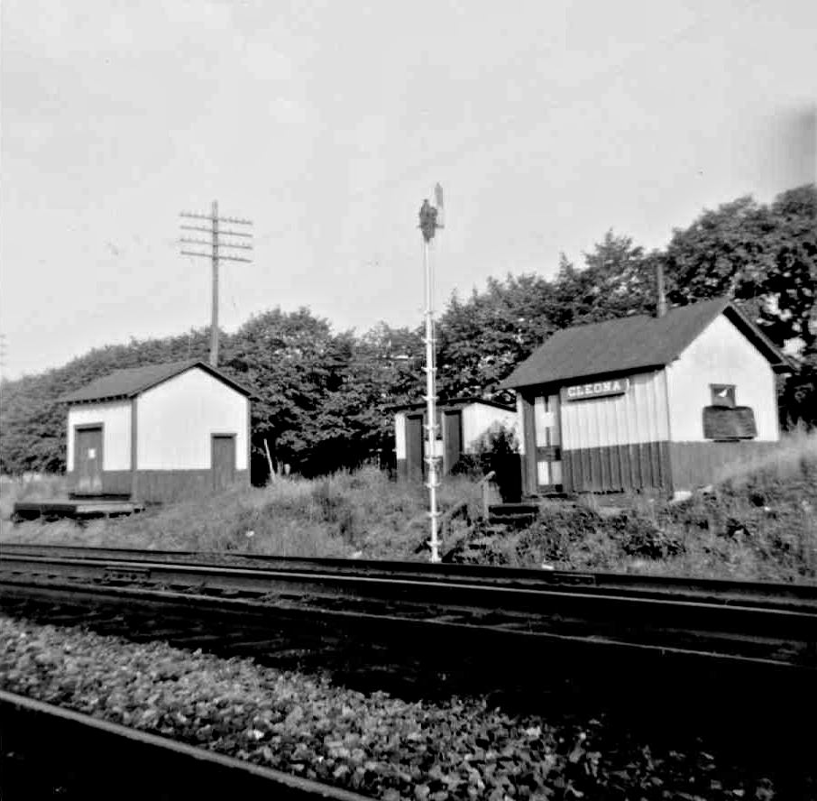
| Cleona |
|
Built in 1889 and closed in 1953. | ||||||
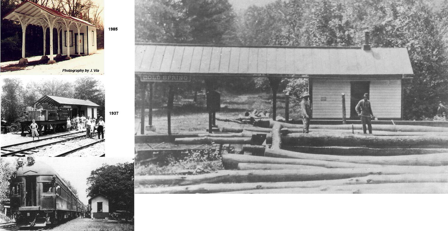
| Cold Spring |
|
This station was in Cold Spring Township. After being vandalized in the late 1980s the station fell apart in 1993 and was taken to the dump. Local historians went to the dump and salvaged what they could. Portions of the station were reassembled and are on display at the Stoy Museum, Lebanon County Historical Society located on 924 Cumberland Street, Lebanon, PA. | ||||||
| Cold Spring |
|
This station was on the border of Cornwall and West Cornwall Townships. | ||||||
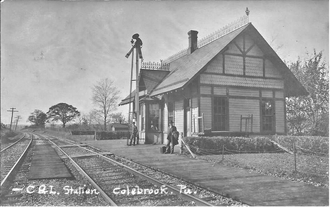
| Colebrook |
|
Passenger station. | ||||||
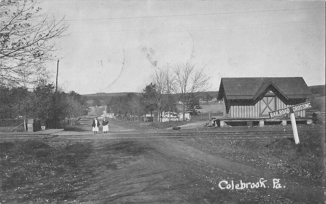
| Colebrook |
|
Freight station. | ||||||
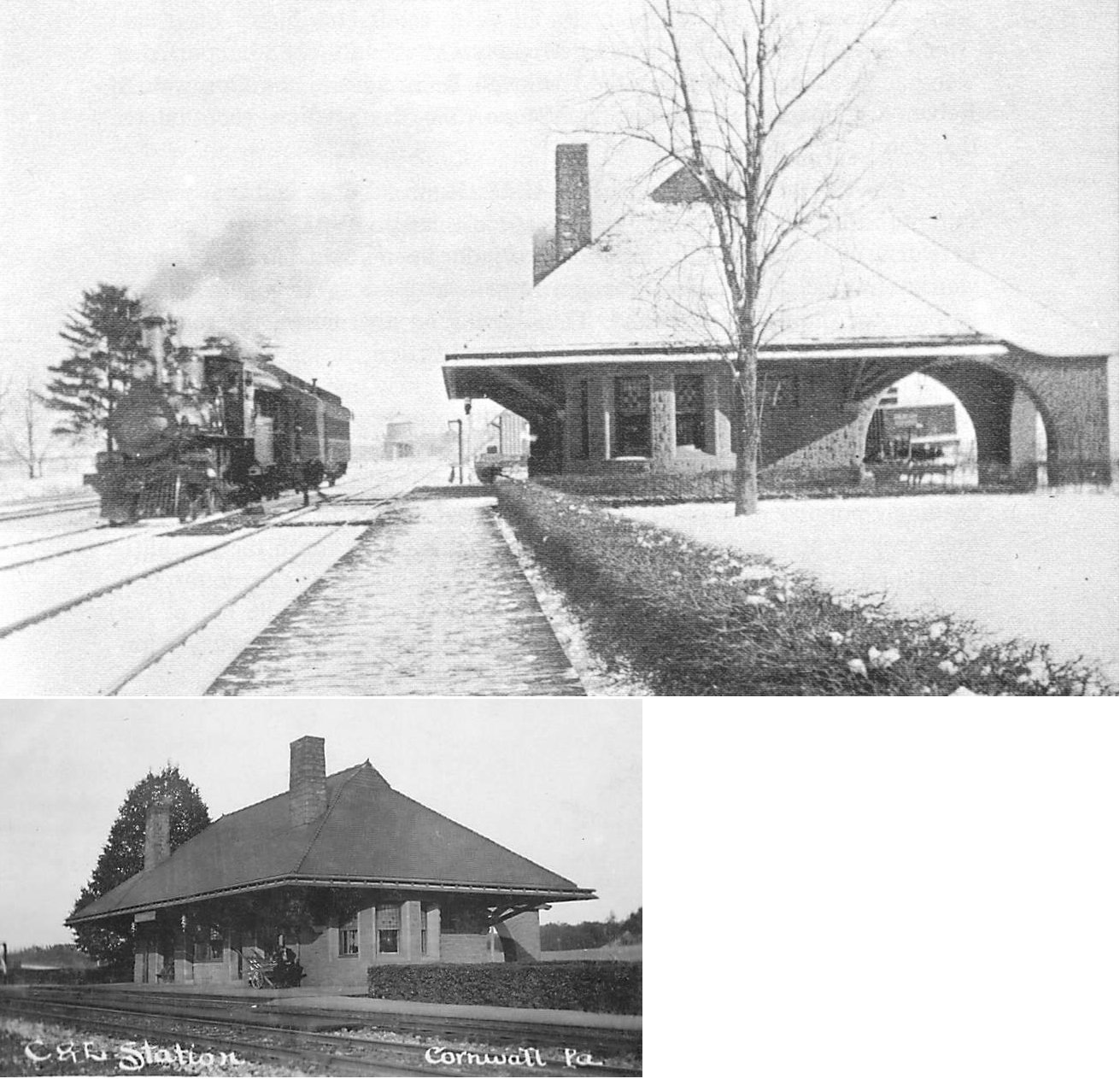
| Cornwall |
|
This station was made of stone and burned in the 1930s. | ||||||
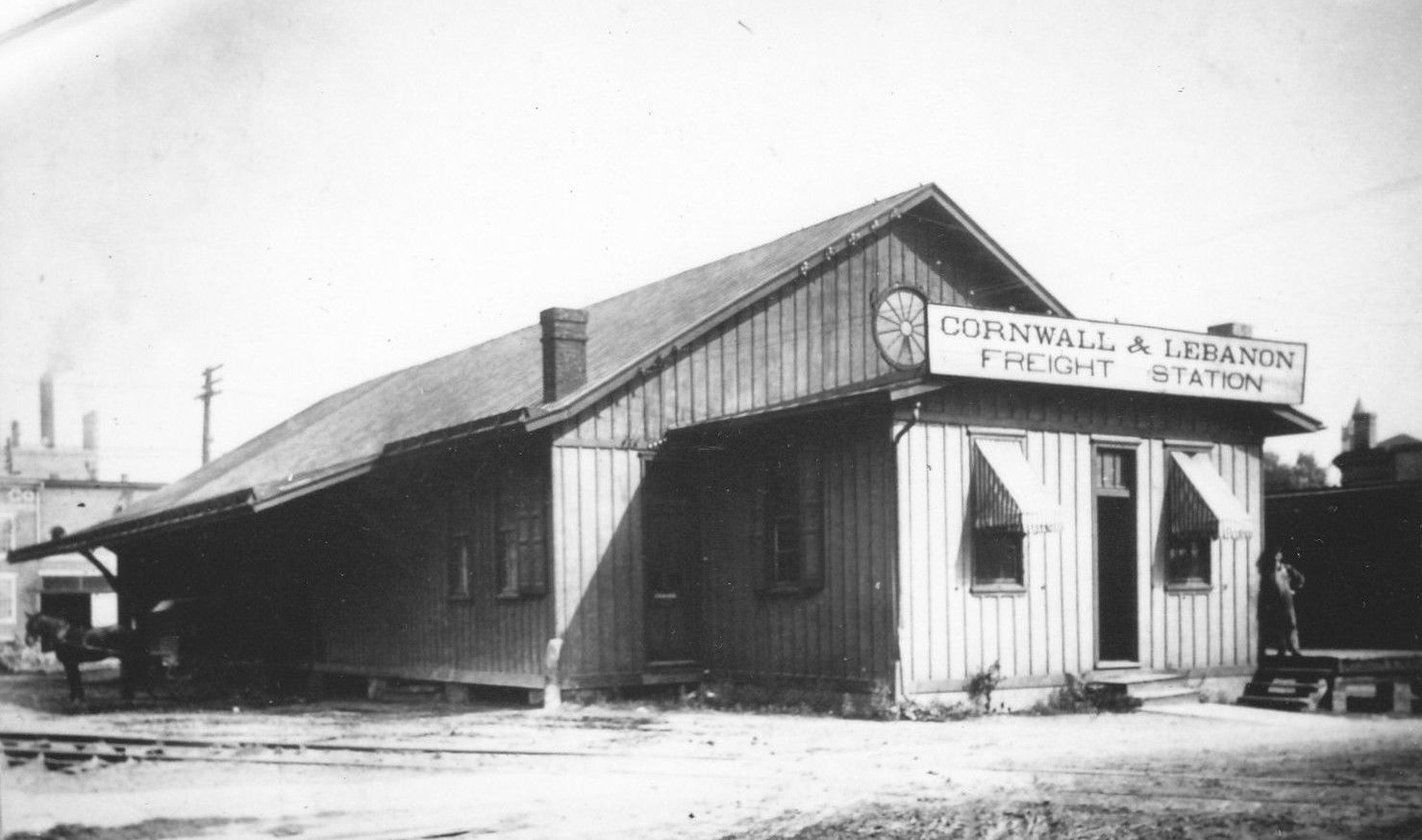
| Cornwall |
|
Freight station. | ||||||
| Gold mine |
|
|||||||
| Green Point |
|
|||||||
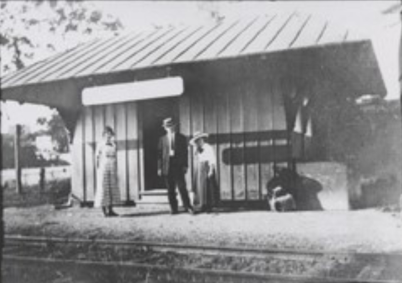
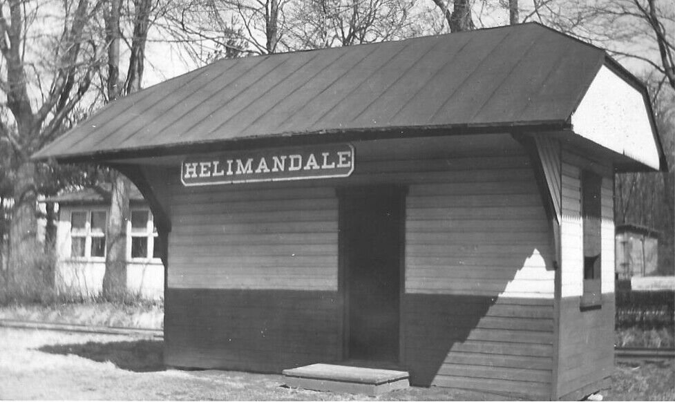
| Heilmandale |
|
I'm not sure what accounts for the spelling on the station sign in the photo... an error or alternate spelling? This station was built in 1870 and closed in 1903. | ||||||
| Inwood |
|
This flag stop shelter station was on the south end of Iron Bridge Road on the north side of the tracks at GPS: 40.476857, -76.523459. | ||||||
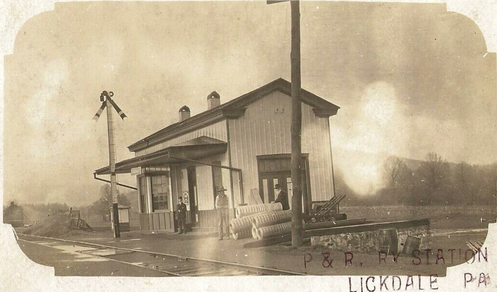
| Indiantown
Gap (Lickdale) |
|
Built and named Lickdale Station around 1870. Renamed Indiantown Gap in 1940 and demolished in the 1970s. | ||||||
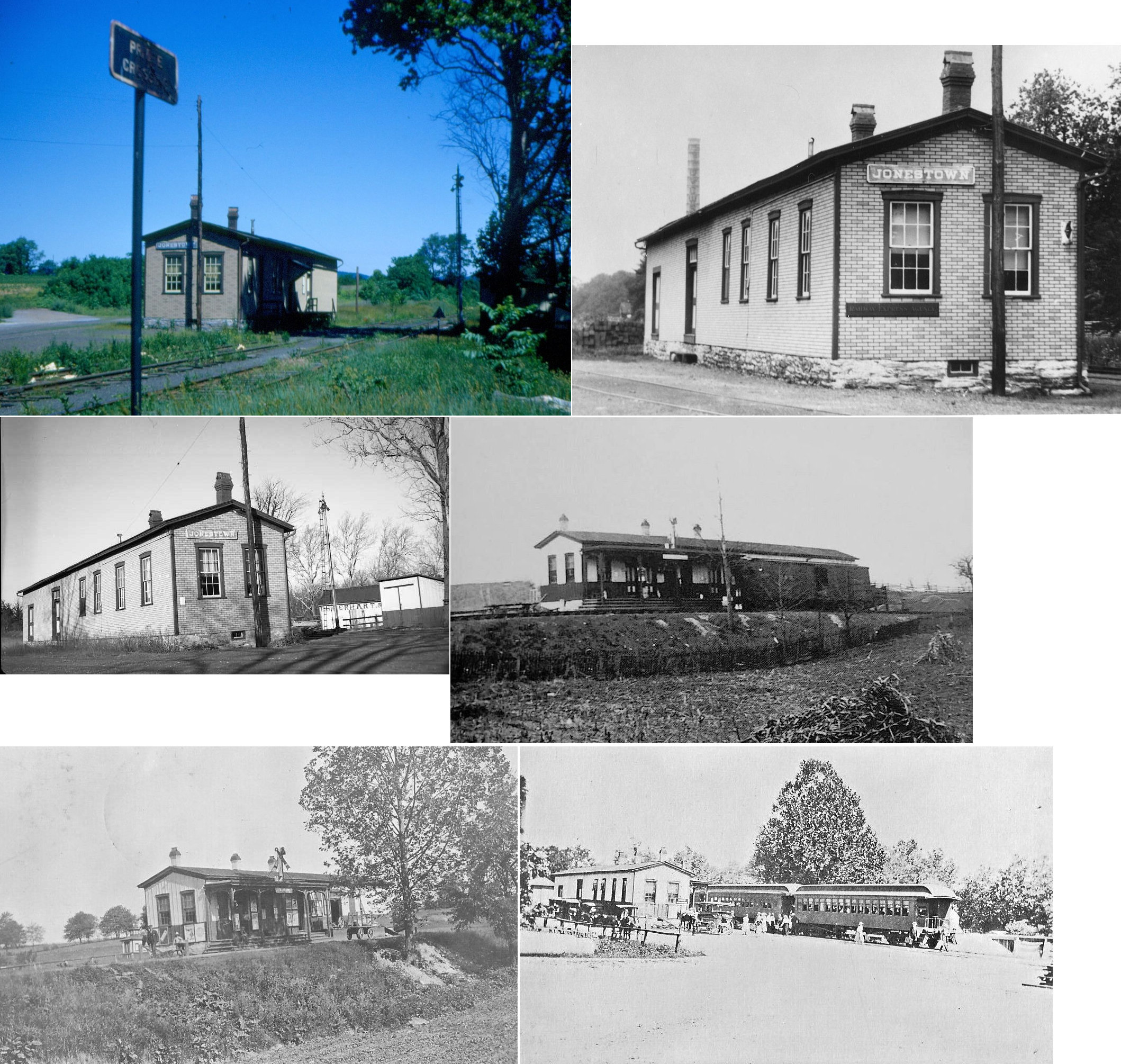
| Jonestown |
|
|||||||
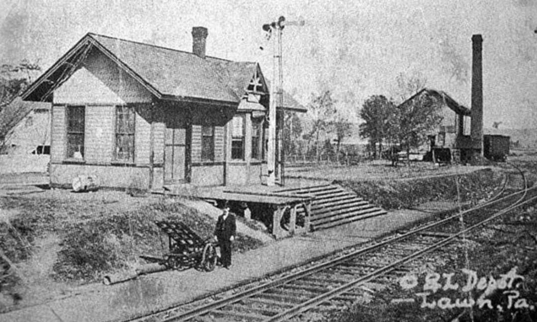
| Lawn |
|
This station was on the north side of Lawn Road/Railroad Street on the west side of the tracks at GPS: 40.221518, -76.539485. | ||||||
| Lebanon |
|
The original frieght house was on the connectiong track between the C&L and the P&R. It was just south of the P&R tracks on North 8th Street at Scull Street at GPS: 40.343047, -76.425216. This station is shown on the 1887 Sanborn map. By 1891 it was replaced by a larger freight house (see listing below). The building is still shown on the 1896 through 1912 maps, but it is labeled as housing a restaurant and barbershop. This may be the same building that is still standing at that location, but more research would be needed. Here is the 1887 map showing the depot. | ||||||
| Lebanon |
|
A new, larger freight house was built between 1887-1896. It was on North 8th Street at GPS: 40.342587, -76.426389. The station was remodeled and extended to the east (toward Doe Alley) in 1918. | ||||||
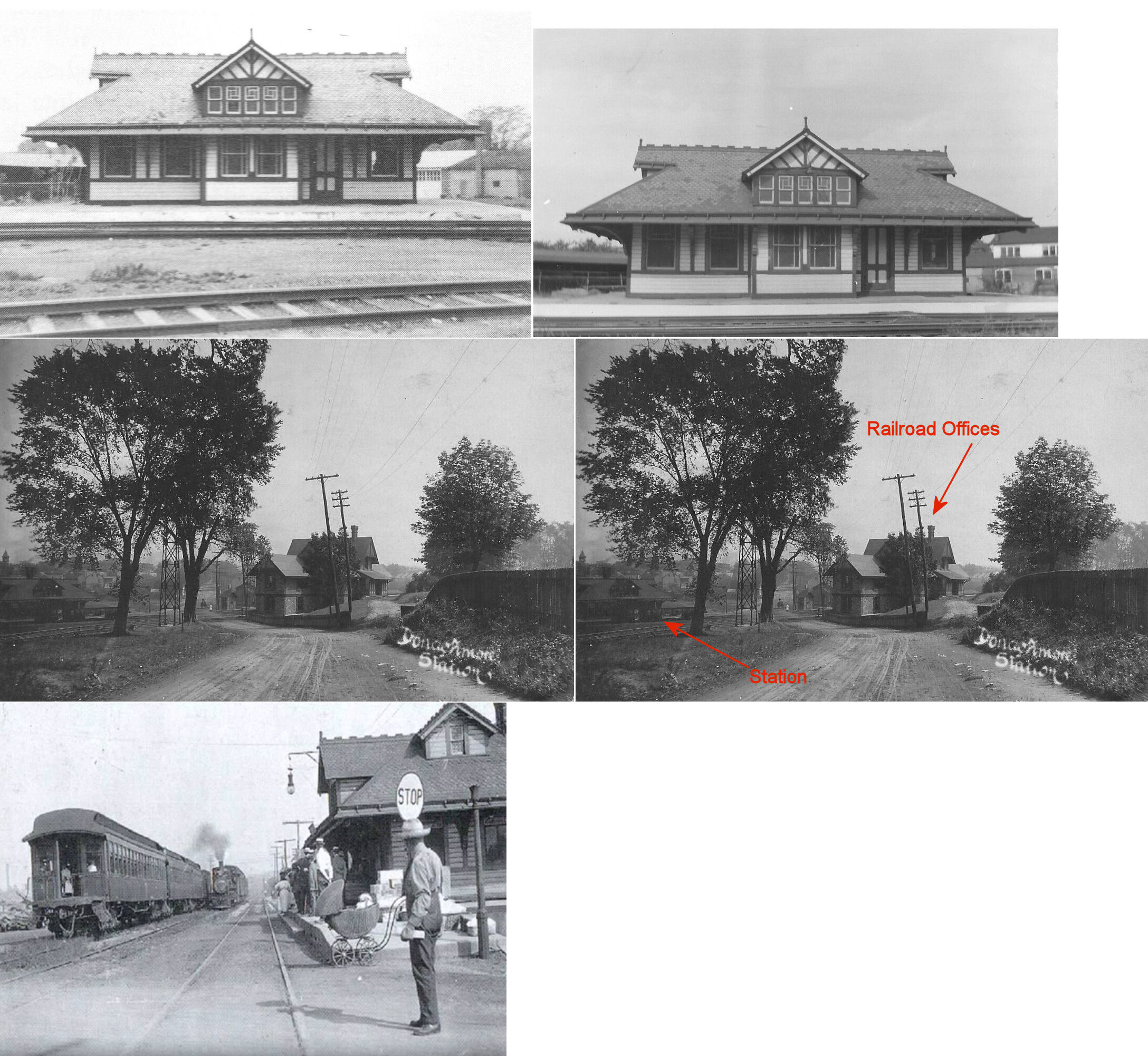
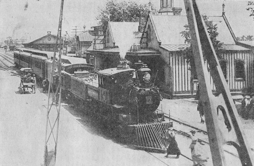
| Lebanon (Donoughmore) |
|
This station was demolished in 1974. The brick building at 1300 Chestnut Street that still stands looks like a station, but was the general office building for the Cornwall Railroad. The actual station was across the street from the office at 1300 Chestnut. This was actually known as the Donoughmore station, just on the western edge of Lebanon City. In fact, the Cornwall RR did not have their own Lebanon station but had trackage rights and used the Lebanon station of the Reading Company. | ||||||
| Lebanon |
|
The original station was in the same location as the station that is still standing at North 8th and Scull Street (GPS: 40.343188, -76.424260). The original freight station was just to the east (as seen in the photo). | ||||||
| Lebanon |
|
A new frame freight station was built here in 1895. It was between the passenger station and North 7th Street at GPS: 40.343287, -76.422939. The station was replaced by the one listed below in 1926. | ||||||
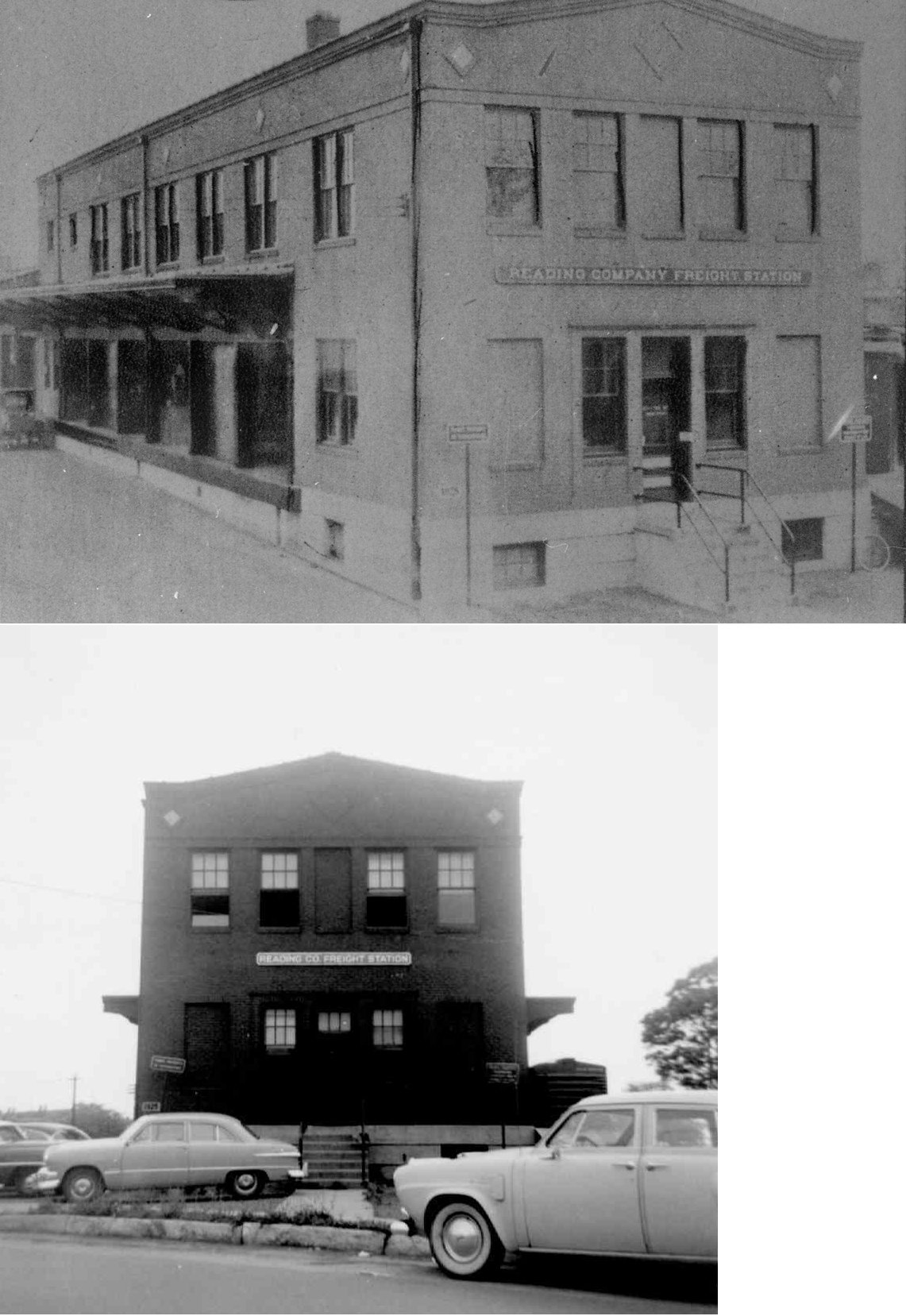
| Lebanon |
|
This brick freight station was built in 1925/1926 on North 7th Street. It featured a large crane, had 19 rolling shutter doors and measured 30'x240'. | ||||||
| Lickdale |
|
|||||||
| Midway |
|
|||||||
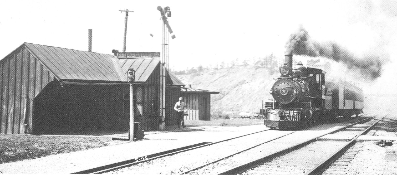
|
Miners Village (Cornwall) |
|
This station was located near the edge of the open pit iron ore mine in Cornwall and the site was swallowed up by expansion of the pit. The rows of miners' homes along Boyd Street sit northeast of the site. | ||||||
| Miners Village |
|
This photo was labeled as a station at Miners Village, but it didn't say what the RR was. I believe both the Cornwall Railroad and the Cornwall & Lebanon went to Minersvillage, so I assume this was the C&L station, but not 100% sure (it may be a different generation Cornwall RR station). Can anyone confirm/deny for sure? | ||||||
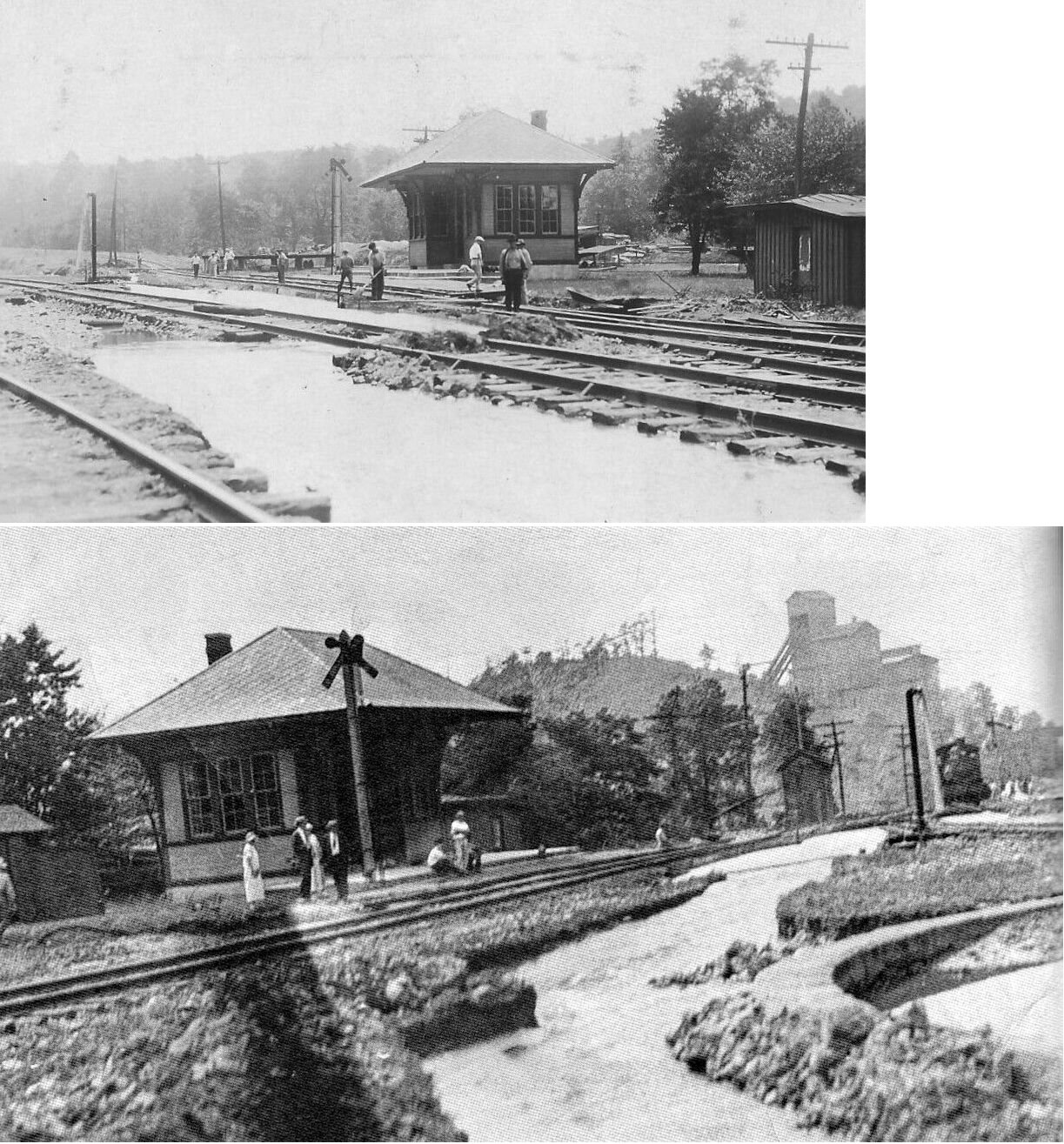
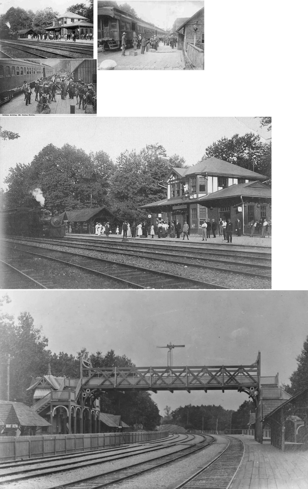
| Mt. Gretna |
|
The village of Mt. Gretna was created in 1889 as a summer colony by Robert Habersham Coleman, an iron processing and railroad industrialist whose Cornwall Iron Furnace still stands nearby and is open to the public. The community was a pleasure stop on Coleman's Cornwall and Lebanon Railroad. Between 1889 and 1916, when it was shut down, Mount Gretna was also the terminus of the C&L RR subsidiary line known as the Mount Gretna Narrow Gauge Railway, a tourist railway that ran to the top of Governor Dick Mountain nearby. | ||||||
| Murray |
|
|||||||
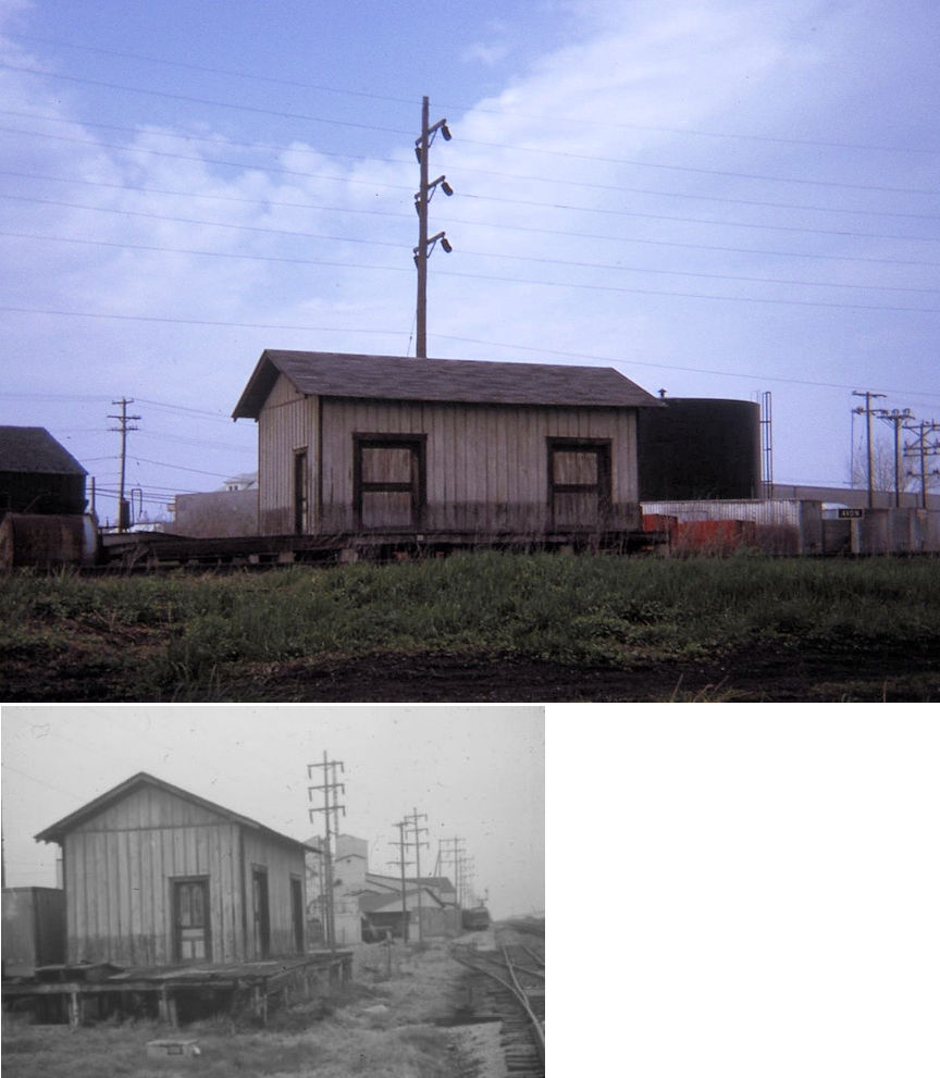
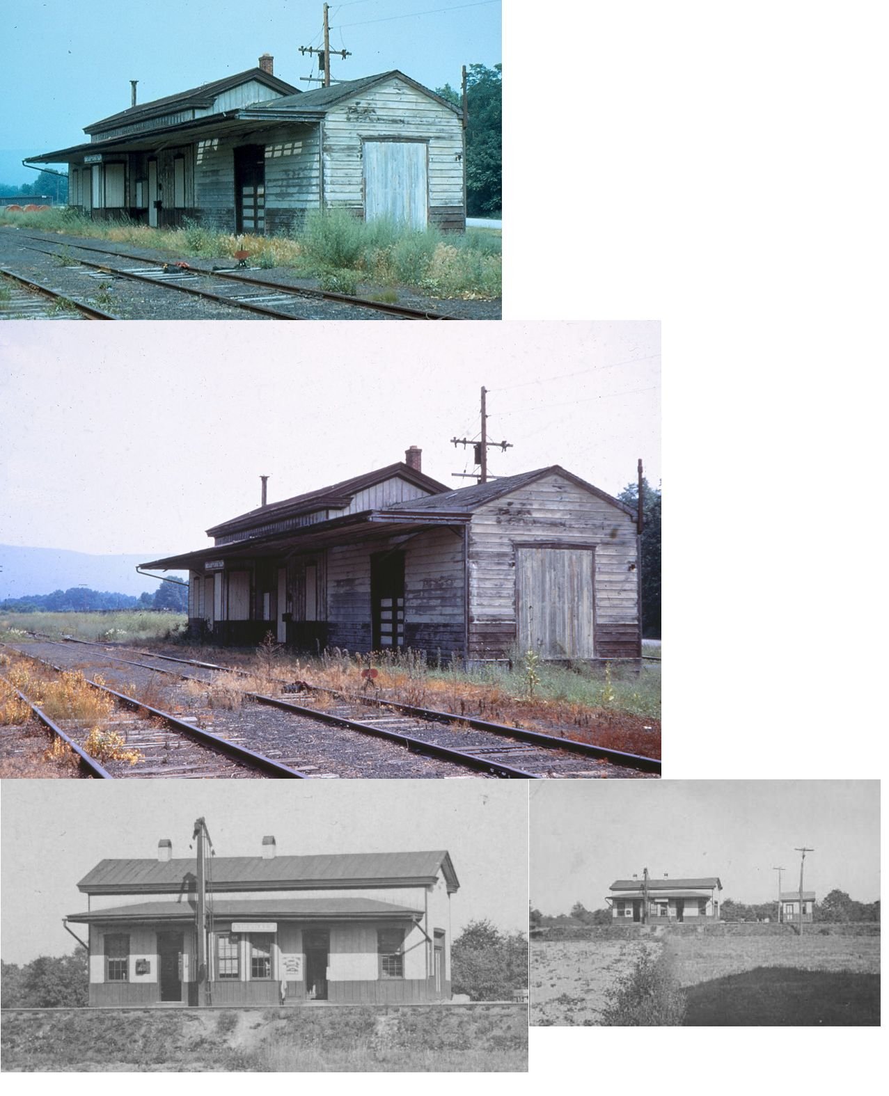
| Myerstown |
|
This station was built in 1858 and was demolished in 1957. It was on the north side of the tracks west of South Railroad Street at GPS: 40.364945, -76.303462. The station caught on fire in 1914 when a painting crew was using torches to burn old paint off the building, but was saved by the fire department (from the Pittston Gazette, 7/28/1914). | ||||||
| Overlook |
|
|||||||
| Palmyra |
|
This was the original station that was replaced by the one that is still standing. It served from 1857 to 1910 and sat on the same site as the existing station. | ||||||
| Palmyra |
|
There was a freight station across the tracks from the passenger station. It was on the NE side of Railroad Street on the south side of the tracks at GPS: 40.312361, -76.599618. | ||||||
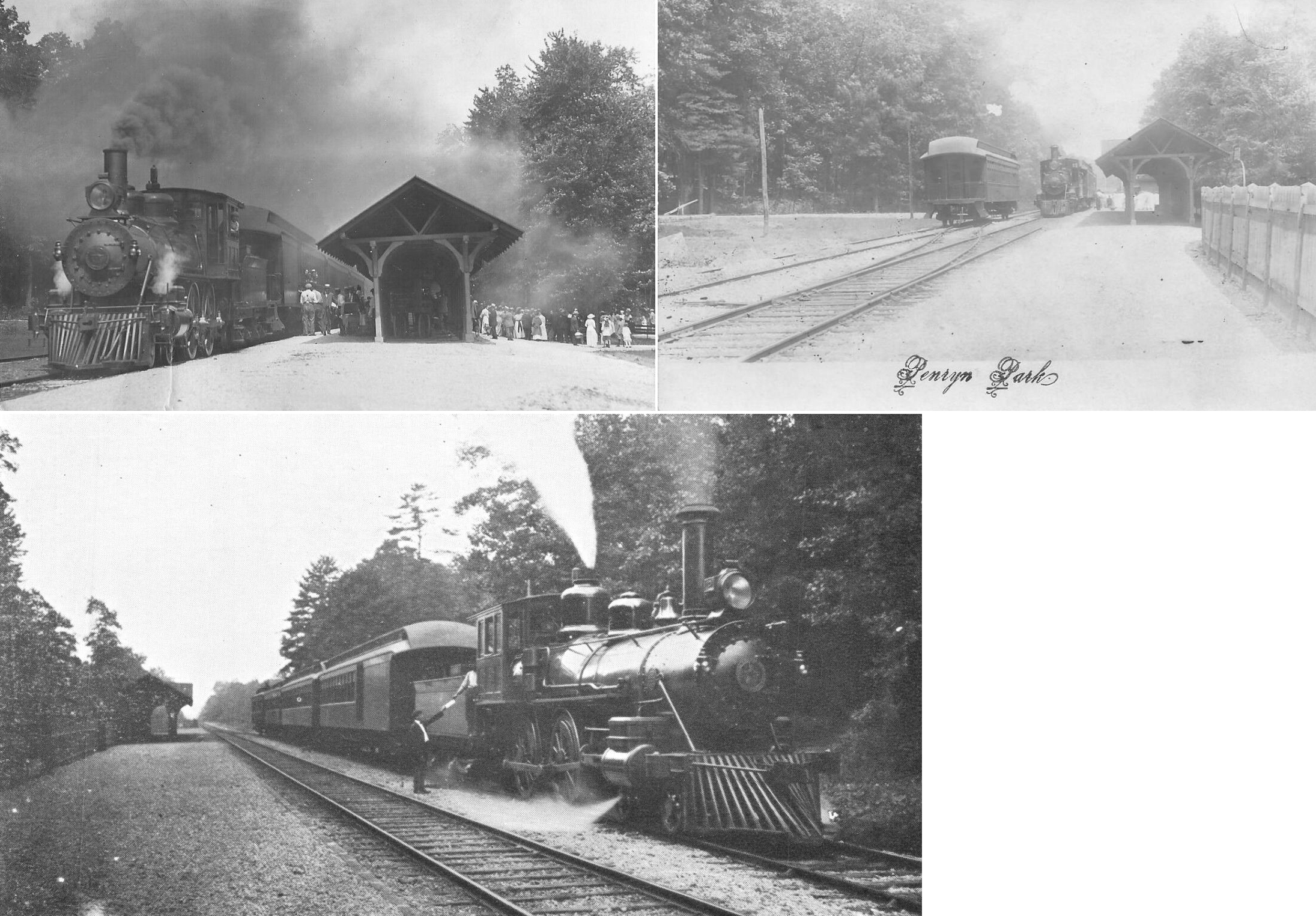
| Penryn Park |
|
The station was along what is now Penryn Lane (the former grade) at approximately GPS: 40.246392, -76.391689. As of 2024 the park is known as YMCA Camp Rocky Creek. | ||||||
| Prescott |
|
|||||||
| Ramona |
|
|||||||
| Rausch Gap |
|
|||||||
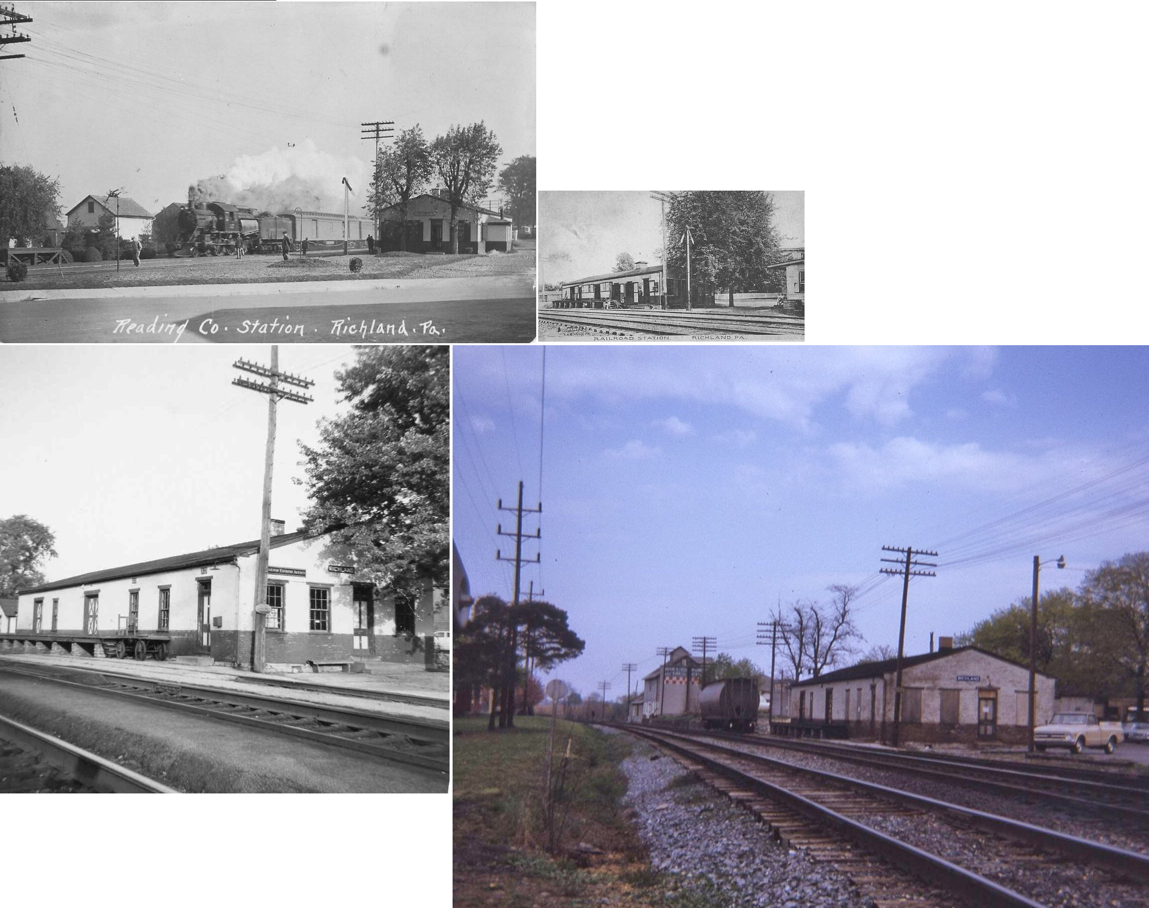
| Richland |
|
|||||||
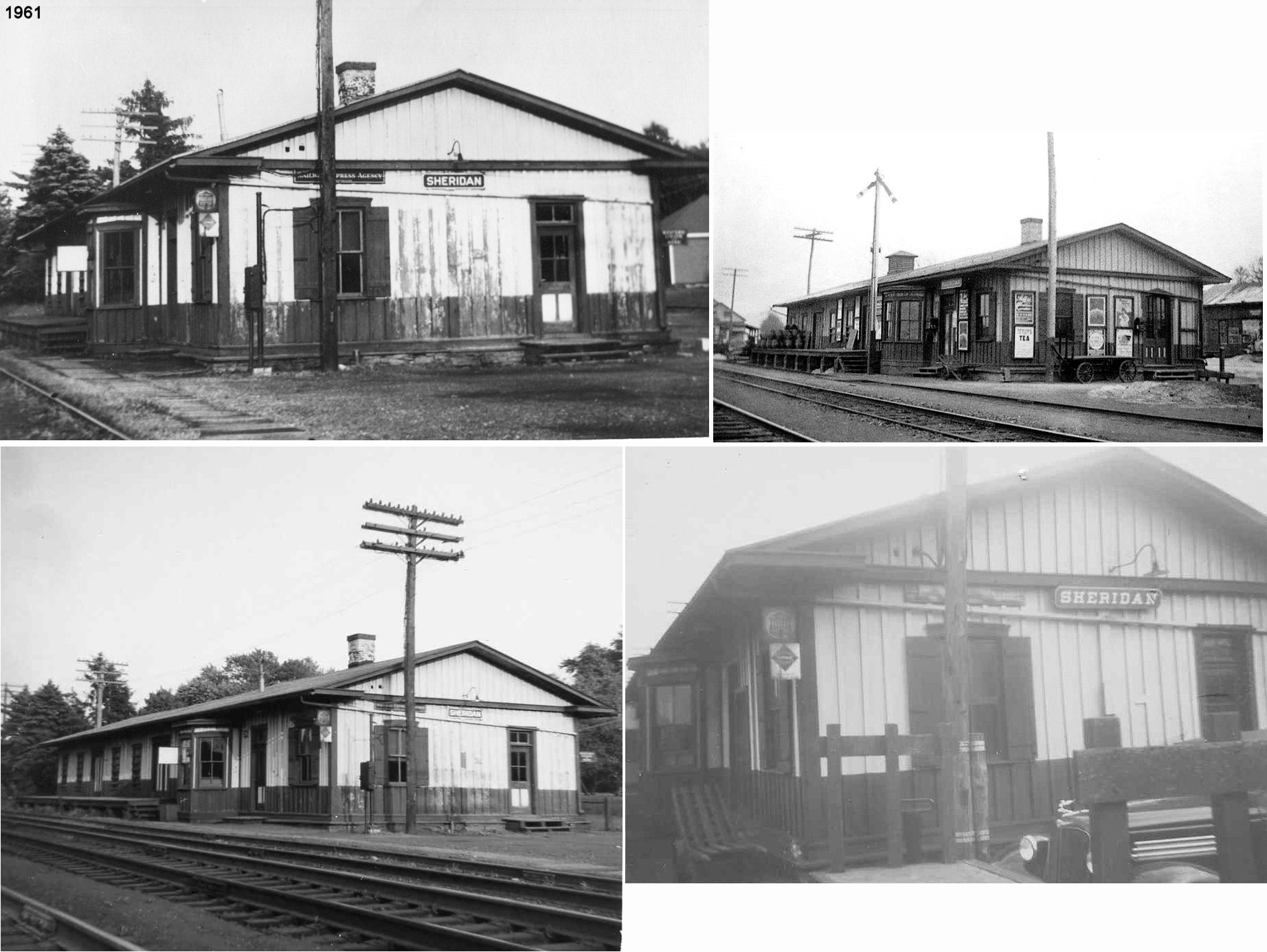
| Sheridan |
|
Built in 1856, this station was on North Street on the south side of the tracks at GPS: 40.357924, -76.224096. | ||||||
| Westmont |
|
|||||||
| Yellow Spring |
|
|||||||
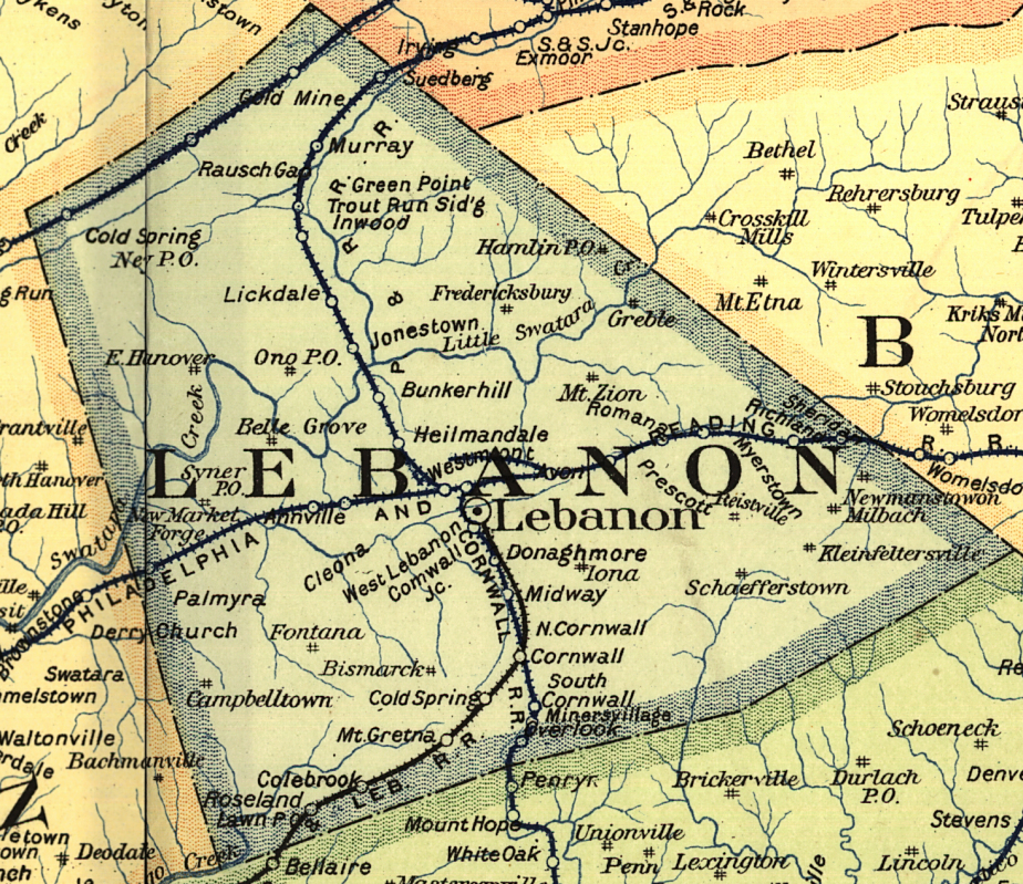
| 1895 LEBANON COUNTY RAILROAD MAP | ||||||||
 |
||||||||
| Notes About Existing
Stations... Annville (RDG) - The station was moved from its original location for restoration work by a local historical group. Cornwall (Cornwall RR) - Station is currently owned by the Borough of Cornwall and is used as their municipal building and police department. It previously housed the post office for Cornwall even during its years as an active station. A major addition to the board-and-batten frame structure sits on the area once occupied by three tracks, now, of course, torn up. It was built sometime prior to 1883. The Cornwall RR ceased operations in 1964, at which time the road was leased to the Reading Co. The Reading then purchased the right of way in 1968. Prior to the sale to the Reading, the Cornwall RR had sold its engine house and shops, office building and the Cornwall station. -- Tom Edkin Myerstown (RDG - Freight) - As of 2014 it housed Ray W. Moyer Plumbing & Heating. Palmyra (RDG - Passenger) - The station housed the Palmyra Train Shop for a while, but has since been renovated into an event space. Palmyra (RDG - Freight) - This station may have been moved or was built after 1911. The 1911 Sanborn map shows the RDG freight station at the corner of East Front and North Railroad at GPS: 40.312296, -76.599593. |
||||||||