|
|
||||||||
| EXISTING STATIONS | ||||||||
|---|---|---|---|---|---|---|---|---|
| Station Name |
Original Railroad |
Current Location |
Type | Current Use |
Date Built |
Track Status |
Building Material |
More Info |
| Brockway |
 |
Alexander Street and 4th Avenue (GPS: 41.250248, -78.798626) |
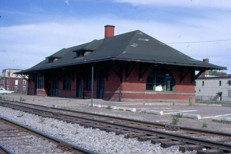
P | Civic | 1913 | In Use | Brick | |
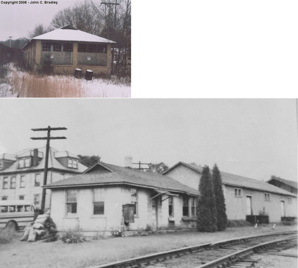
| Brookville |
 |
Western Avenue at 2nd Street (GPS: 41.150617, -79.081218) |
F | Storage | ???? | Gone | Wood | |
| Brookville |
 |
North side of Lincoln Street west of McKinley Street (GPS: 41.150651, -79.072954) |
C | Vacant | ???? | In Use | Brick | |
| STATIONS OF THE PAST | ||||||||
| Station Name |
Original Railroad |
Notes | ||||||
| Anita |
 |
A new was opened here by the Pennsylvania & Northwestern RR in 1896. | ||||||
| Allens Mills (Allen) |
|
This station was on the west side of the bend in Allens Mills road after crossing Mill Creek coming from the east. | ||||||
| Baxter Station |
|
A station is shown here on the 1878 county map and on the 1923 PRR List of Stations & Sidings. | ||||||
| Beechton |
|
|||||||
| BeechTree |
|
This station was on the Beechtree Branch that ran from Lanes Mills to Coal Glen. | ||||||
| Bells Mills |
|
|||||||
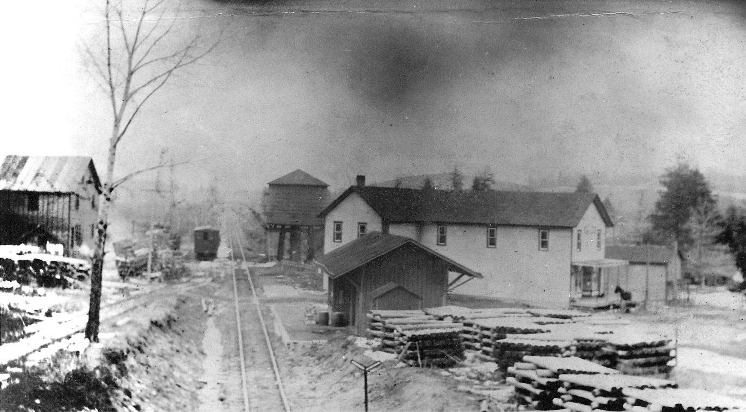
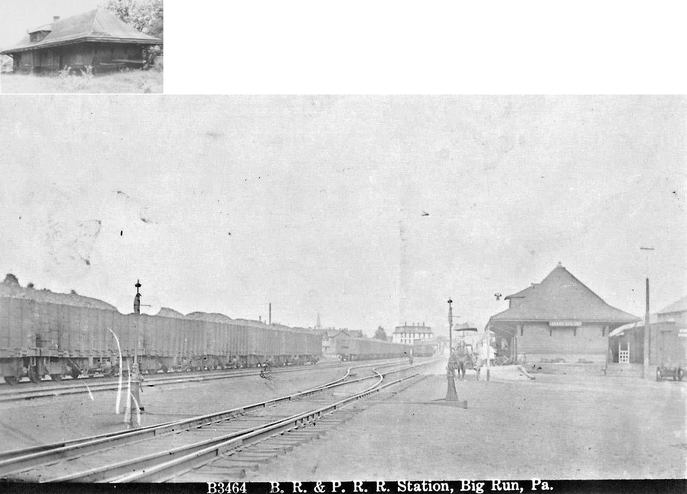
| Big Run |
|
This station was on Station Street behind the Big Run Public School at GPS: 40.967724, -78.876898. It was built in 1897. Big run was on the BR&P's Eleanora Branch. | ||||||
| Blue Rock |
|
This station was north of Brockway near the Elk County line. According to the 1918 PRR valuation records, there was only a platform here at that time. | ||||||
| Bowersville |
|
|||||||
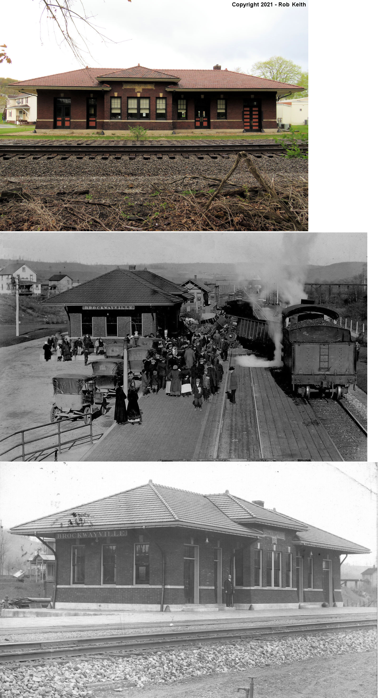
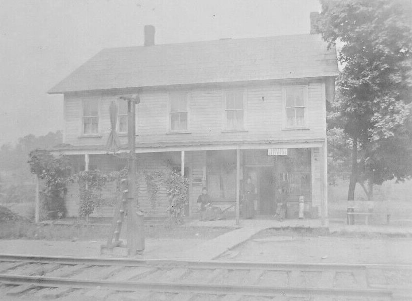
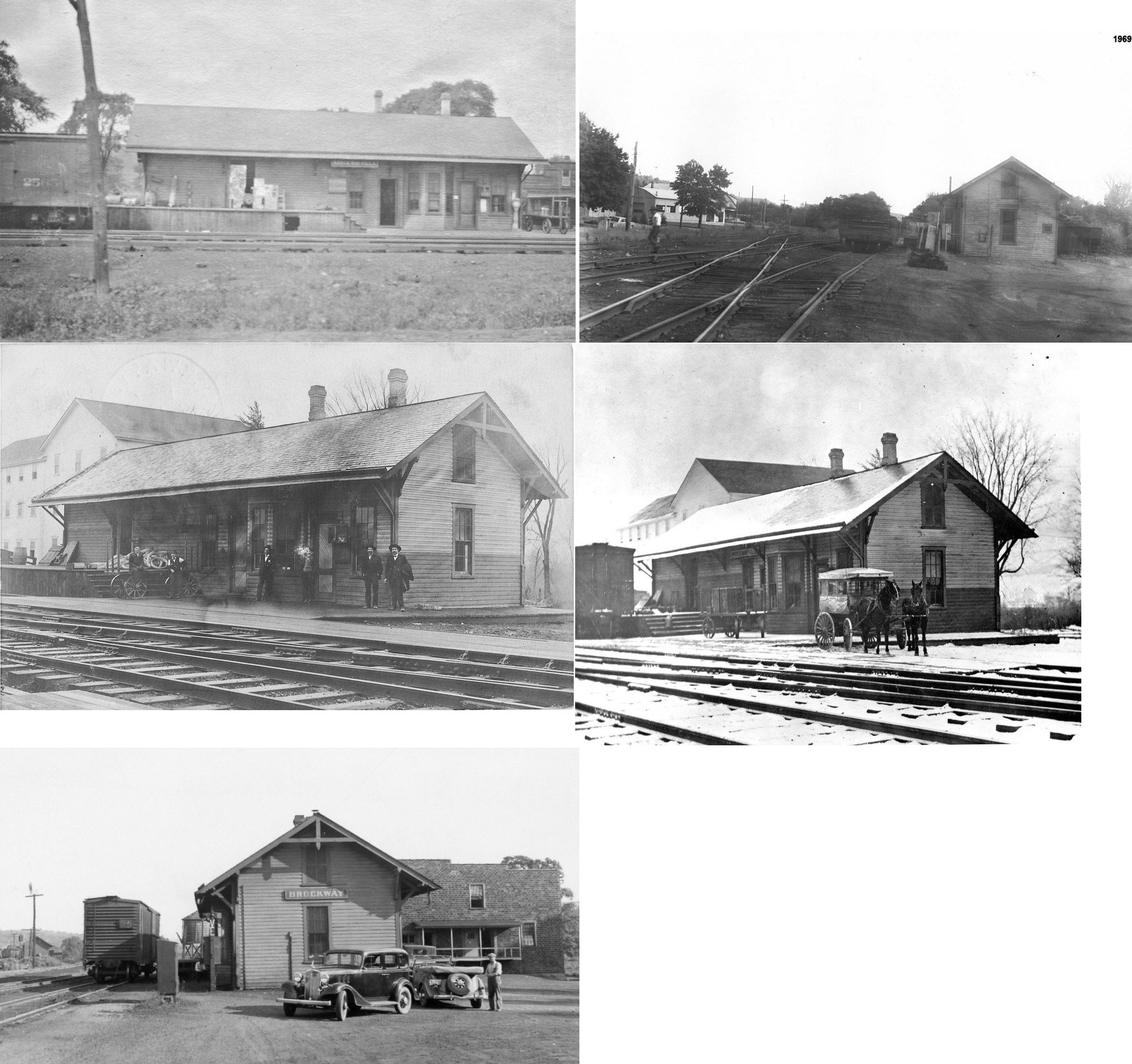
| Brockway |
|
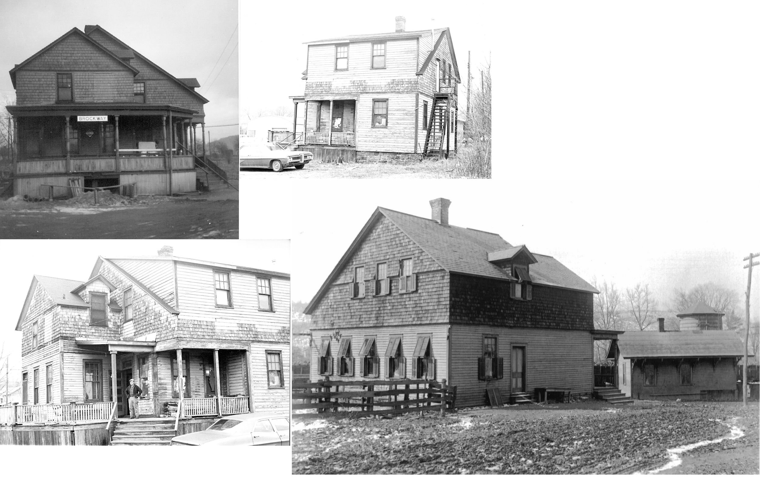
This station was on the south side of Main Street on the west side of the tracks (GPS: 41.246729, -78.786971). It was built in 1884 according to PRR valuation records. | ||||||
| Brockway |
|
The PS&N had its own station, but also stopped at the Erie station as well (according to the 1915 PS&N timetable). | ||||||
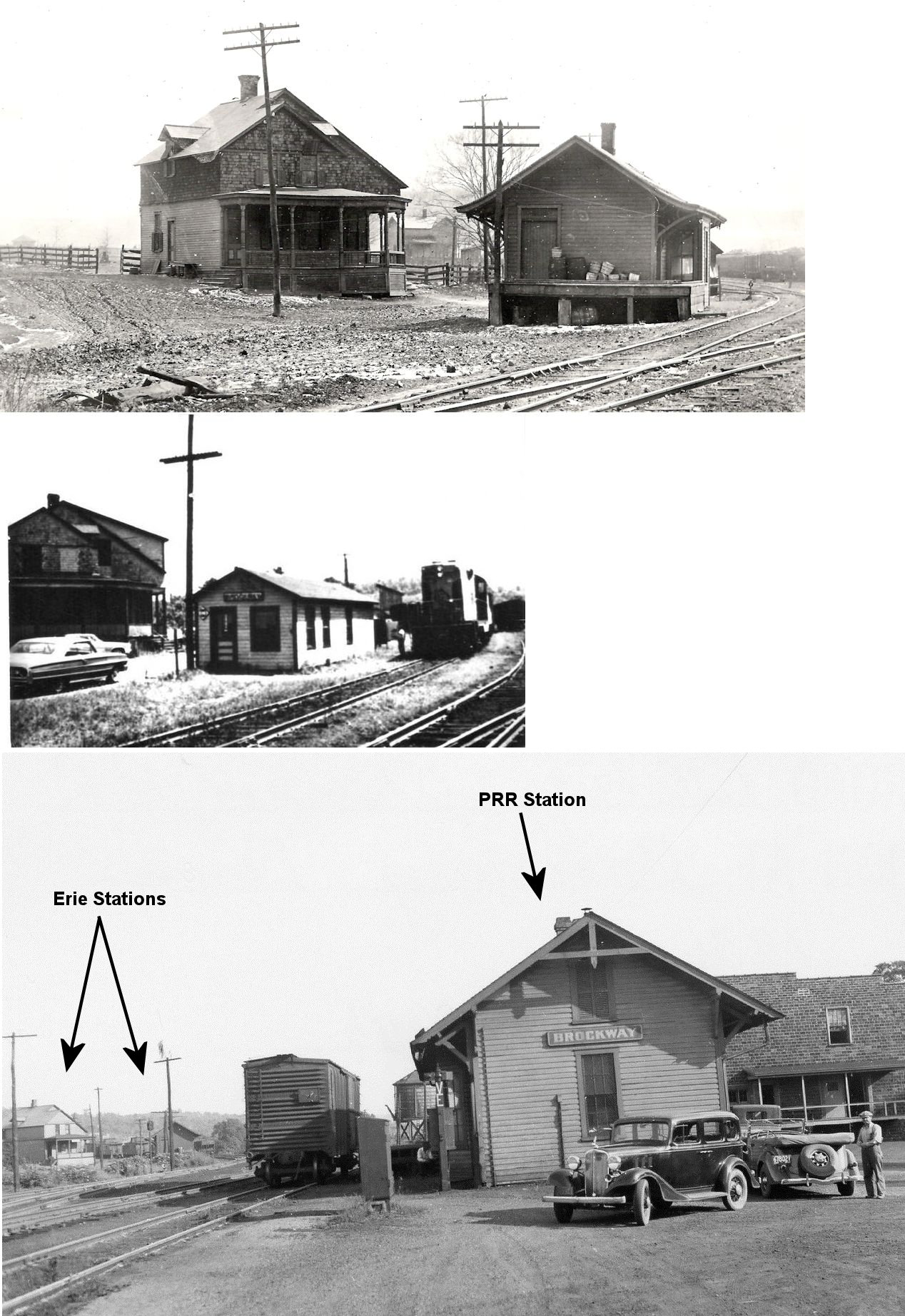
| Brockway |
 AND |
The Erie passenger station was at the corner of Depot Street and Bond Street (GPS: 41.245164, -78.785657). It also housed the RR offices here and was not right next to the tracks. The PS&N also used this station. | ||||||
| Brockway |
|
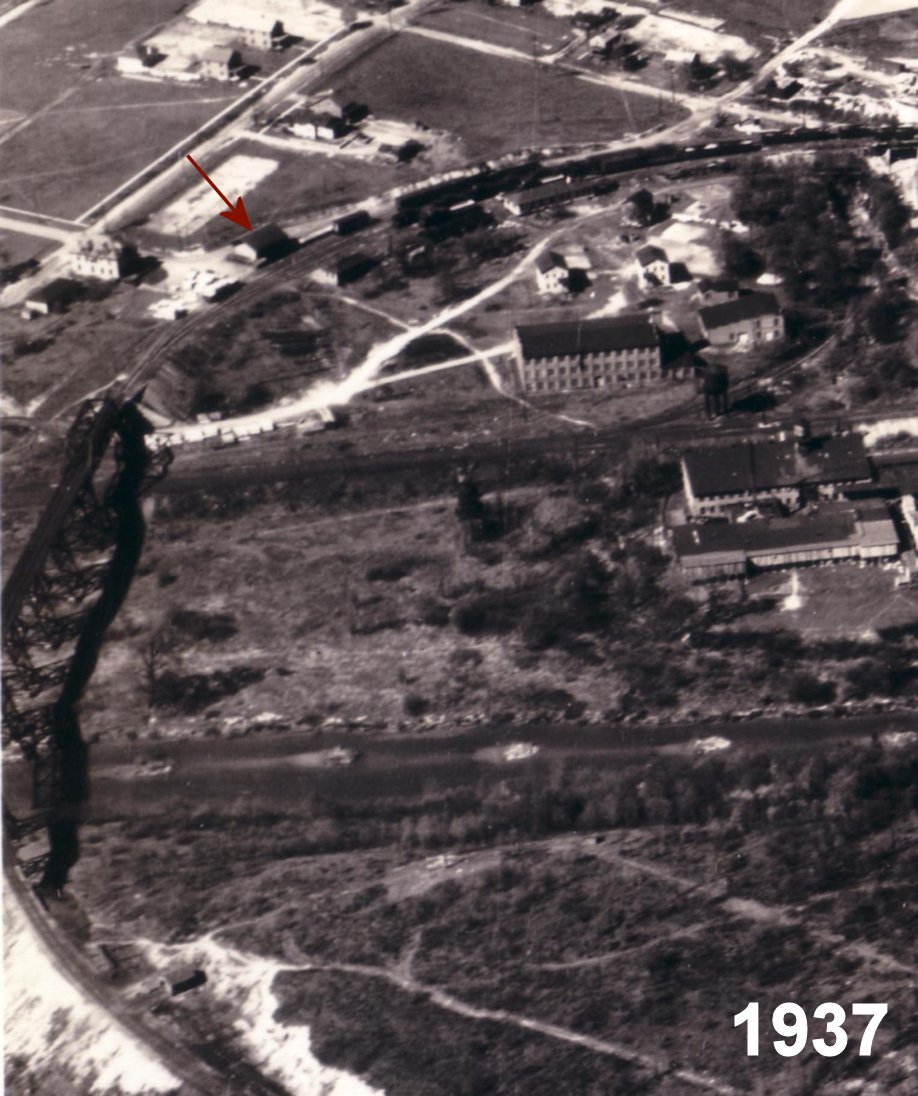
This freight station was just to the west of the passenger station/offices along the tracks at GPS: 41.245249, -78.786027. It appears that in later years only a portion of this station remained or a new smaller station was constructed (see photos). | ||||||
| Brockway |
|
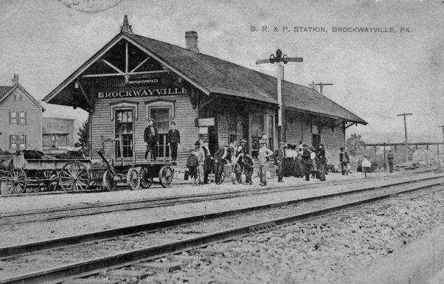
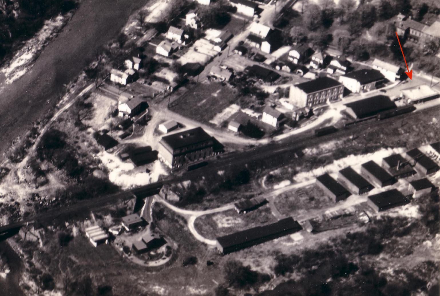
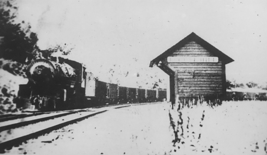
This was the old BR&P station taken when Brockway was still called Brockwayville. Built in the early 1880s, it was at the same site as the existing station (GPS: 41.250248, -78.798626). When the new station was built, it was moved 200 feet north and served as the freight station. It burned down on August 11, 1924. Following the fire, an old boxcar was used as a freight station. Not sure if an new one was built sometime after that. | ||||||
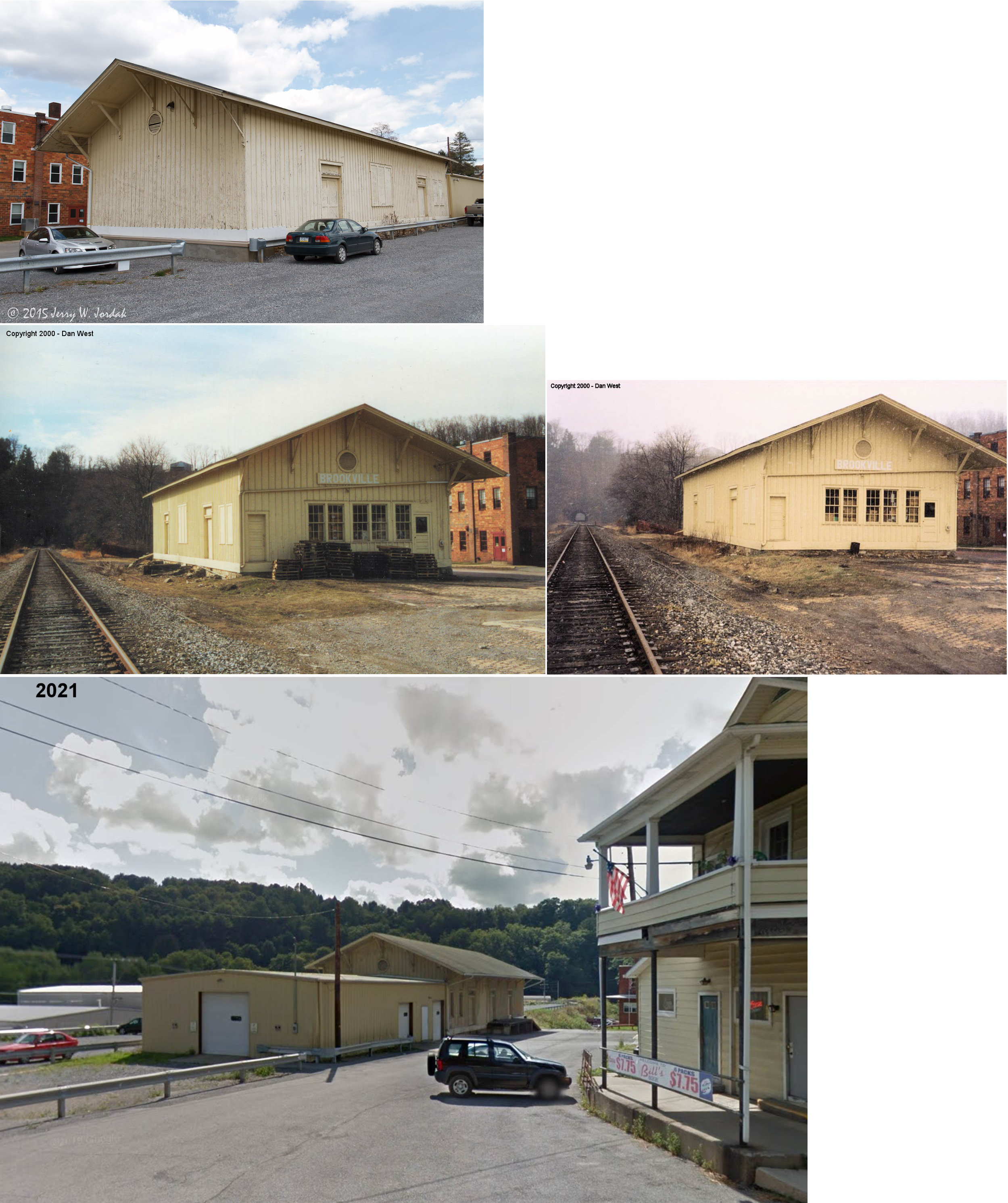
| Brookville |
|
There was freight station at the end of 5th Street just past Long Avenue at GPS: 41.150713, -79.074038. | ||||||
| Brookville |
|
The original passenger station here was on the west side of 2nd Street on the south side of the tracks (GPS: 41.150414, -79.081019). It appears on maps from 1887-1910. The station was originally on the west side of the tunnel, but the AVRR moved it in 1887 to the east side. | ||||||
| Brookville |
|
On the 1923 map a new PRR passenger station is shown. It is on the west side of 2nd street on the north side of the tracks (GPS: 41.150599, -79.080672). It was in front of (on the east side) of the Allegheny Valley freight station (which is still standing). | ||||||
| Carrier |
|
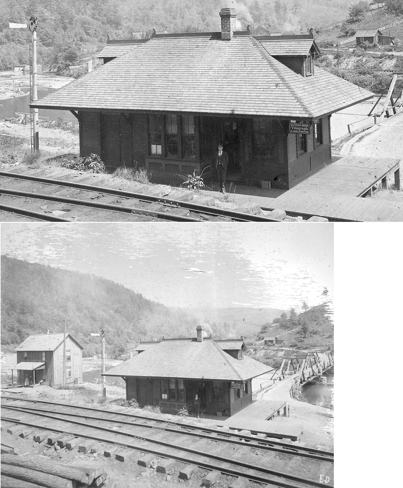
Built June, 1893. Photo from 1896. Some old maps have Carrier located in Elk County, but it was in fact in Jefferson County at GPS: 41.287800, -78.835100. | ||||||
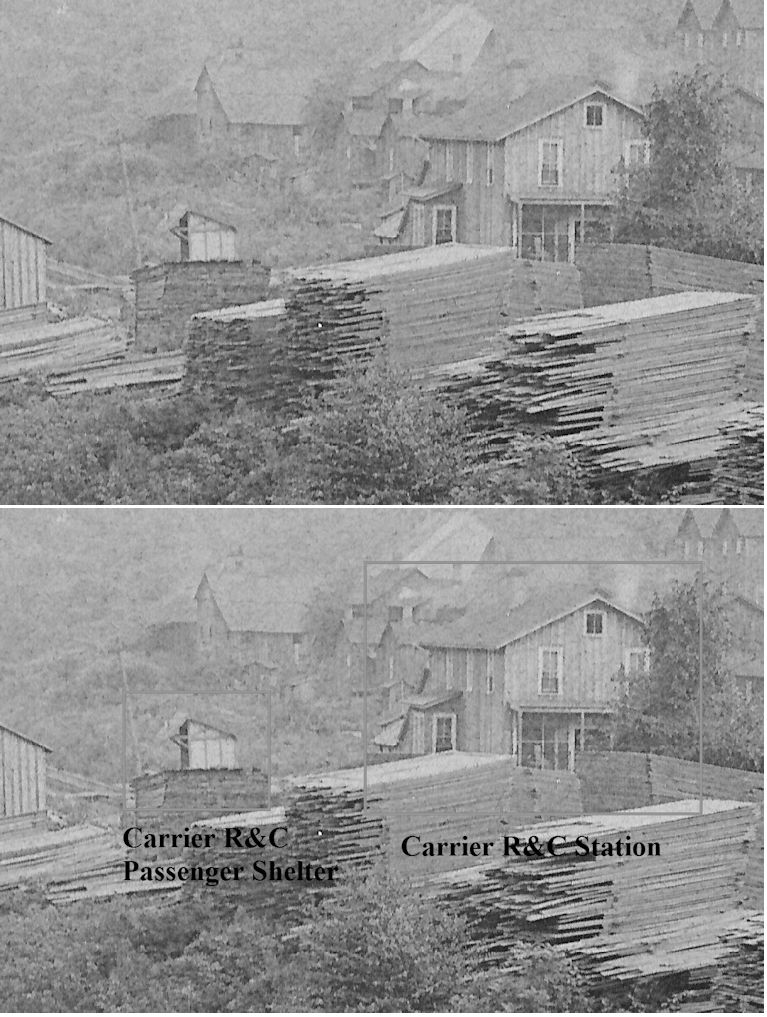
| Carrier |
|
This was a Ridgway & Clearfield RR station located at GPS: 41.290970, -78.835050. According to PRR valuation records, a new passenger shelter was built here in 1898. | ||||||
| Carrier |
|
A station is shown here on the 1878 county map. | ||||||
| Cloe |
|
|||||||
| Coal Glen |
|
This station was on the Beechtree Branch that ran from Lanes Mills to Coal Glen. | ||||||
| Coder |
|
A station is listed here on the 1923 PRR List of Stations & Sidings. | ||||||
| colon |
|
|||||||
| Conifer |
|
Terminus of the Conifer Branch. | ||||||
| Coulter |
|
|||||||
| Cramer |
|
|||||||
| Cravens |
|
This station was on the Beechtree Branch that ran from Lanes Mills to Coal Glen. There may not have been an actual station here as this was listed as a flag stop on the 1902 timetable. | ||||||
| Crenshaw |
|
|||||||
| Dora |
|
|||||||
| East Branch |
|
|||||||
| Elbell |
|
|||||||
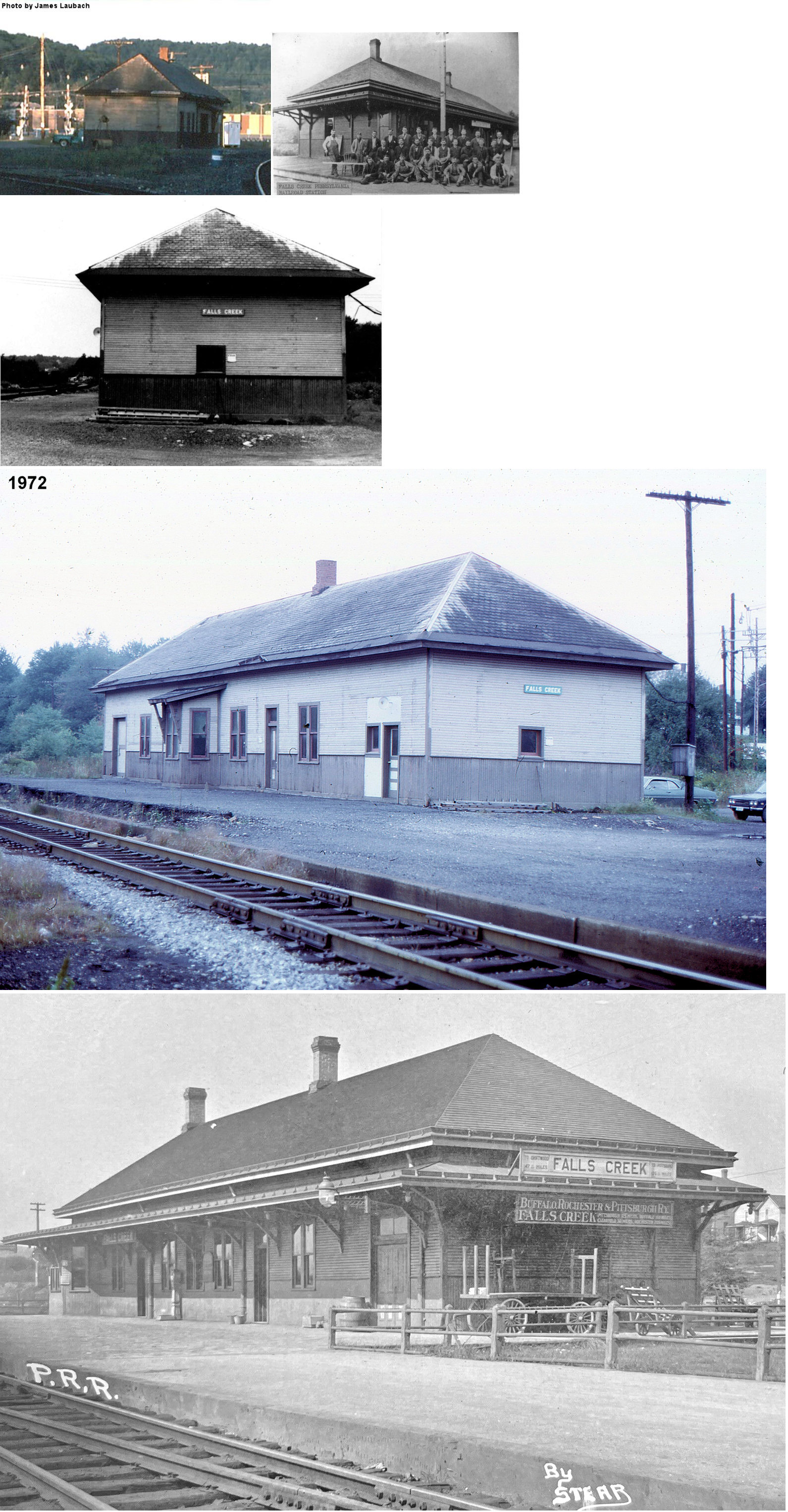
| Falls Creek |
AND  AND |
Shown on the 1878 map as the first station in Clearfield County on this line in Brady Township. This small 10x12 "coop" depot, called the "W Box," (Reynoldsville Star, 9-28-1892) was eventually used by all three railroads in Falls Creek. | ||||||
| Falls Creek |
AND |
The AVRR built a new 25'x100' station in 1893 that stood until the early 1980s. Before the BR&P built its own station it was a tenant at the AVRR station. This station was on Slab Run Road in the NW corner of the diamond at GPS: 41.142127, -78.794597. Although most of Falls Creek is in Jefferson County, the PRR and BR&P stations were just over the line in Clearfield County. | ||||||
| Falls Creek |
|
The BR&P station was in the SW corner of the diamond just south of where F.C. tower still stands today (as of 2021) off Slab Run Road. It was at GPS: 41.141886, -78.793969. | ||||||
| Forest Hill |
|
This small shelter station is pictured on Page 83 of the BR&P book by Paul Pietrak. It was along the BR&P north of Brockway and south of the Empire Tunnel. The photo suggests it was near Bliss Run on the north side of the BR&P tracks, near GPS 41.287598, -78.834778 | ||||||
| Forestville |
|
This station was between Carrier and Brockway. | ||||||
| Fuller Station |
|
A station is shown here on the 1878 county map. | ||||||
| Garrison Station |
|
A station is shown here on the 1878 county map. | ||||||
| Glenn |
 |
According to NYC valuation records, a 10'x16' combination passenger shelter/tool house was built here in 1906. | ||||||
| Hamilton |
|
|||||||
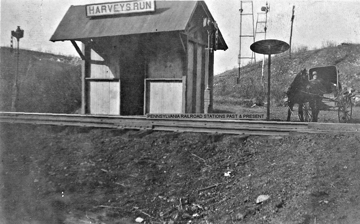
| Harveys Run |
|
|||||||
| Heathville |
|
A station is shown here on the 1878 county map as well as on the 1923 PRR List of Stations & Sidings. It was on Strausser Road near Heathville-Ohl Road. | ||||||
| Horatio |
|
The station here burned down in February 1903 (The Jeffersonian Democrat, 2-13-1903). | ||||||
| Horatio |
|
|||||||
| Hunts run |
|
Was on the Conifer Branch. | ||||||
| Iowa |
|
A station is listed here on the 1923 PRR List of Stations & Sidings. | ||||||
| Indian Camp |
|
|||||||
| Keystone |
|
|||||||
| Knoxdale |
|
|||||||
| Lanes Mills |
|
|||||||
| Lanes Mills |
|
This station is shown on the Ridgway Branch on the 1923 PRR List of Stations & Sidings. According to PRR valuation records, a new passenger shelter was built here in 1898. | ||||||
| Lindsay |
|
|||||||
| Mauk |
|
|||||||
| Mc garys |
|
Was on the Conifer Branch. | ||||||
| MC Minns Summit |
|
This station is shown on the Ridgway Branch on the 1923 PRR List of Stations & Sidings. The 1918 PRR valuation records also list a passenger station here. | ||||||
| Meredith |
|
A station is listed here on the 1923 PRR List of Stations & Sidings. | ||||||
| Norman |
|
|||||||
| O'Donnell |
|
A station is listed here on the 1923 PRR List of Stations & Sidings. | ||||||
| Pancoast |
|
A station is listed here on the 1923 PRR List of Stations & Sidings. | ||||||
| Pattons Station |
|
A station is shown here on the 1878 county map. | ||||||
| Phalen |
|
A freight station is listed here on the 1923 PRR List of Stations & Sidings. It does not appear on the county maps of the time, but it was located 2.6 miles south of Heathville. That puts it in the vicinity of the former end of Township Road 31 which followed along Patton Run to where it emptied into Redbank Creek. The station was in the vicinity of GPS: 41.060118, -79.204018. Does anyone know what the purpose of a freight station at this remote location would have been? | ||||||
| Port Barnett |
|
|||||||
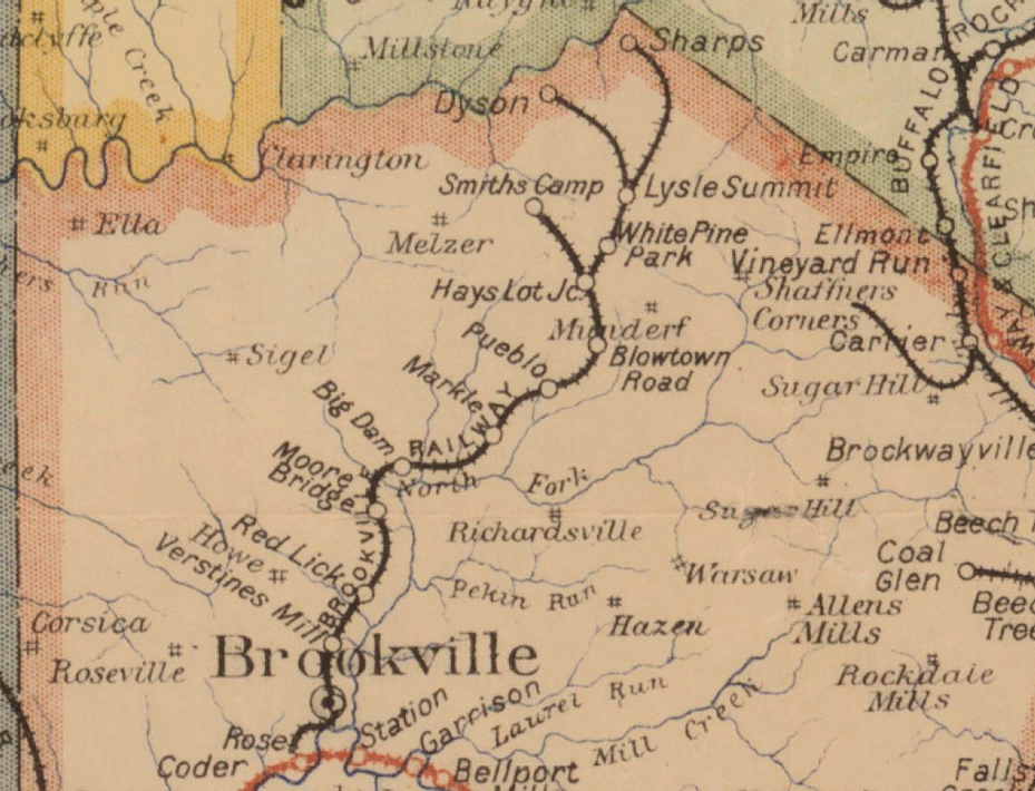
| Pueblo Station |
|
The Brookville Railway ran from the junction of the Brookville Branch to east of Pueblo Station. It also indicated that the line was operated by the PRR and leased by the Allegheny Valley. The line was 12.08 miles long.Other sources say the RR was shut down in 1905 and bought that year by the PRR then subsequently torn up in 1907. This may have been a logging-only RR and may not have had passenger service. Here is a map showing the Brookville Railway. | ||||||
| Puxatawney (Clayville) |
|
This station was on the southwest corner of West Mahoning Street and Sycamore Street on the north side of the tracks at GPS: 40.942134, -78.983479. | ||||||
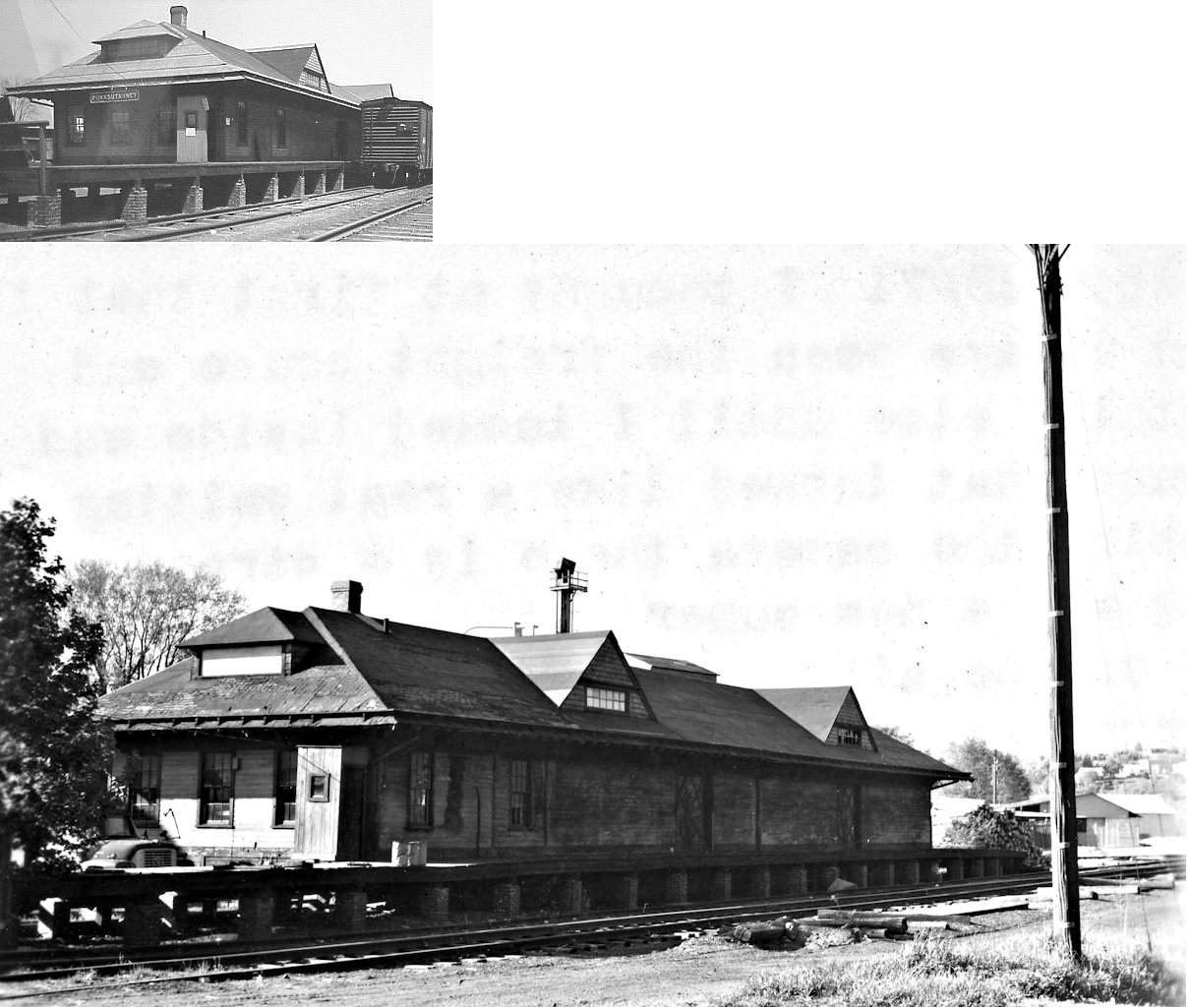
| Punxsutawney |
|
The original 1880s-era passenger station was on the east side of North Findlay Street on the south side of the tracks at GPS: 40.945774, -78.971846. It was moved to a location near Groundhog Plaza on the east side of Penn Street on the south side of the tracks at GPS: 40.946558, -78.969381 where it served as an express freight station and yard office over the years. The station was torn down in 1997 or 1998. | ||||||
| Punxatawney |
|
The original freight station was SW of North Findlay Street behind what is now Groundhog Lanes Bowling Alley at GPS: 40.945421, -78.972927. It was built in 1887 and in 1901, and again in 1916, large platforms were added to both sides. It was demolished in the early 1980s. | ||||||
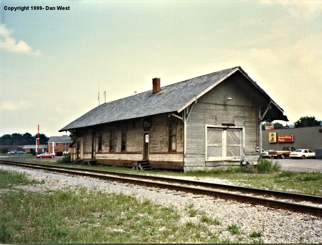
| Puxatawney |
|
In 1903 a new brick passenger station was built at the north end of Jefferson Avenue on the south side of the tracks at GPS: 40.946035, -78.970923. It was torn down in 1981. | ||||||
| Punxsutawney |
|
This Pennsylvania & North Western RR (later PRR) freight station was on the north side of East Mahoning Street at GPS: 40.945162, -78.962363. | ||||||
| Ramsaytown |
|
|||||||
| Reitz |
|
|||||||
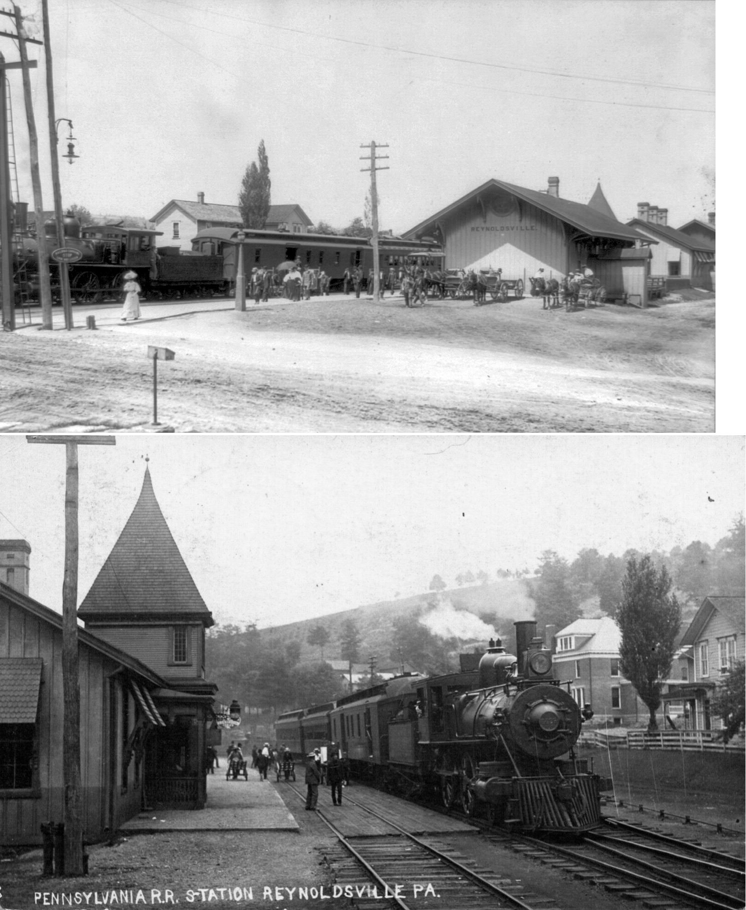
| Reynoldsville |
|
The passenger station was on the north side of West Main Street on the east side of the tracks at GPS: 41.100302, -78.893137. It was built in 1889. | ||||||
| Reynoldsville |
|
This freight station was on Baxter Street north of US 322 at GPS: 41.100670, -78.892733. It was demolished in early summer 2017. | ||||||
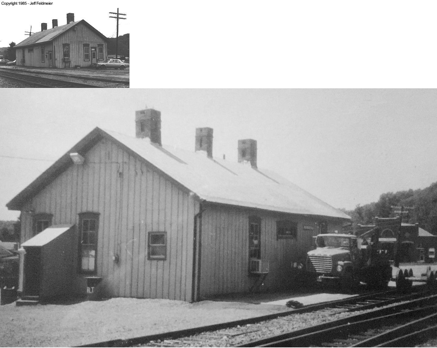
| Reynoldsville |
AND |
Built in 1899, this station was on north side of the the SW end of 4th Street below Jackson Street at GPS: 41.095902, -78.891836. It was torn down on July 24, 2014. BR&P trains which used to stop on Main Street to pick up passengers stopped at this station upon its opening (Reynoldsville Star, 8-16-1899). Ernest C. Davis was the first station agent here. | ||||||
| Ringgold |
|
This was a flag stop between Dora and Timblin. | ||||||
| Rose Siding |
 |
|||||||
| Sherwood |
|
A station is listed here on the 1923 PRR List of Stations & Sidings. | ||||||
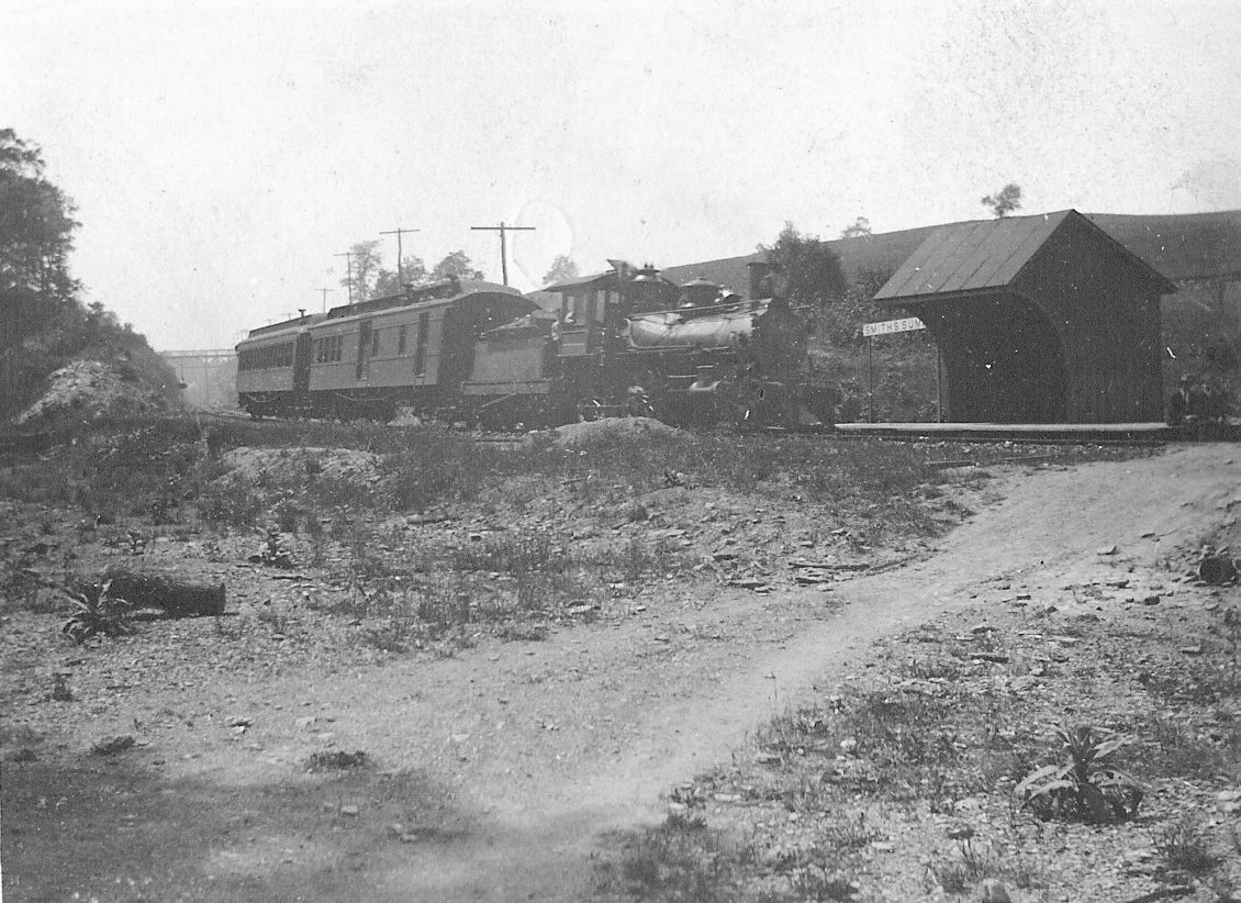
| Smith Summit |
|
This shelter-type station was near the Arch Street tunnel south of Brockway at approximately 41.235472, -78.799958. | ||||||
| Sprankle Mills |
|
|||||||
| Stanton |
|
Was on the Conifer Branch. | ||||||
| Sugar hill |
|
|||||||
| Sulger (North) |
|
The three stations around Sulger were likely shelters or flag stops. | ||||||
| Sulger |
|
|||||||
| Sulger (south) |
|
|||||||
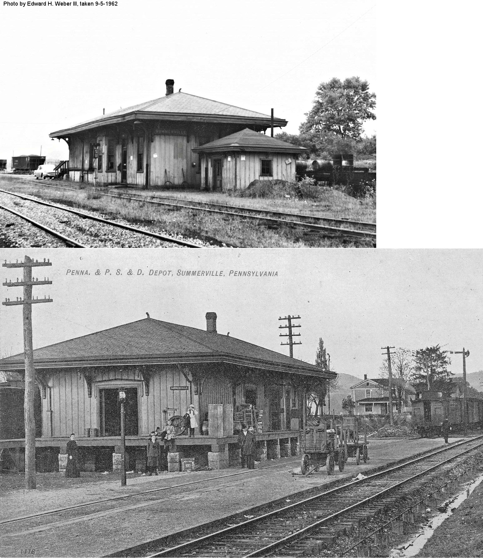
| Summerville |
|
This station was on the NE side of State Street at GPS: 41.115347, -79.184941. | ||||||
| Summerville |
 |
This small station was on the SW side of State Street at GPS: 41.115056, -79.185314. It is shown on the 1918 Sanborn map. | ||||||
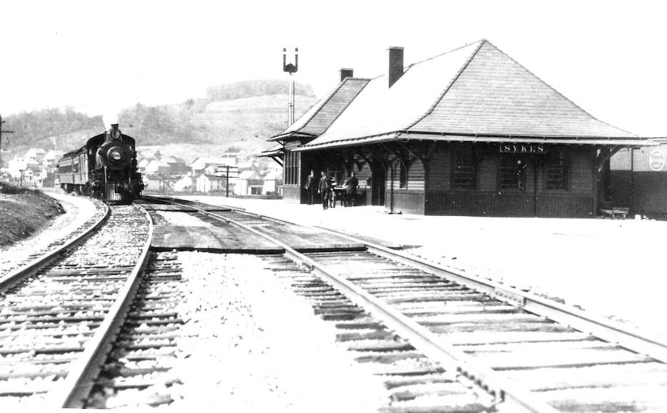
| Sykesville (Sykes) |
|
|||||||
| Tait |
|
|||||||
| Taylor Station |
|
A station is shown here on the 1878 county map. | ||||||
| Timblin |
|
|||||||
| Valier |
|
|||||||
| Vineyard Station |
|
This station was NW of Brockway near the Elk County Line. | ||||||
| Walston |
|
|||||||
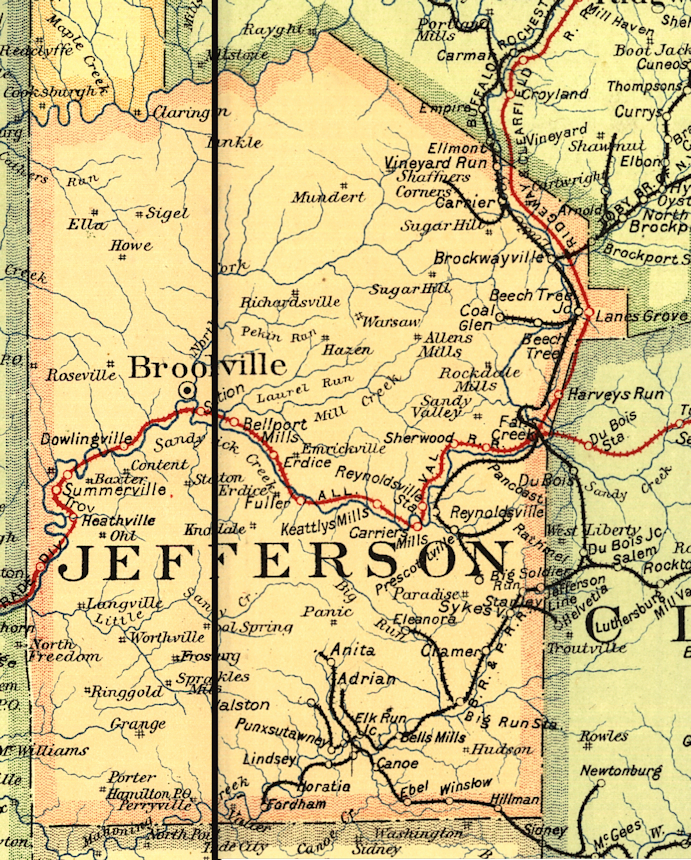
| 1895 JEFFERSON COUNTY RAILROAD MAP | ||||||||
 |
||||||||