|
|
||||||||
| EXISTING STATIONS | ||||||||
|---|---|---|---|---|---|---|---|---|
| Station Name |
Original Railroad |
Current Location |
Type | Current Use |
Date Built |
Track Status |
Building Material |
More Info |
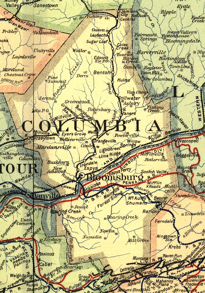
| Benton |
 |
SE corner of Everett and 5th Streets (GPS: 41.198417,-76.384538) |
P | Residence | 1905 | None | Wood |
|
| Benton |
|
5th Street north of Market Street (GPS: 41.1963, -76.3858) |
F | Storage | ???? | Gone | Wood | |
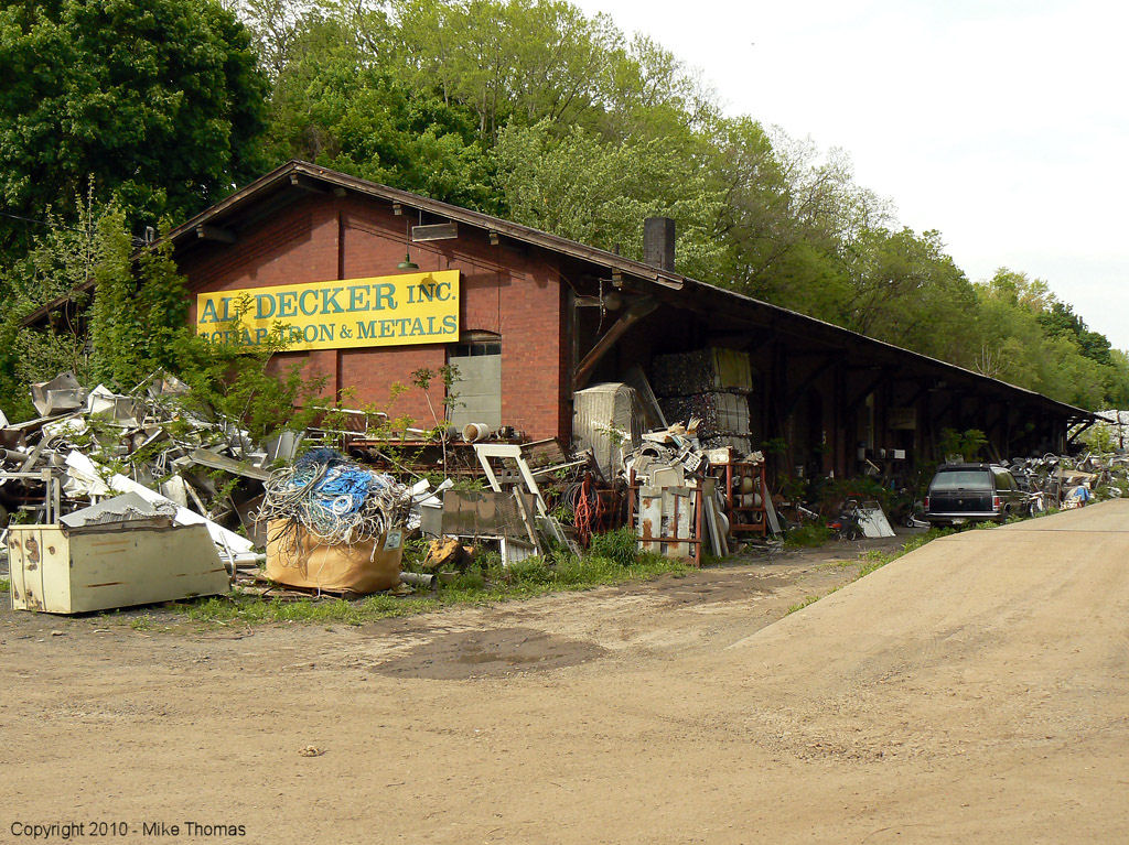
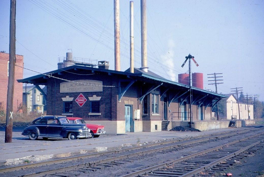
| Berwick |  |
South Market and Canal Streets (GPS: 41.05612,-76.228911) |
F | Business | 1903 | In Use | Brick |
|
| Berwick |
 |
North corner of West 9th Street and North Mulberry Street (GPS: 41.059271, -76.239316) | F | Business | ???? | Gone | Wood | |
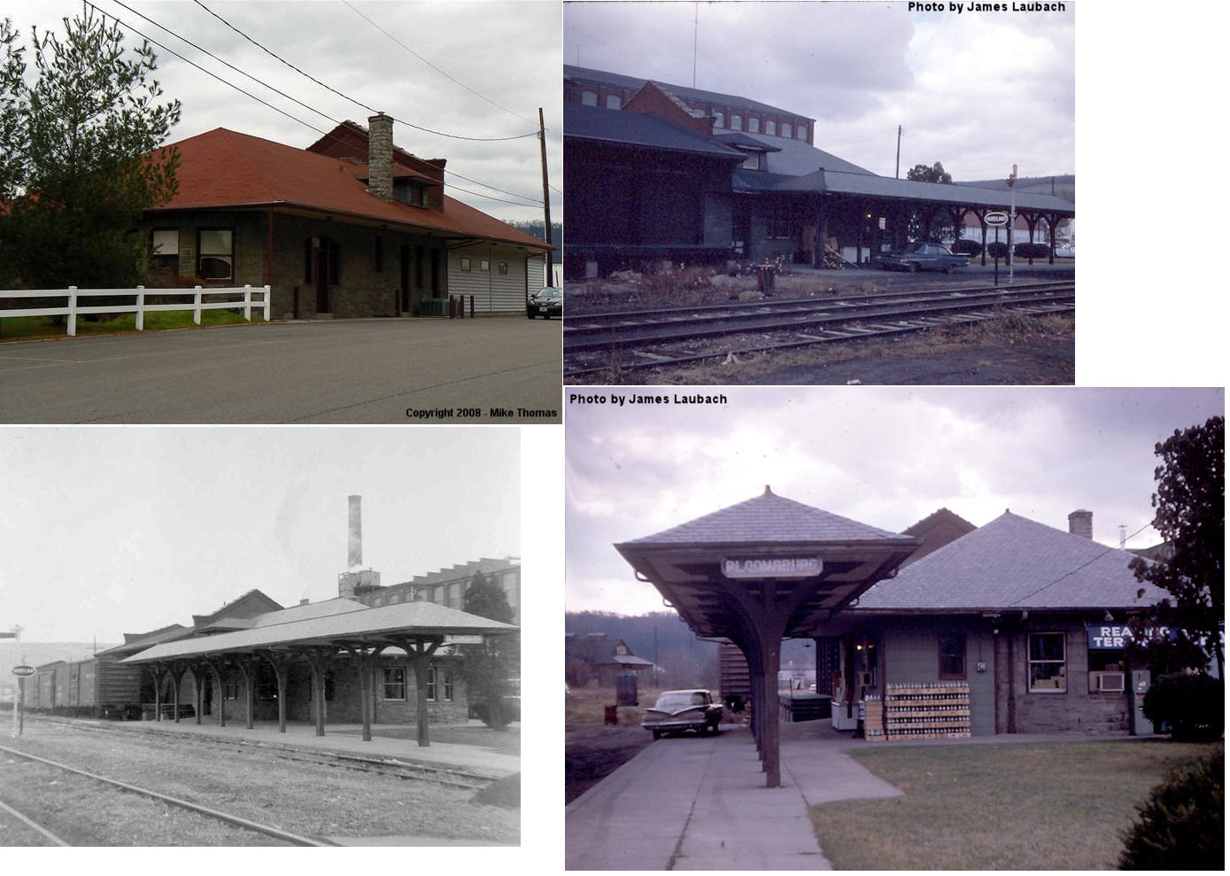
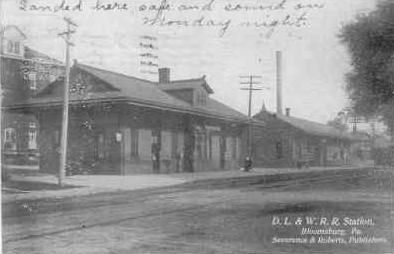
| Bloomsburg |  |
Railroad & 5th Streets (GPS: 40.996543, -76.459706) |
P | Business | 1910 | Gone | Stone | |
| Bloomsburg |  |
South side of U.S. 11 (GPS: 41.015741, -76.395566) |
P | Vacant | 1950s | ??? | Wood |
|
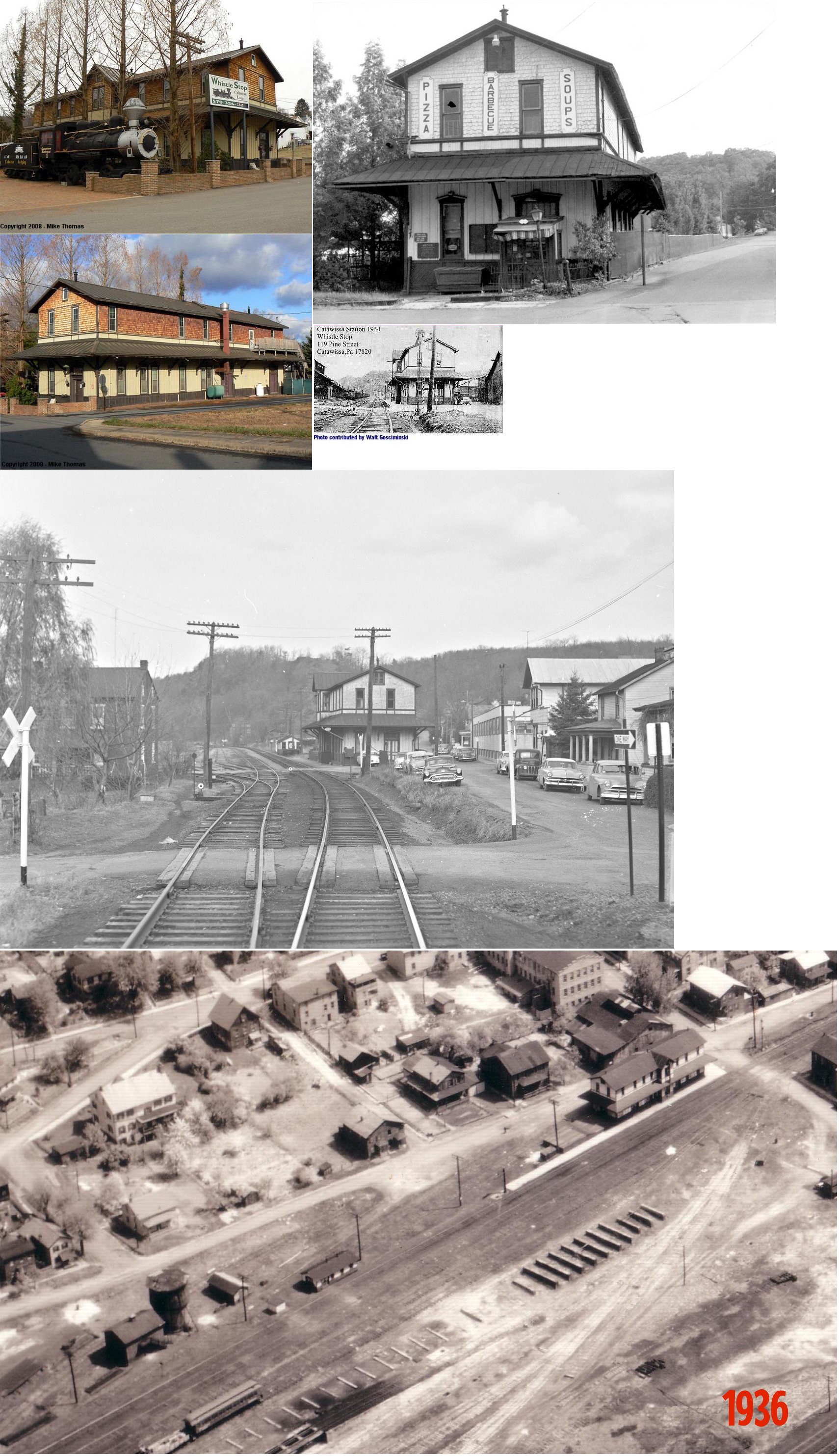
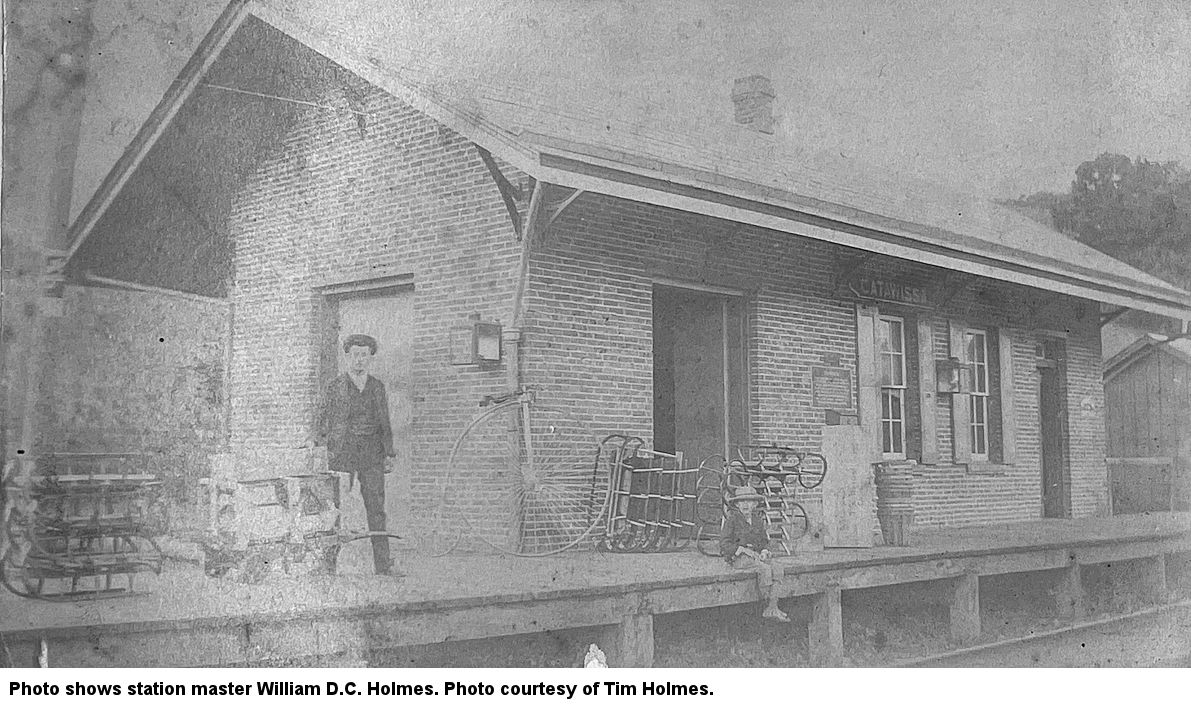
| Catawissa |  |
119 Pine Street (GPS: 40.954769, -76.463485) |
C | Restaurant/ Museum |
???? | Gone | Wood/ Shingled |
|
| Central |
|
On a farm on Jamison City Road? | C | Private | ???? | None | Wood | |
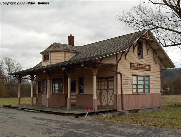
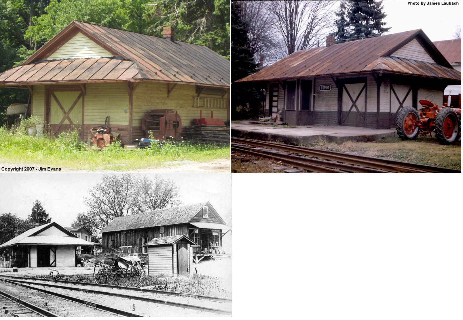
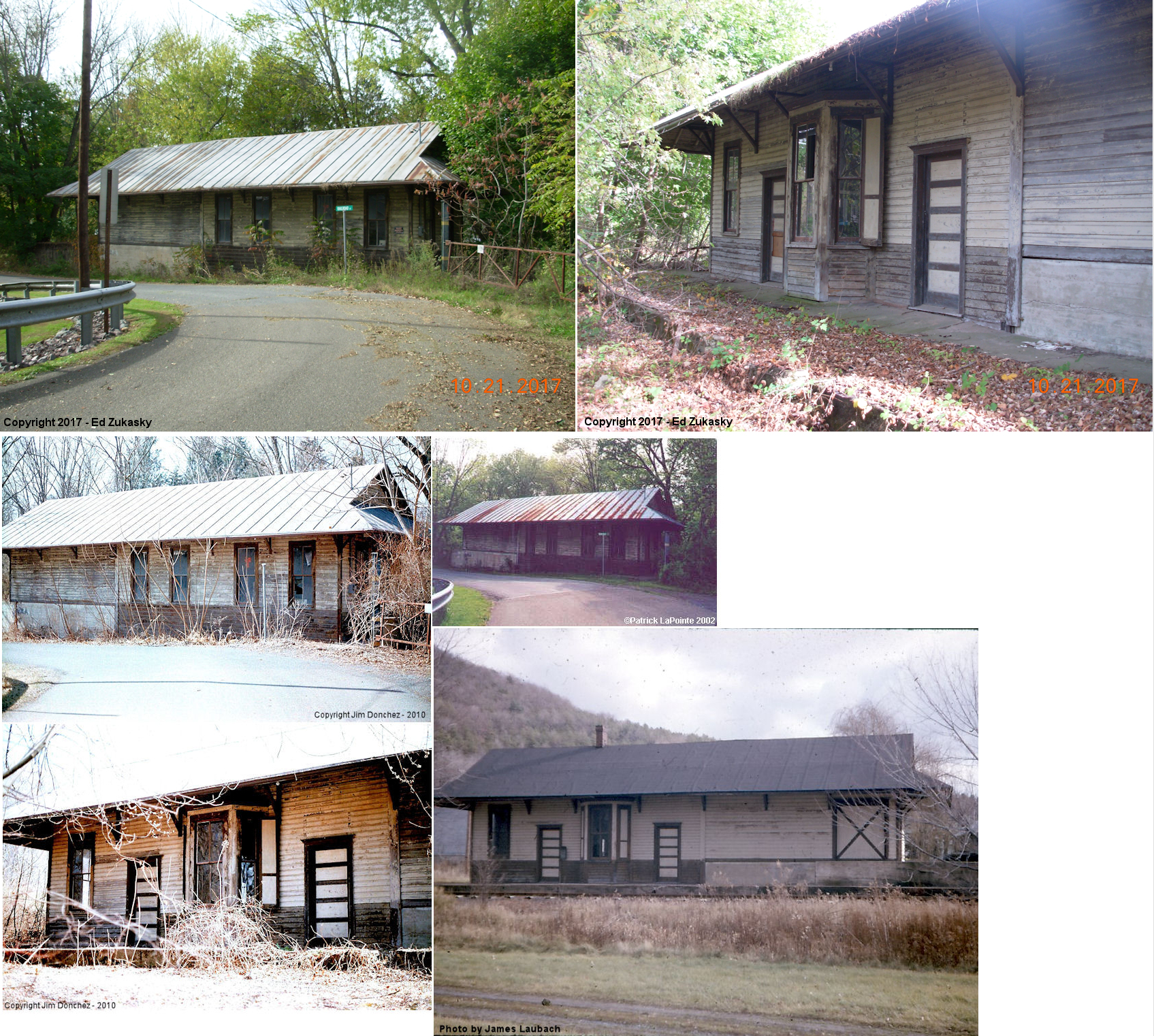
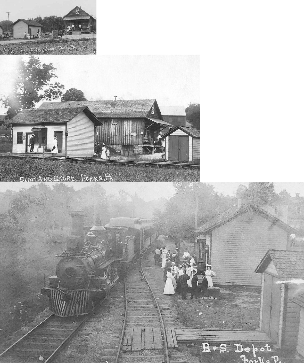
| Forks |
|
Harrison Road 1/4 mile north of Winding Road (GPS: 41.111428, -76.360864) |
C | Storage | 1913 | Gone | Wood |
|
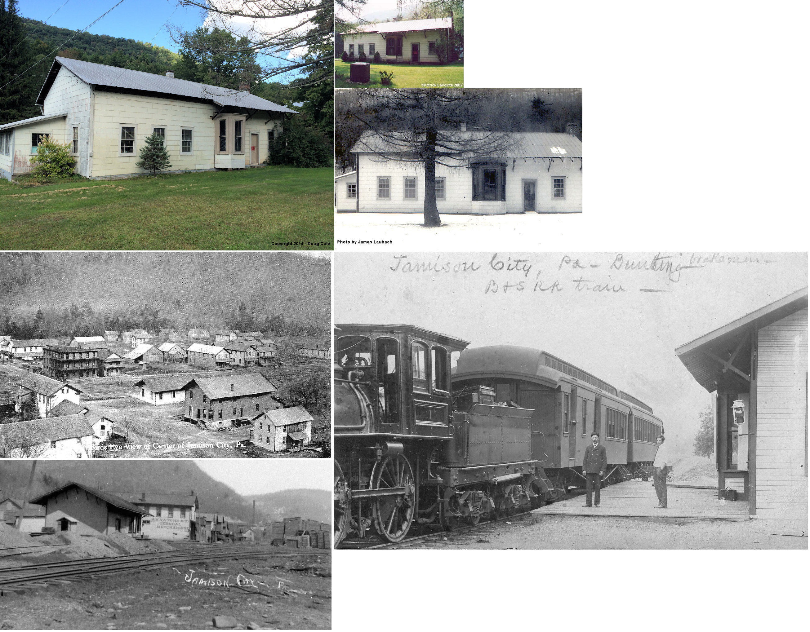
| Jamison City |
|
Broad Street (Jamison City Road) at Market Street (GPS: 41.306864, -76.361452) |
C | Storage | ???? | Gone | Wood | |
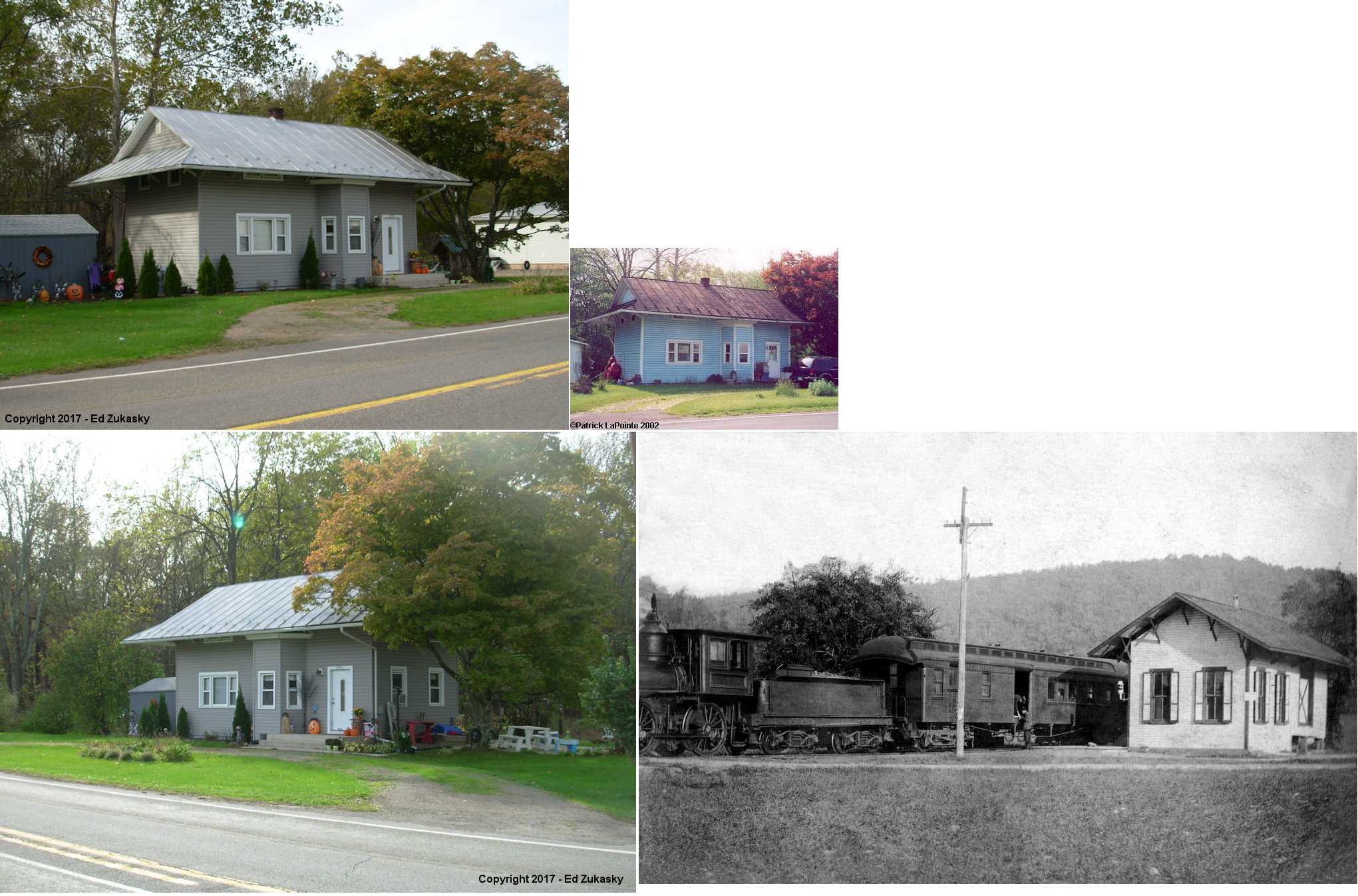
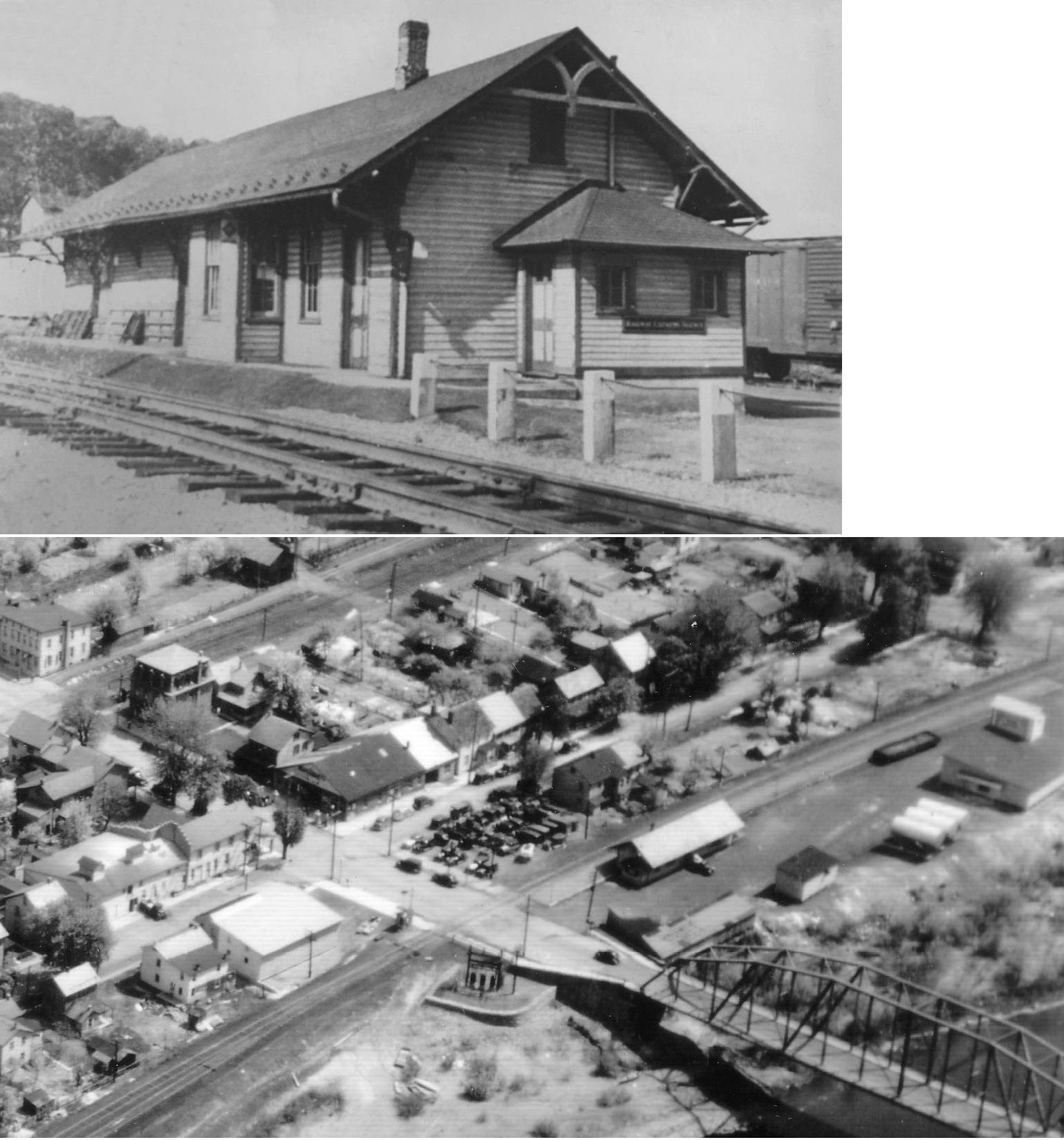
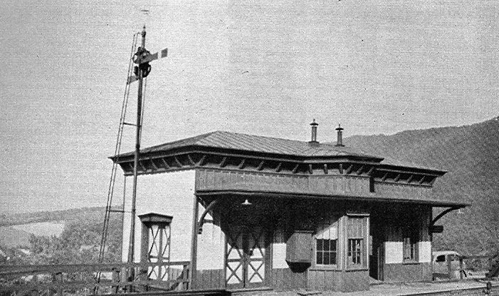
| Orangeville |
AND  |
Railroad Street at Ricketts Street (GPS: 41.080860, -76.414947) |
C | Vacant | 1888 | Gone | Wood |
|
| Stillwater |
|
Between Maple Grove Road (PA487) and Ribble Lane (GPS: 41.176186, -76.384266) |
C | Residence | 1881 | Gone | Wood | |
| STATIONS OF THE PAST | ||||||||
| Station Name |
Original Railroad |
Notes | ||||||
| Almedia | |
This station was on the east side of Bissetts Lane on the north side of the tracks at approximately GPS: 41.019084, -76.385003. It is shown on the 1914 county map. | ||||||
| Aristes (Montana) |
 |
This was on the LV's Montana Branch. | ||||||
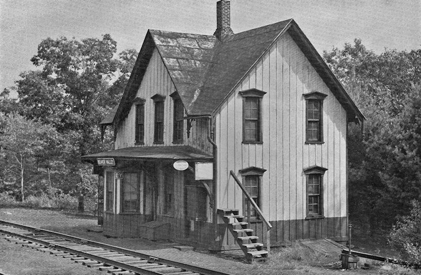
| Beaver Valley | |
This station was at the north end of Beaver Station road at GPS: 40.921850, -76.284473. | ||||||
| Berwick |
|
The passenger station was on 9th Street between North Market Street and North Pine Street (GPS: 41.060289, -76.237314). This building is still shown on the 1919 map, but the tracks end here and the building is not labeled as being in use. The PRR absorbed the SB&B in 1918. There is a station-like structure at the SW end of 9th street, but that is a scale house and not a station. | ||||||
| Berwick | |
The first station here was on the NW side of the tracks near the (former) intersection of Pine Street and Canal Street (now South Market Street). There were three generations of passenger stations at Berwick and they all occupied approximately the same location varying along the tracks by a few hundered feet at most. This station is shown on the Sanborn Fire Insurance maps from 1884 and 1891. | ||||||
| Berwick | |
This second-generation station, built in the mid-1890s (it appears on the 1896 map), burned in the early 1900s. It was on the NW side of the tracks near the (former) intersection of Pine Street and Canal Street (now South Market Street). There was a freight station next door connected with a platform (not sure if it burned as well, but both were subsequently replaced). | ||||||
| Berwick |
|
The thrid generation passenger station was on the north side of the tracks near the (former) intersection of Pine Street and Canal Street at GPS: 41.055097, -76.230914. This was almost at the same location as the station listed above that burned. An new brick freight (still standing) house was constructed to the NE near Chestnut Street. | ||||||
| Bloomsburg | |
The passenger station was built in 1883 and was on the NE side of Market Street between West 6th and West 7th Streets at GPS: 40.997850, -76.453919. and the frieght station was built in 1914. | ||||||
| Bloomsburg | |
The original wood frame freight station was just to the NE of the passenger station at GPS: 40.998084, -76.453582 and was likely built in 1883. | ||||||
| Bloomsburg | |
A new brick fright house was built in 1914 at the same location as the original fright house at GPS: 40.998084, -76.453582. | ||||||
| Bloomsburg |
|
The first station here was a wood frame station built in 1888. It was on the SE side of West 5th Street near Railroad Street at GPS: 40.998084, -76.453582. It was replaced by the existing stone station in 1910. | ||||||
| Bloomsburg |
|
|||||||
|
Bloomsburg (E. Bloomsburg) |
 |
This station was where the tracks crossed PA487 on the south bank of the Susquehanna River. The 1914 map shows the station on the west side of the road on the south side of the tracks at approximately GPS: 40.990854, -76.438039, whereas the 1941 map shows the station on the east side of the road. | ||||||
| Bluf |
|
The 1914 map shows a station here on the NW side of Susque View Road at approximately GPS: 40.944994, -76.510086. No station is shown here on the 1941 map. | ||||||
|
Briar Creek (Rambach) |
|
This station is shown on the 1876 map as Rambach on the Lackawanna & Bloomsburg RR. A seond generation station was built here in 1893. It was near the southern end of River Road east of what is now Commere Drive at approximately GPS: 41.044923, -76.282840. | ||||||
|
Buckhorn Station |
|
The Wilkes Barre & Western opened in 1886. In 1902 it became known as the Susquehanna Bloomsburg and Berwick Railroad. This station was near Township Road 4008 and Millertown Road in the vicinity of GPS: 41.024877, -76.473334. | ||||||
| Cabin Run |
|
This station was on the east side of Harris Road at approximately GPS: 41.050862, -76.371176. It is shown on the 1914 map, but is gone by the 1941 map. | ||||||
| Catawissa | Danville Hazleton& Wilkes Barre |
This station is shown on the 1876 county map. It was on the south side of Catawissa Creek at approximately GPS: 40.950117,-76.465962. Although it was at the south end of 2nd Street at the time, no roads lead this location today. There were several houses and a coal yard near there at the time of the station. | ||||||
| Catawissa | |
The first passenger station was along Railroad Street just north of where the existsing station is. It was at GPS: 40.955035, -76.463508. The existing station was the original freight house after enlargement and a second story addition. When the original passenger station was deemed too small and plagued by flooding, the P&R decided to make additions and improvements to the original freight house and use it as a combination station. This happened in 1901. | ||||||
| Catawissa |
|
A combination station was built here in 1883. It burned down in 1901 (Pittston Gazette, 10-16-1901). | ||||||
| Catawissa |
|
After the station above burned down, a passenger car served as the station until the new station was built. | ||||||
| Catawissa |
|
The new station was on PA42 at approximately GPS: 40.955795, -76.470739. | ||||||
| Catawissa (Catawissa JCT.) |
|
The first station here was at a location called Catawissa Junction, which I believe was SE of town in the vicinity of GPS: 40.950200, -76.468894. This station went out of service in 1891 when the new station opened on Main Street (listed below). | ||||||
| Catawissa |
|
This combination station was on the south side of Main Street on the west side of the tracks at GPS: 40.953396, -76.465582. It was built in 1891 (The Columbian, 4-17-1891). | ||||||
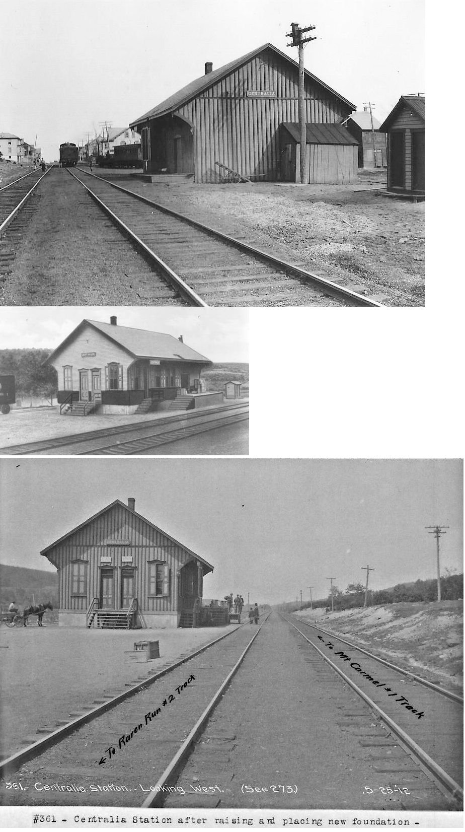
| Centralia | |
The Centralia passenger station was at the north end of Myers Street at GPS: 40.804940, -76.345221. It was built in 1882. | ||||||
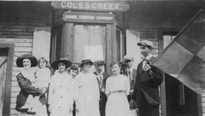
| Coles Creek |
|
This station was on the north side of Hackett Road in the vicinity of GPS: 41.232169, -76.370867. | ||||||
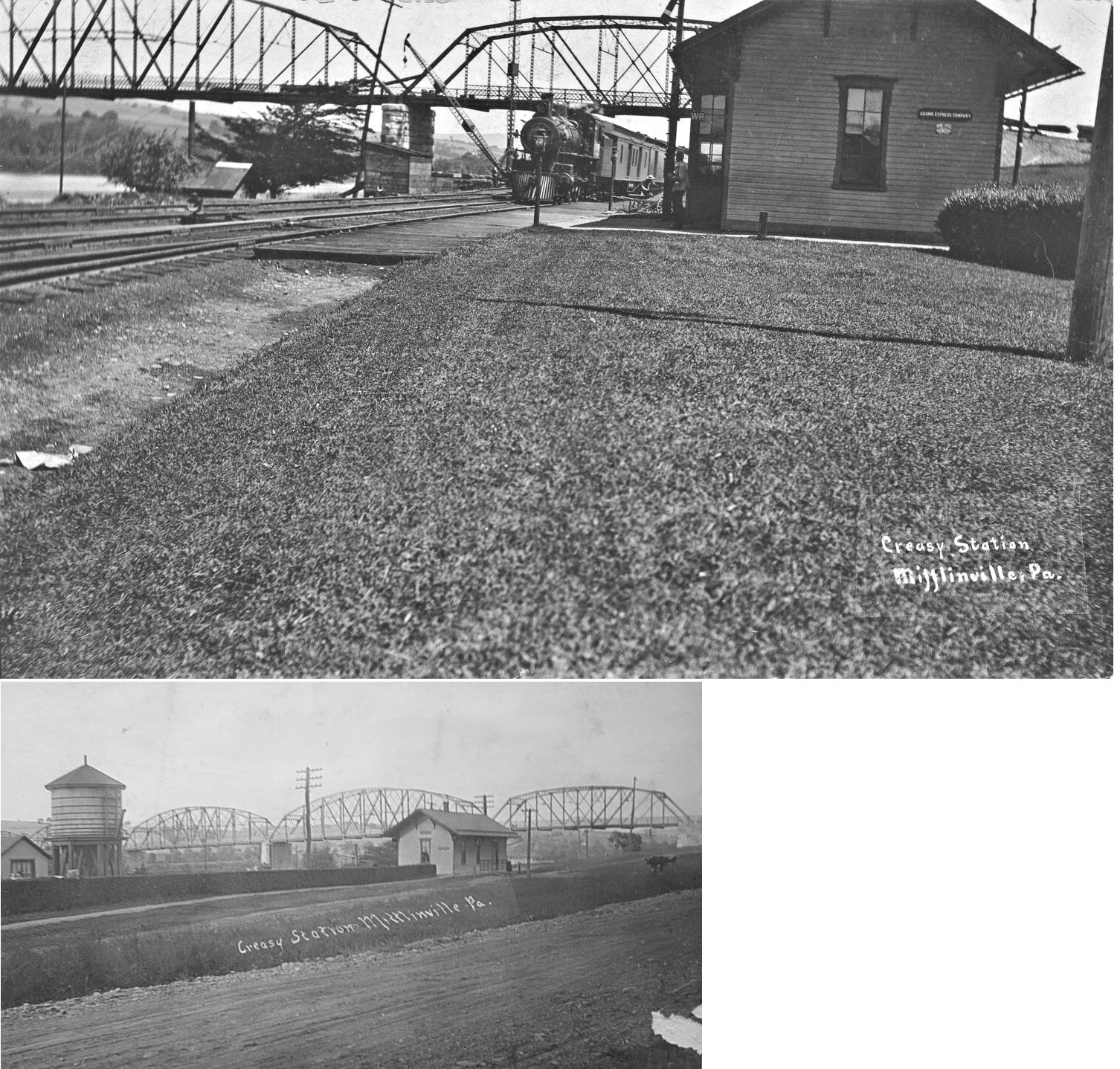
| Creasy |
|
See listing below for Mifflinville. | ||||||
| Dennis Mills |
|
|||||||
| dERRY |
|
|||||||
| Edsons |
|
This station was on the west side of Red Rock Road (PA487) in the vicinity of GPS: 41.215276, -76.375860. | ||||||
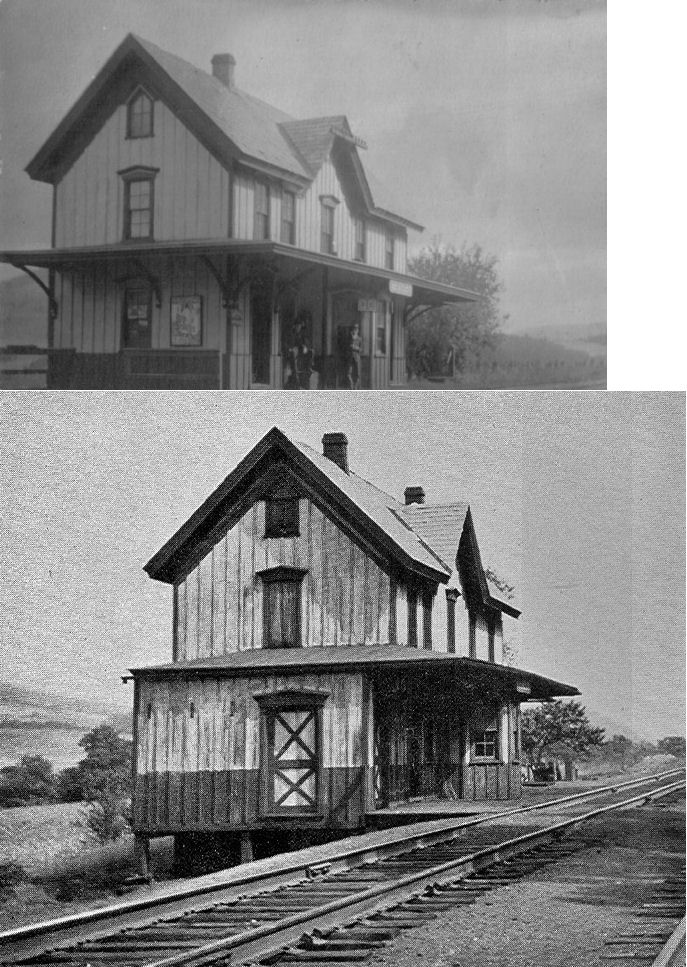
| Espy | |
According to the 1876 map, the original Lackawanna & Bloomsburg station was on the east side of Market Street (not sure which street this is today) on the south side of the tracks. A second generation station was built here in 1878 after the first station burned after a careless smoker threw his cigar into a barrel on the porch of the station. | ||||||
| Espy | |
This station was built in 1878 and may have been moved to the Carroll Park & Western RR (see the note for the Bloomsburg Carroll Park & Western station for further discussion of this). It was on the east side of Tenny Street on the north side of the tracks at GPS: 41.012032, -76.409955. The 1914 map shows the station on the west side of Tenny Street. | ||||||
| Espy Ferry |
|
This station was on the south bank of the Susquehanna River where, apparently, there was a ferry crossing to Espy. It is shown on the 1914 map with a road leading to it. Today there are no raods in this area. The station was at approximately GPS: 41.003949, -76.400333. | ||||||
| Eyers Grove |
|
This station was on the north side of Eyers Grove Road at approximately GPS: 41.088806, -76.518576. | ||||||
| Eyers Grove Junction |
|
A station is shown here on the 1914 map, but no on the 1941 map. It was located south of town on the south side of PA42 at approximately GPS: 41.081594, -76.513526. | ||||||
| Forks |
|
This depot predates the station that remains. | ||||||
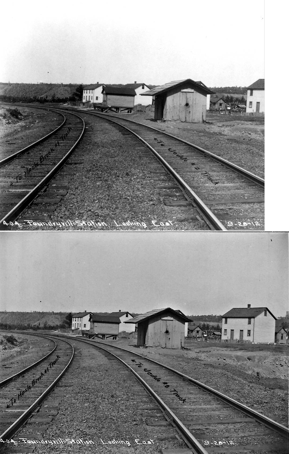
| Foundryville |
|
|||||||
| Fowlersville |
|
This station was on the east side of Ridge Road at Golf Course Road at approximately GPS: 41.055449, -76.329410. | ||||||
| Jerseytown |
|
This station was on the east side of Danville Road (PA642/44) at approximately GPS: 41.085272, -76.576790. | ||||||
| Laubach |
|
I have had vague reports that this station is still standing somewhere. Can anyone confirm/deny? A time line for construction of B&S is as follows: First rail laid at Bloomsburg April 14, 1887; Reached Orangeville June 21, 1887; Reached Benton August 1887; and Finished railroad to Jamison City November 30, 1888. | ||||||
| Light street |
|
Built in 1888, this station was on the south side of Back Branch Road. | ||||||
| Light Street |
|
This station was on the west side of Main Street at approximately GPS: 41.029938, -76.424082. | ||||||
| Lime Ridge |
|
There was a combination station here that was built in 1883. It was on the west side of Low Street on the south side of the tracks at GPS: 41.029280, -76.348504. | ||||||
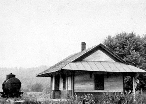
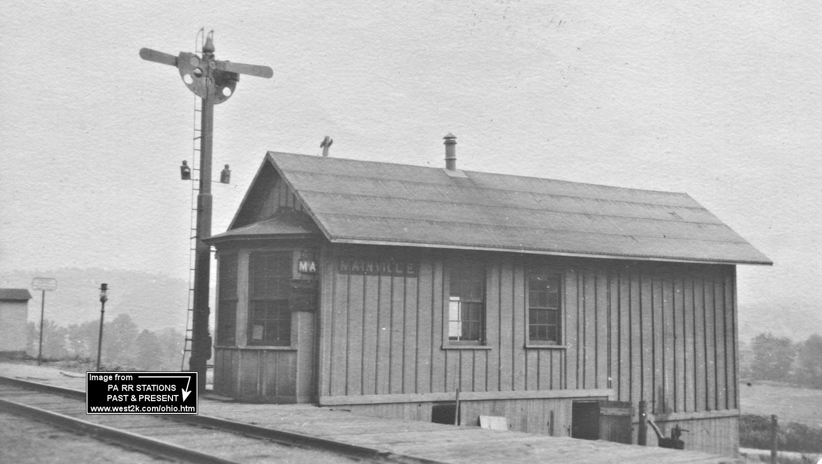
| Mainville |
|
This station was built in 1881. Can anyone give an exact location for this station and the PRR station listed below? | ||||||
| Mainville |
|
|||||||
| McAuley | |
The 1876 county map shows an early Catawissa RR station here. | ||||||
| McAuley | |
Built in 1882. The station was off PA339 to the south in the vicinity of GPS: 40.949488, -76.322290. There are no roads to this location today. | ||||||
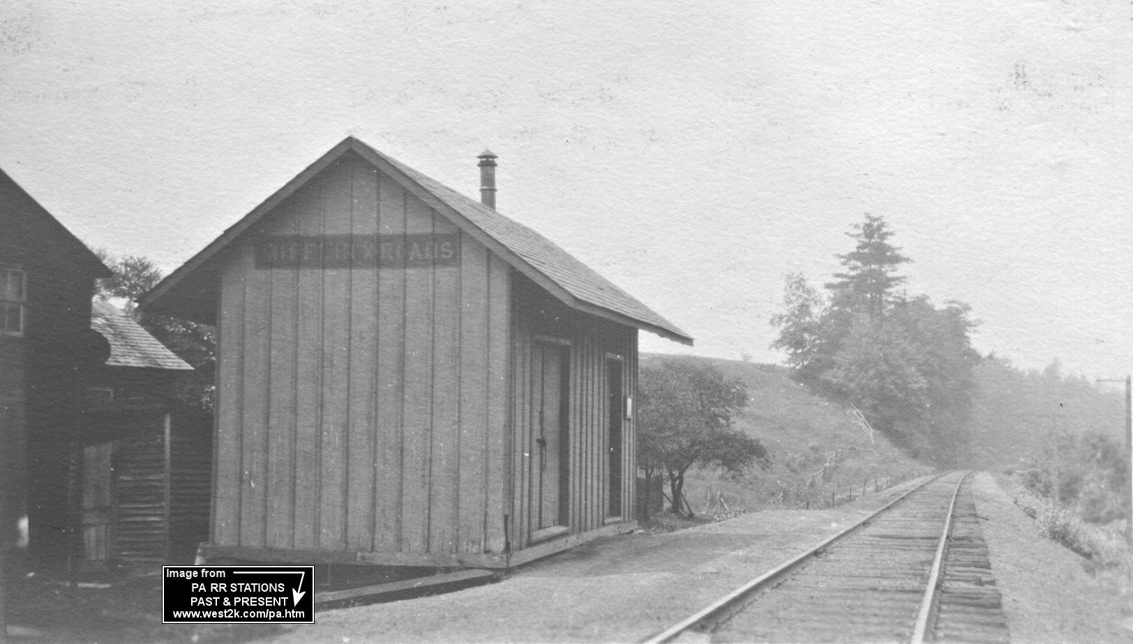
| Mifflin Cross Roads |
|
The 1876 county map shows an early Danville, Hazleton & Wilkes Barre station here. In 1914 the station is shown near the corner of Railroad Lane and Mifflin X Road at approximately GPS: 40.972828, -76.316951. By the 1941 map, this section of the line is gone. | ||||||
| Mifflinville (Creasy Sta.) |
|
This station was on the west side of Market Street on the south side of the tracks at approximately GPS: 41.033848, -76.309475. It was built in 1883. | ||||||
| Millville |
|
The station was at the corner of Moreland Avenue and Railroad Street at approximately GPS: 41.118362, -76.529761. | ||||||
| Paper mill |
|
This station, which is shown on the 1914 county map, was on North Central/Paper Mill Road about where Interstate 80 crosses there today at approximately GPS: 41.026740, -76.442213. It was here that the WB&W crossed the Reading. This is not to be confused with the Reading's "Paper Mills" station between Bryn Athyn and Woodmont. | ||||||
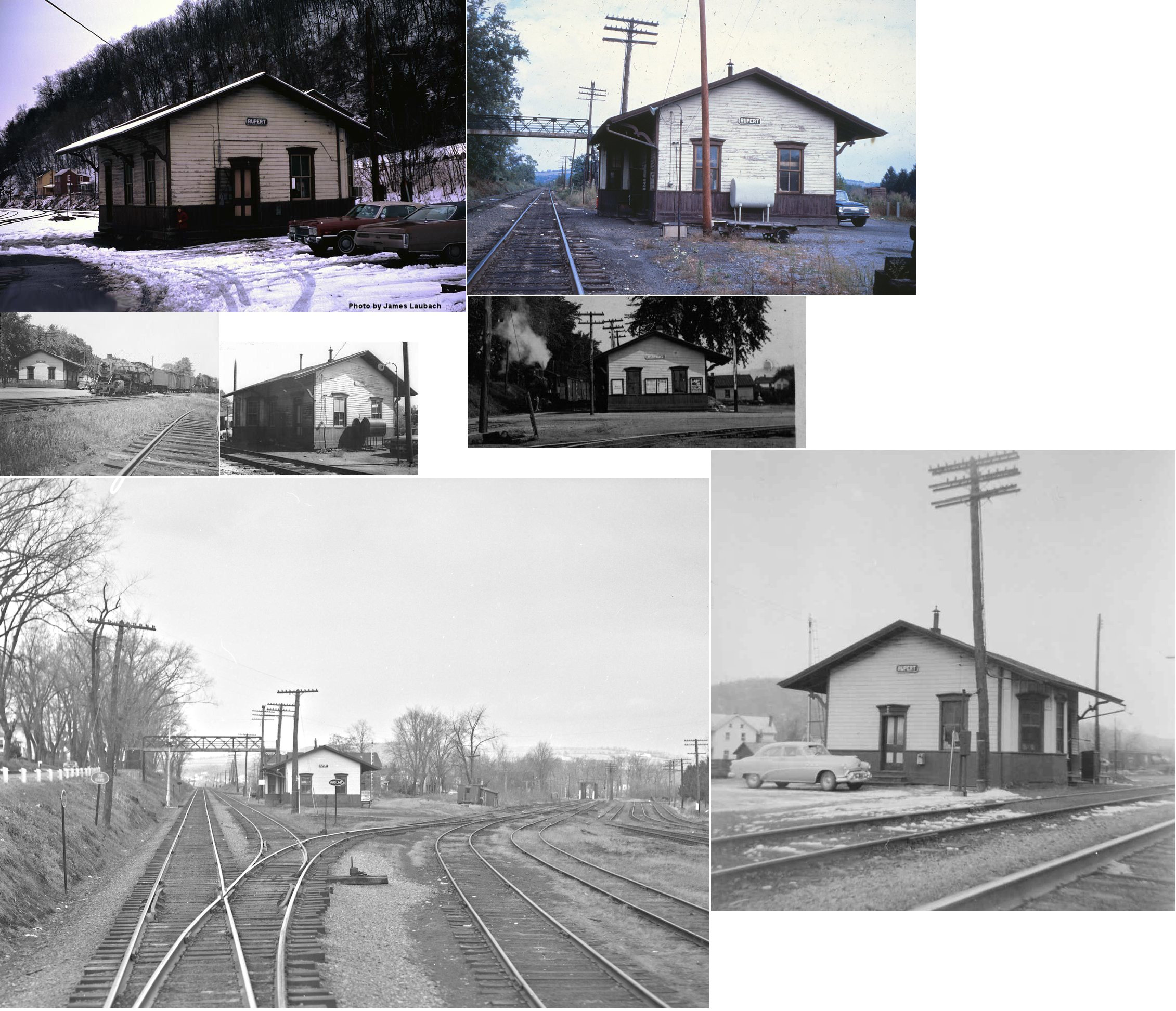
| Rupert | |
Built in 1880. | ||||||
| Rupert | |
There was also a freight station here according to the 1876 county map. | ||||||
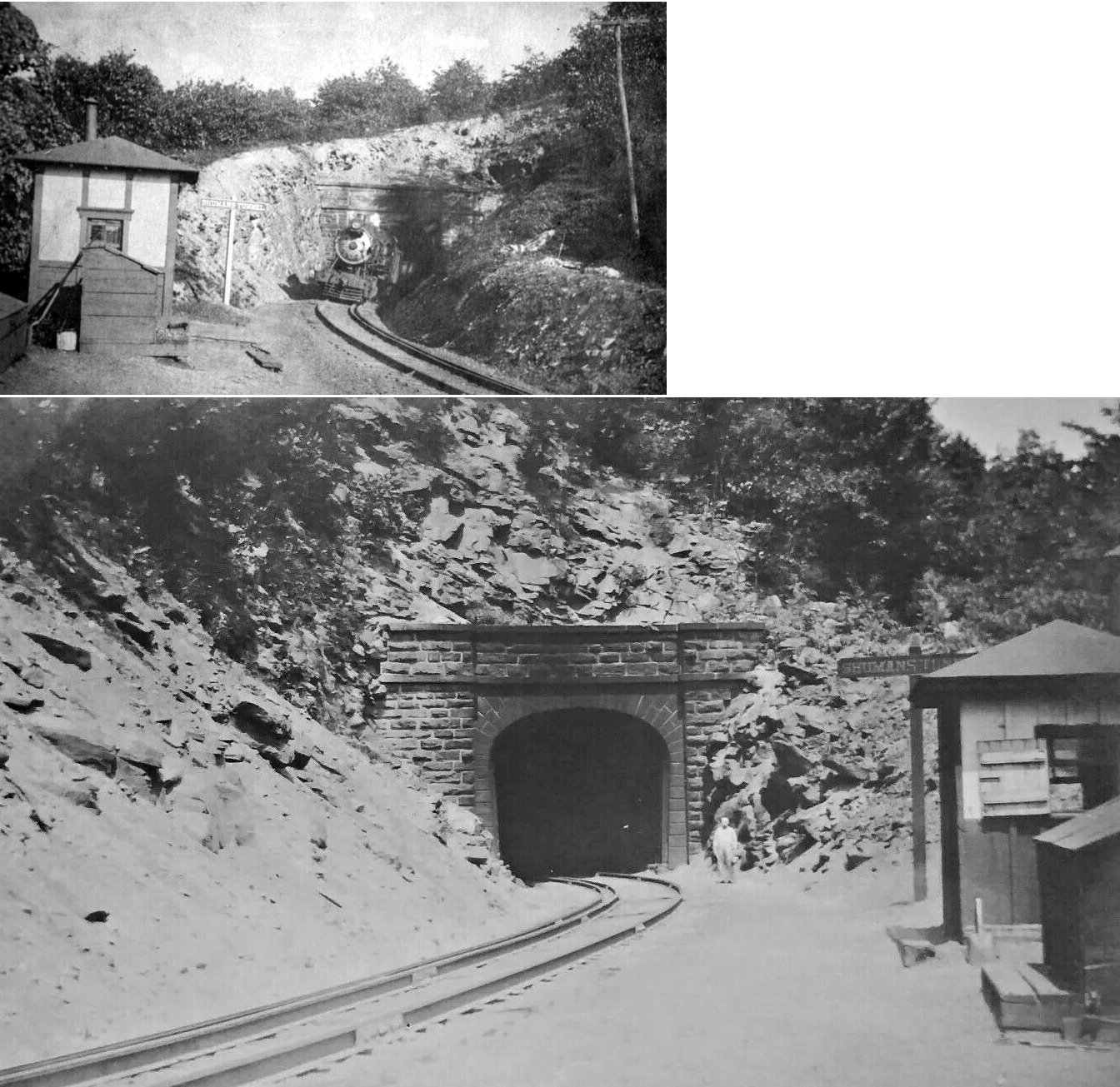
| Schumans | |
A.K.A. Shumans Tunnel Station. The 1876 county map shows an early Catawissa RR station here. Photo is from 1907. This station was located off PA339 in the vicinity of GPS: 40.949599, -76.314104. | ||||||
| Scotch Valley (Glen City) |
|
An early Danville, Hazleton & Wilkes Barre station is shown here on the 1876 county map when the location was known as Glen City. The station was off Scotch Valley Road in the vicinity of GPS: 40.980975, -76.261634. | ||||||
| Sugar Loaf |
|
It appears this station was between Coles Creek and Laubachs based on the 1895 map below. No station or mention of this location is made on the 1914 or later maps. | ||||||
| Wilburton |
|
|||||||
| Willow Springs | |
There was a shelter-type station here that was built in 1903. It was on the west side of Market Street on the north side of the tracks at approximately GPS: 41.039000, -76.314400. | ||||||
| Zaner |
|
Built in 1898. | ||||||
| 1895 COLUMBIA COUNTY RAILROAD MAP | ||||||||
 |
||||||||
| Notes About Existing
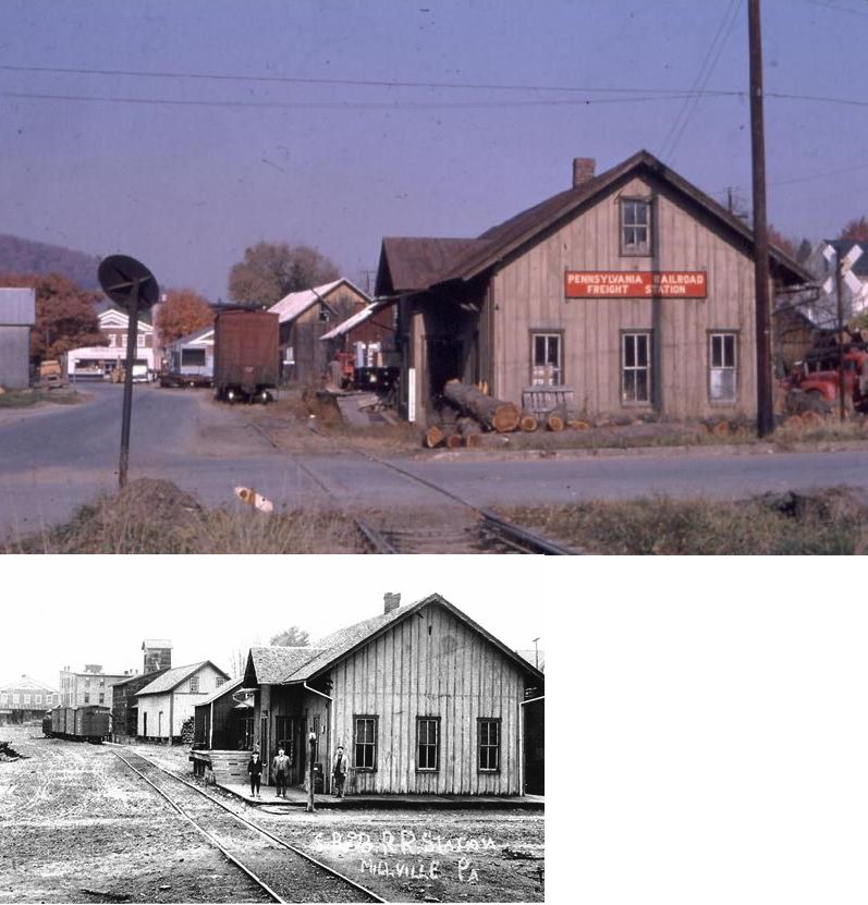
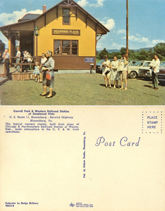
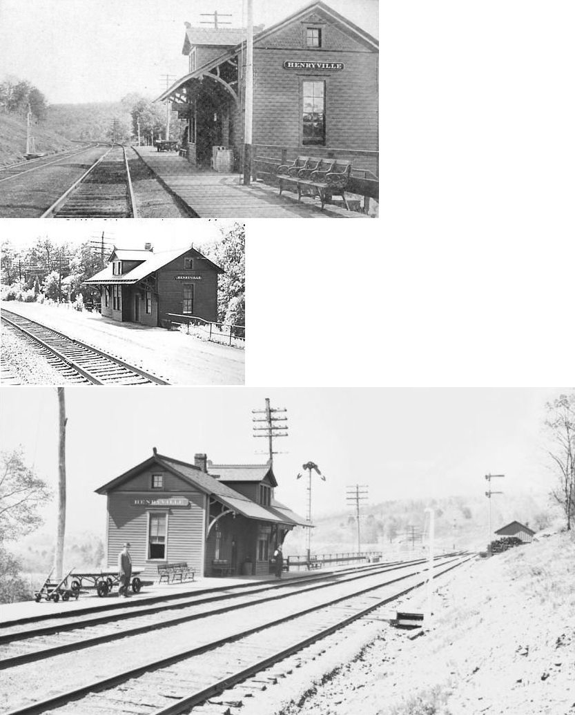
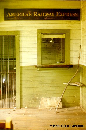
Stations... Benton (B&S) - Station was moved a few hundred yards north of its original location which was on the north side of Market Street between 4th and 5th Streets. Berwick (DL&W) - Station is in good shape except for wood parts. It is surrounded by, and filled with, junk (at Decker's Scrap Yard). Was built in 1903 to replace one that burned. There were 100 steps down to the station from Front and Chestnut which were torn out around 1970. Bloomsburg (CP&W) - This station was part of the Carroll Park & Western excursion RR which is now closed. Some materials published by the old Carroll park claim that this is a replica station based on Chicago & Northwestern RR plans, specifically the station in Wayne, Nebraska (see this postcard). I could not find a photo of that station, but the CNW station from Wayne, Illinois does look similar, although not exact. John Styer, the vilage historian for Espy, PA thinks the station came from that town. He writes: "Once located south east of the Route 11 and Tenny Street intersection it was the second train station that was built after the first station was burnt down by a careless smoker who threw a cigar into a barrel of coal on the porch. Later in the 1950s the station, then abandoned in Espy, was bought by Carroll Stahl who then relocated the station up the track and made it a part of the train excursion that was once up at the park. It was also later used in the train scene in the filming of The Molly McGuires." No photo of the station in its original location in Espy has been found yet. A thrid possibility is that the station was moved to the CP&W from Espy and then modified somewhat. There are DL&W structures that are similar in size and shape (for instance the Henryville, PA station). More documents/photos are needed to support one of these theories over the other. Catawissa (Catawissa RR) - The existing station was the old one-story freight house. When the that station was deemed too small and plagued by flooding, the P&R decided to make additions and improvements to the original and added the second story. This happened in 1901.There was a fire on Dec 29, 2000 that heavily damaged the 2nd floor of the station. The owner has rebuilt the damaged sections. See his site for updates. Forks (B&S) - The red building nearby that looks like a freight station was actually a horse stable built in the 1960s or 1970s that had nothing to do with the RR. Orangeville (RDG) - See interior photo also. This station was also used by the Wilkes Barre & Western. As of 2023 this station was in the process of being restored. |
||||||||