|
|
||||||||
| EXISTING STATIONS | ||||||||
|---|---|---|---|---|---|---|---|---|
| Station Name |
Original Railroad |
Current Location |
Type | Current Use |
Date Built |
Track Status |
Building Material |
More Info |
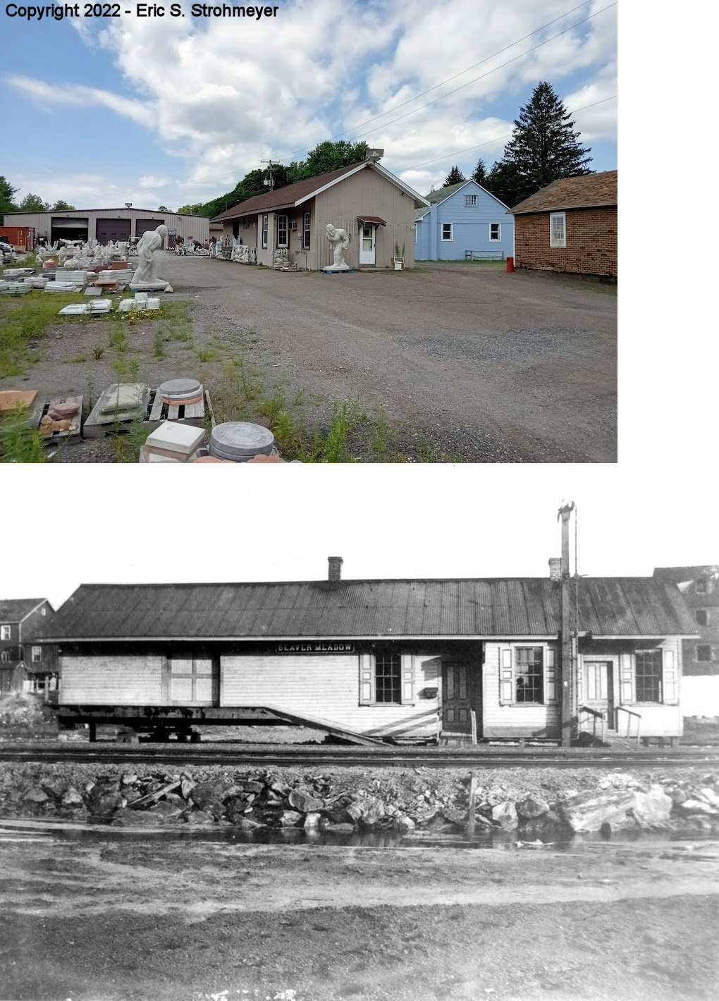
| Beaver Meadows |
 |
South end of Depot Street (GPS: 40.927559, -75.911478) |
C | Business | ???? | Gone | Wood | |
|
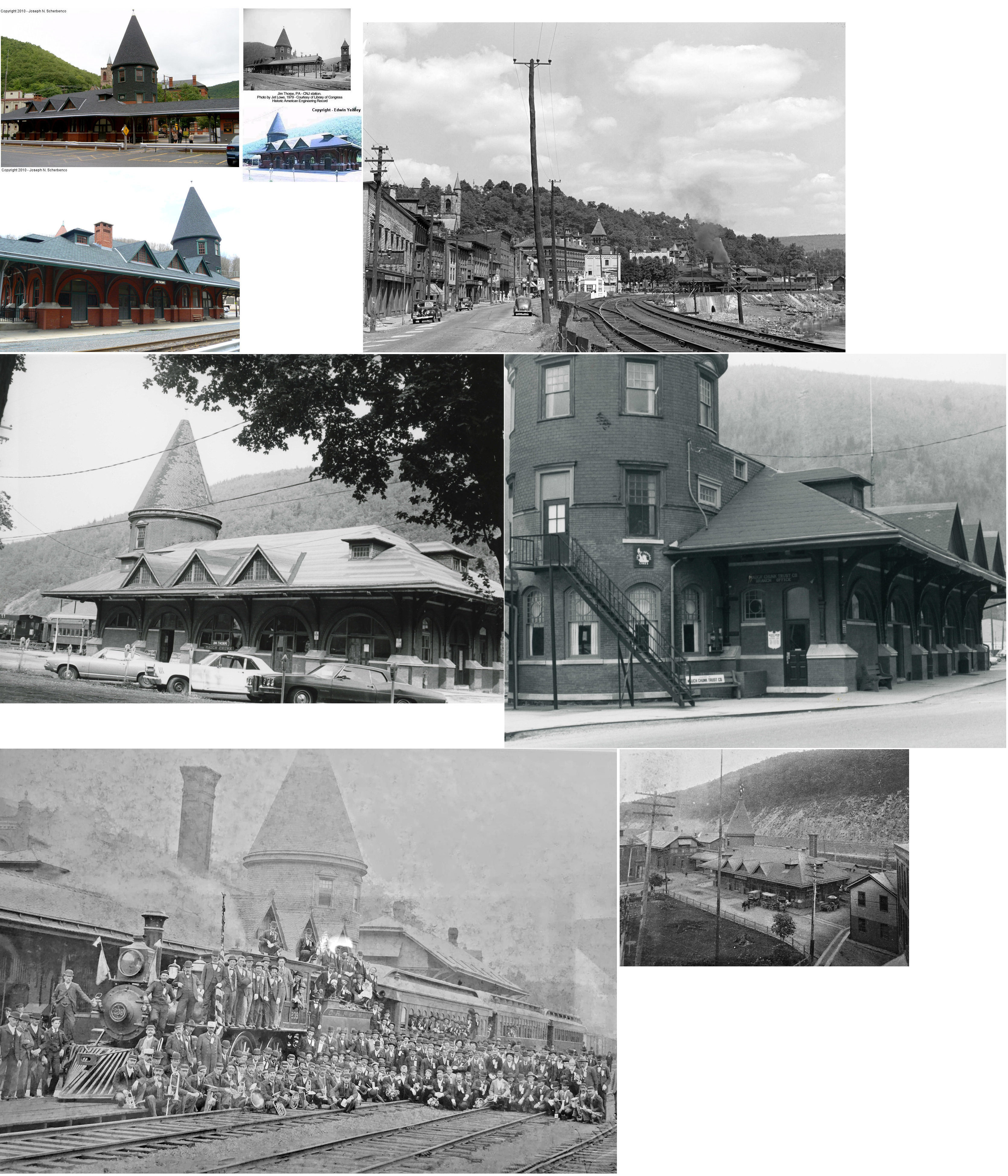
Jim Thorpe (Mauch Chunk) |
 |
Race Street east of U.S. 209 (GPS: 40.863070, -75.737615) |
P | Business | 1888 | In Use | Brick | |
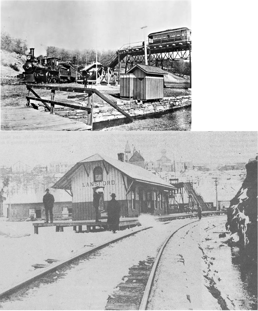
| Lansford |
 |
Dock Street (GPS: 40.832378, -75.889698) |
C | Vacant | 1925 | Aband. | Brick |
|
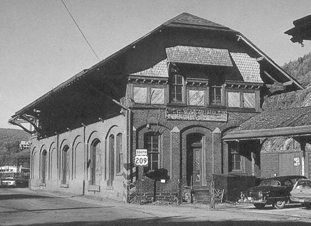
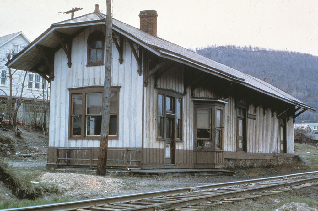
| Palmerton |
|
Mauch Chunk Road West of Delaware Avenue (GPS: 40.799904, -75.618289) |
P | Private | 1909 | In Use | Stone |
|
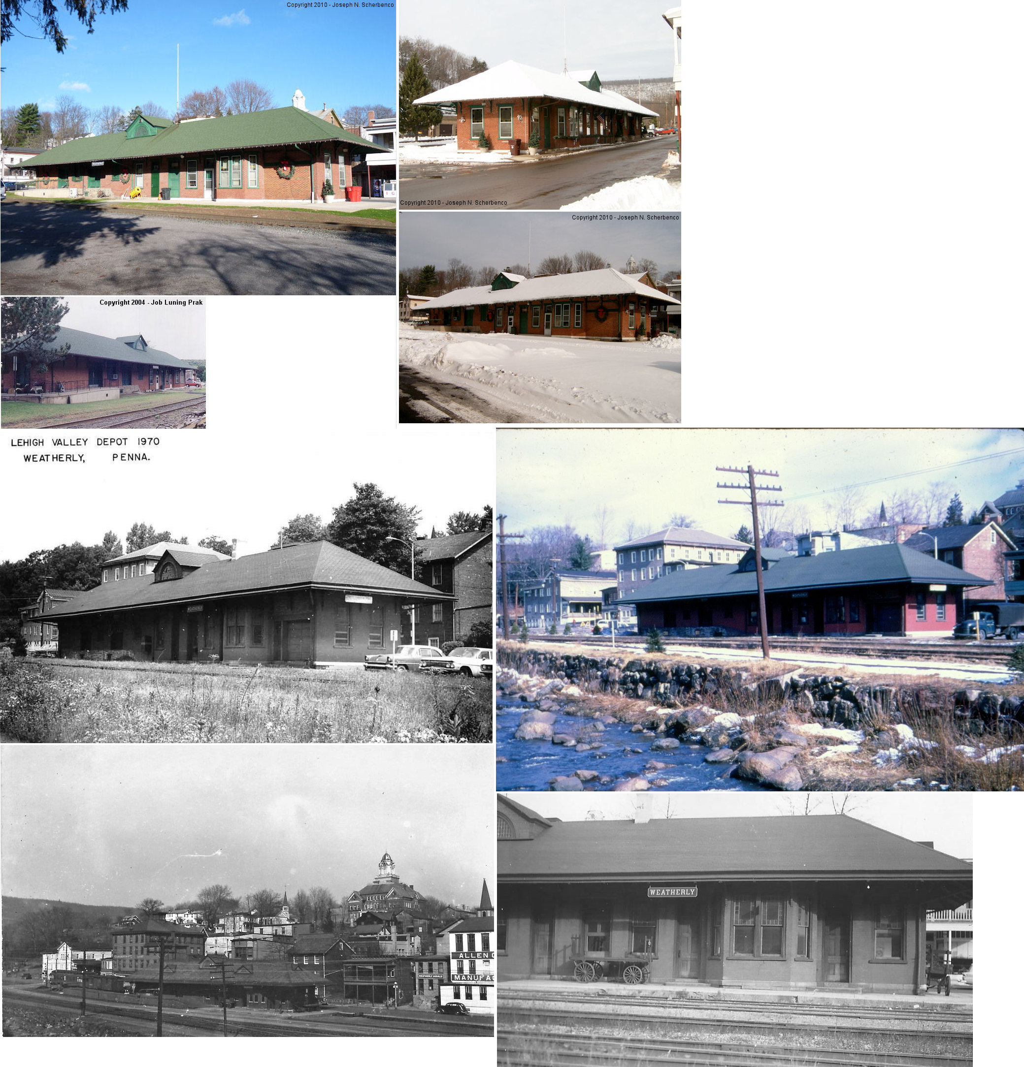
| Weatherly |
|
Wilbur Street between East Main Street and 1st Street (GPS: 40.941323, -75.829211) |
C | Offices | 1889 | In Use | Brick | |
| STATIONS OF THE PAST | ||||||||
| Station Name |
Original Railroad |
Notes | ||||||
| Ashfield Station |
|
This station was on the same road as the Balliet LV station. | ||||||
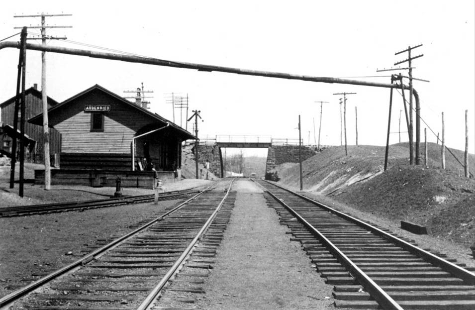
|
Audenried (Yorktown) |
|
A station is shown here on the main street on maps from 1875. It is hard to say exactly where this station was given that the streets have changed so much since then. At one time Audenried (north) and Yorktown (south) were two separate towns. A new station was built here in 1887. | ||||||
| Balliet |
|
|||||||
|
Bear
Mountain (Mauch Chunk) |
|
|||||||
| Beaver Meadows |
|
This may have predated the station that still exists. | ||||||
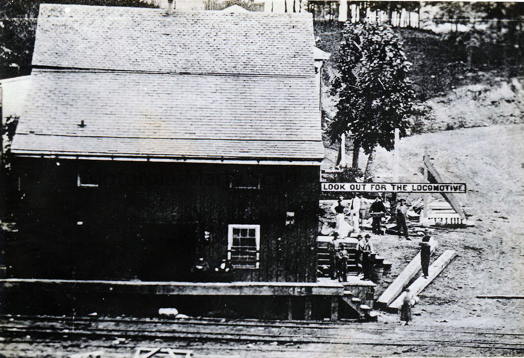
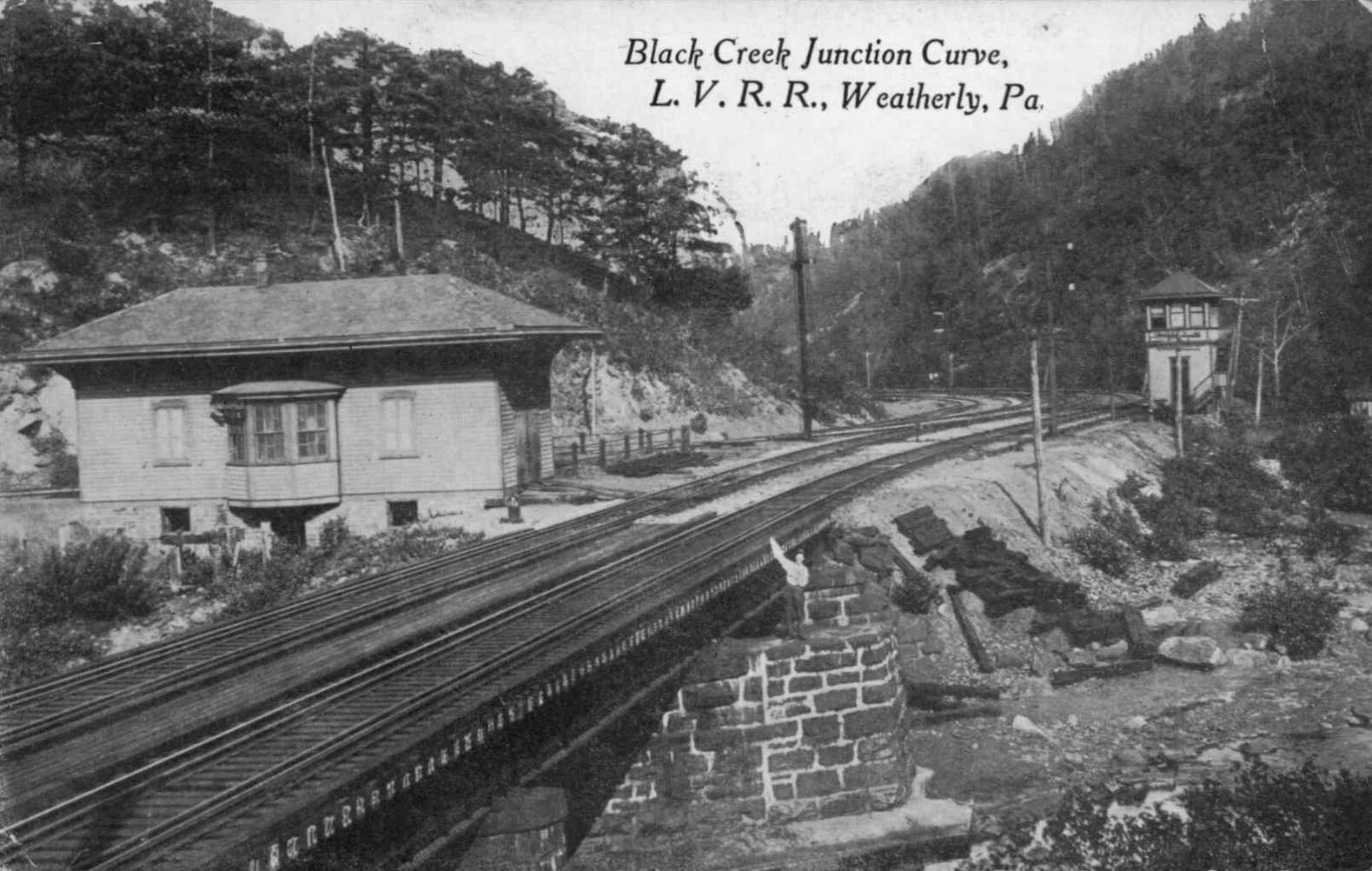
| Black Creek Junction |
|
Perhaps this was the original station here? | ||||||
| Black Creek Junction |
|
|||||||
| Bloomingdale |
|
|||||||
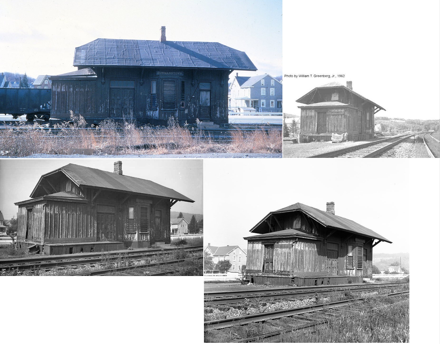
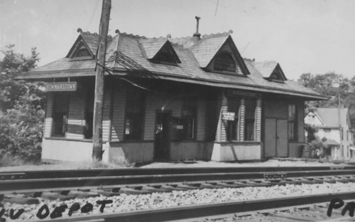
| Bowmanstown |
|
Bowmanstown is on the CNJ side of the river and the town of West Bowmans is on the LV side. The CNJ station was on the SW side of White Street on the SW side of the tracks at approximately GPS: 40.800722, -75.667109. | ||||||
| Bowmanstown (West Bowmans) |
|
|||||||
| Bridgeport |
|
|||||||
| Coalport |
|
|||||||
| Drakes Creek |
|
The Railroad Museum of Pennsylvania has a photo of this station. Drake’s Creek Station was on the Lehigh Valley New York Division Main Line at Milepost 135.1 from Jersey City, NJ. Drake’s Creek was a shipping place for lumber. A saw mill was situated on the wild brook that enters the Lehigh River through a deep rift in the hills. The station was in the vicinity of GPS: 40.971225, -75.712280. | ||||||
| East Mauch Chunk |
|
This freight station sat on Laurel Street behind Jim Thorpe Market. It was wooden but had cinderblock additions in recent years. It burned down in late 2003/early 2004. | ||||||
| Fenstermachers |
|
|||||||
| Fenstermachers |
|
|||||||
| Gerhards (Gearhart) |
|
|||||||
| German's |
|
|||||||
| German's |
|
|||||||
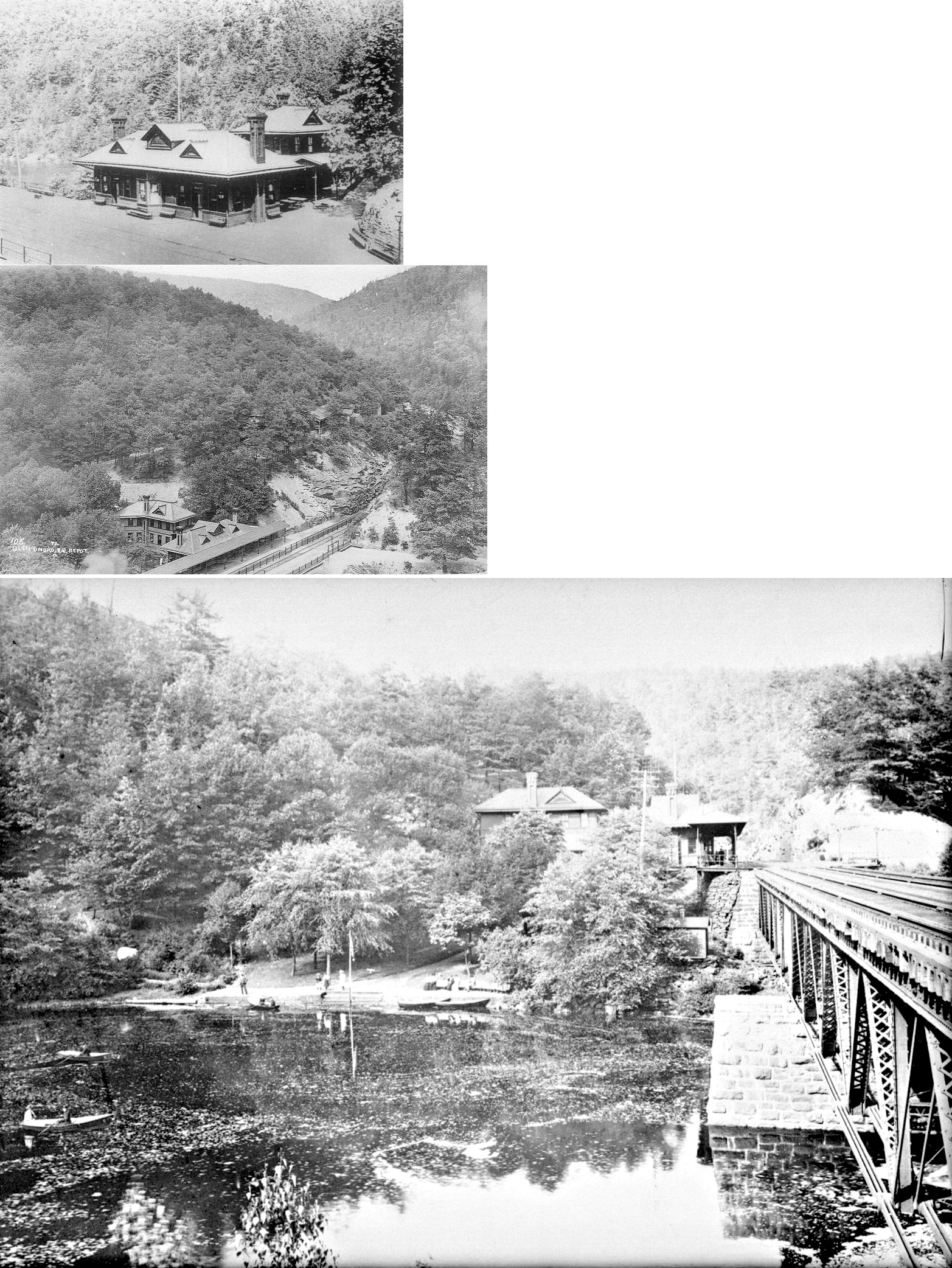
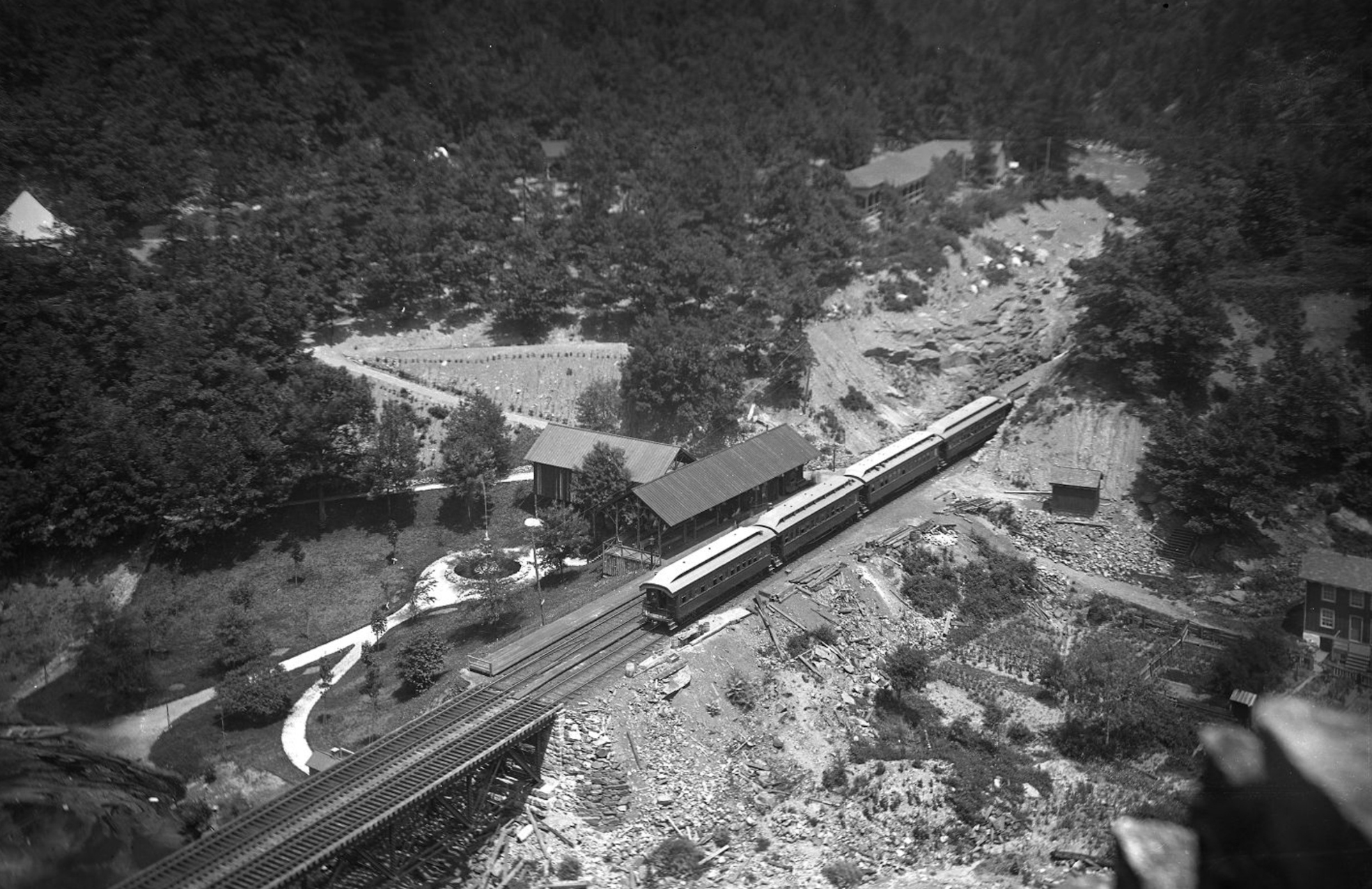
| Glen Onoko |
|
This station burned down on May 1, 1917 when WWI soldiers were camped there and got the chimeny too hot (Allentown Leader, 5-3-1917). | ||||||
| Glen Onoko |
|
In the photo the CNJ station/shelter is to left at the end of the CNJ Turnhole Tunnel bridge before the CNJ tracks were realigned. In the background is the Hotel Wahnetah. The photo was taken from atop the LV bridge. | ||||||
| Glen Onoko |
|
Perhaps this was a later-generation station. Can anyone advise? | ||||||
| Hauto |
|
|||||||
| Hazardville |
|
|||||||
| Hazle Creek Junction |
|
Also known as Hazle Creek Bridge, this station was where the Beaver Meadow Branch of the LV crossed Hazle Creek and junctioned with the Buck Mountain RR just inside the Lausanne Township line. This was just a bit north of where the Hazle Creek flows into the Beaver Creek. The station was in the vicinity of GPS: 40.946688, -75.849005. | ||||||
| Hickory Run |
|
|||||||
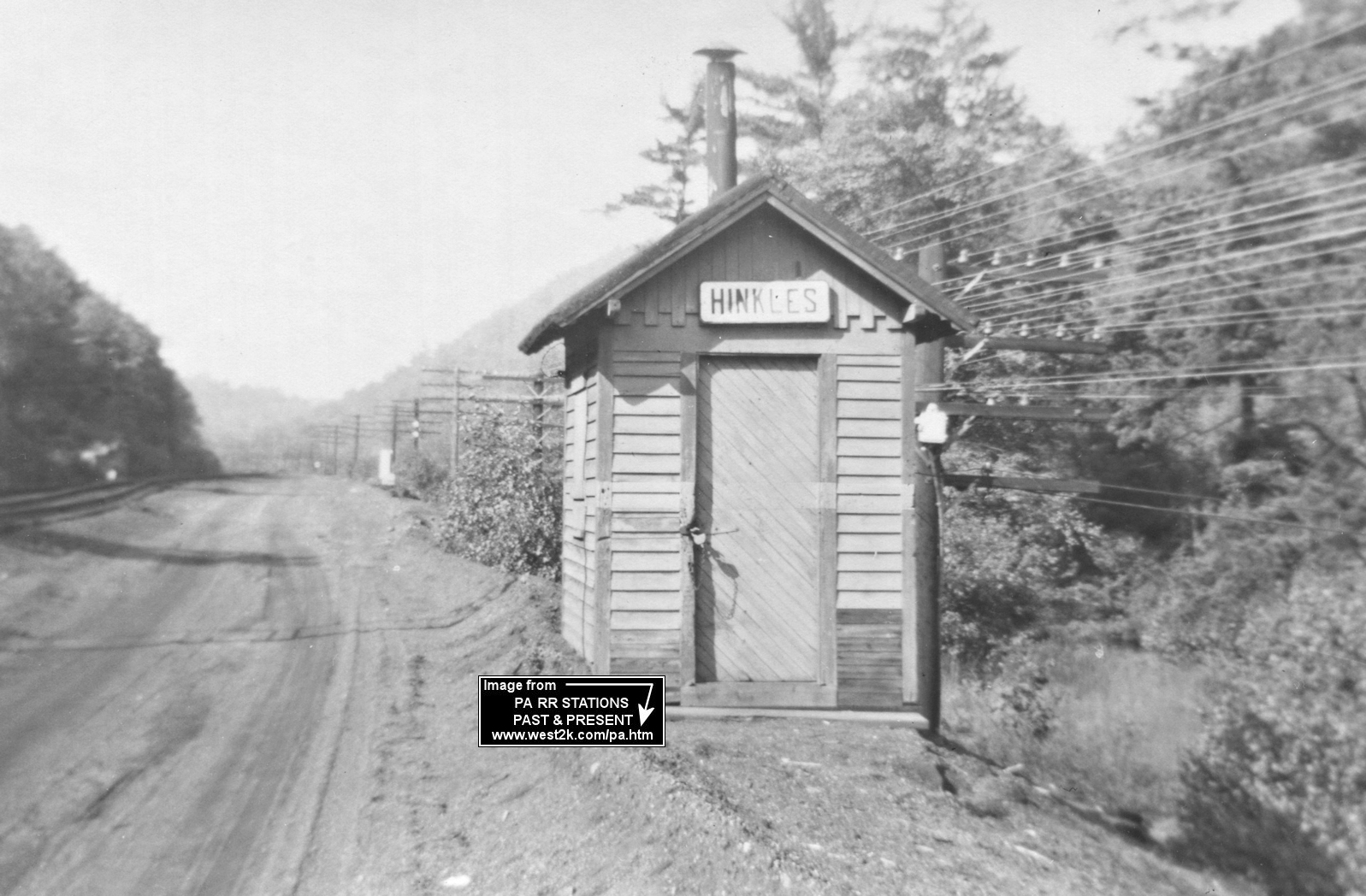
| Hinkles |
|
Hinkles was between Black Creek Junction and M&H Junction on the Ashmore Secondary Track. Black Creek Junction was at milepost 4.3 and Hinkles was at 1.3. | ||||||
| Hudsondale (Hartz) |
|
This was originally called "Hartz Station" by the railroad. | ||||||
| Kittatinny |
|
|||||||
| Lansford |
 |
This station was near the portal to the tunnel and the Lehigh Coal & Navigation office building. | ||||||
| Lehigh Gap |
|
The 1875 and 1921 maps show the station on the south side of what is now PA248 at GPS: 40.793176, -75.612972. | ||||||
| Lehigh Tannery |
|
There were stations on both sides of the river here about 700 feet from each other as the crow flies. The LV station was on the east side of the river (in Carbon Co.) on the south side of Tannery Road on the west side of the tracks. | ||||||
| Lehigh Tannery |
|
The CNJ station here was on the west side of the river (in Luzerne Co.), also on the south side of Tannery Road, on the east side of the tracks. | ||||||
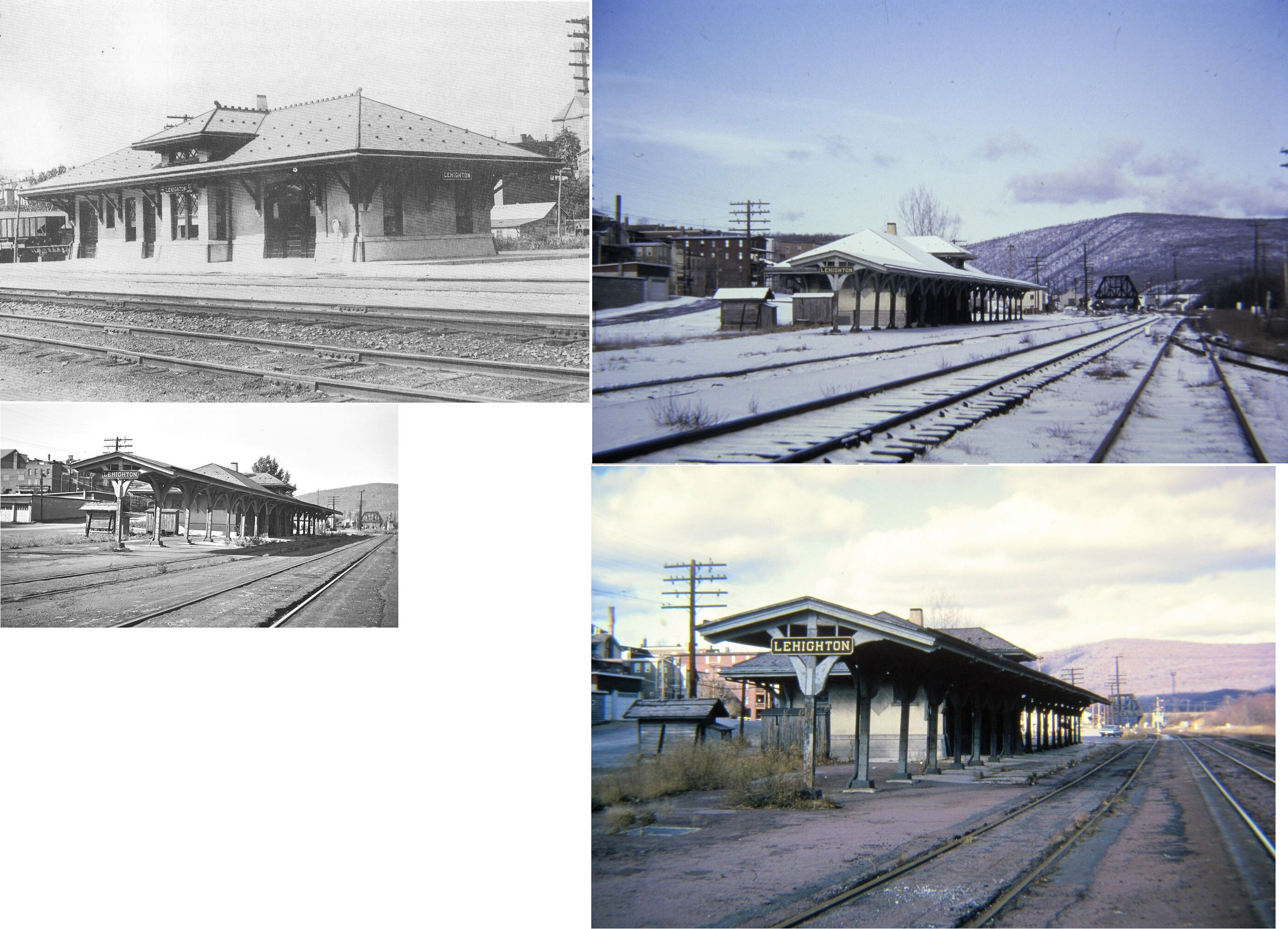
| Lehighton |
|
This staton was east of North 1st Street at GPS: 40.838453, -75.708627. It was torn down in 1960. | ||||||
| Lehighton |
|
The original wooden passenger station here was on what is now Sergeant Stanley Hoffman Boulevard at the end of Coal Street. It was at GPS: 40.837121, -75.707915. | ||||||
| Lehighton |
|
There was a long freight transfer shed located at GPS: 40.837073, -75.706290 along the tracks near the river. | ||||||
| Lehighton |
|
This newer concrete station was located on the street now known as Sergeant Stanley Hoffman Boulevard at GPS: 40.833816, -75.707209. | ||||||
| Lehighton |
|
There was a later concrete freight house along what is now Sergeant Stanley Hoffman Boulevard at GPS: 40.837331, -75.707911. This is just north of where the original passenger station stood. | ||||||
| Leslie Run |
|
|||||||
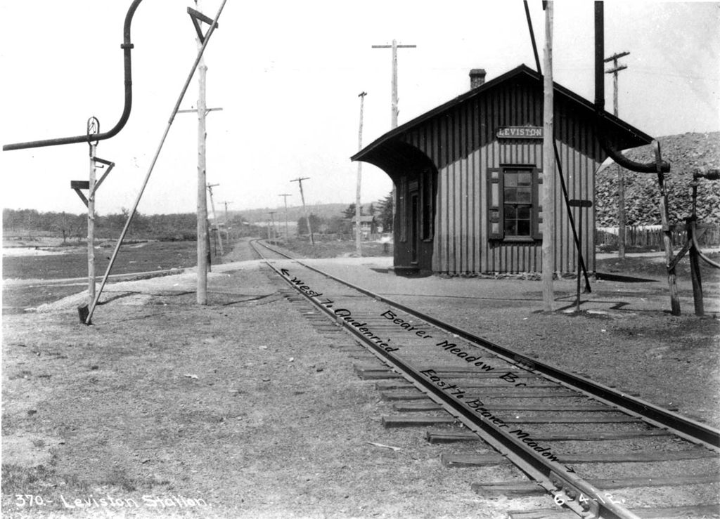
| Leviston |
|
|||||||
| Little Gap |
 |
|||||||
| Lizard Creek Junction |
|
This was where the Pottsville Branch Line of the LVRR joined the main line. | ||||||
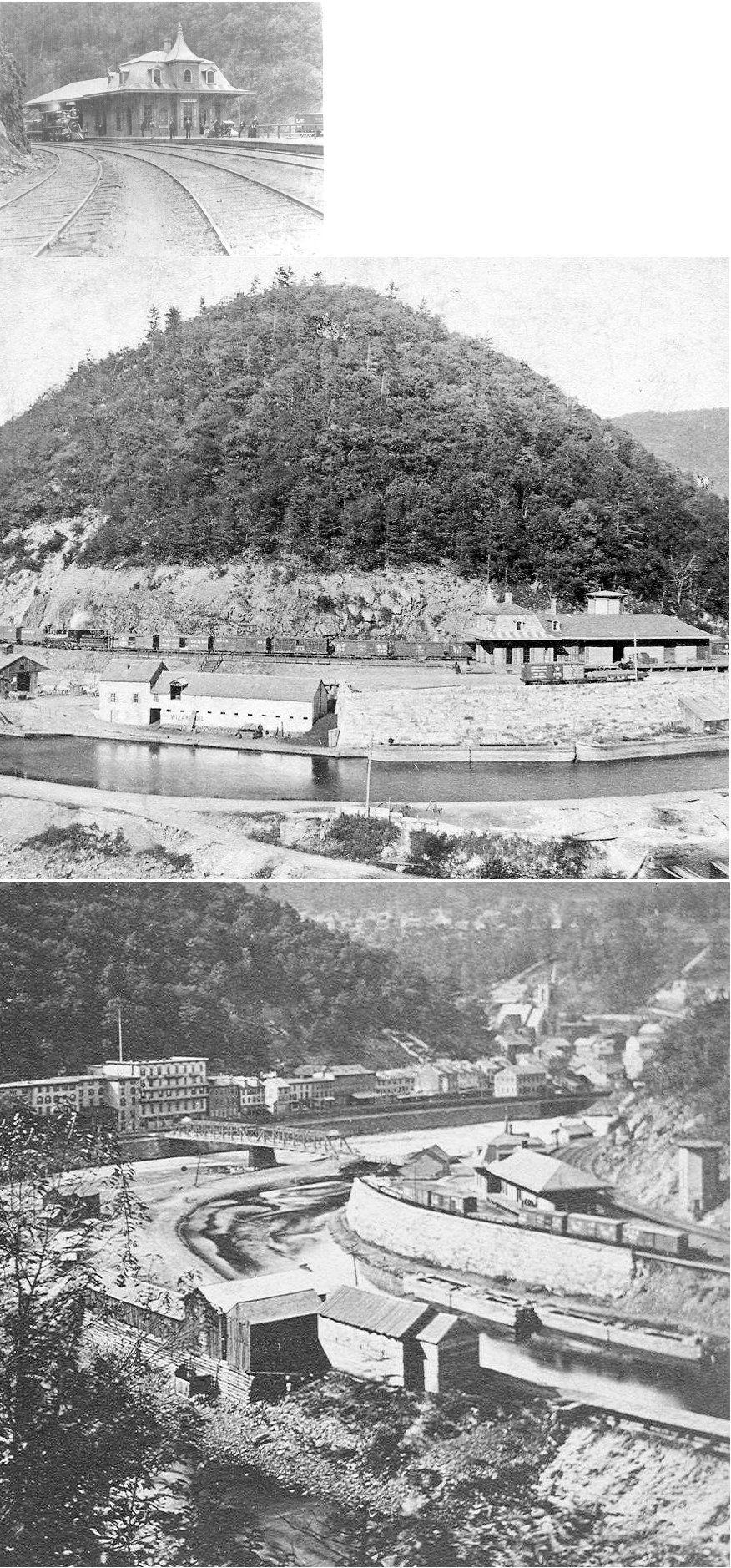
| Mauch
Chunk (Jim Thorpe) |
|
This freight station was next the passenger station to the NE at GPS: 40.863490, -75.737203. | ||||||
| Mauch Chunk (E. Mauch Chunk) (Jim Thorpe) |
|
The first station here. | ||||||
| Mauch
Chunk (E. Mauch Chunk) (Jim Thorpe) |
|
This is the second station. It was abandoned in 1902 when the bridge leading to it from town was washed out in a flood. According to a newspaper article (Pittston Gazette, 3-7-1902) about its demise, the birdge was only used to serve the station which was on a sharp curve. Does anyone know exactly where this station was located? | ||||||
| Mauch Chunk (E. Mauch Chunk) (Jim Thorpe) |
|
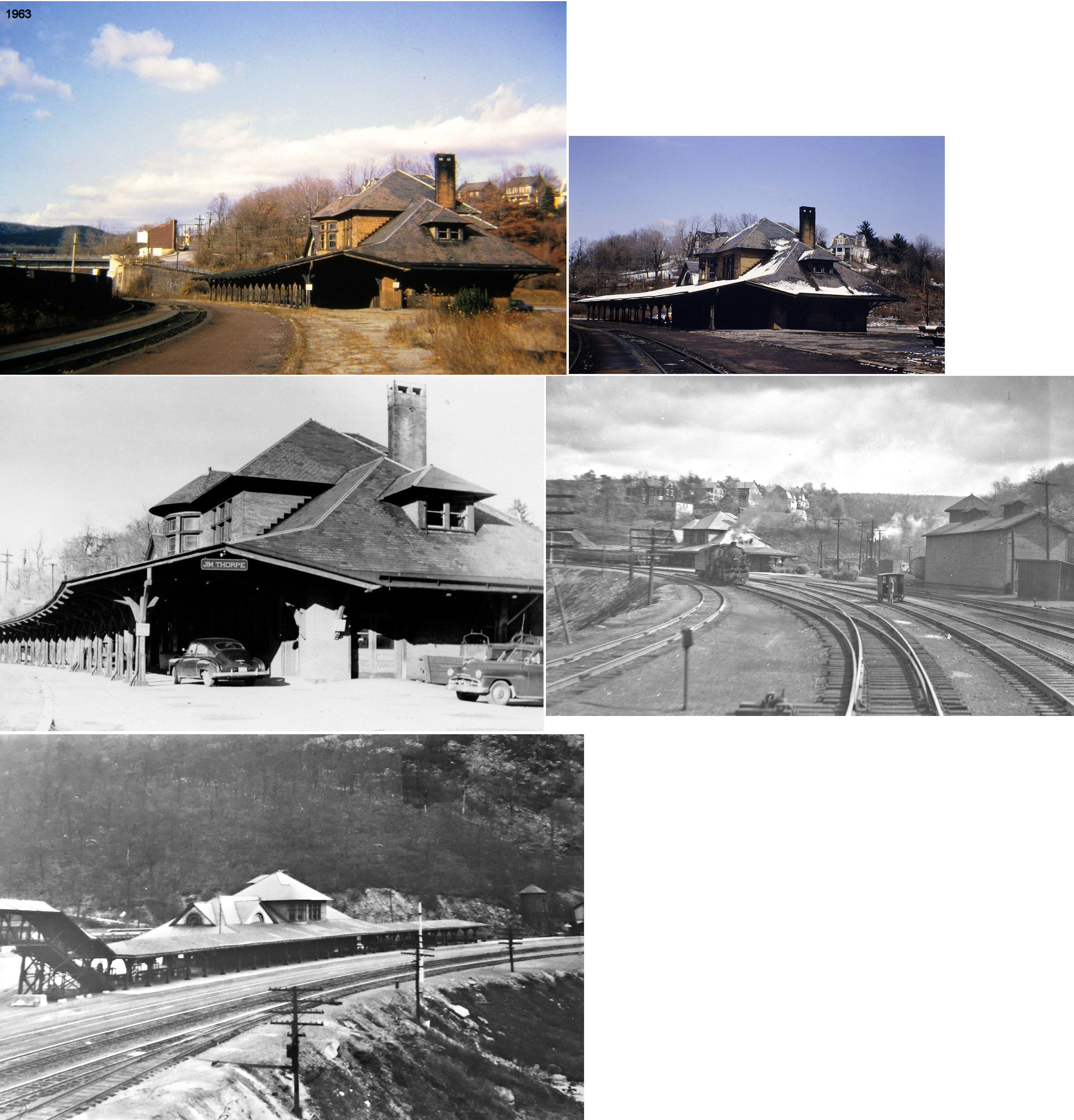
This station was located on Laurel Lane near River Street at GPS: 40.867173, -75.734057. It opened in September of 1903 replacing the one above, but in a different part of town. Between the time the old station was abandoned and the new station was built, there was a temporary wood shelter built here. The passenger station was burned down on August 22, 1964 to make way for a new supermarket (Allentown Morning Call, 8-22-1964). | ||||||
| Mauch Chunk (E. Mauch Chunk) (Jim Thorpe) |
|
There was also a brick freight house just to the NE of the passenger station at GPS: 40.868432, -75.732647. It appear some remnants of this station remain in 2020. | ||||||
| Mauch Chunk (Jim Thorpe) |
 |
The passenger pavillion/ticket office was at the end of Chruch Alley at GPS: 40.866129, -75.737461. | ||||||
| Millers Station |
Hazleton Branch Railroad |
This station was just south of the Luzerne/Carbon County line and just west of Hazle Creek. It is shown on maps from 1875 along with a road that is no longer there. | ||||||
| Mud Run |
|
|||||||
| Nesquehoning |
|
This station was on the south side of the tracks north of Mill Street between Radcliffe and Allen Streets at GPS: 40.863973, -75.815498. | ||||||
| Packerton |
|
|||||||
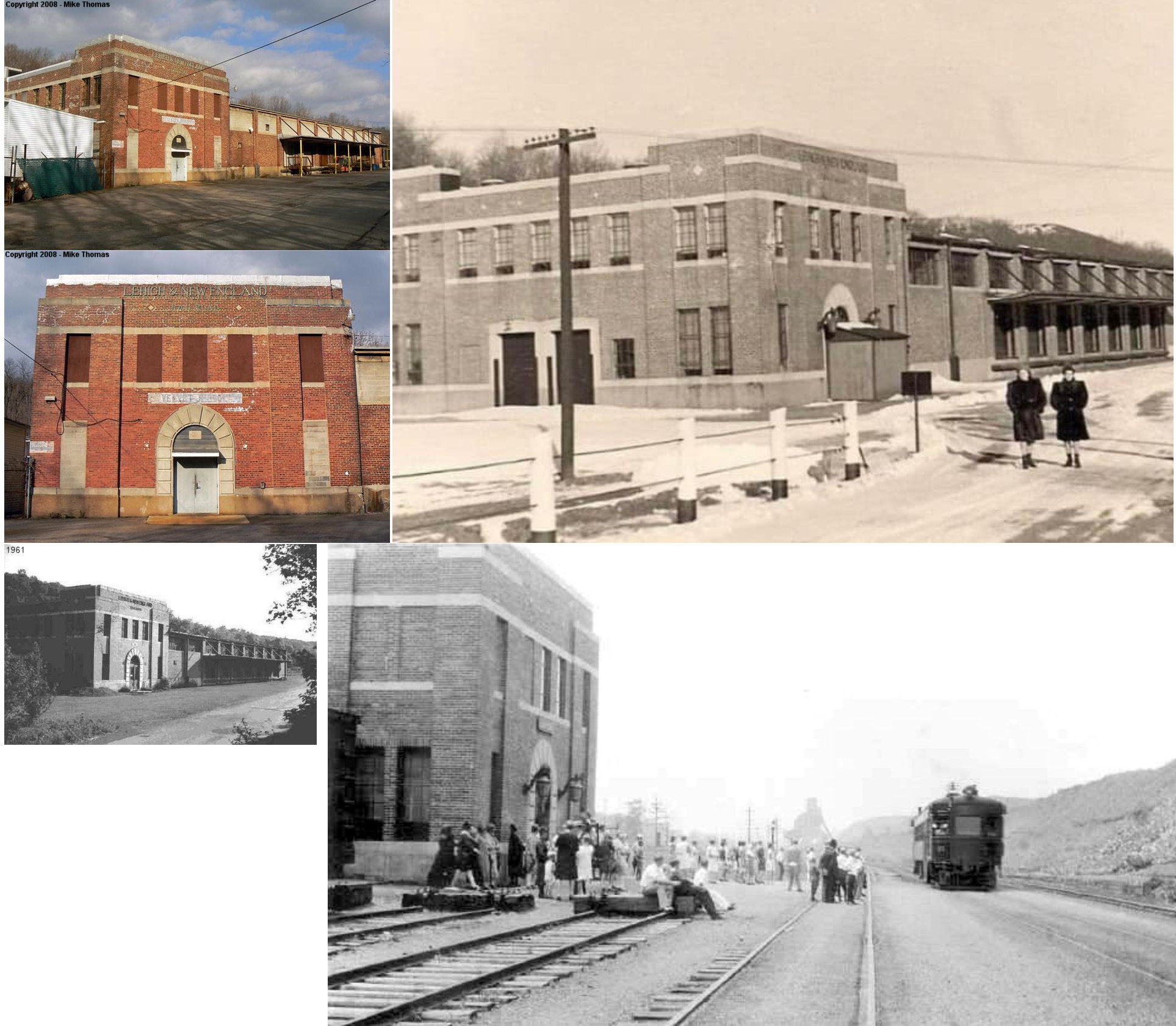
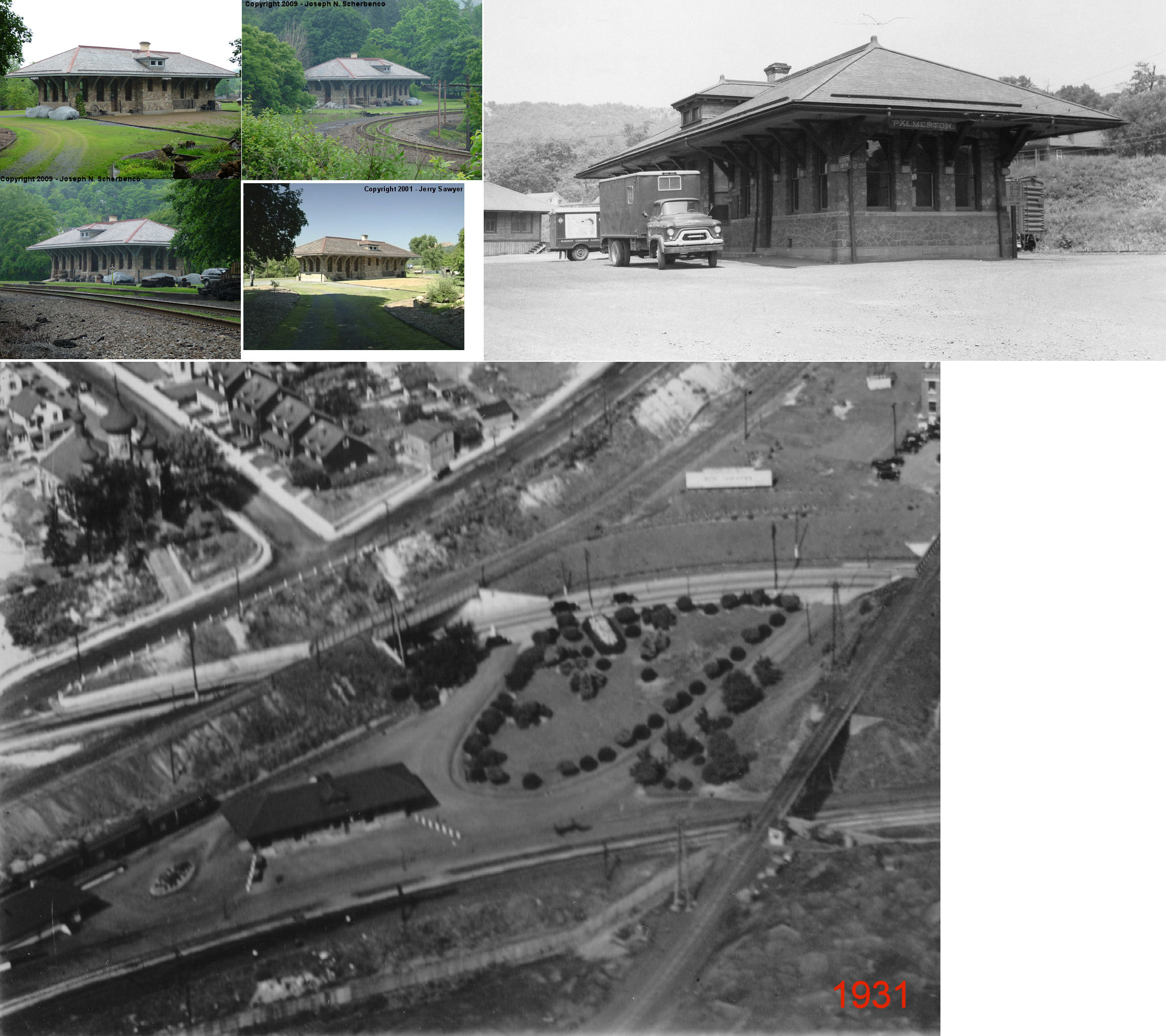
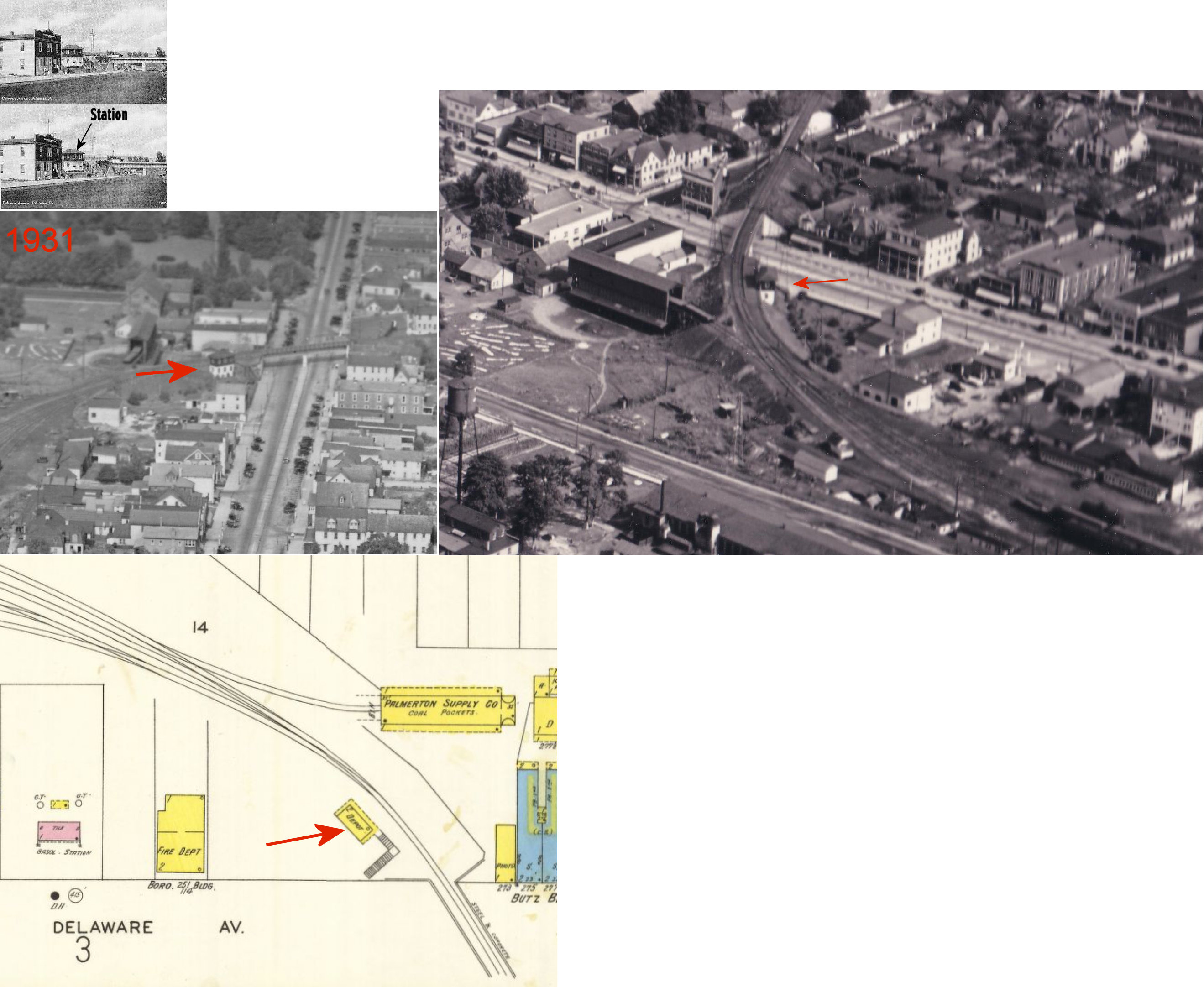
| Palmerton |
|
This two-story station was on the north side of Delaware Avenue just SW of 3rd Street on the SW side of the tracks at GPS: 40.801501, -75.611253. Access to the station was via stairs up from Delaware Avenue. It was built between 1912 and 1921. Prior to this station there was a small 1-story "waiting room" with a platform at the same location. | ||||||
| Palmerton East |
|
|||||||
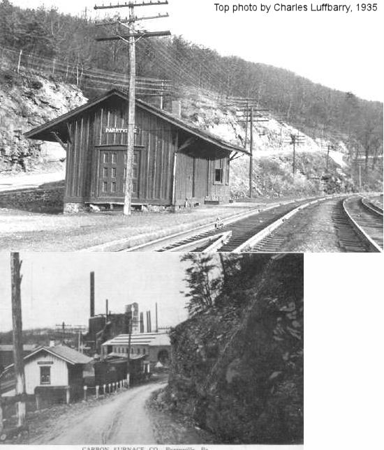
| Parryville |
|
Station was on the north side of the railroad between the mainline and PA248. | ||||||
| Parryville |
|
This station was between the river and where Interstate 476 is today. It was across the river to the SW of the CNJ station. Both the LV and CNJ stations are shown on maps from 1875. | ||||||
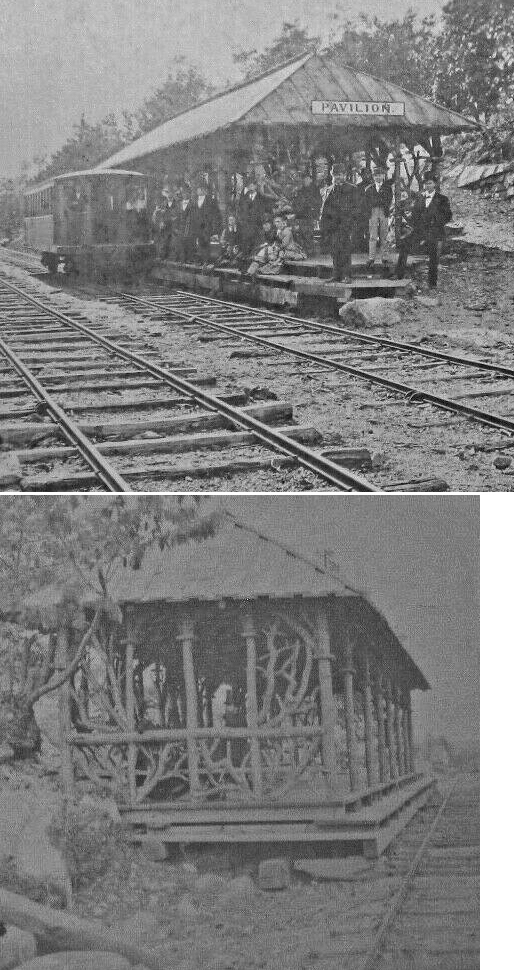
| Pavilion |
|
This station was on the Mt. Pisgah Plane. | ||||||
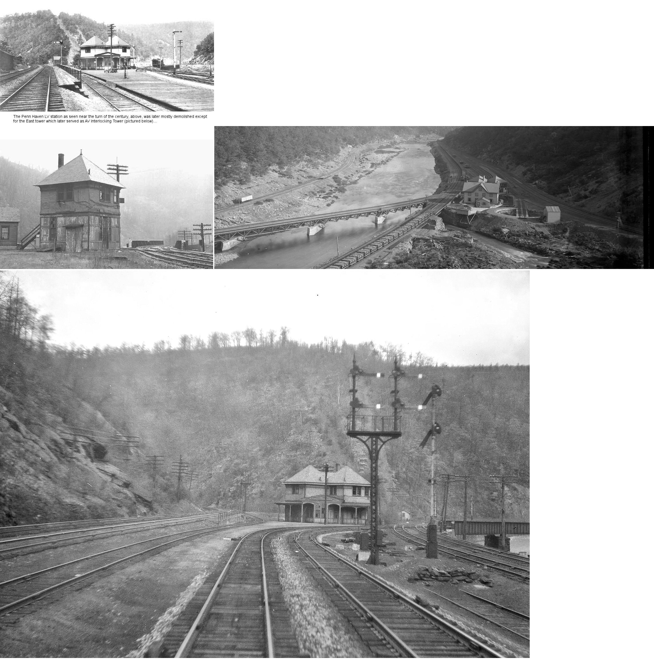
| Penn Haven Jct. |
|
The original Penn Haven station was on the south side of the Quakake Creek just across the trestle where the RR crossed the creek. Later, the station pictured was built between the tracks. | ||||||
| Penn Haven Jct. |
|
This station was not far from the LV station. | ||||||
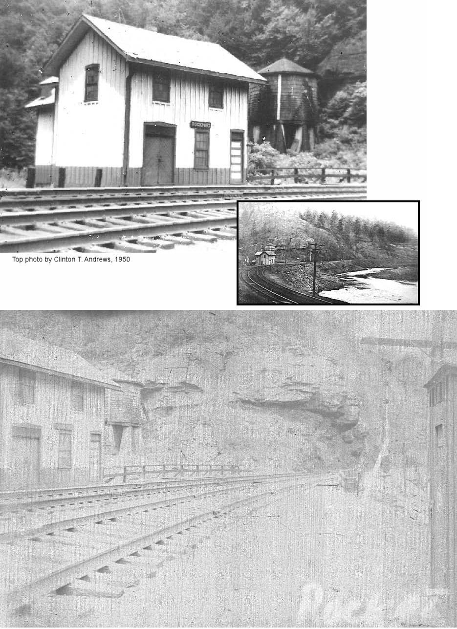
| Rockport |
|
Contained living quarters for the stationmaster and his family, as well as a prepay freight station run by the agent at White Haven. The station was located on the west bank of the Lehigh River and also served the poorhouse at Lowrytown. | ||||||
| Rockport |
|
The Rockport LV station in 1875 was on the east side of the Lehigh River, but there was a ferry to shuttle passengers across the river to and from the town. | ||||||
| Stetler |
|
This station was between Hickory Run and Mud Run stations. It was on the east side of the Lehigh River across the river and just a bit south of where Leslie Run flows into the Lehigh River. | ||||||
| Stony Creek |
|
|||||||
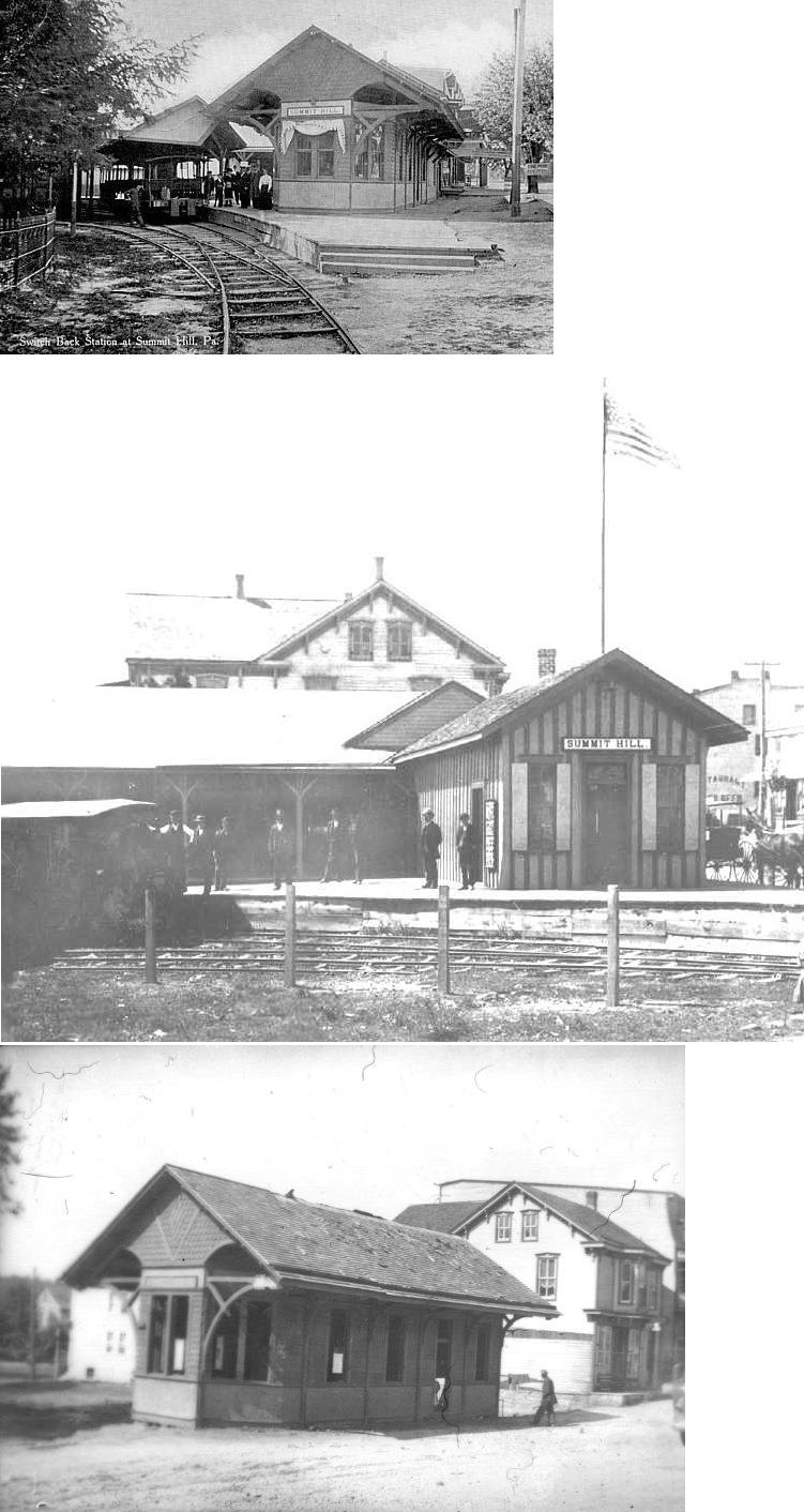
| Summit Hill |
|
This station was on the south side of West Ludlow Street (formerly known as Railroad Street) between Market and Chestnut Streets at GPS: 40.824656, -75.872029. | ||||||
| Walkton |
|
|||||||
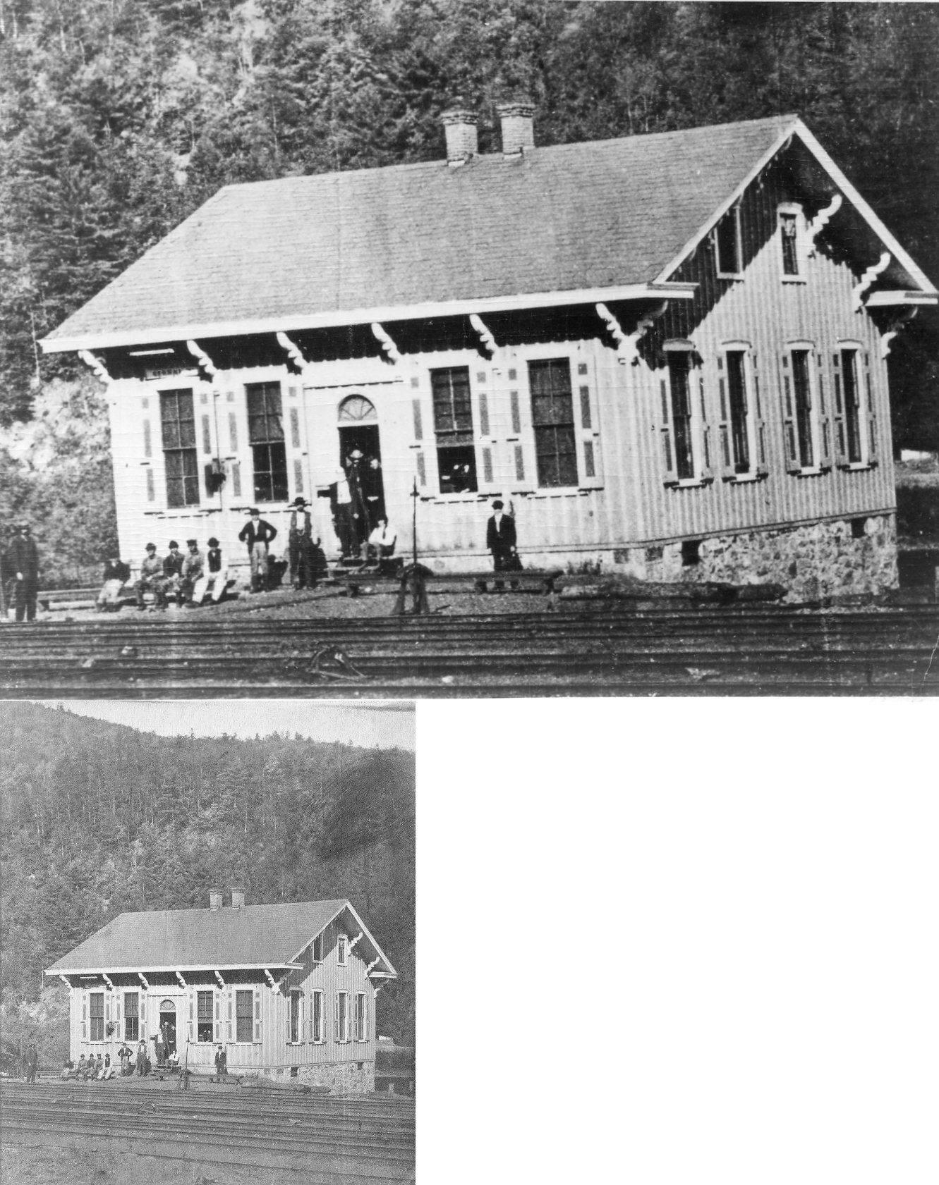
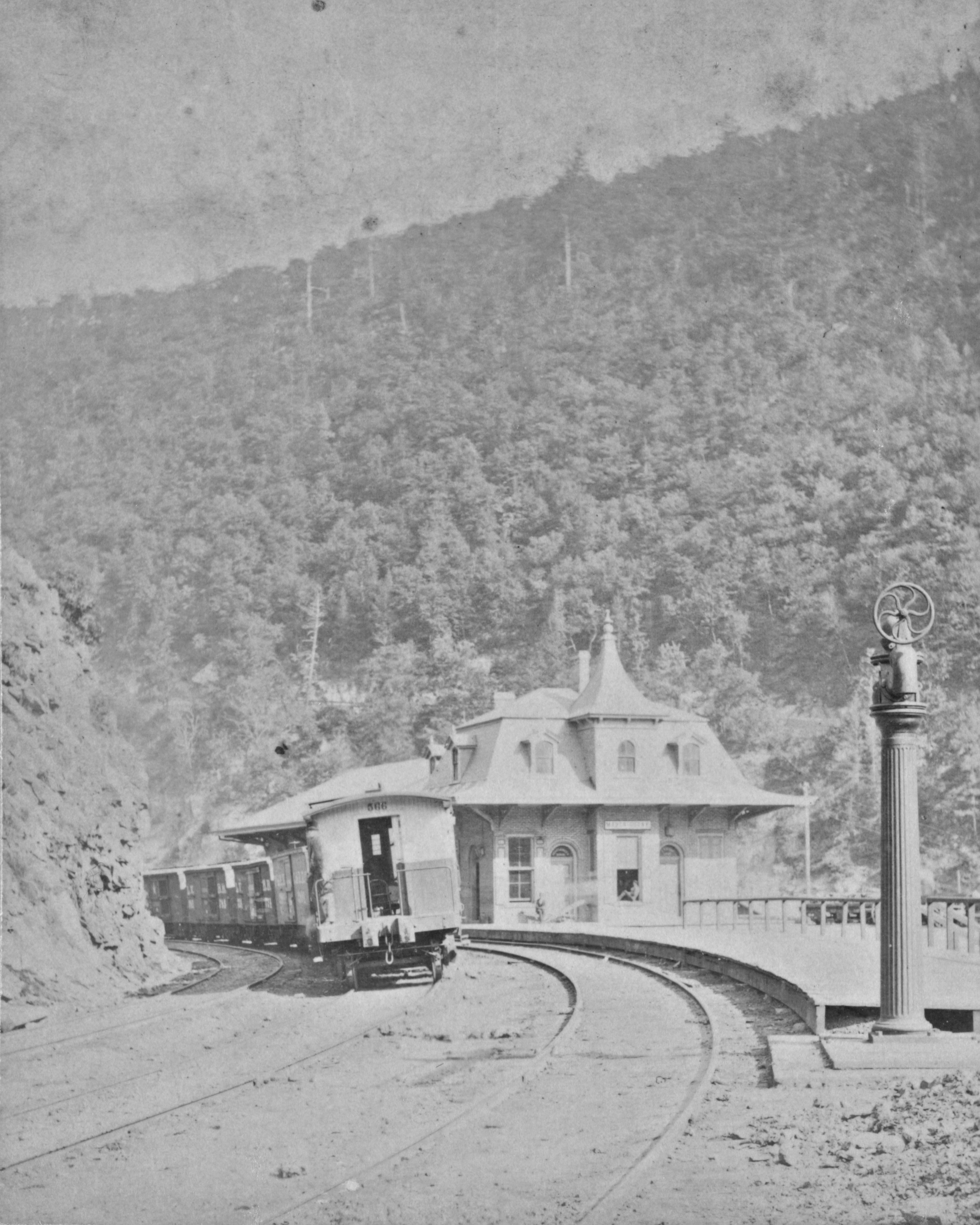
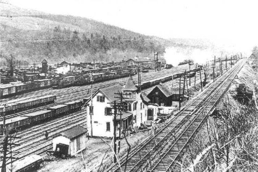
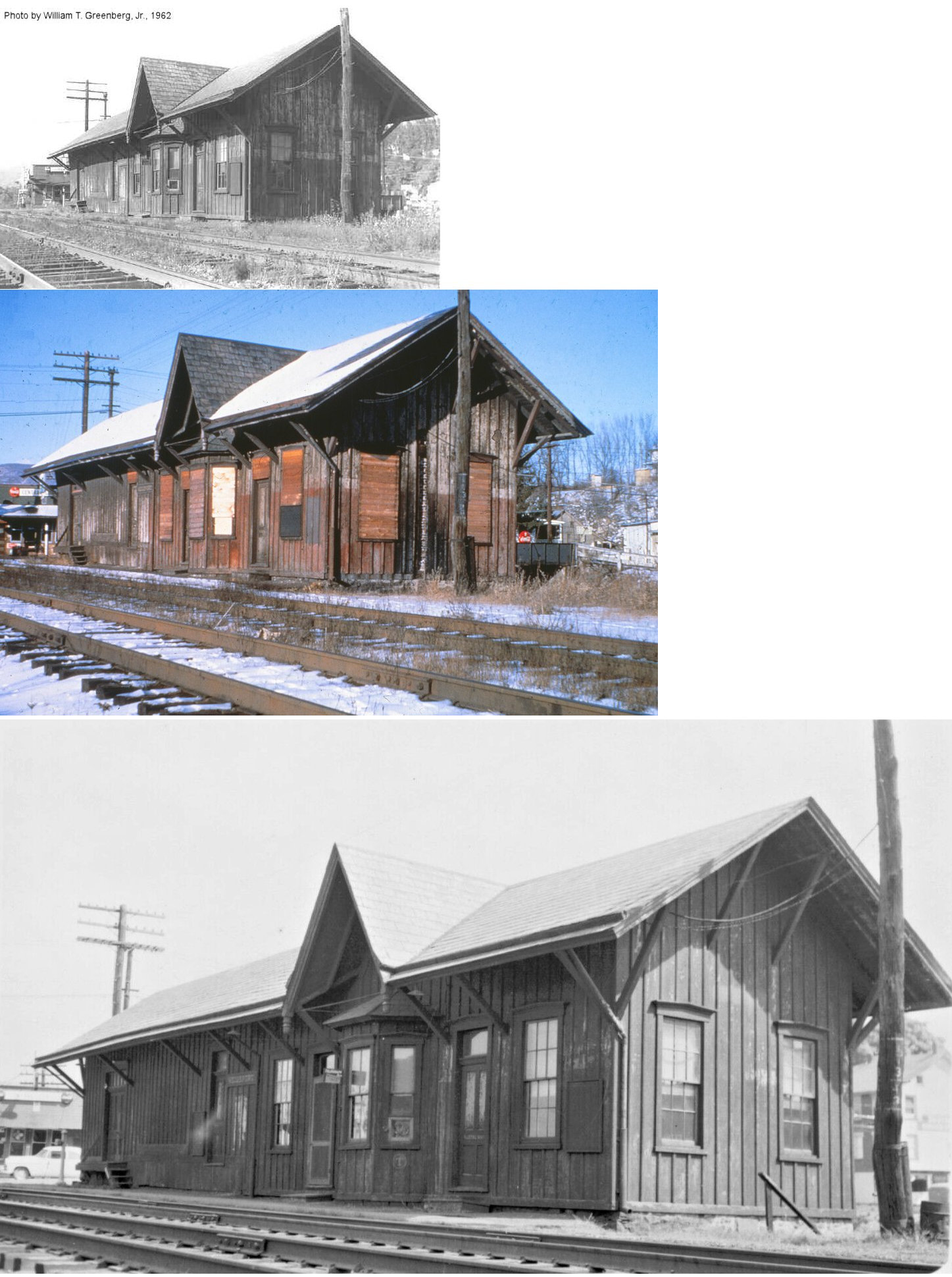
| Weatherly |
|
The photo shows the original LV station. | ||||||
| Weissport |
|
In 1875, the station was near the north end of White Street at what used to be Mill Street. | ||||||
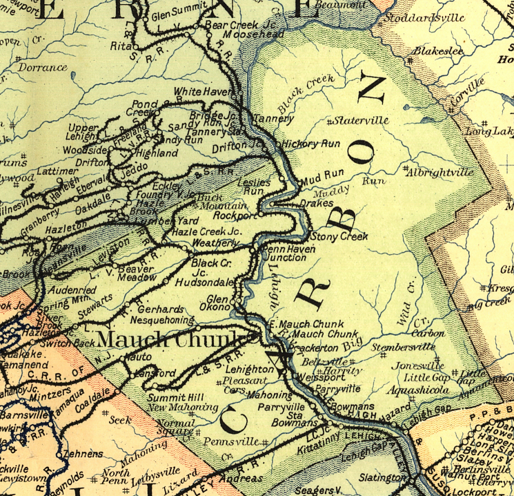
| 1895 CARBON COUNTY RAILROAD MAP | ||||||||
 |
||||||||
| Notes About Existing
Stations... Lansford (L&NE) - The Panther Creek Railroad Company was absorbed by the L&NE in 1913 and this station was built in 1925. It was originally a combination passenger/freight station, but then served as freight-only when passenger service ended in 1937. The station was closed by the railroad in 1952 and the building then served as Hill's Machine Shop from 1956-2021. As of 2022 the building was for sale and there have been efforts to acquire and preserve it. Palmerton (CNJ) - The station is now authentically restored and houses the Millimeter Wave Research Laboratory. The men's waiting room and the baggage room had been vandalized and heavily fire damaged. It has been gutted and rebuilt. The nature of the ongoing research precludes public visitation without prior arrangement. Small groups of ten or less can be accommodated and there is no charge. Weatherly (LV) - In 2021 the building was vacated by the police deaprtment which moved into a new building. The station was then sold to a local businessman. The building along the tracks between Carbon Street and Hudsondale Street, just south of 1st Street was not a depot, but rather a dispatcher's office. It is now The Weatherly Area Musuem and has lots of local railroad artifacts! |
||||||||