|
|
||||||||
| EXISTING STATIONS | ||||||||
|---|---|---|---|---|---|---|---|---|
| Station Name |
Original Railroad |
Current Location |
Type | Current Use |
Date Built |
Track Status |
Building Material |
More Info |
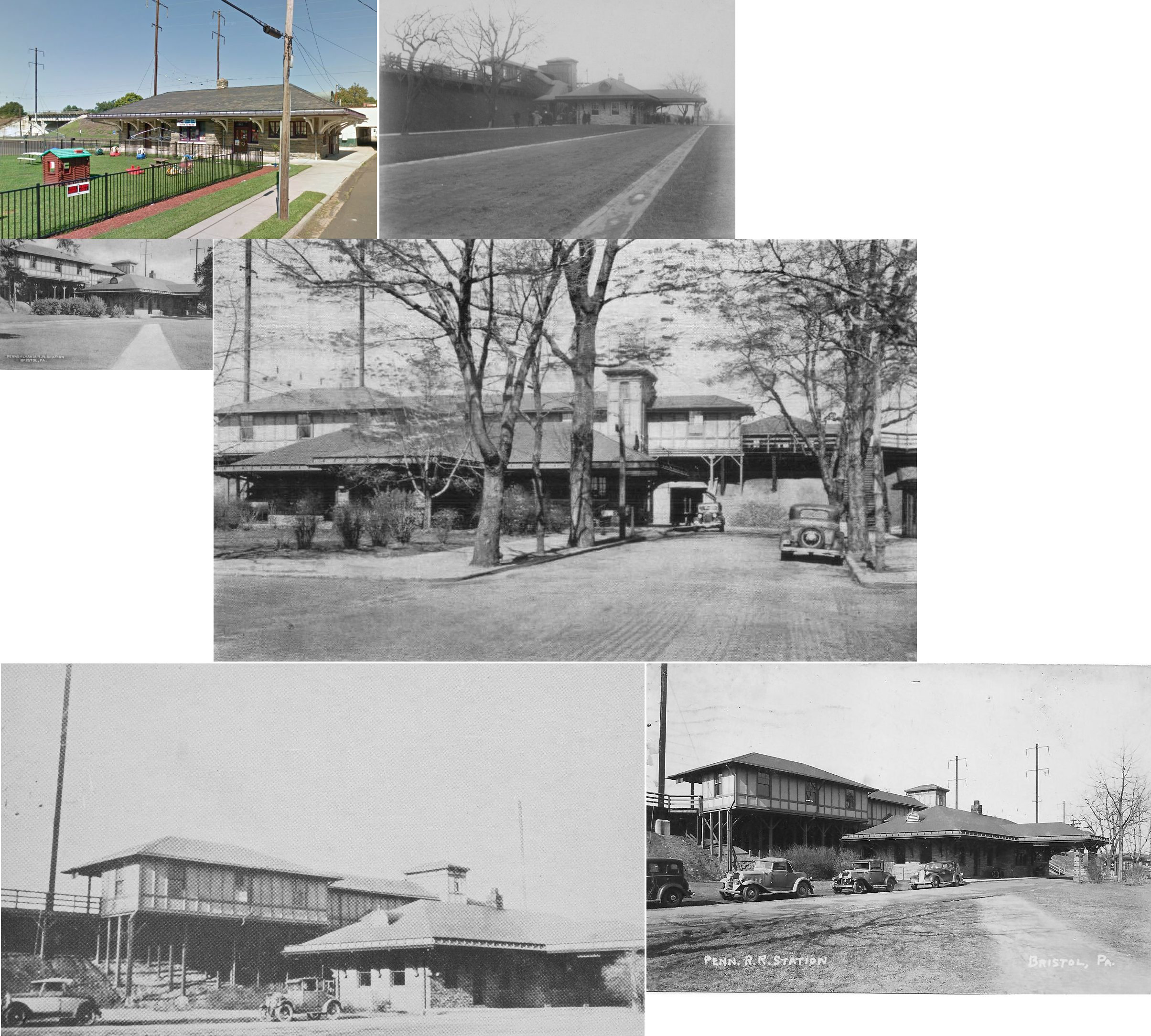
| Bristol |
 |
Corner of Washington Street and Prospect Avenue (GPS: 40.104631, -74.854920) |
P | Railroad | 1911 | In Use | Stone |
|
| Chalfont |
 |
Sunset Avenue near PA152 (GPS: 40.287800, -75.210166) |
P | Unknown | ???? | In Use | Wood/ Stucco |
|
| Chalfont |
 |
Sunset Avenue (GPS: 40.287849, -75.211168) |
P | Railroad | ???? | In Use | Wood | |
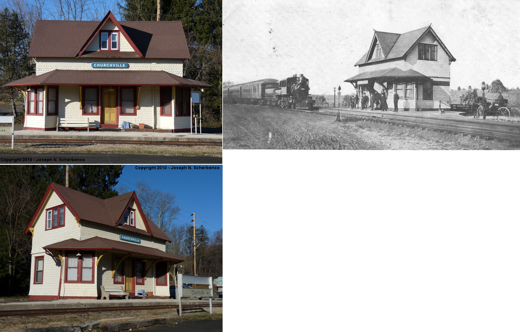
| Churchville |
|
West side of Bustleton Pike at Elm Avenue (GPS: 40.184903, -75.013709) |
P | House | 1892 | Aband. | Wood |
|
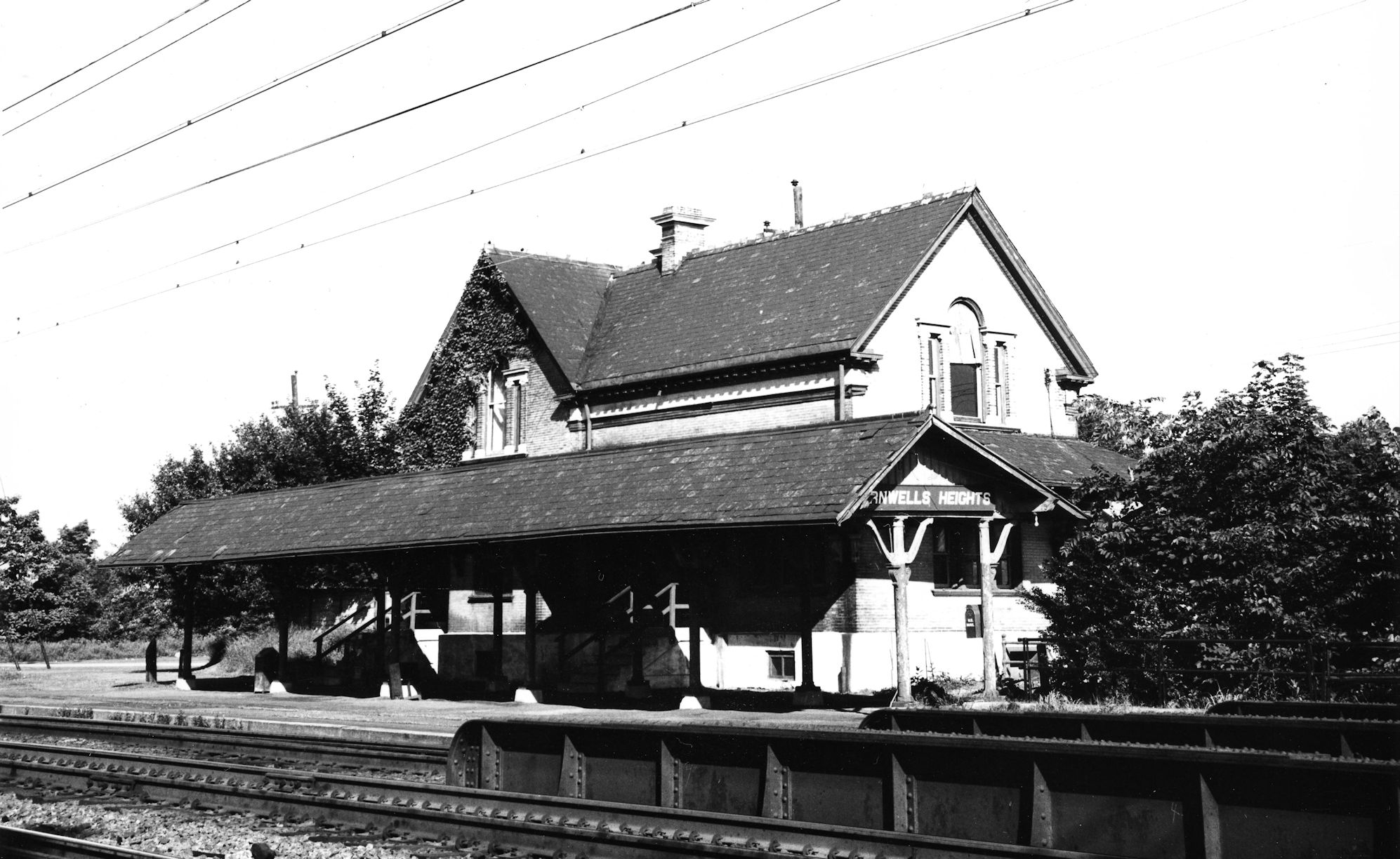
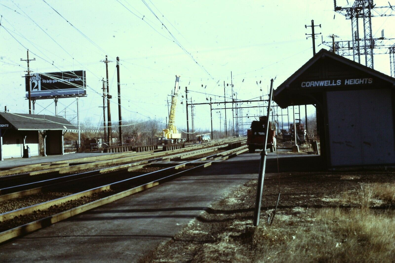
| Cornwells Heights |
|
On Station Avenue near Interstate 95 (GPS: 40.071731, -74.952095) |
P | Railroad | ???? | In Use | Metal | |
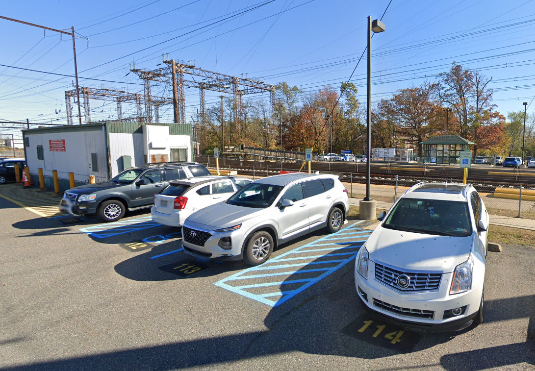
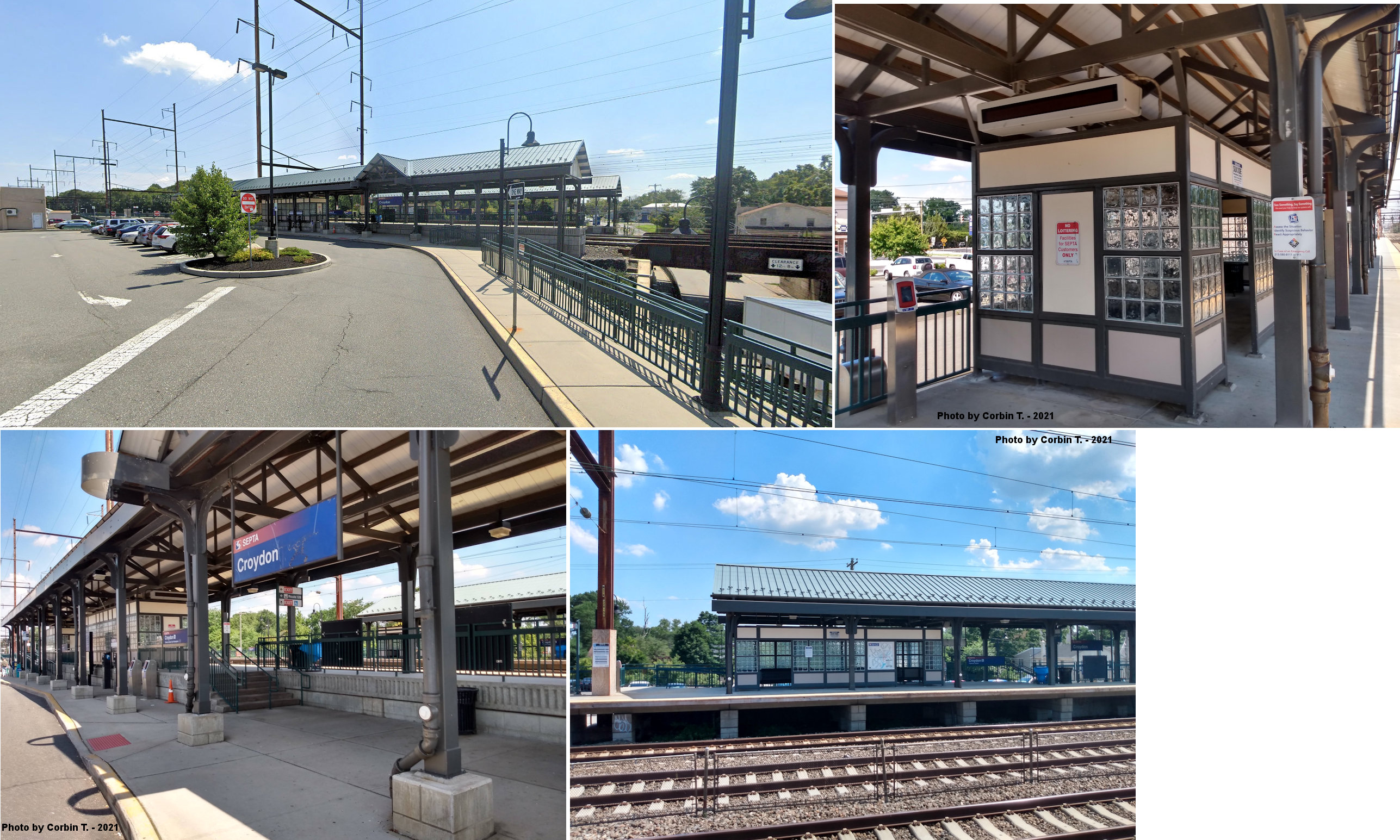
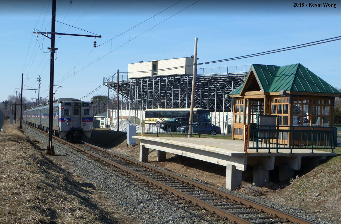
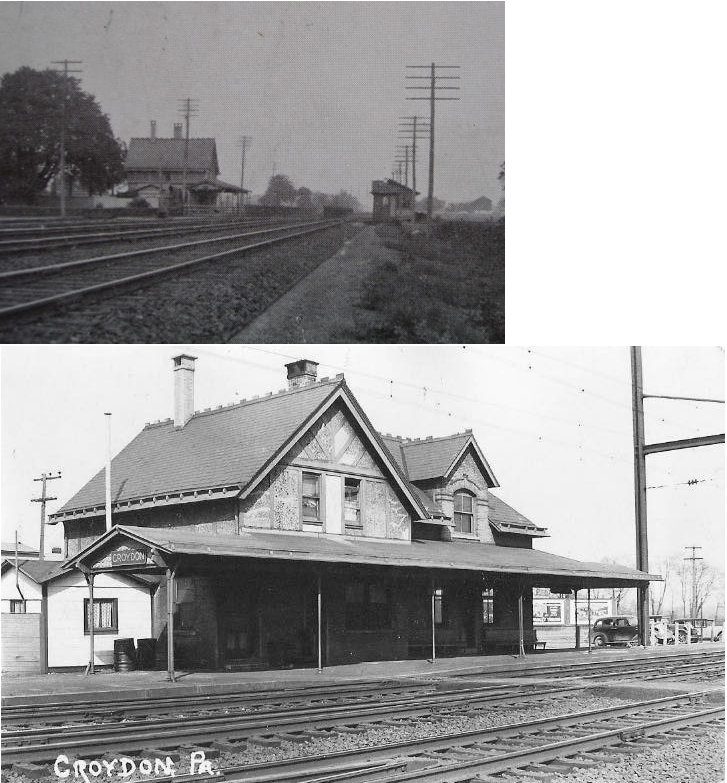
| Croydon |
|
Bristol Pike near Cedar Avenue (GPS: 40.093652, -74.906814) |
P | Railroad | ???? | In Use | Metal | |
|
Delaware Valley University (Doylestown) |
|
Next to stadium paring lot off Campus Loop Drive (GPS: 40.297272, -75.161760) |
P | Railroad | 1977 | In Use | Wood |
|
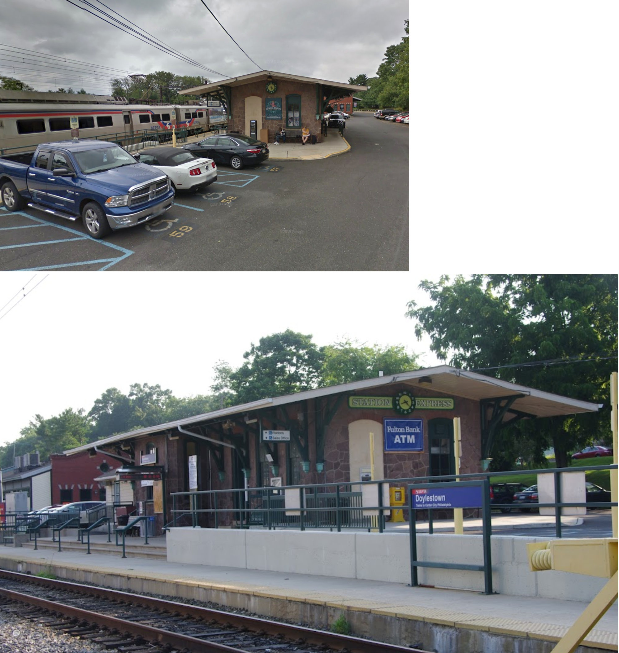
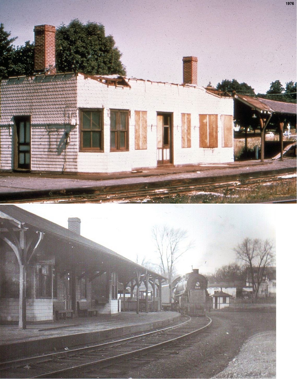
| Doylestown |
 |
South Clinton Street and Ashland Street (GPS: 40.306276, -75.130838) |
P | Railroad | 1871 | In Use | Stone |
|
| Doylestown |
|
South Clinton Street and Ashland Street (GPS: 40.305817, -75.131433) |
F | Railroad | ???? | In Use | Brick | |
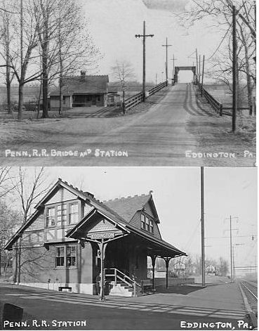
| Eddington |
|
Street Road (PA132) between Delaware Expressway (Interstate 95) and
Dunksferry Road (GPS: 40.082887, -74.933597) |
P | Railroad | ???? | In Use | Brick | |
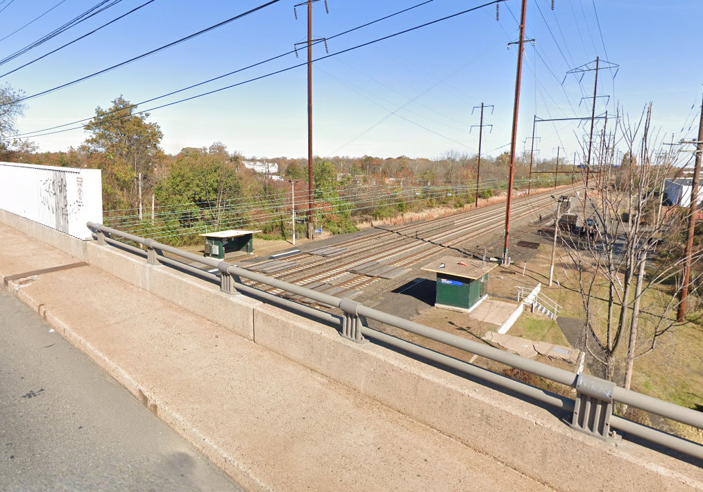
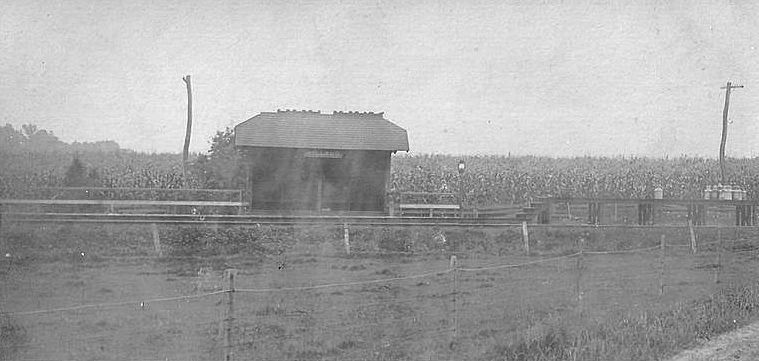
| Fairless Junction? |
|
SE corner of South Lincoln Avenue and East Centre Avenue in Newtown (GPS: 40.227420, -74.931519) | P | Vacant | ???? | None | Wood |
|
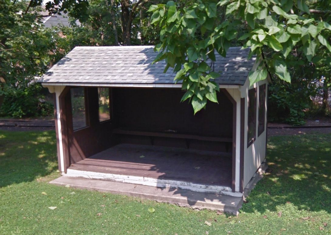
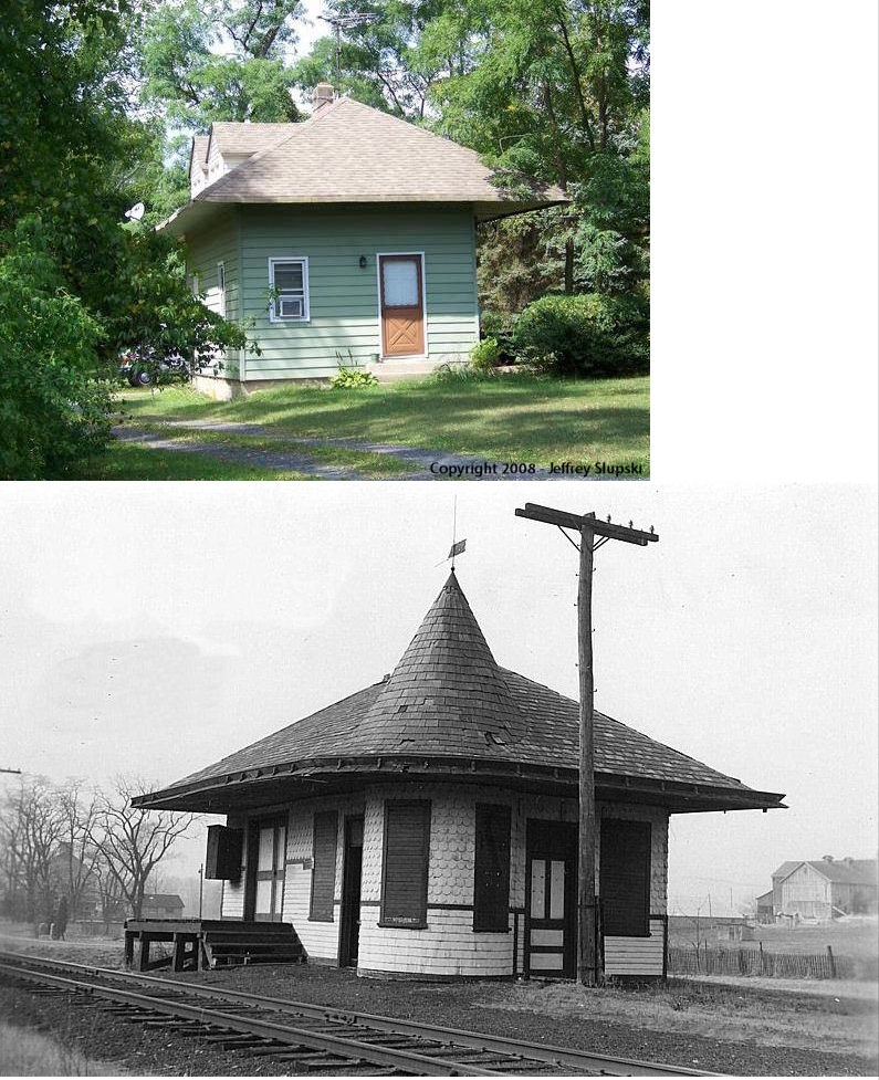
| Lahaska |
 |
Street Road between Upper Mountain Road and Lower Mountain Road (GPS: 40.337363, -75.014379) |
C | Railroad | 1989? | In Use | Wood |
|
| Lahaska |
|
5822 Lower Mountain Road (GPS: 40.334080, -75.012579) |
P | Residence | 1891 | None | Wood |
|
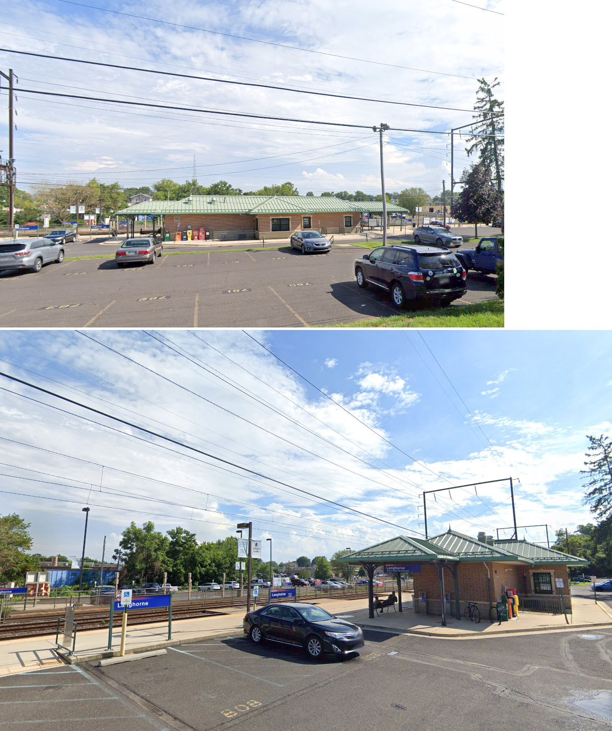
| Langhorne |
|
137 Comly Avenue, near Bellevue Avenue (GPS: 40.160766, -74.913072) |
P | Railroad | 2010 | In Use | Brick | |
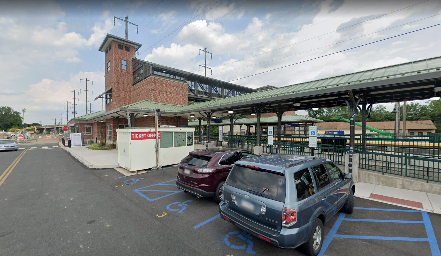
| Levittown |
|
Levittown Parkway between Bristol Pike (US-13) and Fallsington Avenue (GPS: 40.140214, -74.817287) |
P | Railroad | ???? | In Use | Brick | |
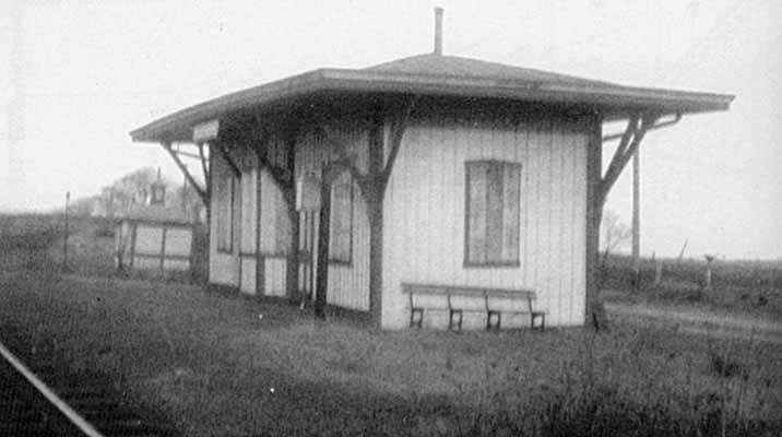
| Neshaminy Falls |
|
West side of East Bristol Road on the north side of the tracks (GPS: 40.146918, -74.962226) |
C | Railroad | ???? | In Use | Metal | |
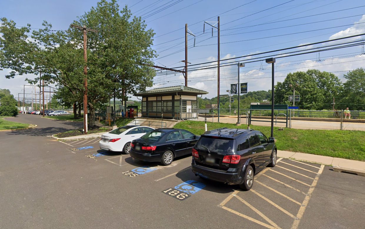
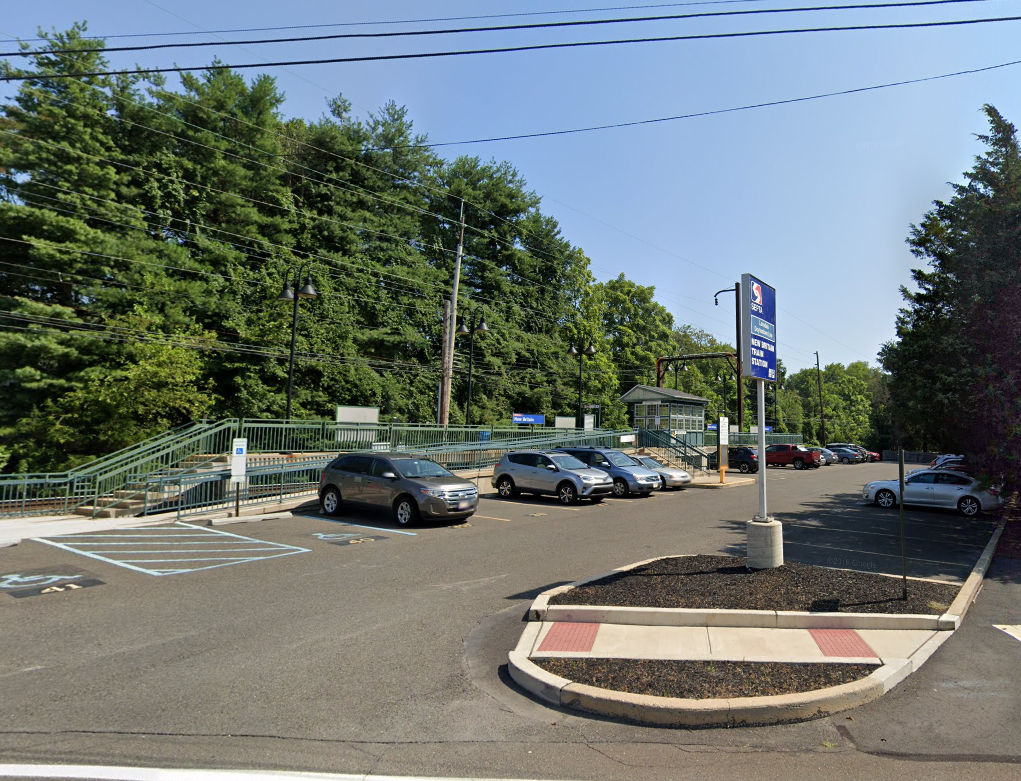
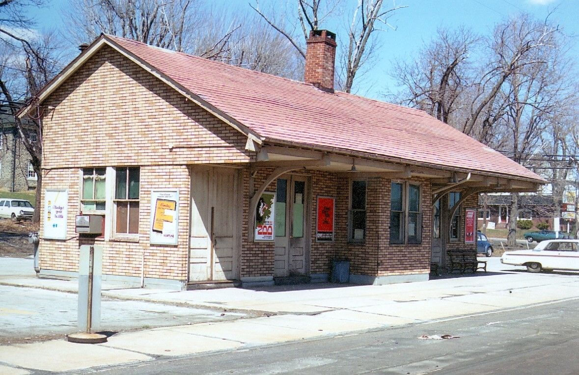
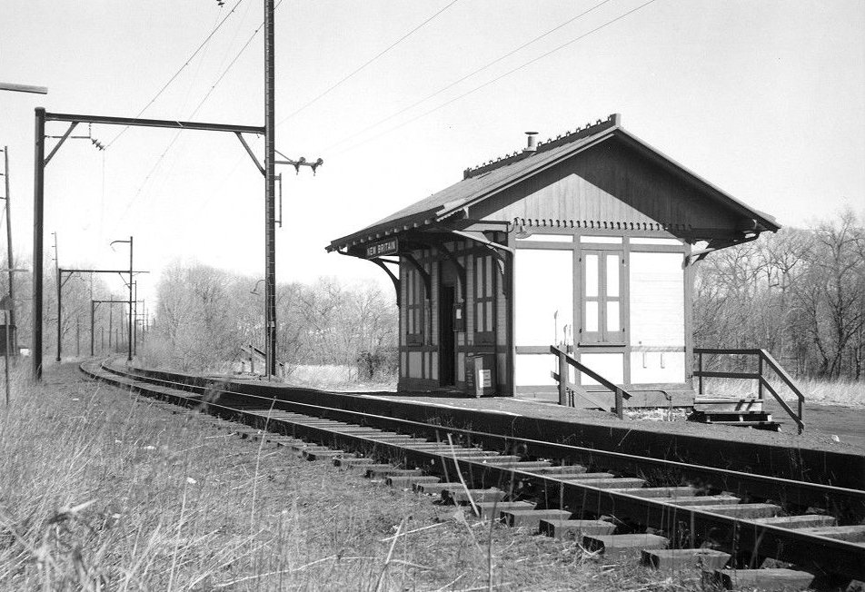
| New Britain |
|
South Tamenend Avenue near Matthews Avenue (GPS: 40.297437, -75.179649) |
P | Railroad | ???? | In Use | Metal | |
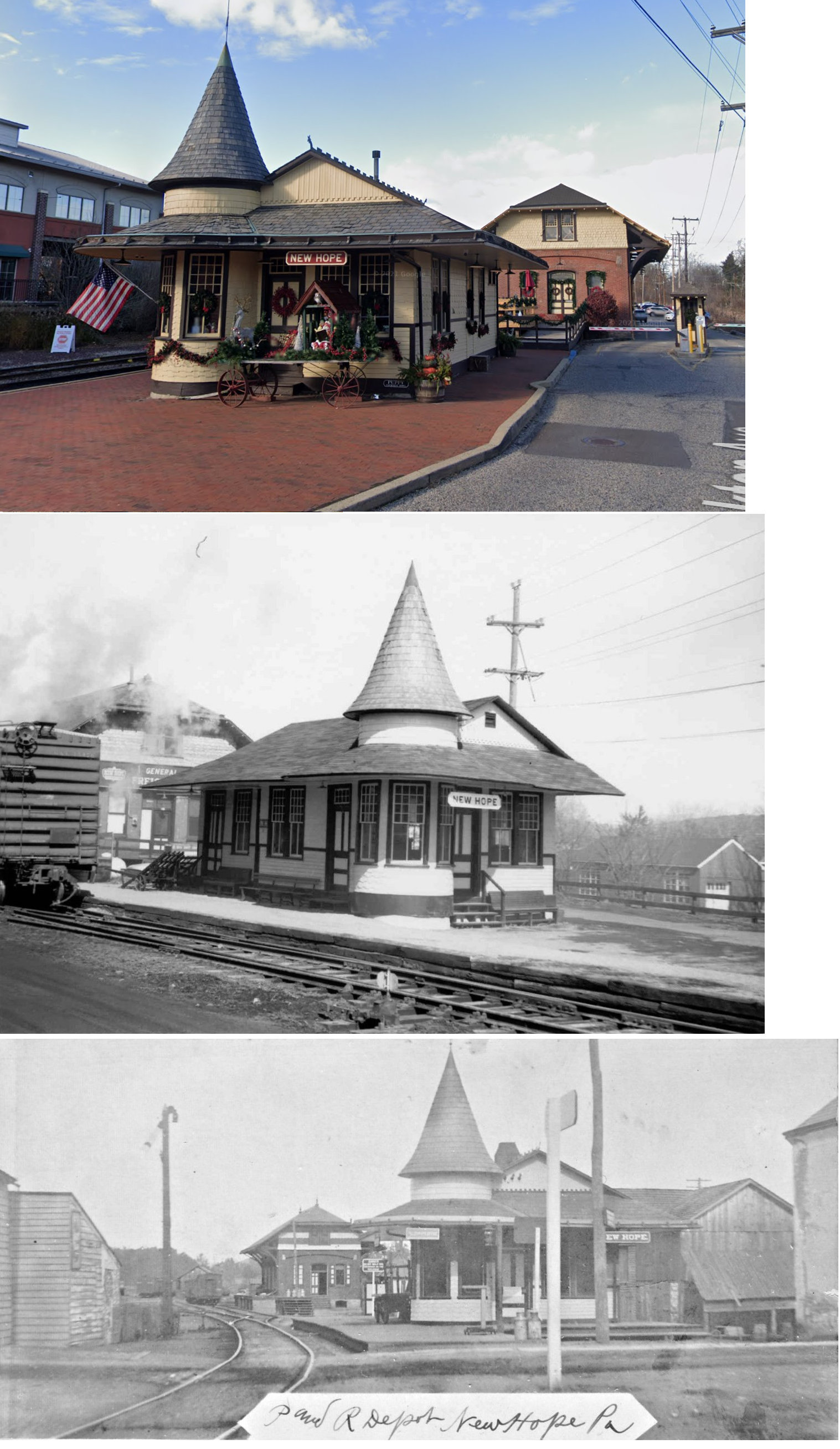
| New Hope |
|
Stockton Avenue north of West Bridge Street (GPS: 40.364976, -74.953419) |
P | Railroad | 1891 | In Use | Wood |
|
| New Hope |
|
Stockton Avenue north of West Bridge Street (GPS: 40.365260, -74.953479) |
F | Railroad | 1891 | In Use | Brick | |
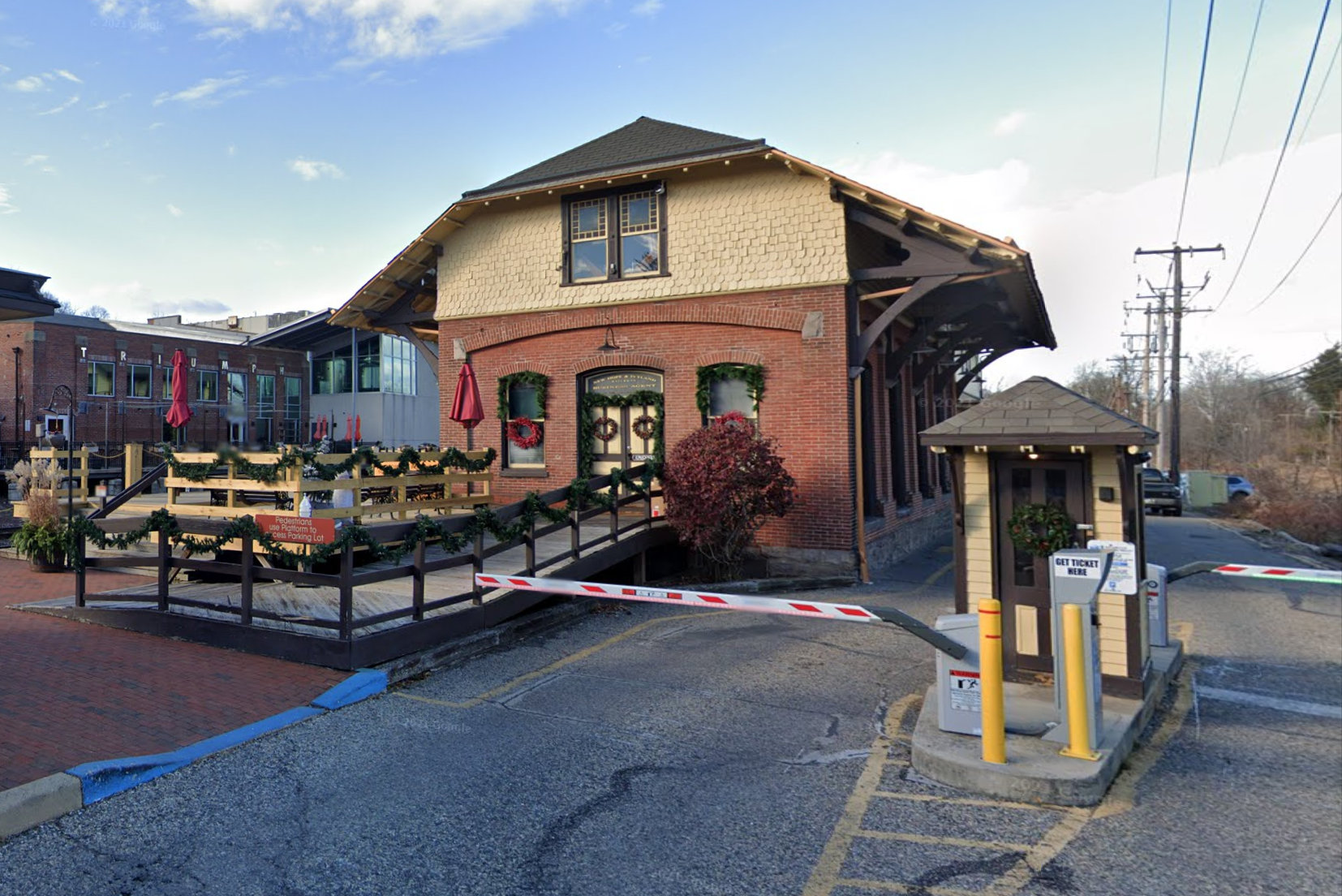
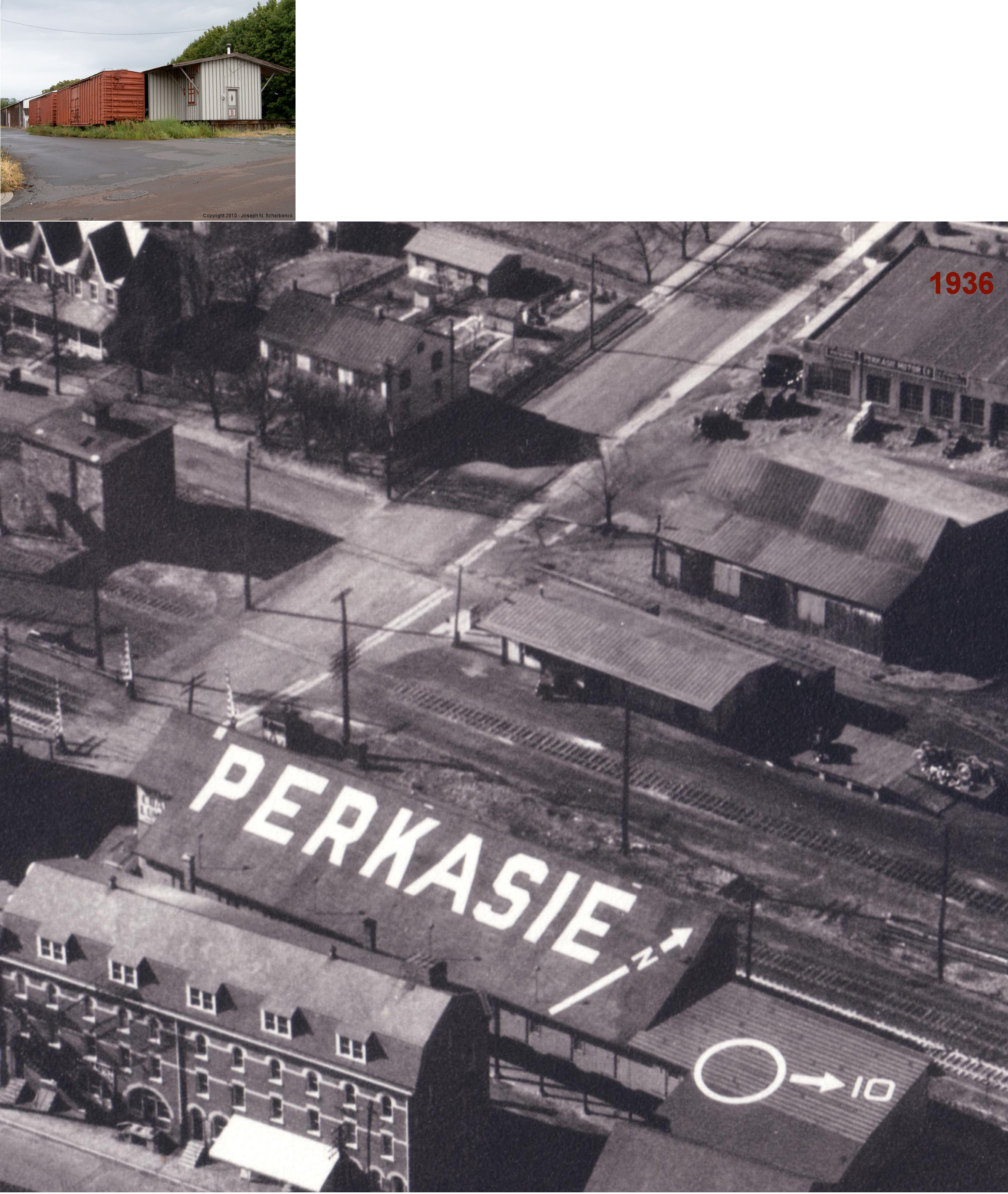
| Perkasie |
|
50 South 7th Street (GPS: 40.374452,-75.296836) |
P | Business | 1891 | In Use | Brick/ Stone |
|
| Perkasie |
|
West Market Street at North 8th Street (GPS: 40.375337,-75.296388) |
F | Business | 1891 | In Use | Wood | |
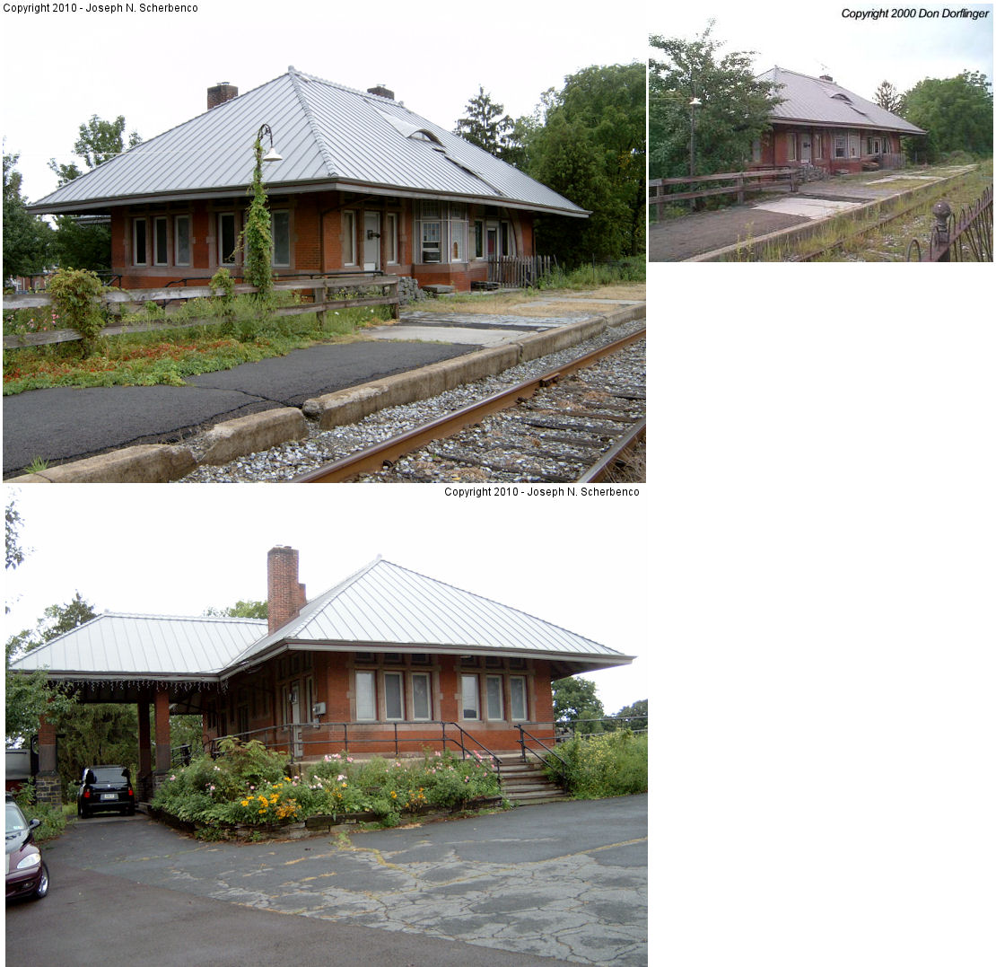
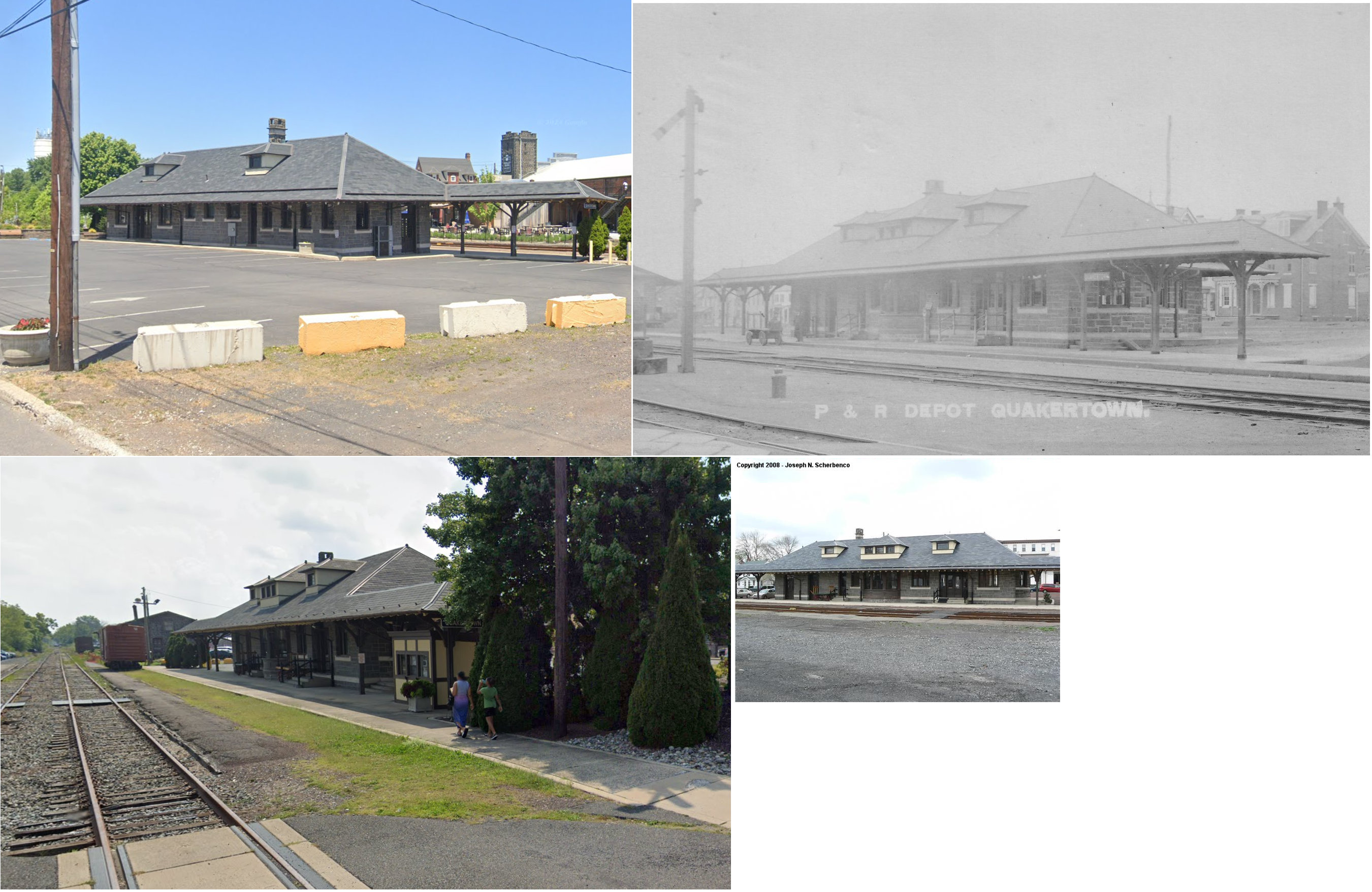
| Quakertown |
|
Route 313 (Broad Street) and Front Street (GPS; 40.440883, -75.334620) |
P | Vacant | 1902 | In Use | Stone |
|
| Quakertown |
|
Front Street south of Route 313 (Broad Street) (GPS: 40.440243, -75.334060) |
F | Storage | 1902 | In Use | Stone | |
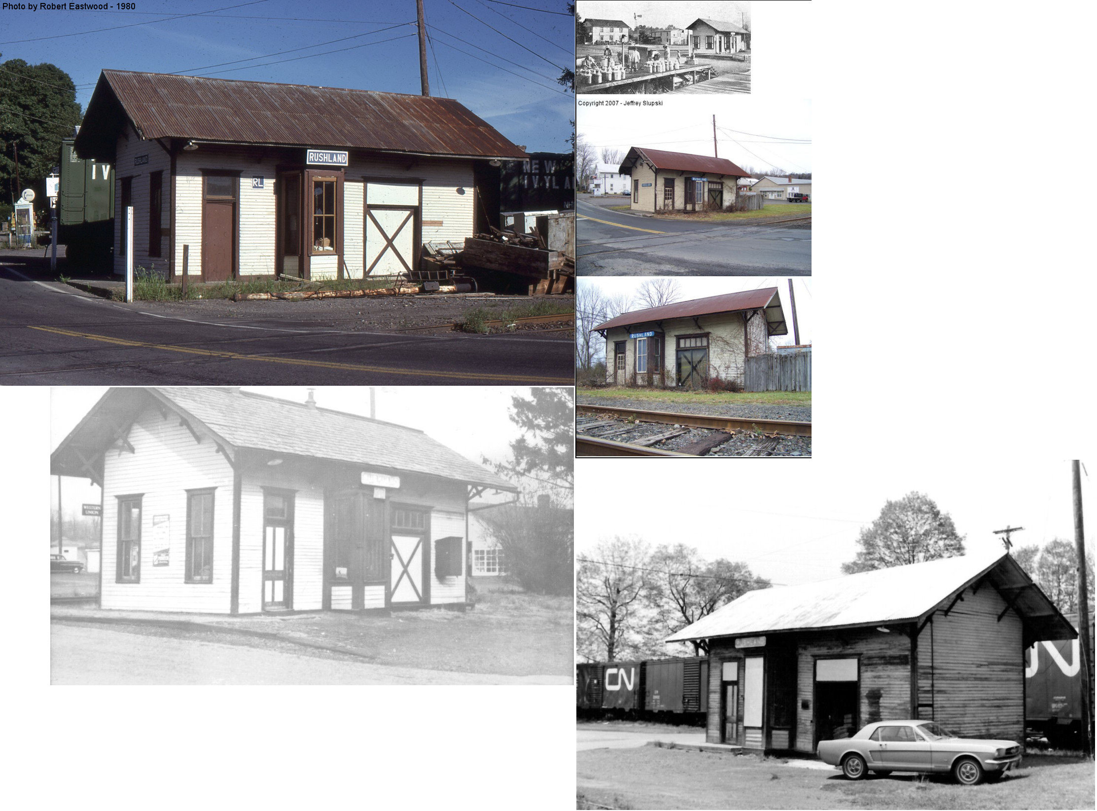
| Rushland |
|
1068 Swamp Road at Old Sackettsford Road (GPS: 40.257907, -75.030190) |
C | Vacant | 1890 | In Use | Wood | |
| Rushland |
|
Old Sackettsford Road near Swamp Road (GPS: 40.257565, -75.030397) |
F | Vacant | ???? | In Use | Wood |
|
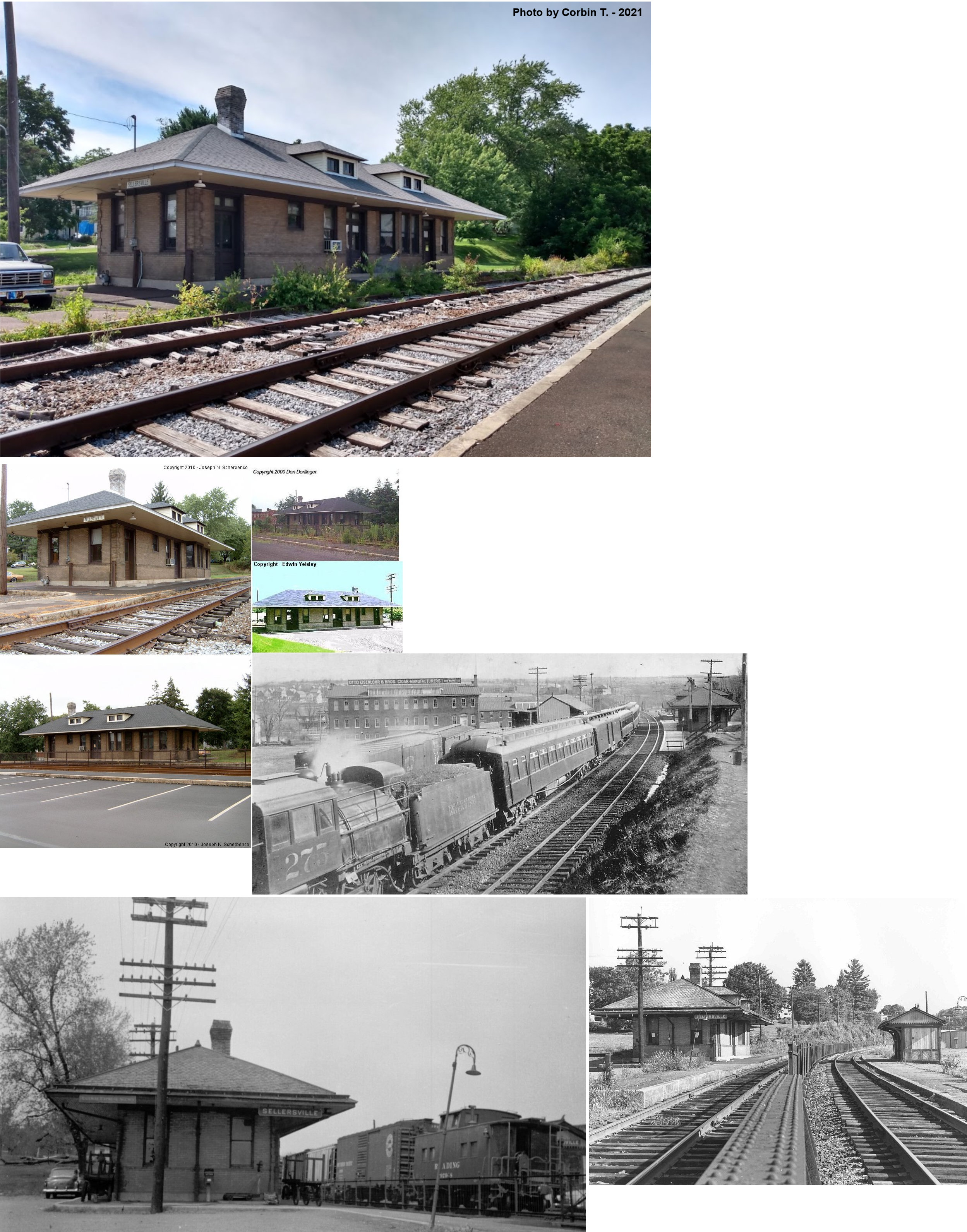
| Sellersville |
|
Lawn Avenue north of Maple Avenue (GPS: 40.359009,-75.312347) |
P | Civic | 1902 | In Use | Brick | |
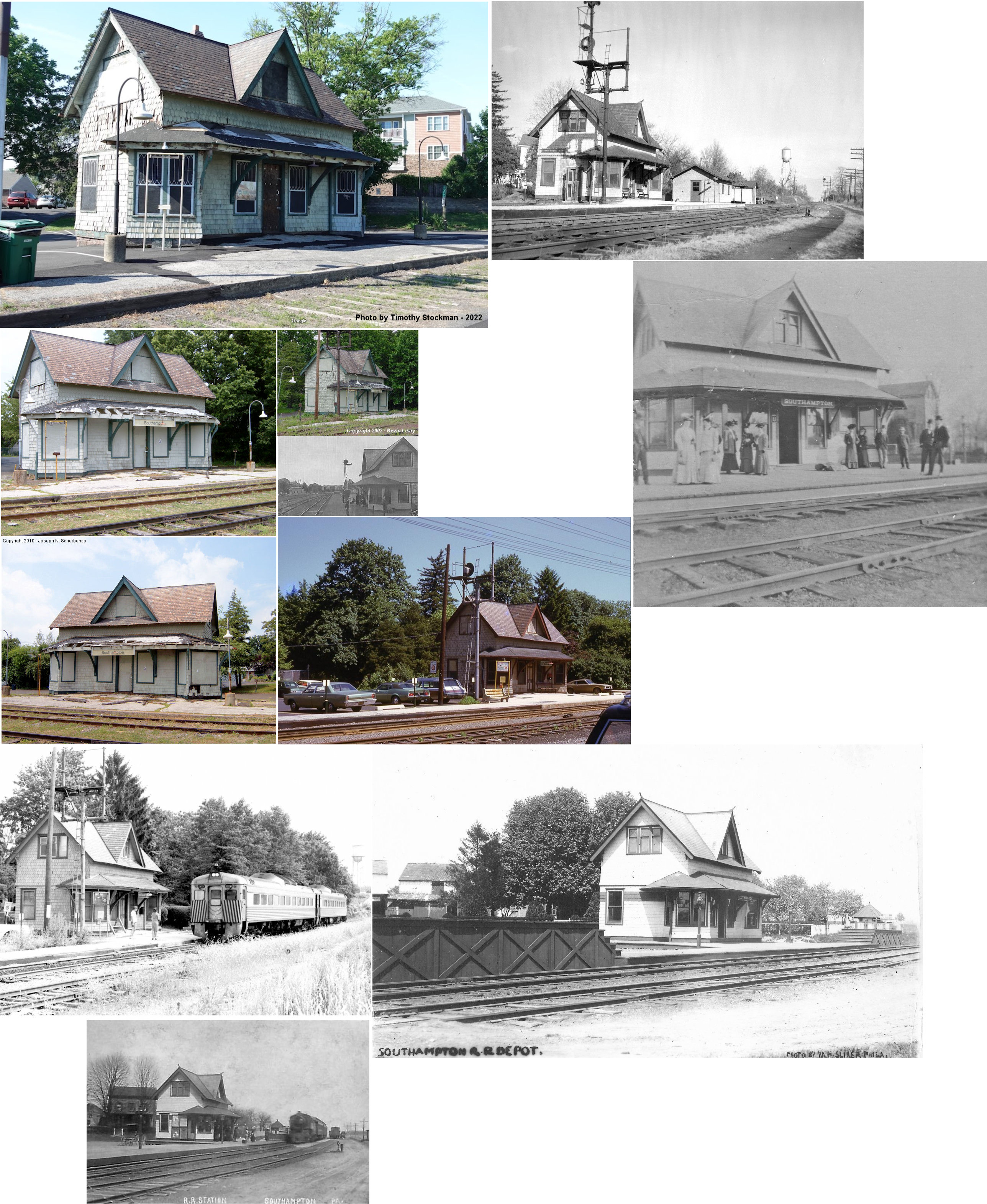
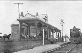
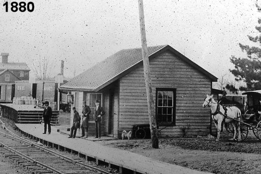
| Southampton (Southamptonville) |
|
East side of 2nd Street Pike on the north side of the tracks (GPS:40.172083, -75.043793) |
P | Vacant | 1892 | Aband. | Wood |
|
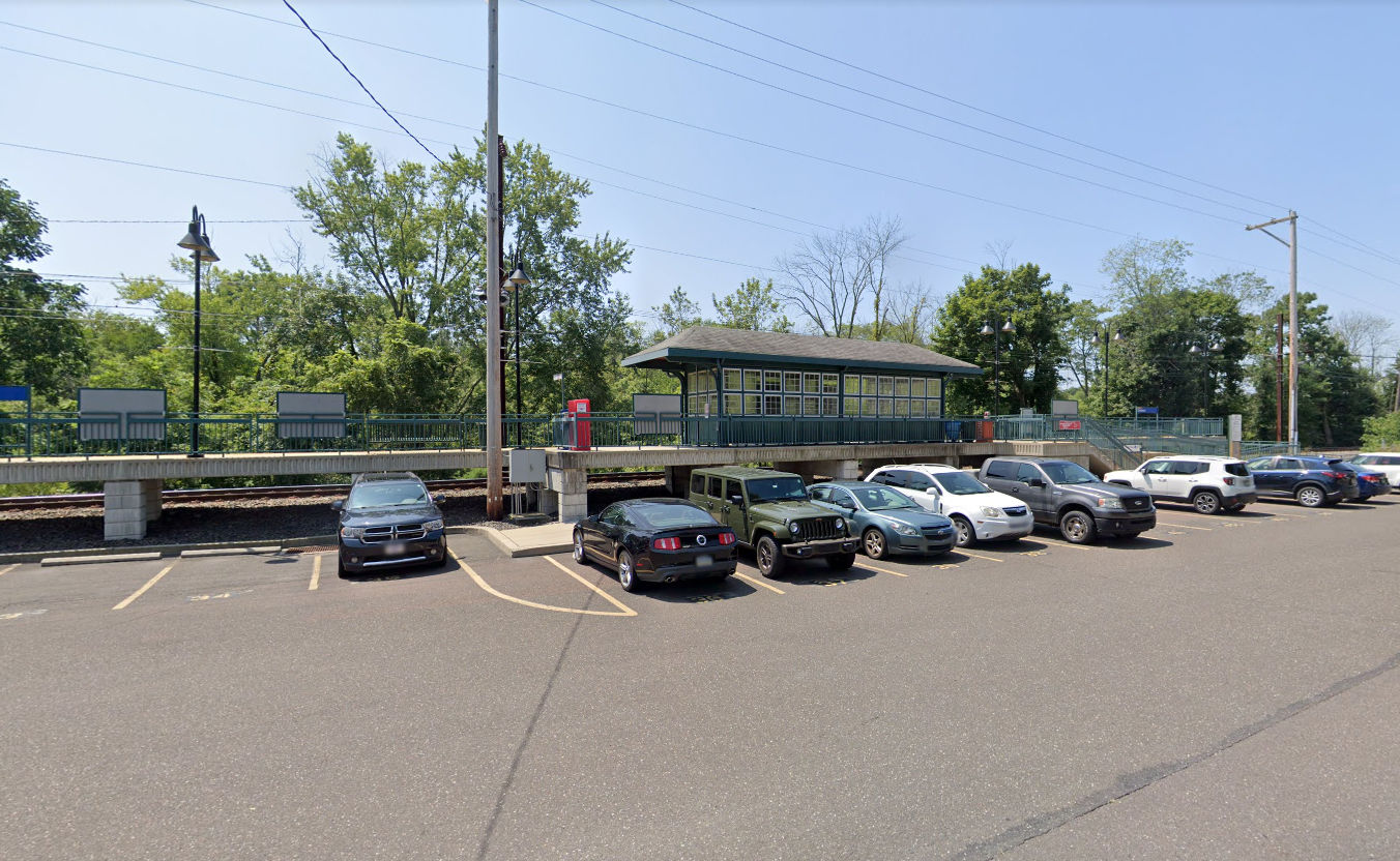
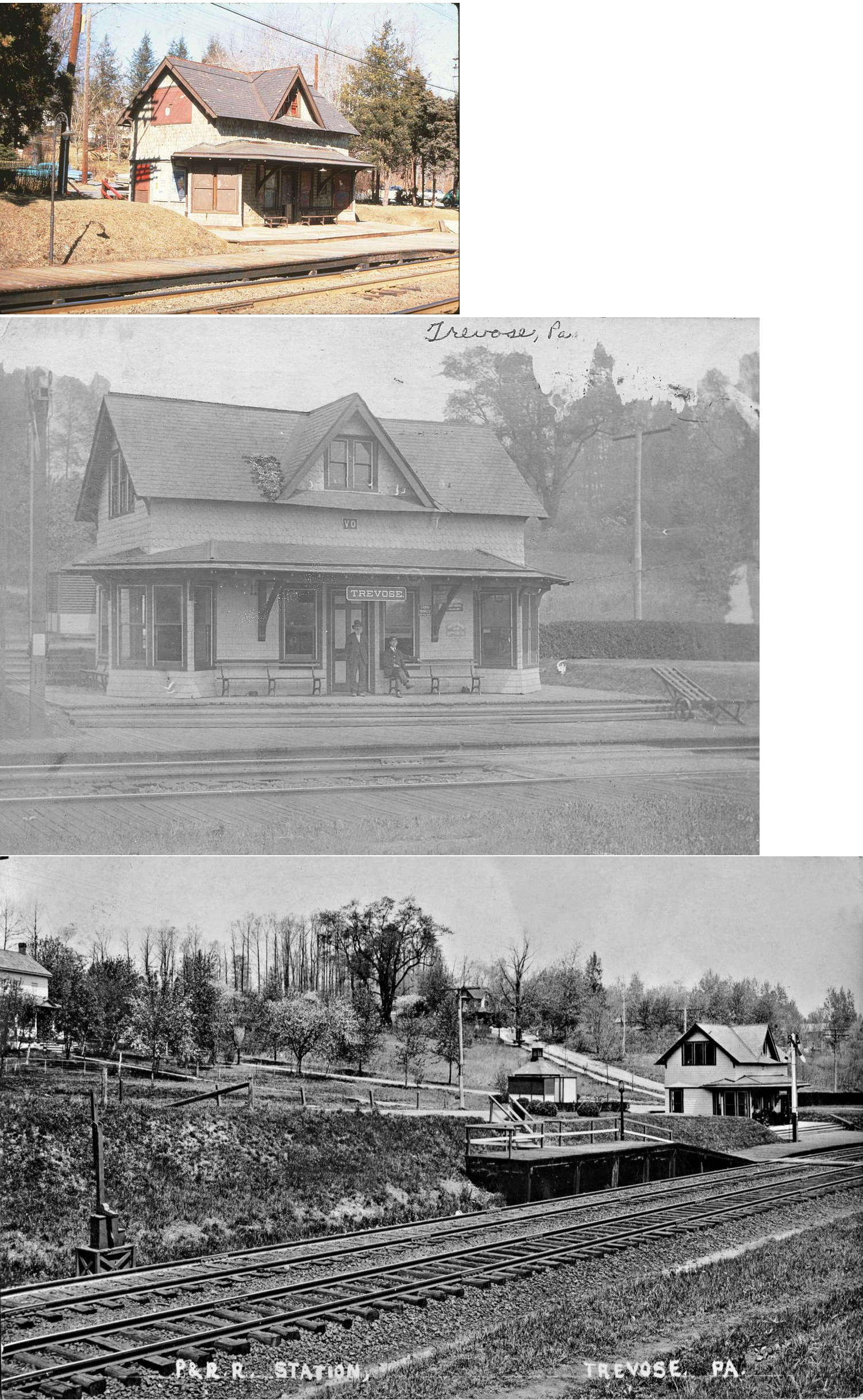
| Trevose |
|
Boundbrook Avenue near Rail Avenue (GPS: 40.140202, -74.982808) |
P | Railroad | ???? | Railroad | Metal | |
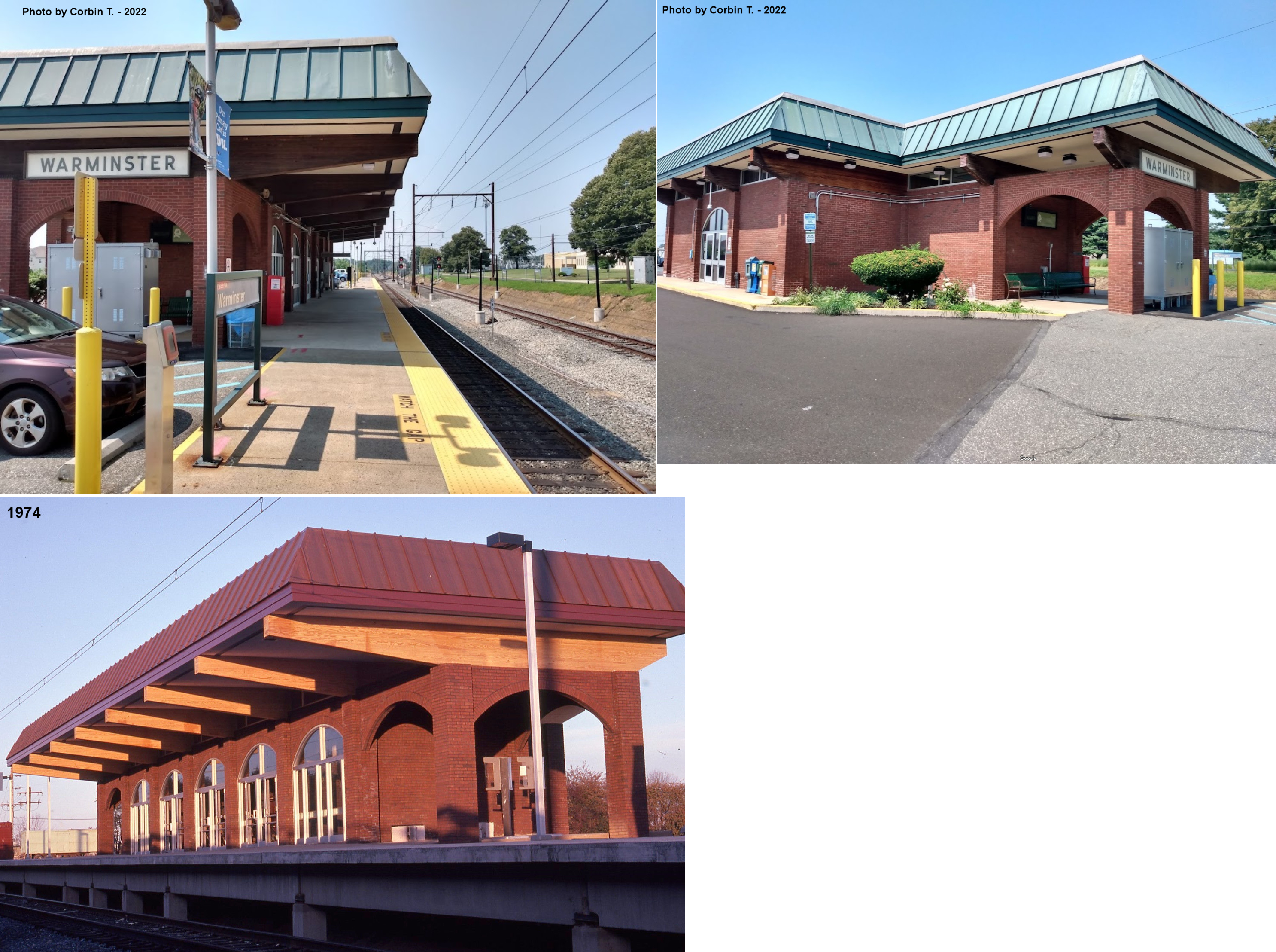
| Warminster |
|
Park Avenue SW of Maple Street (GPS: 40.195084, -75.088936) |
P | Railroad | 1970s | In Use | Brick | |
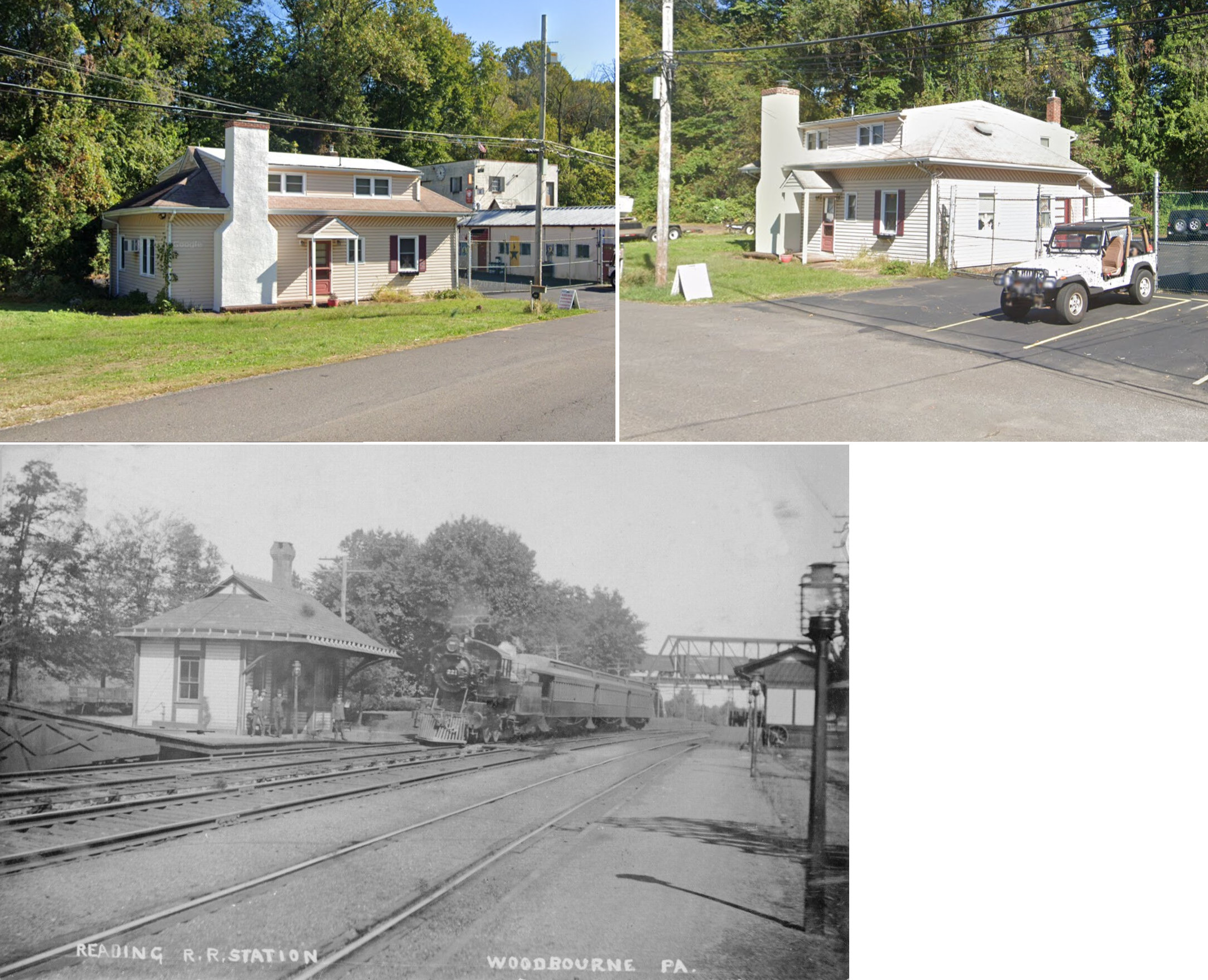
| Woodbourne |
|
North side of Woodbourne Road between the PRR overpass and the RDG grade crossing. (GPS: 40.193385, -74.891801) |
P | Business | 1882 | None | Wood | |
| Woodbourne |
|
Woodbourne Road near U.S. Route 1 (GPS: 40.190890, -74.890979) |
P | Railroad | ???? | In Use | Cement | |
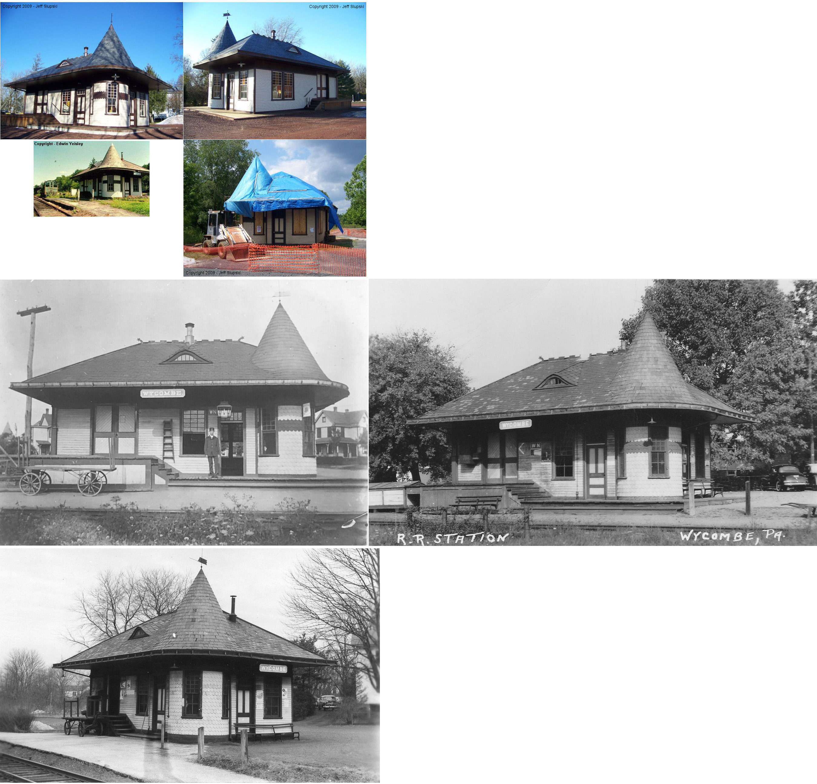
| Wycombe (Lingockren) |
|
SR 2115 (Mill Creek Road at SR 2097) (GPS: 40.282233, -75.019523) |
C | Civic | 1891 | In Use | Wood |
|
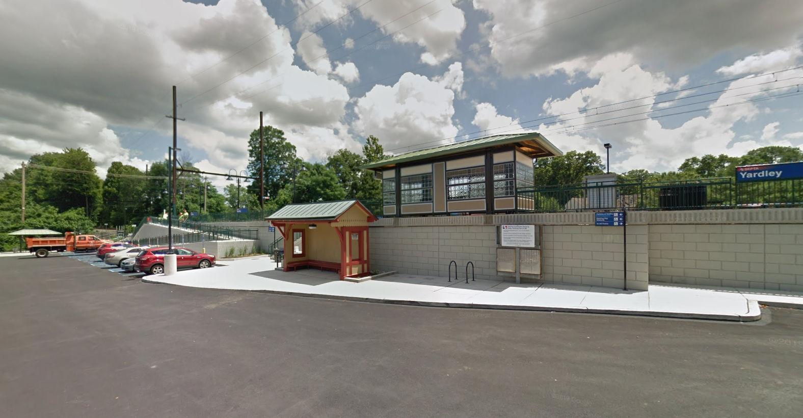
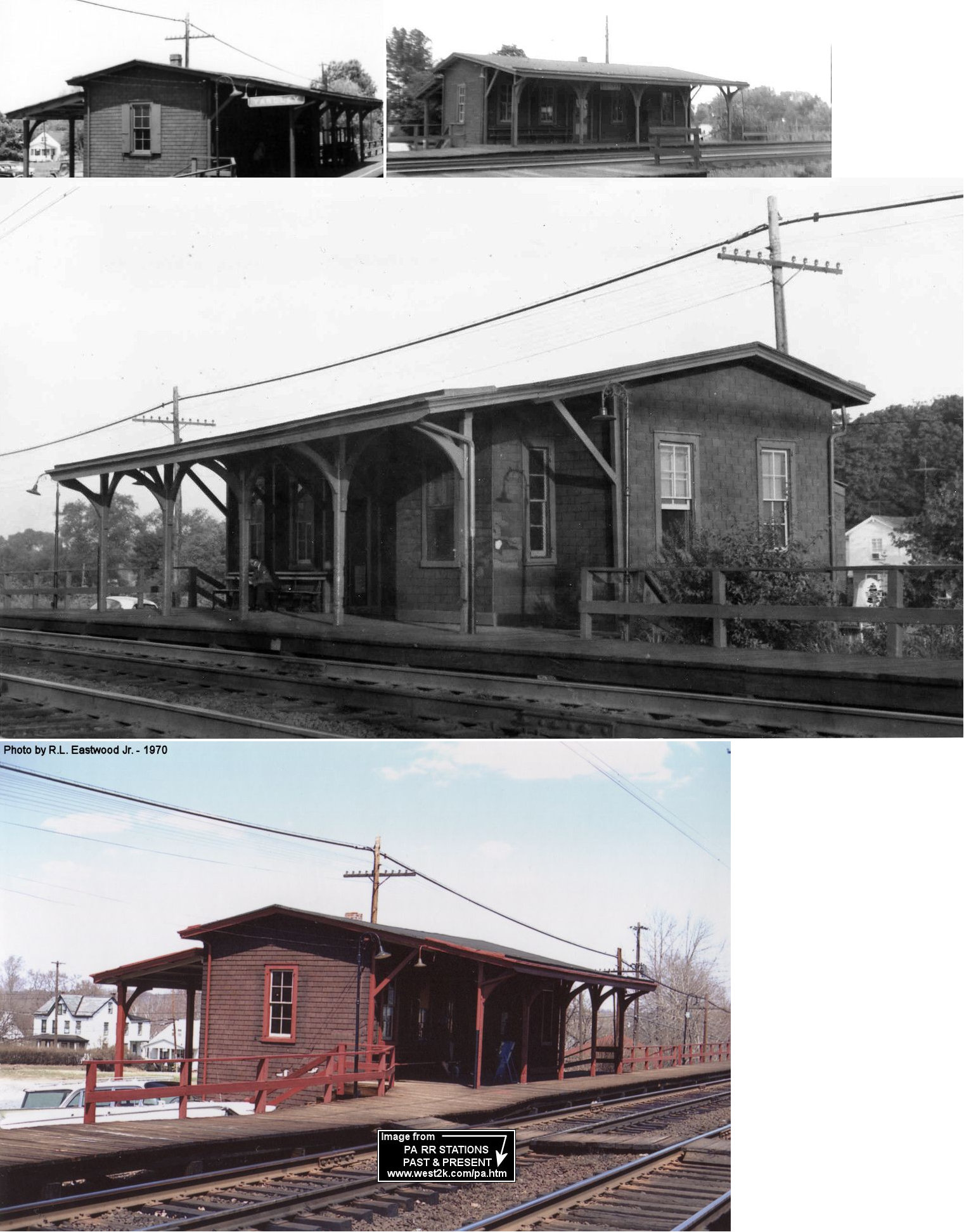
| Yardley |
|
Reading Avenue near South Main Street and Yardley Station Drive (GPS: 40.235054, -74.831133) |
P | Railroad | ???? | In Use | Metal/ Wood |
|
| STATIONS OF THE PAST | ||||||||
| Station Name |
Original Railroad |
Notes | ||||||
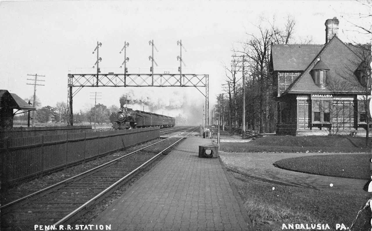
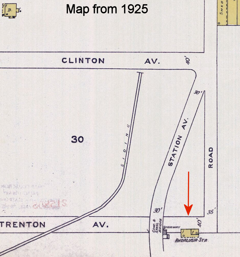
| Andalusia |
|
The original Andalusia station was abandoned in 1893 and Borie Station was rechristened as Andalusia Station. | ||||||
| Andalusia (Borie Station) |
|
|||||||
| Andalusia |
|
The 1925 Sanborn map shows only a very small one-story station here near where Tennis Avenue (formerly Station Avenue) now crosses the tracks at approximately GPS: 40.063519, -74.970378. | ||||||
| Attleboro |
|
A station was built here in 1891 when passenger service began on this part of the Trenton Cutoff. | ||||||
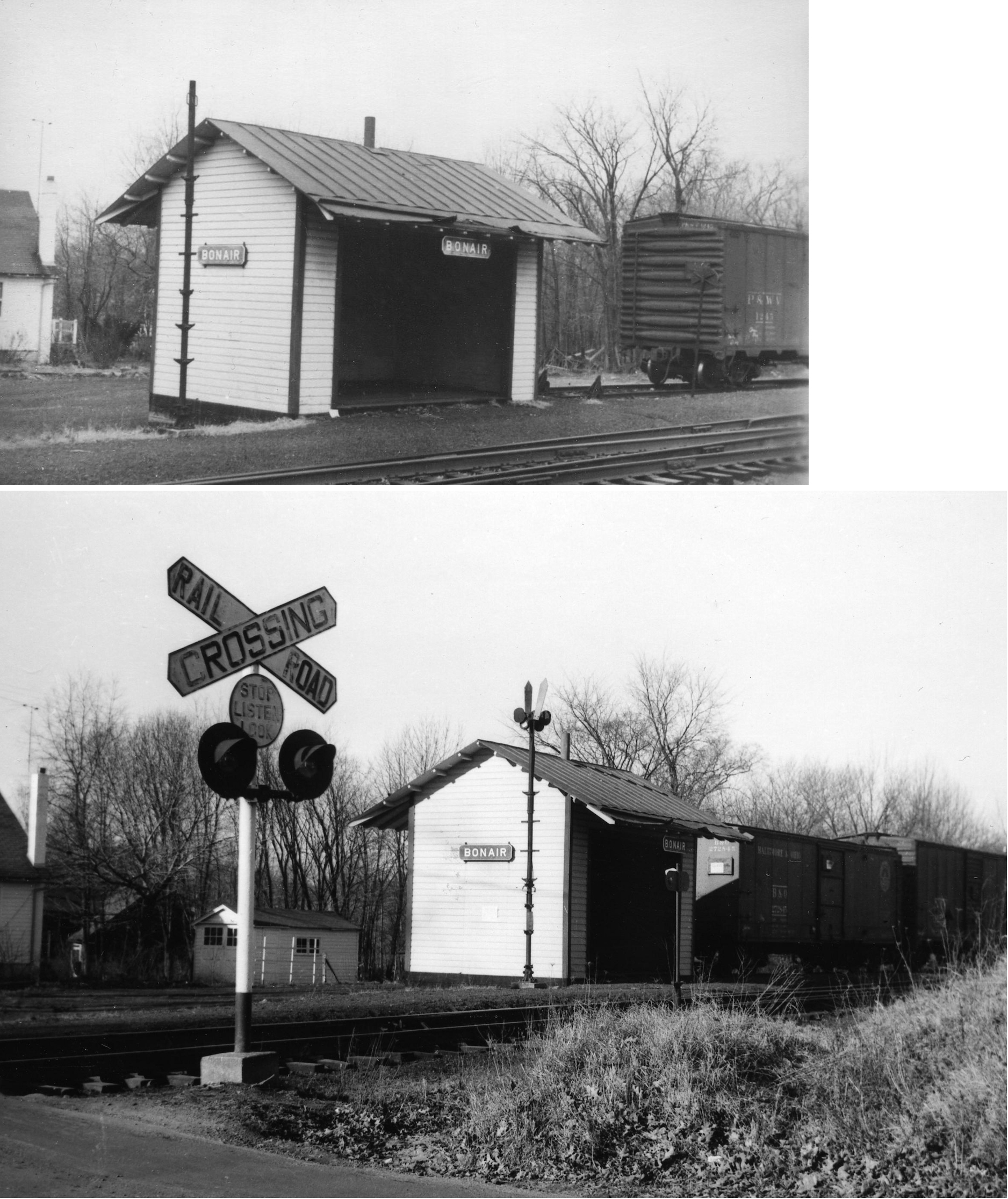
| Bonair (Warminster) |
|
Warminster had two stations: Johnsville and Bonair. Johnsville was on the north side of West Street Road on the east side of the tracks (GPS: 40.198749,-75.085362). Bonair was on the north side of East County Line Road on the west side of the tracks (GPS: 40.18666,-75.096864). | ||||||
| Borie Station |
|
This station is shown on the 1891 county atlas. It was near where Tennis Avenue crosses the tracks in Andalusia. Cornwells, Andalusia and Borie stations were all within a mile and a half of each other. Borie was a little over a mile SW of Andalusia. When Andalusia station closed in in 1893, Borie Station was renamed Anadlusia. | ||||||
| Bridgetown |
|
This station was on Newtown-Langhorne Road near Penns Avenue (GPS: 40.184742,-74.921479). This station was between Bridgetown and Langhorne and the 1891 atlas does not give the station a name. | ||||||
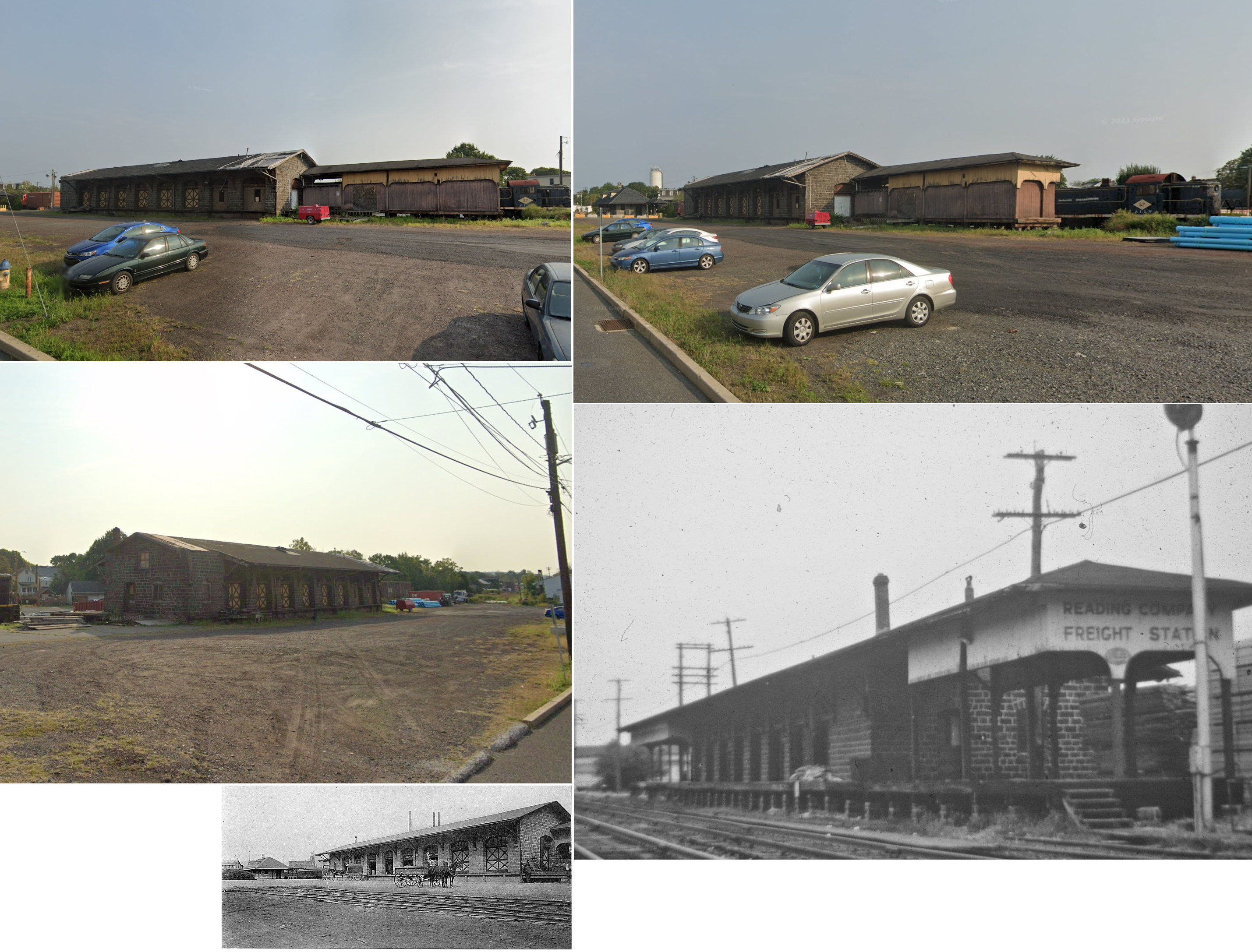
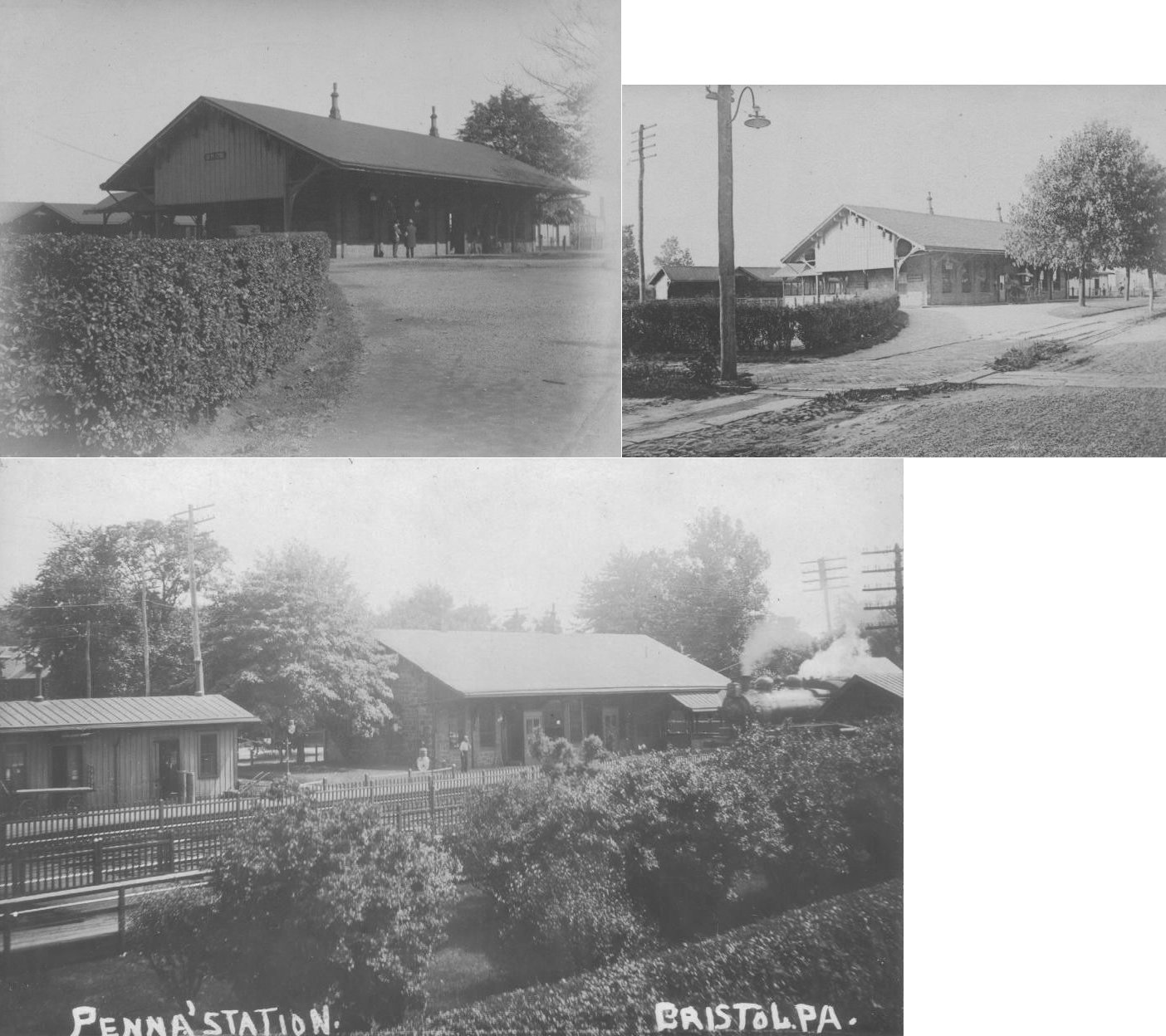
| Bristol |
|
This was the original stone-construction Bristol passenger station which sat at Pond and Market Streets (GPS: 40.097232, -74.858561). The station was on the south side of the tracks, with a shelter on the north side. It was in service until the new station was built in 1911. | ||||||
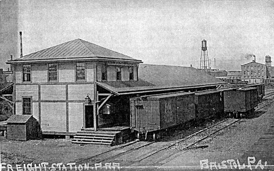
| Bristol |
|
The original brick freight house was on Pond Street near the NW end of Mulberry Street on the NW side of the tracks (GPS: 40.097425, -74.857716). It is shown on the 1886 map. It was eventually replaced by the station listed below. | ||||||
| Bristol |
|
There was a freight house at the NW end of Mulberry Street (what is now Grundy Tower Drive) on the NW side of the tracks (GPS: 40.097923, -74.857465). This was a one-story, wood-frame freight house with a two-story head end for offices. | ||||||
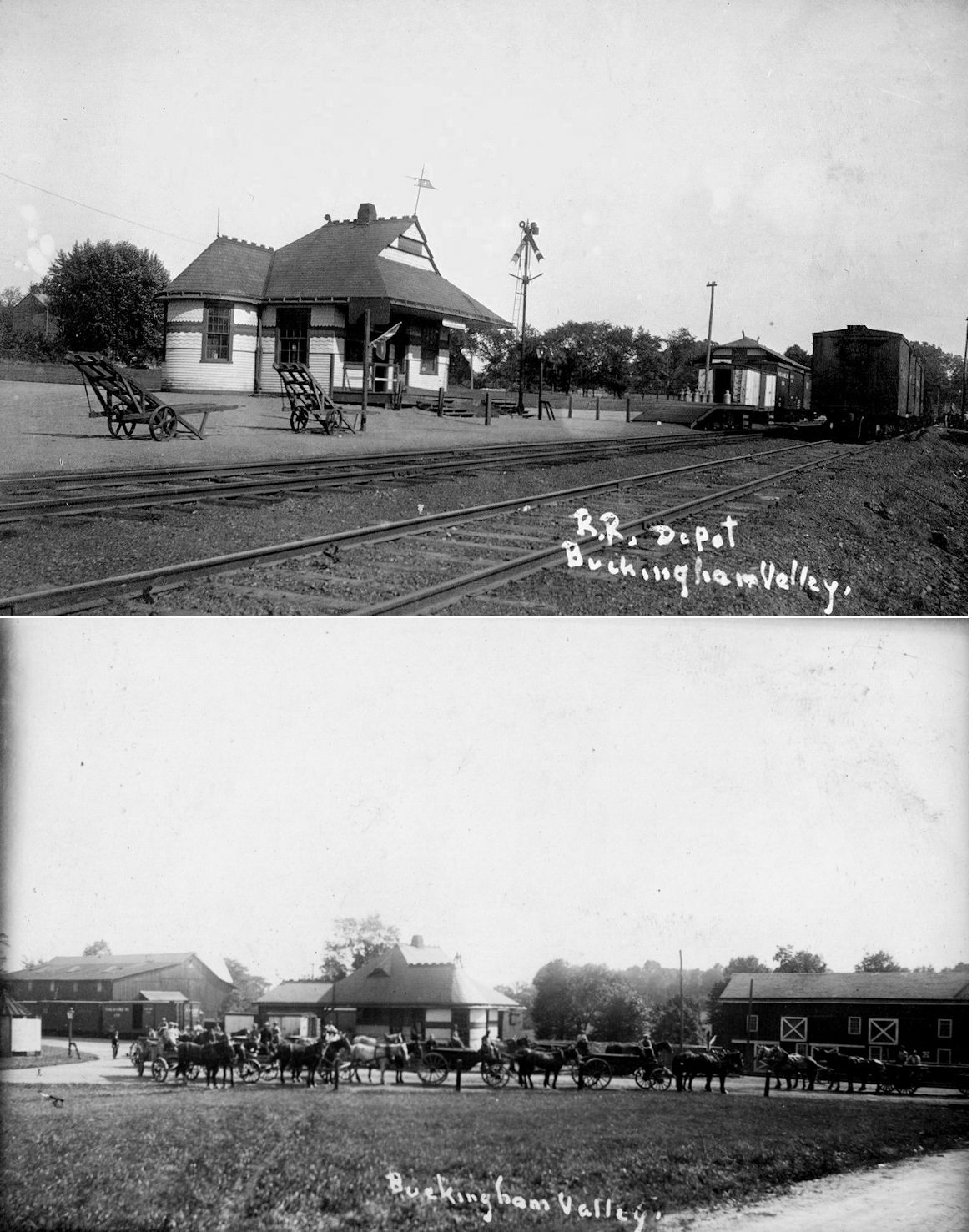
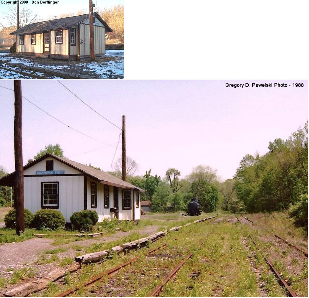
| Buckingham Valley |
|
Demolished in 1953. | ||||||
| Buckingham Valley |
 |
This station that was at Buckingham is not an original Reading station. It was built by the Valley Forge Scenic Railroad as their French Creek Station in 1968. When the Valley Forge Scenic Railroad merged with the New Hope and Ivyland in 1970, it was dismantled and reassembled at Buckingham Valley. The original RDG station at Buckingham Valley was demolished in 1953 as noted above. As of 2025 the station was no longer on site at Upper Mountain Road SW of PA413 (Durham Road) (GPS: 40.309952, -75.050072). Does anyone know for sure if it was demolished or moved? | ||||||
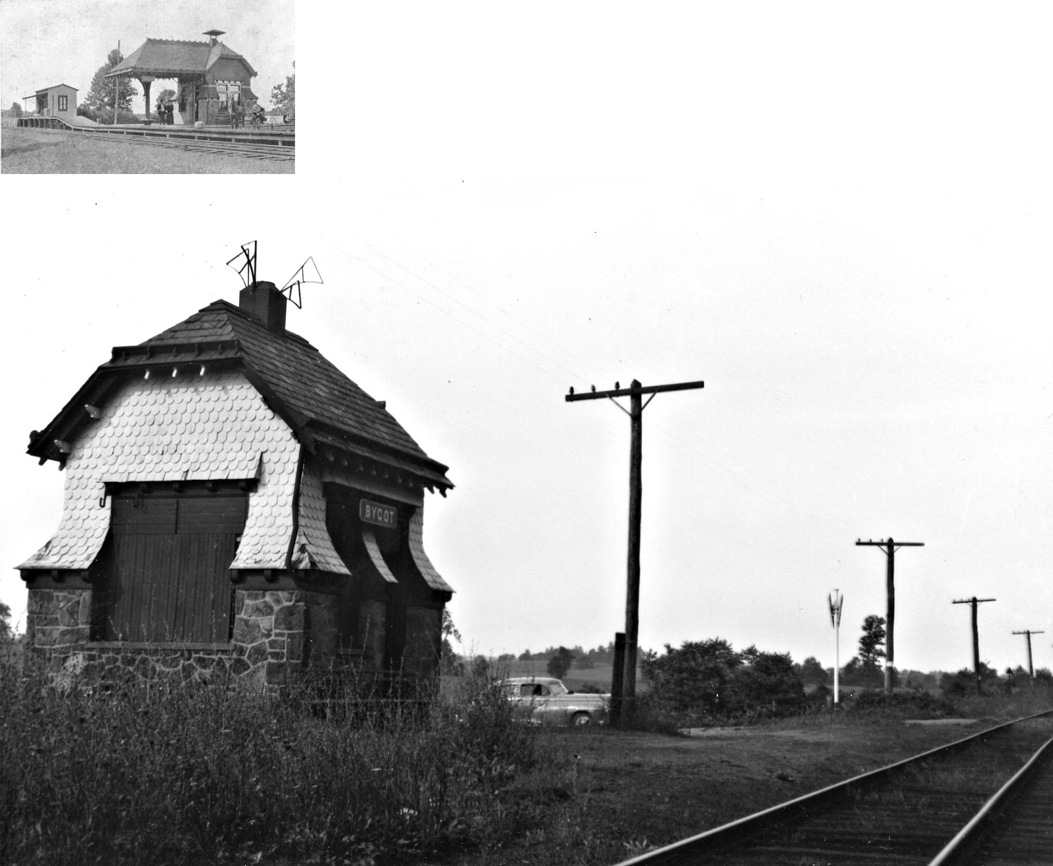
| Bycot (Holicong) |
|
This station probably sat on Bycot Road south of Holicong. It was built in 1891, closed in 1918, but used as a passenger shelter until 1954. | ||||||
| Chalfont |
 |
The old Chalfont NPRR station was in the same location as the station that still exists. | ||||||
| Chestnut Grove Station |
|
This station was near the southern-most point of what is today Aspen Way SW of Doylestown (GPS: 40.300611,-75.138561). It is shown on the 1891 county atlas. | ||||||
|
Churchville Road Station |
|
This station was on the Trenton Cutoff at MP 32.9 between Street Road Station and Roxton. | ||||||
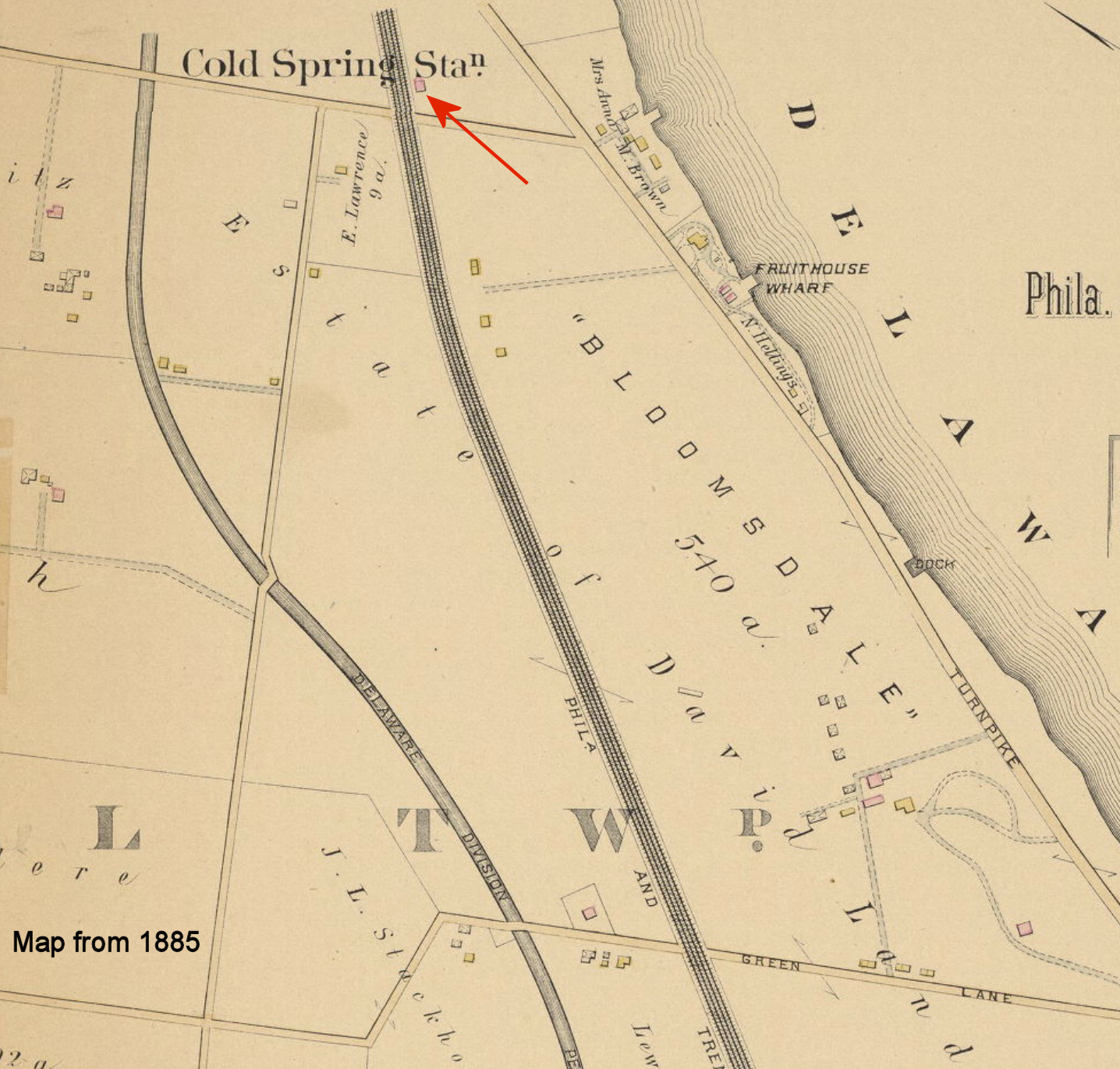
|
Cold Spring (Edgley) |
|
This station was in the vicinity of Edgley Road around GPS: 40.126408, -74.832501. It is shown on the 1885 "Atlas of Properties near the Philadelphia and Trenton Rail Road." | ||||||
| Cornwells Heights |
|
A new station was built here in 1892 (opened in early 1893). The station was built 600 feet west of the old station here on the west Side of Station Avenue at GPS: 40.072153, -74.952099. | ||||||
| Cornwells Heights |
|
A later generation set of PRR shelter sheds. | ||||||
|
Croydon (Schencks) |
|
On the 1885 "Atlas of Properties near the Philadelphia and Trenton Rail Road," this station is shown as Schenck's Station near the estate of Dr. J.H. Schenck. | ||||||
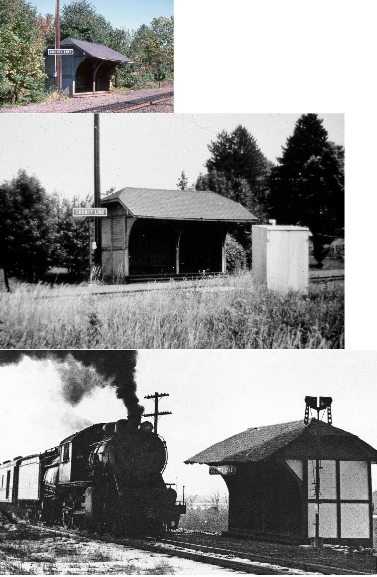
| County Line |
|
This passenger shelter was built in 1892. It was on the NE side of County Line Road just SE of New Road on the NW side of the tracks at GPS: 40.164808, -75.060008. | ||||||
| County Line Road |
|
|||||||
| Delaware Valley College |
|
This was the old station here prior to the new SEPTA station being built. | ||||||
| Derstines |
|
|||||||
| Dublin |
|
|||||||
| Dunlap |
|
A station was built here in 1891 when passenger service began on this part of the Trenton Cutoff. | ||||||
| Durham |  |
The single-track Quakertown & Eastern shortline railroad ran from Quakertown to Riegelsville. | ||||||
| Eddington |
|
A new station was built here in 1890 (there was a station shown here on the 1885 "Atlas of Properties near the Philadelphia and Trenton Rail Road,"" so this was likely the second station). This station burned on Sept. 27, 1956 according to the Bristol Daily Courier (9/28/1956). Arson was suspected. The station was on the east side of Street Road on the north side of the tracks at GPS: 40.083019, -74.933902. | ||||||
| Fairless Junction |
|
This station was under where the Maple Avenue overpass is today at approximately GPS: 40.177012, -74.897271. In the old photos Maple Avenue is a grade crossing. | ||||||
| Fallsington |
|
A station was built here in 1891 when passenger service began on this part of the Trenton Cutoff. | ||||||
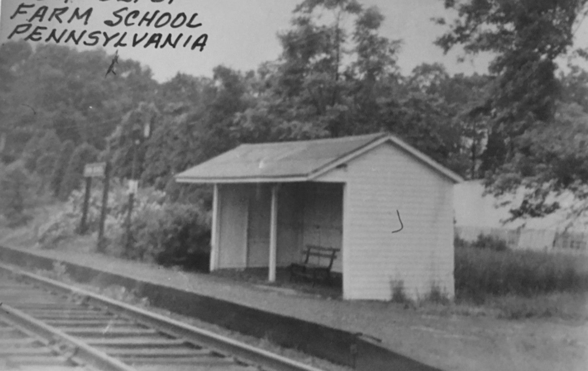
| Farm School Station |
|
This was the station for Delaware Valley College. | ||||||
| Feasterville Station |
|
This early station is shown on the 1891 county atlas. | ||||||
| Gehman | |
|||||||
| George School |
|
Built 1905, closed in 1960. Only platform remained as of 1999. | ||||||
| Glenlake Station |
|
This station was on South Flowers Mills Road about one mile NE of Langhorne Station. It is shown on the 1891 county atlas. | ||||||
| Grenoble |
|
Built 1891, closed in 1954. | ||||||
|
Hewitt (Durham Furnace) |
|
This station served the Durham Iron Works which wwas next to Cooks Creek. Both the iron works and the railroad closed around 1906 (although the railroad would be revived later). | ||||||
| Holland |
|
This shelter was constructed in 1897 and demolished in the early 1950s. | ||||||
| Huffnagle (Rosenthal) |
|
This was a shelter-type station. | ||||||
| IVYLAND (Hartsville Station) |
|
This station is shown on 1876 and 1891 county atlases. It was right on the border of Warminster and Northampton Townships. This was the terminus of the NE Pennsylvania RR until 1891 when the line was extended to New Hope. Later the station here became known as Ivyland. The station was placed there from elsewhere in 1871. | ||||||
| Ivyland |
|
The Ivyland station was moved to this location from an unknown origin on the NEPRR in 1890. It was 425 feet North of the intersection of Greely and Chase Avenues (GPS: 40.211024, -75.073499). It was closed in 1954 and torn down not too long after that. | ||||||
| Janney |
|
This station was between Neshaminy Falls and Parkland at MP 21.8. | ||||||
| Johnsville (Warminster) |
|
Warminster had two stations: Johnsville and Bonair. Johnsville was on the north side of West Street Road on the east side of the tracks (GPS: 40.198749,-75.085362). Bonair was on the north side of East County Line Road on the west side of the tracks (GPS: 40.18666,-75.096864). There were two stations at Johnsville. The first was built in 1891 and burned after only one year of service with the second built in 1892. | ||||||
| Kirk Station |
|
This was the name of the first station at Rushland (Rush Valley). It was in approximately the same location as the existing station at the time (1891) on the property of John Kirk. | ||||||
| Langhorne |
|
This station, built in 1881 and designed by Frank Furness, was located at Bellevue Avebue (PA413) at Comly. It was torn down by SEPTA in April, 2010 to make way for a new station. | ||||||
| Langhorne (Attleboro) |
|
A station was built here in 1891 when passenger service began on this part of the Trenton Cutoff. Although the town had changed its name from Attleboro to Langhorne in 1876, this station on the PRR was called Attleboro. A new station was built here in 1893. (Not sure why if old station was a couple years old. Maybe the old station burned?) On the 1900 PRR List of Stations & Sidings the station is called "Langhorne." | ||||||
| Lizette |
|
This station was on the NE side of Stony Hill Road in Lower Makefield Township. | ||||||
| Montessori School Station |
|
This station was between Buckingham and Wycombe off Creek Road. | ||||||
|
Morgan (Furnace Jct.) |
|
|||||||
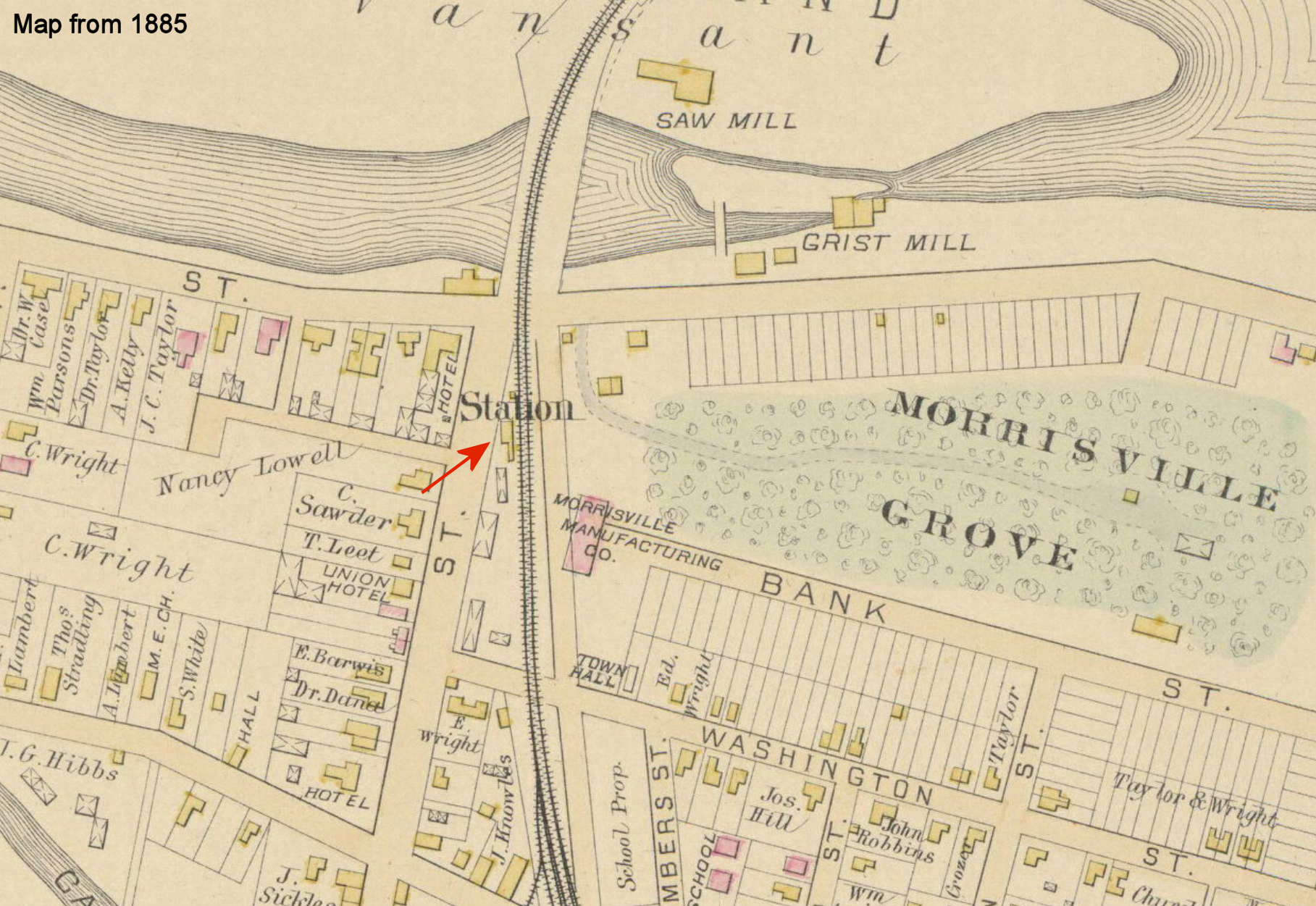
| Morrisville |
|
The first station here was on Green Street just NE of Bank Street. | ||||||
| Morrisville |
|
Built around 1891 to replace the earlier station (on the 1891 map both stations are shown with this station labeld "new station"). This station was on the SE corner of Green and Washington Streets. | ||||||
| Neshaminy |
|
This station was on the Trenton Cutoff at MP 35.4 between Roxton and Langhorne. | ||||||
| Neshaminy Falls |
|
The original station here was knocked over by high winds in the fall of 1887. The new station was built in the fall of 1888 (Wilkes-Barre Times Leader, 10-4-1888). | ||||||
| Neshaminy Falls |
|
This station, built in 1888, was on the west side of East Bristol Road on the north side of the tracks (GPS: 40.146928, -74.962212). It was torn down in 1970. | ||||||
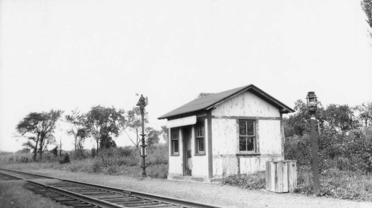
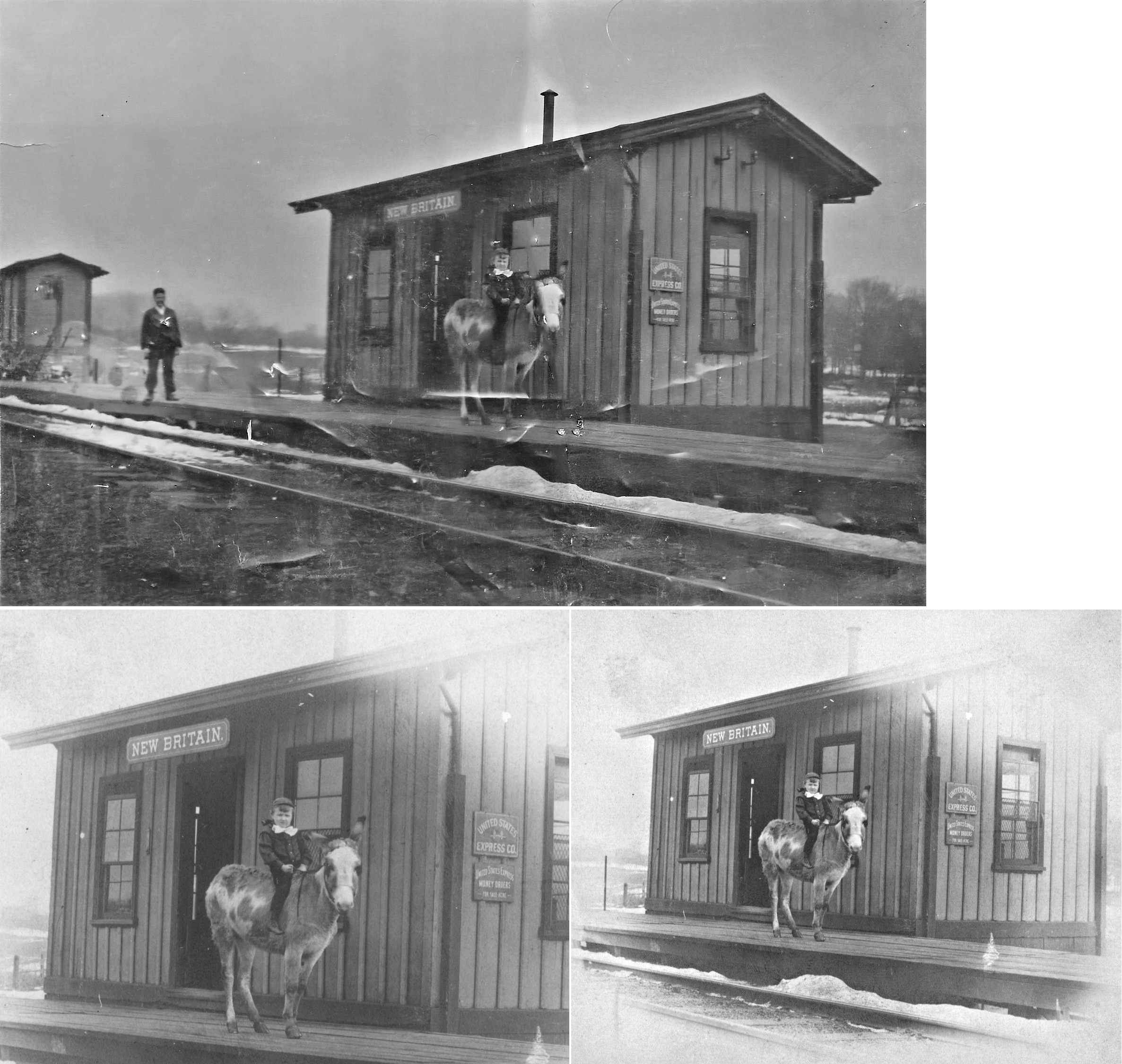
| New Britain |
|
This was likely the original station. | ||||||
| New Britain |
|
This station was on the NE side of South Tamenend Avenue on the south side of the tracks where the current SEPTA shelter is today. It was built in 1898. | ||||||
| Newtown |
|
In 1891, the Newtown RR station was on Chancellor Street north of State Street (GPS: 40.222206,-74.934204) at the site of the current Clubhouse Bar & Grill (in 2012). | ||||||
| Newtown |
|
This station was on the NE corner of Lincoln and Penn Streets (GPS: 40.226680, -74.931300). | ||||||
| Newtown |
|
There was a freight station just to the NE of the passenger station on a spur that ran up into the next block. This freight station was at GPS: 40.227061, -74.930905. | ||||||
| Parkland |
|
This station, shown on the 1891 county atlas, was one mile SW of Langhorne station. It was at the SE end of Woodvale Avenue (which doesn't go through to the tracks anymore). It was at GPS: 40.155494, -74.934354. | ||||||
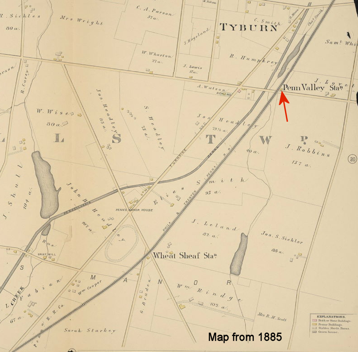
| Penn Valley |
|
This station was on the east side of the tracks where Penn Valley Road used to cross the tracks at GPS: 40.174456, -74.788227. | ||||||
| Perkasie |
|
There was an older station here prior to the 1891 station which is still standing. It was in approximately the same location (GPS: 40.374452,-75.296836). | ||||||
| Pleasant Valley | |
This station may have also been known as Schleiffer at some point. | ||||||
| Pullen | |
This station was just north of where the line crossed Pullen Station Road at the S-curve | ||||||
| Quakertown |
|
Before the stone passenger and freight stations were constructed in 1902, there were smaller wood-frame passenger and freight stations at the exact same locations. These can be seen on the 1897 Sanborn map. | ||||||
| Quakertown | |
The single-track Quakertown & Eastern shortline railroad ran from Quakertown to Riegelsville. Quakertown was milepost 0. | ||||||
| Reeder |
|
This was a shelter-type station. | ||||||
| Richlandtown | |
|||||||
| Riegelsville | |
The 15-mile, single-track Quakertown & Eastern shortline railroad ran from Quakertown to Riegelsville. | ||||||
| Rockhill |
|
|||||||
| Roelofs |
|
This station was between Woodbourne and Yardley at MP 28.8. | ||||||
| Roxton |
|
A station was built here in 1891 when passenger service began on this part of the Trenton Cutoff. | ||||||
| Schencks Station |
|
See listing above for Croydon. | ||||||
| Sellersville |
|
The location of the original station was across the tracks from the location of the existing station (GPS: 40.359184,-75.312105). | ||||||
| Sellersville |
|
There was a freight station to the north of the passenger station on the east side of the tracks (GPS: 40.359578, -75.312192). This station can be seen on the 1908 and 1913 Sanborn maps. It may have been the old passenger station repurposed as a freight station. | ||||||
| Sellersville |
|
On the 1921 Sanborn map there is a new freight station just to the north of the original freight station. It was at GPS: 40.360146, -75.312234. | ||||||
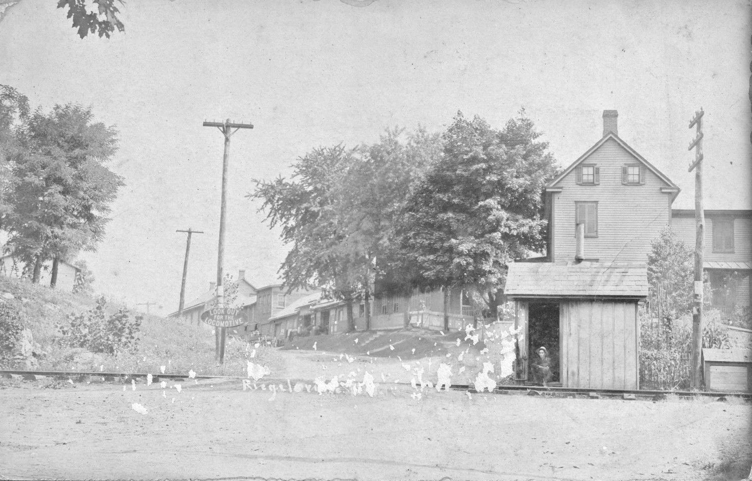
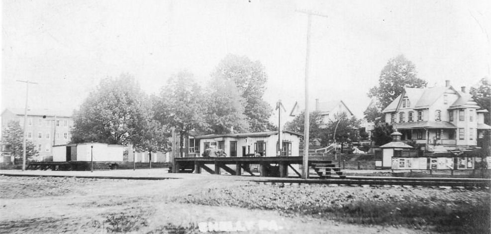
| Shelly Station |
|
Shelly was one of the freight stops on the North Pennsylvania Railroad (N.P.R.R.). The Philadelphia to Bethlehem rail lines, known as the Bethlehem Branch, became operable in 1857 and were important to the coal and lumber regions of the Lehigh Valley. Route 309, which was constructed in the mid-1930s, ran parallel to these lines. Passenger travel to and from Shelly was instituted in 1882 with the construction of its train station. The station measured 11 by 36 feet and was made of wood. Shelly Station was small and cheaply fabricated as initial plans were to have numerous and inexpensive waystations along the Bethlehem Branch. It was demolished in 1954. --Note by Jill Ruch | ||||||
| Springtown | |
|||||||
| St. Leonard |
|
This station was on Spring Avenue near St. Leonards Road. | ||||||
| Street Road Station |
|
This station was on the Trenton Cutoff at MP 32.3 between County Line Station and Churchville Road Station. | ||||||
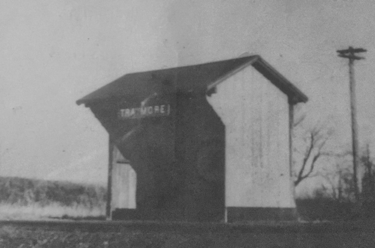
| Traymore |
|
This station was between Ivyland and Grenoble. In 1890 an NPRR station was moved here by the RR (from where unknown). It was first known as Warwick, but the name was changed to "Wendover" in 1893 and finally "Traymore" in 1894. It was on Mearns Road. The station was closed in 1919 with business then handled in Ivyland. The station may have reopened sometime later, but that's unclear. It was likely torn down in the 1950s as it was removed from Reading accounts in 1954. | ||||||
| Traymore |
|
This shelter likely replaced the original station in later years. | ||||||
| Trevose Station |
|
The old Trevose station, built in 1889 (although the book "Lower Bucks County says 1893), was torn down. There is currently a small shelter at the stop to keep the passengers out of the elements and is still in service by SEPTA on its West Trenton line. | ||||||
| Tullytown |
|
This station was near where Falsington Avenue crosses over the tracks on the NW side of the tracks (GPS: 40.14132,-74.816133). The station was built in 1836 (The Bucks County Gazette, 11-9-1905). A shelter-type station was added here in 1896. The station here was blown from its foundation and onto the tracks during a strong wind storm in 1911. | ||||||
| Warwick |
|
|||||||
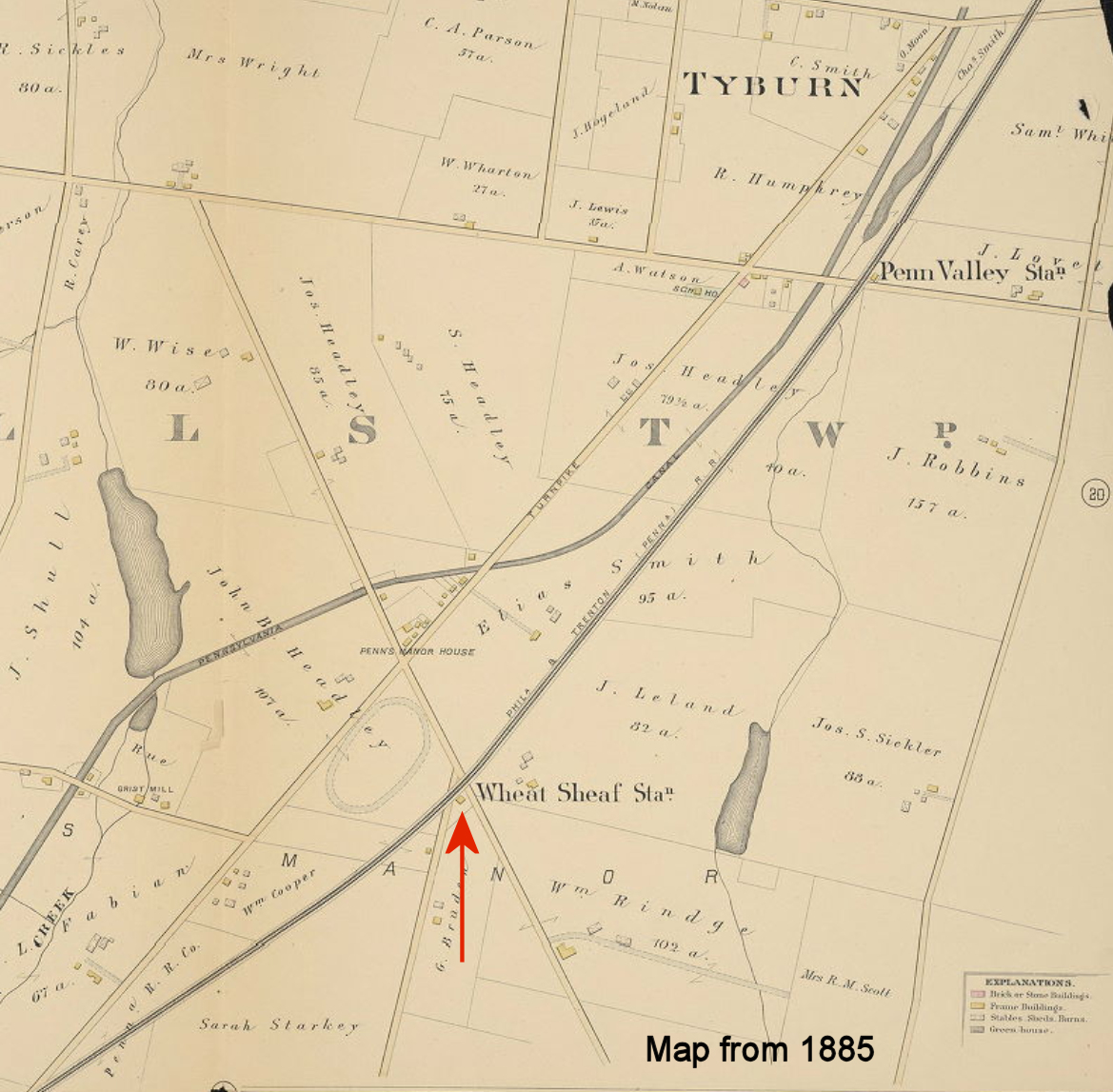
|
Wheat Sheaf (Tyburn) |
|
This station was near the SE end of what is now Wheat Sheaf Lane in the vicinity of GPS: 40.160416, -74.795930. | ||||||
| Windmere |
|
|||||||
| Witte | |
|||||||
|
Woodbourne (Oxford Valley) |
|
|||||||
| Yardley |
|
This station was on the SW side of South Main Street on the NW side of the tracks at GPS: 40.235377, -74.830772. It was built in 1876. | ||||||
| Yardley |
|
This freight station was across the tracks from the passenger station. | ||||||
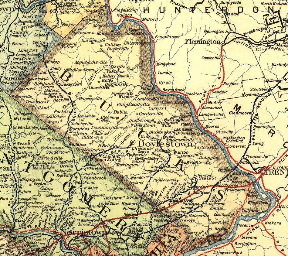
| 1895 BUCKS COUNTY RAILROAD MAP | ||||||||
 |
||||||||
| Notes About Existing
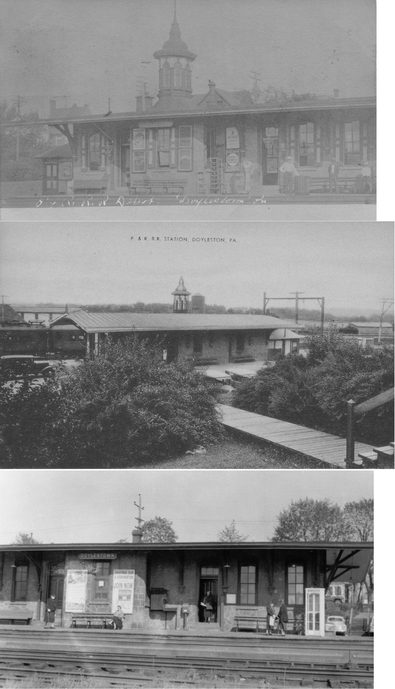
Stations... Bristol (PRR) - Bristol Historic Preservation Inc. renovated the station and there is a bagel shop inside. Churchville (RDG) - Northampton Historical Society received a $5,000 state grant to fix up the station. The building is a tan, two-story wooden building with brown trim, fish-scale siding, and gingerbread detail. It served as the village post office for about six years in the early '70s. SEPTA owns the station and rents it as a private residence. Delaware Valley College (SEPTA) - Originally was called "Delaware Valley College Station" until 2015, when the College adjacent to the station was renamed to "Delaware Valley University." Doylestown (NEPRR) - Used as office by the RR. Here is an old photo of Doylestown. This is the current station minus the cupola centered over the ticket office. This is probably the last remaining original North East Pennsylvania RR station as the line was absorbed into the Reading in 1879. All the other stations on this line were built after the NEPRR become part of the RDG. Some sources say this station was built in 1871, whereas others say 1876. The cupola was removed in the 1930s. Fairless Junction? (RDG) - According to some, this shelter station was moved to Newtown supposedly from Fairless Junction. However, this does not appear to be the same station pictured as the former RDG station at Fairless Junction (in the stations of the past section). More research is needed on the provenance of this station. Lahaska (NH&I) - The station that currently exists at the original Lahaska site is much more recent and more resembles a fancy garden shed than the original station that had the witch's hat turret common to both the New Hope and Wycombe stations. The original 1891 station now rests about 4/10 mile south of its original location. There is now green siding and the "turret" had been replaced with a square room. It is the same kind of structure as the Wycombe and New Hope stations. Lahaska (RDG) - The station that currently exists at the original Lahaska site is much more recent and more resembles a fancy garden shed than the original station that had the witch's hat turret common to both the New Hope and Wycombe stations. The original 1891 station now rests about 4/10 mile south of its original location. There is now green siding and the "turret" had been replaced with a square room. It is the same kind of structure as the Wycombe and New Hope stations. New Hope (RDG) - The passenger station was moved at some point about 75 yards to the north. It used to sit closer to Bridge Street before Stockton Avenue was built. It can be seen at this location (GPS: 40.364361, -74.953281) on the 1909 Sanborn map. Quakertown (RDG) - On National Register of Historic Places. Although the Quakertown station was designed in 1889, it was not actually built for another 13 years, making the architectural style older than the building itself. A crane (also on NRofHP) located on the South end of the property is believed to be one of two remaining built by Phoenix Steel in Phoenixville, PA. Rushland (RDG) - This is a converted boxcar that was used as a freight station. As of 2025 it was barely standing. Southampton (P&R) - Here is an old photo. Wycombe (RDG) - The NH&I sold this depot to the County of Bucks around 2002-2003. Restoration was completed in summer 2009. On the 1891 county atlas this station is called "Lingockren." |
||||||||