 COUNTY COUNTY
|
|
||||||||
| EXISTING STATIONS | ||||||||
|---|---|---|---|---|---|---|---|---|
| Station Name |
Original Railroad |
Current Location |
Type | Current Use |
Date Built |
Track Status |
Building Material |
More Info |
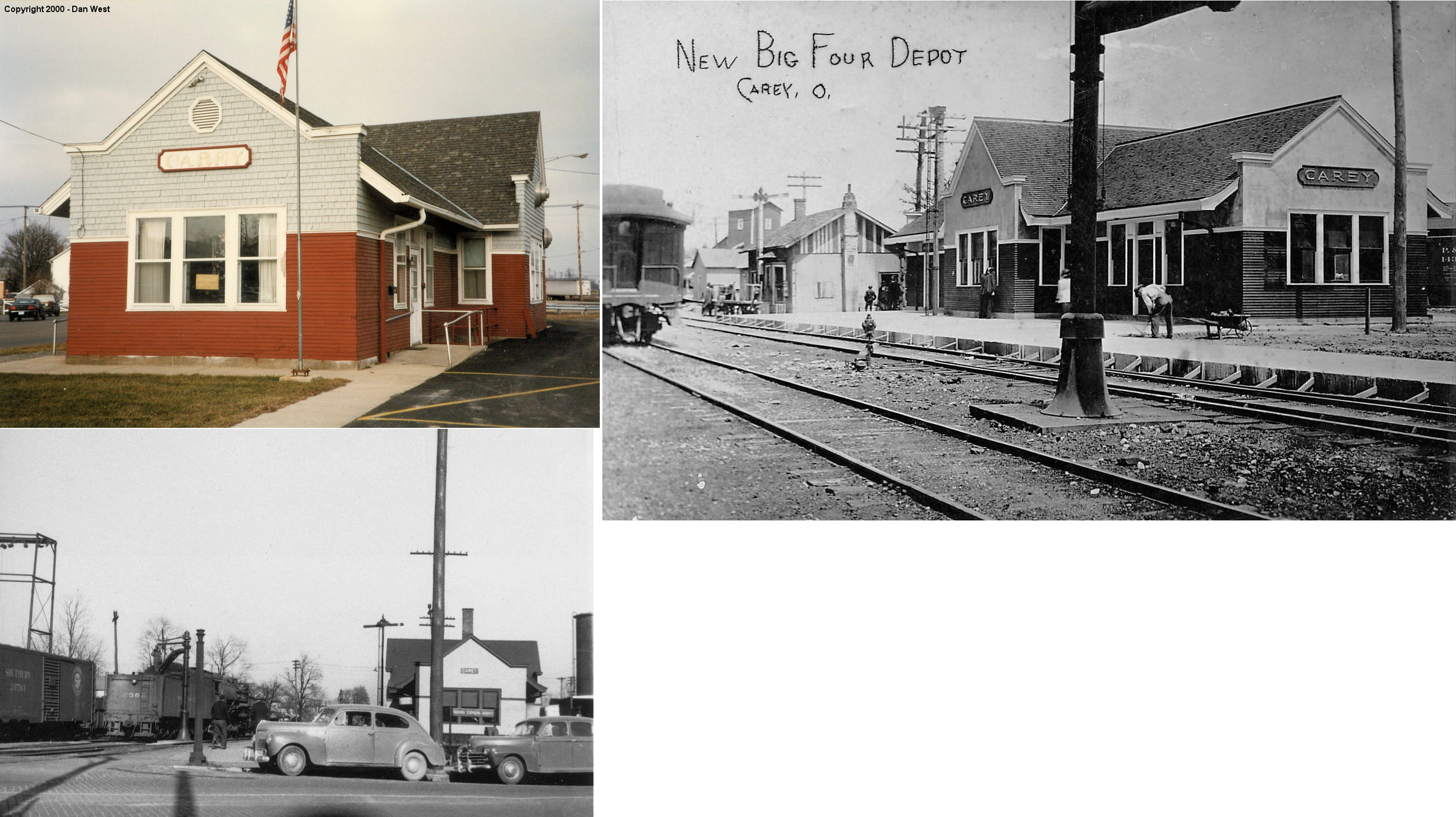
| Carey |  |
North side of East Findlay Street between Patterson & Vance Streets (GPS: 40.952599, -83.380538) |
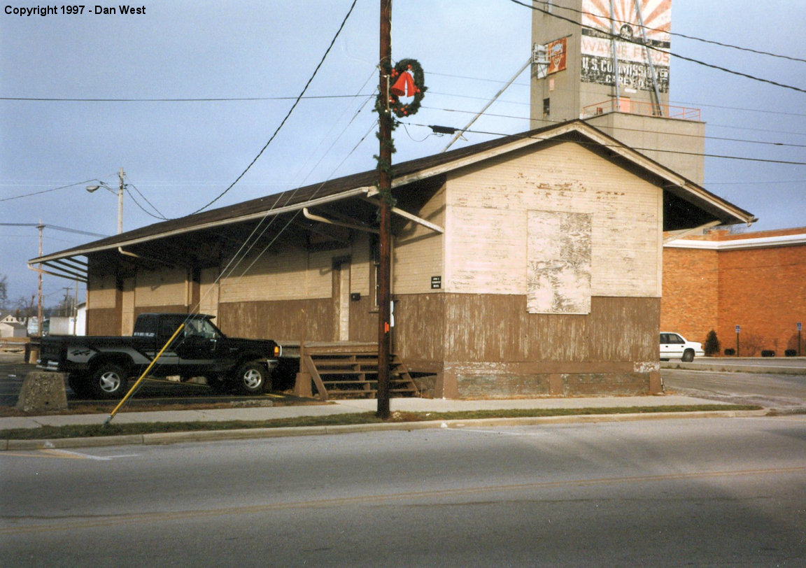
P | Business | 1908 | Gone | Wood | |
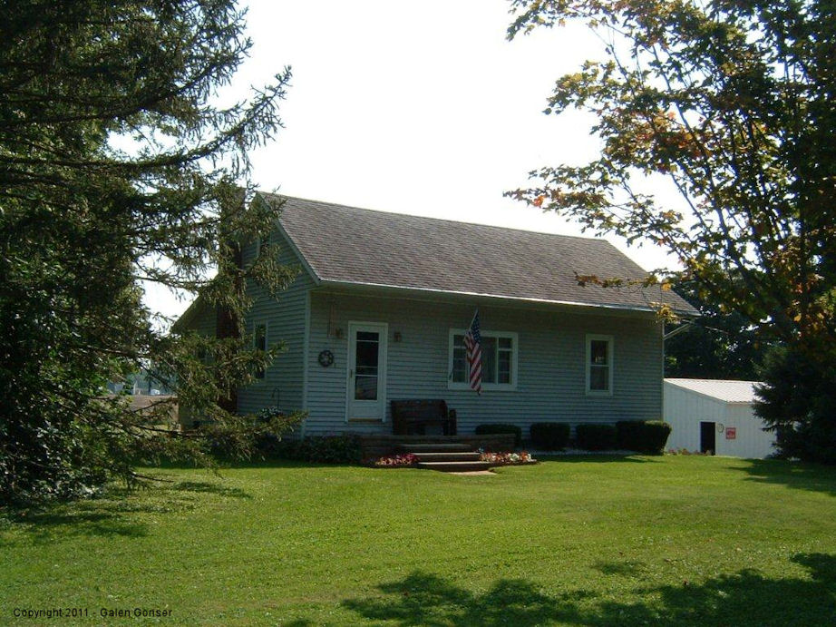
| McCutchenville |  |
7331 County Road 58 (GPS: 40.992580, -83.253224) |
P | Residence | ???? | None | Wood |
|
| STATIONS OF THE PAST | ||||||||
| Station Name |
Original Railroad |
Notes | ||||||
| Carey |  |
This station was located on the east side of the tracks near the intersection of Findlay and Columbus Avenues. | ||||||
| Carey | |
This was the Big 4 freight station on the north side of East Findlay Street. It was torn down in 1998. | ||||||
| Carey |  |
The depot was on the east side of North Vance north of Brown Ave. | ||||||
| Crawford | |
In 1879 the combination store/post office/depot was on the south side of Township Highway 103 on the east side of the tracks (GPS: 40.91815,-83.350557). At this time the railroad was the Columbus & Toledo RR. | ||||||
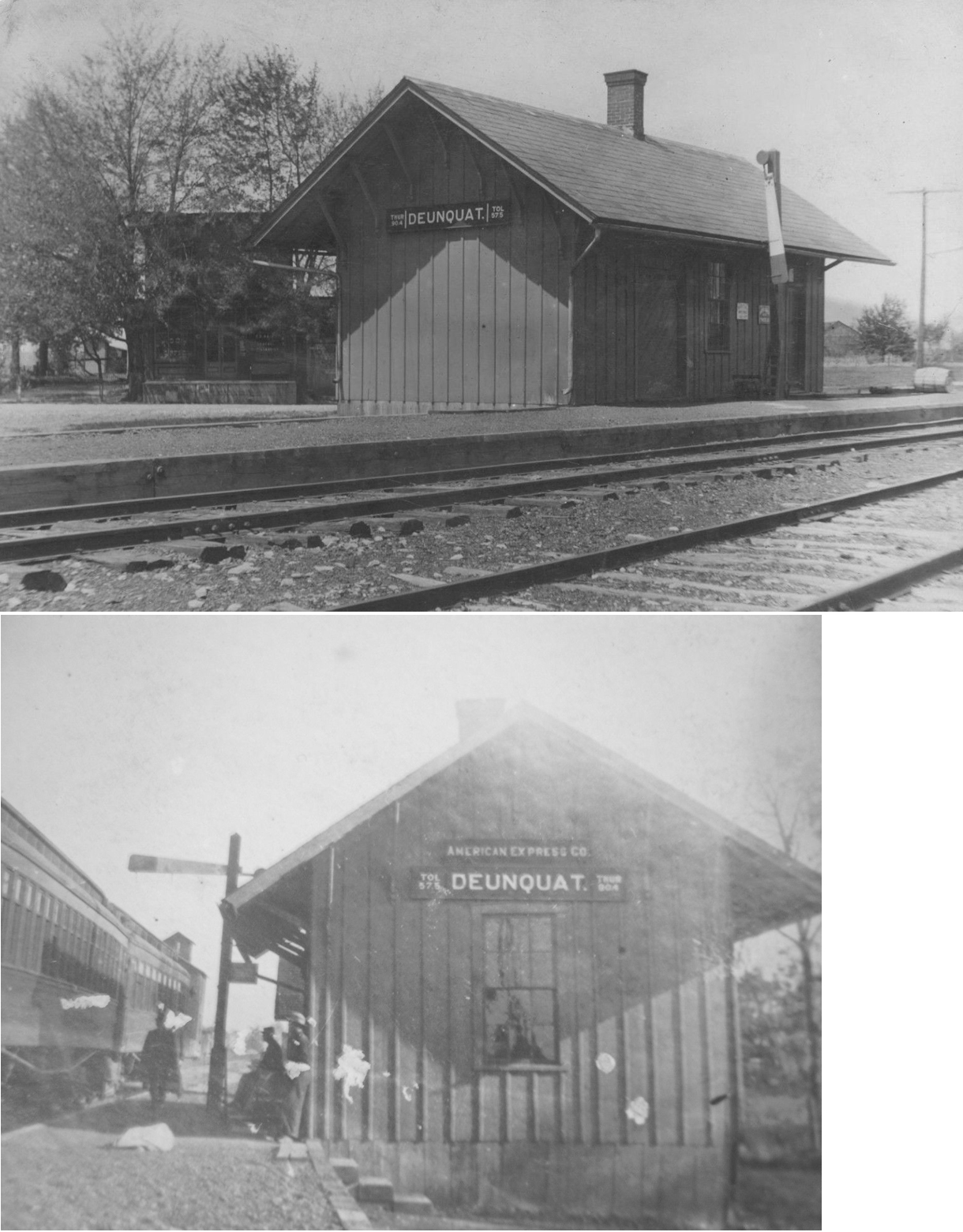
| Deunquat | |
|||||||
| Edenville |
 |
|||||||
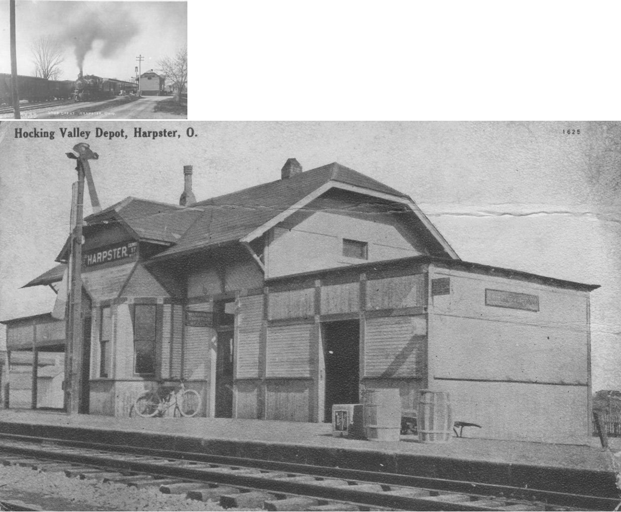
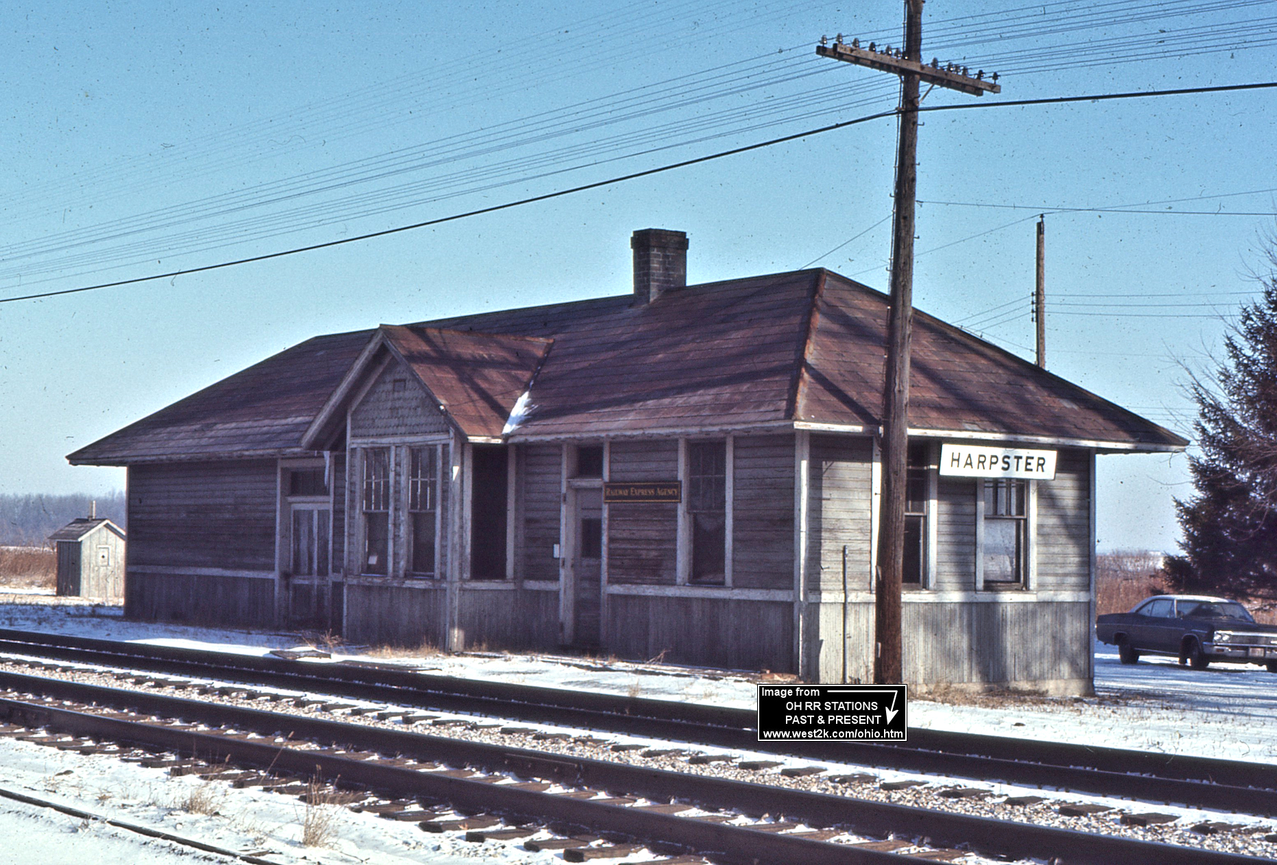
| Harpster | |
There were two HV stations at Harpster. The first was burned down by children playing with matches around 1917. Harpster was formerly known as Fowler City/Pitt P.O. In 1879, the Toledo & Columbus station was on the south side of Maumee Street on the northeast side of the tracks. | ||||||
| Harpster | |
This station was built to replace the burned station in 1918. It was torn down in the early 1980s. | ||||||
| Lovell | |
In 1879 the Columbus & Toledo RR station was on the north side of County Highway 42 (formerly Salem Street) on the southeast side of the tracks (GPS: 40.890819,-83.331589). | ||||||
| Kirby |
|
In 1879 the station was on the south side of the tracks between Main Street and Jackson Street (GPS: 40.811832,-83.419592). | ||||||
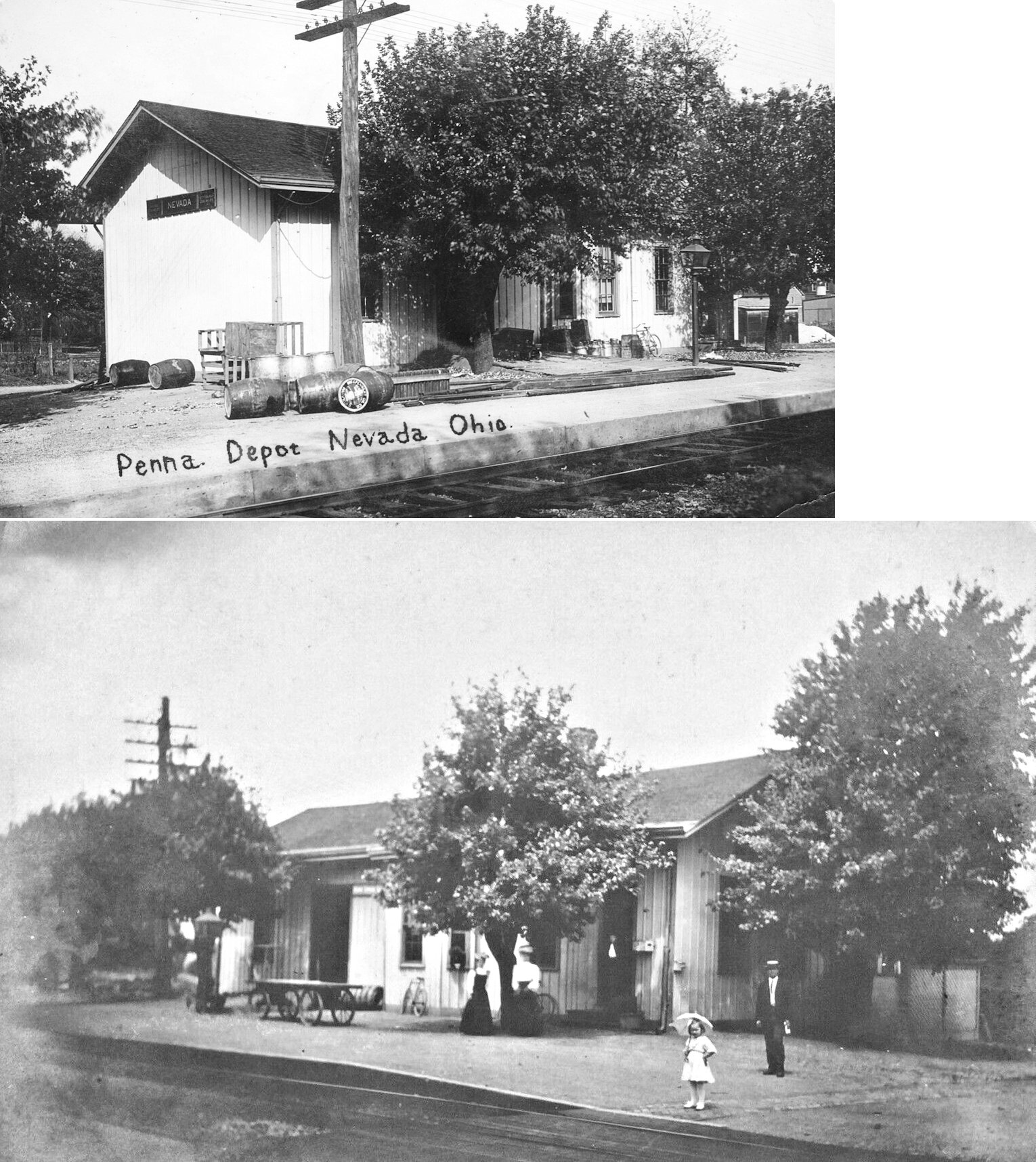
| Nevada |
|
This station was on the west side of Goodbread Street on the north side of the tracks. | ||||||
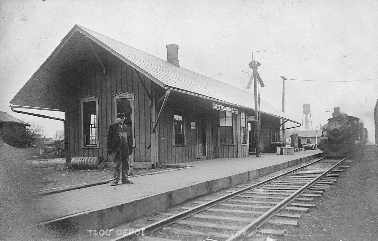
| Sycamore |
|
This station was on what is now the east-west section of North Pennington Street just west of Sycamore Street. | ||||||
| Sycamore | |
This station was on the west side of Griffith Street, just north of East 7th Street. | ||||||
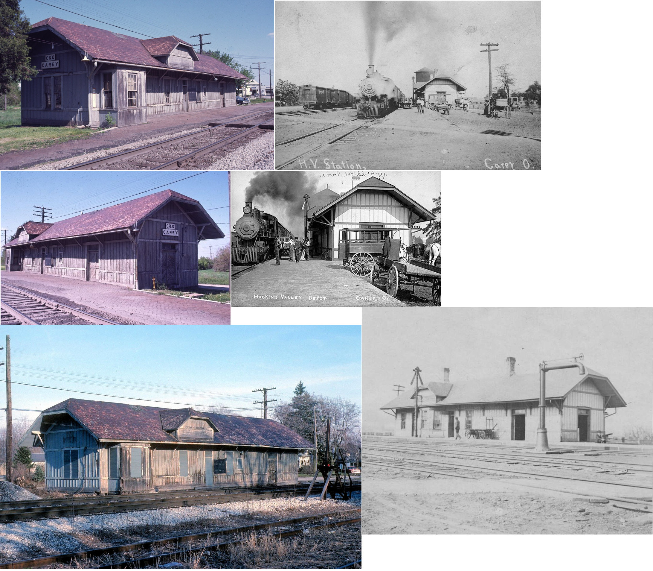
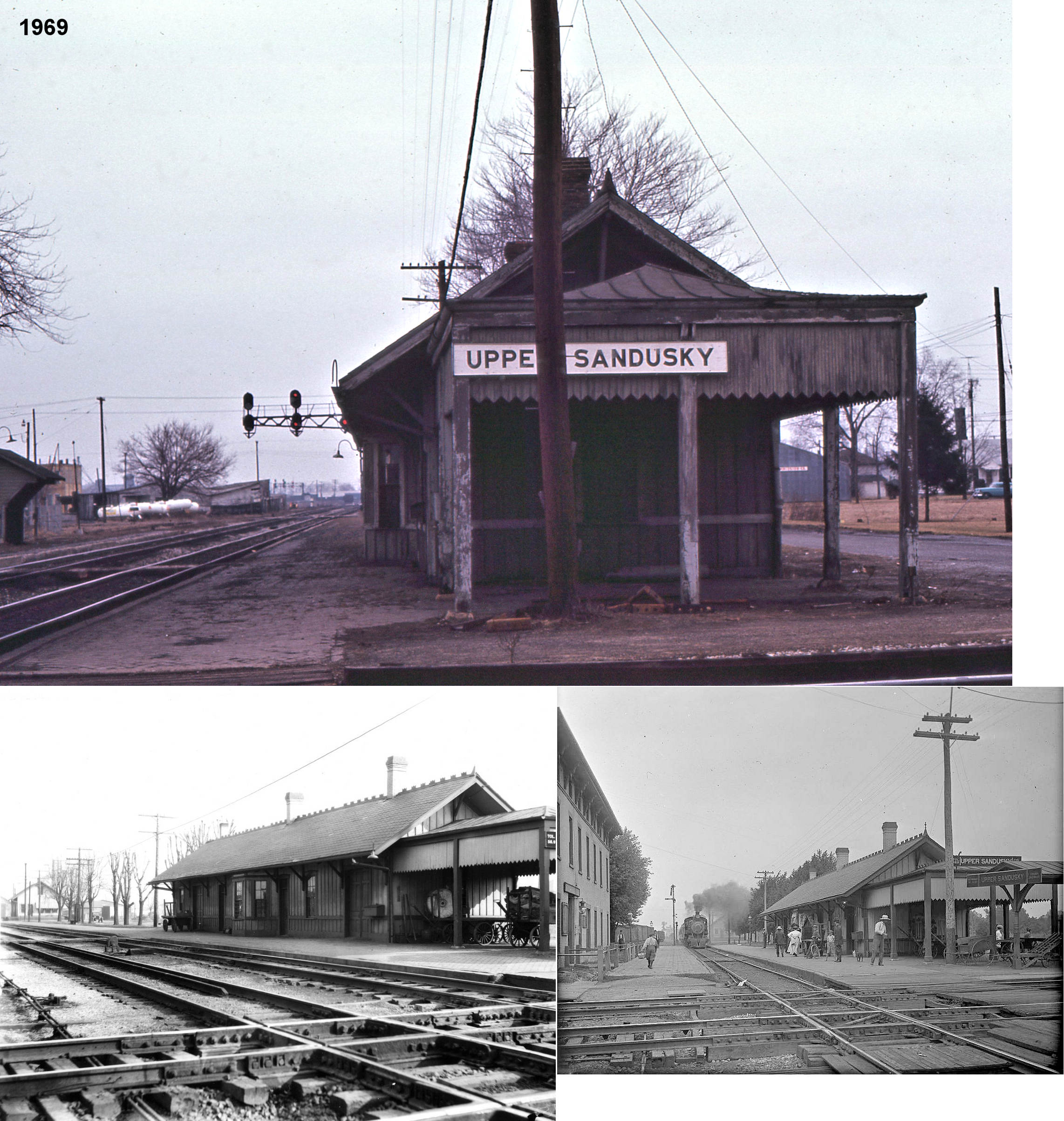
| Upper Sandusky | AND  |
This station was in the NE corner of the PRR/CHV&T diamond at the intersection of Chief Street (formerly Railroad Street) and W. Hicks Street (GPS: 40.824941,-83.291624). The CHV&T Hotel was across the tracks in the NW quadrant. The station faced the CHV&T tracks, but a long platform wrapped around the side of the building on the south side to serve the PRR tracks. The station was built by the CHV&T with the PRR moving into the station later after closing its station on 7th Street in 1900 (see below). A station is shown here on the 1879 map when the line was the Columbus & Toledo RR. There was also a freight station on the north side of Johnson Street on the east side of the tracks (GPS: 40.826224,-83.291667). | ||||||
| Upper Sandusky |
|
The PFt.W&C passenger station was on the SW corner of Hicks and 7th Street (GPS: 40.824689,-83.283148). That building was later used as a RR maintenance building and office after the PRR moved into the CHV&T station in 1900. The passenger station was torn down around 1920. The freight station was just to the west on Hicks Street between 7th and 8th Streets on the south side of the tracks (GPS: 40.824649,-83.283792). | ||||||
| Upper Sandusky |
|
|||||||
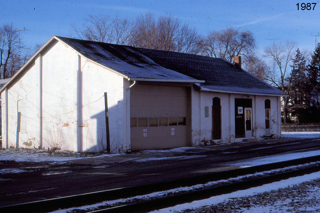
| Upper Sandusky | |
The CHV&T freight station was on the north side of Johnson Street, on the east side of the tracks. | ||||||
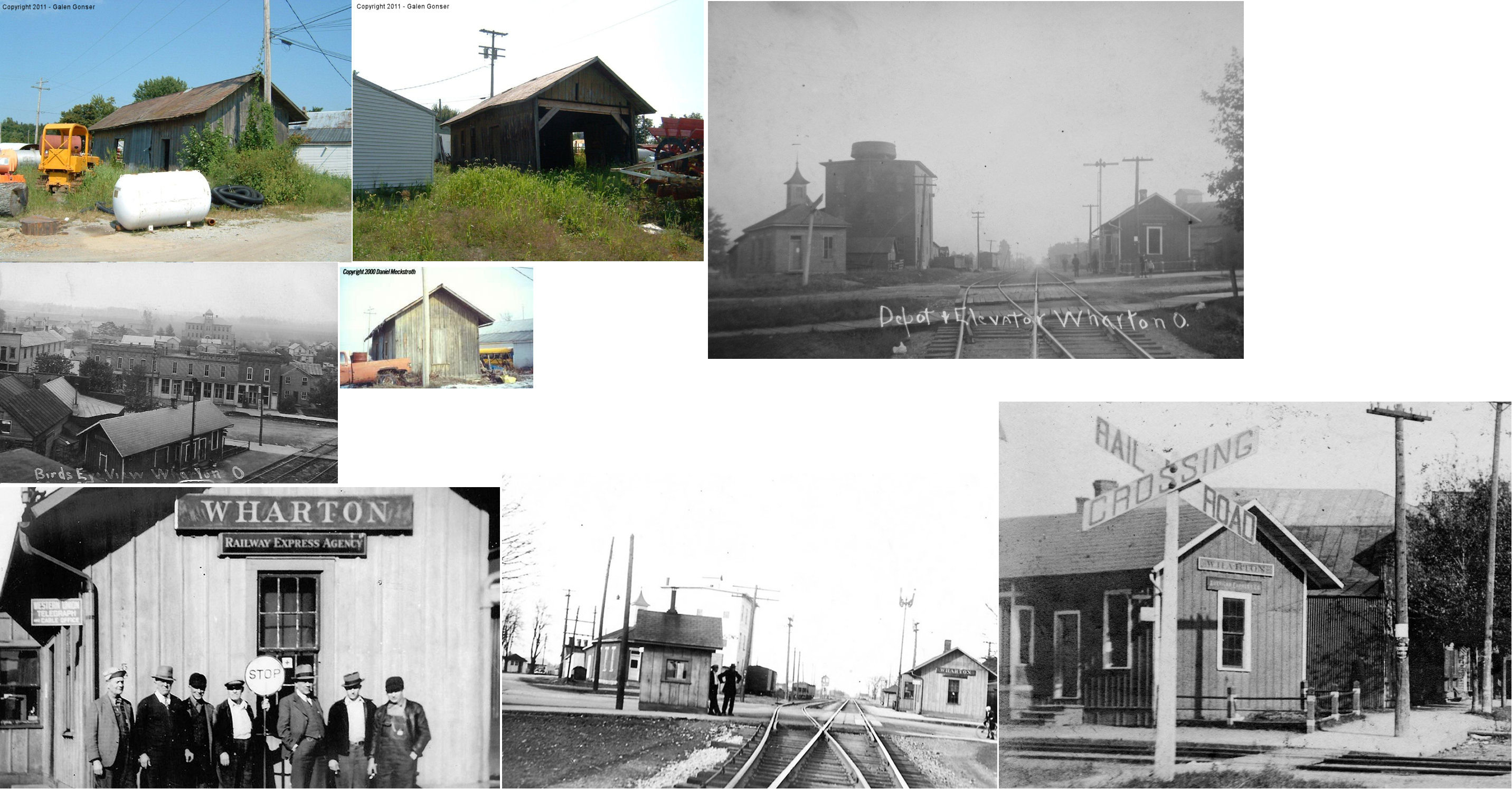
| Wharton |
 |
In 1879 when the village was still called Whartonsburg, there was a CS&S station on the north side of Sandusky Street on the southeast side of the tracks (GPS: 40.861578,-83.463424). | ||||||
| Wharton | |
Moved from its original location on West Sandusky Street on the east side of the New York Central tracks to its final location fff Cass Street (GPS: 40.862077,-83.462791) . The depot was moved in the late 1950s, when passenger service and the signaling system were taken off the line, to make room for the new post office. It was used by Boden's Garage for storage for several years before it collapsed around 2012-2013. The north end of the building was missing and it had been modified with large opening to accommodate vehicles. | ||||||
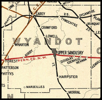
| 1898 WYANDOT COUNTY RAILROAD MAP | ||||||||
 |
||||||||
| Notes About Existing
Stations... McCutchenville (T&OC) - Originally the station was located in Senaca County on the north side of town on the east side of Route 53 where the Heritage Cooperative office building is presently (2011) located. It was moved from the original site to its current location around 1952. It still has the original wood flooring, walls and interior doors. the lower level was once a garage, but has been expanded and converted into additional living space. |
||||||||