 COUNTY COUNTY
|
|
||||||||
| EXISTING STATIONS | ||||||||
|---|---|---|---|---|---|---|---|---|
| Station Name |
Original Railroad |
Current Location |
Type | Current Use |
Date Built |
Track Status |
Building Material |
More Info |
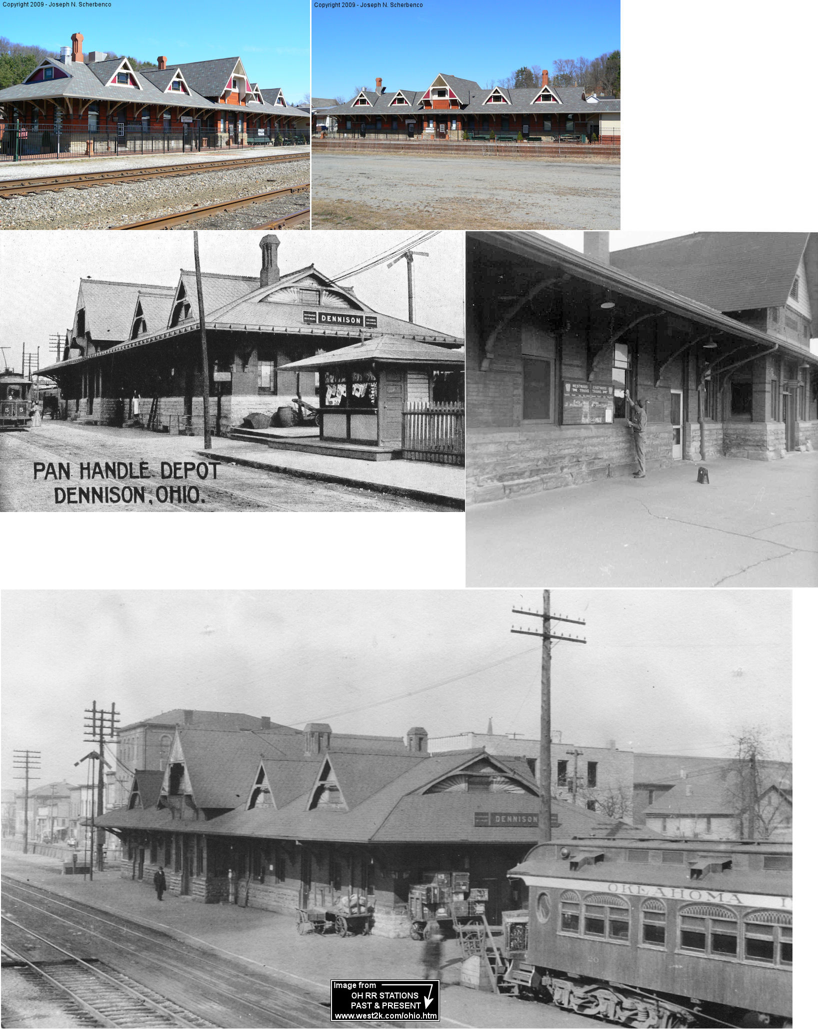
| Dennison |  |
400 Center Street (GPS: 40.392154,-81.332171) |
P | Museum | 1887 | In Use | Brick |
|
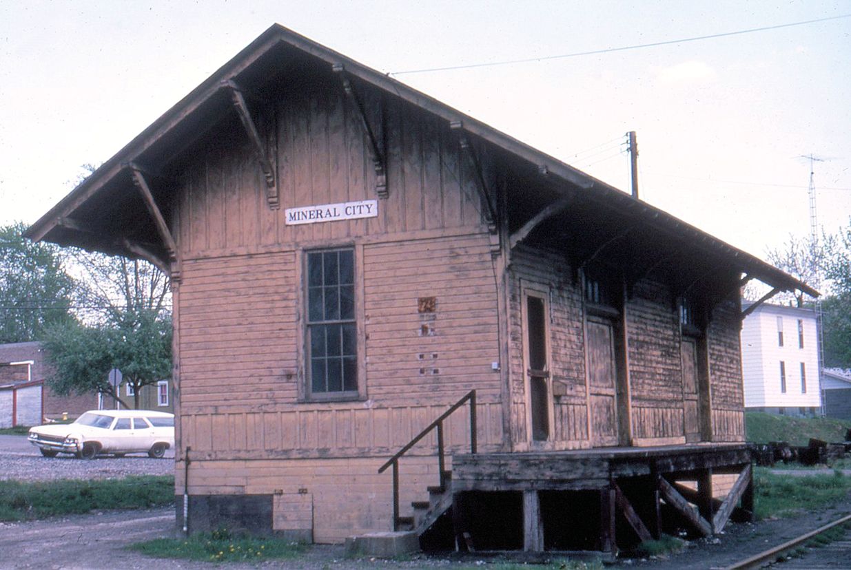
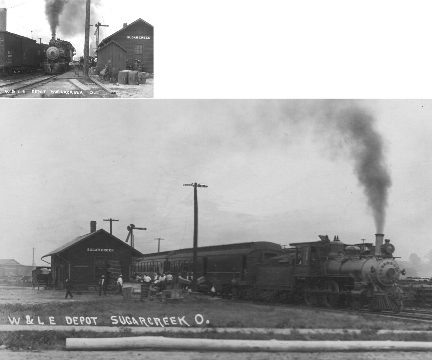
| Sugarcreek |  |
Factory Street north of Main Street (GPS: 40.502704, -81.639352) |
C | Railroad | 1915 | In Use | Brick | |
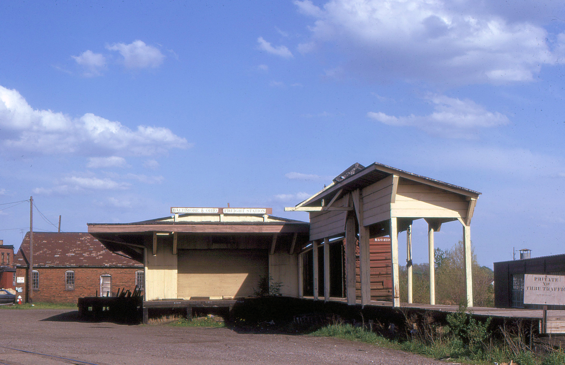
| Uhrichsville |  |
East 4th Street (40.392385,-81.344729) |
F | Business | ???? | In Use | Brick | |
| STATIONS OF THE PAST | ||||||||
| Station Name |
Original Railroad |
Notes | ||||||
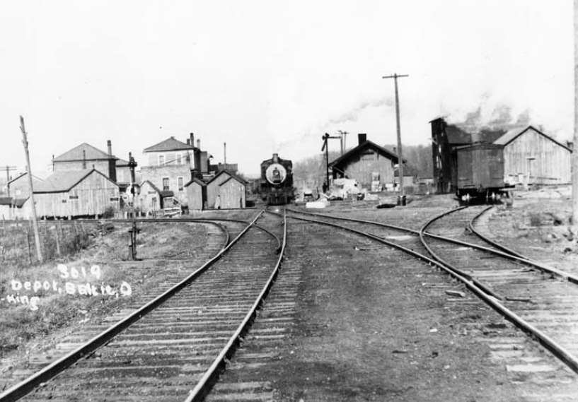
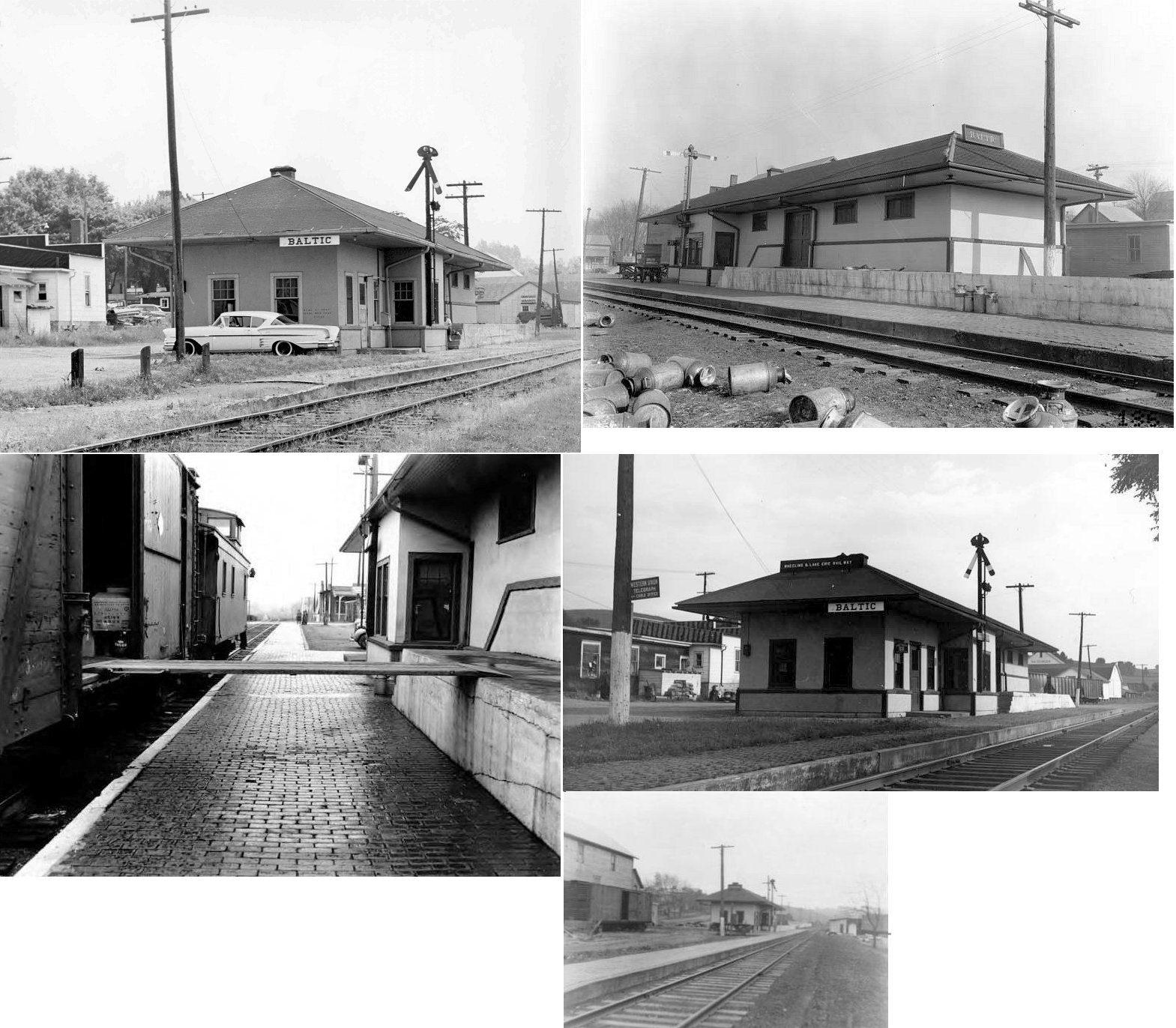
| Baltic (Buena Vista) |
|
This was the first station in Baltic. Baltic was also known as Rowville in early years, and breifly known as Beuna Vista. | ||||||
| Baltic | |
This second-generation station was on the west end of Mill Street on the east side of the tracks (GPS: 40.439637,-81.702898). | ||||||
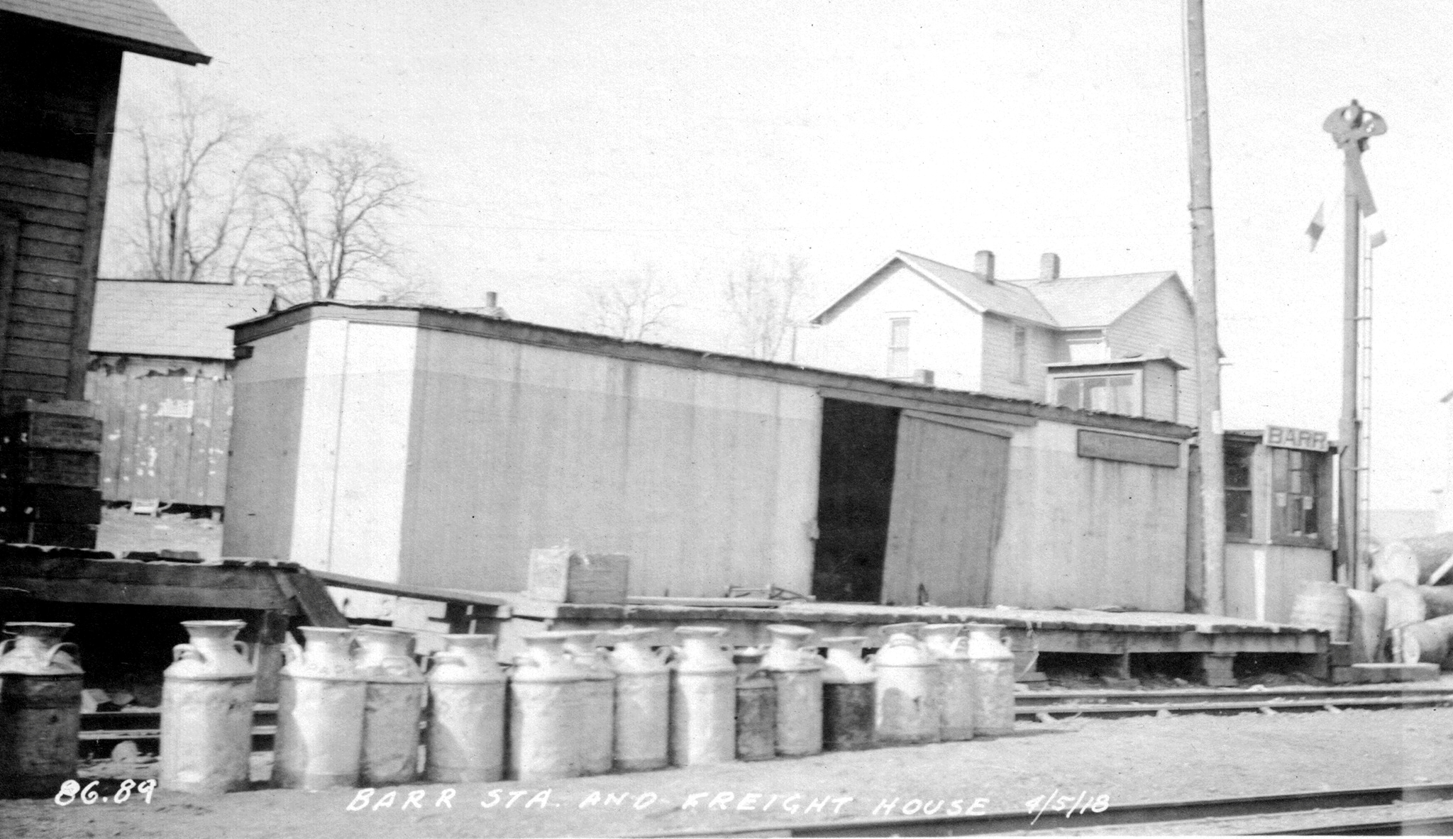
| Barrs Mills (Barr) |
|
|||||||
| Bethel |
 |
This station was between Stone Creek and Wolf. The post office here was called "Haunsburg." | ||||||
| Black Band |
|
This station was between Yorktown and Phillipsburg. | ||||||
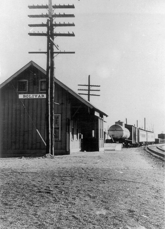
| Bolivar | |
The passenger/freight station for Bolivar was located near where Poplar Street curves to the NW on the east side of the tracks (GPS: 40.652143,-81.460662). At one time, there were several spurs in this area that served the freight depot and a brick yard that once was located to the west side of the tracks. The station was torn down in the late 1960s. | ||||||
| Dennison | |
The original frame station here was at the corner of Center and 6th Streets (GPS: 40.392062,-81.330368). It was built in 1873 and is shown on the 1875 map at that location. When the new brick station was built in 1887, this station was moved west to a location between 2nd and 3rd Streets (at GPS: 40.392244, -81.334971) and converted to a freight station. | ||||||
| Dover |  |
The passenger station was at the corner of West Front and Factory (North Tuscarawas) streets. It was torn down by the PRR in July, 1956 (Dover Daily Reporter, Sept. 20, 1967). | ||||||
| Dover | |
This freight station was near the passenger station on West Front Street. The PRR had another freight station on the corner of West 3rd and Broad Streets just to the northwest of the old Hardesty Milling Company. | ||||||
| Dover | |
This brick freight station was at 185 South Tuscarawas Avenue (GPS: 40.516416, -81.474802). It was demolished by the railroad in 2016. | ||||||
| Dover |
 |
According to the Nov. 27, 1874 Coshocton Age (Tribune), there was an original Lake Shore & Tuscarawas Valley RR (later Cleveland, Tuscarawas Valley & Wheeling, later CL&W, later B&O) station built at Canal Dover in 1874. A newspaper report from 1877 says that the roof of the station was blown off by a storm on September 1, 1877 (Summit County Beacon, Sept. 5, 1877). The Belmont Chronicle reported that the station burned down in 1899 (8-22-1889 edition). | ||||||
| Dover |
|
This station was on West 3rd Street between Broad Street and Commercial Parkway. It was demolished by the RJ Corman Railroad on April 9, 2013. | ||||||
| Dover |
|
This is the original or an early CL&W freight station which was replaced by the B&O freight station listed below. After it went out of service as a station it served as as a yard office. | ||||||
| Dover |
 |
This appears to be the old B&O station near the junction with the C&M. The photo was taken right after the 1913 flood. | ||||||
| Dover |
|
Freight station. | ||||||
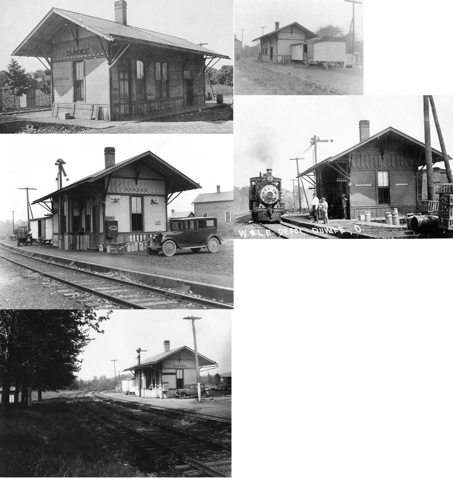
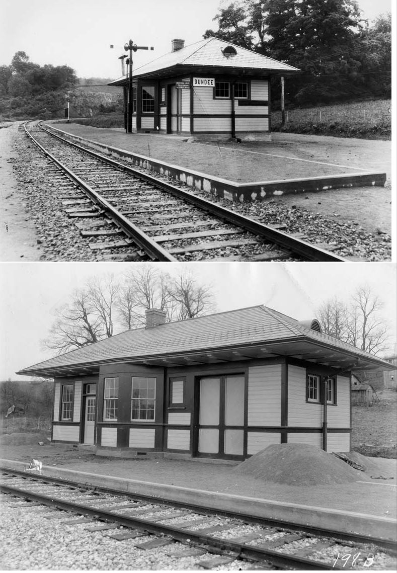
| Dundee | |
The station was on the north side of Main Street on the east side of the tracks. | ||||||
| Dundee | |
A new station was built here around 1937. | ||||||
| Gnadenhutten | |
According to PRR valuation records, this station was built in 1901. | ||||||
| Goshen Station |
|
This was the first station SE of New Philadelphia. | ||||||
| Harwalk |
|
A station is shown here on the 1923 PRR List of Stations & Sidings. It was on the Stasburg Branch. It was one mile from the end of the branch which was at the Wayne Coal Company. | ||||||
| Joyce |
|
A station is shown here on the 1923 PRR List of Stations & Sidings. | ||||||
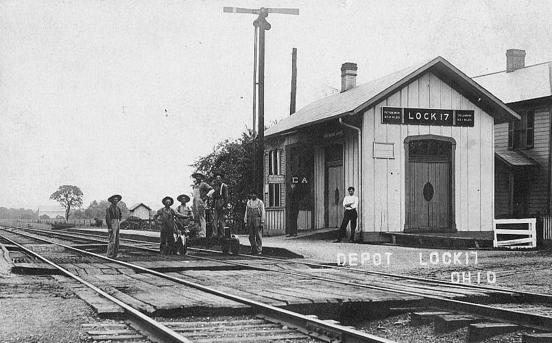
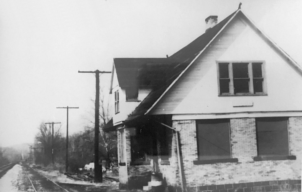
| Lock 17 |
|
According to PRR valuation records, this station was built in 1875. | ||||||
| Midvale |
|
This station was built from locally made bricks. | ||||||
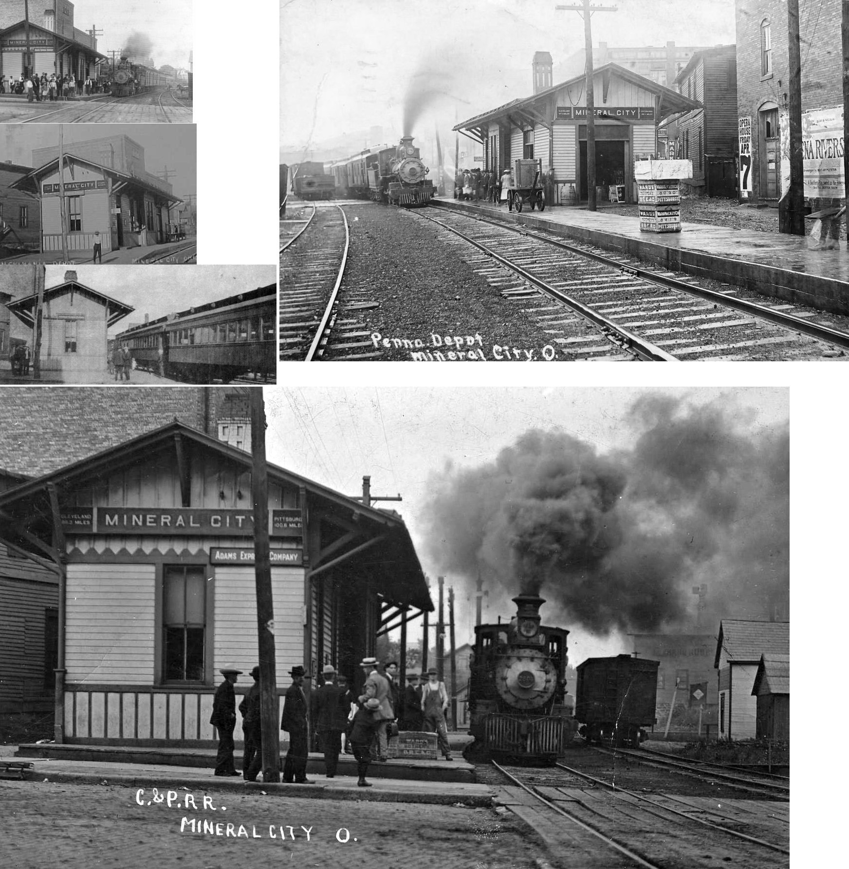
| Mineral City |  |
This station, built in 1897, was on the east side of High Street just south of Center Street. There was a freight depot across the tracks to the southeast. After going out of service as a passenger station, it was used as a telegraph office and express office and then closed in that regard in 1948. The telegraph and express office were then moved to the freight station across the tracks. The depot was purchased by W.W. Stutz of Beach City for $1,200 (New Philadelphia Daily Times, 3-18-1948). It is not clear whether Stutz moved the station or tore it down. | ||||||
| Mineral City | |
This freight depot was across the tracks from the passenger station to the southeast. The freight station remained until at least the late 1970s, perhaps longer. | ||||||
| Mineral City | |
This combination station was on the east side of High Street just south of Miners Street (GPS: 40.599886,-81.360782). The station was abandoned by the railroad in 1932 (when service on the Tuscarawas Branch ended) and then burned down in 1935 (New Philadelphia Daily Times, 6-3-1935). A small RR tool house was then built on the site. An early station is shown at this same location on the 1875 map and is noted as a combination store/depot. | ||||||
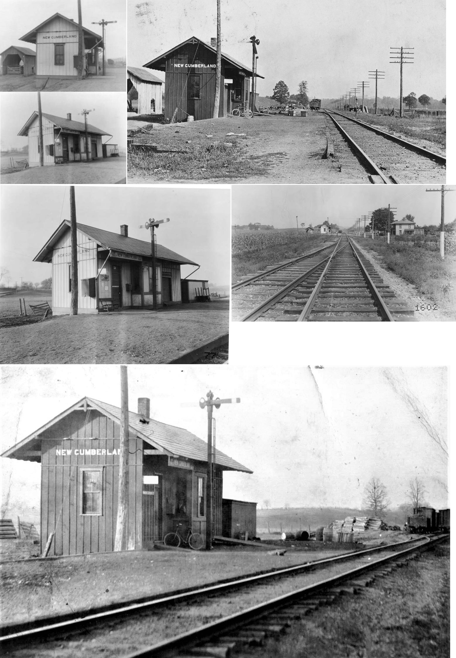
| New Cumberland |
|
This was the original station here. It served until 1938 when the tracks were moved to higher ground to reduce flood risk. | ||||||
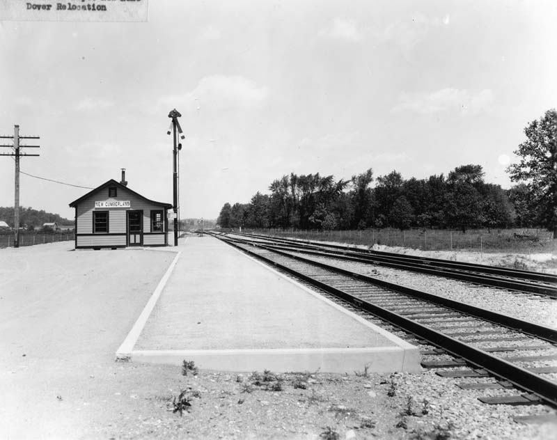
| New Cumberland |
|
A new station was built on the newly realigned tracks in 1938. | ||||||
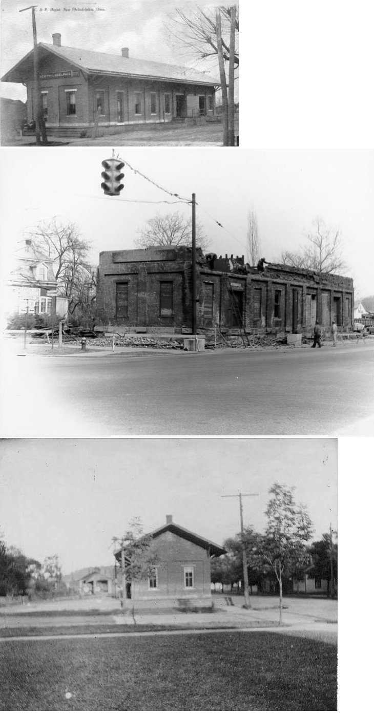
| New Philadelphia |
|
This combination station was located bewteen 1st Drive SW and Broadway just south of St. Clair Avenue SW (in the old days 1st Drive SW (then called 5th Street) extended all the way to the tracks) (GPS: 40.485751,-81.447444). This station was replaced by the B&O station listed below sometime between 1901-10. After that, this original station was used as a freight-only station. | ||||||
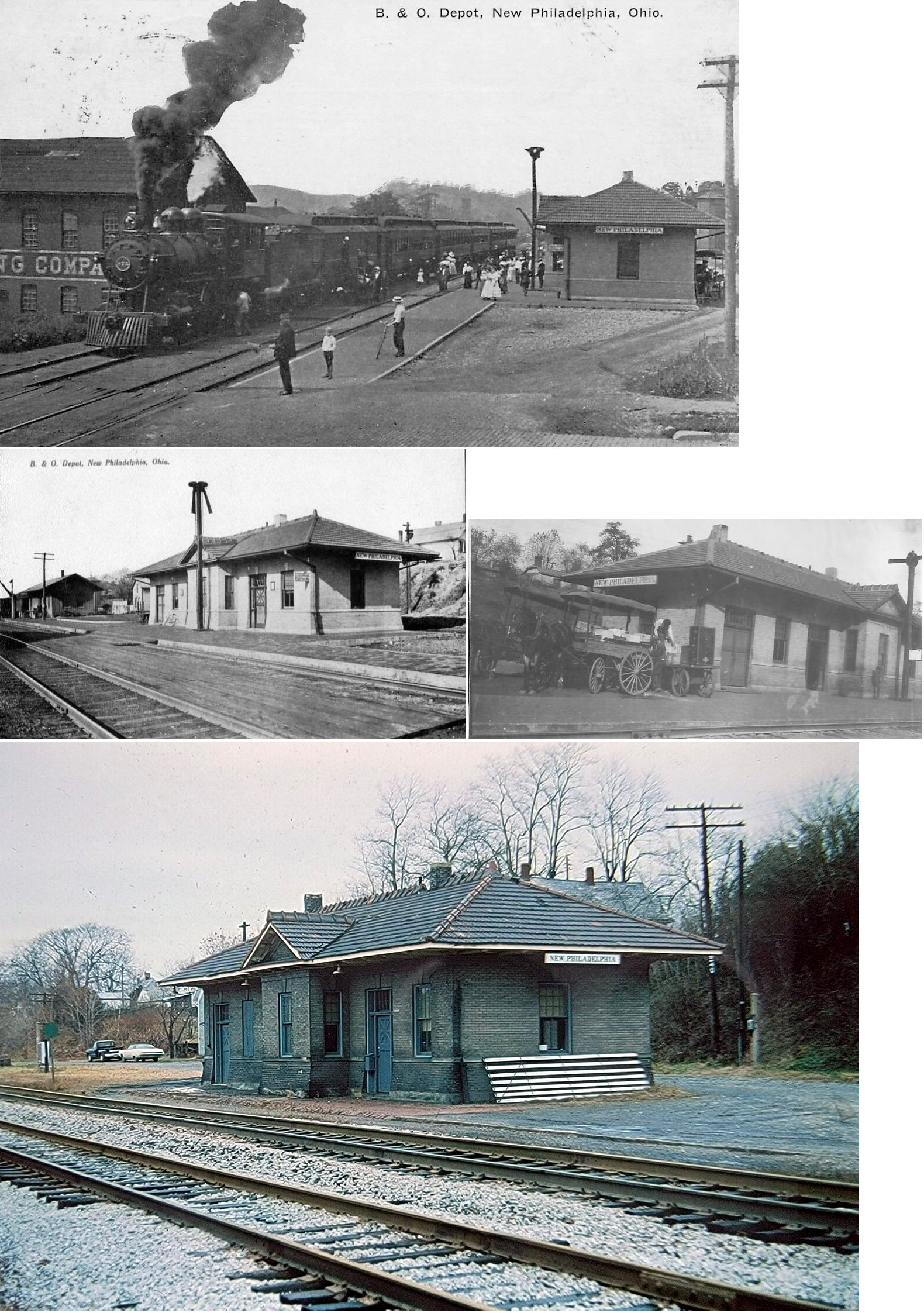
| New Philadelphia | |
Built by The Pittsburgh Construction Company, this station was on the west side of South Broadway on the north side of the tracks. It was built in 1905. | ||||||
| New Philadelphia | |
This combination station was on the NW corner of North Broadway and East Ray (GPS: 40.49307,-81.444365). It is shown on the 1875 map of the city (at that time this branch line ended here at the station). | ||||||
| New Zoarville |
AND AND |
See listing below for Zoarville. | ||||||
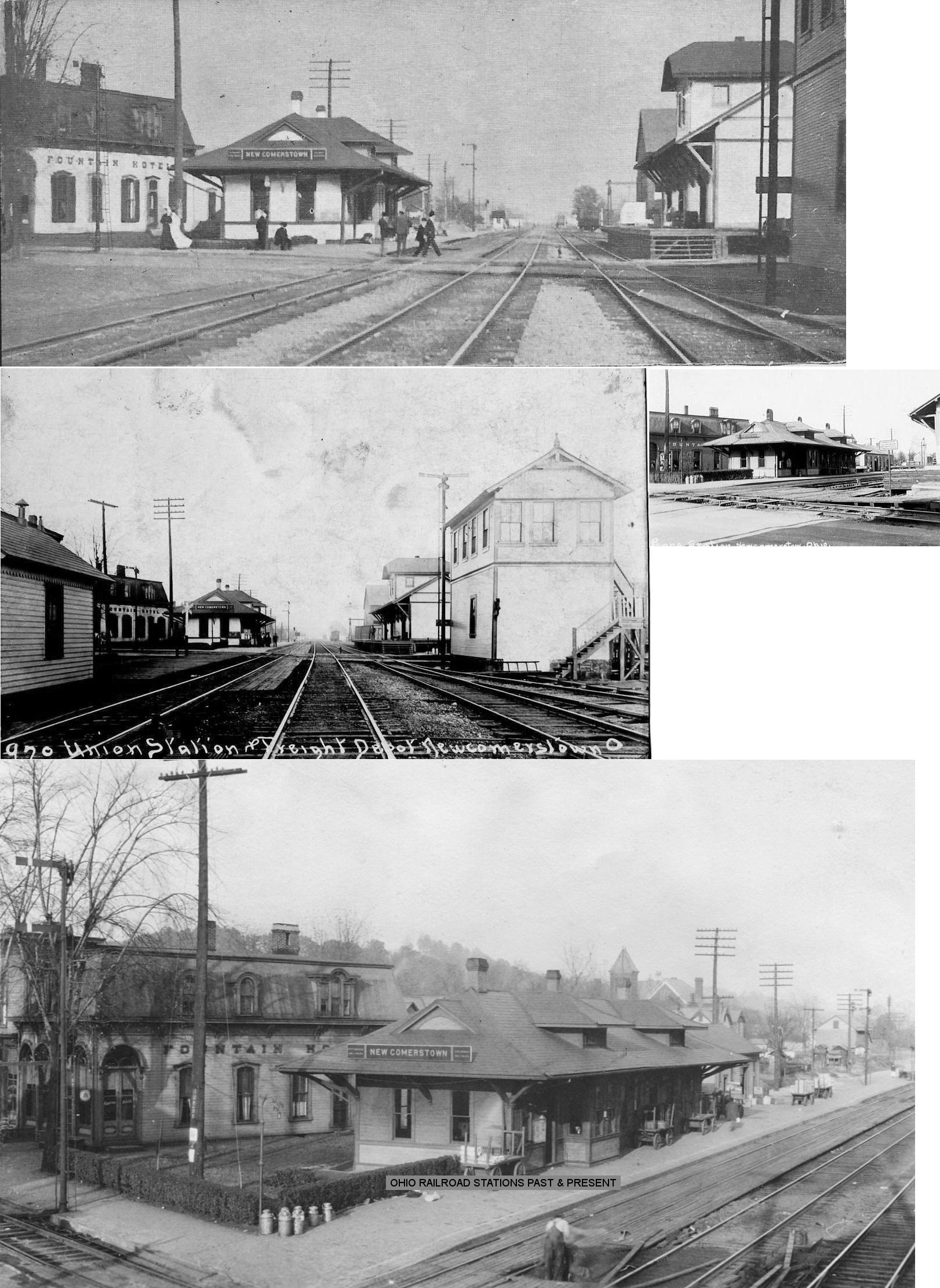
| Newcomerstown | |
The original PCC&St.L station here was a combination depot that sat between Bridge Street (formerly Railroad St.) and South River Street (GPS: 40.273002,-81.607282). It only served the PCC&St. L line. This station can be seen on 1895 maps, but was gone by 1901. | ||||||
| Newcomerstown |
|
The original C&M stations were along the tracks in the SE corner of the diamond on the east side of Bridge Street (GPS: 40.273346,-81.605785). The freight station was closest to the diamond and had a platform along the PCCC&St.L and the another along the C&M. The passenger station was just to the south of the freight station. These stations can be seen on 1895 maps, but were both gone by 1901 when the new PCC&St.L freight station was in this location and the new passenger station had been built across the tracks to the north. | ||||||
| Newcomerstown | |
The passenger and freight stations were on Railroad Street just south of Church Street. The passenger station was in the NE corner of the C&M/PCCC&St.L diamond while the freight station was in the SE corner. According to PRR valuation records, the passenger station was built in 1899. | ||||||
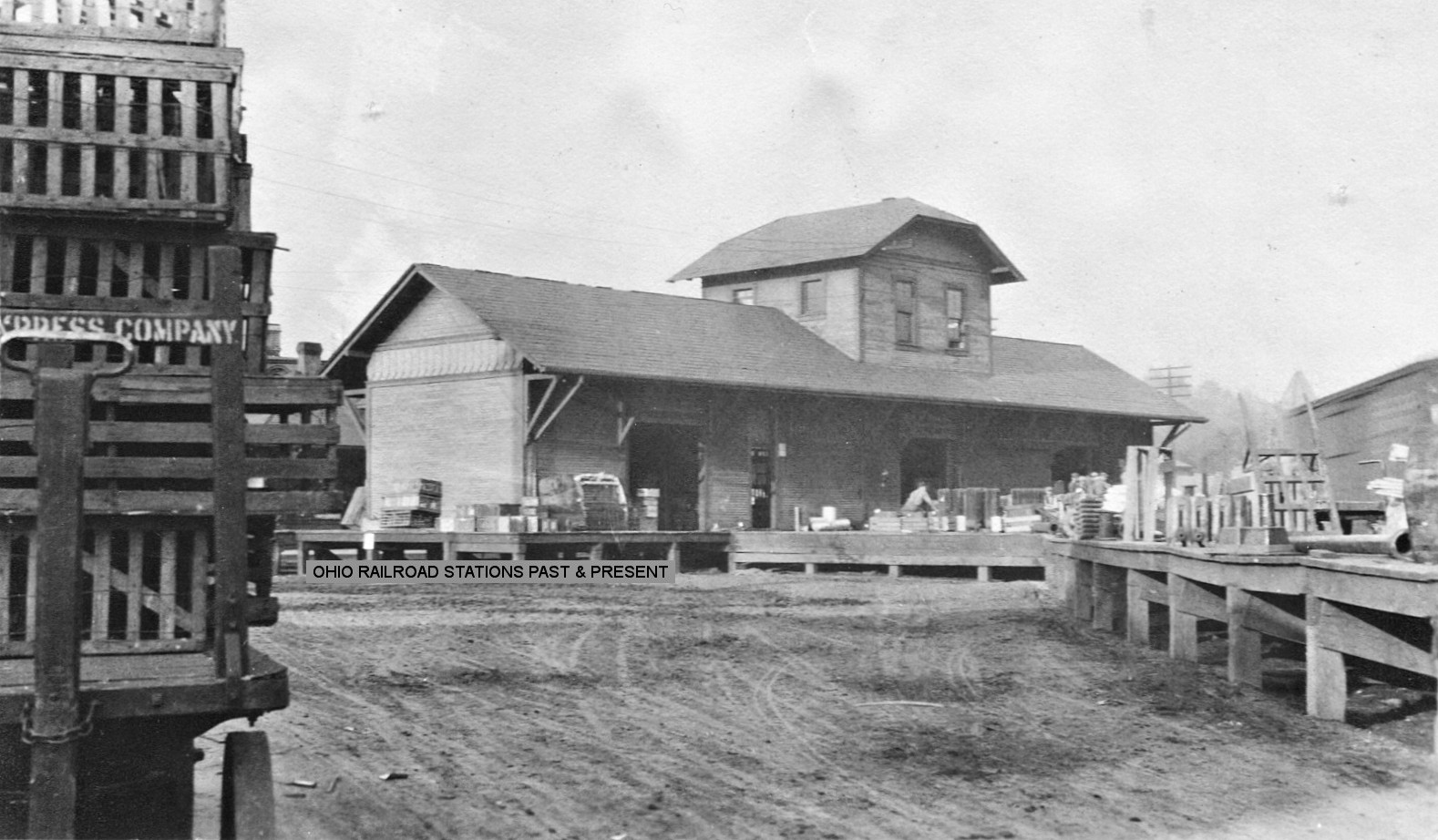
| Newcomerstown | |
The freight station was built in 1903. The freight station was doubled in size around 1905 and then replaced with another freight station (shown on 1933 maps) that was farther to the SE, diagonal along the transfer track between the C&M and PCC&St.L lines. | ||||||
| Newport | |
This station was south of Urichsville. It was a three-sided passenger waiting shed as the station was a flagstop only. | ||||||
| Parral |
|
A station is shown here on the 1923 PRR List of Stations & Sidings. It was on the Stasburg Branch. | ||||||
| Philadelphia Station (Odbert) |
|
|||||||
| Phillipsburg |
|
|||||||
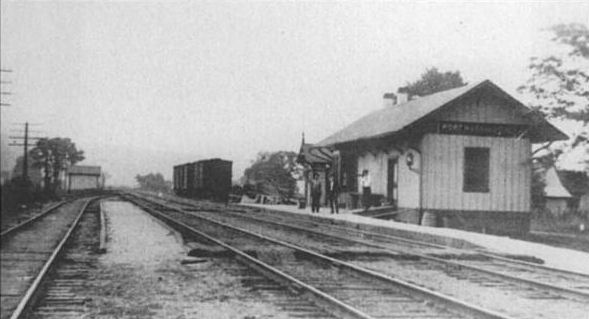
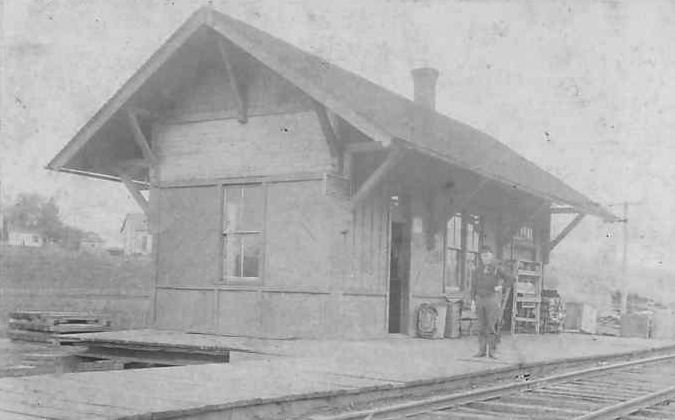
| Port Washington | |
This station was at the end of High Street on the NW side of the tracks (when High Street went through to the tracks) (GPS: 40.327702,-81.516275). According to PRR valuation records, this station was built in 1886. | ||||||
| Post Boy |
|
|||||||
| Royal |
|
|||||||
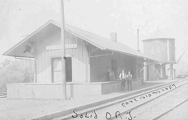
| Sandyville | |
|||||||
| Somerdale |
|
The station was located approximately 1/2 mile west of current village of Somerdale. It was located between the railroad and what is now State Route 212. The station was torn down when the tracks were relocated in 1938. | ||||||
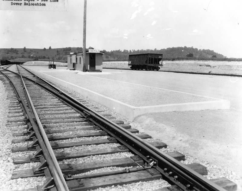
| Somerdale |
|
After the tracks were relocated (for flood control), an old passenger car on a concrete foundation served as the station here. | ||||||
| Stillwater |
|
|||||||
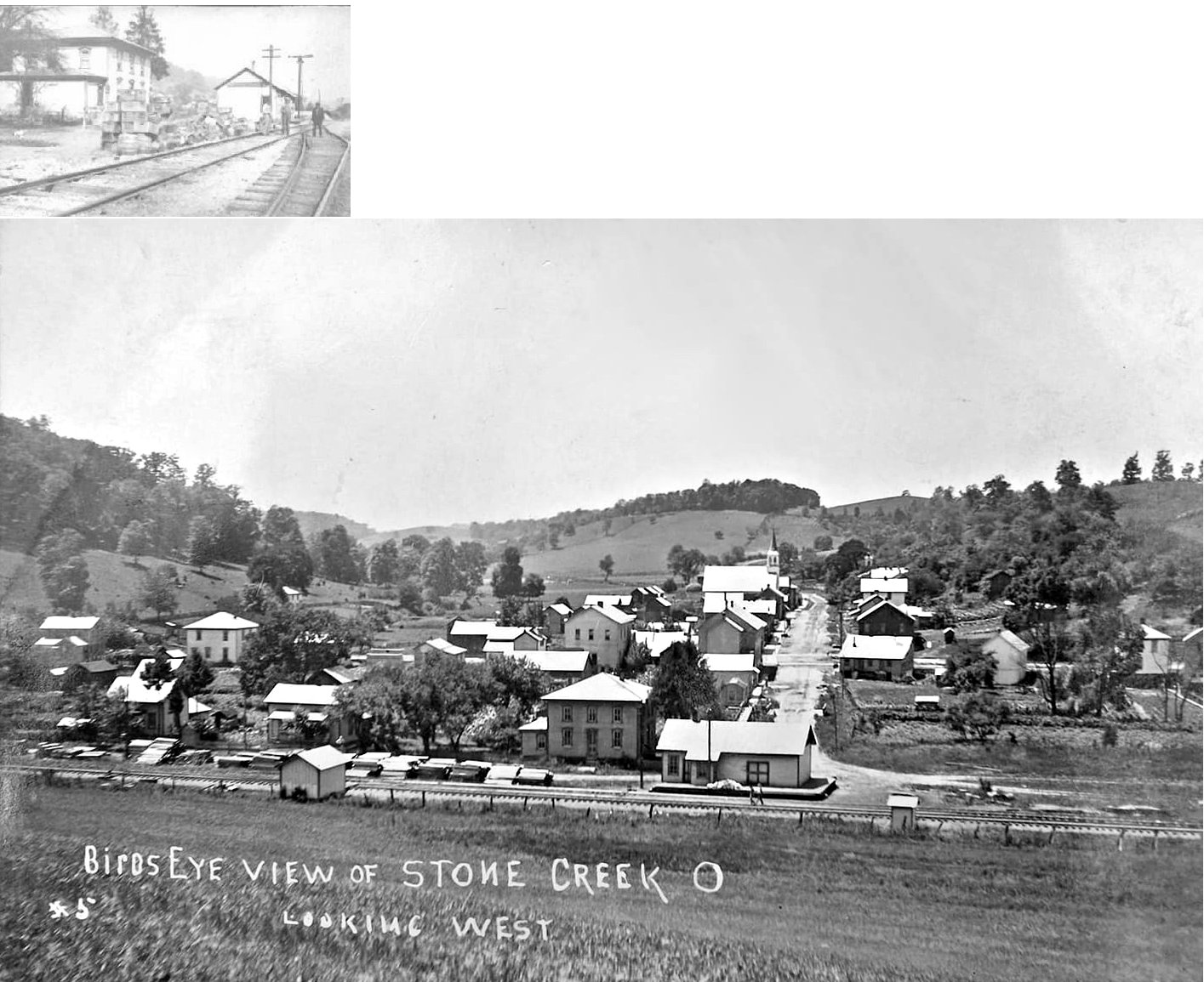
| Stone
Creek (Phillipsburg) |
|
A station is shown here on the 1923 PRR List of Stations & Sidings. | ||||||
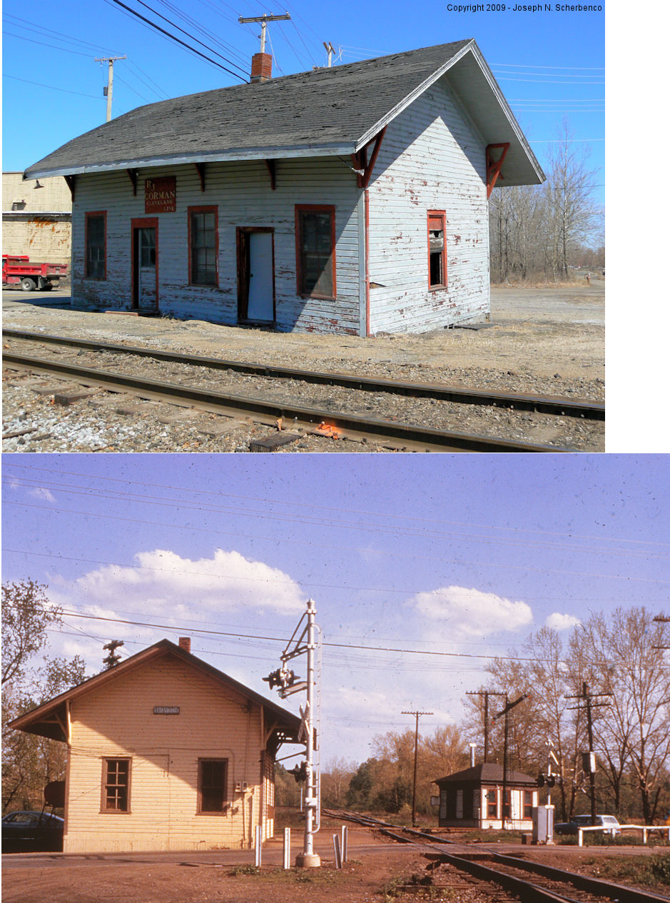
| Strasburg |
|
The station was ont he north side of Cross Street (1st Street) on the west side of the tracks (GPS: 40.597234,-81.52599). | ||||||
| Strasburg |
|
A station is shown here on the 1923 PRR List of Stations & Sidings. | ||||||
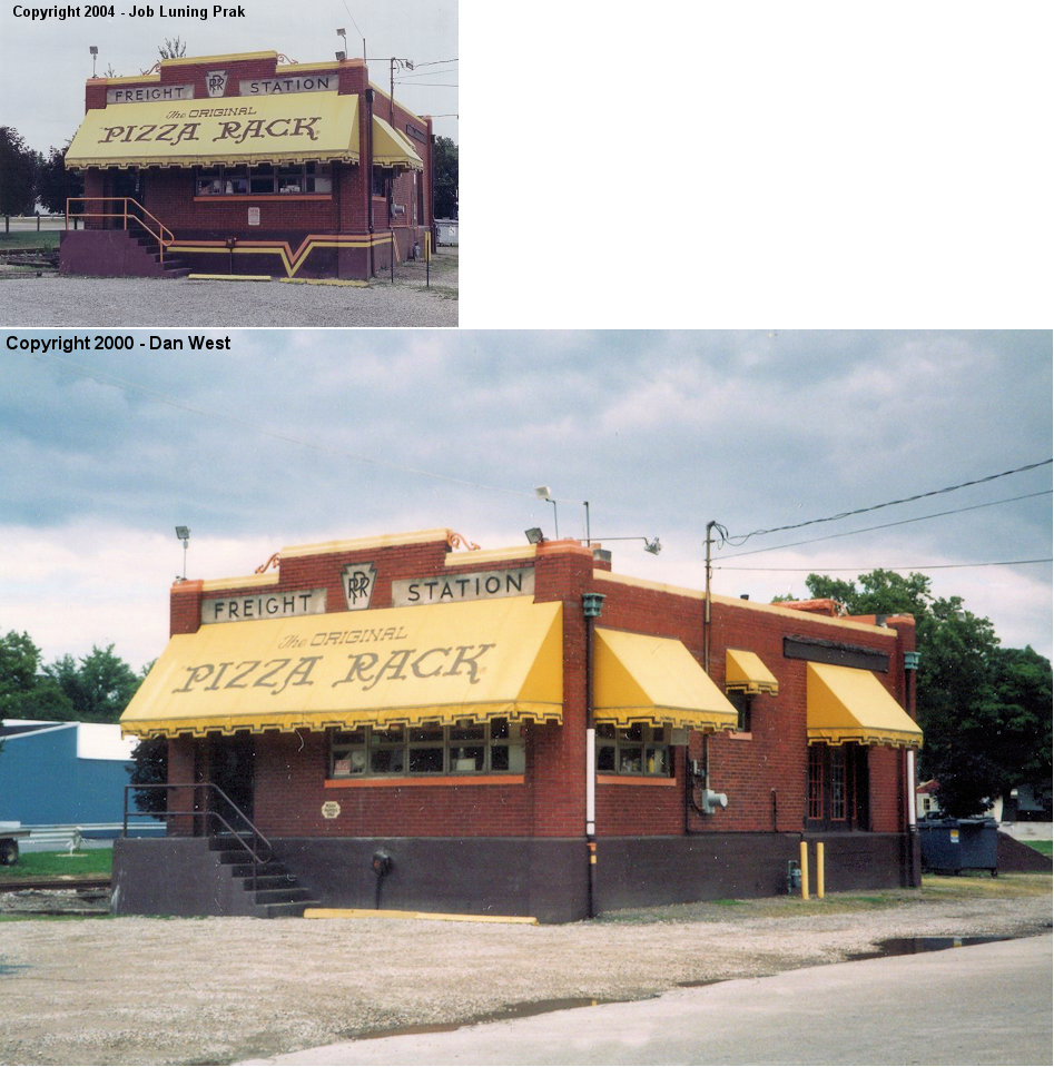
| Sugarcreek |  |
Burned in 1914, replaced with current brick station. | ||||||
| Summit Siding |
|
Only a platform is listed here on the 1923 PRR List of Stations & Sidings. | ||||||
| Turners |
|
|||||||
|
Tuscarawas (Trenton Sta.) |
|
According to PRR valuation records, this station was built in 1875. It was on the east side of US 36 near where the old bridge to Tuscarawas used to cross the river. It was at approximately GPS: 40.385521, -81.394676. Formerly known as Trenton Station. | ||||||
| Uhrichsville | AND |
This union station was north of West 1st Street in the SE corner of the diamond (GPS: 40.392948,-81.356785). The B&O had a freight station a few feet to the east (between the station and the CL&W roundhouse). The freight station was on a siding that came up behind the passenger station. This siding split off the main line around Trenton Avenue. According to PRR valuation records, this station was built in 1881. | ||||||
| Uhrichsville |
|
This station served the CL&W before the union station (listed above) was built. It was located between Trenton Avenue and West First Street on the west side of the tracks (GPS: 40.391384,-81.356742). | ||||||
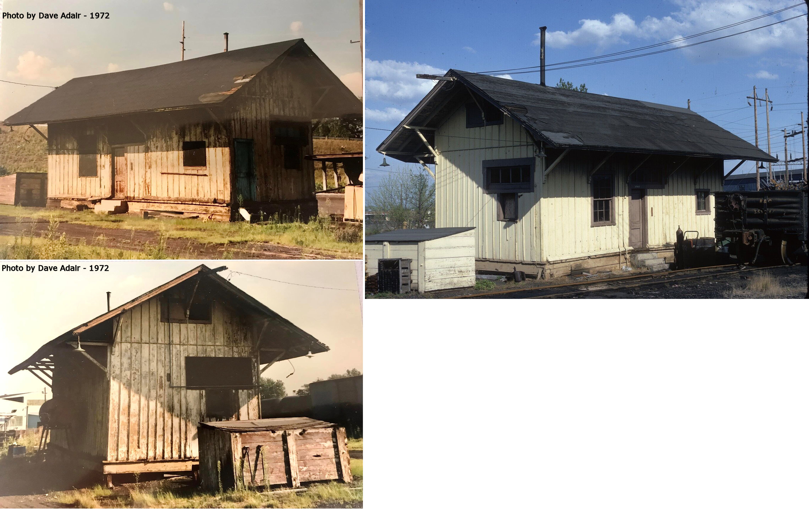
| Uhrichsville |
|
This freight station was on the south side of West 1st Street at GPS: 40.391633,-81.356544 near the crossing of the RJ Corman (B&O) and Ohio Central (PRR). It was torn down on March 15, 2021 after being vacant and derelict for several years. | ||||||
| Urichsville |
|
The original station here, before union station was built, was at the corner of 4th and Main Streets on the south side of the tracks (just west of where the existing freight station is) (GPS: 40.392407,-81.345016). | ||||||
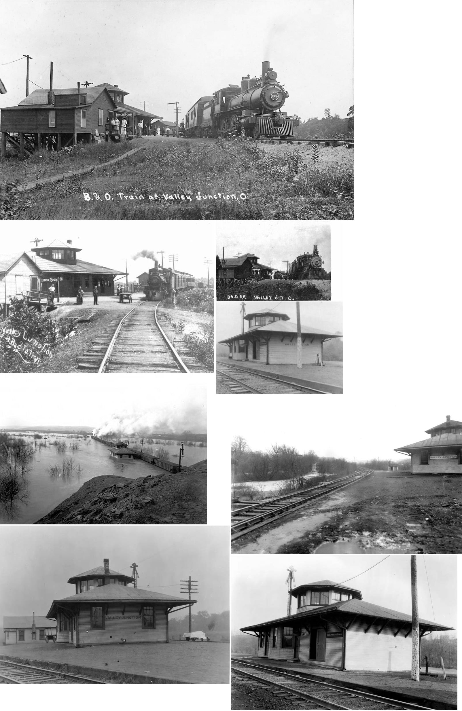
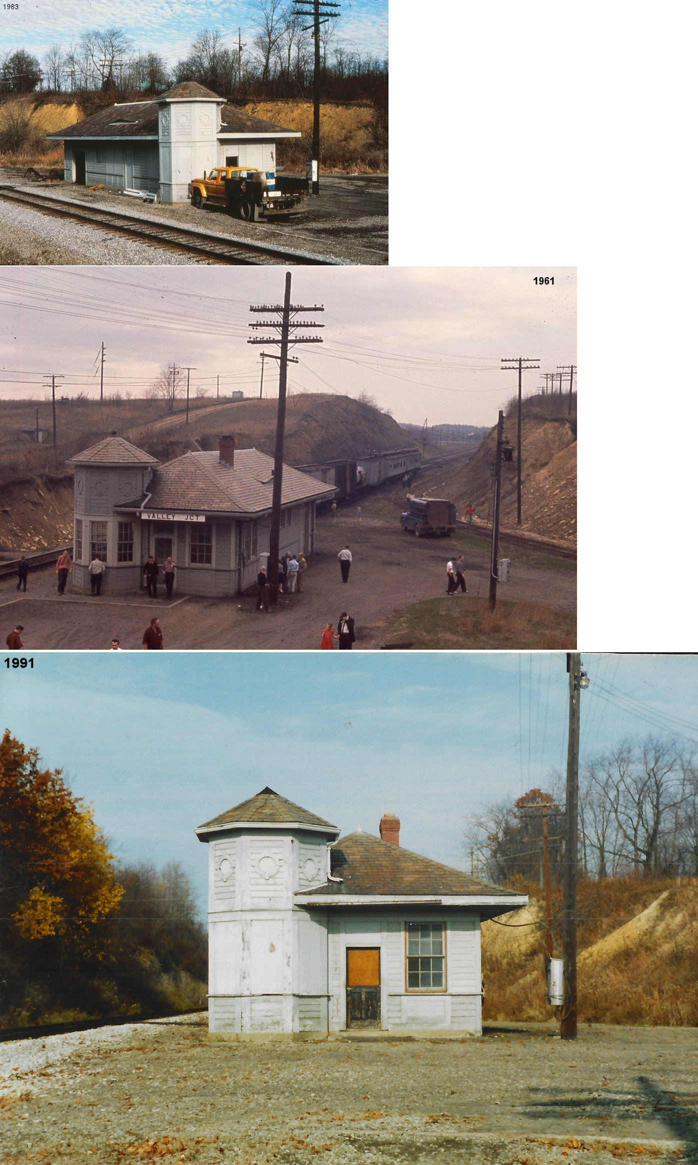
| Valley Junction (Zoarville) | AND AND |
This station, built in 1907, was the second depot on this site on the original track alignment (prior to dam construction and track relocation) after the original station burned down in 1906. This station served until 1937. | ||||||
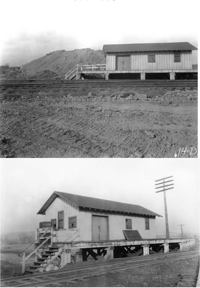
| Valley Junction (Zoarville) | AND AND |
This was the freight transfer house. The photos are from the W&LE valuation records. | ||||||
|
Valley Junction (New Zoarville) |
AND AND |
After the tracks were moved this new station was built in 1937. A station is shown here on the 1923 PRR List of Stations & Sidings. All C&P (PRR) structures in Old Zoarville were torn down in the mid-1930s when the roadbed was relocated uphill due to the downstream construction of the Dover Dam. The Old Zoarville C&P station was not rebuilt as part of that construction. Instead, C&P passengers were directed to use this new station built across the valley in New Zoarville (Valley Junction) which served the B&O, W&LE and the C&P. | ||||||
|
Wolf Station (Glasgow) |
|
Maps show a station here as early as 1875. A station is shown here on the 1923 PRR List of Stations & Sidings. | ||||||
| Yaegels |
|
This station is shown on the 1881 C&M timetable between Phillipsburg and Wolf's Station. | ||||||
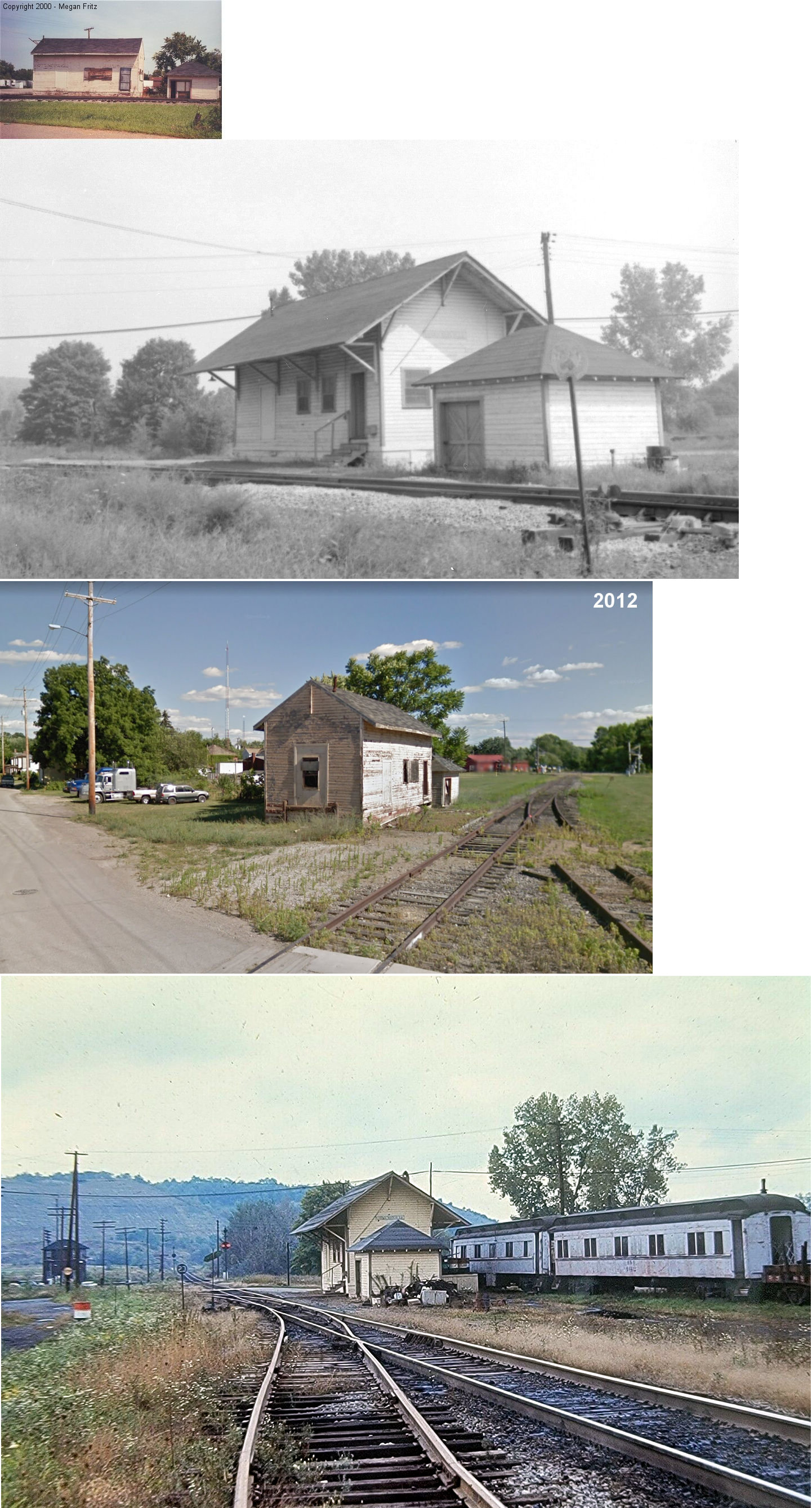
| Yorktown |
|
|||||||
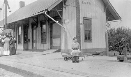
| Zoar | |
This station was at the southern end of Park Street (when Park Street went through to the tracks). It was on the west side of the end of the street on the north side of the tracks (GPS: 40.610923,-81.423733). | ||||||
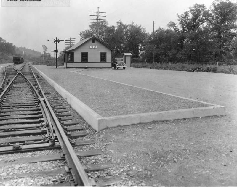
| Zoar | |
This station was near the intersection of Eberhart Road and Towpath Road at GPS: 40.608876, -81.430818.This station was built to replace the original Zoar railroad station (listed above) that was closed and demolished when the Dover Dam was built in 1938. The rail line was moved due to being in the flood plain and the Zoar Levy was built. The new station was built for passenger and mail service to the village of Zoar. | ||||||
|
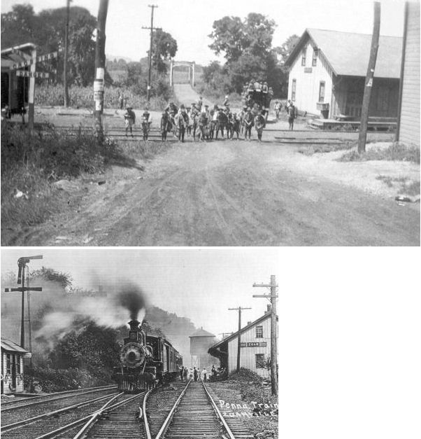
Zoarville (Old Zoar) |
|
This combination station was located on the NW side of the tracks below the intersection of Connotton Street and abandoned State Route 212 (now a hiking trail). "JN" cabin was near the station. All the structures in the photo were torn down in the mid-1930s when the roadbed was relocated uphill due to the downstream construction of the Dover Dam. The station was not rebuilt as part of that construction. Instead, C&P passengers were directed to use a station built across the valley in New Zoarville which served the B&O, W&LE and the C&P. Zoarville was previously known as Zoar Station and Fairfield. There was a station here when the town was known as Fairfield in as early as 1875. This was the junction of the branch line to Valley Junction. | ||||||
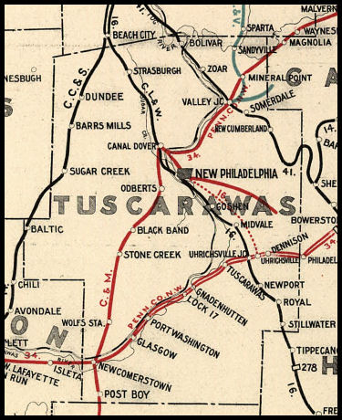
| 1898 TUSCARAWAS COUNTY RAILROAD MAP | ||||||||
 |
||||||||
| Notes About Existing
Stations... Dennison (PCC&St.L) - Museum info. On National Register of Historic Places. |
||||||||