 COUNTY COUNTY
|
|
||||||||
| EXISTING STATIONS | ||||||||
|---|---|---|---|---|---|---|---|---|
| Station Name |
Original Railroad |
Current Location |
Type | Current Use |
Date Built |
Track Status |
Building Material |
More Info |
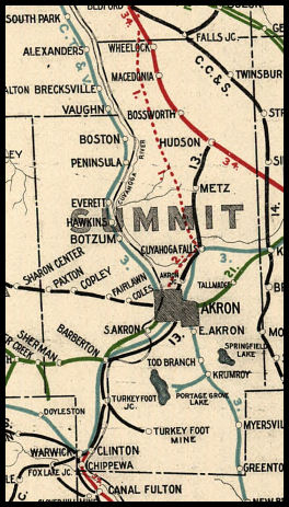
| Akron |
 |
Grant Street off Wolf Ledges Parkway | P | University | 1950 | In Use | Brick |
|
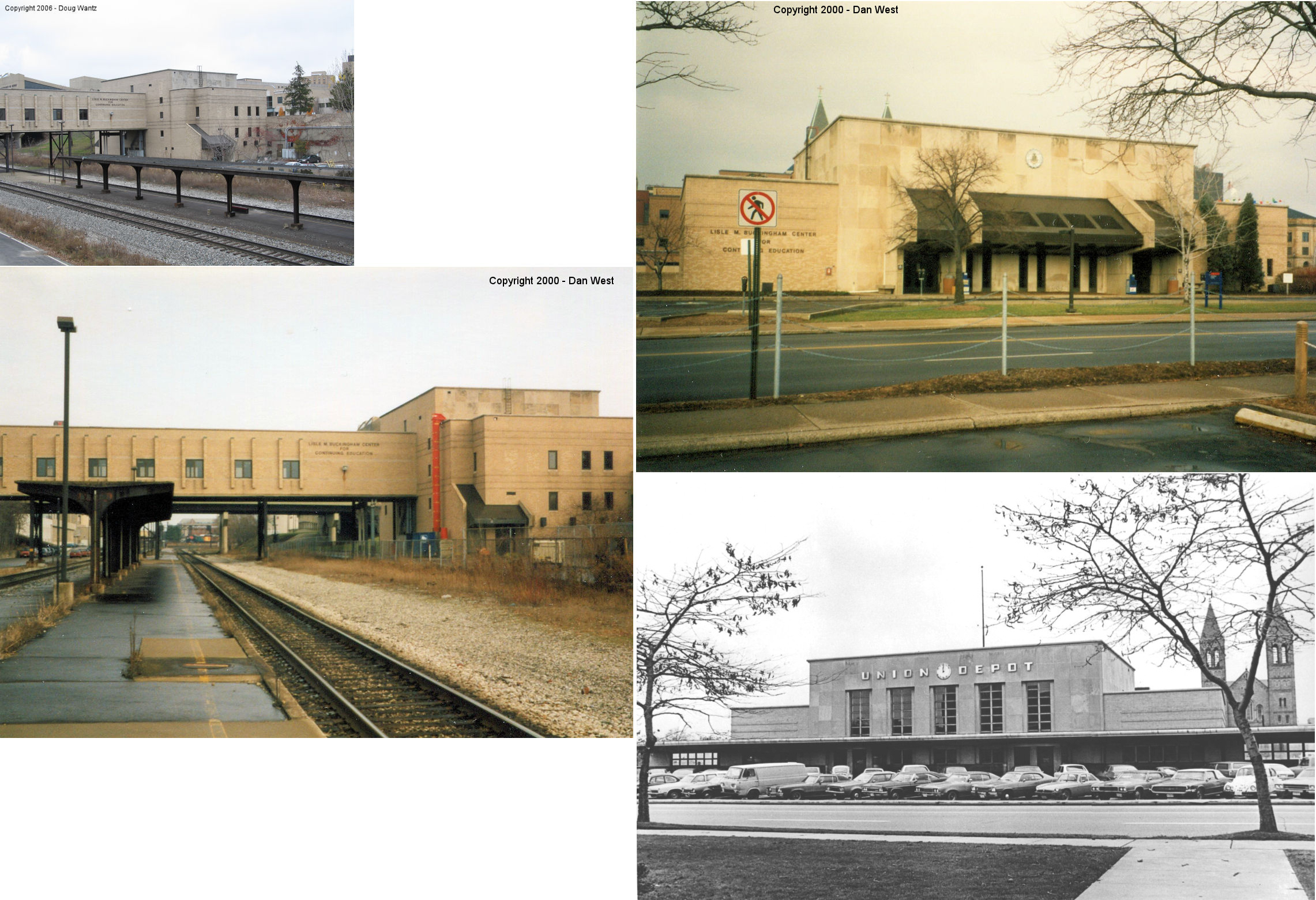
| Akron |
 |
96 East Bowery Street (GPS: 41.079950, -81.515398) |
P | Vacant | ???? | In Use | Stucco | |
| Akron |  |
East Mill Street | F | Business | 1903 | Gone | Brick |
|
| Akron |  |
31 North Case Avenue (GPS: 41.070445, -81.486887) |
F | Unknown | ???? | In Use | Brick |
|
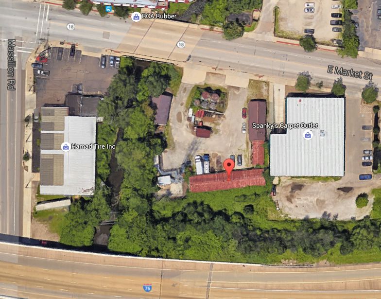
| Akron | |
1924 East Market Street (West of Spanky's Carpet Outlet) (GPS: 41.061332, -81.461460) |
F | Storage | ???? | Gone | Wood | |
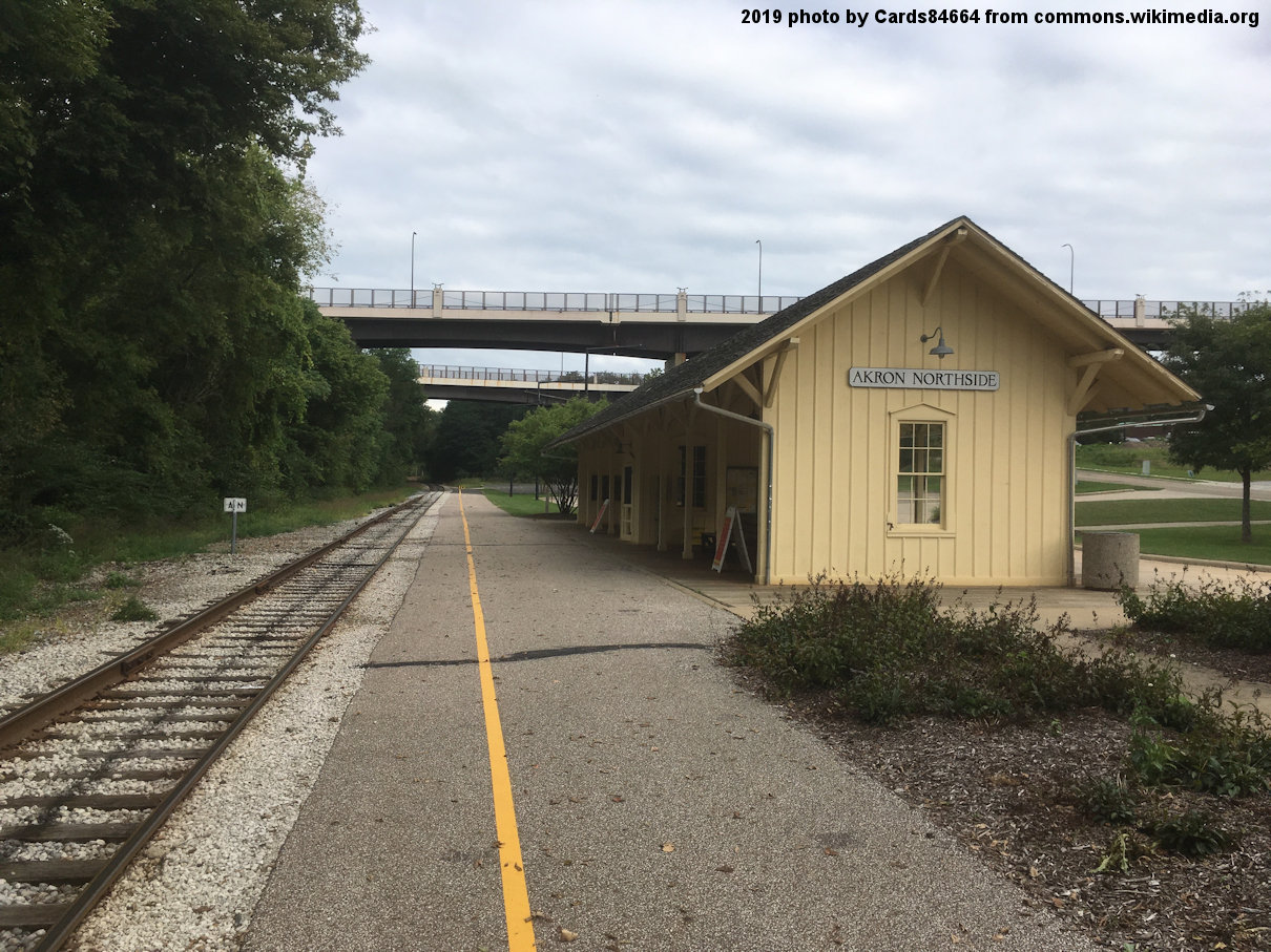
| Akron Northside |
 |
27 Ridge Street (GPS: 41.089496, -81.514993) |
P | Railroad | ???? | In Use | Wood | |
| Barberton |  |
361 4th Street NW (GPS: 41.020650, -81.609155) |
P | Business | 1890 | In Use | Wood |
|
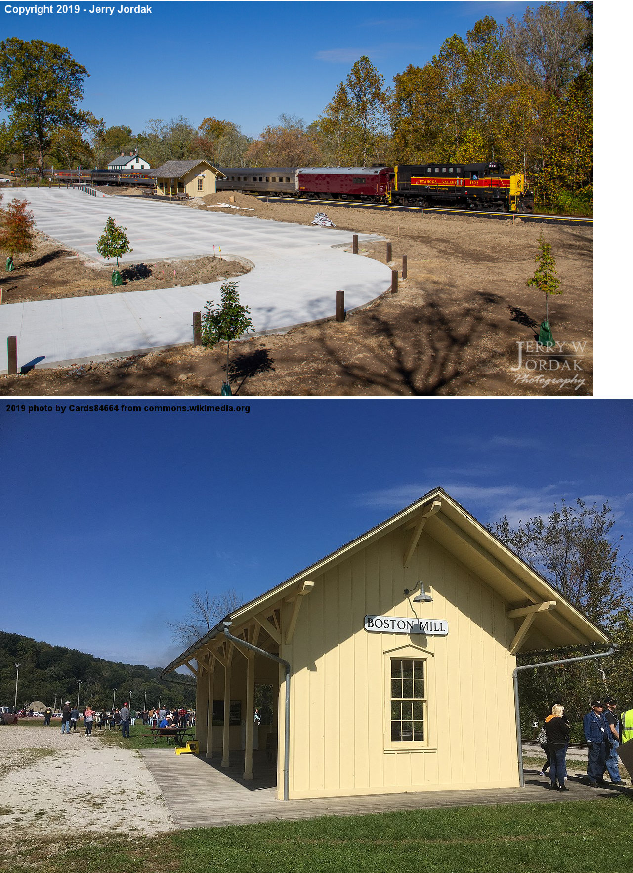
| Boston Mill |
|
7029 Riverview Road, Peninsula (GPS: 41.2656, -81.5634) |
P | Railroad | ???? | In Use | Wood | |
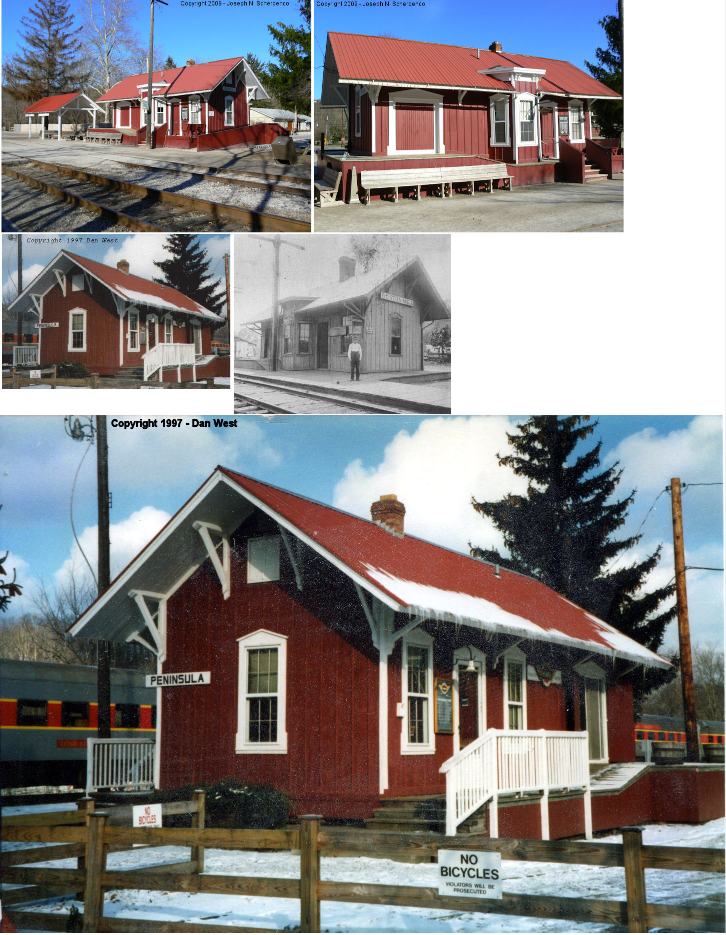
| Boston Mills (Peninsula) |
 |
At the bend in Mill Street in Peninsula | P | Railroad | ???? | In Use | Wood |
|
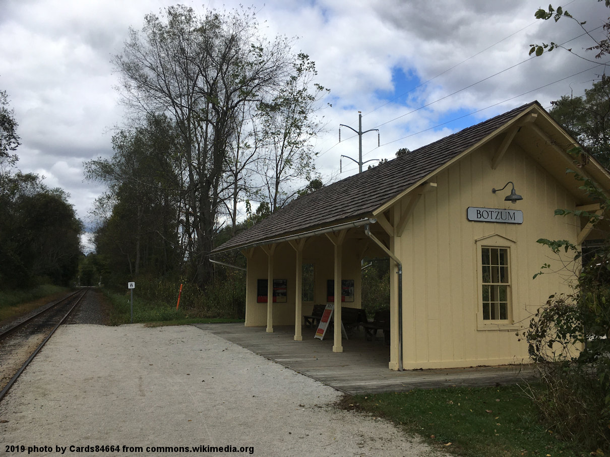
| Botzum |
|
2912 Riverview Road (GPS: 41.1595, -81.5752) |
P | Railroad | ???? | In Use | Wood | |
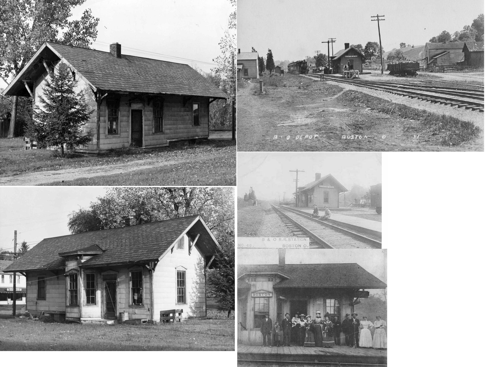
| Brecksville | |
721 West Highland Road, Sagamore Hills (GPS: 41.292241, -81.547908) |
F | Barn | ???? | None | Wood |
|
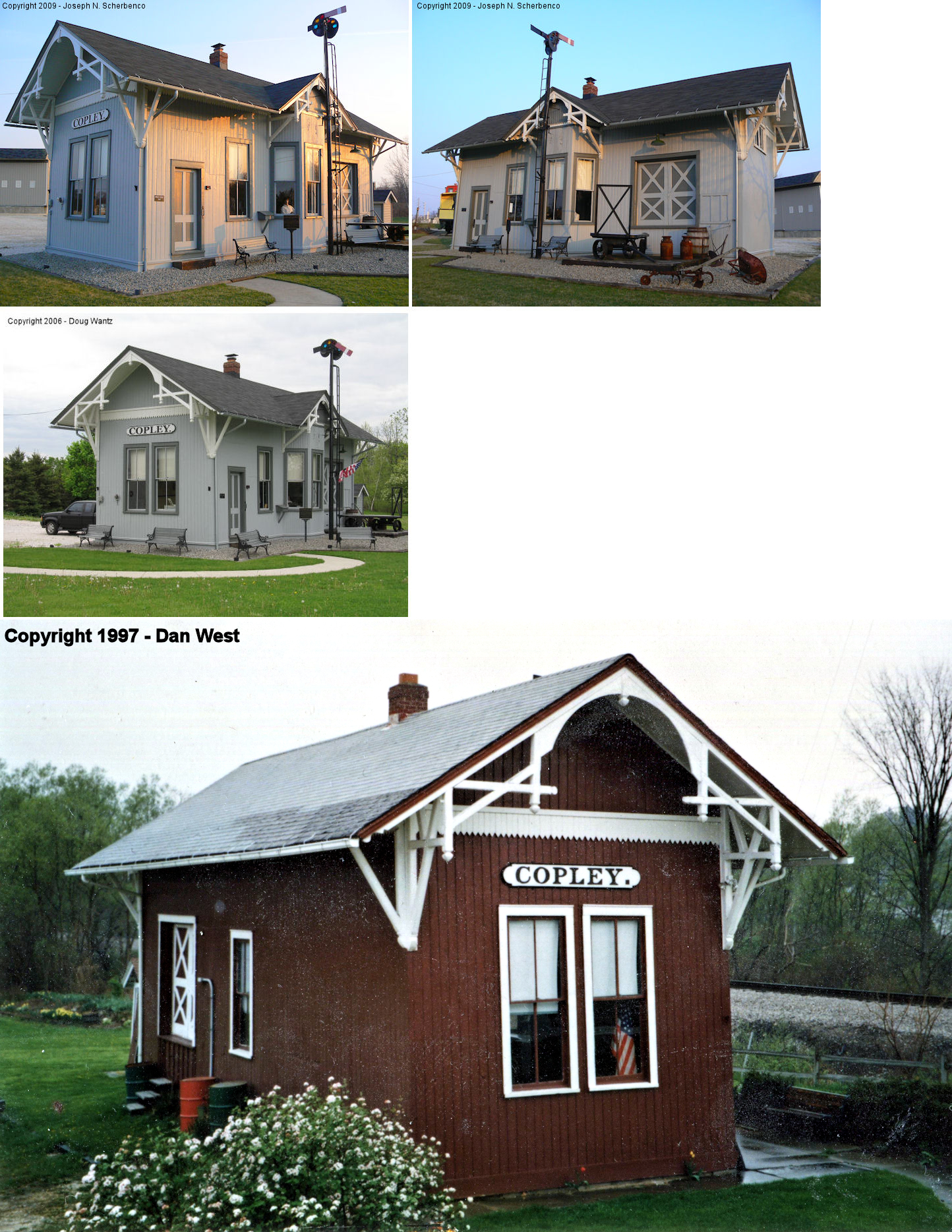
| Copley |  |
3772 Copley Road | C | Museum | 1891 | In Use | Wood |
|
| Cuyahoga Falls |  |
215 East Portage Trail (GPS: 41.136533, -81.479636) |
F | Railroad | ???? | In Use | Wood | |
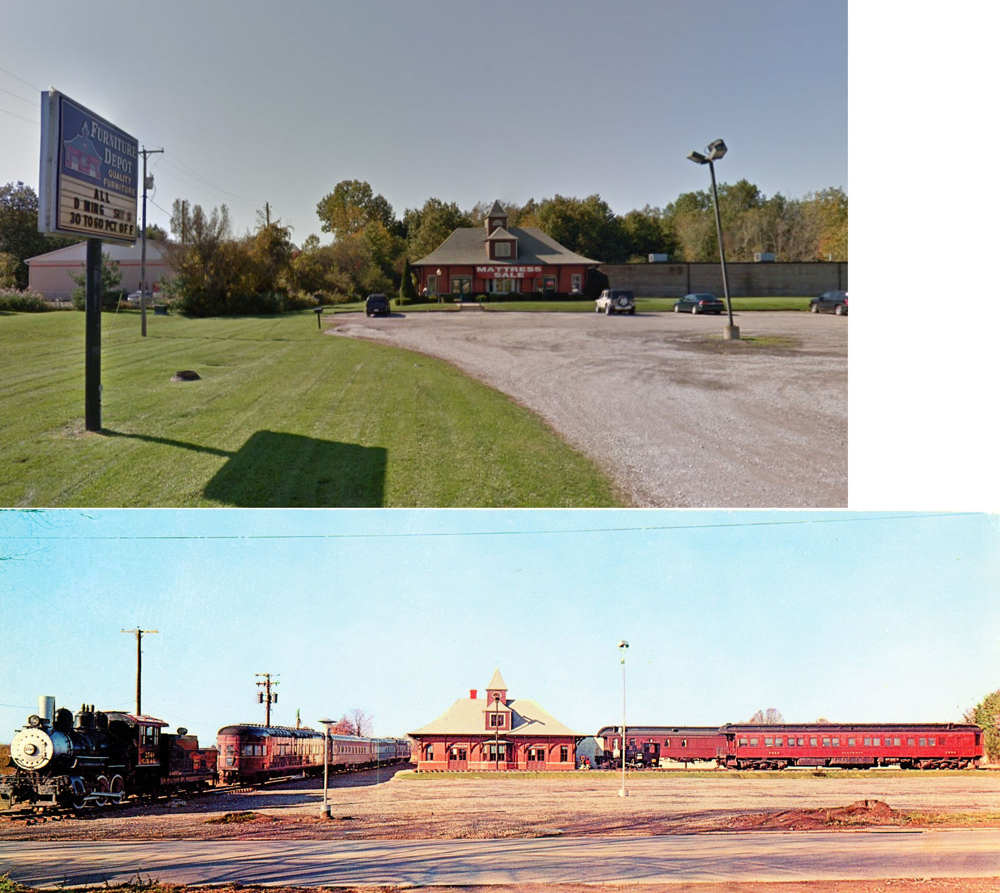
| Cuyahoga Falls |
 |
3656 State Road (GPS:41.170635, -81.509351) |
P | Business | 1962 | None | Brick |
|
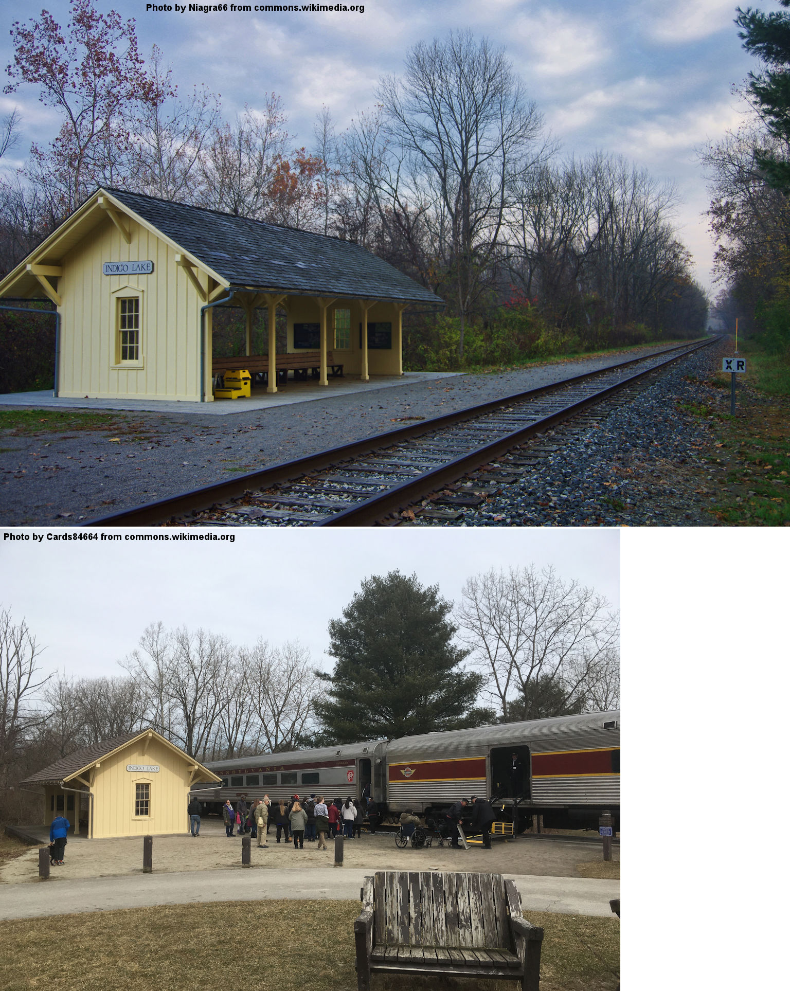
| Indigo Lake |
|
4300 Riverview Road, Peninsula (GPS: 41.194067, -81.579268) |
P | Railroad | ???? | In Use | Wood | |
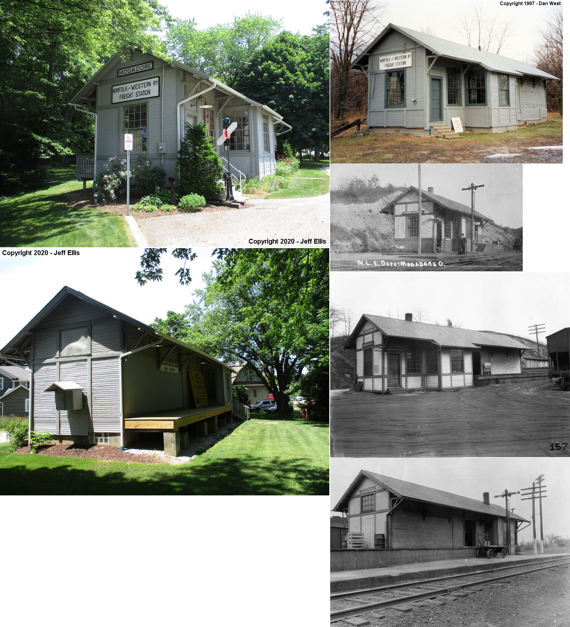
| Mogadore |  |
87 South Cleveland Avenue, near Gencorp Plant | P | Society | ???? | None | Wood |
|
| Peninsula |
|
Mill Street, north of the Boston Mills depot. | F | Public | ???? | In Use | Wood |
|
| Sharon Center | |
SR 94 north of Sharon Center | ? | Residence | ???? | ???? | Wood | |
| STATIONS OF THE PAST | ||||||||
| Station Name |
Original Railroad |
Notes | ||||||
| Akron |
|
This was Akron's first union station built around 1852-53 by the Cleveland & Pittsburgh RR (later Cleveland, Zanesville and Cincinnati RR, later CA&C). The Atlantic & Great Western (later Erie) moved into this station as well in 1864 (Summit County Beacon, 3-31-1864). It was torn down in 1891. This station was located on Mill Street at the intersection with Summit Street. | ||||||
| Akron |
|
The CA&C RR built a temporary union station here in 1890 to serve until the new union station opened in 1891. | ||||||
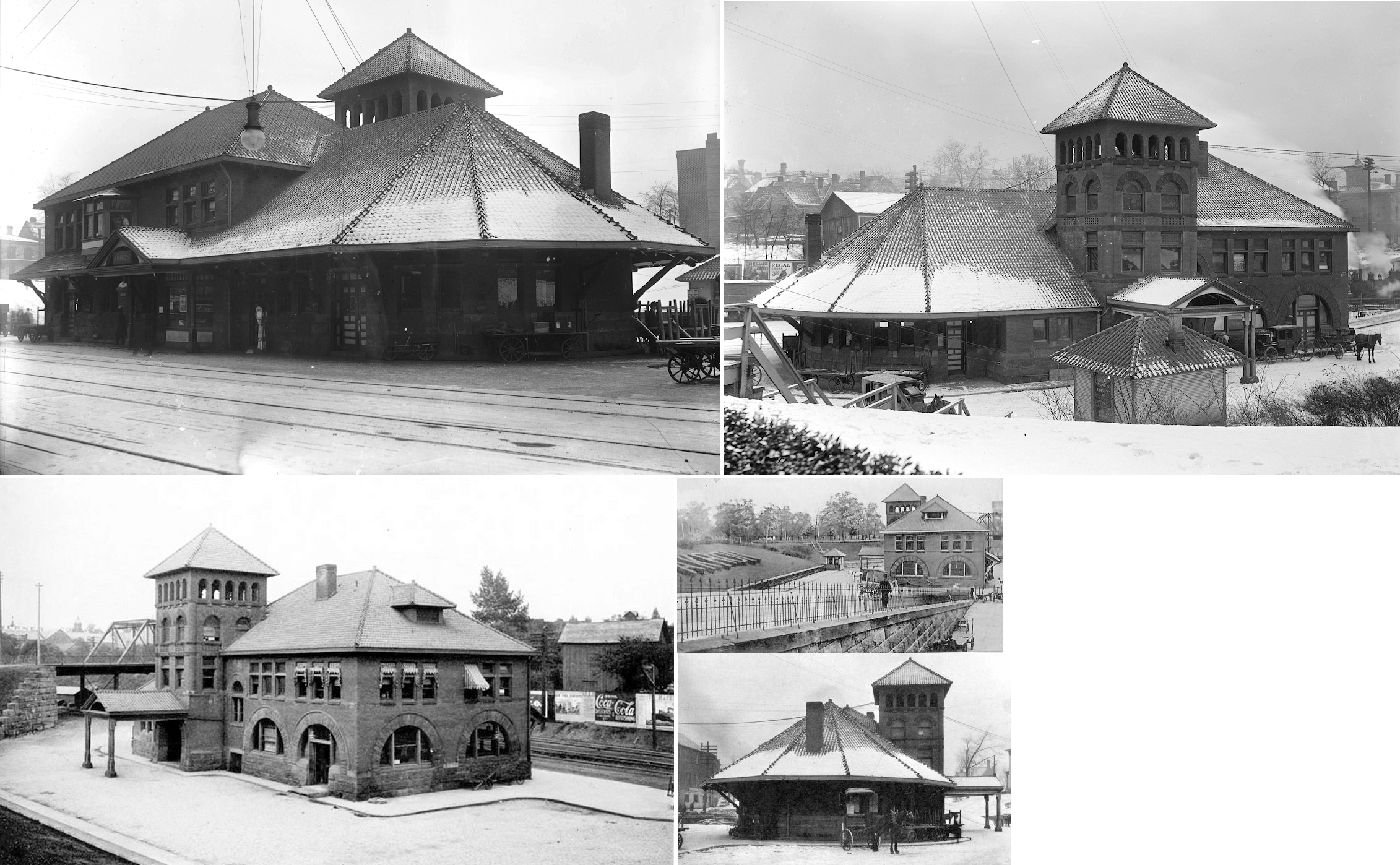
| Akron |
|
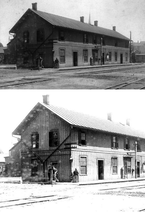
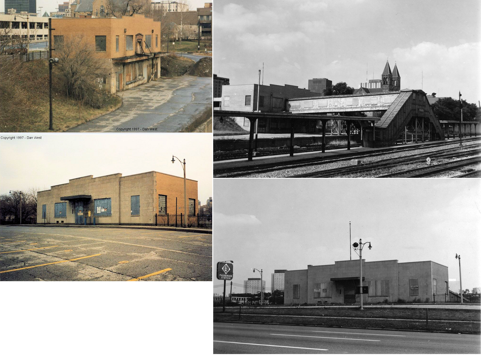
Old Union Station. Built in 1891 and demolished in 1951. This was Akron's second Union Station and was located between East Market and Park streets in what was called "Amelia Flats." The station served the B&O, CA&C (PRR) and Erie (which became a tenant in 1901). The CA&C had an office nearby on East Market next to the Hotel Pendleton. The Amelia Hotel was also nearby on Park Street. | ||||||
| Akron |
|
This station sat at the northern corner of West Market and South Canal Streets. According to Mark Camp's book "Railroad Depots Of Northeast Ohio" it was in service from 1852-1890, although the book "Akron Railroads" by Craig Sanders claims it began service in 1888. The building still appears on an 1892 Sanborn Fire map, but it is listed as vacant. Other information says that the station was built in 1888 and after its tenure as a railroad station served as a meat packing plant and stoof until the 1960s. | ||||||
|
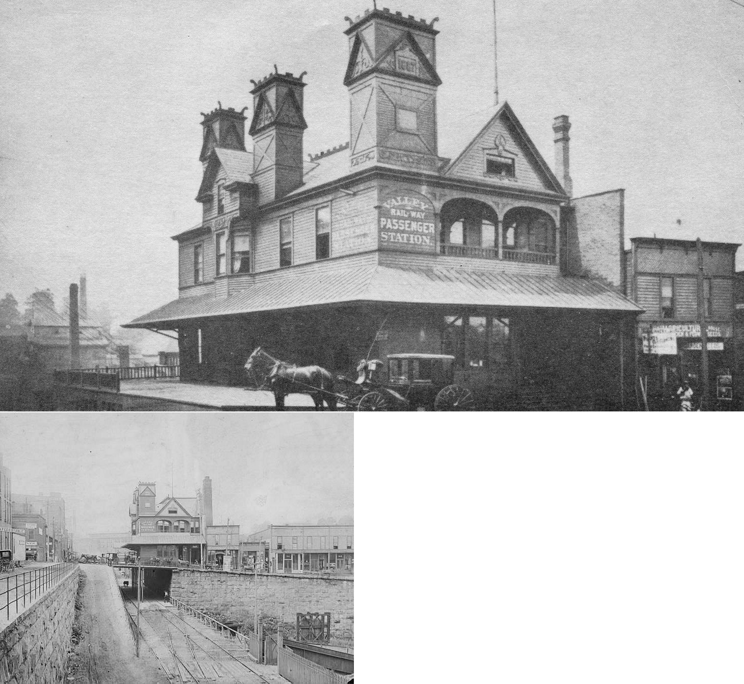
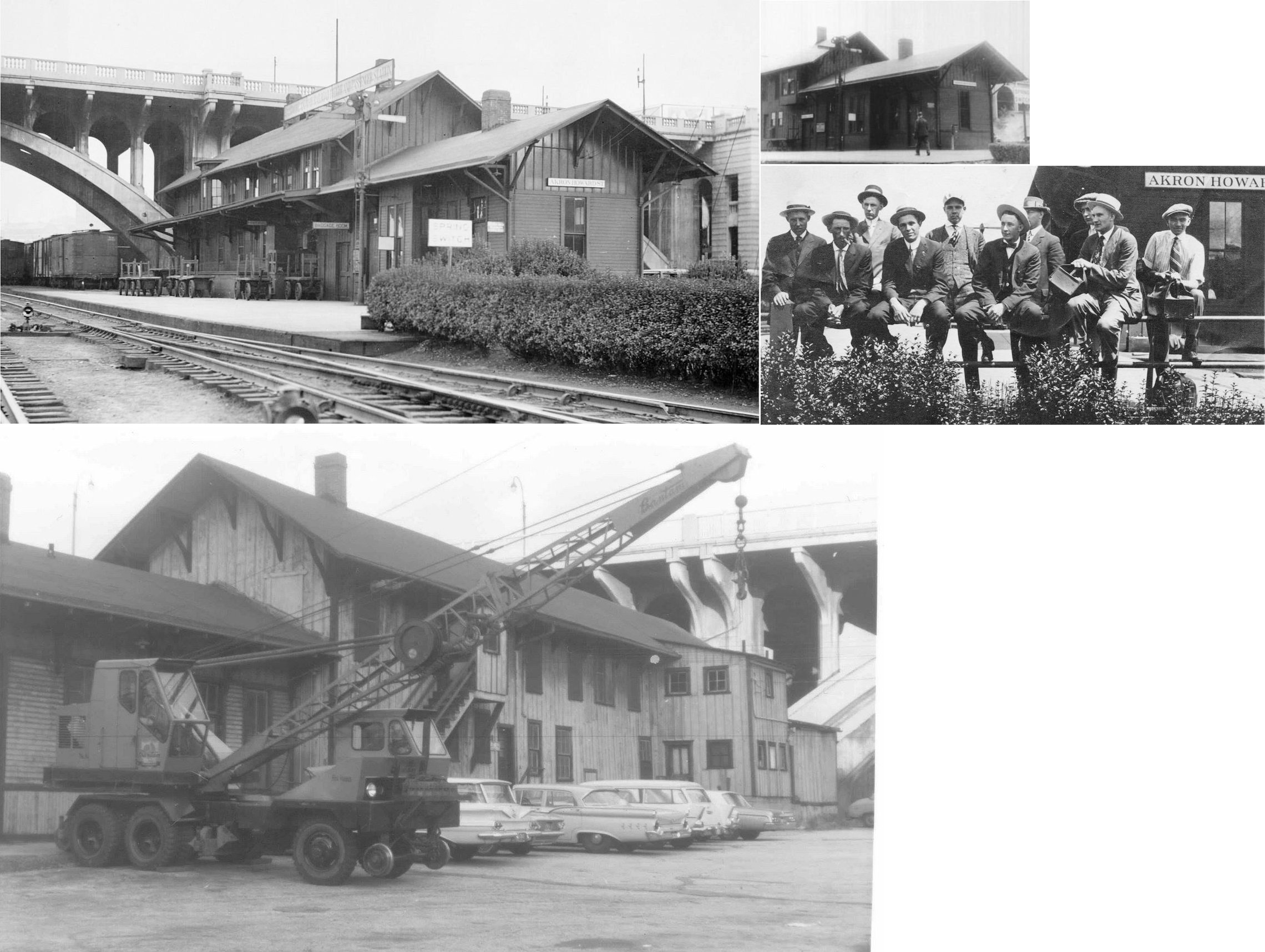
Akron (Howard ST.) |
|
The Valley (later B&O) also had
this passenger station and a large freight station on Ridge Street at North
Howard (GPS: 41.089488,-81.515014). The passenger station part of the structure stood until the mid-1960s
(B&O ended service to the station in 1963). Craig
Sanders' book "Akron Railroads" claims that this was the first
Valley Railway station in Akron, but was supplanted by the West Market
station above because passengers found this location inconvenient. On
the 1891 county atlas, the entire station is shown, but it is only labeled
"Freight Depot." The Valley Railway also had a freight station on the south side of East Water Street just northeast of the intersection with East Market Street. |
||||||
| Akron (East Akron) |
|
There was a passenger and a freight station on the east corner of East Market Street and Case Avenue (GPS: 41.070212,-81.487366). The freight station was adjacent to the AC&Y freight station that still stands in this area. | ||||||
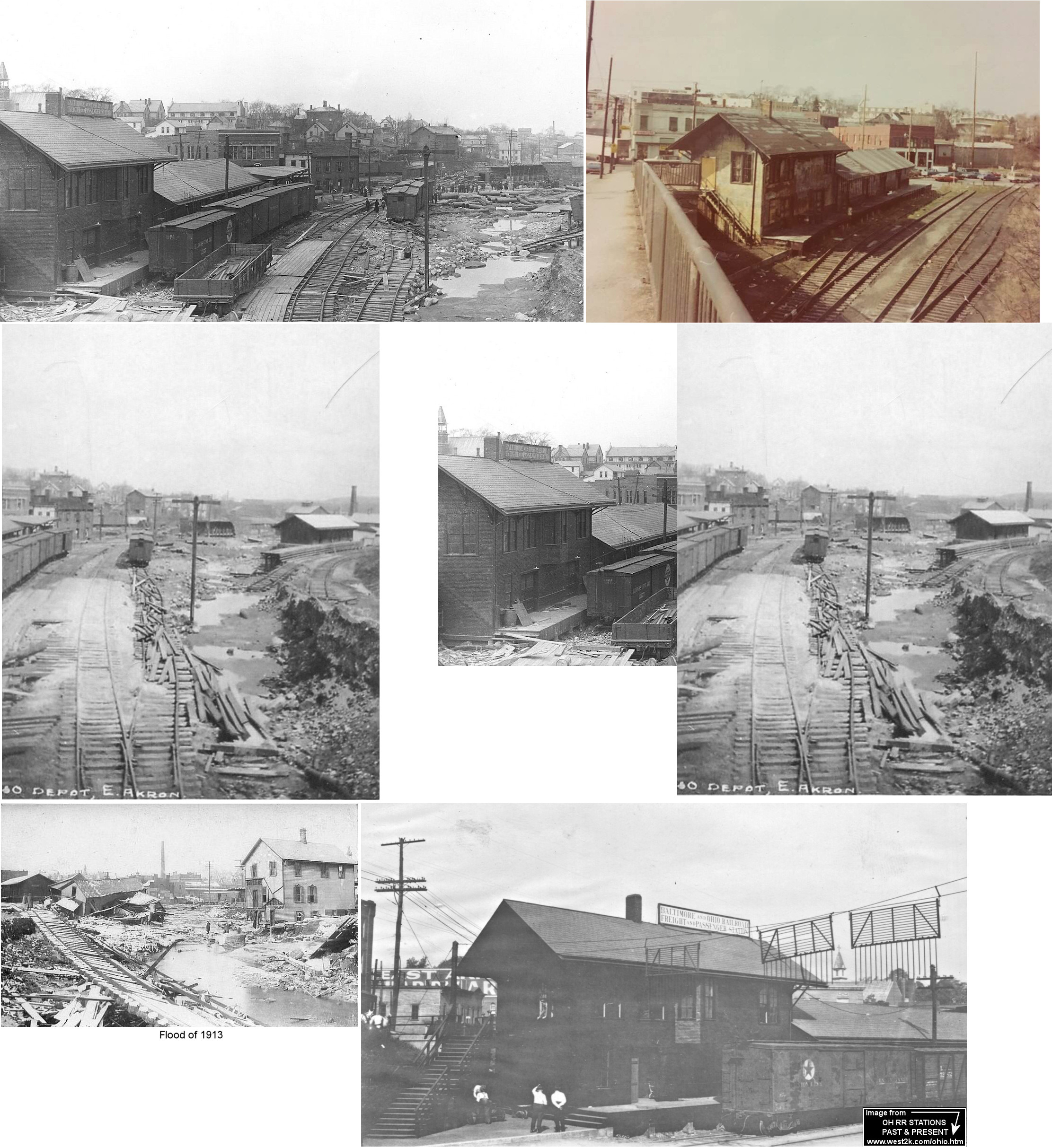
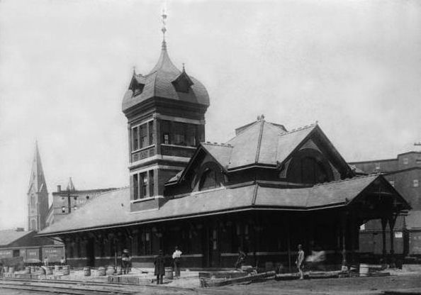
| Akron |
 |
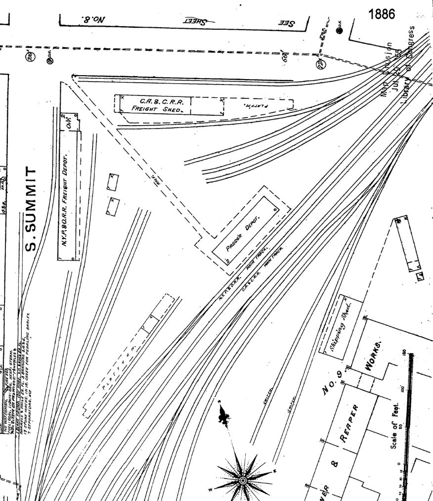
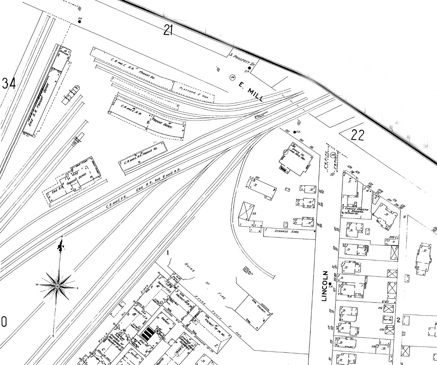
The first passenger and freight stations were located at South Summit and East Mill Streets. See this map for detail. Later another NYP&O/CA&C freight station was added at that location just east of the passenger station. That original passenger station was later a freight house for the Erie RR. | ||||||
| Akron |
 |
This station was on the west side of North Main Street on the north side of the tracks at GPS: 41.087663, -81.516064. | ||||||
| Akron |  |
This appears to be the NYP&O freight station that was on the corner of South Summit and East Mill Street. | ||||||
| Akron | |
This station, which was located on North Broadway near Exchange Street at GPS: 41.076064,-81.518914, was built in 1947 and was torn down 2/25/97 to make way for a new bank. It sat vacant for several years prior to demolition. | ||||||
| Akron | |
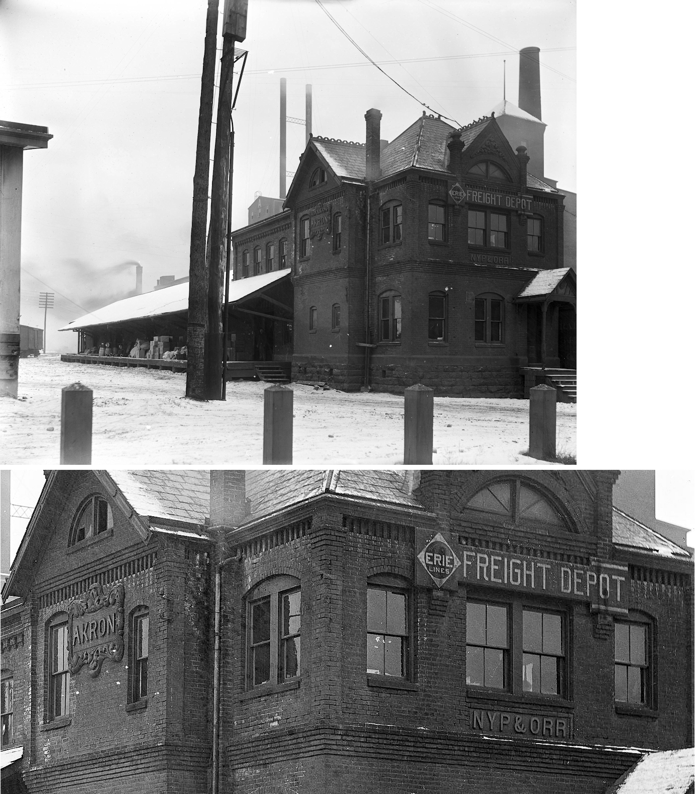
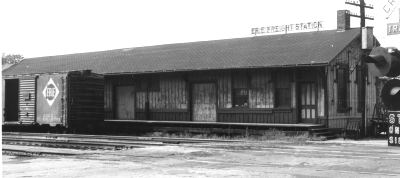
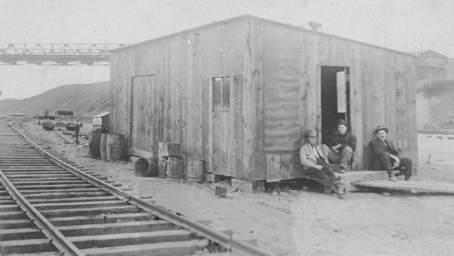
I was told this was an Erie freight station in Akron, but I am not sure. Does anyone know about this building and its location? | ||||||
|
Akron (South Akron) |
|
The "South Akron" passenger station was on Front Street off Ira Avenue near the former Akron Electrical Manufacturing Company and Brigger Belting Company (later American Hard Rubber) factories. That station was later used for freight only. The station was at GPS: 41.053805, -81.530511. | ||||||
| Akron | |
This freight station was built in 1916 and torn down in 2013 to make way for student housing. Prior to its demolition it was used by the Akron Beacon Journal to store rolls of paper. It was located on the SE corner of South Broadway and Exchange Streets at GPS: 41.075257,-81.519681. It ran along South Broadway about 3/4th of the way to Selle Street. | ||||||
| Akron | |
The original CA&C freight station was near the corner of Mill and Summit Streets. See this map of the area from 1886 that also shows the old NYP&O passenger and freight stations. | ||||||
| Akron | |
The railroad had a station (unclear if it was freight or passenger) on South High Street near Steiner Ave. This station was right next to what was the Globe Sign Company. The CA&C also had a roundhouse and shops near the intersection of S. Forge and Hill Streets behind the old Akron Twine and Cordage factory. | ||||||
| Akron | |
The PA&W had a passenger station on the west side of North Main Street between Tallmadge (Federal) St. and Furnace St. The freight station was on the east side of North Main. This station appears on a Sanborn Fire map dated 1892. | ||||||
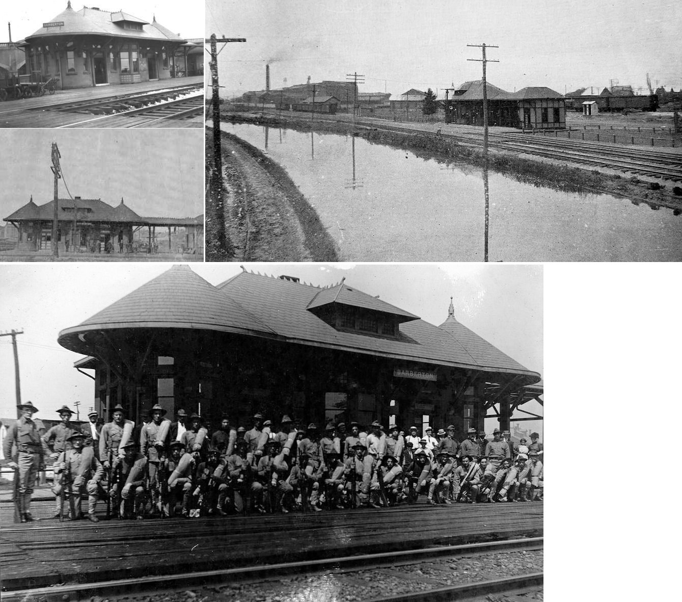
| Barberton | |
This station was on Tuscarawas Ave. and was demolished in 1940 to provide more room for parking. It was originally built by the CA&C to replace the "New Portage" station. During the later PRR years it was a passenger station for both the B&O and PRR. It was vacated after the B&O and PRR moved the passenger waiting area to the nearby freight station (see below). |
||||||
| Barberton | |
Originally this was the CA&C freight station and later became the passenger and freight station for the PRR and B&O, although the 1923 PRR List of Stations & Sidings lists seperate freight and passenger stations here at the same milepost (20.2 - distance from Hudson). | ||||||
| Barberton | |
This freight station was on 4th Street. | ||||||
| Barberton | |
This station was built in 1888 (according to the B&O Annual Report of that year). | ||||||
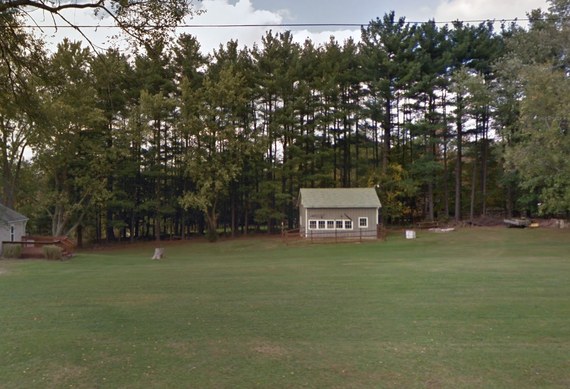
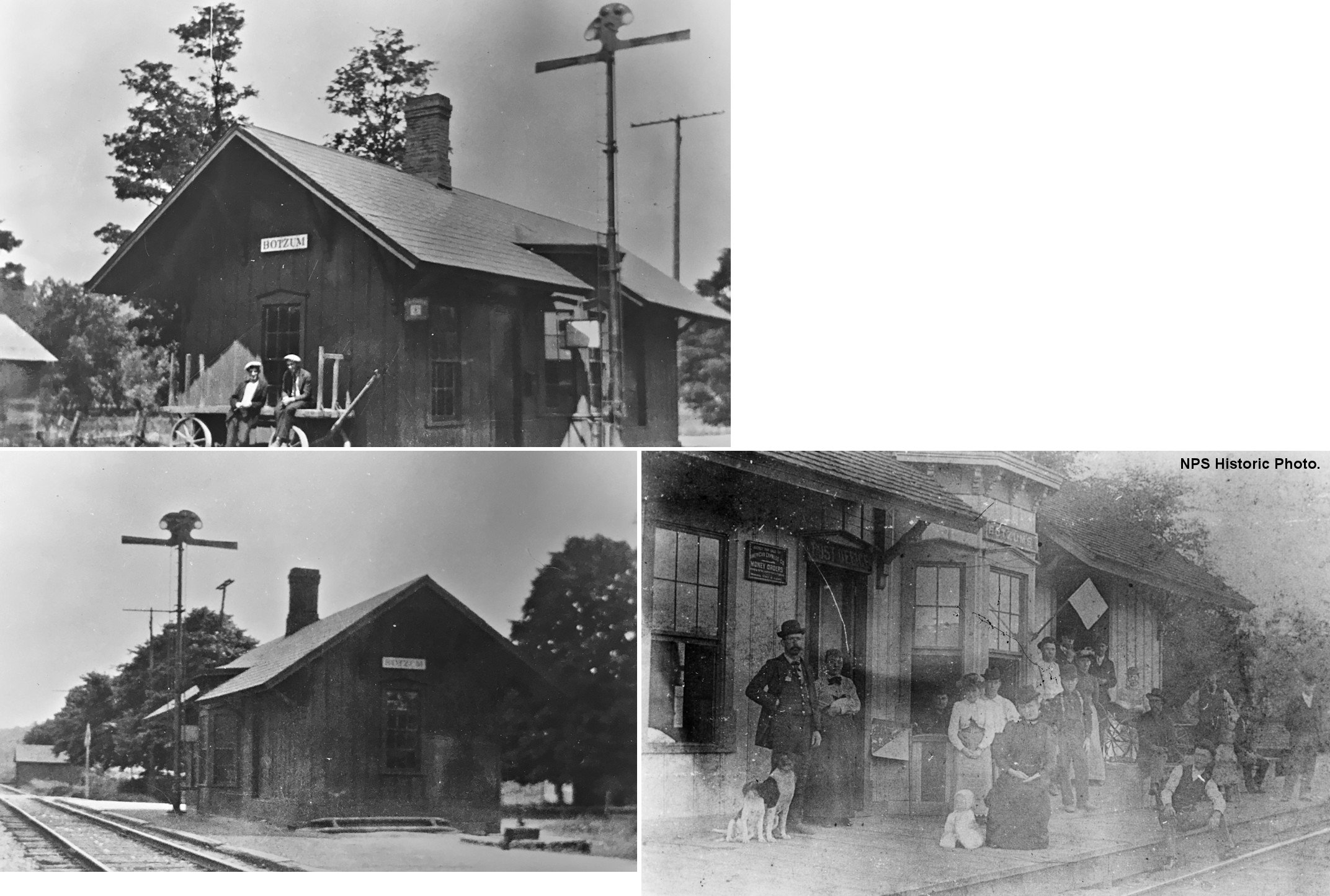
| Botzum |
|
This station was located near the intersection of Bath and Riverview Roads in what is now the Cuyahoga Valley National Park. | ||||||
| Clinton |
|
This station was on the south side of Main Street on the east side of the tracks (GPS: 40.928137,-81.632736). It is listed on the 1923 PRR List of Stations & Sidings. | ||||||
| Copley |
|
The frieght station was on the north side of the tracks at the intersection of Sawmill Road and Cleveland-Massilon Road. It was torn down in 1992. | ||||||
| Cottage Grove |
|
This was at the end of the Cottage Grove Branch. See listing for Krumroy for details. It's unclear whether there was a station here at the park. | ||||||
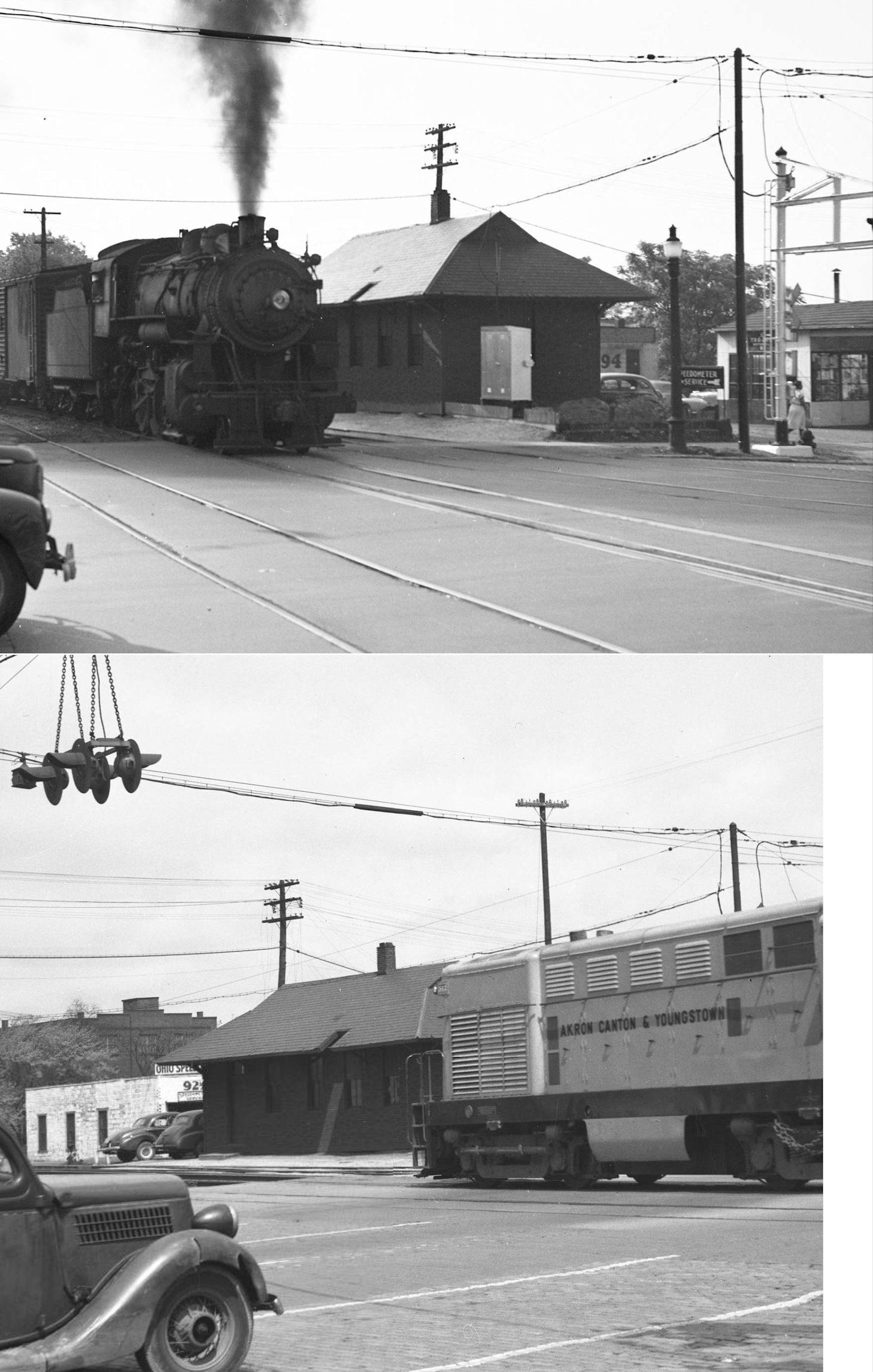
| Cuyahoga Falls | |
The B&O passenger station was located on the south side of Portage Trail across the street from the freight depot (still standing). Both the passenger and freight stations can be seen in the 1920 ICC valuation photo. | ||||||
| Cuyahoga Falls | |
This station was on Water Street just south of Portage Trail. Water Street and this location are no longer there and have been replaced by the freeway (SR 8 & 59). There was an earlier CA&C station here on the north side of Portage Trail (as shown on the 1891 map). | ||||||
| Cuyahoga Falls (Glens) |
|
There was a small station for the Glens just south of the east end of the Glens High Bridge on the west side of the tracks known as "Glens Depot" (GPS: 41.130262,-81.48242). This station is shown on the 1891 map with the tracks being locted where SR-8 is today. The station was not listed on the 1923 PRR List of Stations & Sidings, so it was likely closed prior to that. | ||||||
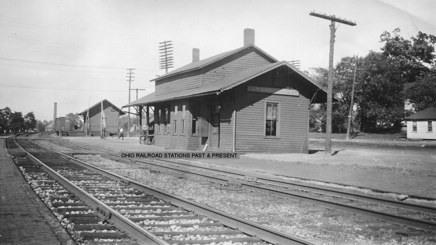
| Darrowville |
 |
This was a station on the Lake Erie and Pittsburgh Railroad. The LE&P, which ran from Cleveland (Marcy) to Brady Lake near Kent, was owned and operated by the NYC. Not sure if this building in the photo was a station or some other type of RR building. | ||||||
| Dennison Station (SHERMAN) |
|
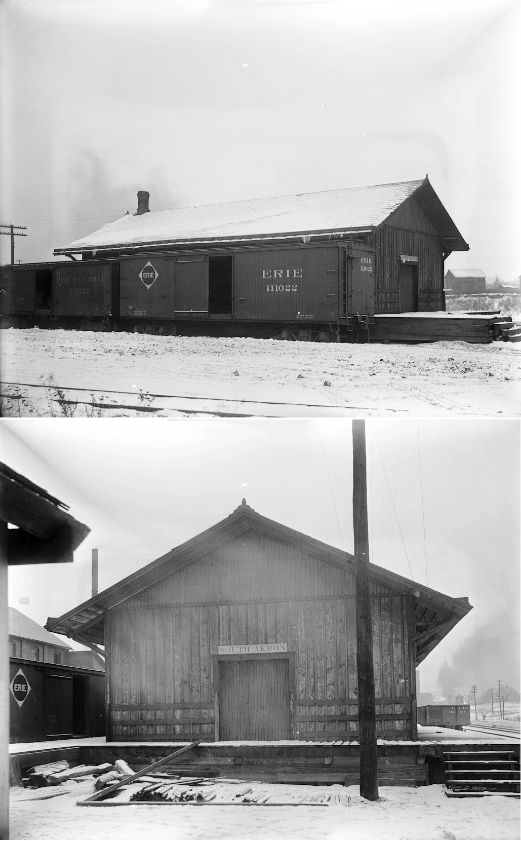
This was an early station on the line. It was also known as Buckeye and later as Sherman and is now part of Norton. The station was located ion the west side of SR-21 on the north side of the tracks near Dorothy Avenue (GPS: 41.014379,-81.664647). A station is shown at this location on the 1891 county map. | ||||||
| Everett |
|
This station was on the north side of Everett Road on the west side of the tracks (GPS: 41.204691,-81.572843). | ||||||
|
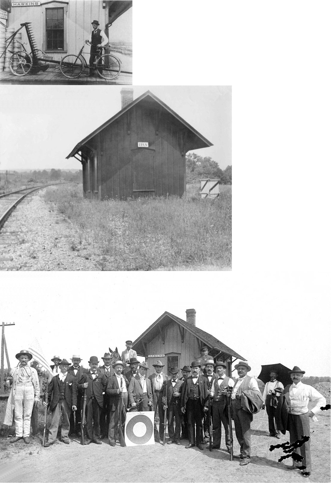
Hawkins (Ira) |
|
The town was later renamed Ira because there was another town called Hawkins on the B&O (although I don't believe the other Hawkins was in Ohio). See map below for location. On August 21, 1887 a collision of freight cars near the station sent a boxcar hurtling through the air and landing on the depot resulting in its complete demolition. The station agent escaped before the boxcar came to rest and a hobo on one of the boxcars was also unharmed after crawling out of the boxcar/depot wreckage (Cincinnati Enquirer, Aug. 22, 1887). | ||||||
| Highland Springs |
 |
A passenger shelter was built here in 1912. This station was between Hudson and Macedonia. The 1923 List of Stations & Sidings lists a "passenger platform" for Highland Springs located near property owned by the City of Cleveland (why?). According to the mile marker location, the station was on East Hines Hill Road in the vicinity of GPS: 41.260621, -81.466684. | ||||||
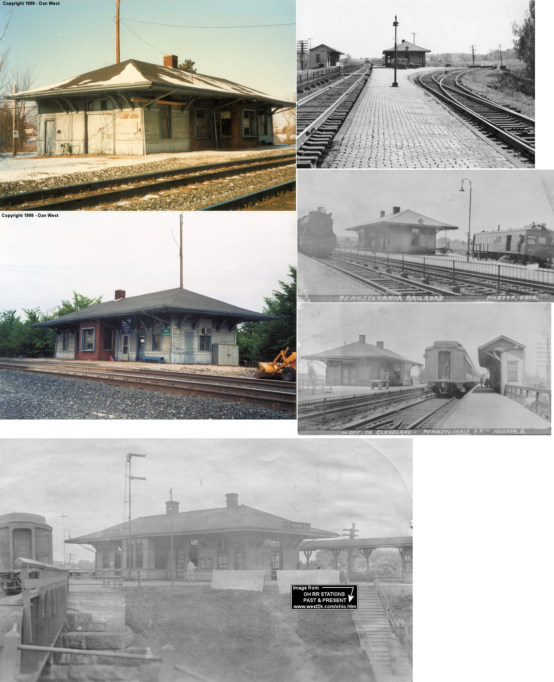
| Hudson |
|
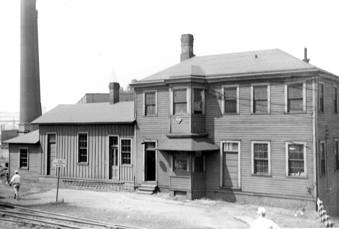
In 1886 the Hudson C&P station was moved to the site of the small passenger shelter near the junction of the CA&C and the C&P. This then became a joint station for both railroads (which would both eventually become part of the PRR). | ||||||
| Hudson |
|
This station which sat just to the north of the SR 303 underpass at GPS: 41.240263, -81.444600, was demolished by the railroad on August 28, 2013. It was built in 1903. This was Hudson's third depot. | ||||||
| Hudson |
|
There was an early freight station near Turner's Mill. | ||||||
| Hudson (Boys Home) |
|
This station was on Hines Hill Road near where the old Cleveland Boys Home sat and served the campus there. | ||||||
| Hudson |
|
There was originally a small passenger shelter here for the CA&C. | ||||||
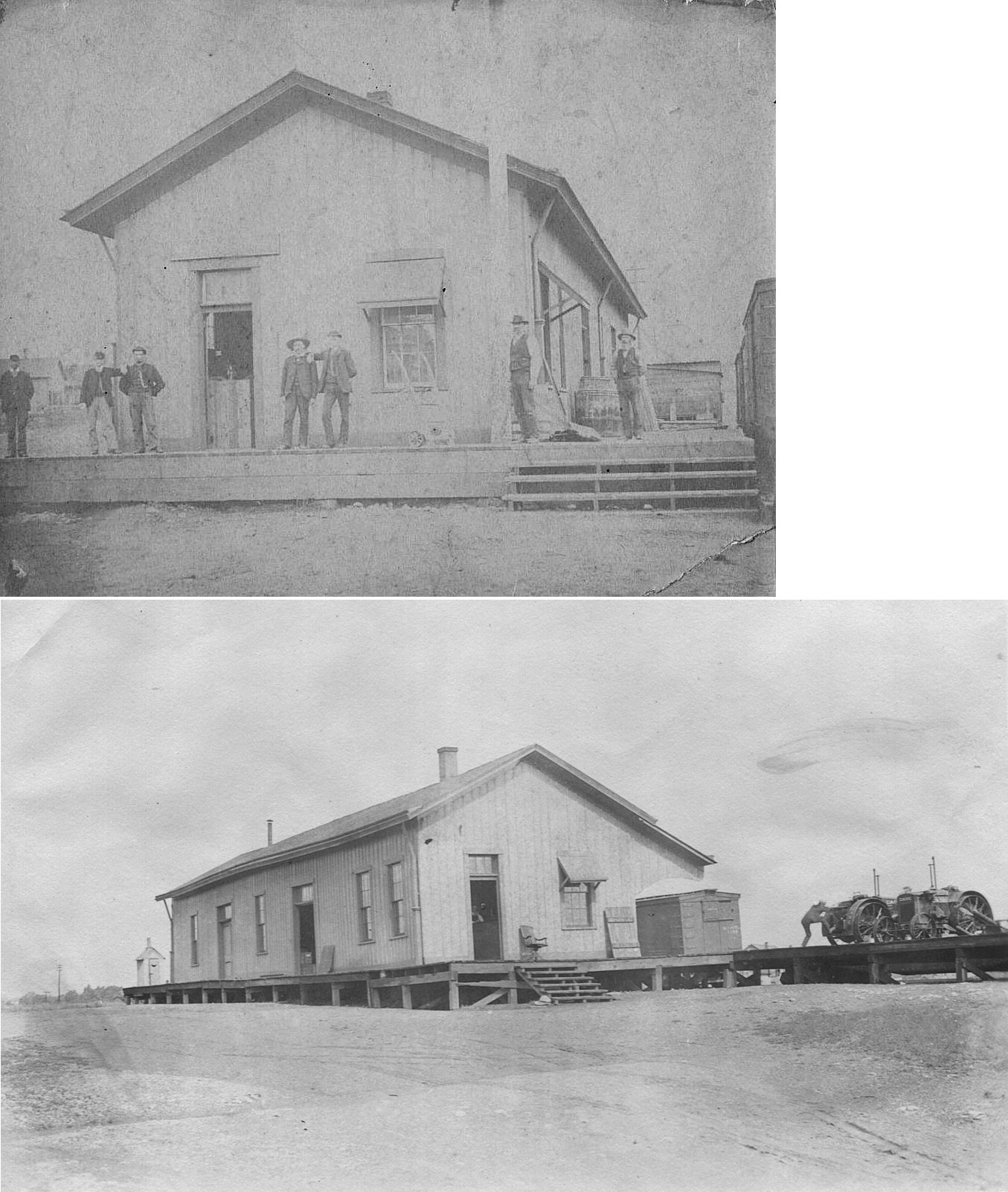
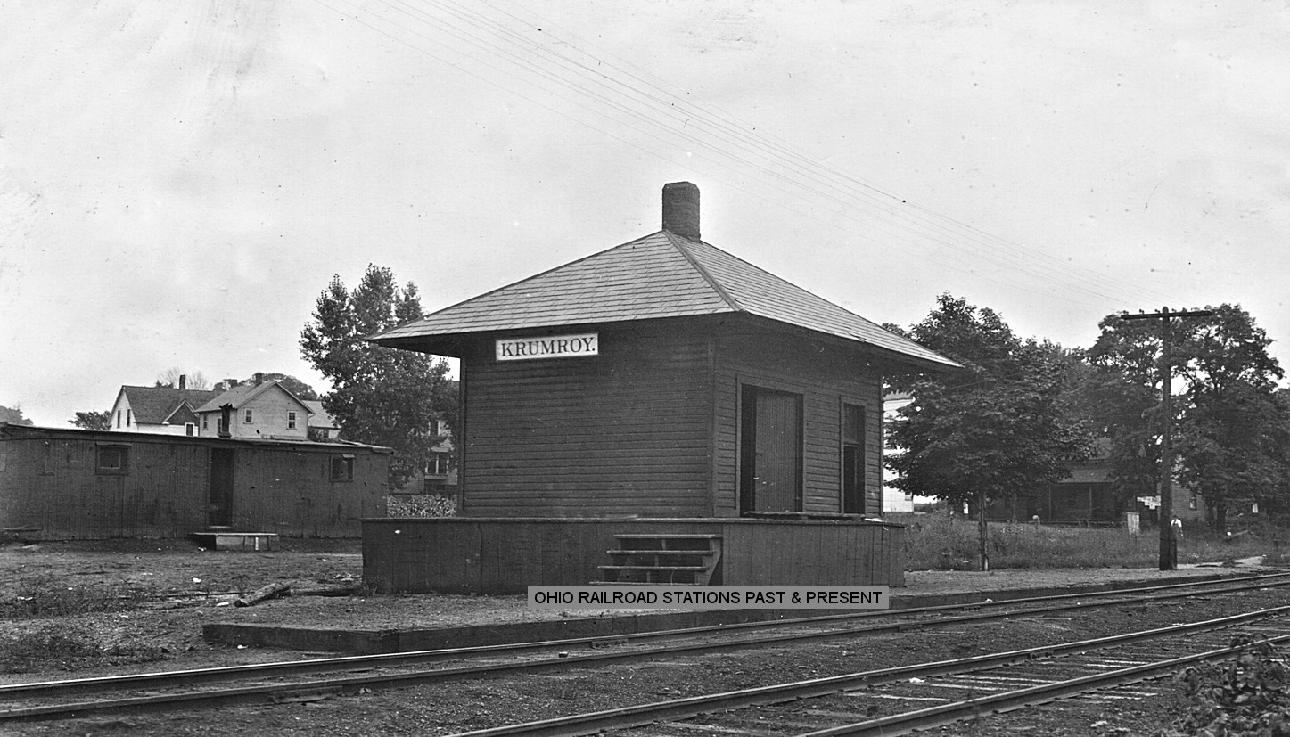
| Krumroy Station |
|
Krumroy station is where the 3.5-mile Cottage Grove Branch diverged from the main line west to Cottage Grove Lake (formerly Tuscarawas Reservoir, now East Reservoir). According to Matt Delsander, "the branch was originally opened in 1880 and was called the Tod Branch, named after the Tod, Stambaugh & Co. Its main purpose was to serve coal mines east of the reservoir in Coventry and Green Townships. When two new mines opened in May 1885, the branch was extended 4.80 miles in length. Sometime in the 1890's it was reduced to 3.47 miles in length. Cottage Grove resort opened in June 1886, and was purchased by the Cleveland Terminal and Valley Railroad (B&O subsidiary) in July 1899." The resort included a 12-acre park, picnic area, and dance hall on the lake to attract passengers. The park was sold to the Akron Area YMCA in 1911 and it established Camp Mudjikuwis there. The camp closed in 1930 and was sold to private entities. | ||||||
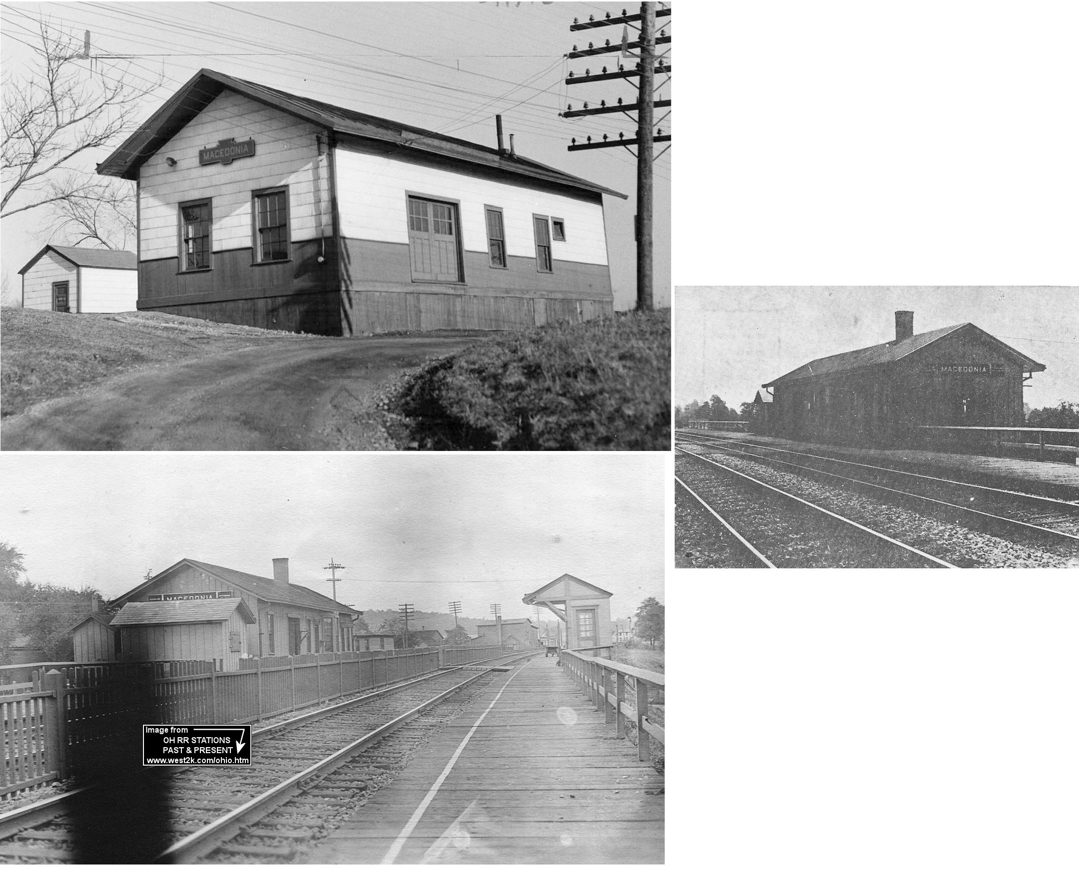
| Macedonia | |
This station was on the south side of Aurora Road on the west side of the tracks at GPS: 41.313277, -81.509880. According to PRR valuation records, it was built in 1867. It was torn down in 1962. | ||||||
| Metz |
|
This station was on Harmon Road in Stow Township. It is listed on the 1923 PRR List of Stations & Sidings. | ||||||
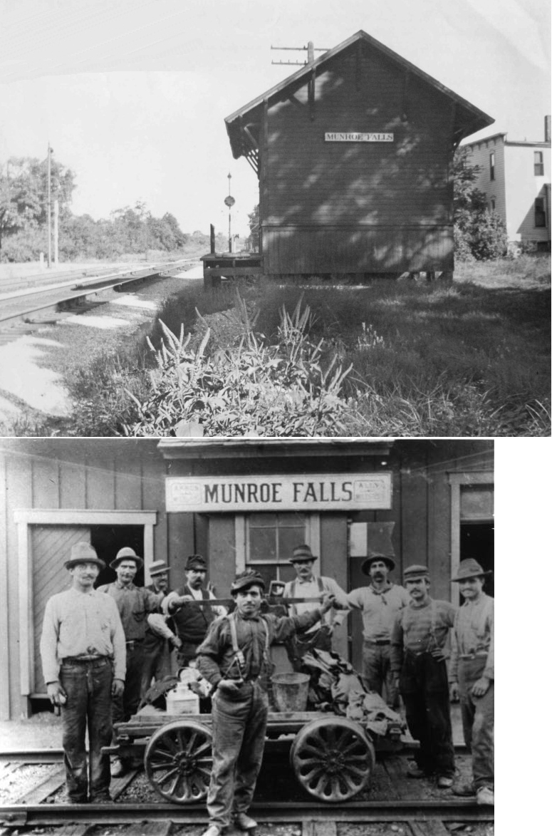
| Munroe Falls | |
The station was on the west side of Main Street on the north side of the tracks (GPS: 41.140377,-81.439486). | ||||||
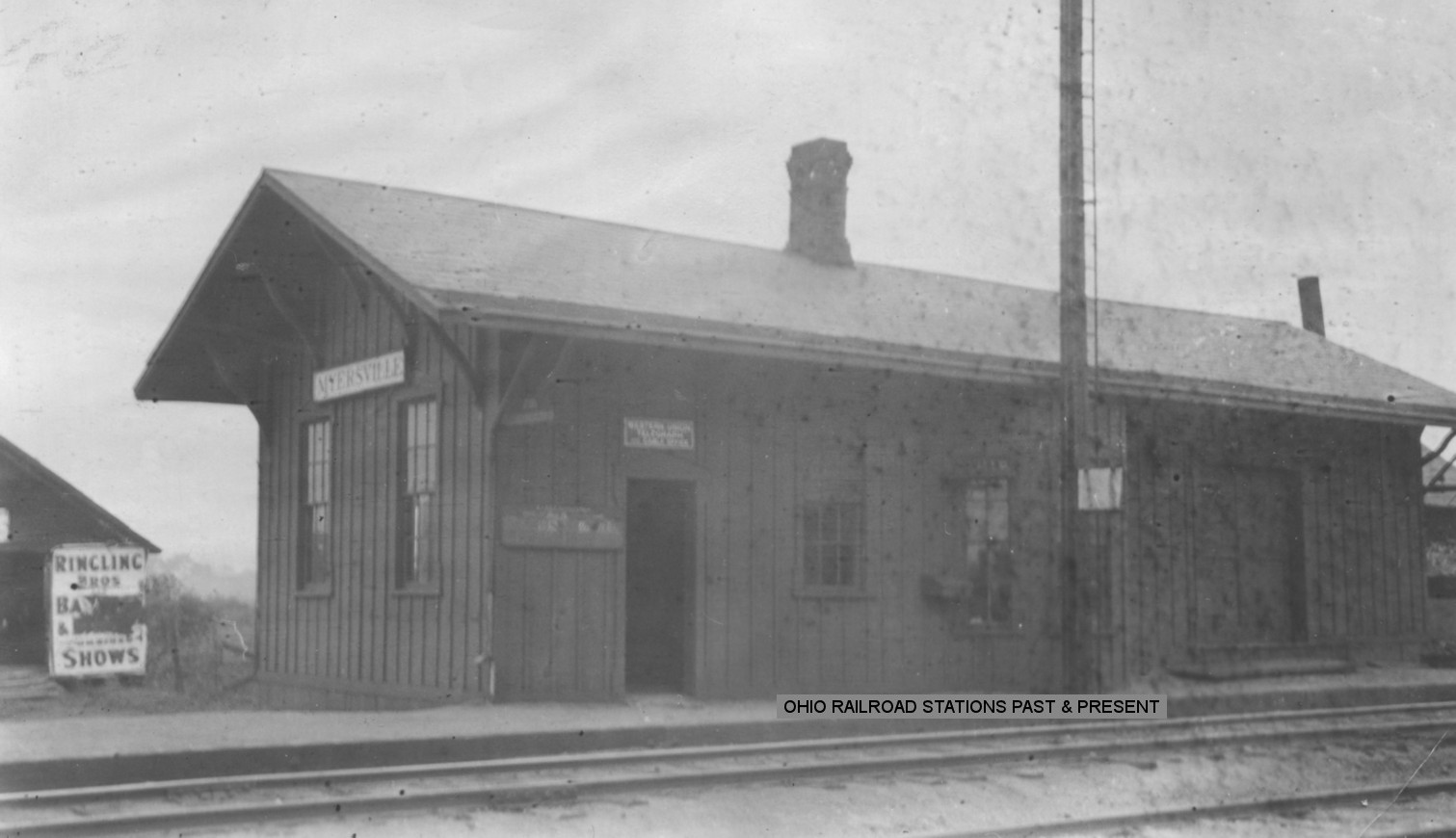
| Myersville (Uniontown) |
|
This station was built in 1878 and closed in 1932. It was originally called "Uniontown." The name was changed to "Myersville" by the B&O around 1907 in order to entice a local landowner, John Myers, to sell his land to the railroad so it could expand its freight operations there. (Akron Beacon Journal, 7-13-1932). | ||||||
| New Portage (Barberton) |
|
New Portage is now part of Barberton, but before the towns merged it had its own station on the SW side of Fairview Avenue on the SE side of the tracks (GPS: 41.023895,-81.593268). | ||||||
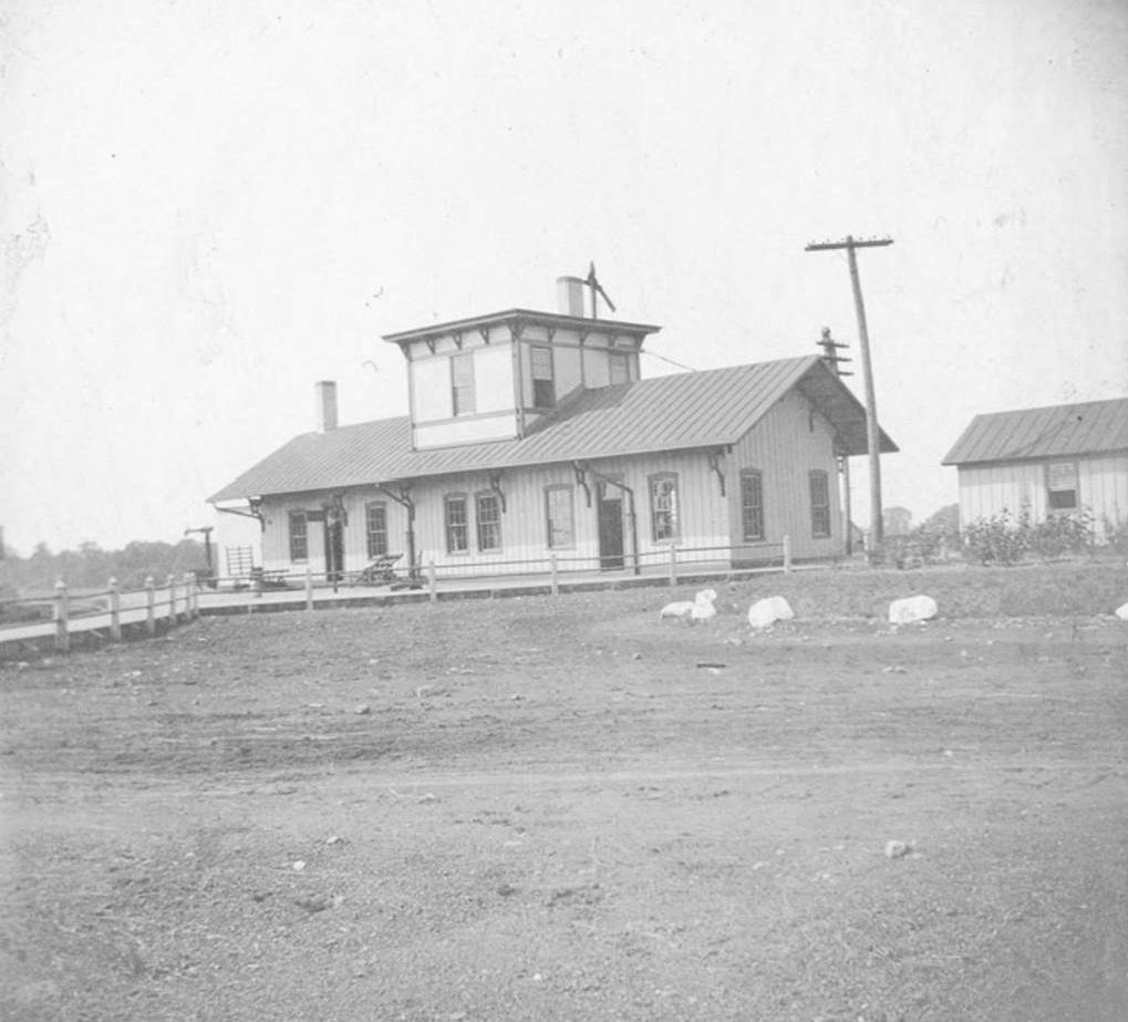
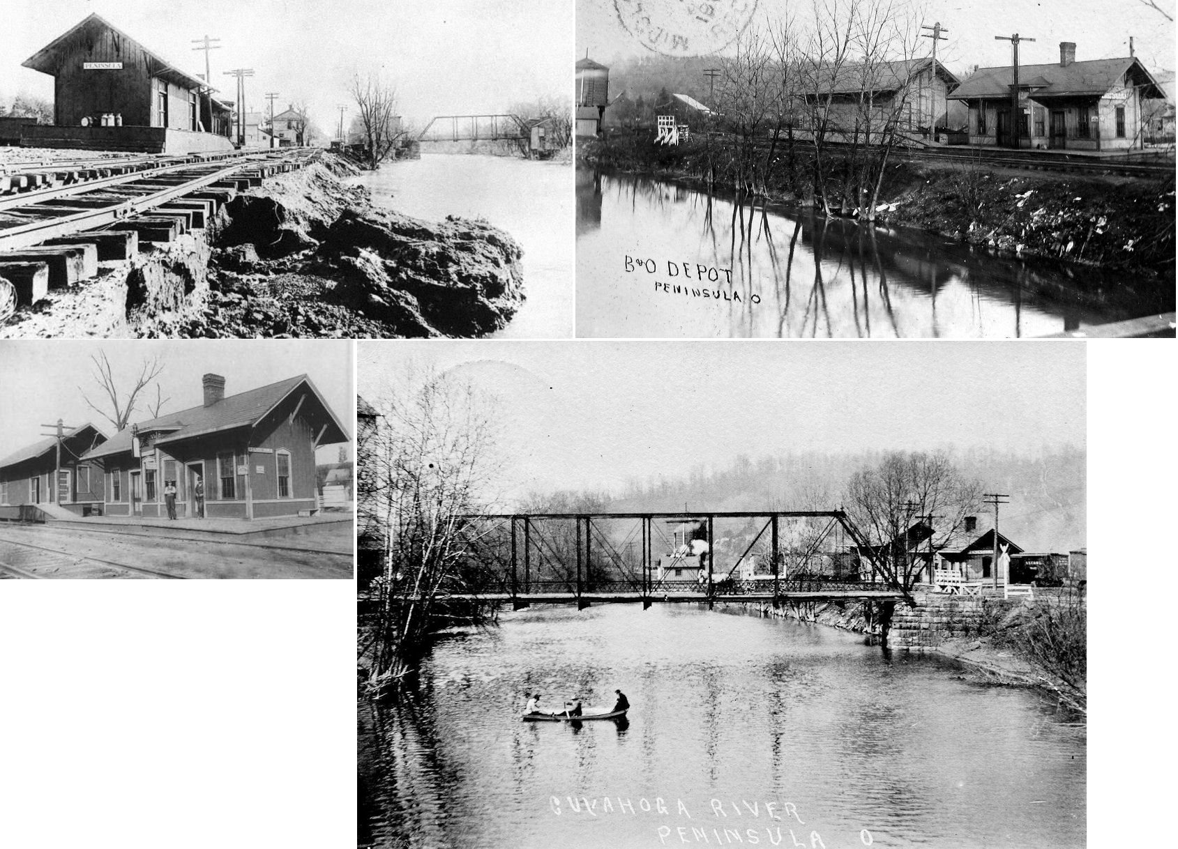
| Peninsula |
|
This was the original Peninsula depot. The photo shows the station in the aftermath of the big 1913 flood. It was located at the bend in Mill Street, where the relocated Boston Mills depot now stands. | ||||||
| Silver Lake Station |
|
|||||||
| Tallmadge | |
|||||||
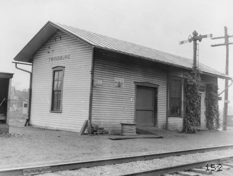
| Twinsburg |
 |
This station was built in 1881 (The Summit County Beacon, 6-15-1881). It was at the corner of Cannon Road and Depot Street. | ||||||
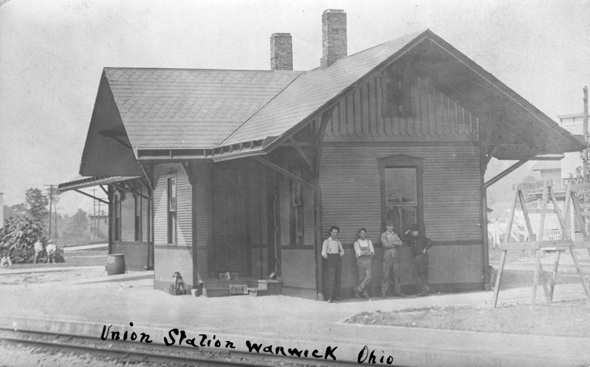
| Warwick | AND |
The joint station was located on 4th Avenue just south of Division Street between the tracks. Warwick tower was to the south across the CA&C tracks. The station was shared by the Akron & Chicago Junction RR (A wholly-owned subsidiary of the B&O) and the Cleveland, Akron a& Canton RR (later PRR). | ||||||
| 1898 SUMMIT COUNTY RAILROAD MAP | ||||||||
 |
||||||||
| Notes About Existing
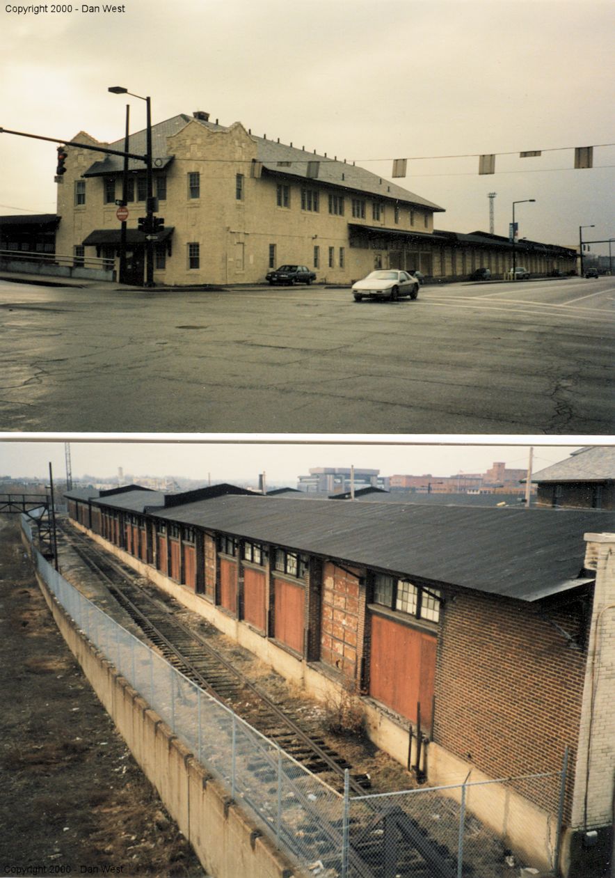
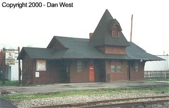
Stations... Akron (B&O/PRR) - This was Akron's third Union Station serving the B&O and PRR. It is now U of A's Buckingham Center. Akron (CA&C) - At Quaker Square. This was the 1903 CA&C freight station which later served as the REA Express Agency station. It replaced older freight houses at the same site. Here is a map showing all the freight houses in the area of Mill and Summit Streets in 1904. And here is a map from 1886 showing the same area. Akron (AC&Y) - Plain, boring building. Now houses a heating and cooling company. There was also a B&O freight forwarding station adjacent to this building that was demolished. Barberton (Erie) - The oustside of the station was restored in 2005. Here is a 2000 Photo. The station was built in 1890 by town founder Ohio Columbus Barber to promote east/west rail traffic in Barberton. The style of construction is Eastlake Stick Construction. The NYP&O also had a large freight station across the tracks in the old days. The station has been moved across the tracks, rotated 180 degrees so it still faces the tracks and moved across 4th street. The site was once a coal yard into the 1950's. It is now the Erie Depot Ice Cream Shop: https://theeriedepotbarberton.wordpress.com/about/ Boston Mills (B&O) - Moved from Boston Mills to Peninsula in 1967. Here are a couple more old photos of the station in its original location on the south side of Boston Mills Road on the west side fo the tracks (GPS: 41.262396,-81.560488). Brecksville (CT&V) - Building was purchased by the operator from Jaite and moved to the current location in 1942. Copley (PA&W) - Now houses Copley Historical Society. Cuyahoga Falls (Replica) - Opened in 1962 by Mack Lowry, an Akron clothing store owner, this replica station served as the Railways of America Museum. The building replicated to a great extent the former T&OC railroad at Bowling Green (which itself was torn down in 1962). The museum housed model railroads inside and eight pieces of rolling stock the outside. In 1976, the model railroad collection was moved by Lowry to the second floor of the old Railway Express building in Quaker Square and other parts of it were utilized by the eatery on the first floor. Following Lowry's passing in 1986, his widow sold the collection to Quaker Square which then later passed ownership to the University of Akron. The collection was auctioned off through the years by UA with most the final remnants sold off in 2017. Mogadore (W&LE) - This station is technically in Portage County as the county line is Cleveland Avenue. It was moved from its original location on the east side of North Cleveland Avenue at the W&LE crossing. A train derailed and hit the building in 1912. Peninsula (B&O - Freight) - Houses public restrooms near park entrance. |
||||||||