 COUNTY COUNTY
|
|
||||||||
| EXISTING STATIONS | ||||||||
|---|---|---|---|---|---|---|---|---|
| Station Name |
Original Railroad |
Current Location |
Type | Current Use |
Date Built |
Track Status |
Building Material |
More Info |
| Adair |
 |
Hilight Road (SR-26) at Paine Road (GPS: 39.836914, -81.082225) |
P | ???? | 1916 | None | Wood | |
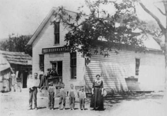
| Brister |
|
Zanesville | P | Storage | 1916 | None | Wood |
|
| Brister |
 |
South side of SR-78 about .4 mile west of St. Joseph catholic Church (GPS: 39.792487, -81.270062) |
C | Vacant | 1883 | Gone | Wood |
|
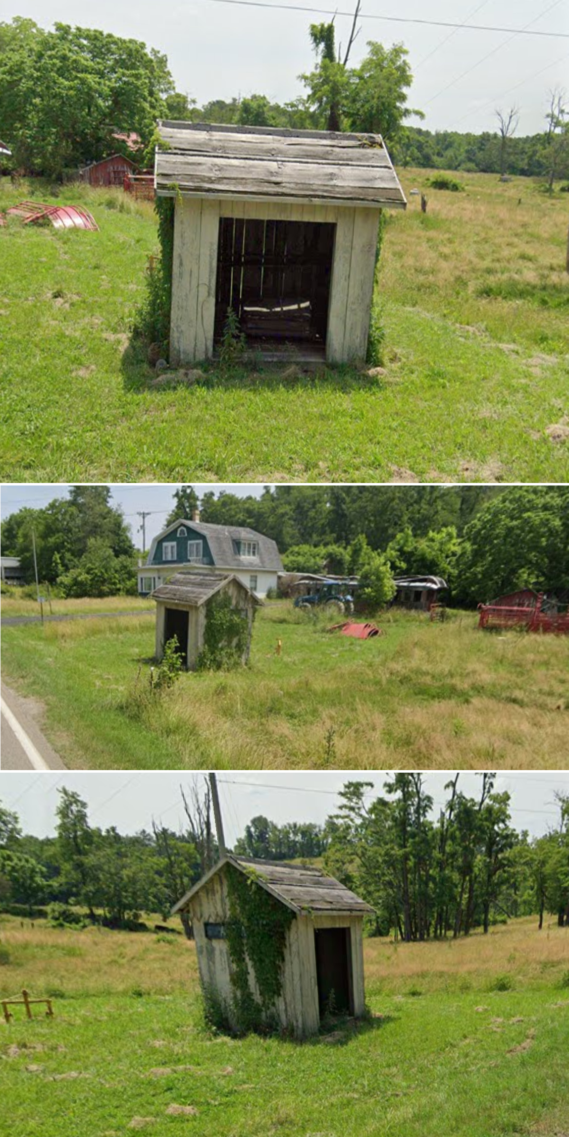
| Burkhart |
|
Intersection of SR-78 and Summit Township Road 70 (GPS: 39.785183, -81.259406) |
C | Private | 1883 | Gone | Wood |
|
| STATIONS OF THE PAST | ||||||||
| Station Name |
Original Railroad |
Notes | ||||||
| Beallsville |
|
This was the first station here which was a waiting platform added onto Miller's General Store. | ||||||
| Beallsville |
|
After Miller's General Store closed, the OR&W built this station in 1924 according to PRR design (as the PRR owned the OR&W by then). | ||||||
| Buchanan |
|
A shelter-type station was built here in 1912. | ||||||
| Cedar Creek |
|
A shelter-type station was built here in 1912. | ||||||
| Clarington Station |
 |
The B&O station for Clarington was across the river in West Virginia. | ||||||
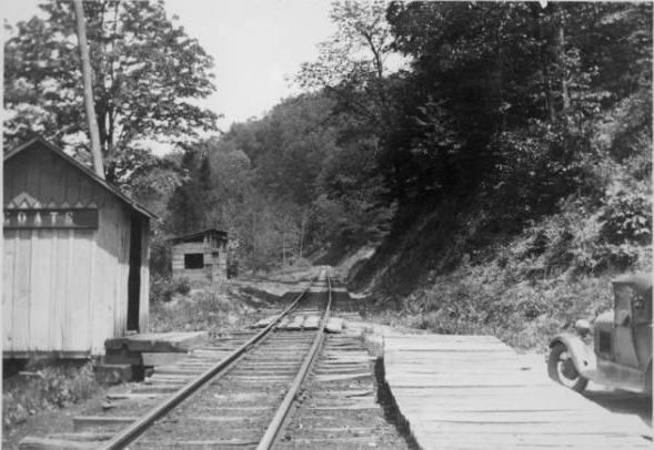
| Coats |
|
This shelter-type station was built here in 1915. | ||||||
| Decker |
|
A shelter-type station was built here in 1905. | ||||||
| Doherty |
|
A general store/private residence served as the station here. | ||||||
|
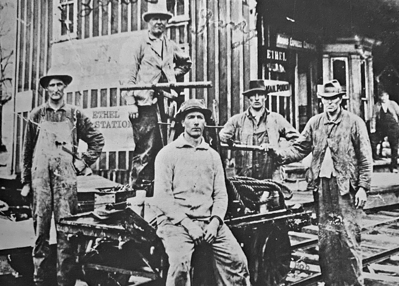
Ethel (Pryor) |
|
A general store/private residence served as the station here. It was near the intersection of SR-78 and Swazey Road. | ||||||
| Herlan |
|
A shelter-type station was built here in 1916 next to the general store/private residence that served as the station. | ||||||
| Hutchinson |
|
A shelter-type station was built here in 1912. | ||||||
| Kerr |
|
A shelter-type station was built here in 1912. | ||||||
| Jerusalem |
|
This was a privately-owned general store that also served as the station. | ||||||
| Lewisville |
|
The first station here burned down in 1891 after being struck by lightning. Prior to this railroad-built station, a general store served as the station. | ||||||
| Lewisville |
|
The second station was a rebuild of the original station. It burned down in 1899 | ||||||
| Lewisville |
|
This Ohio River & Western station was between Railroad Street and what is now SR-78 just east of Back Street (GPS: 39.764882,-81.216608). This station was built in 1899. It was gone by 1949. | ||||||
| Lupton |
|
A shelter-type station was built here in 1916. | ||||||
| Ozark |
|
|||||||
| Starkey |
|
A shelter-type station was built here in 1915. | ||||||
| Tunnel Hill |
|
A shelter-type station was built here in 1916. | ||||||
| Wise |
|
A shelter-type station was built here in 1916. | ||||||
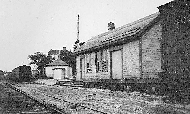
| Woodsfield |
|
This station, built in 1879, was at the intersection of East Marietta and First Streets at Mill Street (GPS: 38.942688,-83.654537). | ||||||
| 1898 MONROE COUNTY RAILROAD MAP | ||||||||
 |
||||||||
| Notes About Existing
Stations... Brister (OR&W)- Two separate structures comprised Brister Station. There was a passenger/freight waiting structure referred to as a sheltershed which was built during the years that the PRR operated the OR&W. It was moved to Norwich (Muskingum County) and resided on a private farm where it eventually collapsed. In July of 2024 the remnants were disassembled and taken to a private residence in Zanesville where the owner hope to rahabilitate it. The station building adjacent to the sheltershed, dating from the BZ&C years, was also general store, post office, ticketing agent location. It also still exists, but has been abandoned at its original location. Burhart (BZ&C)- This was a general store that also served as the station. |
||||||||