 COUNTY COUNTY
|
|
||||||||
| EXISTING STATIONS | ||||||||
|---|---|---|---|---|---|---|---|---|
| Station Name |
Original Railroad |
Current Location |
Type | Current Use |
Date Built |
Track Status |
Building Material |
More Info |
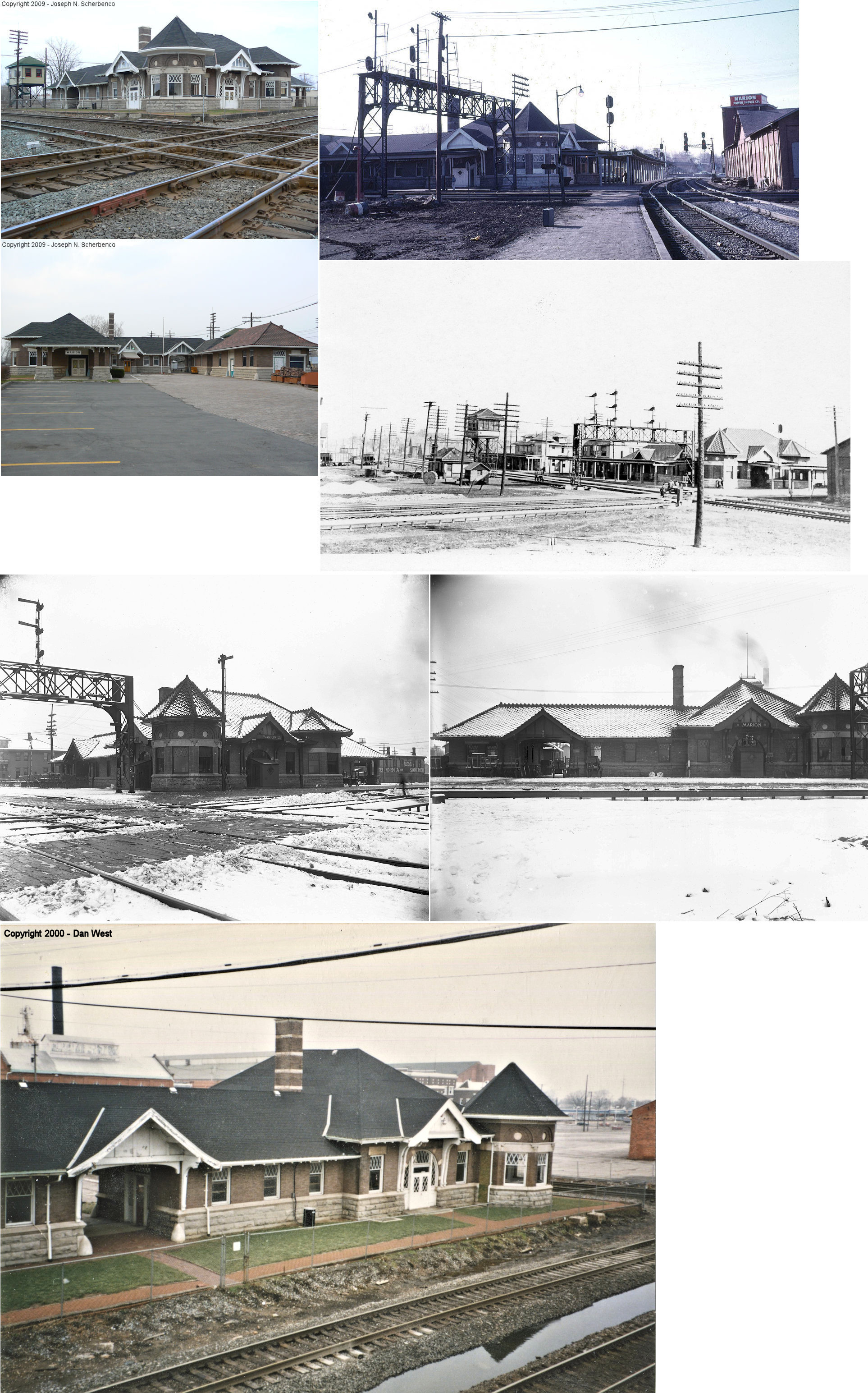
| Marion |
 |
North side of West Center Street between Park Boulevard and Davids
Street (GPS: 40.589439,-83.1408) |
P | Club | 1902 | In Use | Brick |
|
| Marion |
|
North side of West Center Street between Park Boulevard and Davids
Street. Adjacent to passenger station. (GPS: 40.589236,-83.140484) |
F | Club | ???? | In Use | Brick |
|
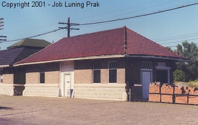
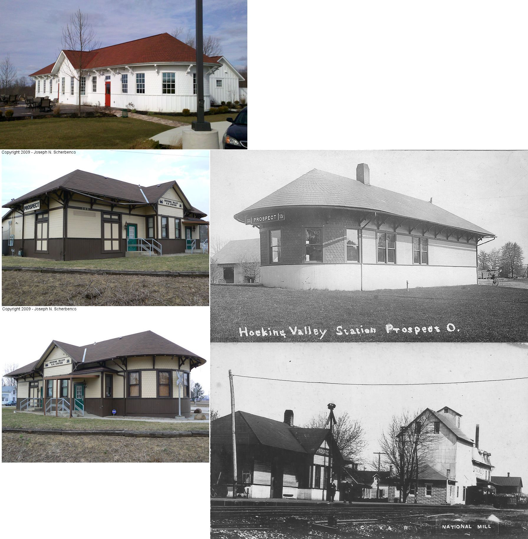
| Prospect |  |
Golf Village at Central Park, on Science Boulevar/Tech Center Drive in
Gahanna, Franklin County (GPS: 39.996693,-82.844735) |
C | Business | 1902 | None | Wood |
|
| STATIONS OF THE PAST | ||||||||
| Station Name |
Original Railroad |
Notes | ||||||
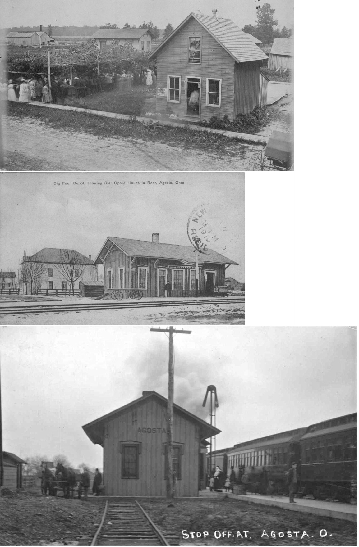
| AGOSTA |
 |
See listing below for New Bloomington. | ||||||
| Bryan Station |
 |
This early station is shown on the 1878 map of the county. This was located just south of the intersection of SR-203 (Prospect-Upper Sandusky Road) and SR-95 in Big Island Township (GPS: 40.585946,-83.21745). | ||||||
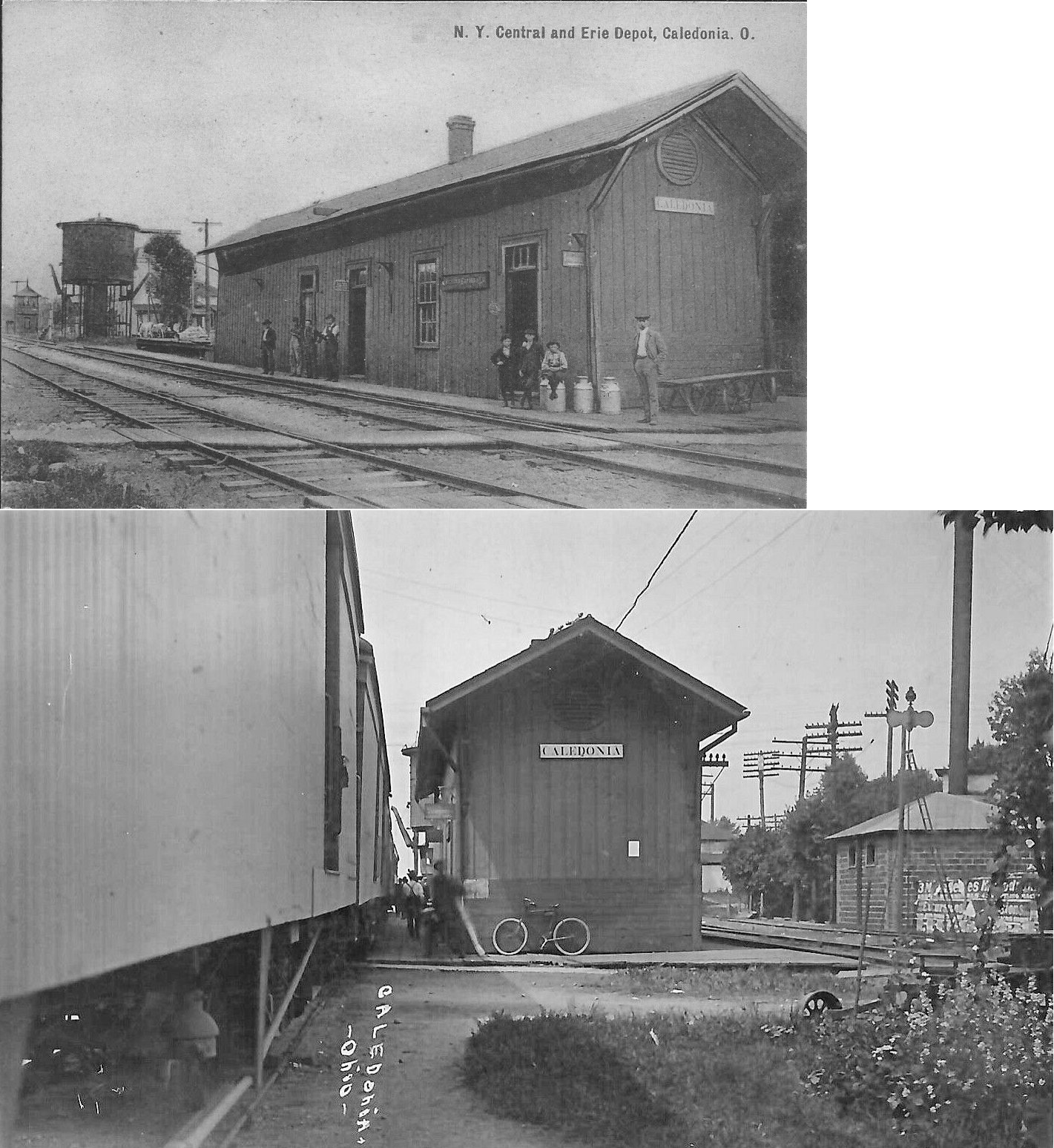
| Caledonia |  AND |
This station was between the Erie and Big 4 tracks on the west side of the Water Street crossing (GPS: 40.637518,-82.967822). It served both railroads and appears on maps as early as 1878 (when the railroads were the A&GW and CCC&I). In 1953 the New York Central ran a classified ad in the Marion Star (1-27-1953) advertising the depot for sale with the stipulation that the buyer must remove the depot from the property. Its disposition after that is unknown. | ||||||
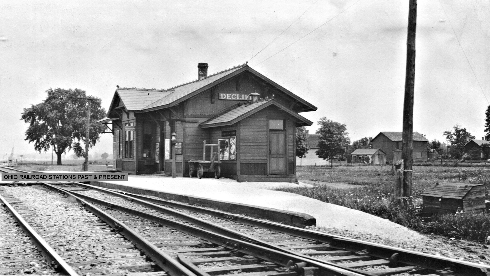
| DeCliff (Clifton) |
|
This station is listed as Cliftons on the 1886 C&A local timetable. | ||||||
| Espyville |
 |
This station is shown on the 1886 C&A timetable of local stations. | ||||||
| Green Camp |
 |
This is Green Camp's first station. It was located at the NW end of Erie Street on the SE side of the tracks (GPS: 40.53356,-83.210878). | ||||||
| Green Camp | |
A second station was built here to replace the earlier depot (see above) in 1913. | ||||||
| Gurley Station |
|
This early station is shown on the 1878 map of the county. This was located just south of the intersection of Espyville Road and SR-95 in Big Island Township (GPS: 40.585962,-83.255575). | ||||||
| Harvey |
 |
|||||||
| Hords |
|
This station is shown on the 1886 C&A timetable of local stations, although no trains are listed as stopping there so it may have been a flagstop. This station was between Marion and Espyville. | ||||||
| La Rue |
|
This station sat on the north side of the tracks between Front and High Streets north of Vine Street. It is shown on maps from 1878. | ||||||
| Marion |
|
The original two-story Chicago & Atlantic (later Chicago & Erie) station was on the north side of the tracks about 500 feet east of the interesection of Hocking and Edwards Streets (GPS: 40.589731,-83.142305). The "C&A Hotel & Eating House" was on the east side of the station. It is shown on the 1888, 1892, and 1900 Sanborn maps. After Union Station was built this original station served as a RR office for the Erie RR. It is shown as such on the 1908 and 1919 maps and all the other buildings around it, including the hotel next door, had been torn down. The building was gone by the 1929 map. The C&A was a narrow-gague later owned by the Erie RR. The Erie RR converted the line to standard gague in 1881. This station survived into Erie days, so the Erie had two passenger stations in town before Union Depot was built. | ||||||
| Marion |
|
The passenger station was on the south side of the tracks between east Huber Street and East Quarry Street about 200 feet east of North State Street (GPS: 40.590525,-83.126571). The freight station was on the north side of the tracks (GPS:40.590684,-83.126593). The "NYP&O House" hotel was just to the west of the freight station. | ||||||
| Marion | |
This station was north of West Center Street just a few feet south of where Marion Union Station is today (GPS: 40.589022,-83.140674). | ||||||
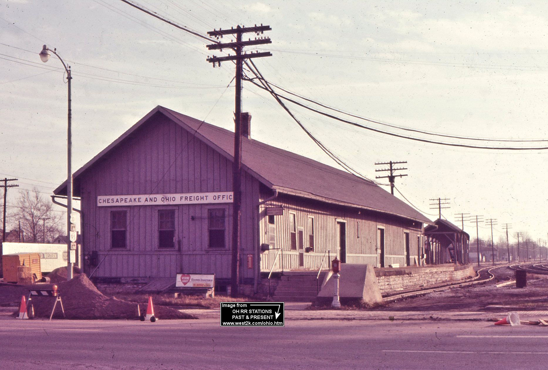
| Marion | |
The freight station was on the south side of West Center Street on the east side of a siding track that ended at Center Street (GPS: 40.588378,-83.140379). It was built in 1904. | ||||||
| Marion | |
The original CCC&I station was behind the Merchant Transfer Company near the corner of East Huber and North Vine Streets at approximately GPS: 40.590193, -83.124784. | ||||||
| Marion | |
The passenger station was on the north side of the tracks on East Huber Street about 200 feet east of North State Street (GPS: 40.590277,-83.126378). It was built around 1892. The "Big 4 Hotel" was just to the west of the passenger station. The station was demolished in August 1902 after passenger operations were moved to the new Union Station. | ||||||
| Marion | |
The freight station, which was 100 feet long, was to the east on Huber Street just west of Vine Street (GPS: 40.590285,-83.124838). There was likely an earlier frame CCC&I station at this same location. This station was slated to be moved to the former location of the passenger station after 1902 (Marion Star, 7-19-1902), but it appears from Sanborn maps after that time that the freight station remained in its original location. | ||||||
| Marion | |
There was an express station loacted to the east of the Union Depot Hotel at GPS: 40.589539,-83.139553. | ||||||
| Marion |
 |
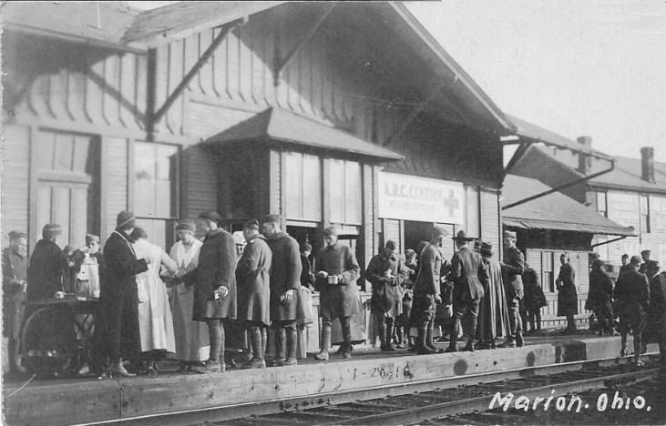
A passenger car without wheels/trucks derisively called "Jim" Fisk's private car" (although Jim Fisk never owned the car) was used as the station at some point before Union Station was built in 1902. The wheels were separated from the chassis and the car was lowered into place. The 1907 Marion County History says that the station so offended city leaders, including Marion Star owner Warren G. Harding, that they began the drive for a Union Station fit for a major city. This station was located between Quarry and Huber Streets on the south side of the tracks at GPS: 40.590536, -83.126533. There was also a freight station on the north side of the tracks. | ||||||
| Marion | |
The original Erie freight house was on the north side of the tracks on the south side of Hocking Street at GPS: 40.589600, -83.144536. This freight house is shown on the 1908 Sanborn map, but is no longer there on the 1914 map when the freight station listed below appeared. | ||||||
| Marion | |
There was a freight house constructed sometime between 1908-1914 that was on the south side of West Center Street between Kenton and Cayuga Streets (GPS: 40.58813,-83.144193). | ||||||
| Marion | |
This was a freight transfer house/office. It may have been at the Erie yards or it may have been on the west side of Ballantine Avenue (when it crossed the tracks) at GPS: 40.590794, -83.123766. There is a building that resembles it on the 1900 Sanborn map, but it's not clearly labeled. | ||||||
| MArion |
|
This CS&H (later PRR) passenger station was on the north side of West Center Street on the east side of the tracks (GPS: 40.589111,-83.139853). | ||||||
| Marion |
|
The freight station was on Park Boulevard between Chruch and West Center Streets (GPS: 40.587804,-83.139816). | ||||||
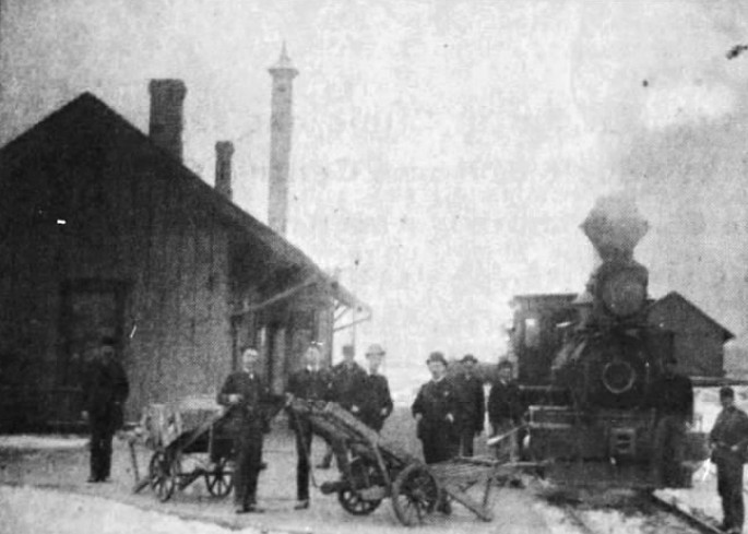
| Martel |
|
The Big 4 depot here was demolished by a 20-freight car derailment on July 5, 1907 at 9:35 a.m. (Marion Daily Mirror, same date). Until the new union station was built a few years later, a freight car served as the freight station (Marion Daily Mirror, July 28, 1909). | ||||||
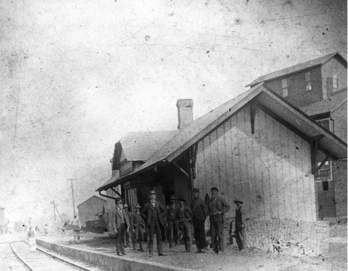
| Martel |  |
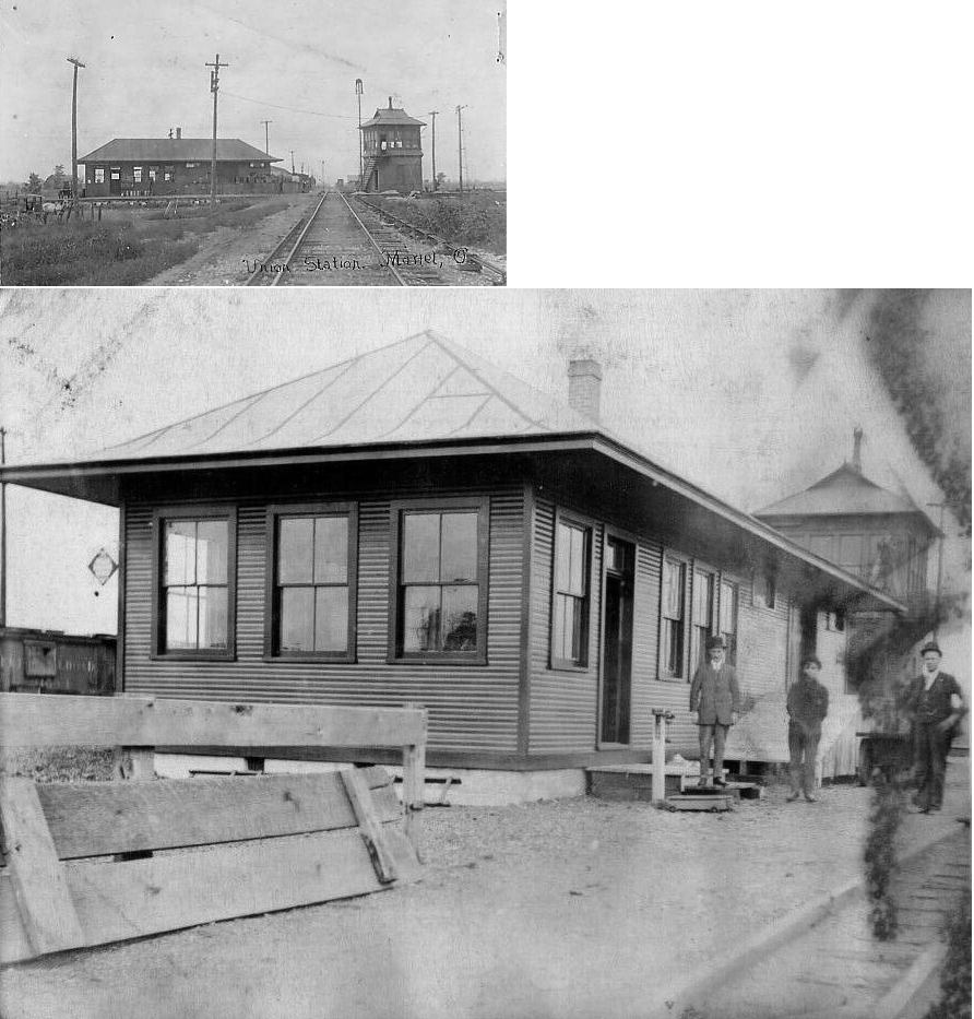
This union station, built around 1910, sat at the single track crossing of the T&OC with the shared double-track line of the CCC&St. and Erie. | ||||||
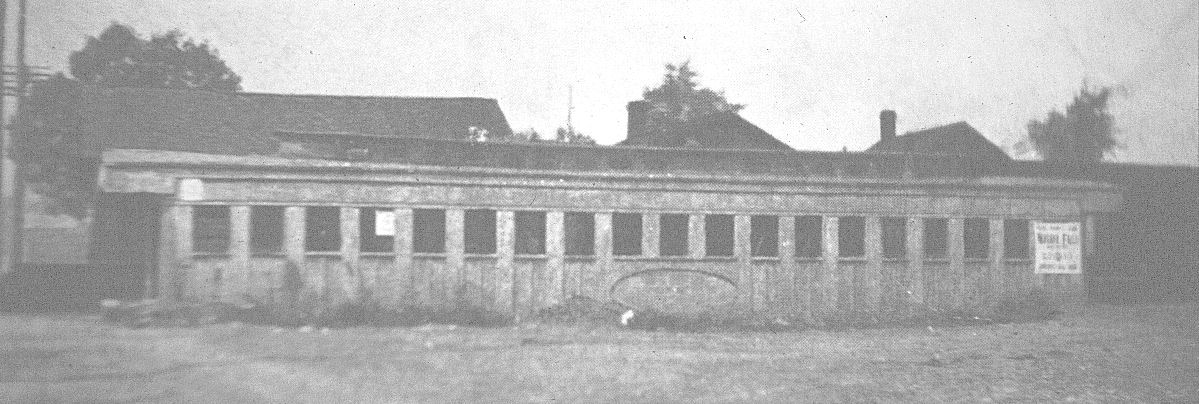
| Martel | AND |
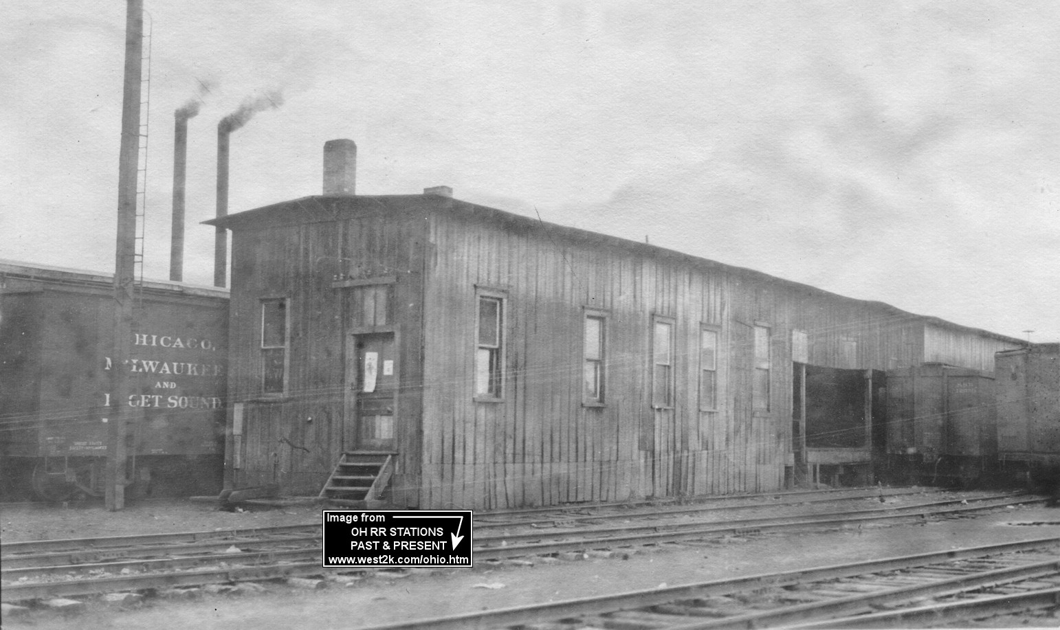
The freight station here was a series of old boxcars connected together with trackside platforms. Some of the boxcars in the complex had windows where there were presumably offices. The boxcars lined both the Erie and T&OC tracks, so they were probably used as a freight transfer point. | ||||||
| Morans |
|
This station is shown on the 1888 C&A timetable of local stations. | ||||||
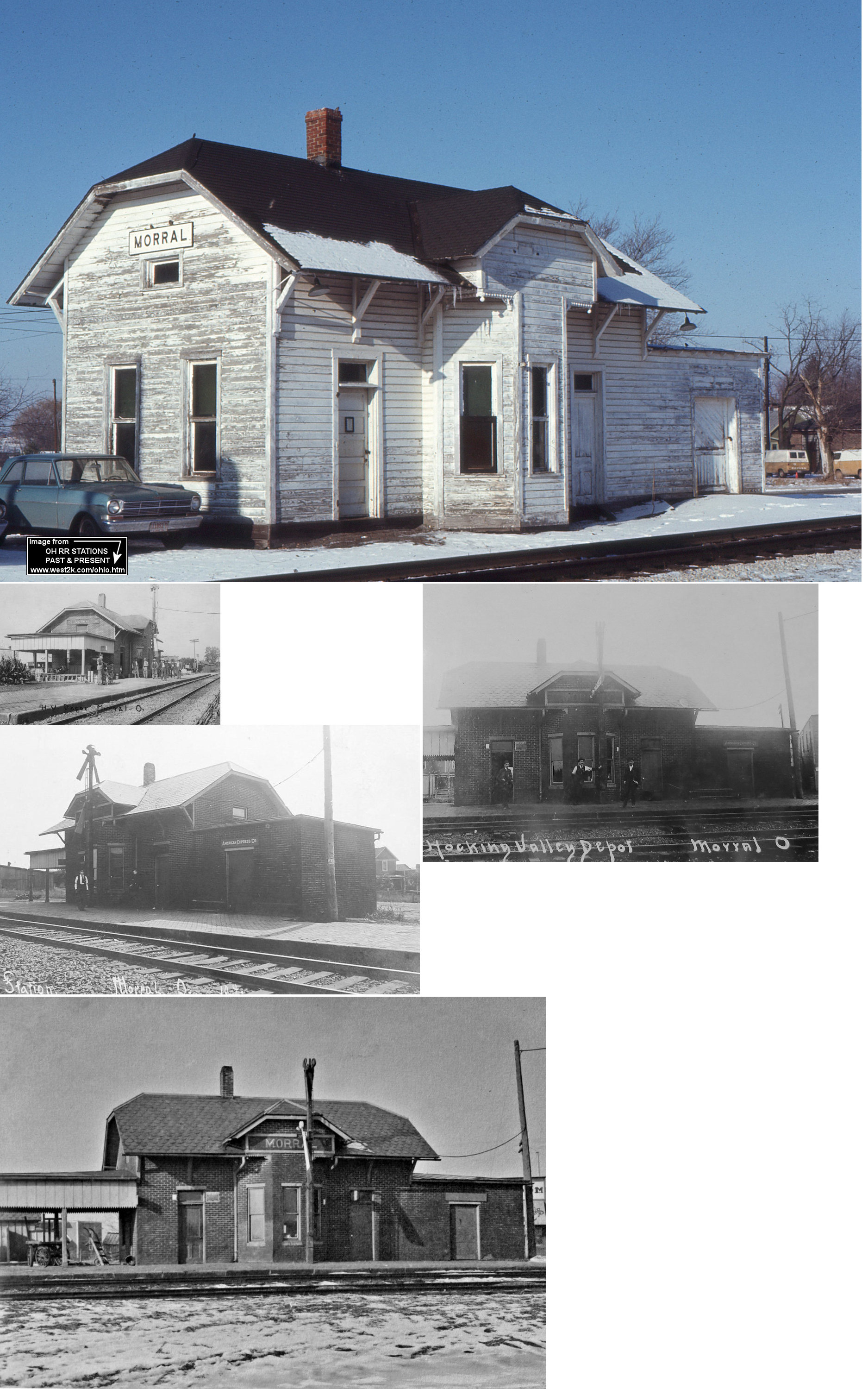
| Morral | |
The original station here burned down in 1890. | ||||||
| Morral | |
The station closed in 1975, suffered fire damage in the late 1970's, and was torn down by 1983, if not earlier. The station was originally built with metal siding that looked like brick. That siding was later removed (hence the brick-to-wood look over the years). | ||||||
| New Bloomington (AGOSTA) |
|
In 1878 this station was on the west side of Carey Street on the south side of the tracks (GPS: 40.585816,-83.313725). | ||||||
| Owens | |
There was an 18'X50' station here. | ||||||
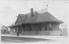
| Prospect | |
There was a frame station here prior to 1902 that was built by predecessor line Columbus & Toledo in 1876. It was off Railroad Street between Water Street and Park Avenue. This original station was located on the east side of the tracks. | ||||||
| Tobias |
|
|||||||
| Waldo |
|
This station was on the north side of Main Street, on the east side of the tracks. | ||||||
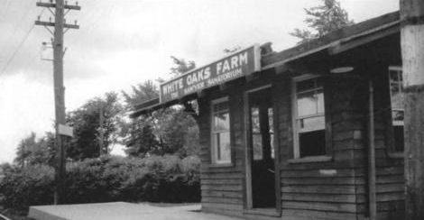
| White Oaks Farm | |
This station, which sat on sanitarium grounds on White Oaks Road, was built by Sawyer's Sanitarium. The sanitarium also had its own siding. | ||||||
| 1898 MARION COUNTY RAILROAD MAP | ||||||||
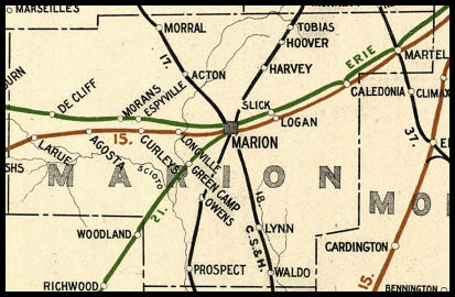 |
||||||||
| Notes About Existing
Stations... Marion (Union) - All three railroads pass within 50 feet of this "Union" Station. The old waiting room is currently open M-F 10-2 for rail fans. The tracks to the north are now CR, they were originally Erie/ EL and NYC. The tracks to the east are now NS. They were PRR until 1964, then N&W and NS. The tracks to the west are CSX, former C&O/Chessie. All three railroads currently have 2 tracks at the station. It is quite a spot for rail fans, with nearly 100 trains passing every 24 hours (CSX 30, NS 27, CR 25 plus locals). During its active years the station was operated and maintained by the CHV&T (C&O). Note that the brick building nearby on the corner of Park and West Center is not a PRR freight station as some have claimed. It was originally build by the Marion Steam Shovel Company and later served as a PRR freight office, but was never a station. Marion (Union, Frieght) - The freight section of the station was built sometime after 1914 (as it is not shown on that year's map with the rest of the station, but it is shown on the 1919 map). At various times this served as an express station and mail station. Prospect (CHV&T) - This station is now at its third location. The original location was on Railroad Street between Water Street and Park Avenue in Prospect. This station was located on the west side of the tracks (built across the tracks from the original Prospect CHV&T frame station). It was then moved one mile from original location in 1978 to the NE corner of North East and Market Streets (GPS: 40.453187, -83.187561). It served as a restaurant until that closed in 2008. It was then moved to its current location in Gahanna in April 2011. |
||||||||