 COUNTY COUNTY
|
|
||||||||
| EXISTING STATIONS | ||||||||
|---|---|---|---|---|---|---|---|---|
| Station Name |
Original Railroad | Current Location |
Type | Current Use |
Date Built |
Track Status |
Building Material |
More Info |
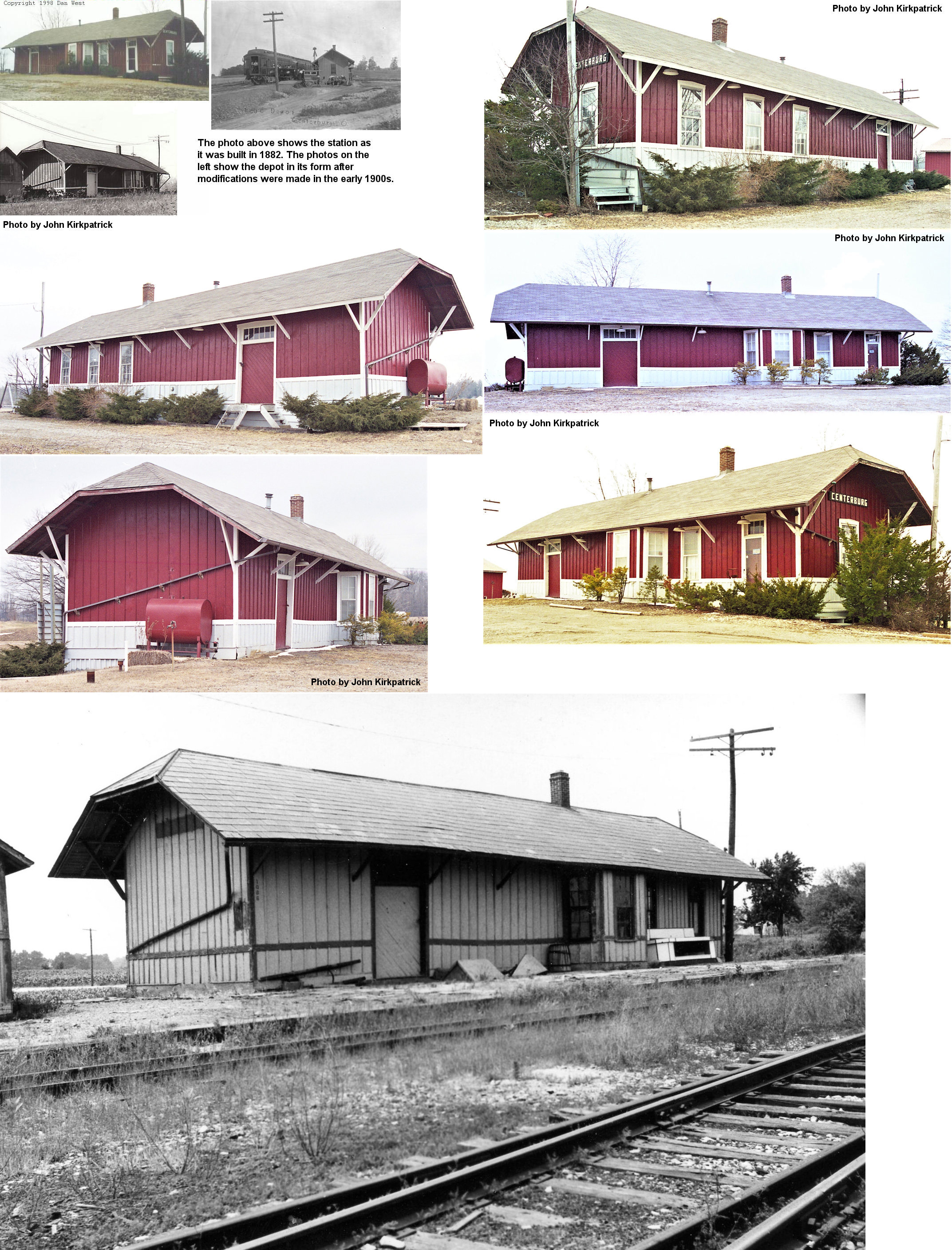
| Centerburg |  |
SR-3 & US-36 south of town | P | Business | ???? | None | Wood |
|
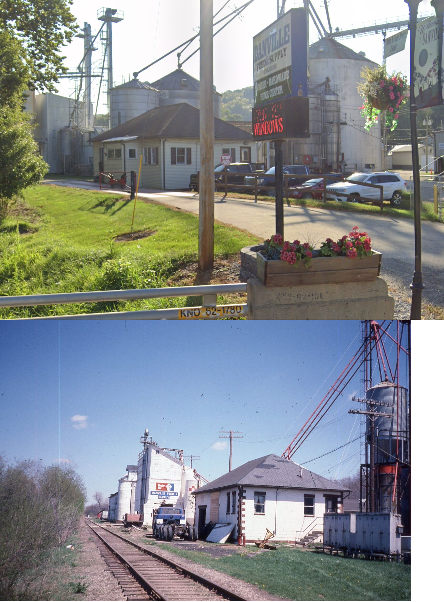
| Danville (Buckeye City) |
 |
East side of US-62 (GPS: 40.444951,-82.260019) |
P | Business | ???? | Gone | Brick |
|
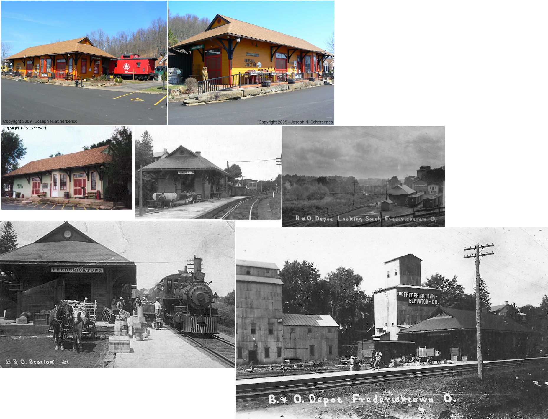
| Fredericktown |  |
US 36 west of SR 93 in West Lafayette, Coshocton Co. | C | Business | 1890 | None | Wood |
|
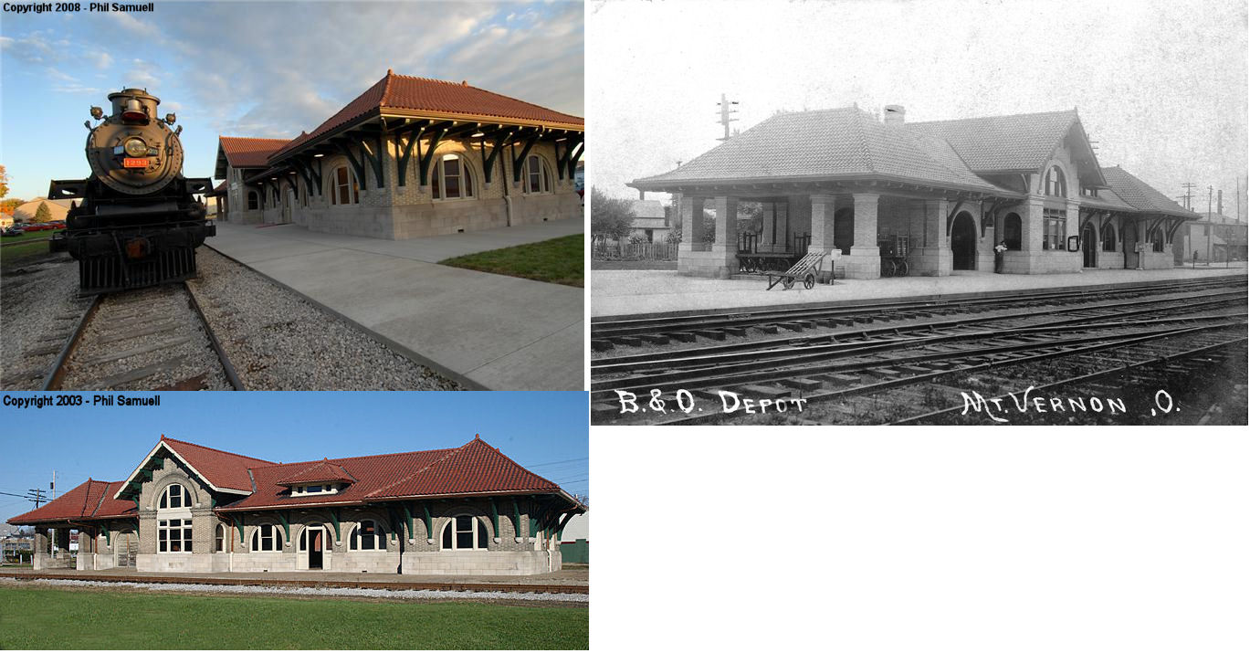
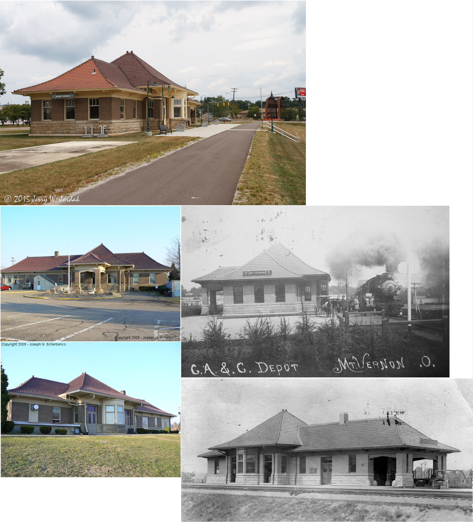
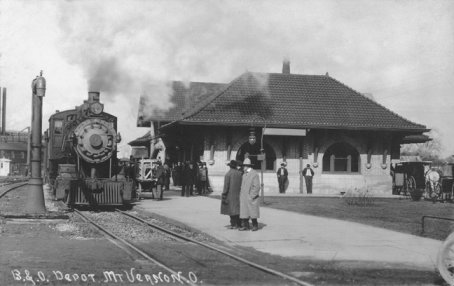
| Mount Vernon | |
West High Street & Brunswick Avenue | P | Railroad | 1907 | In Use | Brick |
|
| Mount Vernon | |
South Main Street & Columbus Road | P | Civic | 1905 | Aband. | Brick | |
| Mount Vernon | |
South Gay Street & Howard Street | F | Business | ???? | Gone | Wood |
|
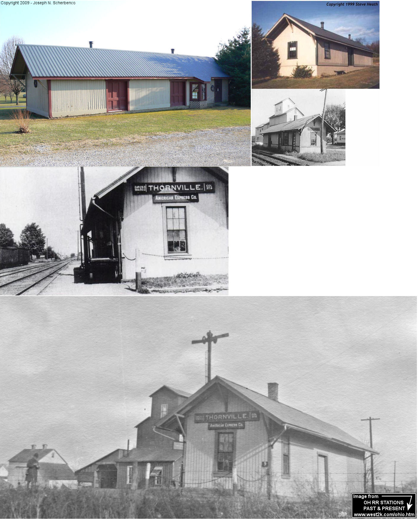
| Thornport | |
7345 Newark Road (SR 13), Mount Vernon (GPS: 40.342252, -82.467786) |
P | Business | 1872 | None | Wood |
|
| STATIONS OF THE PAST | ||||||||
| Station Name |
Original Railroad |
Notes | ||||||
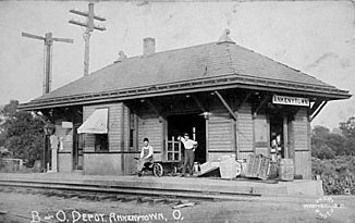
| Ankenytown (Shaler Mills) |
|
This depot, built in 1905, was on the north side of Main Street on the east side of the tracks. Not sure what street that is today as all the names have changed. | ||||||
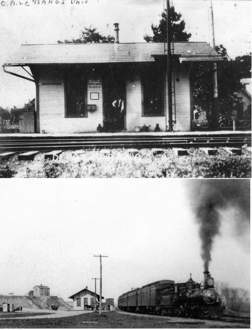
| Bangs | |
This station was on the north side of the tracks on the west side of Johnstown Road at approximately GPS: 40.350142, -82.552682. | ||||||
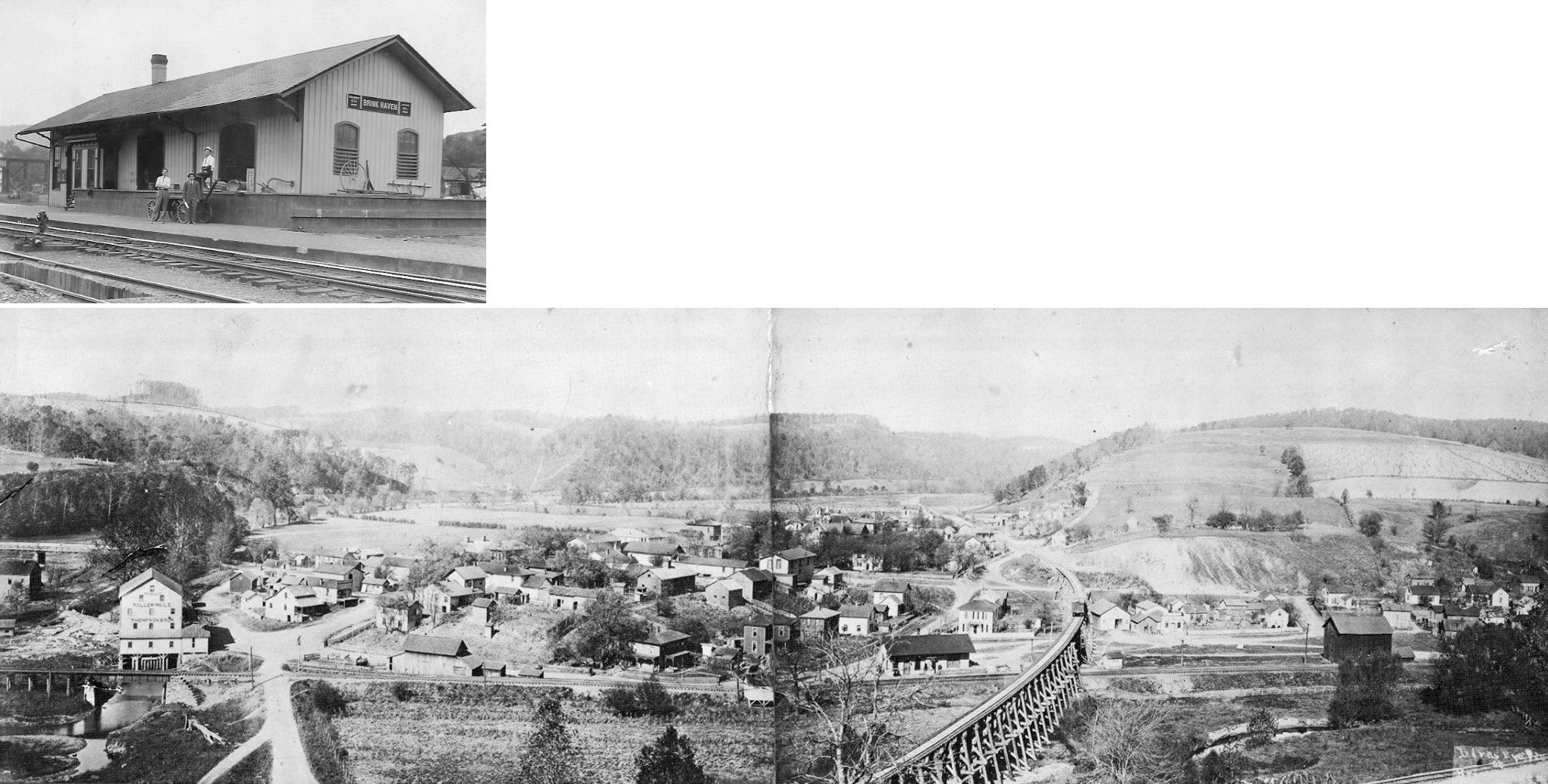
| Brinkhaven (Gann) |  |
This line later became part of the Pennsylvania RR. It crossed the CA&C RR at an angle on the hillside a few hundred feet East of the high CA&C railroad bridge over the Walhonding river which has now been made into a covered bridge for the bike trail which runs between Danville and Brinkhaven. The station was on the north side of Pine Street on the west side of the tracks. | ||||||
| Brinkhaven (Gann) | |
There were passenger and freight stations here. These stations were on the north side of what is now State Street (US-62). One of the stations was near the TWV&O crossing (in the NW corner of the diamond) and the other was to the east of the diamond (according to the 1896 maps). | ||||||
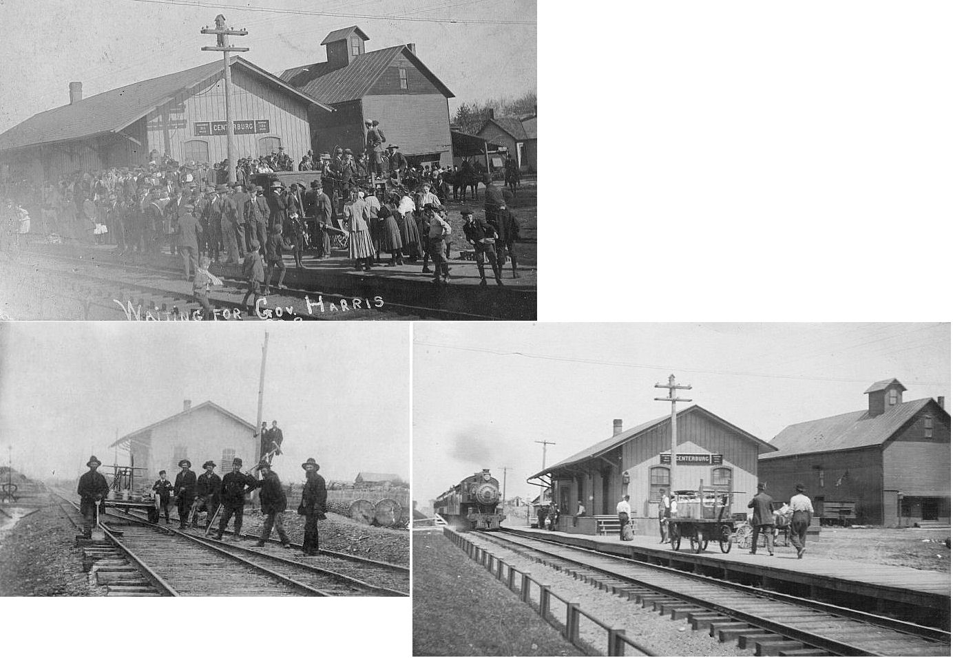
| Centerburg | |
This station was at the end of Hartford Avenue. It was most likely built when the railroad was known as the Cleveland, Mt. Vernon & Columbus as the older photo was from around 1885. | ||||||
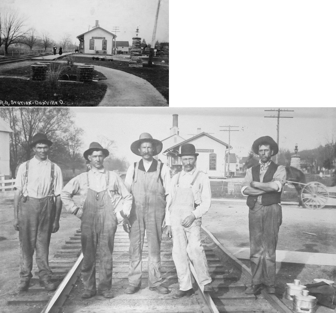
| Danville | |
This station was near where the existing station is today. | ||||||
| Fredericktown | |
This first station here was on the SE side of Mill Street at GPS: 40.483622, -82.542381. It was on part of the first floor of a larger grain elevator building (in 1890 this was the M.J. Simons & Son Elevator). | ||||||
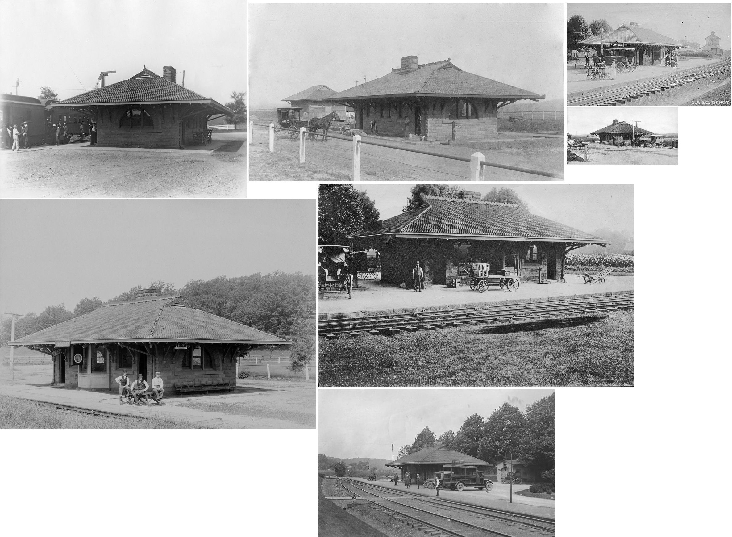
| Gambier | |
This station was on the east side of Duff Street (Ackland Street) on the north side of the tracks. There was a freight station about 600 yards to the east and a smaller freight station/baggage house near the passenger station. The station was demolished in 1955. | ||||||
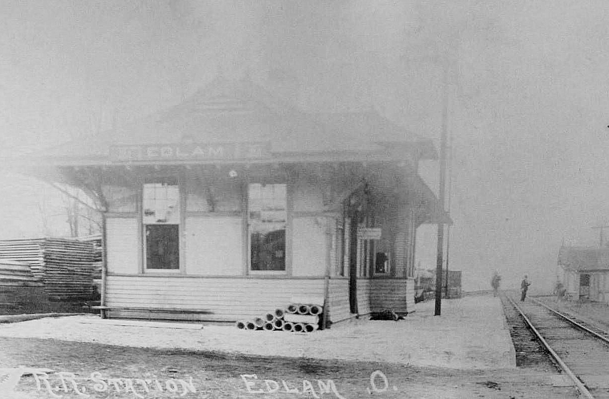
| Greersville (Edlam) | |
This was known as the Edlam-Greersville station. It was on the north side of Main Street on a siding track on the west side of the main line. | ||||||
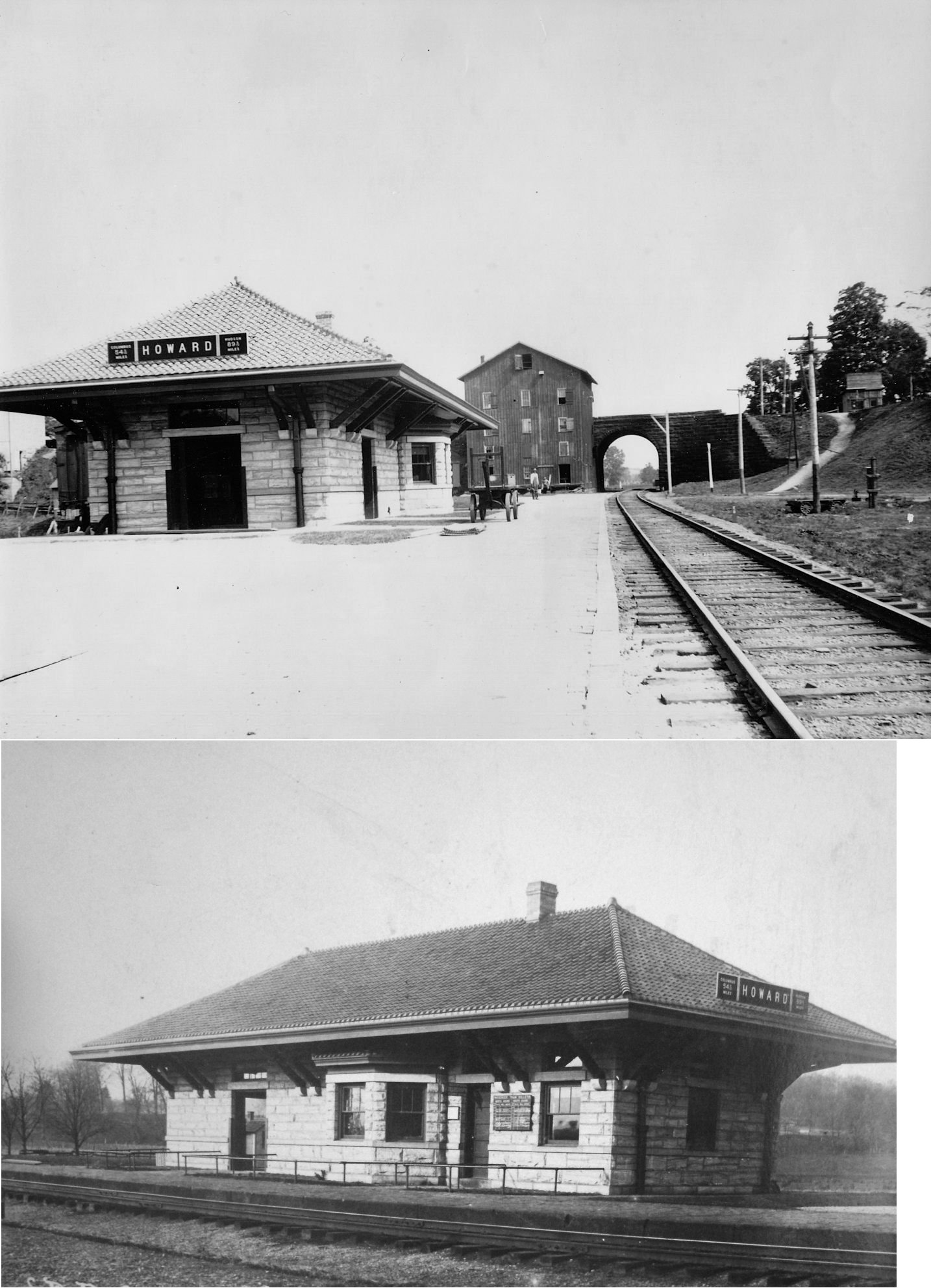
| Howard | |
The station was on the SW side of Coshocton Road (tucked behind a hotel) on the SE side of the tracks (GPS: 40.407075,-82.326297). The 3.8-mile Howard Branch began here and ran East to Millwood with the Millwood White Sand Company being the terminus. | ||||||
|
HUNT Station |
|
According to B&O valuation records, this station was built in 1889. | ||||||
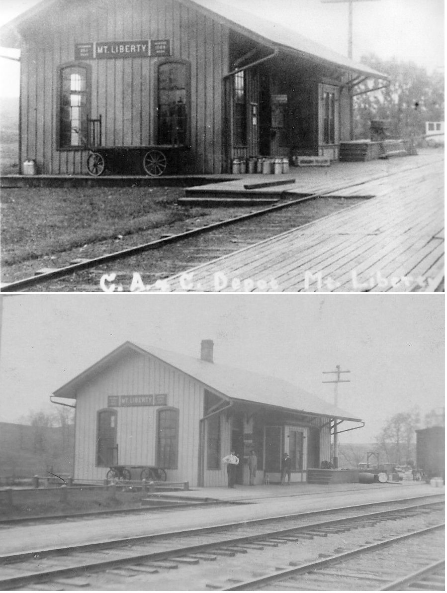
| Mount Liberty | |
This station was on the SW side of CR-25 on the south side of the tracks. (GPS: 40.34578,-82.63084) | ||||||
| Mount Vernon | |
The original CA&C passenger station was just east of where the existing freight station is along Howard Street (formerly called Water Street). It was located just to the west of South Mackenzie Street. The freight station that still exists is the second freight station, replacing an older and smaller building around 1900. The original freight station was closer to the old passenger station along Howard Street near the intersection of East St. When the new brick station was built around 1905-1907, the original passenger station was torn down. It does not appear on the September 1907 map. | ||||||
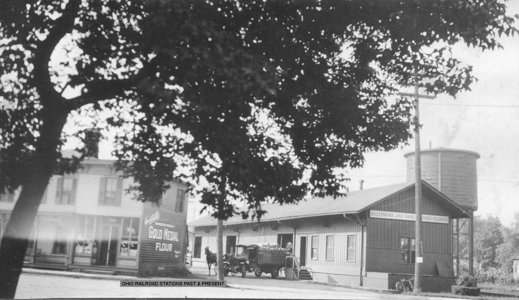
| Mount Vernon | |
The original B&O passenger/freight station was a frame building on the opposite side of High Street from where the existing station is. It occupied the southwest corner of South Norton and West High. According to B&O valuation records, it was built in 1889. After the new passenger station was built in 1907, this building become the freight station. The B&O also had a water softening plant across the tracks from this station. | ||||||
|
Rich Hill (Hilliar) |
|
This station was on the north side of Rich Hill Road on
the NE side of the tracks. (GPS: 40.322087,-82.734722) |
||||||
| 1898 KNOX COUNTY RAILROAD MAP | ||||||||
 |
||||||||
|
Notes About Existing Stations... Centerburg (T&OC) - Station is in its original location. It was heavily modified in the early 1900s modernization project when it was given a new roof, modern plumbing, and fresh paint scheme. Danville (CA&C) - Used by a grain elevator. Covered with vinyl siding. Fredericktown (B&O) - Moved from Fredericktown to West Lafayette. The original location of this station was on the SE side of Mill Street just east of Main Street in Fredericktown at GPS: 40.484158, -82.543061. It was on the SW side of the tracks. Mount Vernon (B&O) - Station has been restored and is available for rent for events and dinners. For more information, see the Mount Vernon Depot site. Here is an old photo. Mount Vernon (CA&C Freight) - This station was on a connecting track between the B&O and PRR. It was known as the "Horn" Track and crossed the B&O just north of the B&O's Kokosing River Bridge, then arced northwestward to tie in back at the B&O almost opposite of the B&O station. With this track, PRR was able to serve the feed mill (Farmer's Exchange) and a coal retailer. The tower there, MN, controlled two diamonds, the south (east per railroad) end of the B&O siding and something called the "Red Mill" track. There were "Armstrong" sliding pipes that were strung over the bridge to control the switches, derails and locks, as the tower was south of the bridge, closer to the PRR main track crossing, just north of Columbus Road. --Brad Upham Thornport (T&OC) - Moved to Mount Vernon from Thornville in Perry Co. |
||||||||