 COUNTY COUNTY
|
|
||||||||
| EXISTING STATIONS | ||||||||
|---|---|---|---|---|---|---|---|---|
| Station Name |
Original Railroad | Current Location |
Type | Current Use |
Date Built |
Track Status |
Building Material |
More Info |
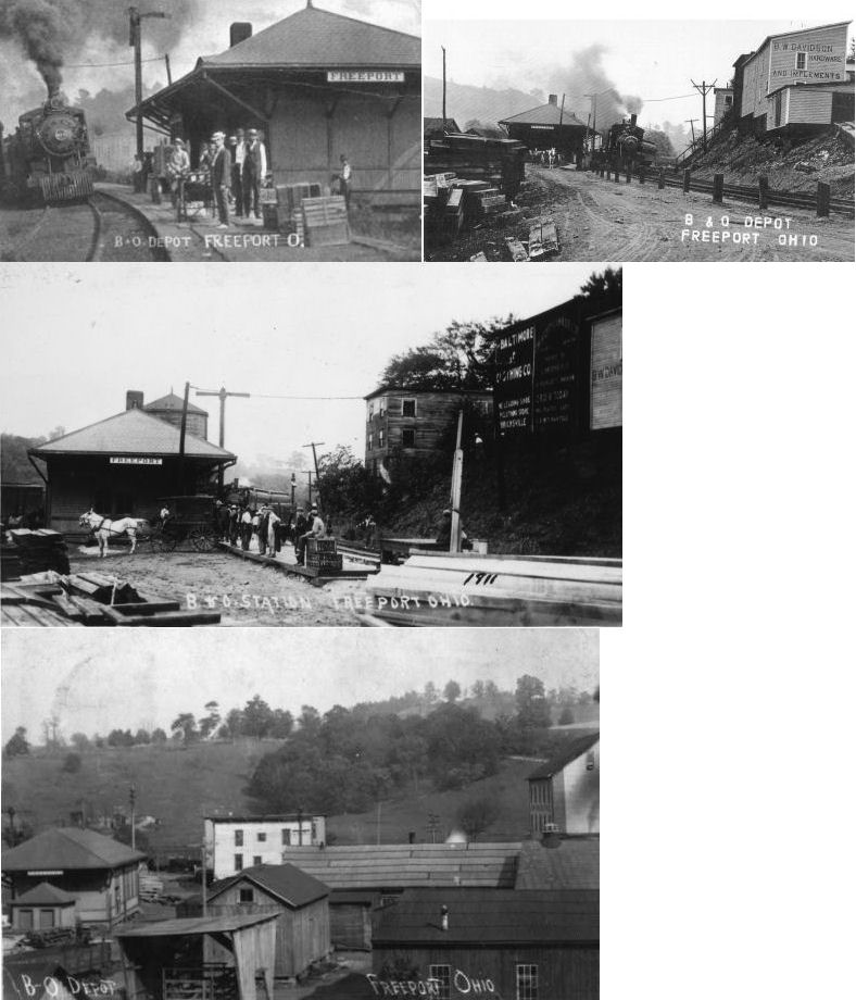
| Freeport |  |
John Marstell Park | P | ???? | ???? | None | Wood |
|
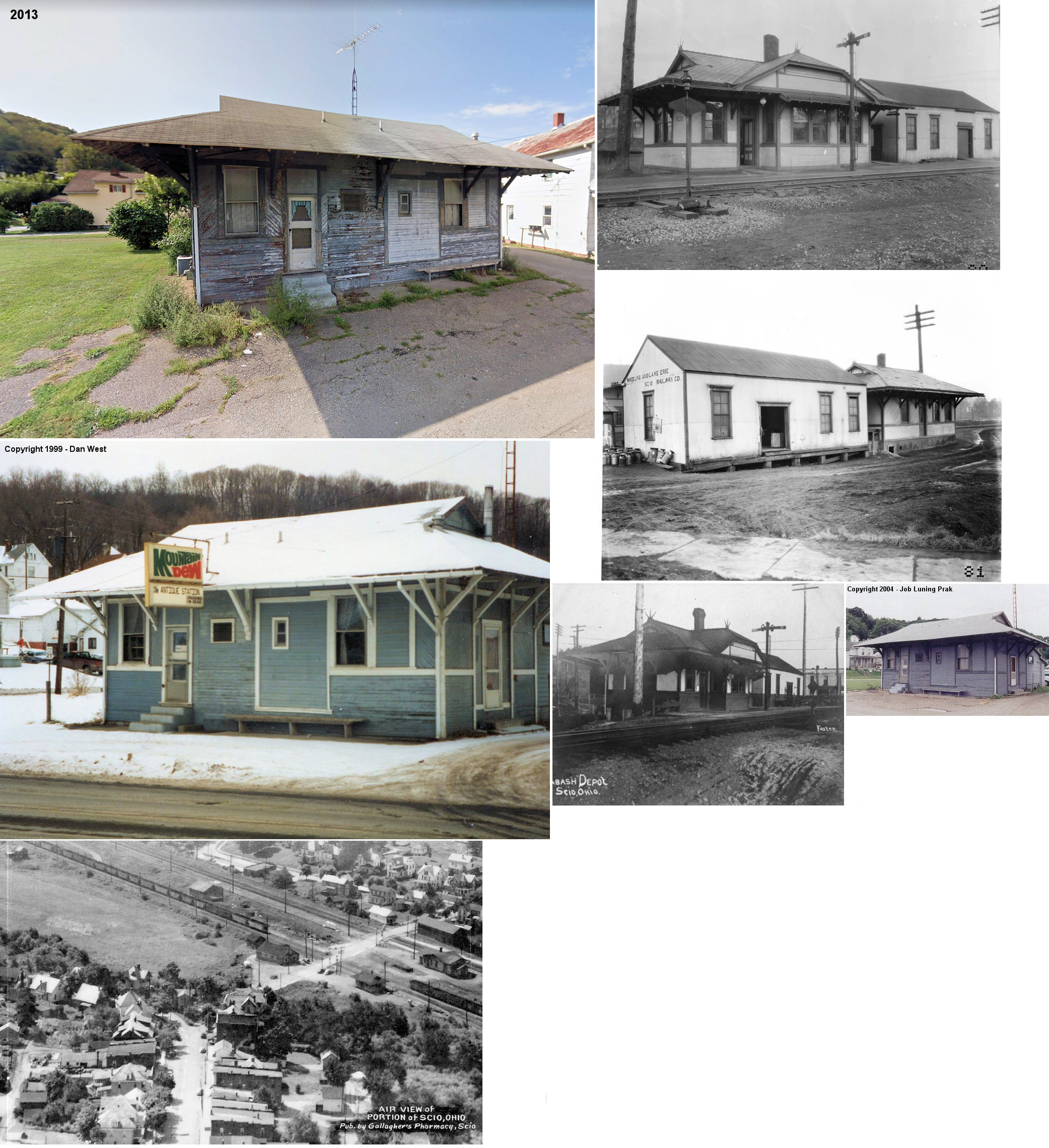
| Scio |  |
112 E. Main | P | Business | 1889 | None | Wood |
|
| STATIONS OF THE PAST | ||||||||
| Station Name |
Original Railroad |
Notes | ||||||
|
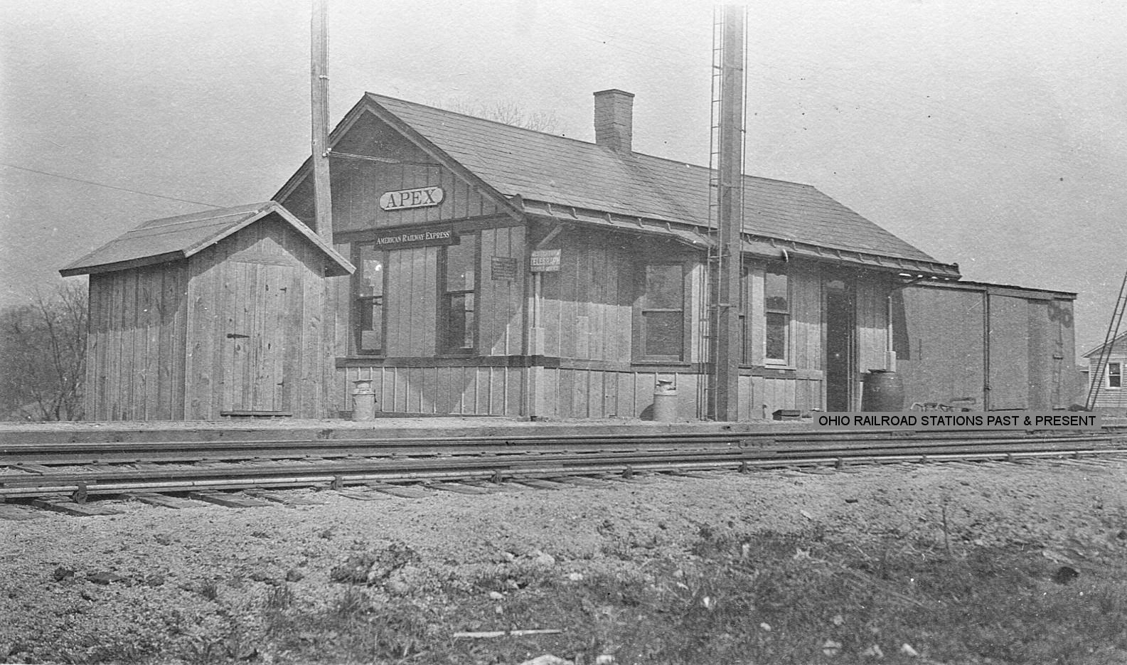
Apex (Germano Sta.) |
 |
This station also served as the station for Germano a couple miles to the west. It was on the north side of Annapolis Road at approximately GPS: 40.410176, -80.932553. According to NYC valuation records, the station was built in 1903 and measured 16'x30'. A 9'x29' converted boxcar was used as a freight station. | ||||||
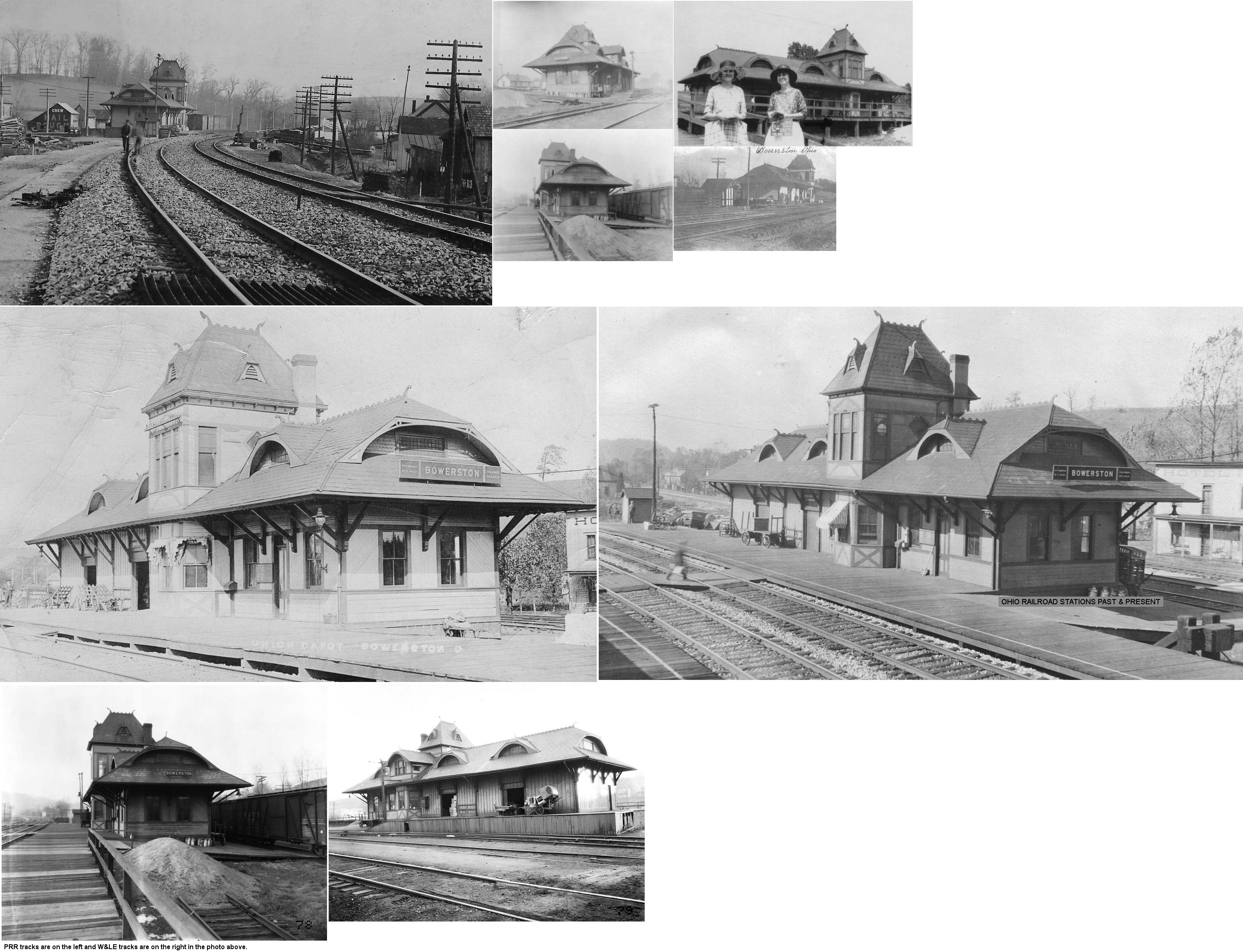
| Bowerston |  |
The first station here was at the end of Water Alley northwest of Grant Street. This station is shown on a map of the town from 1875. (GPS: 40.427723,-81.19077) | ||||||
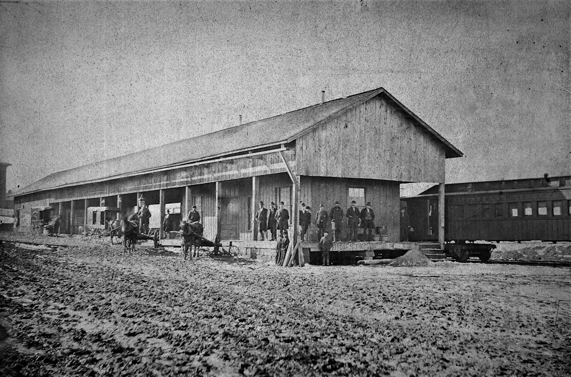
| Bowerston | AND |
This station was located on Erie Street between the W&LE and PRR tracks. There was a freight station with a long wooden platform and walkway on the south side of the PRR. According to PRR valuation records, this station was built in 1903. | ||||||
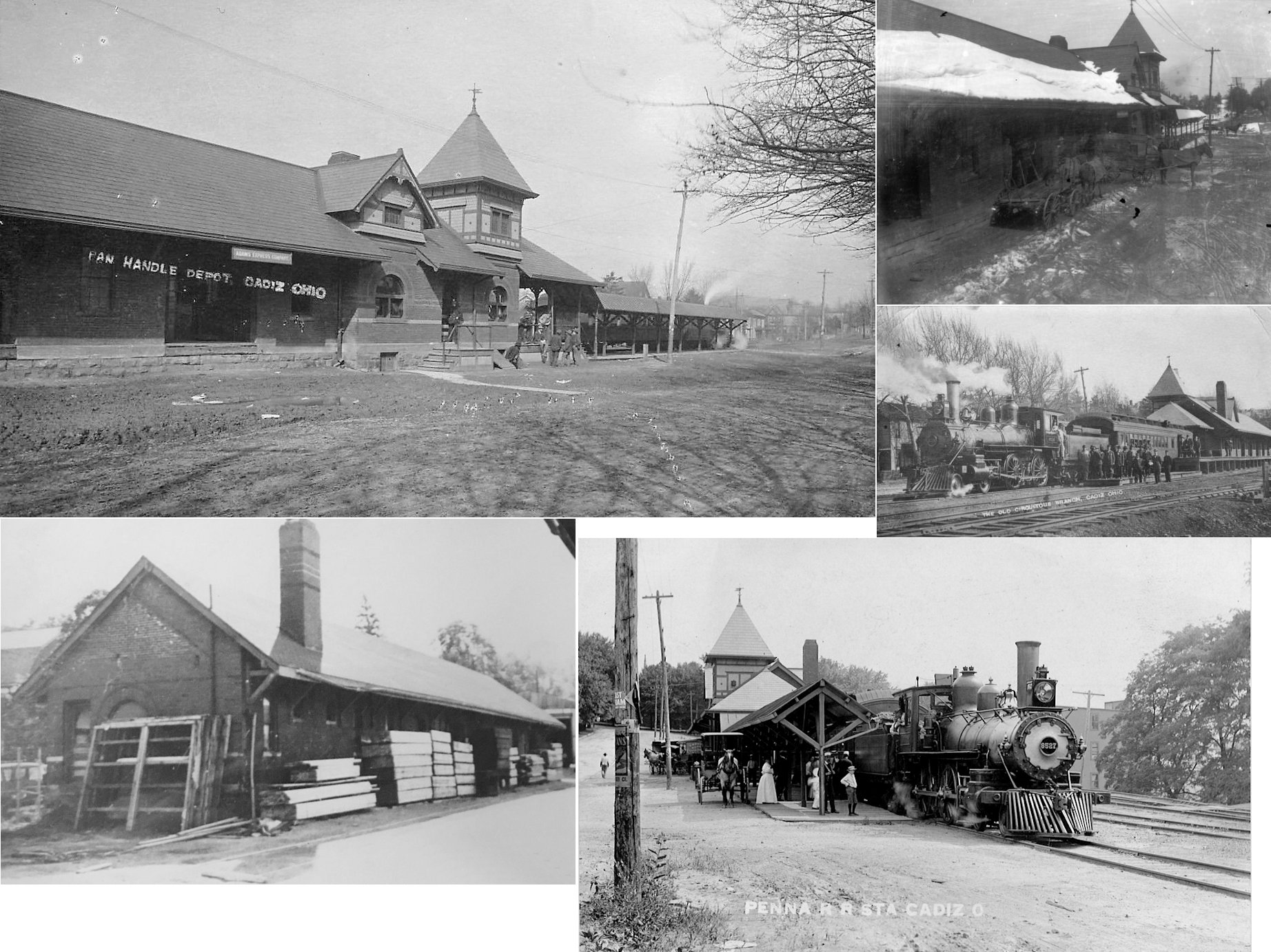
| Cadiz |
|
The first combination station at Cadiz was built in 1854 when the line was still called the Stuebenville & Indiana RR (Cadiz Sentinel, 9-13-1854). | ||||||
| Cadiz | |
This combination station, built in 1893, sat on Lincoln Avenue just south of the intersection with Spring Street at GPS: 40.27495,-80.999494. There was an engine house and turntable near the depot (to the south) so the train could turn around and return to Cadiz Junction in German Township. | ||||||
|
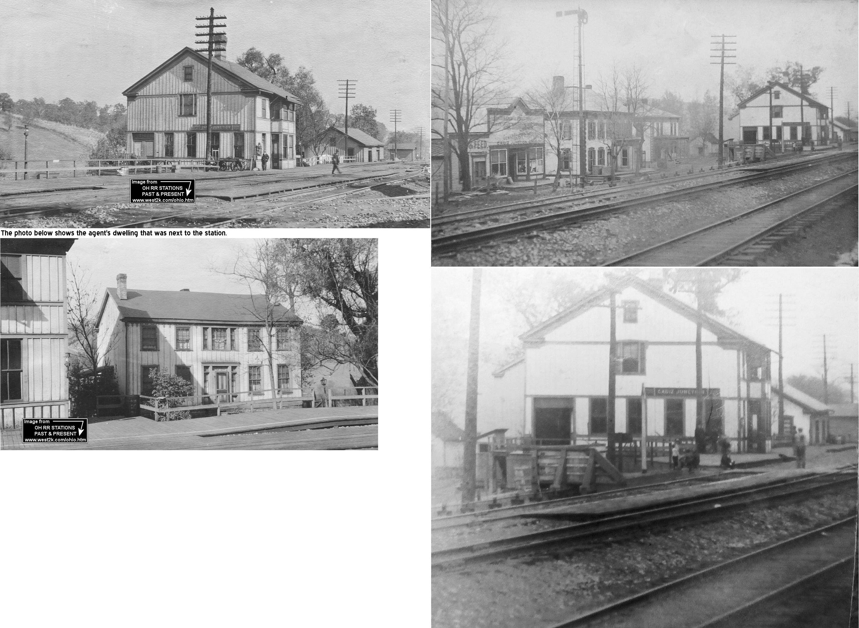
Cadiz Junction (Means) |
|
The original station here was built in 1857 and rebuilt in 1884. There was an agent's dwelling next to the station. This was the northern terminus of the Cadiz Branch. As of 2005 the old pump and power house still stood at the site. | ||||||
| Cadiz Junction | |
According to the 1916 PRR valuation records, a freight station was built here in 1875. | ||||||
|
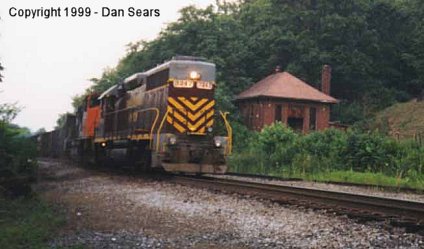
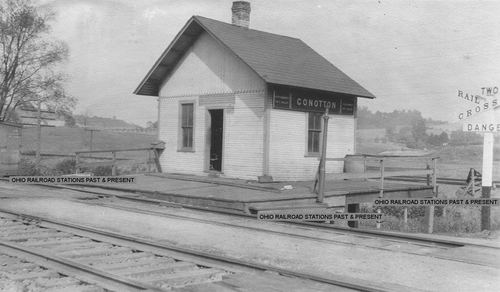
Conotton (Mastersville) |
|
According to the 1916 PRR valuation records, this station was built in 1876. | ||||||
| Conotton | |
|||||||
| Conway | |
This station was on the 8-mile Cadiz Branch. The stations on that branch in order from north to south were Cadiz Junction, Copeton, Folks (a.k.a. Halls Folks), Conway, Wykega, Loofborrows, and Cadiz. On the 1923 PRR List of Stations and Sidings, the stations listed in order were called: Cadiz Junction, Copeton, Folks, Woolton, Narva, Keys, Wykega, Warford, Lando, Rygate, and Cadiz. | ||||||
| Copeton |
|
This station was on the 8-mile Cadiz Branch. The stations on that branch in order from north to south were Cadiz Junction, Copeton, Folks (a.k.a. Halls Folks), Conway, Wykega, Loofborrows, and Cadiz. On the 1923 PRR List of Stations and Sidings, the stations listed in order were called: Cadiz Junction, Copeton, Folks, Woolton, Narva, Keys, Wykega, Warford, Lando, Rygate, and Cadiz. | ||||||
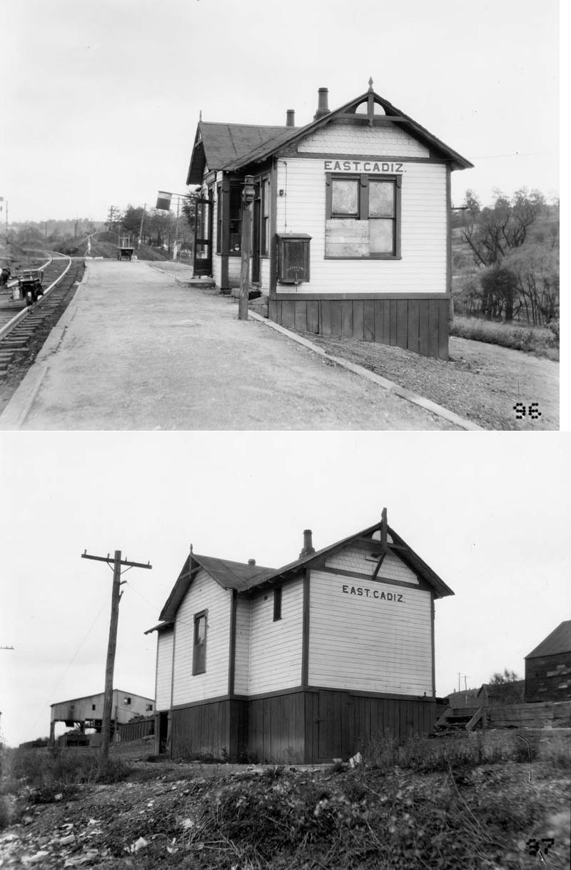
| East Cadiz |
|
|||||||
| Fisher |
|
This station was about a mile from the west portal of Tunnel No. 10. It is shown on the 1923 PRR List of Stations & Sidings. "KN" tower was near the station here. | ||||||
|
Folks (Halls Folks) |
|
This station was on the 8-mile Cadiz Branch. The stations on that branch in order from north to south were Cadiz Junction, Copeton, Folks (a.k.a. Halls Folks), Conway, Wykega, Loofborrows, and Cadiz. On the 1923 PRR List of Stations and Sidings, the stations listed in order were called: Cadiz Junction, Copeton, Folks, Woolton, Narva, Keys, Wykega, Warford, Lando, Rygate, and Cadiz. | ||||||
|
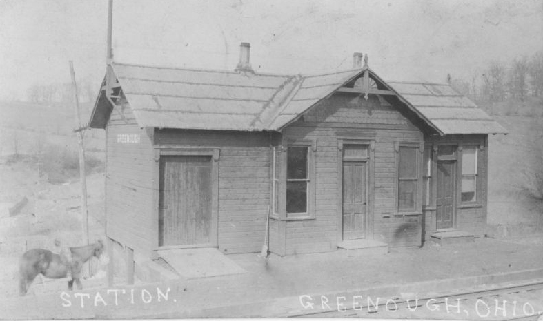
Greenough (Cadiz Junction) |
|
Origanlly called "Greenough," this station was later renamed to "Cadiz Junction." | ||||||
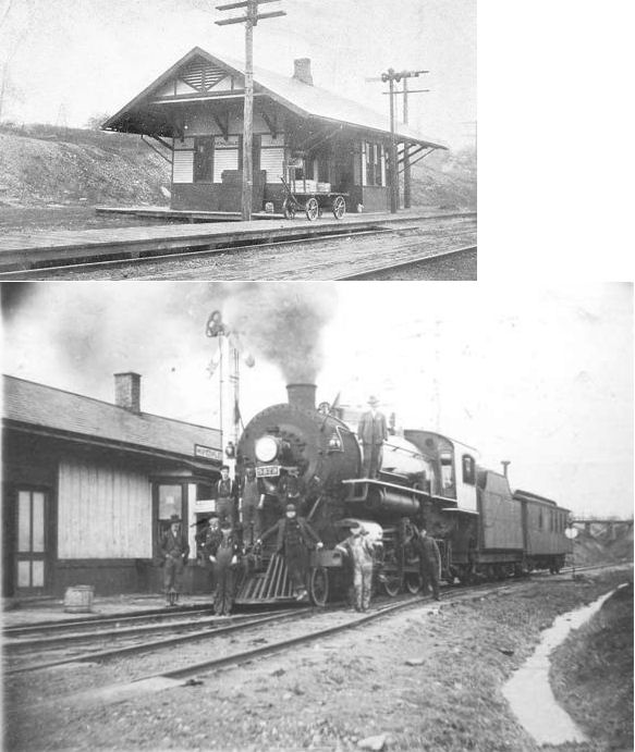
| Hopedale |
 |
|||||||
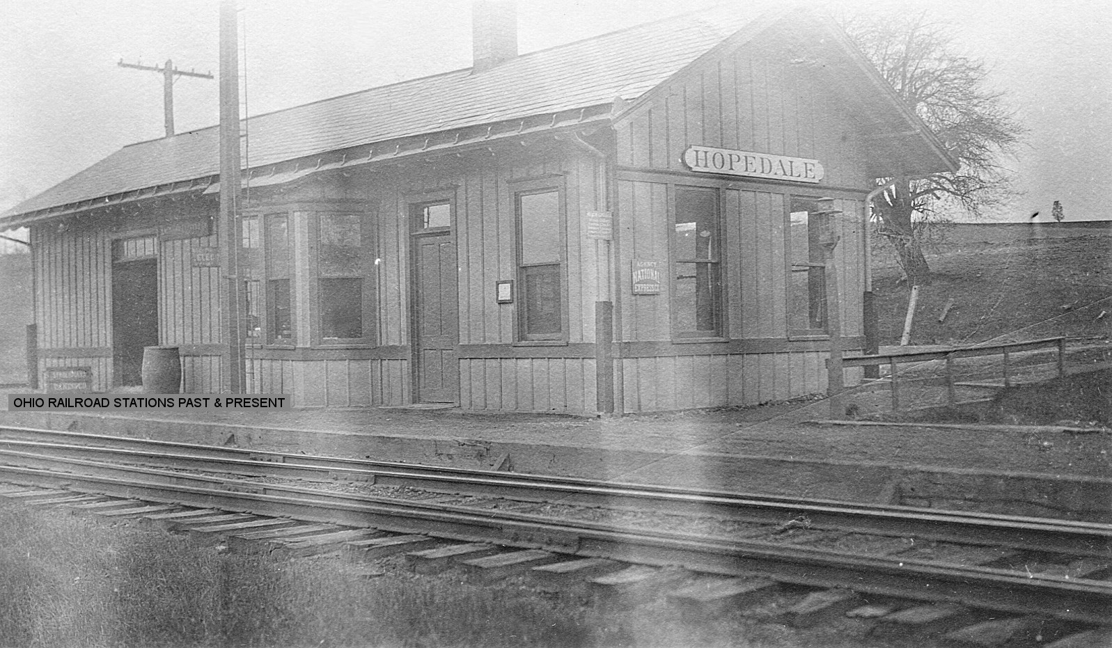
| Hopedale | |
According to NYC valuation records, this station was built in 1902 and measured 16'x56'. It was at the SE end of Penn Central Road at GPS: 40.323969, -80.885982. | ||||||
| Jewett | |
Prior to 1882 this station was known as Fairview on the PCC&St.L. | ||||||
| Jewett | AND |
This station, built in 1888 by the W&LE, sat on the south side of Water Street between Cadiz Street and W&LE Street. There was a wooden incline or stairs leading up to a platform along the PCC&St.L tracks. | ||||||
| Kenwood |
|
This station was along Unionvale-Kenwood Road to the NW of Springdale Hill Road. | ||||||
| Keys |
|
This station was on the 8-mile Cadiz Branch. The stations on that branch in order from north to south were Cadiz Junction, Copeton, Folks (a.k.a. Halls Folks), Conway, Wykega, Loofborrows, and Cadiz. On the 1923 PRR List of Stations and Sidings, the stations listed in order were called: Cadiz Junction, Copeton, Folks, Woolton, Narva, Keys, Wykega, Warford, Lando, Rygate, and Cadiz. | ||||||
| Lando |
|
This station was on the 8-mile Cadiz Branch. The stations on that branch in order from north to south were Cadiz Junction, Copeton, Folks (a.k.a. Halls Folks), Conway, Wykega, Loofborrows, and Cadiz. On the 1923 PRR List of Stations and Sidings, the stations listed in order were called: Cadiz Junction, Copeton, Folks, Woolton, Narva, Keys, Wykega, Warford, Lando, Rygate, and Cadiz. | ||||||
| Loofborrows |
|
This station was on the 8-mile Cadiz Branch. The stations on that branch in order from north to south were Cadiz Junction, Copeton, Folks (a.k.a. Halls Folks), Conway, Wykega, Loofborrows, and Cadiz. On the 1923 PRR List of Stations and Sidings, the stations listed in order were called: Cadiz Junction, Copeton, Folks, Woolton, Narva, Keys, Wykega, Warford, Lando, Rygate, and Cadiz. | ||||||
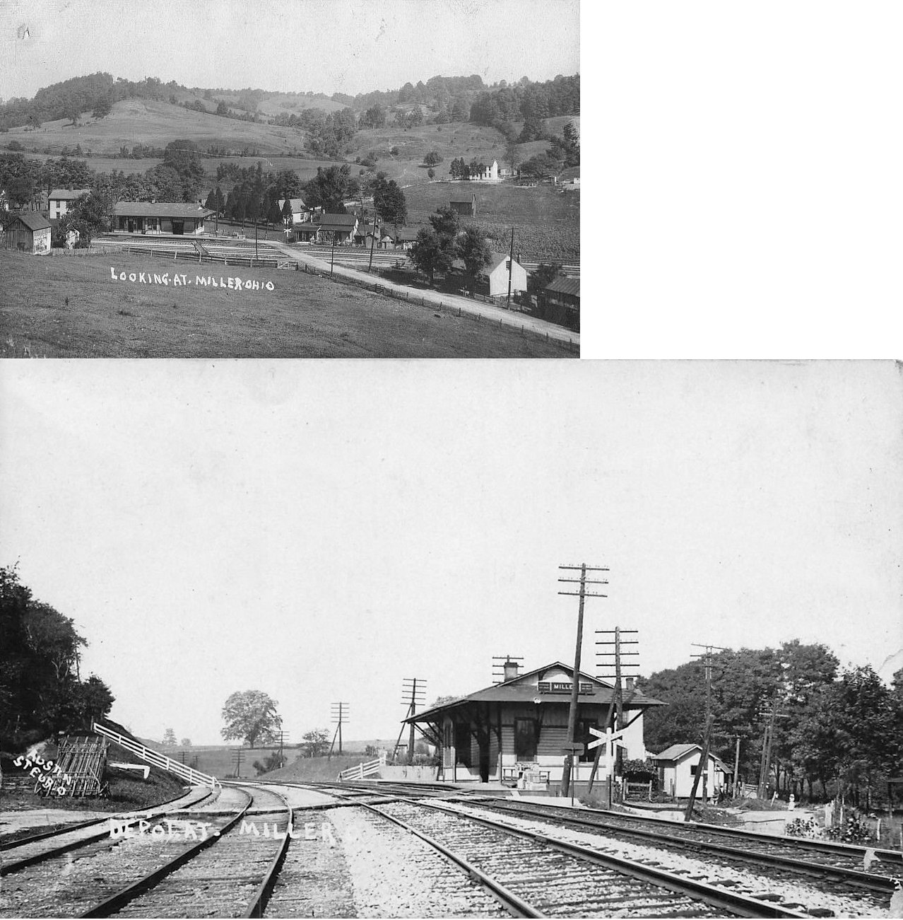
| Miller |
|
This station was on the west side of Miller Station Road at GPS: 40.359877, -80.900023. According to PRR valuation records, it was built in 1888. | ||||||
| Narva |
|
This station was on the 8-mile Cadiz Branch. The stations on that branch in order from north to south were Cadiz Junction, Copeton, Folks (a.k.a. Halls Folks), Conway, Wykega, Loofborrows, and Cadiz. On the 1923 PRR List of Stations and Sidings, the stations listed in order were called: Cadiz Junction, Copeton, Folks, Woolton, Narva, Keys, Wykega, Warford, Lando, Rygate, and Cadiz. | ||||||
| Panhandle (PH Crossing) |
|
There were two shelters at this location. One was a 10'x12' shelter that was built in 1905, and the other was a 9'x35' converted carbody. | ||||||
|
Philadelphia Road (Station 15) |
|
This station was on the north side of the tracks where U.S. 250 used to cross (it has since been rerouted to the west and the portion south of the tracks renamed Sale Barn Road). It was at GPS: 40.390223, -81.259859 just south of SR-151 (Patterson Road). The new underpass eliminating the original grade crossing there was constructed in 1940-41. There were lots of accidents at the original grade crossing, including one which took the life of the Governor of Indiana, Frank Hanley, in 1920. William Leo Cummings was the station agent here in the early 1900s through 1920 (not sure how long after that). According to PRR valuation records, this station was built in 1886. The station appear to have undergone a remodel and extention at some point. | ||||||
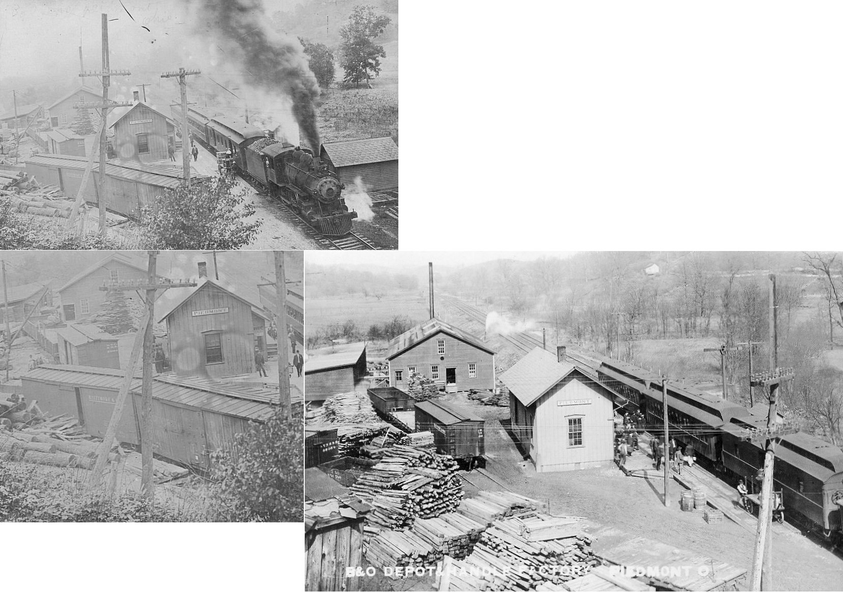
| Piedmont |  |
|||||||
| Pittsburgh Junction |
|
|||||||
| Rygate |
|
This station was on the 8-mile Cadiz Branch. The stations on that branch in order from north to south were Cadiz Junction, Copeton, Folks (a.k.a. Halls Folks), Conway, Wykega, Loofborrows, and Cadiz. On the 1923 PRR List of Stations and Sidings, the stations listed in order were called: Cadiz Junction, Copeton, Folks, Woolton, Narva, Keys, Wykega, Warford, Lando, Rygate, and Cadiz. A station is shown here on the 1923 PRR List of Stations & Sidings on the Cadiz Branch. It was only .6 mile from the Cadiz station. | ||||||
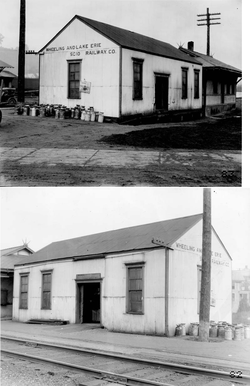
| Scio (New Market) |
|
Scio was known as New Market when the railroad first came through town as the Steubenville & Indiana. "New Market" is shown for the station on timetables of that era. | ||||||
| Scio | |
This station was on the west side of Main Street (SR 646) just north of College Street. According to PRR valuation records, this station was built in 1886. | ||||||
| Scio |
|
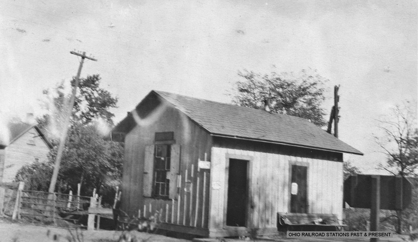
A shown in the photo, the freight station was next to the passenger station at its original location. The building that still exists at GPS: 40.393188, -81.085208 seems to have the same profile as the frieght station. Could that be it? Does anyone know for sure? | ||||||
| Swanson |
|
This station was between Germano (Apex) and Panhandle. It was mainly a flag stop, but one train per day had a regular stop there according to the 1913 LEA&W timetable. Not sure if there was a station building here or just a shelter or platform. | ||||||
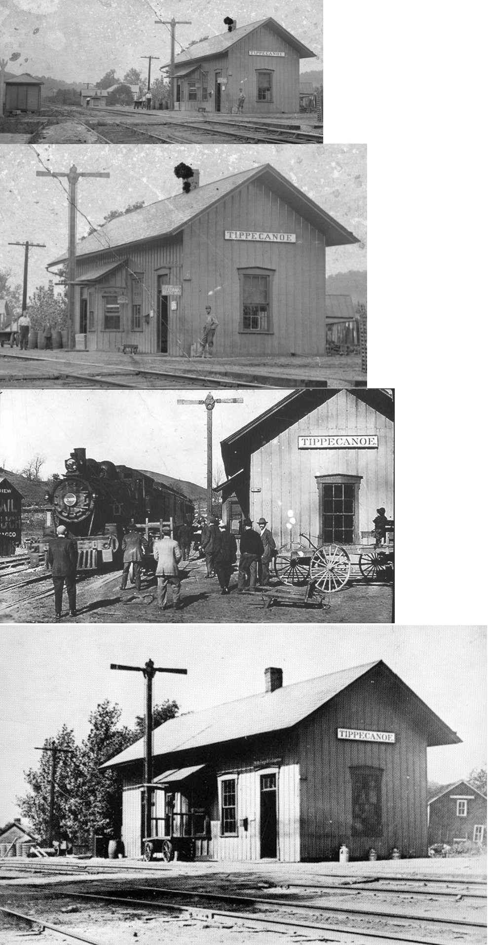
| Tippecanoe | |
Built around 1879 when the Cleveland, Tuscarawas Valley & Wheeling (later part of the B&O) first came through the area. It was torn down in the 1940s. | ||||||
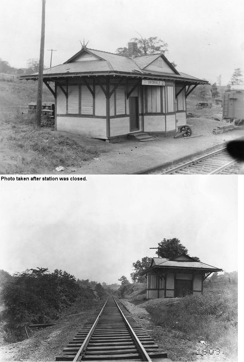
| Unionvale |
|
|||||||
| Warford |
|
This station was on the 8-mile Cadiz Branch. The stations on that branch in order from north to south were Cadiz Junction, Copeton, Folks (a.k.a. Halls Folks), Conway, Wykega, Loofborrows, and Cadiz. On the 1923 PRR List of Stations and Sidings, the stations listed in order were called: Cadiz Junction, Copeton, Folks, Woolton, Narva, Keys, Wykega, Warford, Lando, Rygate, and Cadiz. | ||||||
| Woolton |
|
This station was on the 8-mile Cadiz Branch. The stations on that branch in order from north to south were Cadiz Junction, Copeton, Folks (a.k.a. Halls Folks), Conway, Wykega, Loofborrows, and Cadiz. On the 1923 PRR List of Stations and Sidings, the stations listed in order were called: Cadiz Junction, Copeton, Folks, Woolton, Narva, Keys, Wykega, Warford, Lando, Rygate, and Cadiz. | ||||||
| Wykega |
|
According to PRR valuation records, this station was built in 1902. This station was on the 8-mile Cadiz Branch. The stations on that branch in order from north to south were Cadiz Junction, Copeton, Folks (a.k.a. Halls Folks), Conway, Wykega, Loofborrows, and Cadiz. On the 1923 PRR List of Stations and Sidings, the stations listed in order were called: Cadiz Junction, Copeton, Folks, Woolton, Narva, Keys, Wykega, Warford, Lando, Rygate, and Cadiz. | ||||||
| 1898 HARRISON COUNTY RAILROAD MAP | ||||||||
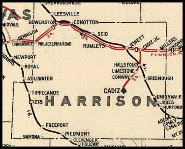 |
||||||||
|
Notes About Existing Stations... Freeport (B&O) - Can anyone confirm if this is still standing in the park? Scio (W&LE) - This used to sit right across the tracks from the old PRR station. It has since been moved and the PRR station demolished. |
||||||||