 COUNTY COUNTY
|
|
||||||||
| EXISTING STATIONS | ||||||||
|---|---|---|---|---|---|---|---|---|
| Station Name |
Original Railroad | Current Location |
Type | Current Use |
Date Built |
Track Status |
Building Material |
More Info |
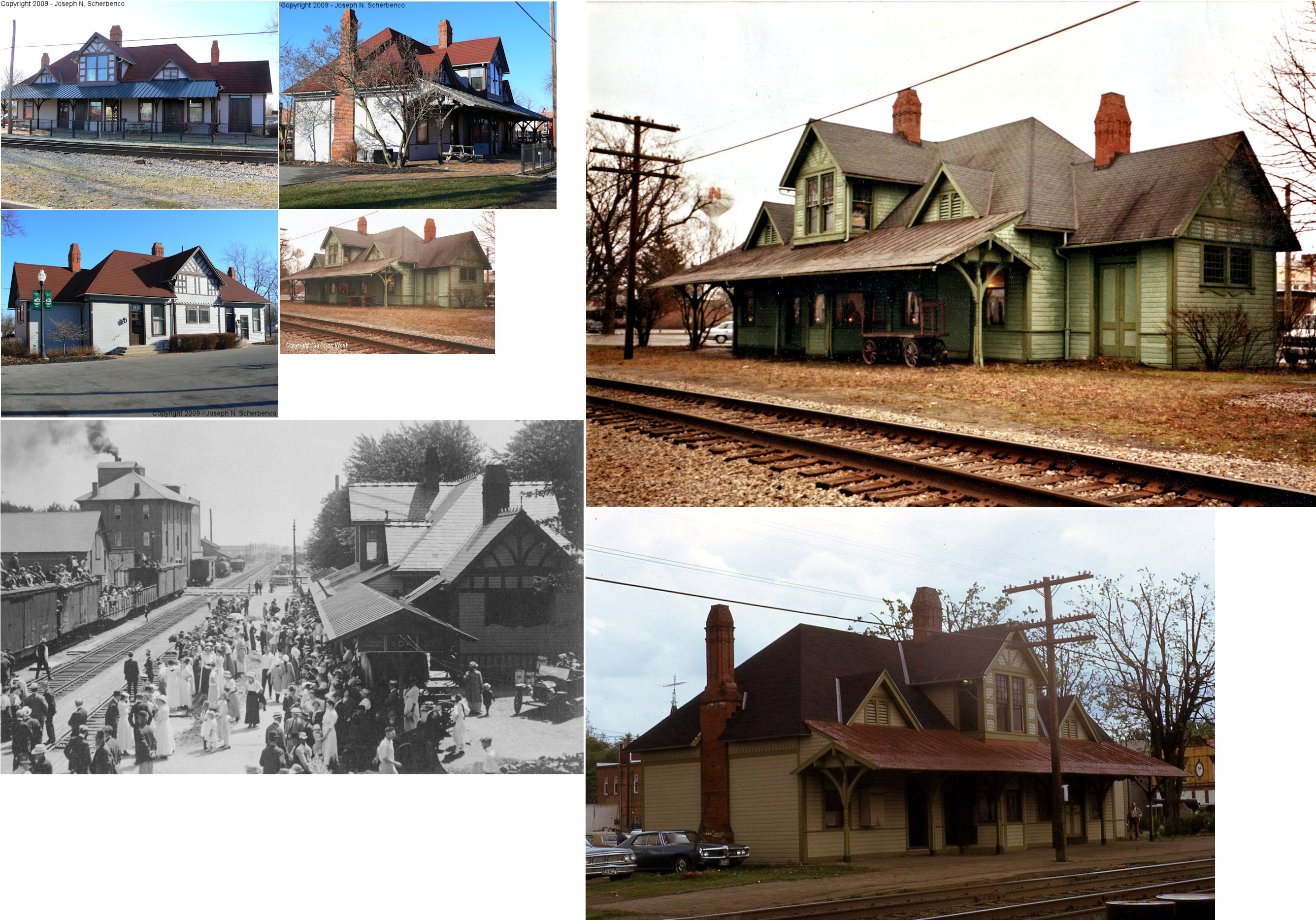
| Ada |
 |
112 Central Street (GPS: 40.770654,-83.822481) |
P | Society | 1887 | In Use | Wood |
|
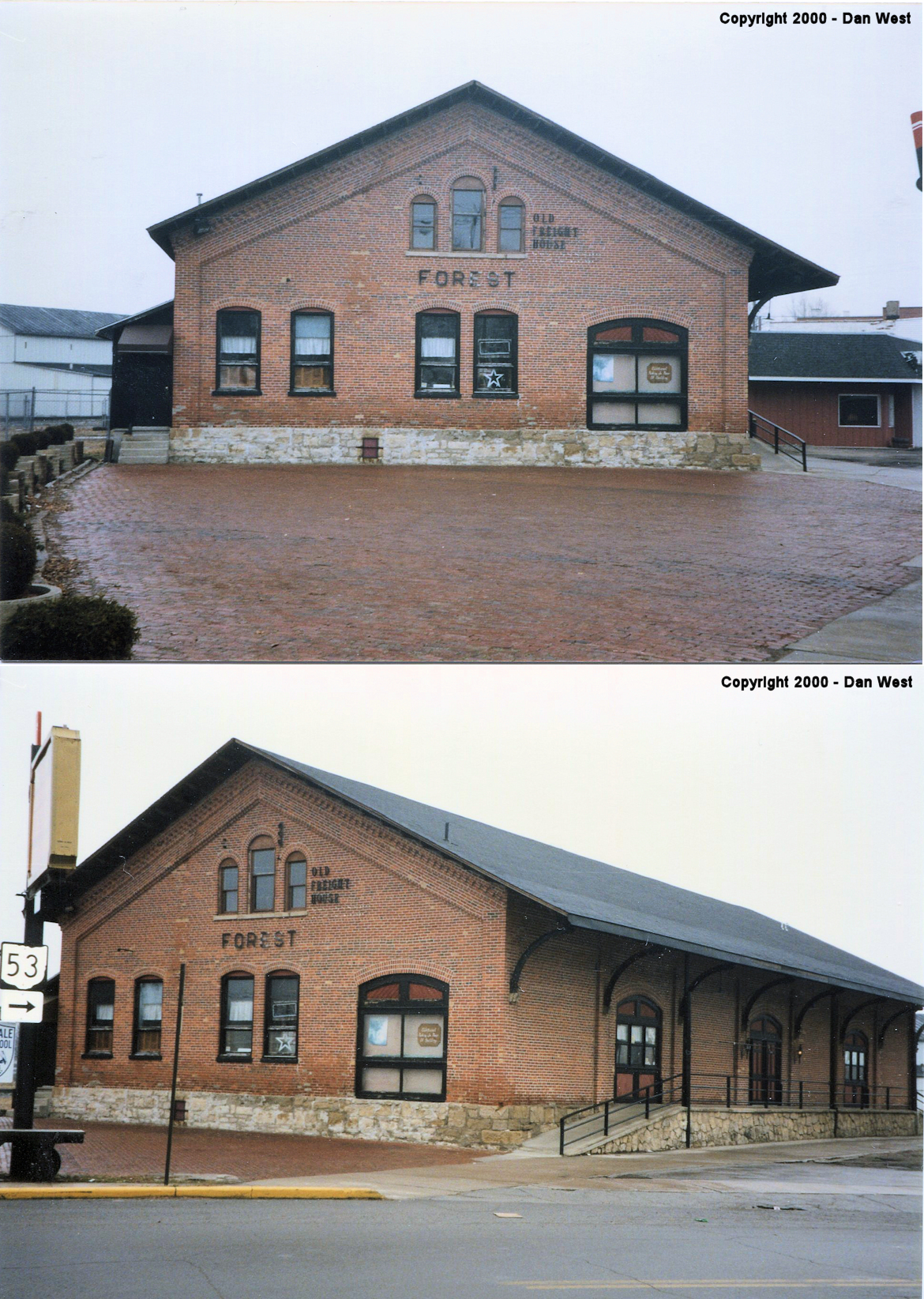
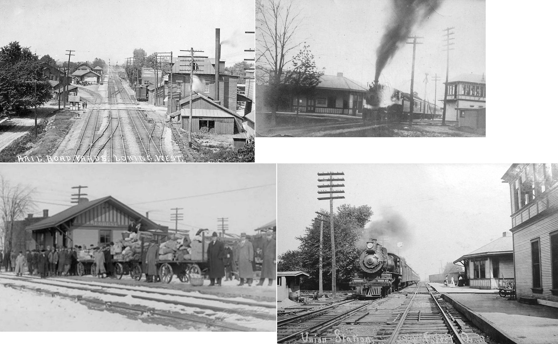
| Forest | AND  |
102 West Lima Street (SR-37) (GPS: 40.802083,-83.511983) |
F | Library | 1887 | In Use | Brick | |
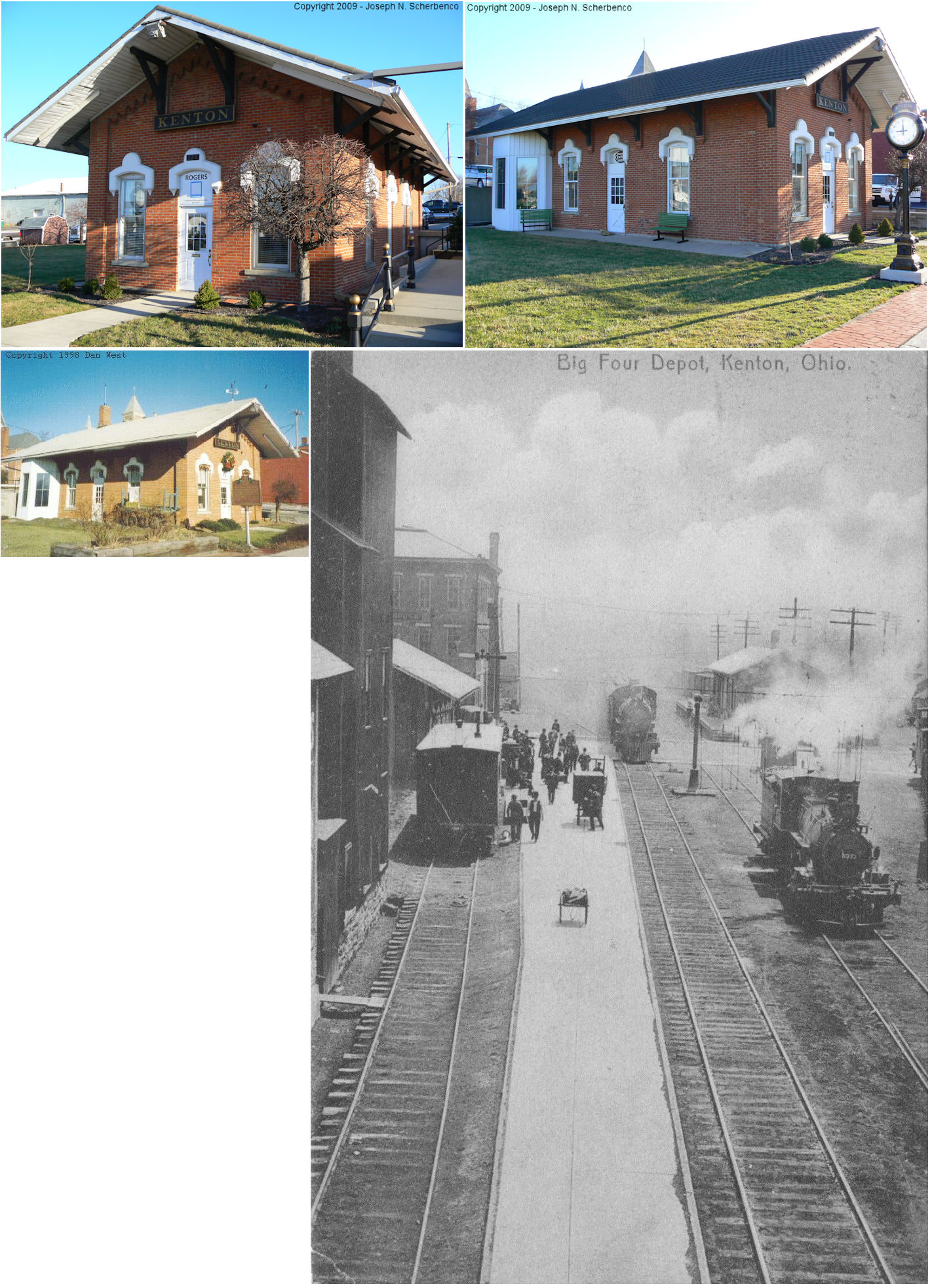
| Kenton |  |
322 West Franklin Street (GPS: 40.647472,-83.611445) |
P | Business | 1882 | Gone | Brick | |
| STATIONS OF THE PAST | ||||||||
| Station Name |
Original Railroad |
Notes | ||||||
| Ada | |
According to old maps, the old freight
station sat on the southeast corner of where Johnson Street crosses the
tracks. It sat directly across the tracks from the N.R. Park Grain
Elevator and Warehouse. This was most likely the first passenger
station, built around 1854, which was later converted to a freight station
when the new station was built in 1887. (GPS: 40.770853,-83.821314) Ada was first known as Johnstown, but renamed after confusion with the other Johnstown, Ohio in Licking County. |
||||||
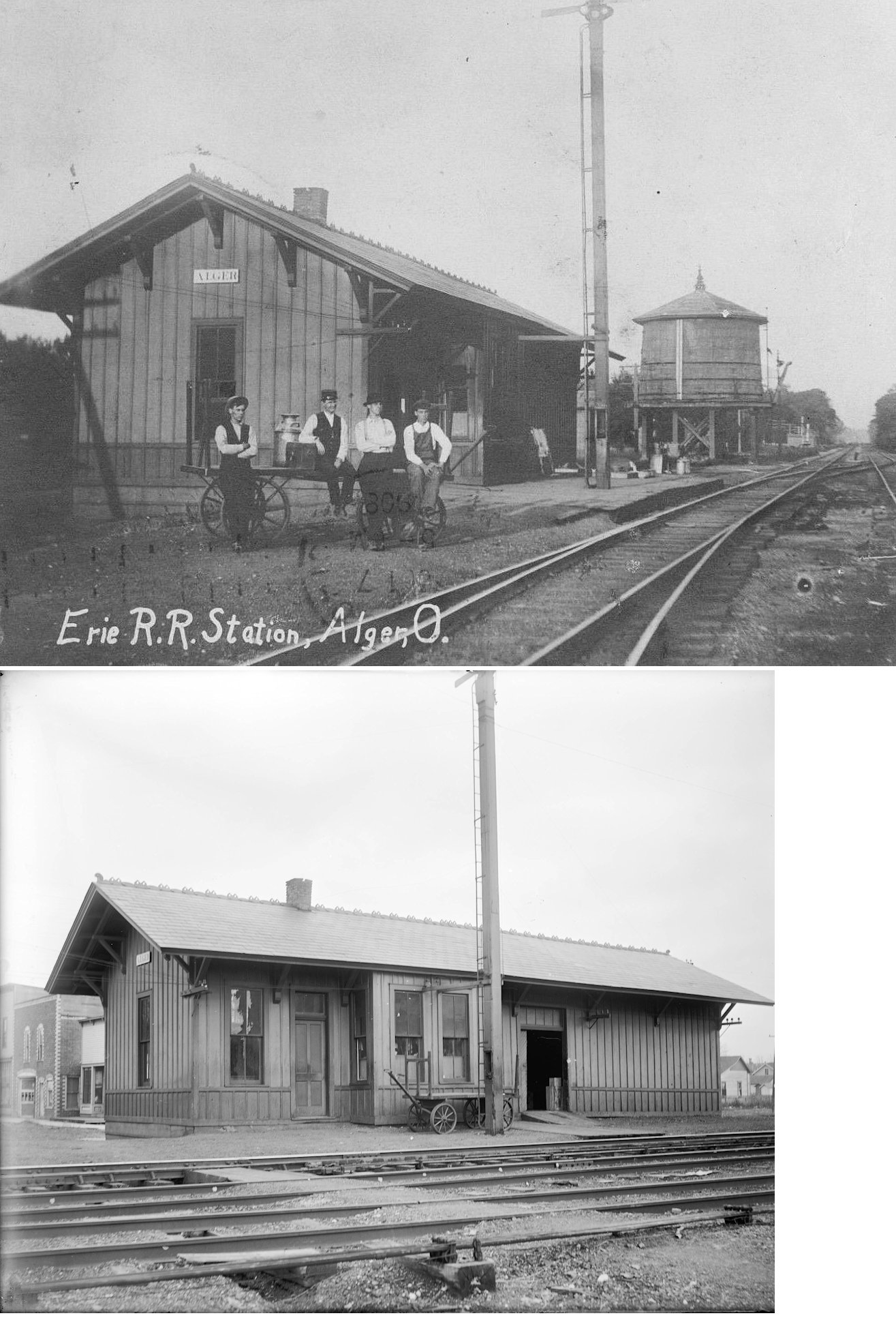
| Alger (Preston) |
 |
Built in 1883, the station was moved a short distance in 1928, and demolished in the early 1970s. Its post-1928 location was between Main and Front Streets at GPS: 40.705430, -83.842910. The original station here was called "Preston" and is listed as that on the 1886 Chicago & Atlantic local timetable. | ||||||
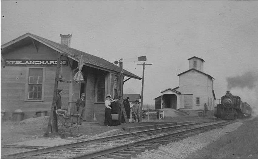
| Blanchard |  |
This station was likely on the west side of the tracks. | ||||||
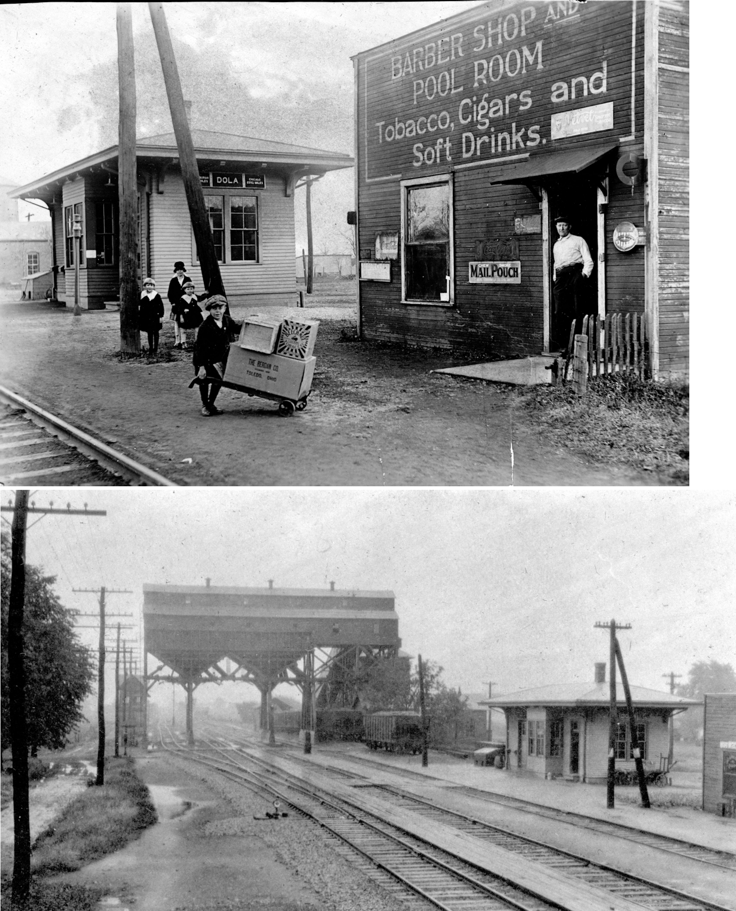
| Dola | |
This town was formerly called North Washington before becoming Dola in 1907. The name was changed to avoid confusion with the town of New Washington for postal purposes. | ||||||
| Dudley | |
Dudley was between Hepburn and Kenton. | ||||||
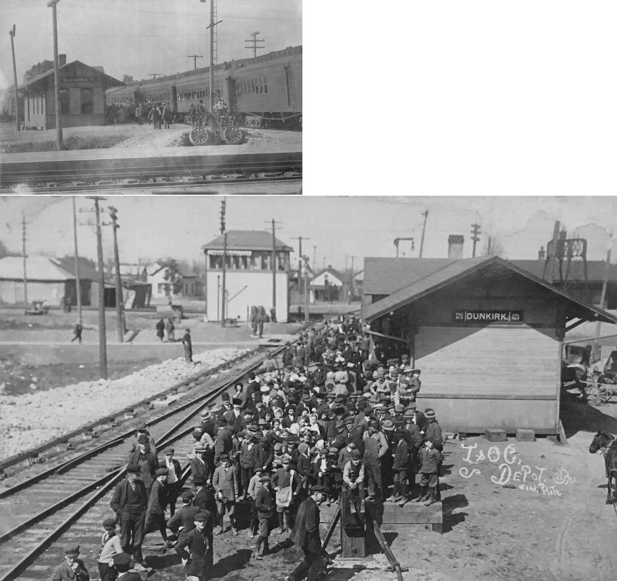
| Dunkirk | |
The passenger station was in the northeast quadrant of the crossing with the T&OC. The freight station was on the east side of Main Street. The first PFt.W&C train came through town in April of 1864. A new station was built here in 1886. | ||||||
| Dunkirk | |
Anyone know where the passenger station sat? I believe it was on South Railroad Street south of Washington St. The T&OC had a freight station in the southeast quadrant of the crossing with the PRR and this building had frontage on West Washington Street. | ||||||
|
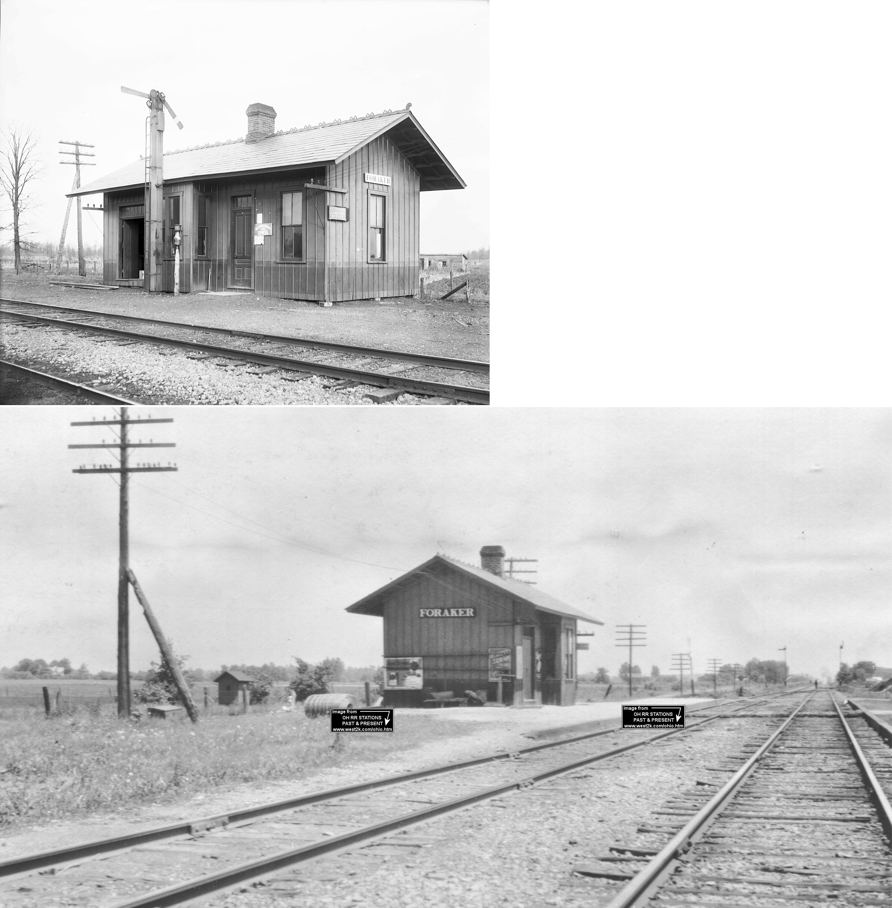
Foraker (Oakland) |
|
Town was originally called "Oakland" and is listed as that on the 1886 Chicago & Atlantic local timetable. | ||||||
| Forest | AND |
Forest's union station sat across the transfer track from the location of the existing freight station on Lima Street. The station sat on the southeast corner of the diamond with platforms along both RRs. Across the Big 4 tracks was the interlocking tower. (GPS: 40.802288,-83.512182) | ||||||
| Forest | AND |
Maps from 1879 show a freight house at the same location as the 1887 freight house. At that time it was the only station in town. | ||||||
| Grants Station | |
Founded originally as a coaling station for the RR. | ||||||
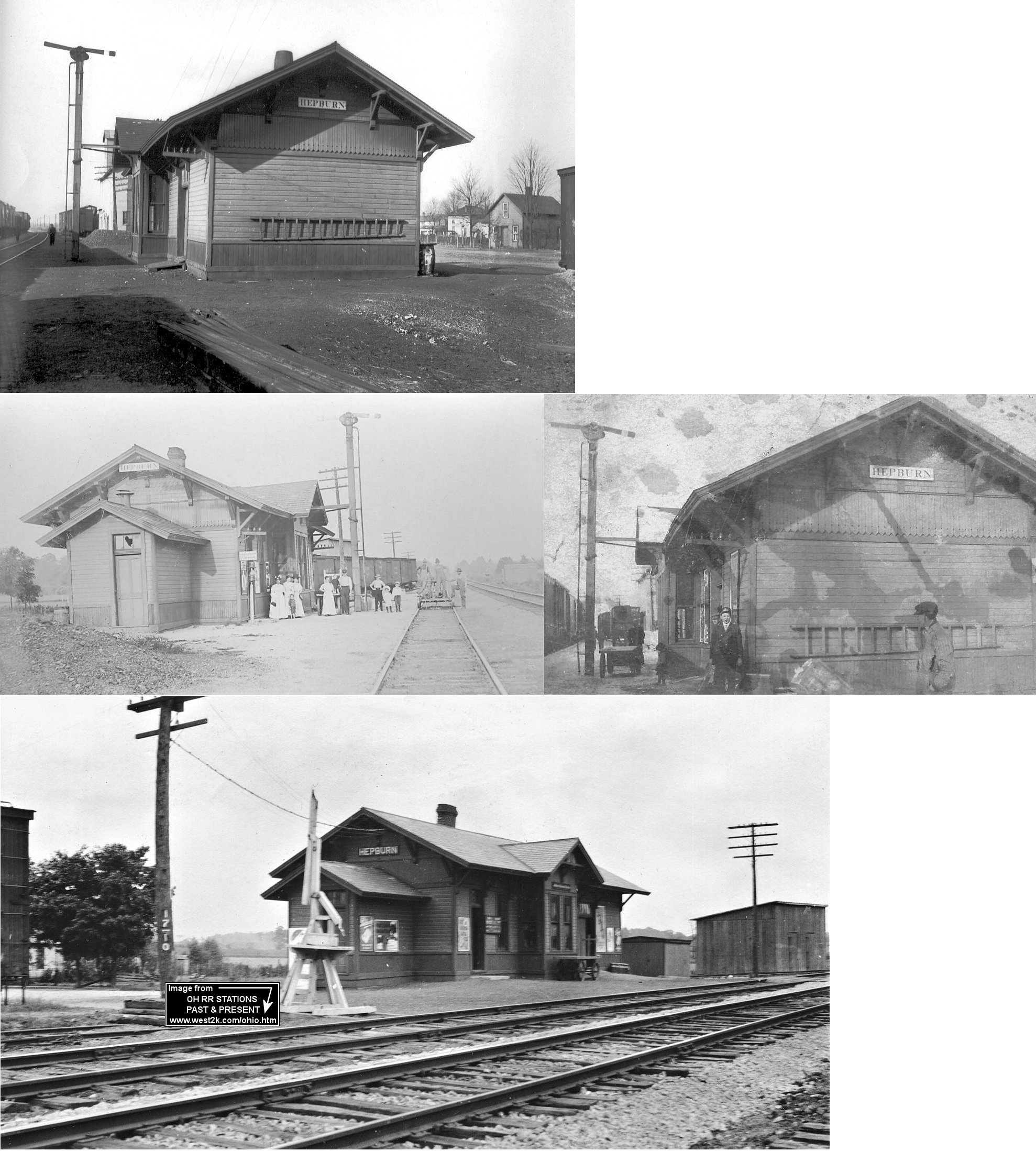
| Hepburn | |
Built in 1883 by the Chicago & Atlantic RR. | ||||||
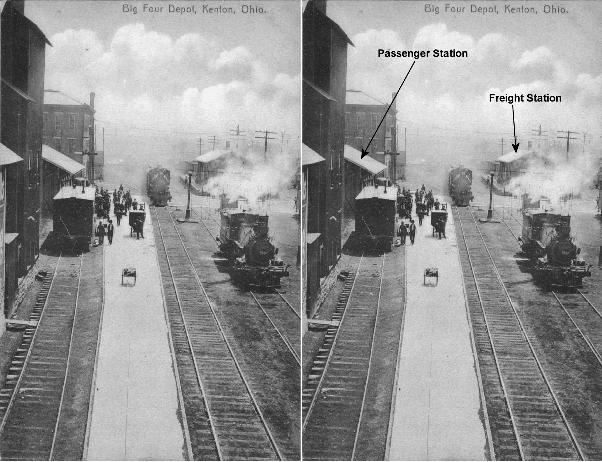
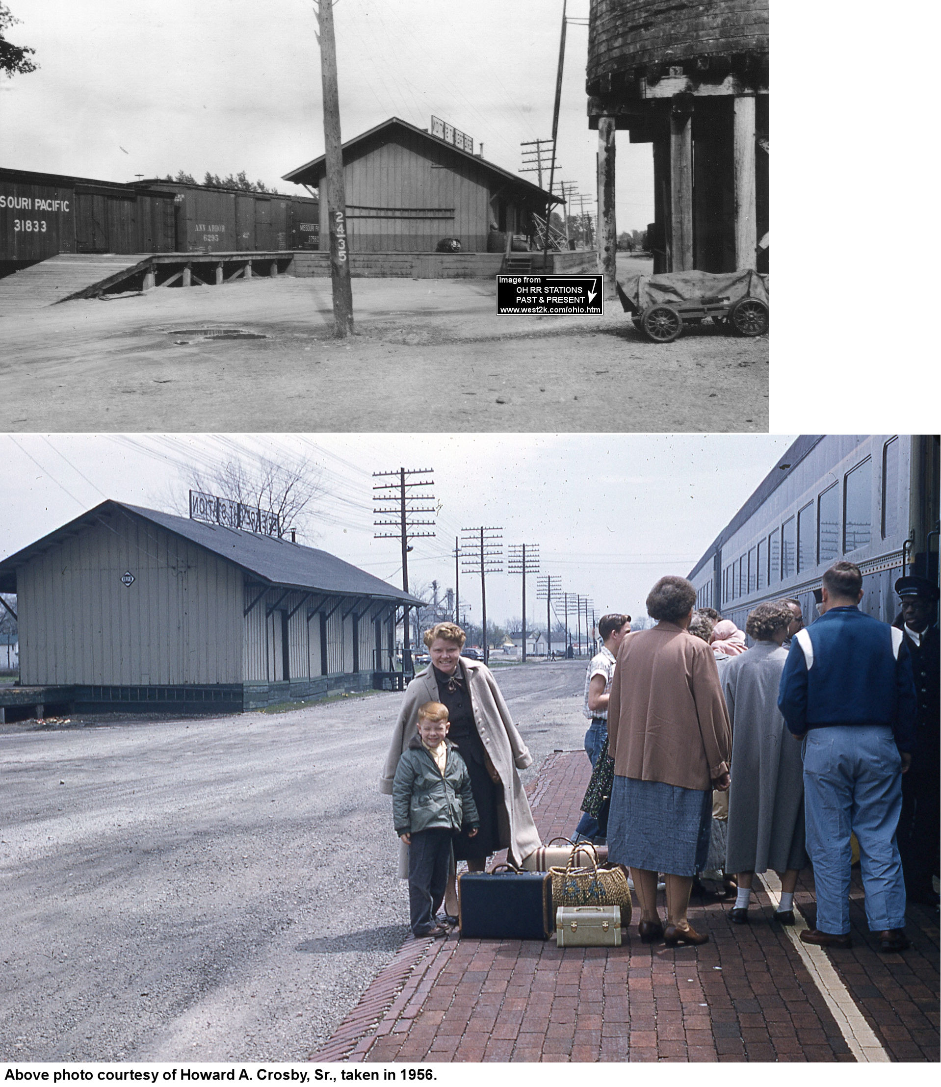
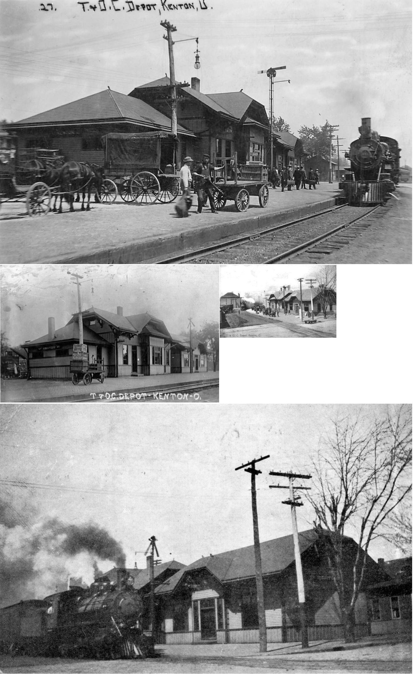
| Kenton |
|
The Big Four freight station was across the street (West Franklin) from the existing passenger station. It was on the west side of the tracks at GPS: 40.647123, -83.611768. | ||||||
| Kenton | |
The original Chicago & Erie station here burned down on June 25, 1898. | ||||||
| Kenton | |
This passenger station, built to replace the one listed above, was about 100 yards back from the road on the east side of Fountaine Street (U.S. 68) at GPS: 40.637692, -83.610740. The station was demolished in the early 1980s. | ||||||
| Kenton | |
The freight station was the west side of Steiner Avenue on the north side of the tracks at GPS: 40.637062, -83.608874. | ||||||
| Kenton |  |
The passenger station was located on the north side of West Decatur just west of South Main Street. The freight station was across the tracks just north of the river. This RR later became part of the T&OC. | ||||||
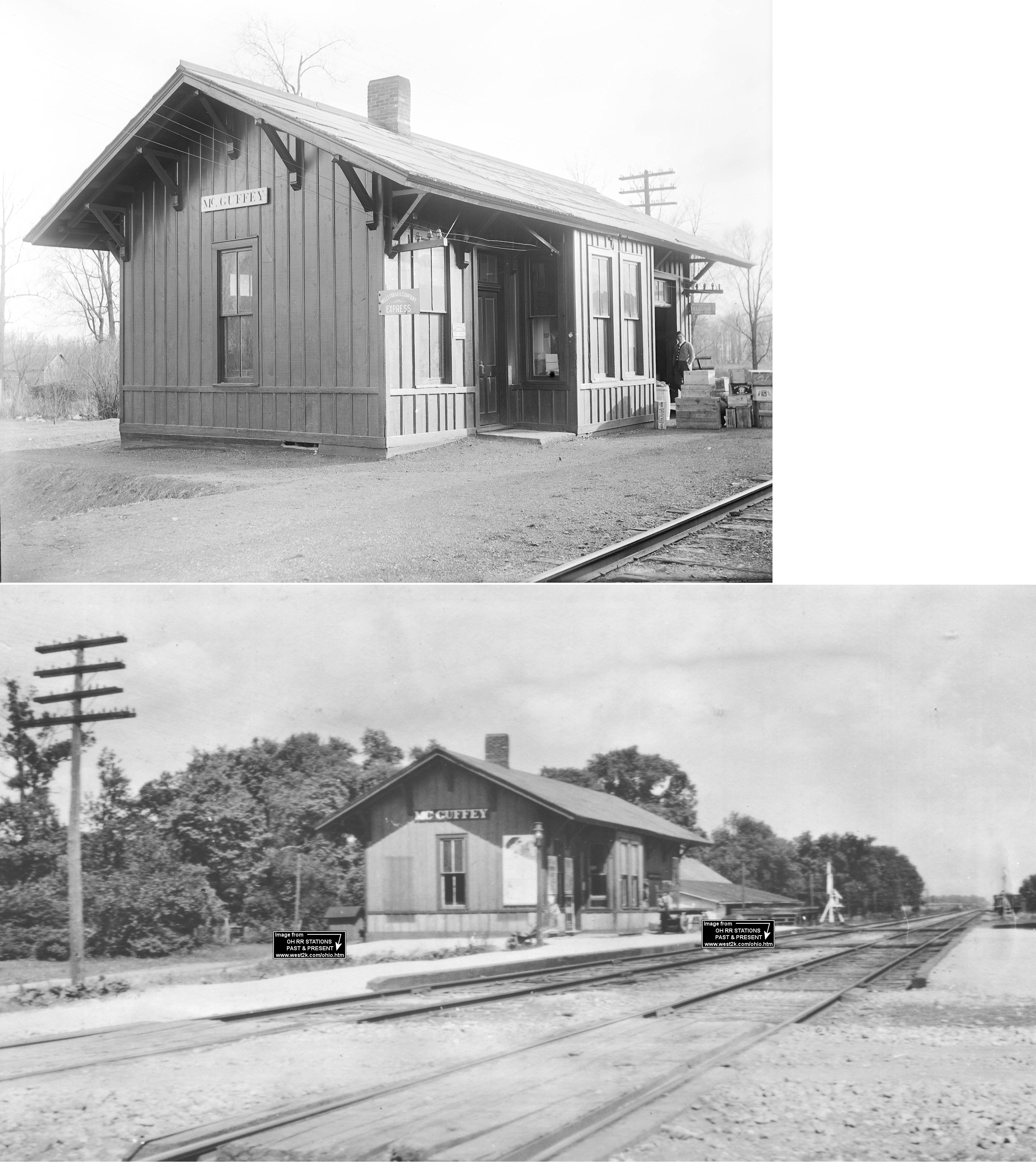
| McGuffey (Scioto) |
|
This station was on the east side of Courtright Street on the north side of the tracks at approximately GPS: 40.694542, -83.784982. It was torn down in 1969. This station was listed as "Scioto" on the 1886 Chicago & Atlantic local timetable. | ||||||
| McVitty | |
This town was established by the railroad as a shipping station for the Herzog Stone Quarry. | ||||||
| Mentzer (Buxton) |
|
|||||||
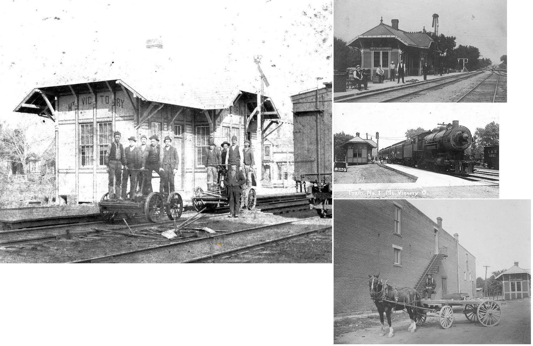
| Mount Victory | |
|||||||
| Patterson | |
Formery known as Petersburg and Sylvia, was named for Robert Patterson, secretary-treasurer of the Mad River and Lake Erie Railroad (a Big 4 predacessor). | ||||||
| Pfeiffer Station |
|
This may have been the same station as Dudley. | ||||||
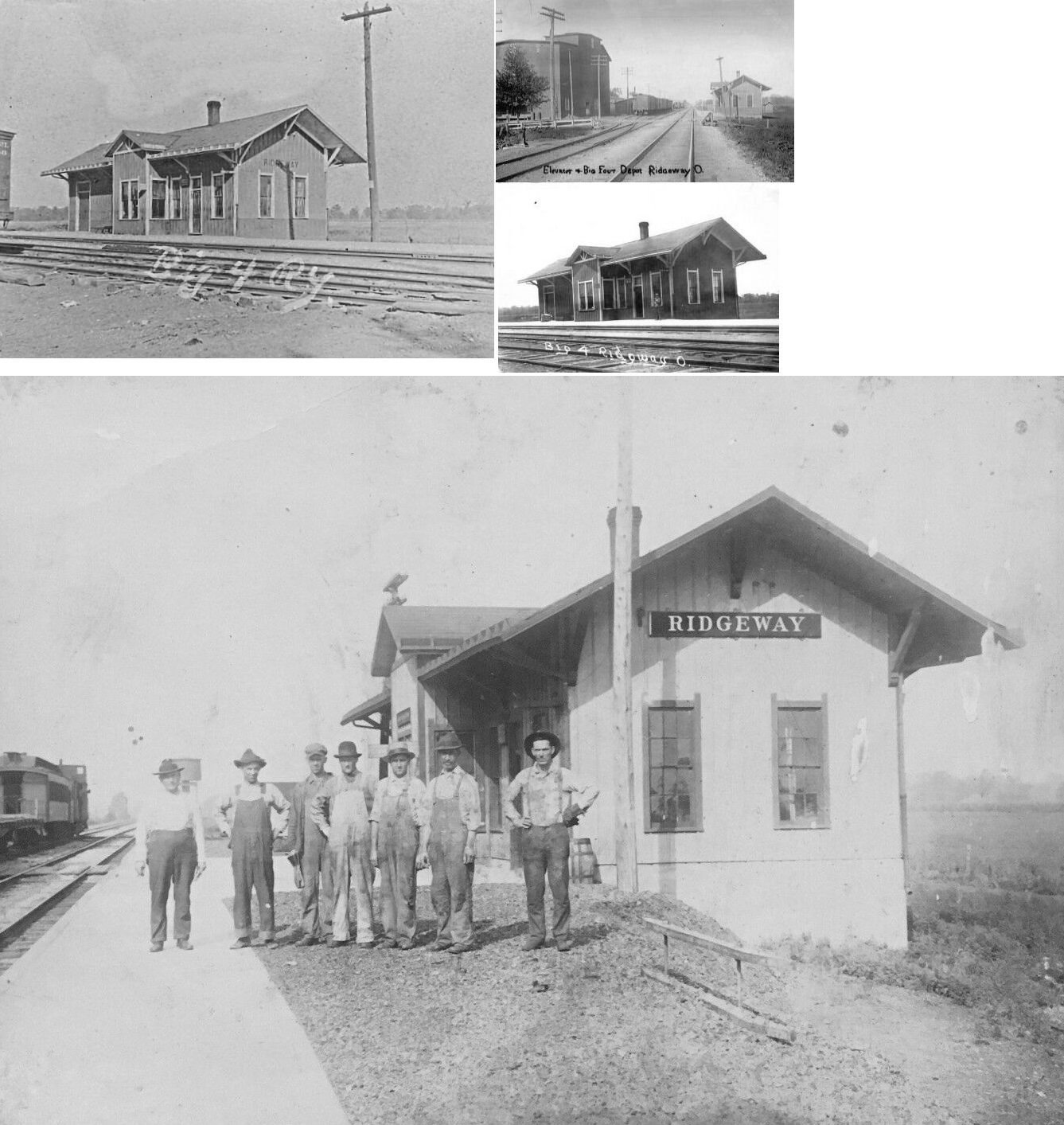
| Ridgeway | |
The first station here was on the west side of Main Street, on the north side of the tracks (according to maps from 1879) (GPS: 40.516222,-83.573636). I'm not sure if the station pictured is the first station or a later replacement. | ||||||
| Ridgeway | |
|||||||
| Sage | |
Sage was between Foraker and Kenton. | ||||||
| Silver Creek | |
Previously known as Hudson, Hudsonville and Turkey Ridge. | ||||||
| Yelverton | |
Was named in 1858 to honor John Yelverton, a large stockholder in the Mad River and Lake Erie Railroad. | ||||||
| 1898 HARDIN COUNTY RAILROAD MAP | ||||||||
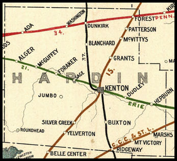 |
||||||||
|
Notes About Existing Stations... Ada (PFt.W&C) - This Victorian era station has been placed on the National Register of Historic Buildings. The downstairs of the station is being used by the City of Ada. The upstairs is used by the Ada Model Railroad Assoc. This organization meets on Saturdays in the upstairs of the depot. For further information on this organization, contact Cass Telles. |
||||||||