 COUNTY COUNTY
|
|
||||||||
| EXISTING STATIONS | ||||||||
|---|---|---|---|---|---|---|---|---|
| Station Name |
Original Railroad | Current Location |
Type | Current Use |
Date Built |
Track Status |
Building Material |
More Info |
| Arcadia |  |
Four miles east of Arcadia?? | C | House | 1881 | None | Wood |
|
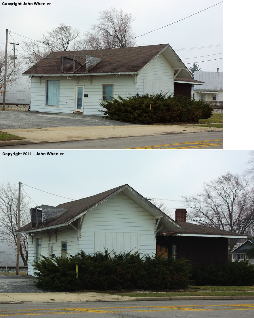
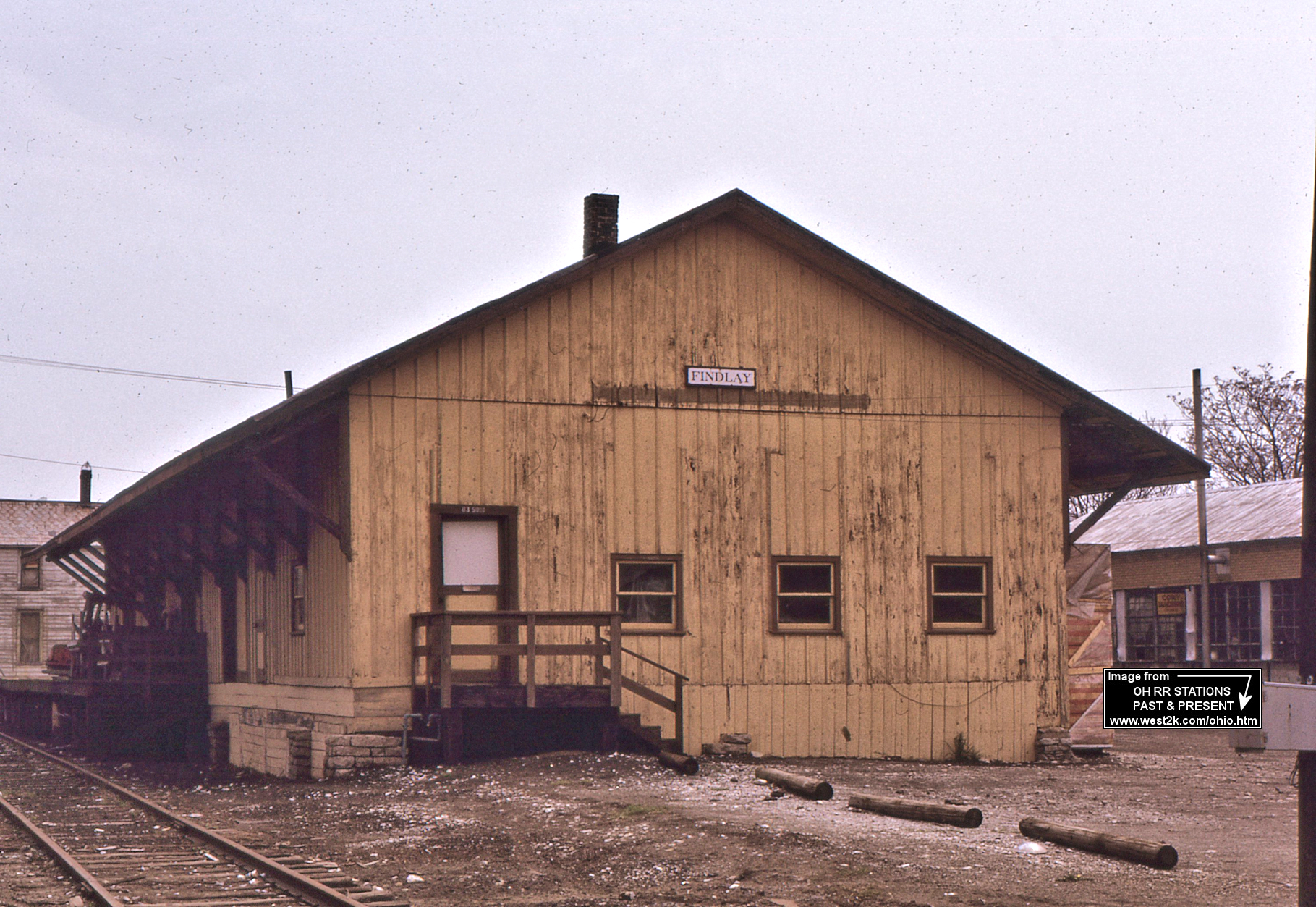
| Findlay |  |
Between West Main Cross Street and Putnam Street on the SE side of the tracks. (GPS: 41.039001, -83.657522) |
F | Vacant | ???? | In Use | Wood | |
| Findlay |  |
Crystal Avenue at Walnut Street (GPS: 41.047238,-83.646295) |
C | Vacant | ???? | None | Wood |
|
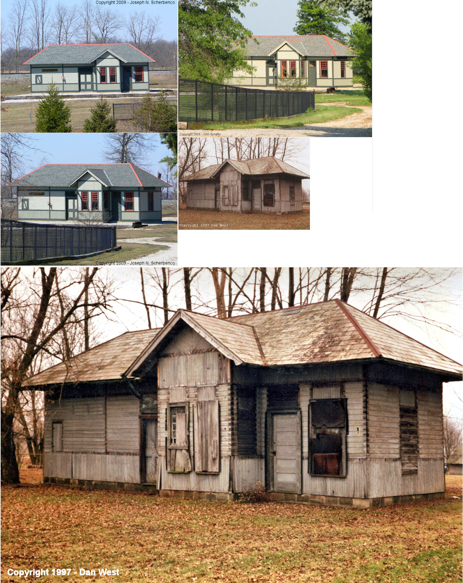
| Hatton (Millgrove) |
 |
NW Ohio Railroad Preservation grounds, 11600 County Rd. 99, Findlay | C | Museum | 1885 | None | Wood |
|
| Huber Station |  |
11750 Township Road 190 (GPS: 40.995844, -83.535669) |
P | Residence | ???? | Gone | Wood |
|
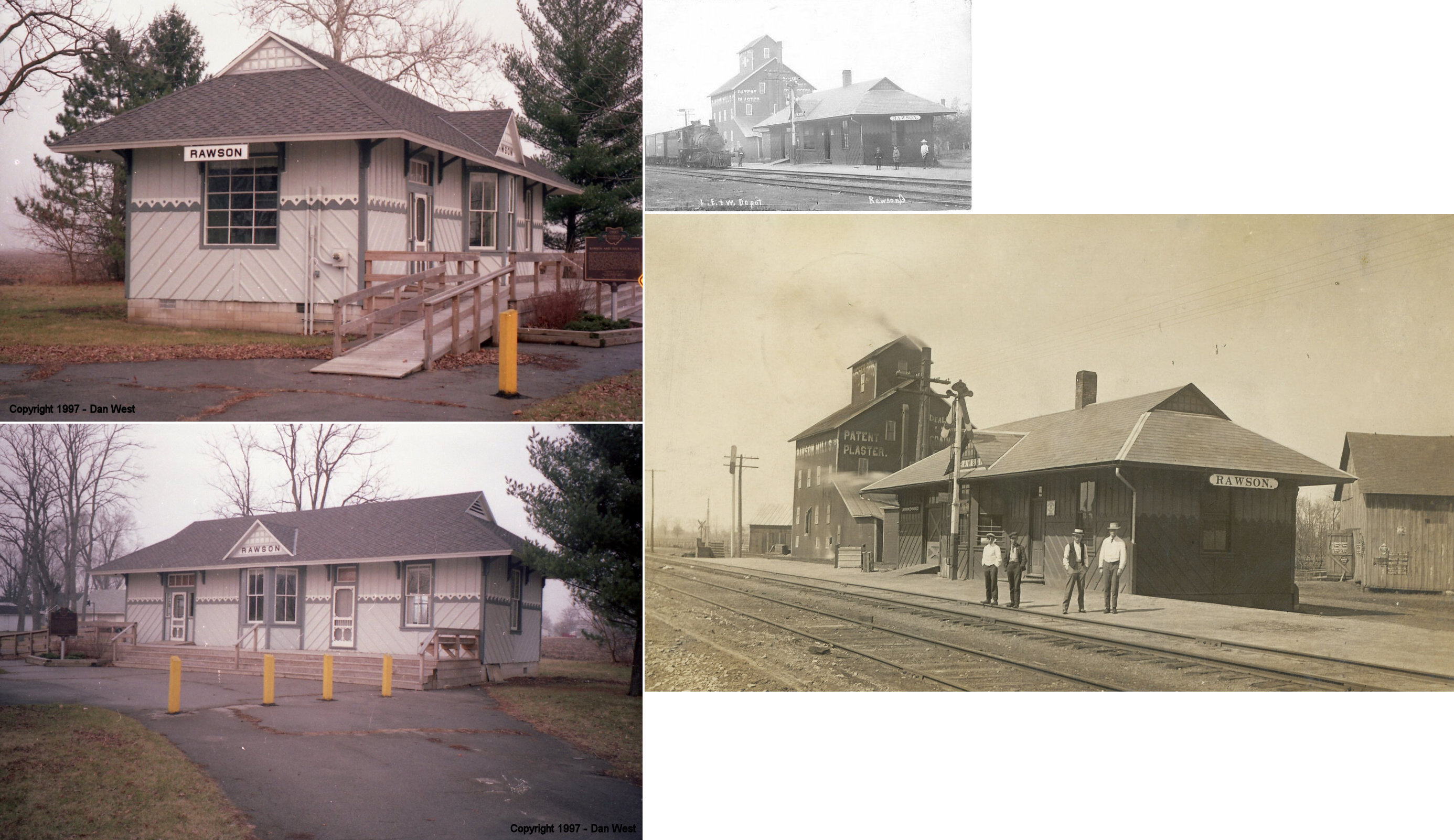
| Rawson | |
Village Park in SE part of town (off Park Street) (GPS: 40.953261,-83.783557). | P | Civic | 1898 | None | Wood |
|
| Williamstown | |
Bus. Rt. 25A about 5 miles south of Wapakoneta and north of Botkins (Auglaize County). | P | Private | ???? | None | Wood |
|
| STATIONS OF THE PAST | ||||||||
| Station Name |
Original Railroad |
Notes | ||||||
| Arcadia |
AND |
The first station here may have been a joint station
between the LE&L (Lake Erie & Louisville) and the C&A (Chicago &
Atlantic). It was on the west side of Main Street where
the tracks used to cross when the NKP line ran straight east/west through
town. It was at GPS:
41.112288, -83.513030. This can be seen on the 1875 map. Later, the
two RRs had seperate stations. The C&A RR was graded, and even had ties laid but was never built, it's shown on the 1875 map because it was still assumed that it would be constructed. The grade east from Arcadia through Tiffin never saw a rail, the western section was sold to the builders of the NKP in 1881 and finally finished. The NKP grade east of Arcadia paralleled the LE&W into Fostoria after crossing it in Arcadia. Some time after the 1923 merger the LE&W station became redundent due to the NKP already having a station in Arcadia and the LE&W depot became a house (still standing, see above). |
||||||
| Arcadia | |
This station was moved from original location and extensively modified with siding, etc. The house was on the SE side of Fremont Street (SR 12) just NE of Scott Street at GPS: 41.110774, -83.508943. As of late 2022 it appears that it was torn down and the lot was cleared. | ||||||
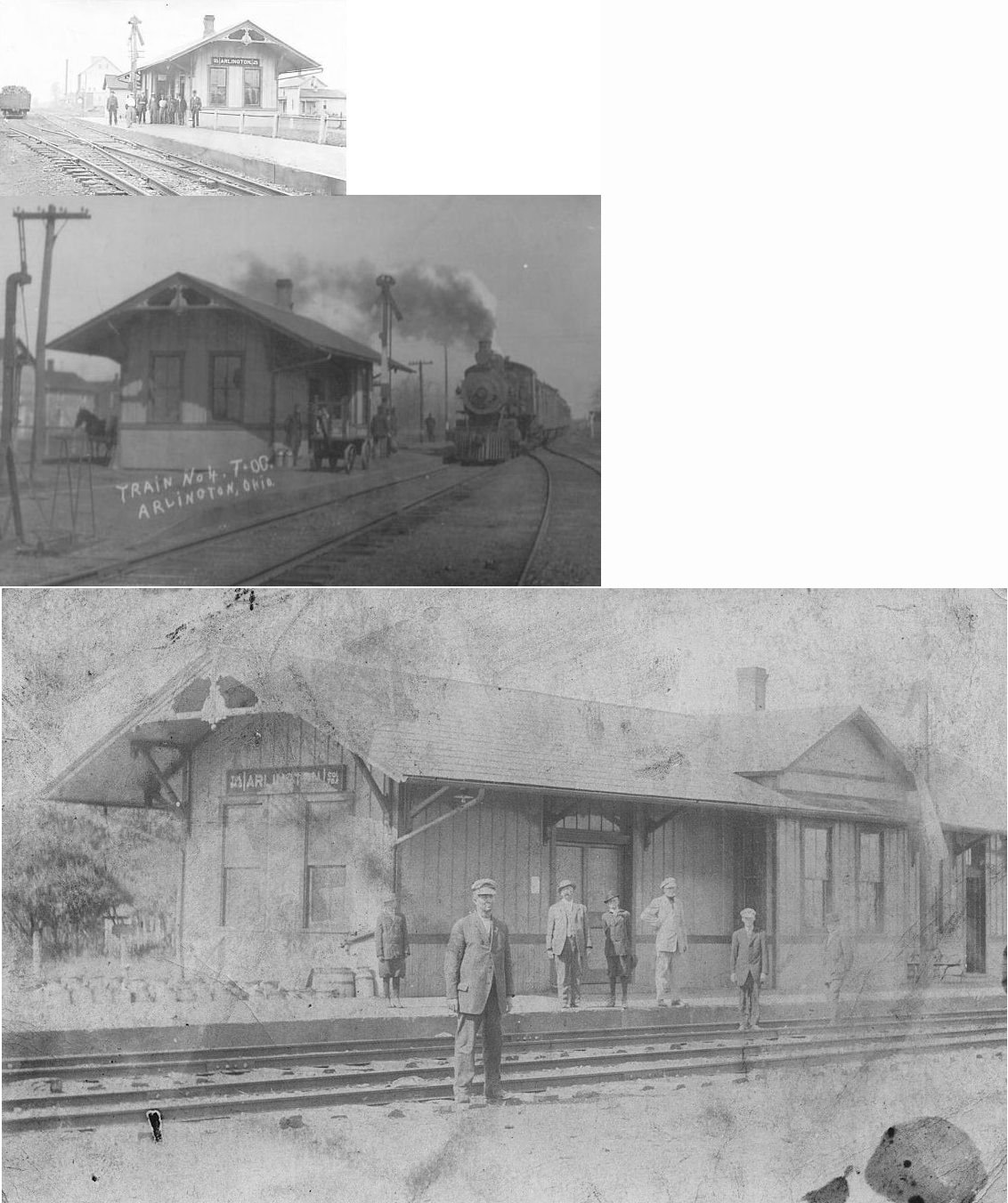
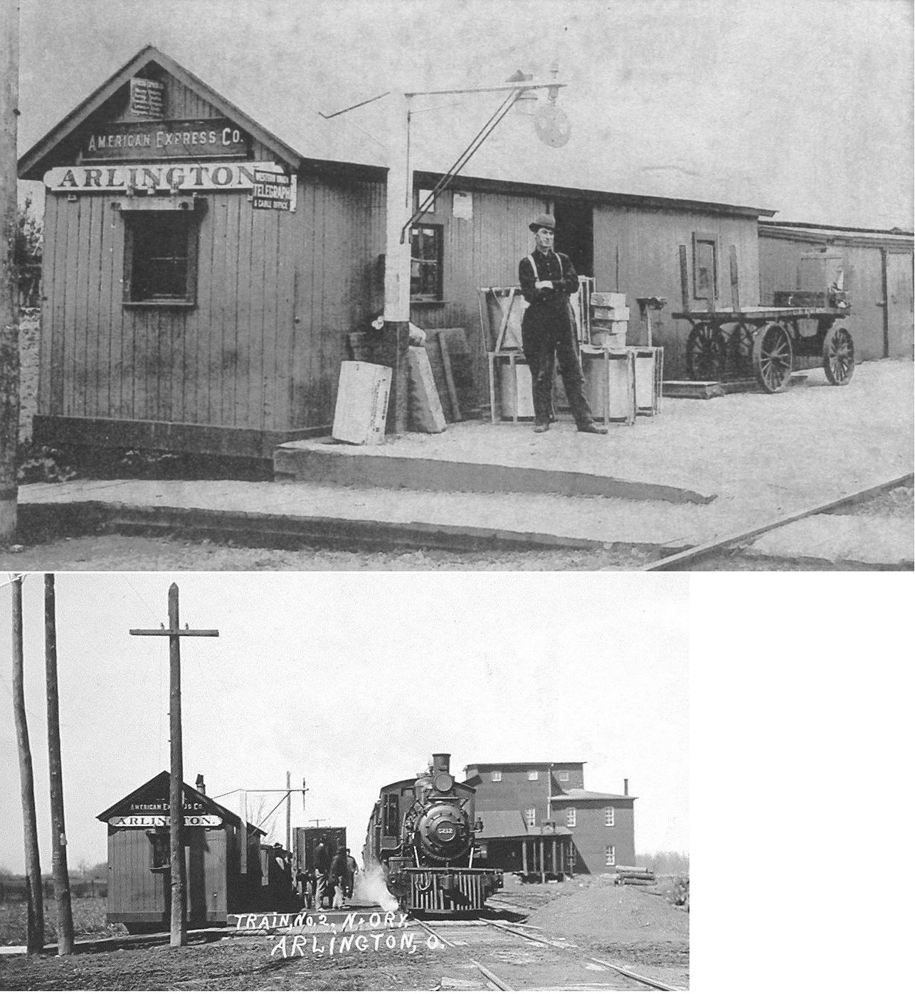
| Arlington | |
And here is a photo of train derailment at the station in 1908. | ||||||
| Arlington |  |
|||||||
| Beagle | |
This stop had a combination station/post office. It was located on County Road 26 just east of US 68. | ||||||
| Benton (Benton Ridge) |
 |
This is listed as a stop on the 1893 and 1915 timetables. There was likely no depot here, although a Weekly Jeffersonian blurb from Oct 06, 1898 refers to the "Benton Ridge depot road." It was listed as a flag stop on the 1915 timetable. | ||||||
| Butlers Mill | |
|||||||
| Chase | |
|||||||
| Conine | |
|||||||
| Deweyville | |
|||||||
| Findlay | |
The depot was in the northeast corner of 6th and Main Streets at GPS: 41.022579, -83.649972. Evidence suggests that it was built by T&OC predecessor Toledo, Columbus & Cincinnati, when TC&C built its track into south Findlay in 1887-1889. The original location is unknown, and 6th and Main Streets location is .4-mile west of TC&C’s mainline, so probably not built there. The T&OC’s 1918 ICC Valuation record described it as “F.FT.W.&W. Station No. 200…92’-0” East of East Curb of So. Main St.,” which confirms the 6th and Main Street location and suggests that the FFt.W&W leased the depot and presumably moved it there. | ||||||
| Findlay Shops | |
This is listed on the 1907 timetable and as a flagstop on the 1915 timetable. There was likely no depot here. | ||||||
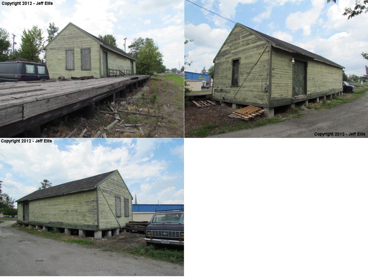
| Findlay | |
The freight station was on the southeast corner of North Cory and High Streets. The 1924 Sanborn Fire map shows the old passenger station as vacant and the freight station handling both passenger and freight operations. The 1930 Sanborn map shows the original passenger station gone from that location. | ||||||
| Findlay (Broad Avenue) |
|
This station was in the NW part of town where the CH&D crossed Broad Avenue in the vicinity of GPS: 41.050499, -83.664818. | ||||||
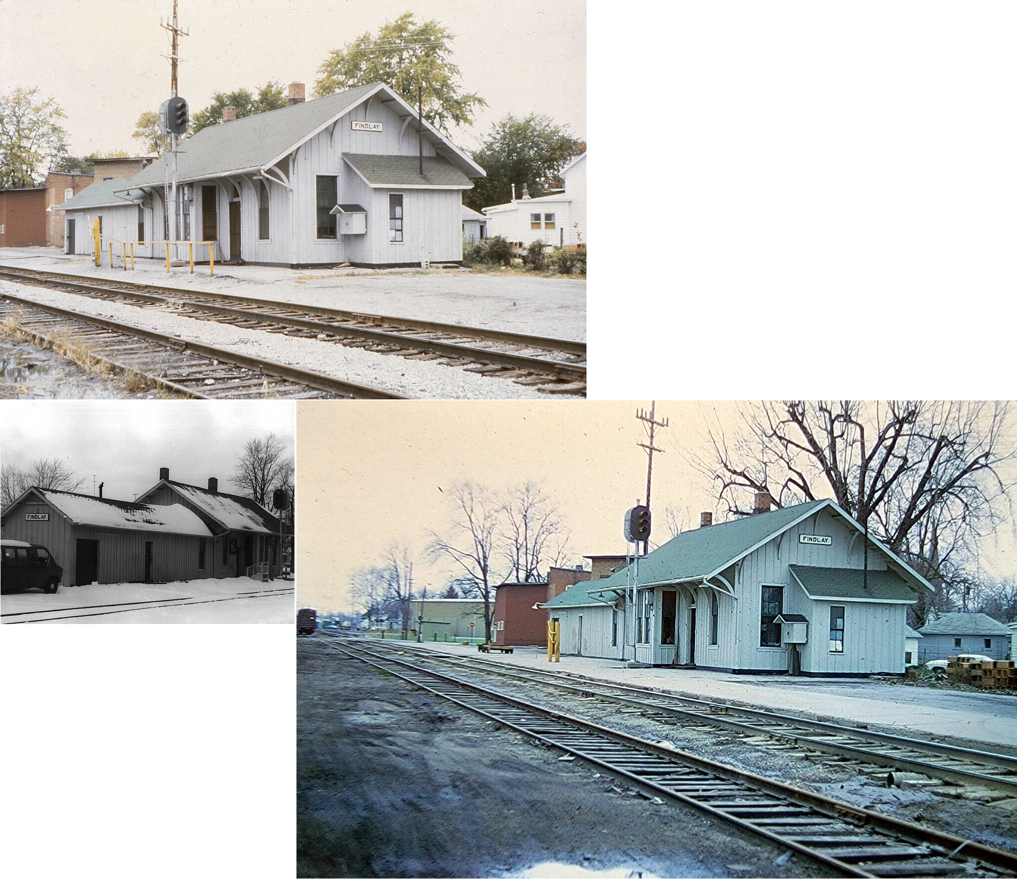
| Findlay |
 |
Station was moved from its original
location (on the east side of North East Street just north of Sandusky St. and north of
the old Union School building) to NE corner of East Main Cross St. and South Blanchard Street
where it was used as a residence. It moved from its original location
sometime between 1925-1935, and was torn down in 2002. A
combination freight station/elevator sat across the tracks. Later,
between 1895-1901, the CCC&St.L tore down the original freight station and
built a new freight station on the south side of the tracks. That building
was still standing as of 1949 and was then used as a coal shed. It is not
known whether, or when, that building was torn down or if it is still
standing. It is shown on maps from 1875. The original location GPS is: 41.037698,-83.64659 |
||||||
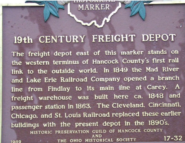
| Findlay |
|
There was a freight station near the corner of East Street and East Crawford Street. The station burned in the early 1990s, but the histroical marker (see photo) remained there until the early 2010s (GPS: 41.037506,-83.646555). | ||||||
| Findlay | |
The passenger station was between West Front and West Main Cross Streets. | ||||||
| Findlay | |
The passenger station sat on the south side of East Sandusky Street next to the old Union Hotel. It was torn down in 1979 or the early 1980s. The freight station was just south of the dead end of East Hardin Street near where Grand Avenue is today. | ||||||
|
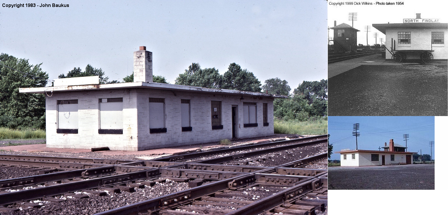
Findlay (N. Findlay) |
 |
According to old maps this station was not around for very long. It was built sometime between 1887 and 1895. This station sat between Walnut and Crystal Avenues on the northwest corner of the crossing of the Toledo, Columbus & Cincinnati (TC&C) with the Lake Erie and Western railroad. The stop would have been called "North Findlay," but this is not the same location as Mortimer which is also called North Findlay. This section of town was called North Findlay long before that name was attached to Mortimer. According to the maps, the station was gone by 1901 giving it a life span of only 14 years maximum. In 1892 the TC&C merged with the Toledo & Ohio Central. Because the T&OC already had a station in town, this TC&C station was probably redundant and therefore demolished. | ||||||
| Finks |
|
This station was on the Findlay Branch at mile marker 13 (from Carey). | ||||||
| Hancock | |
|||||||
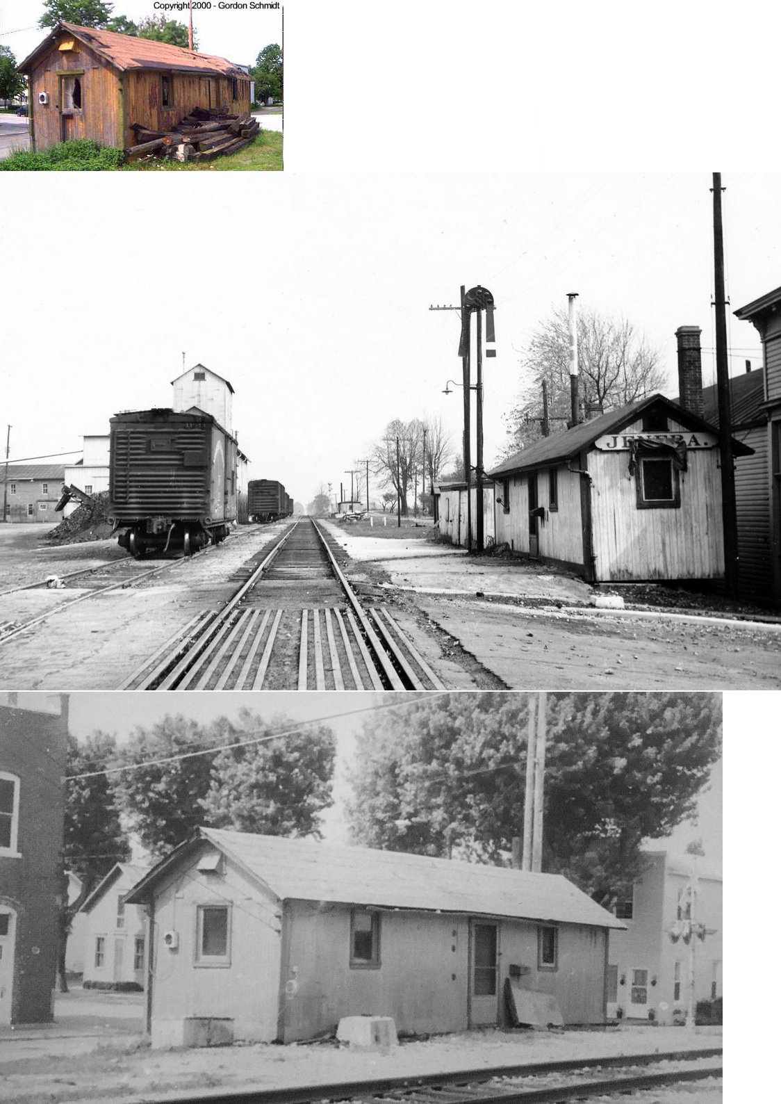
| Jenera | |
Sat near the tracks at SR 698. Torn down in late 2000. Was an old boxcar converted to a station. | ||||||
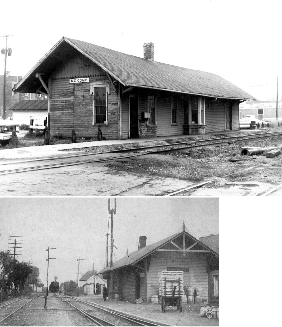
| McComb | AND |
Although of NKP design, this station served both railroads. It was located on the west side of North Liberty Street along the NKP tracks. | ||||||
| Moffits | |
This is listed as a stop on the 1893 and 1915 timetables. There was likely no depot here. It was listed as a flag stop on the 1915 timetable. | ||||||
| Mortimer | |
A frame passenger and freight station sat at this location (off County Road 216), but burned down around 1947 and was replaced by the station that is listed below. | ||||||
| Murphy | |
|||||||
|
Mortimer (N. Findlay) |
|
This station was off Off County Road 216 (41.110557,-83.645313). When the NKP built this station in 1947-48 they renamed the station stop North Findlay so that the Passenger Department could advertise that it served the city of Findlay, 6 miles south of Mortimer. It was on the SW corner of the NKP (NS) and the NYC (T&OC) rail crossing. It was closed with the end of the Passenger trains, but was in use by NS as a MofW building up until it was torn down in Fall, 2010. The depot was built of cinder block and glass block. | ||||||
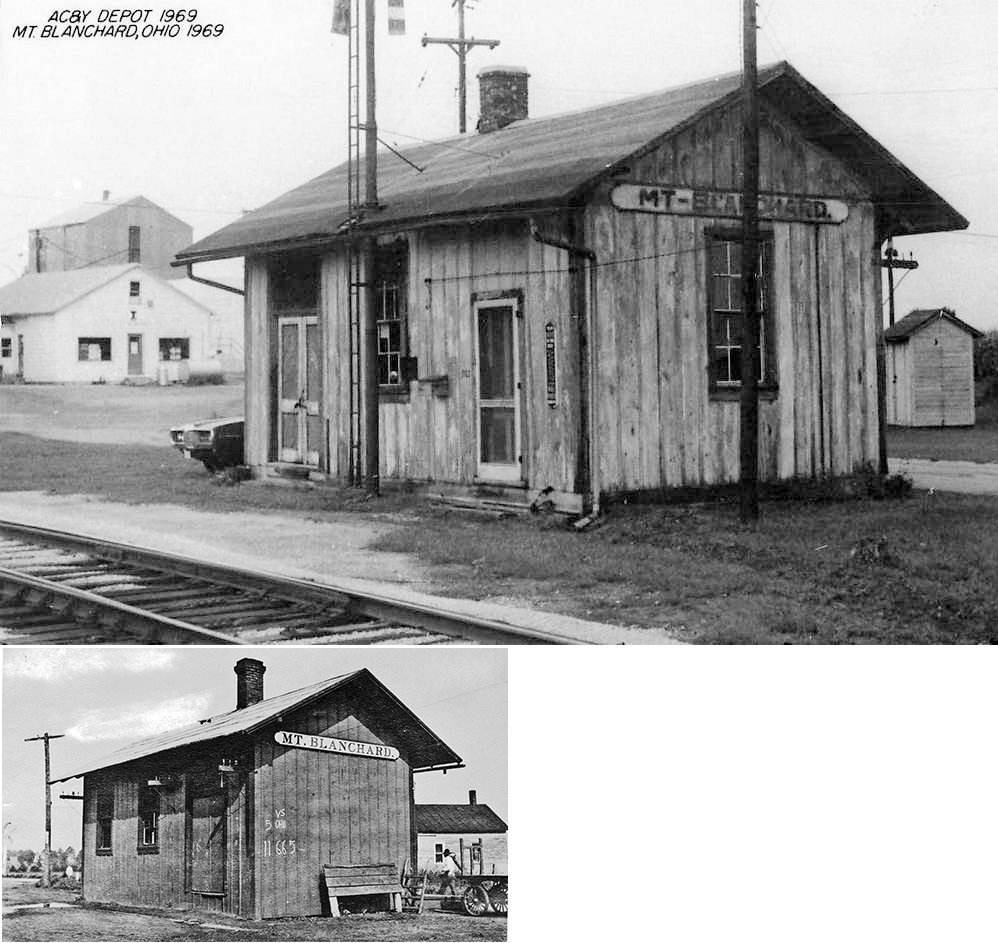
| Mt. Blanchard |
 |
This station was between North Main and High Streets at GPS: 40.903398, -83.555123. | ||||||
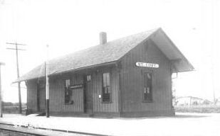
| Mt. Cory | |
|||||||
| Pratts |  |
This station was just off SR-103 and stood until around the early 2000s when it collapsed. It served as a depot and a boarding house, looking more like the latter than the former. | ||||||
| River Bridge |
|
This station was on the Findlay Branch at mile marker 11 (from Carey) between Huber Station and Finks. It was likely near where the line crossed the Blanchard River. | ||||||
| Stewartsville (Stuartsville) |
|
A new station was built here by the Toledo, Columbus & Southern RR in 1887 (The Weekly Jeffersonian, 8-25-1887). | ||||||
| Van Buren |
|
|||||||
| Vanlue | |
The first station here was on the west side of Buffalo Street on the north side of the tracks. (GPS: 40.974572,-83.480253) | ||||||
| 1898 HANCOCK COUNTY RAILROAD MAP | ||||||||
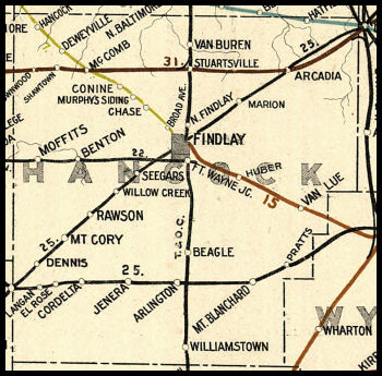 |
||||||||
|
Notes About Existing Stations... Arcadia (NKP) - Station was located West of Main street in Arcadia and may have been moved slightly after 1923 re-alignment. Sometime after 1950 it was supposedly moved four miles east of Arcadia and became a residence. Can anyone confrim this with a recent photo? Findlay (B&O) - Moved about 1/4 mile from original location which was on the west side of North Main Street at West High (next door to the old Taylor Public School building and later the site of the Findlay Dairy Company). Hatton (T&OC) - This station was dismantled in Hatton (Wood County) in 2005 and reassembled in Findlay in 2006. See the NWORRP website for photos and details. Huber Station (CCC&St.L) - This was a station on the Findlay Branch of the CCC&ST.L at mile marker 8.7 (from Carey). The owner of the station has photos of the boards in the walls that are stamped "Huber Station." The heavily modified station appears to have been turned with the middle section of the house being the old station. Rawson (LE&W) - Moved to park in 1951. Williamstown (T&OC) - Moved in Summer 2002. Here is a photo after restoration. |
||||||||