 COUNTY COUNTY
|
|
||||||||
| EXISTING STATIONS | ||||||||
|---|---|---|---|---|---|---|---|---|
| Station Name |
Original Railroad | Current Location |
Type | Current Use |
Date Built |
Track Status |
Building Material |
More Info |
| Jeffersonville |
 |
Railroad Street between East High Street and Creamer Avenue on the east
side of the tracks. (GPS: 39.654313, -83.560282) |
F | Vacant | ???? | In Use | Metal |
|
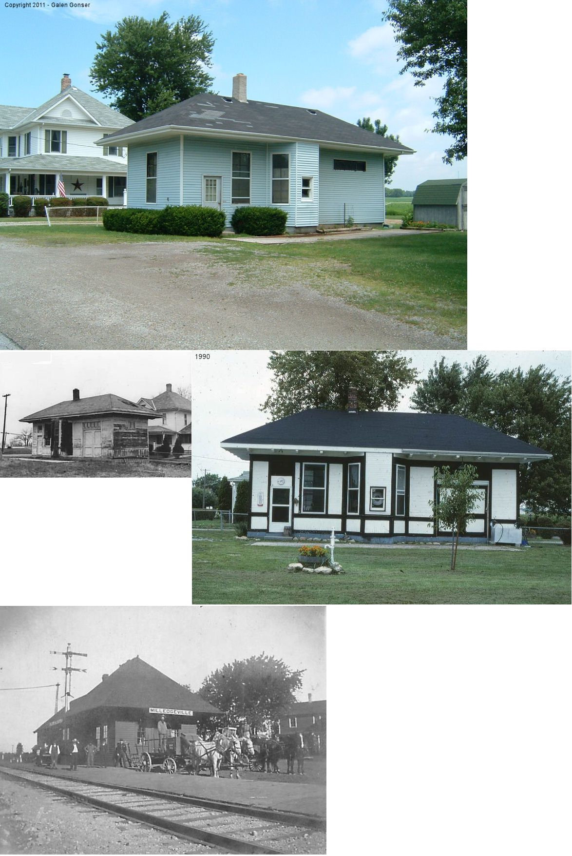
| Milledgeville |
 |
East side of Main Street NW just north of the old RR grade. (GPS: 39.594884,-83.587503) |
C | Residence | ???? | None | Wood |
|
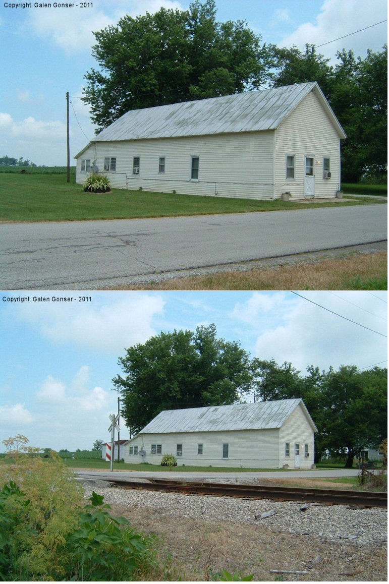
| ParroTt |
 |
2460 Parrott Station Road NW (GPS: 37.0625,-95.677068) |
F | Residence | ???? | In Use | Wood | |
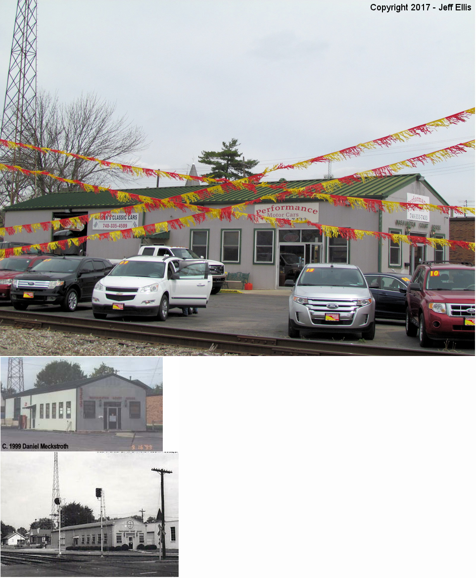
| Washington Court House |
|
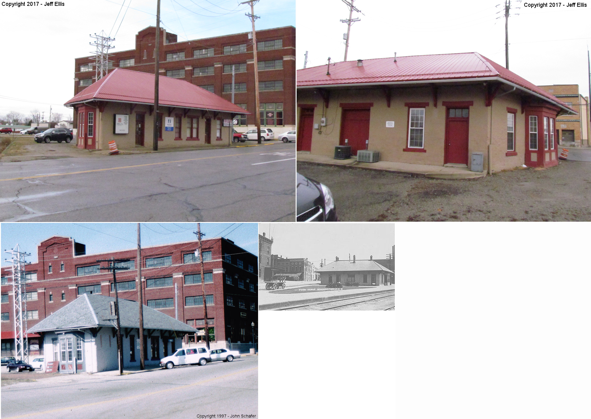
Corner of West Court Street and Veterans Way. (GPS: 39.534659,-83.442326) | F | Business | 1950s | In Use | Metal |
|
| Washington Court House |
|
SW side of South Main Street just north of the river. (GPS: 39.533736,-83.438088) | F | Business | ???? | In Use | Wood |
|
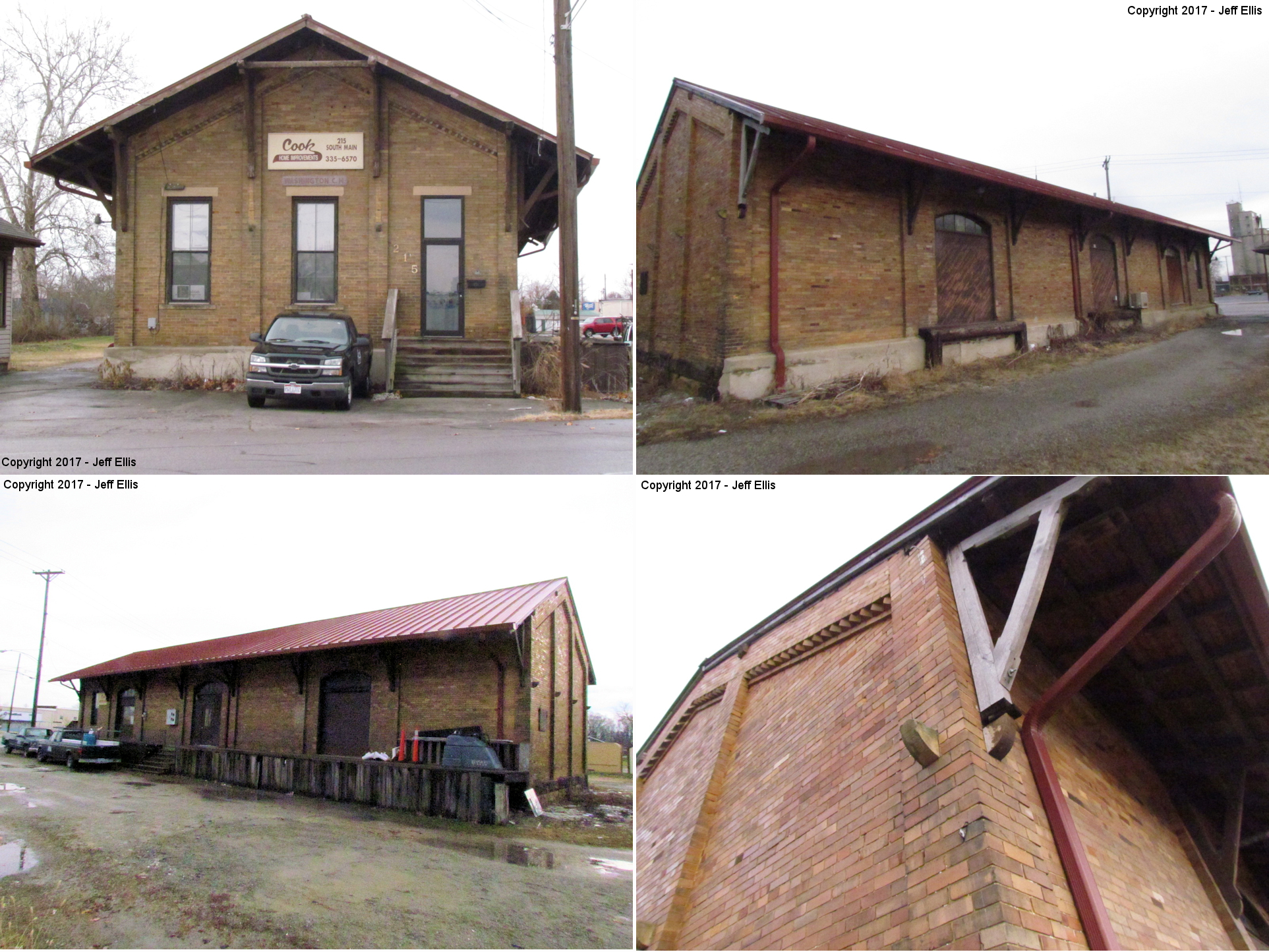
| Washington Court House |
 |
215 South Main (GPS: 39.534378,-83.438877) |
F | Business | ???? | Gone | Brick |
|
| Washington Court House |
|
Corner of South Main Street and West East Street. (GPS: 39.534688,-83.438984) | P | Business | ???? | Gone | Brick | |
| STATIONS OF THE PAST | ||||||||
| Station Name |
Original Railroad |
Notes | ||||||
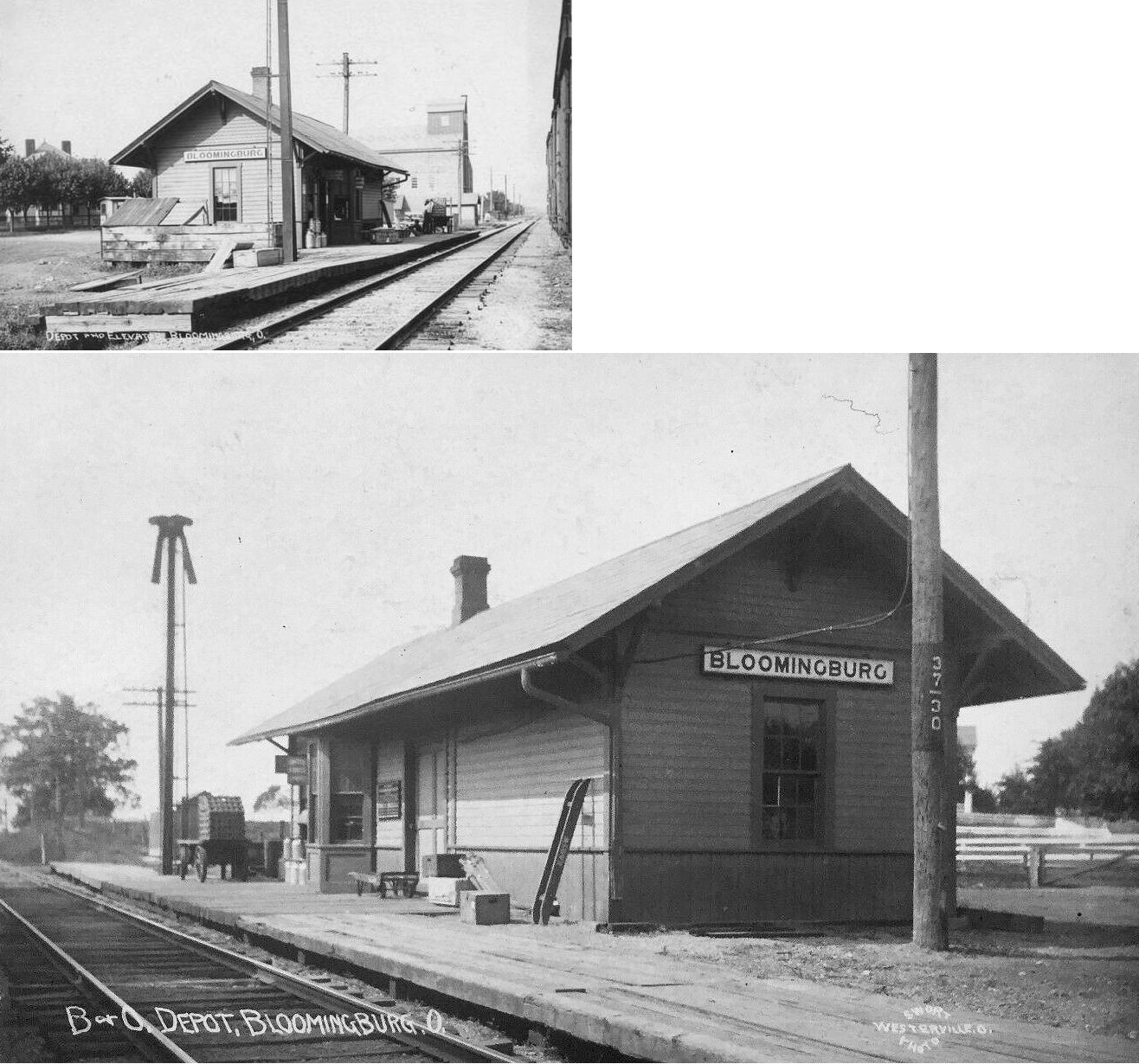
| Bloomingburg |
 |
Torn down in mid 1970s. | ||||||
| Carton |
|
This was the first station SE of the Washington Court House station. The station was probably in the vicinity of Robinson Road SE between Evergreen Drive and CR-140. It was 1.2 miles from the WCH station. | ||||||
| Cooks |
|
|||||||
| Edgefield |
|
|||||||
| Fairview |
|
|||||||
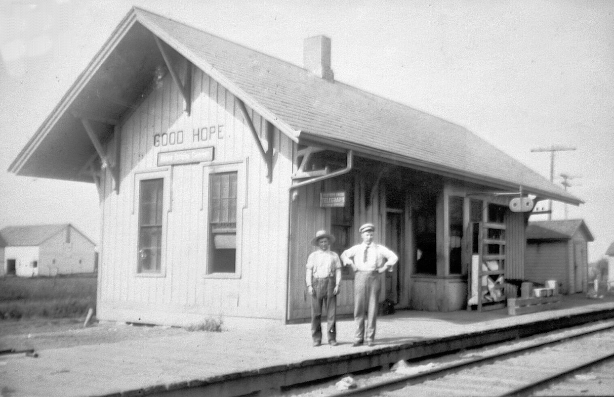
| Good Hope |
|
|||||||
| Hagler |
|
|||||||
| Jasper |
|
|||||||
| Jasper Mills |
|
In 1875 this station was on the east bank of Camp Run where the tracks cross there on a trestle. This spot is not accessible by road today. (GPS: 39.519445,-83.517978) | ||||||
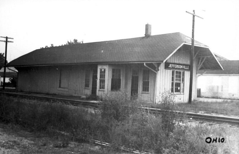
| Jeffersonville |
|
The combination passenger/freight station was located on the west side of the tracks at the corner of East High Street and Railroad Avenue (now part of Walnut Ave.). It was torn down in 1980. | ||||||
| Johnson |
|
|||||||
| Jonesboro |
|
|||||||
| Luray |
|
|||||||
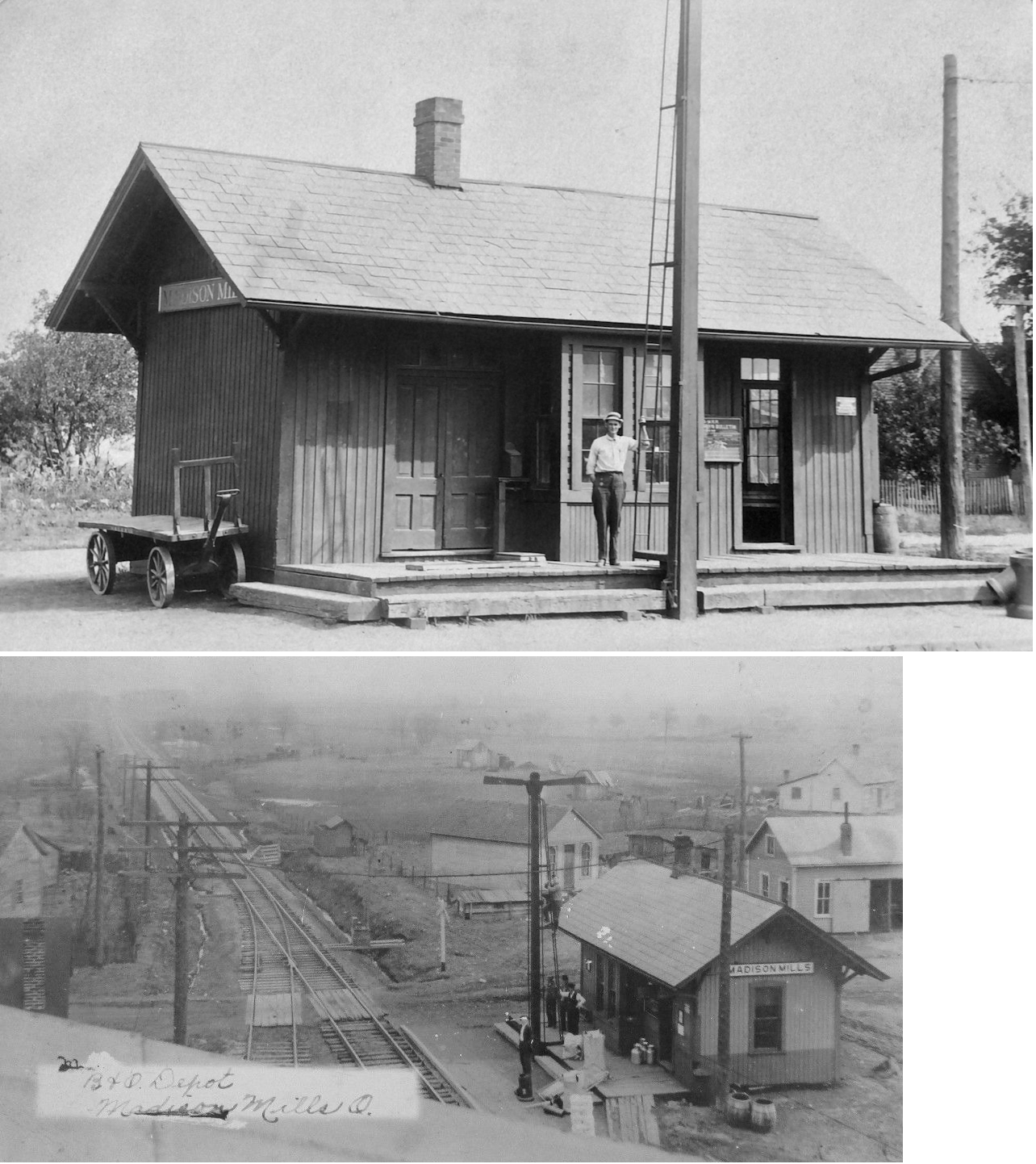
| Madison Mills |
|
|||||||
| McLean (Cisco) |
|
|||||||
| Octa (Allentown) |
|
This was a station on the old Dayton Southern RR. | ||||||
| Octa (Allentown) |
|
This was a station on the original route of the Cincinnati, Columbus & Hocking Valley Railway. The CC&HV was subsequently purchased by the Ohio Southern RR (DT&I). | ||||||
| Parrot |
|
The passenger station was about 300 feet north of the existing freight station. The freight station was served by a team track. | ||||||
| Pearsons |
|
This was a station on the original route of the Cincinnati, Columbus & Hocking Valley Railway. The CC&HV was subsequently purchased by the Ohio Southern RR (DT&I). | ||||||
| Washington Court House |
 |
This REA station sat between the DT&I and CH&D tracks. It was between Temple Street and Paint Street parallel to Water Street. | ||||||
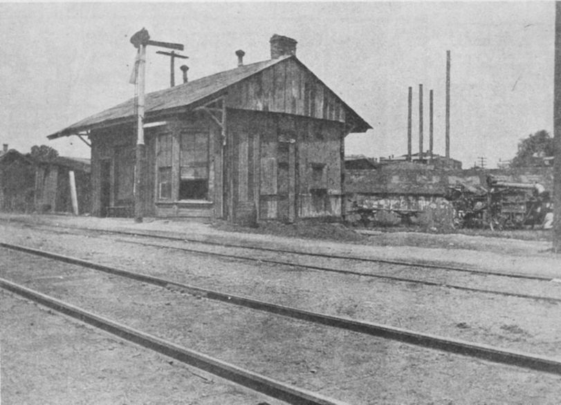
| Washington Court House |
|
This station burned in 1907, and was poorly repaired, earning the nickname the "Burnt Depot." It sat just west of Fayette Street. | ||||||
| Washington Court House |
|
The Panhandle station st the time was destroyed by the 1885 cyclone which leveled a good part of the city. | ||||||
| Washington Court House |
|
The old passenger station was at the corner of Water and West Market Streets. There was an old freight station here too at the same location as the modern freight station that is still standing. The Ohio Southern RR station was destroyed by the 1885 cyclone which leveled a good part of the city. | ||||||
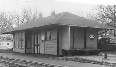
| Washington Court House |
AND |
Built between 1907-1914, this station was on the north side of Paint Street just east of North Water Street at the diamond (GPS: 39.537189, -83.445155). It was shared by the B&O SW and CH&D. There was a smaller B&O station at this location prior to this one (as shown on the 1907 map). | ||||||
| Washington Court House |
|
The B&O had a freight station at the north corner of Paint and Hinde on a spur track at GPS: 39.537748, -83.444051. | ||||||
| Washington Court House |
 |
Before the B&O built a new, larger station at the Paint Street location (see above), the smaller original Columbus & Cincinnati Midland RR station was at that same location. The Midland station was destroyed by the 1885 cyclone which leveled a good part of the city. | ||||||
| Washington Court House |
 |
This narrow gague RR station (before it became part of the CH&D) was on South Fayette Street just to the NW of Paint Creek. It was on the NW side of the tracks. The D&I station was destroyed by the 1885 cyclone which leveled a good part of the city. | ||||||
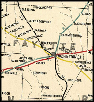
| 1898 FAYETTE COUNTY RAILROAD MAP | ||||||||
 |
||||||||
|
Notes About Existing Stations... Jeffersonville (DT&I) - The building has been in poor condition for quite sometime. It is next to a siding and has plywood sheeting patches over a hole on the wall facing the tracks where the bay window of a train order station would have been. One neighbor said a team track was located across the tracks at the end of Walnut Street, a block south of the location of the passenger depot, which was demolished in the early 1980s. Old maps do not show a railroad building at this location. Can anyone confirm that this building was in fact a DT&I structure? Milledgeville (CH&D) - After going out of service, the station served as an office for the grain elevator. It was moved sometime in the 60s or 70s and became a residence. Washington Court House (DT&I) - Unique pre-fab building made of steel (manufactured by local DT&I on-line customer), currently a used-car sales lot. Active agency and section house until 1980s. Located at the junction of the DT&I main line (torn up, now a hiking trail), PRR Morrow-Trinway line (also torn up), and active section of stub of CSX (ex B&O Dayton-Wellston line). Restored crossing guard's shack across street in small park. Washington Court House (CH&D) - Rambling old freight station now used as livestock-feeder factory. Still has platforms, ramps, etc. 1 block south of ex-PRR stations. Washington Court House (C&MV) - Well-preserved, in continuous use since rail service ended with Conrail startup in 1976. Still has ramps and team track platforms. Across roadbed from former passenger station. Still very PRR-like appearance. C&MV = Cincinnati & Muskingum Valley. |
||||||||