 COUNTY COUNTY
|
|
||||||||
| EXISTING STATIONS | ||||||||
|---|---|---|---|---|---|---|---|---|
| Station Name |
Original Railroad | Current Location |
Type | Current Use |
Date Built |
Track Status |
Building Material |
More Info |
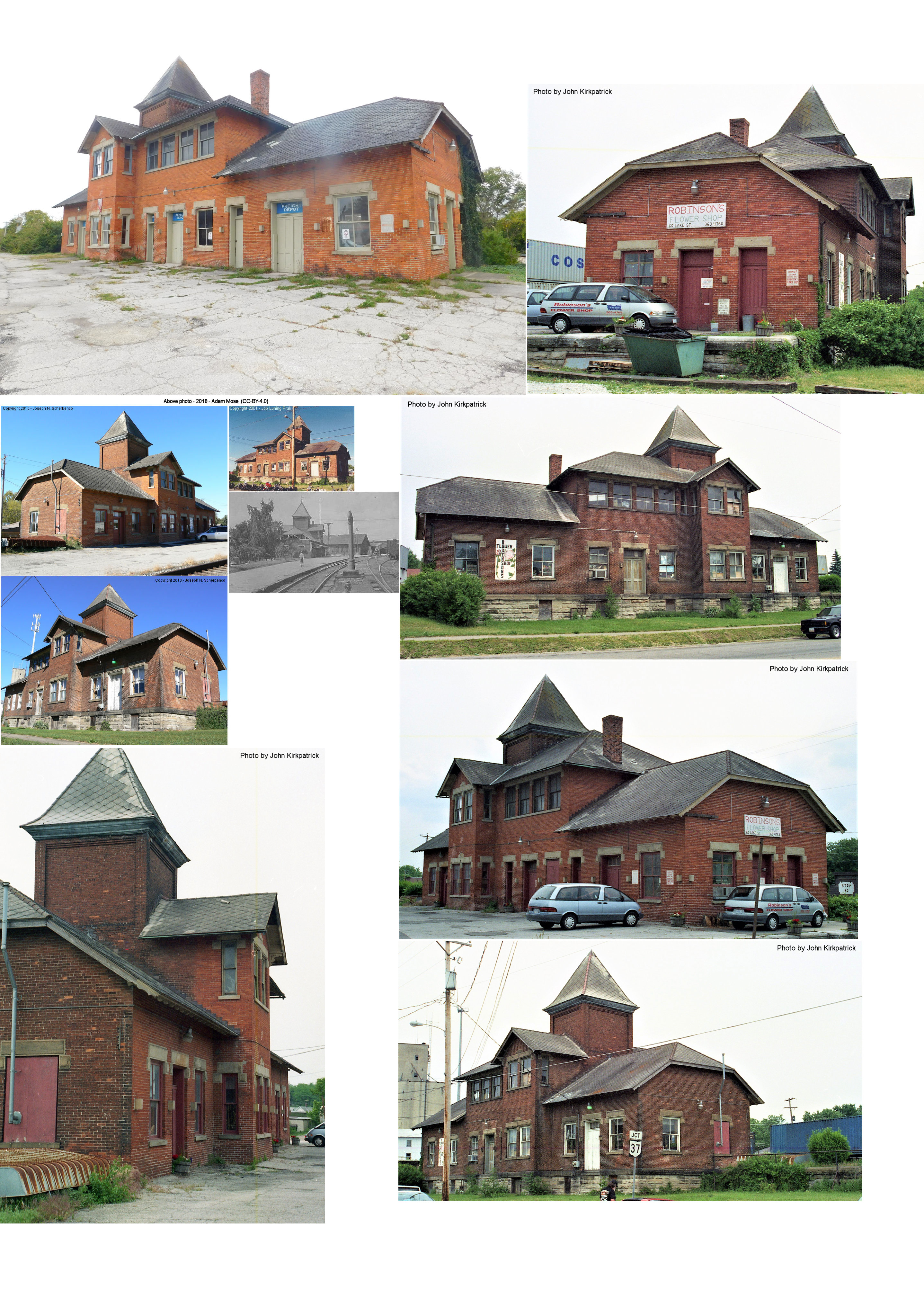
| Delaware |
 |
Corner of SR 37 and US 42
(Central Avenue & Lake Street) (GPS: 40.300532, -83.058506) |
P | Business | 1887 | In Use | Brick |
|
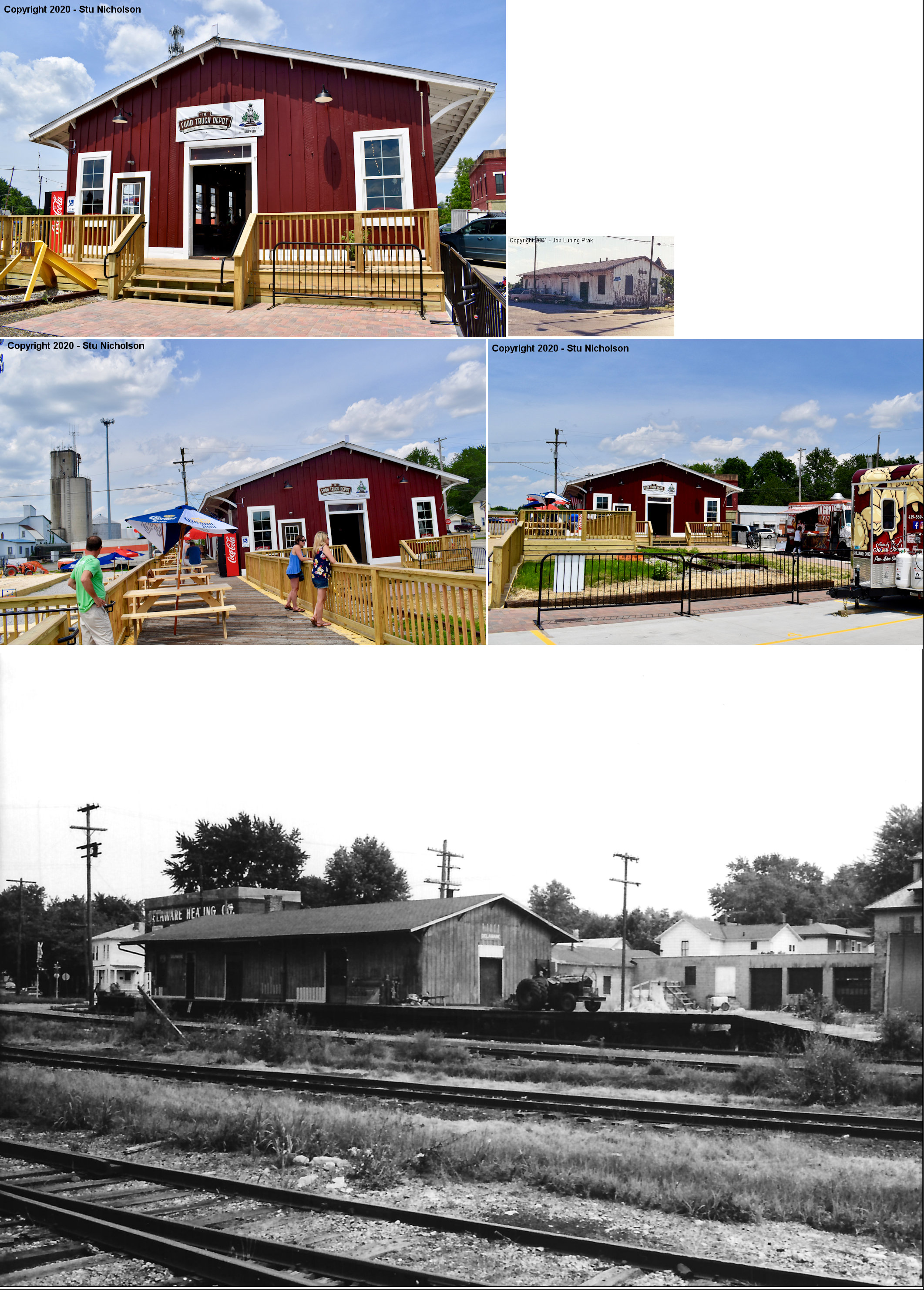
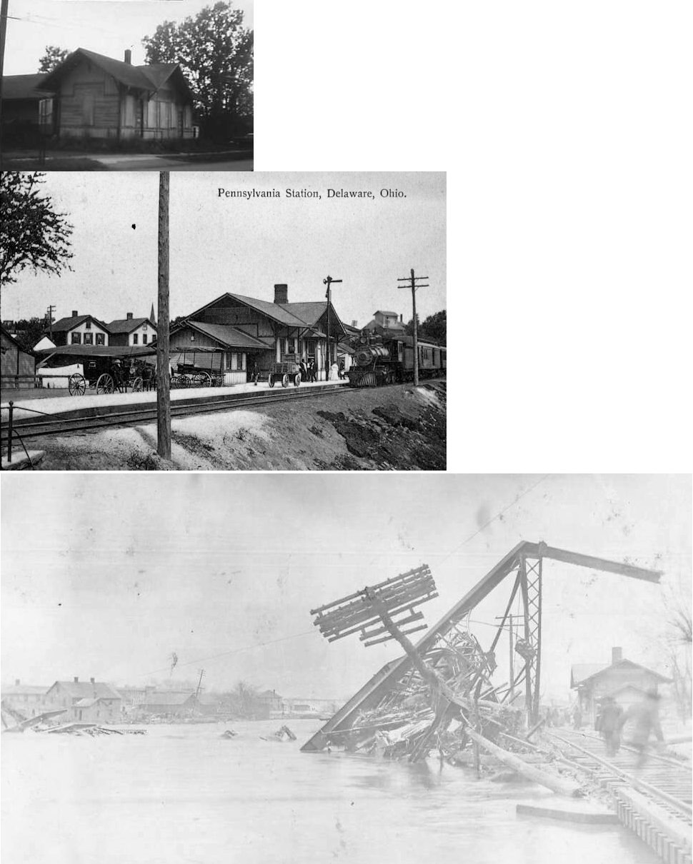
| Delaware |
 |
190 East Central Aveune (GPS: 40.300597, -83.057732) |
F | Business | c. 1895 | Gone | Wood |
|
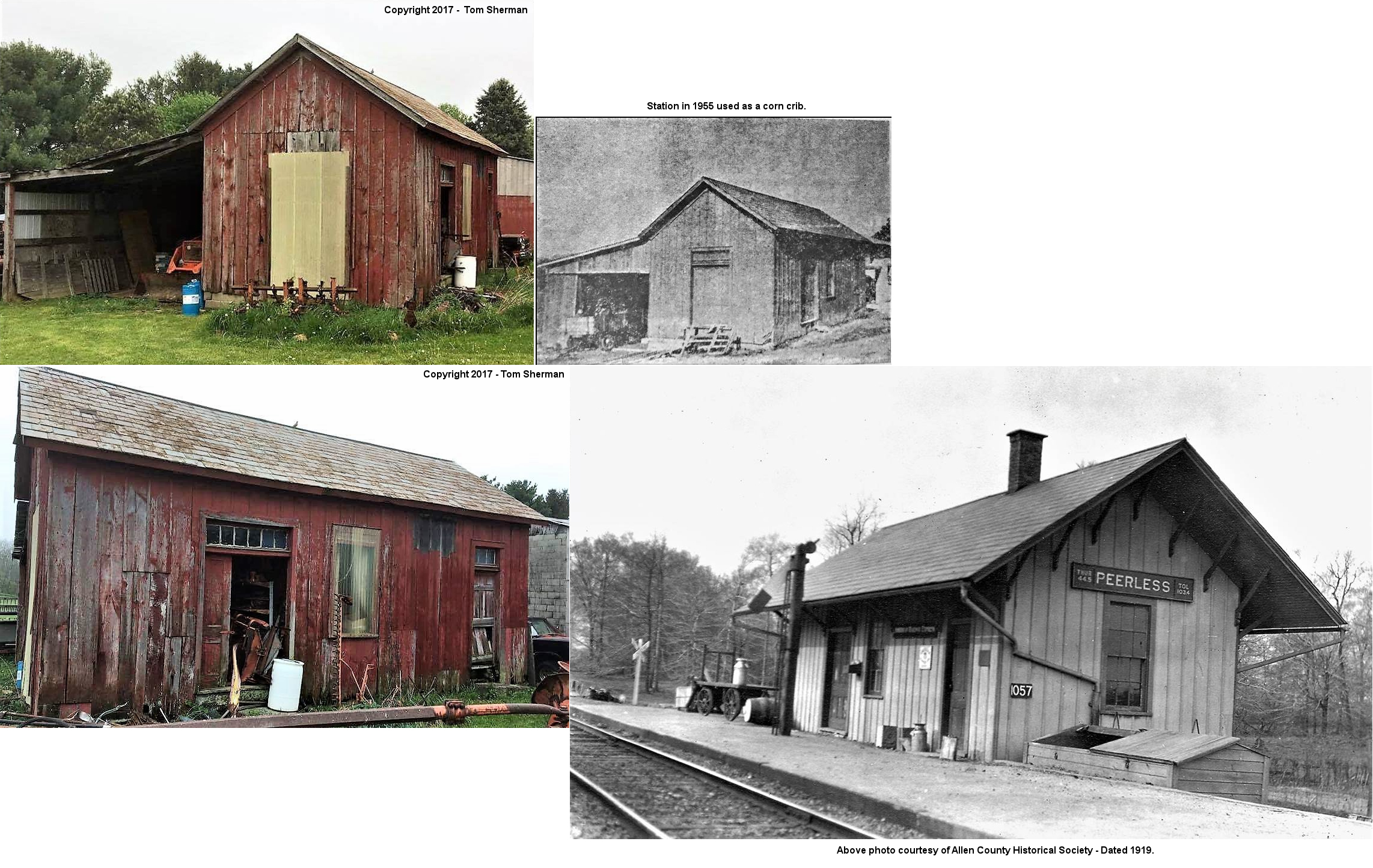
| Peerless |
 |
Back of the farm at 16140 Peerless Road (GPS: 40.349302, -82.761455) |
C | Private | 1881 | None | Wood |
|
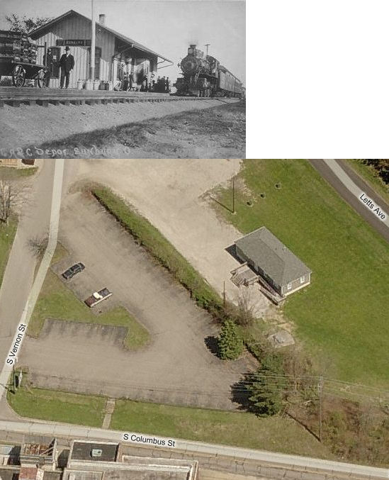
| Sunbury |
 |
168
South Vernon Street (GPS: 40.238862, -82.859693) |
P | Civic | ???? | Gone | Wood |
|
| STATIONS OF THE PAST | ||||||||
| Station Name |
Original Railroad |
Notes | ||||||
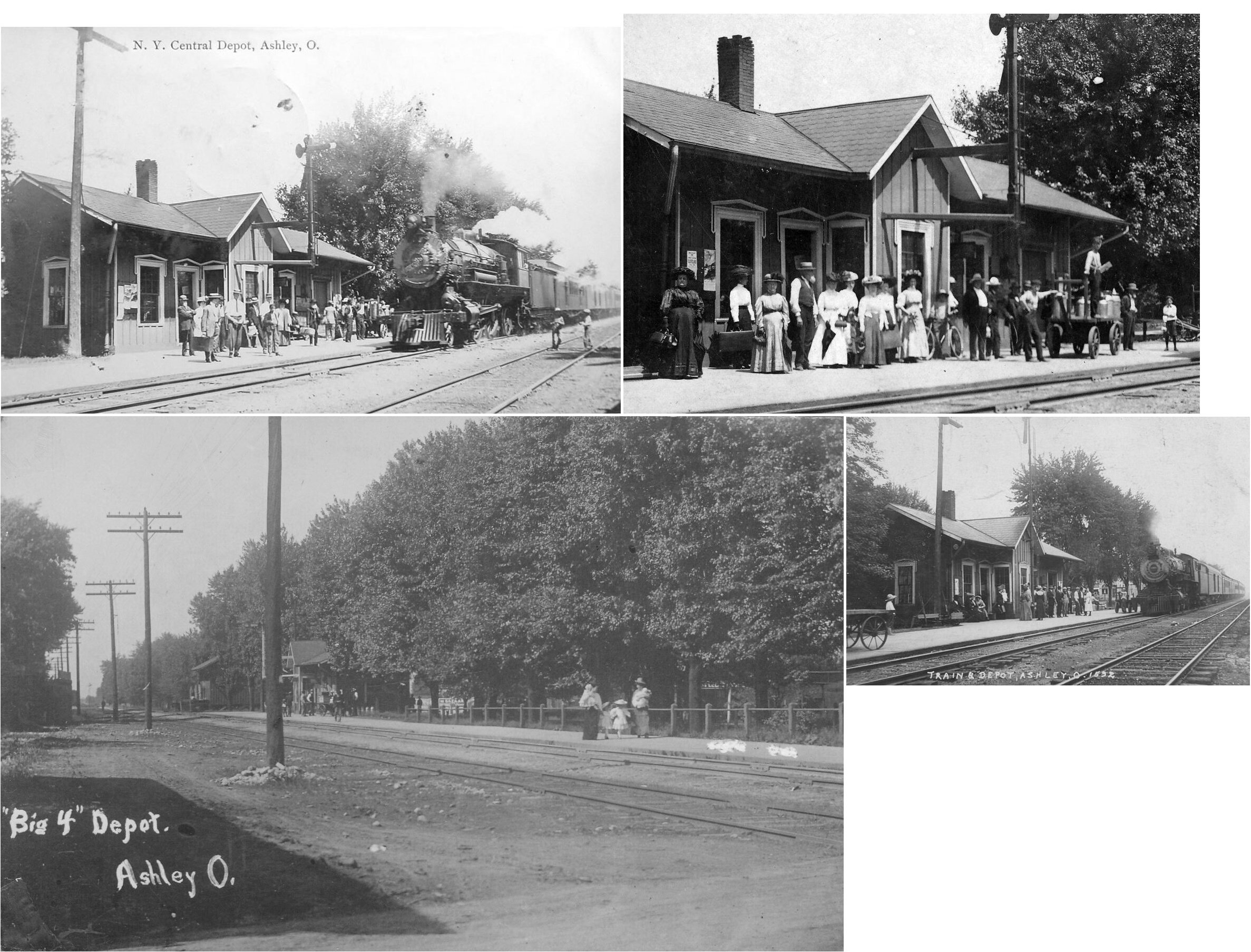
| Ashley |
|
This station, built in 1890, was on South Franklin Street. It was closed by the New York Central in November of 1955 (The Marion Star, 11-11-1955). | ||||||
| Berlin (Tanktown) |
|
A station is shown here on the 1866 map when the village was known as Tanktown. The village was alternately known as West Berlin and Pershing Station. The depot was on Berlin Station Road where the tracks cross west of Gregory Road. | ||||||
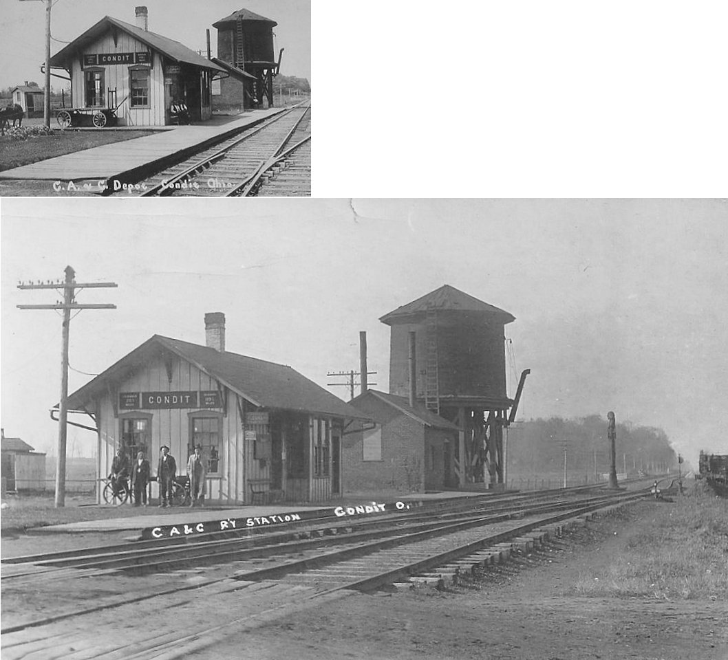
| Condit |
|
|||||||
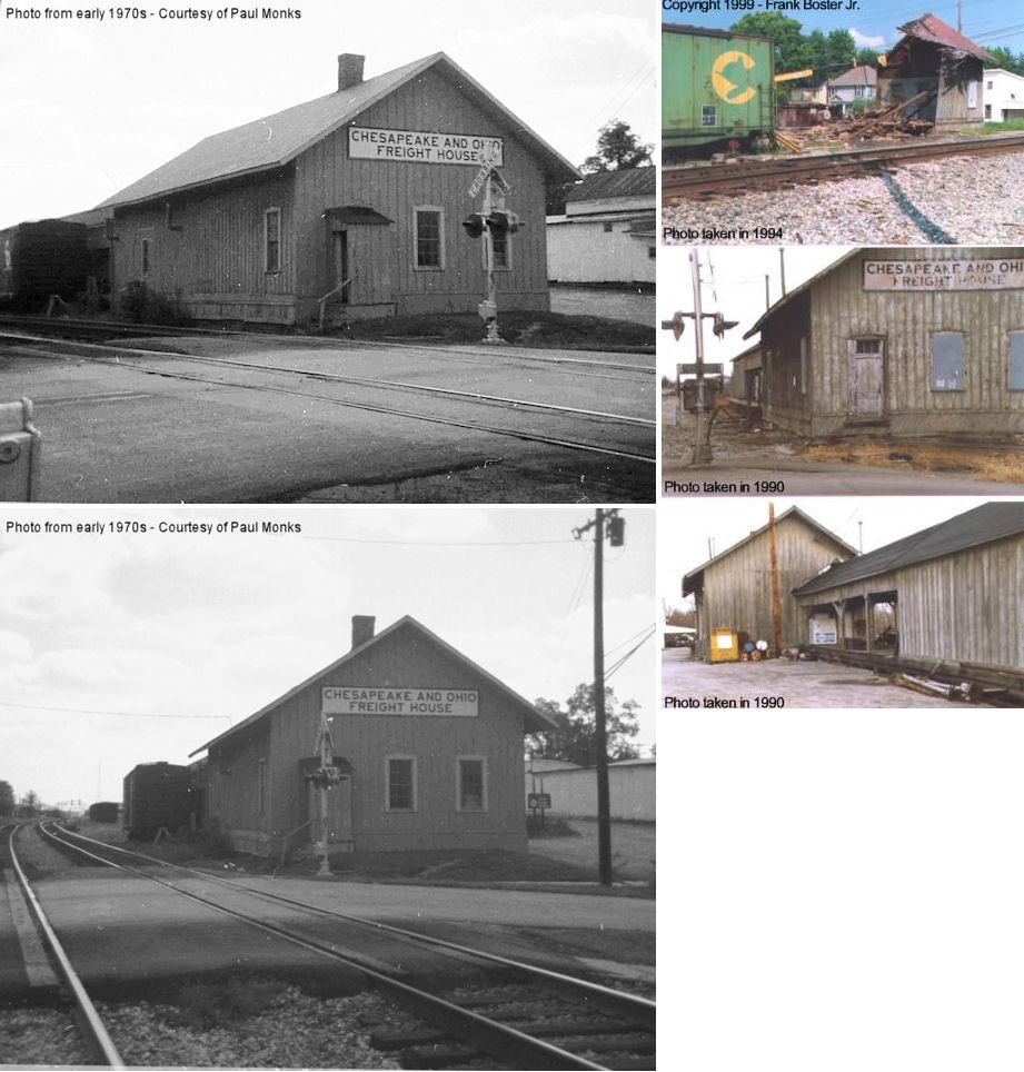
| Delaware |
 |
The first HV passenger and freight stations here were built in 1876. | ||||||
| Delaware |
|
|||||||
| Delaware |
|
This may have been the original freight station from 1876. | ||||||
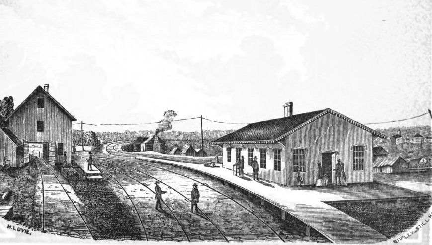
| Delaware |
 |
The CS&H (later PRR) passenger station sat along the Olentangy River just north of East Winter Street. It was built around 1895. The freight station sat in a small yard on the southeast corner of East Winter and North Henry Streets (where US 23 is today). | ||||||
| Delaware |
|
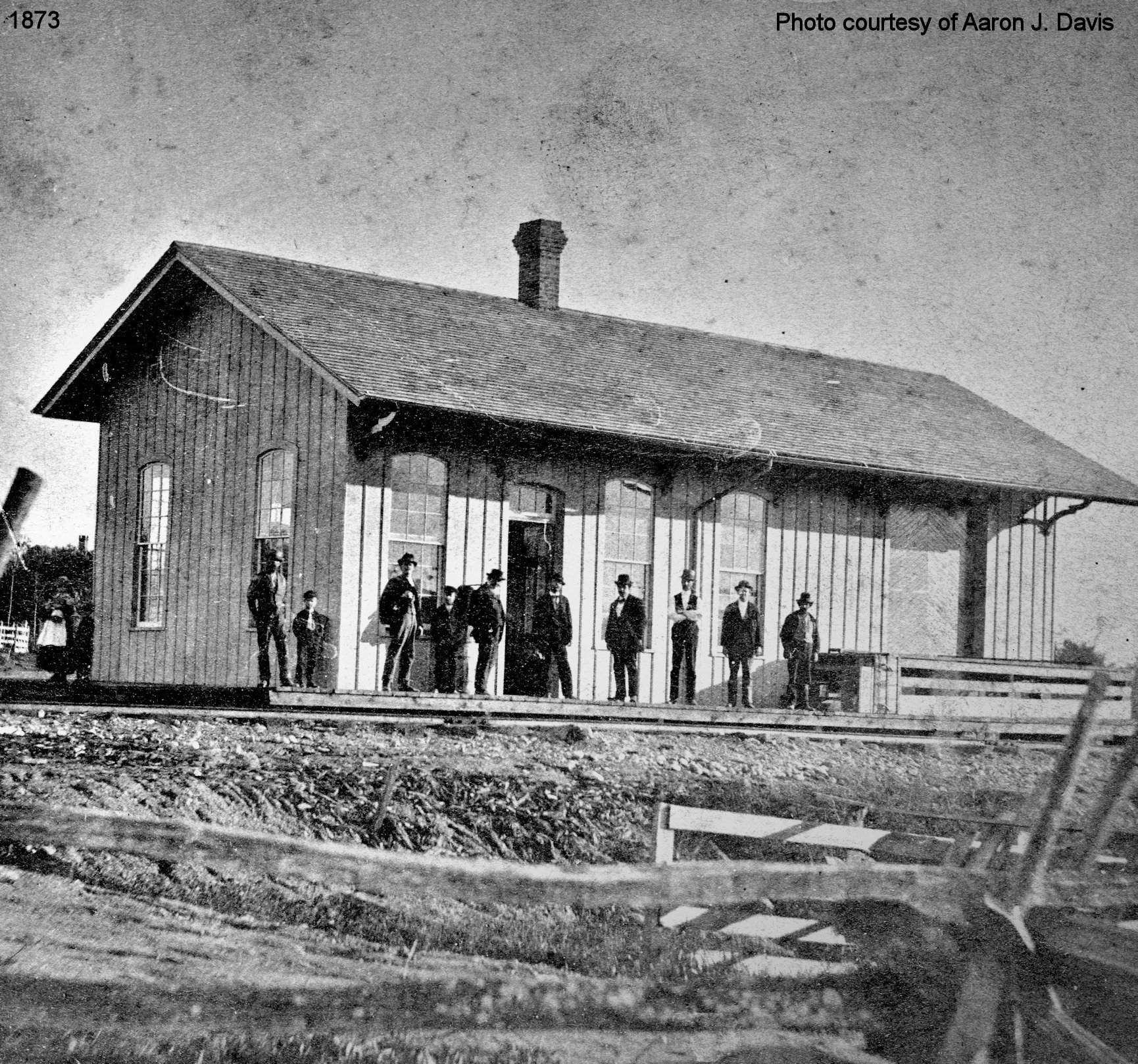
The illustration is of the first station at Delaware for the Cleveland, Columbus & Cincinnati RR (CC&C). It is dated 1854. "The 1866 Atlas for the City of Delaware shows on a map a passenger depot north of East Winter Street, and south of E Berkshire Street (now E. Central Ave) between the tracks curving west and tracks curving east. This is consistent with this drawing as a view looking south. The map also show a track south of the depot crossing from the east side of depot to join the track heading west on the west side of the depot. I show the merger to form the CCC&I occured in 1868." - Paul Monks | ||||||
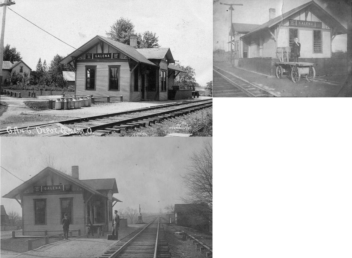
| Galena |
|
An earlier Cleveland, Mt. Vernon & Columbus RR (pre-CA&C) station here was destroyed by fire on November 4, 1898. | ||||||
| Galena |
|
|||||||
| Gregory |
|
|||||||
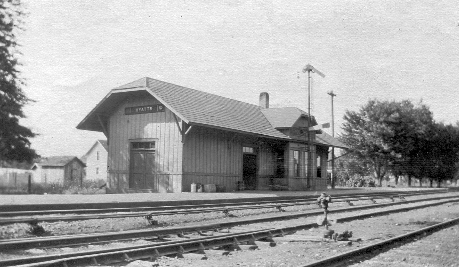
| Hyatts (Hyattsville) |
|
This station was on the west side of the double line tracks, immediately north of the County Road 123 (now Hyatts Road) crossing at approximately GPS: 40.216282, -83.088103. The station was built in 1895 and closed in 1945. | ||||||
| Leonardsburg |
|
This town was formerly known as Eden Station while the nearby town of Kilbourne was known as Eden (according to 1875 maps). | ||||||
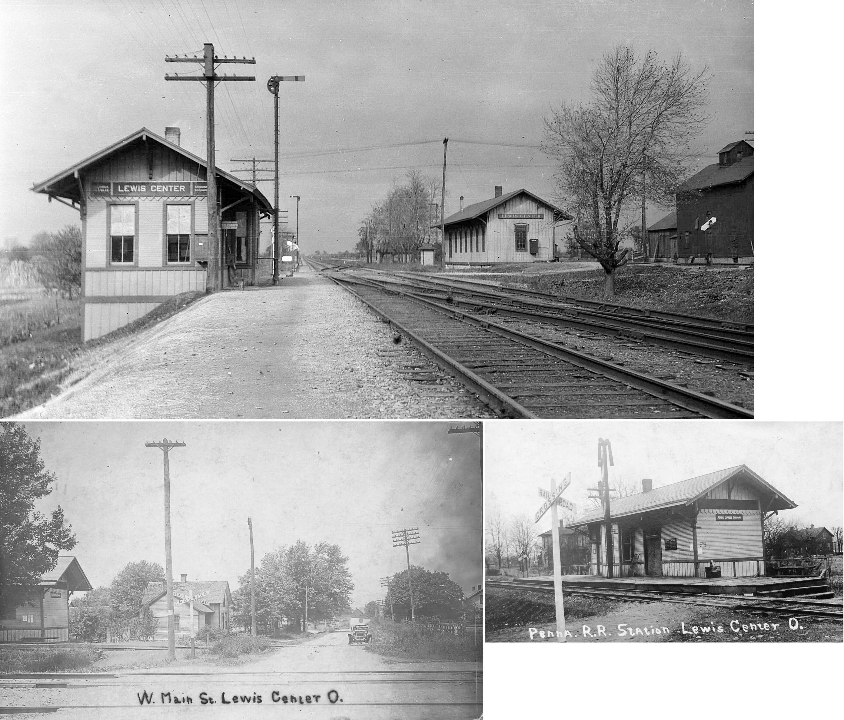
| Lewis Center |
|
This station was on the north side of Lewis Center Road on the west side of the CCC&St.L tracks (between the CCC&St.L and PRR tracks) at GPS: 40.199481, -83.009840. In the photo the PRR station is on the left and the Big 4 station is on the right looking north down the tracks. | ||||||
| Lewis Center |
|
This station was on the south side of Lewis Center Road on the west side of the PRR tracks at GPS: 40.199160, -83.010059. | ||||||
| Norton |
|
|||||||
| Orange |
|
|||||||
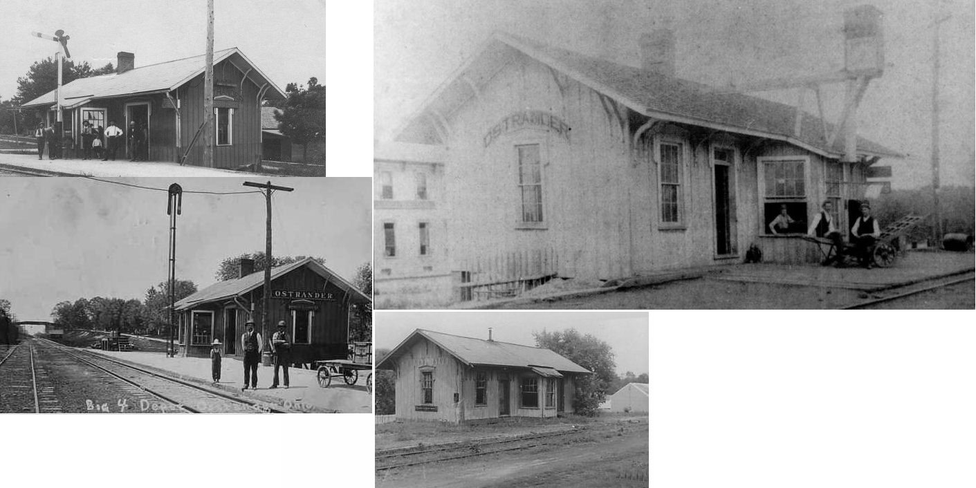
| Ostrander |
|
|||||||
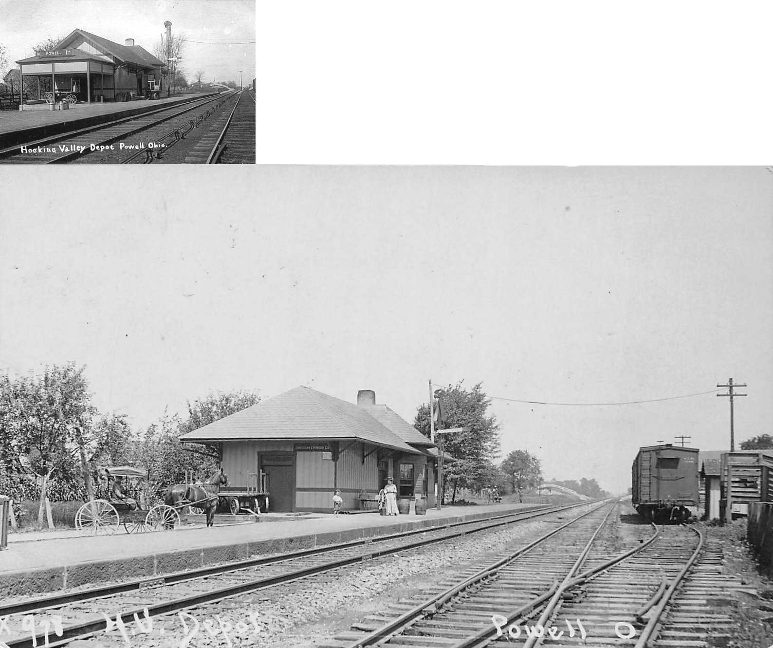
| Powell |
|
The original station here was built in 1876 and replaced in 1893 (the station shown in the photos). The station was retired in 1961. | ||||||
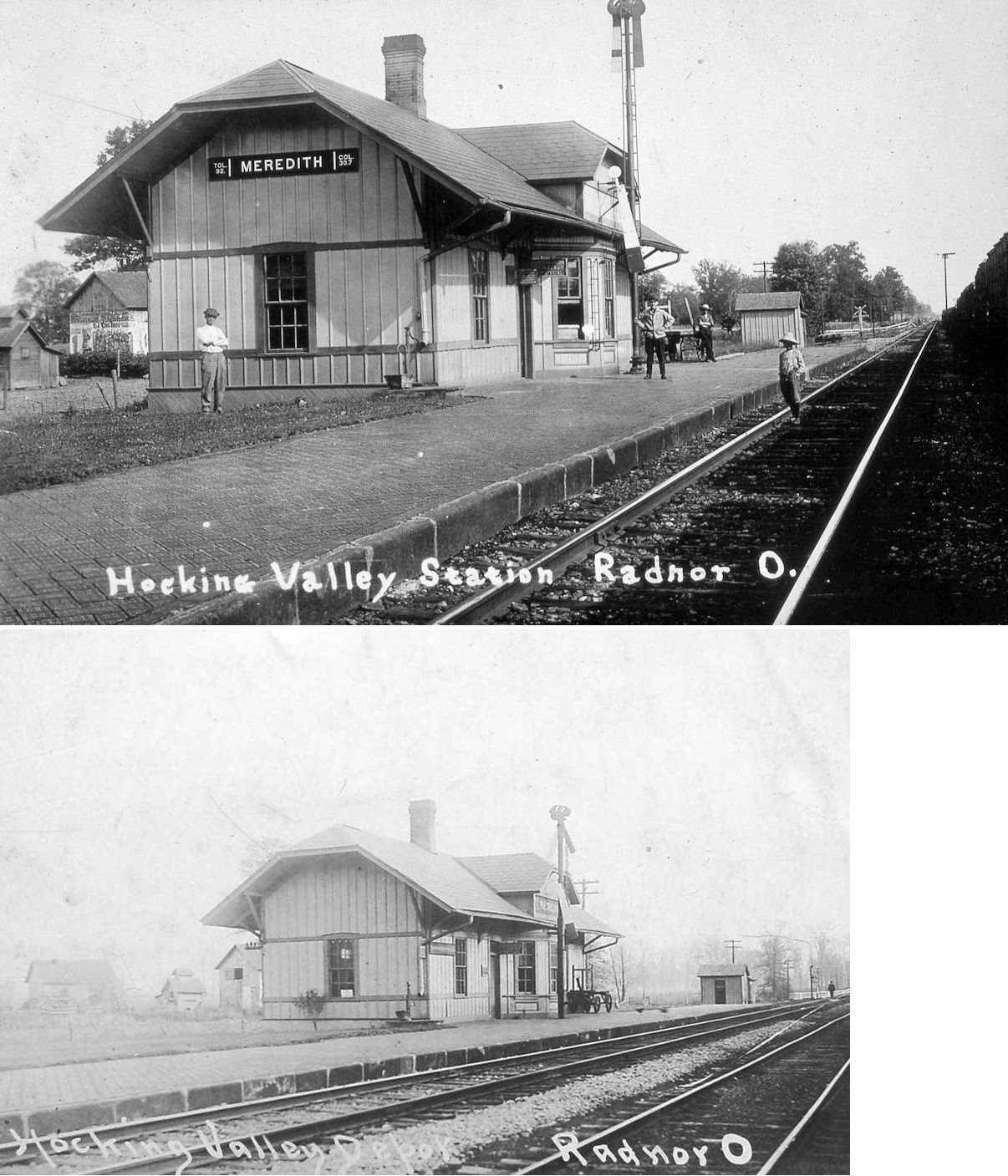
| Radnor (Meredith) |
|
The name of this station was changed from Meredith to Radnor in 1905. It was retired in 1956. That may have been the second station here replacing an earlier one. | ||||||
| Scioto |
|
|||||||
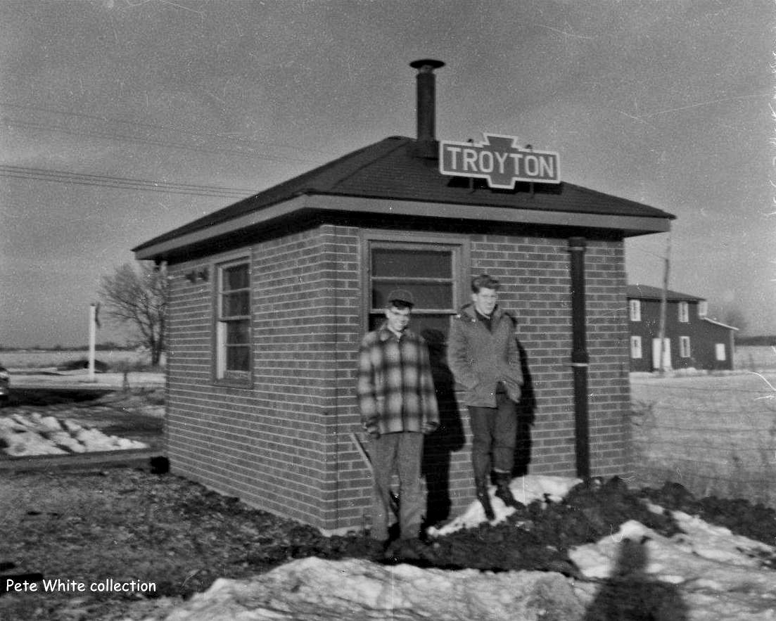
| Troyton |
|
At one time there was a passenger station/shelter here. In later years this was a block/signal station that may have also served passengers (hence the station sign), but that is unclear. It also served the nearby grain facility. | ||||||
| White Sulphur |
|
This station served Hart Springs Resort and Millville. It was located at the west end of the iron bridge over the Scioto River at the intersection of Penn Road and SR-257 (GPS: 40.276847, -83.157653). Later it served the Industrial Girls Home which was five miles directly south at Home Road. A small village sprung up around the station. A sizable limestone quarry, White Sulfur Lime & Stone Co. was located about a quarter mile to the west, and a spur ran off the south side of the track across Penn Road into the quarry. It filled with water after a spring was was hit sometime in the 20's or 30's, and rumor has it that all the equipment and rail cars are still at the bottom of the quarry. The last train went through in 1971. Last passenger service was in 1961. | ||||||
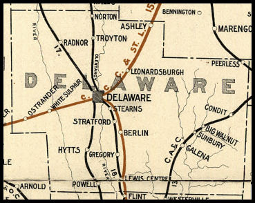
| 1898 DELAWARE COUNTY RAILROAD MAP | ||||||||
 |
||||||||
|
Notes About Existing Stations... Delaware (CCC&I ) - Station track gone. Flower shop. A smaller CCC&I frame station predated this station at the same site (it appears on 1885 maps). The CCC&I was renamed the CCC&St.L a couple years after this station was built. In the old days there was a "Railroad Eating House" just south of the station. Delaware (CCC&St.L ) - Across the tracks from the passenger station. The freight station was rehabilitated into what is now "The Food Truck Depot." Much of the building's interior was cleaned and kept original. It now serves beer and other beverages and hosts a revolving number of food trucks outside along the street and in its parking lot. Peerless (T&OC ) - Original location was where the T&OC crossed Peerless Road. Station was moved a short distance to a nearby farm when it was purchased in 1941 by Paul Boyd who converted it to a corn crib. Although the station had been closed for over a decade and moved, it still appeared on the New York Central Railroad’s tariff listing in 1955 when there was a subsequent Ohio Public Utilities Commission hearing to remove it from the tariff list. Sunbury (CA&C) - This is an example of the heavy modification the PRR performed on some old CA&C depots in later years. It received a different roof, lost its bay window and was covered with fake-brick siding (which has mercifully been removed as of 2009). It served as a residence after its railroad days and as of 2015 was occupied by the Delaware County Model Railroaders. The building is owned by Preservation Parks of Delaware County. There are two open house days per month on Saturday and Sunday (see this calendar for details). |
||||||||