 COUNTY COUNTY
|
|
||||||||
| EXISTING STATIONS | ||||||||
|---|---|---|---|---|---|---|---|---|
| Station Name |
Original Railroad | Current Location |
Type | Current Use |
Date Built |
Track Status |
Building Material |
More Info |
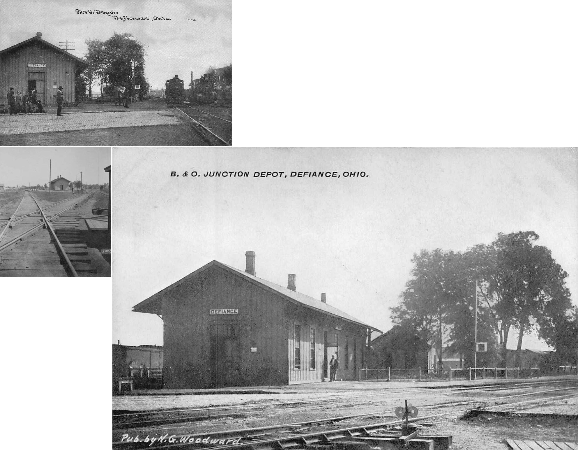
| Defiance |  |
SW of 5th Street between Jackson and Harrison Streets. (GPS: 41.284797,-84.367632) | P | Railroad | pre-1888 | In Use | Wood |
|
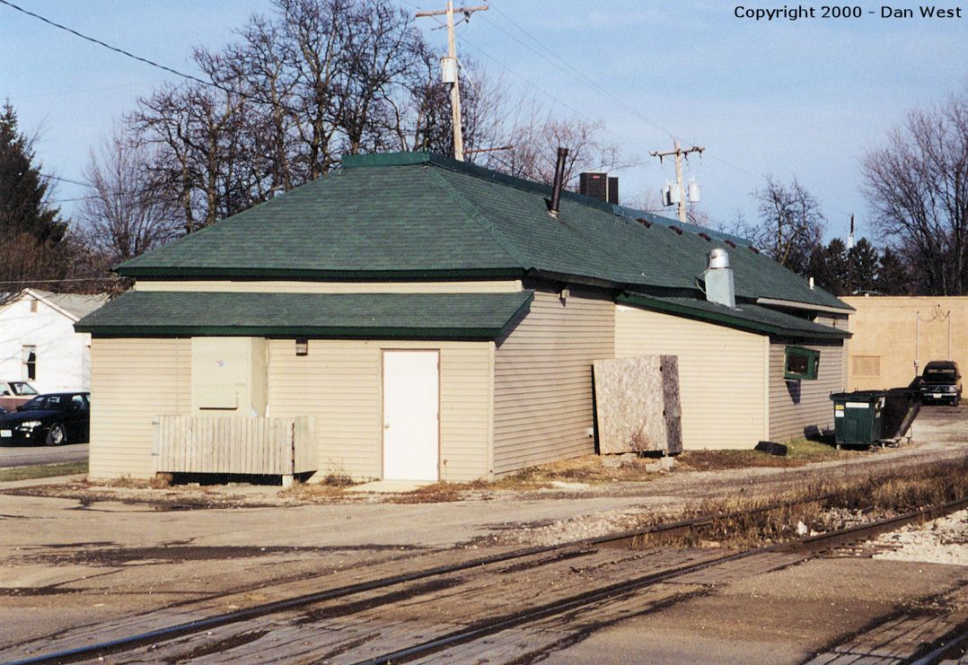
| Defiance | |
1121 Harrison Street near Deatrick Street. (GPS: 41.278284,-84.377784) |
F | Business | ???? | In Use | Wood |
|
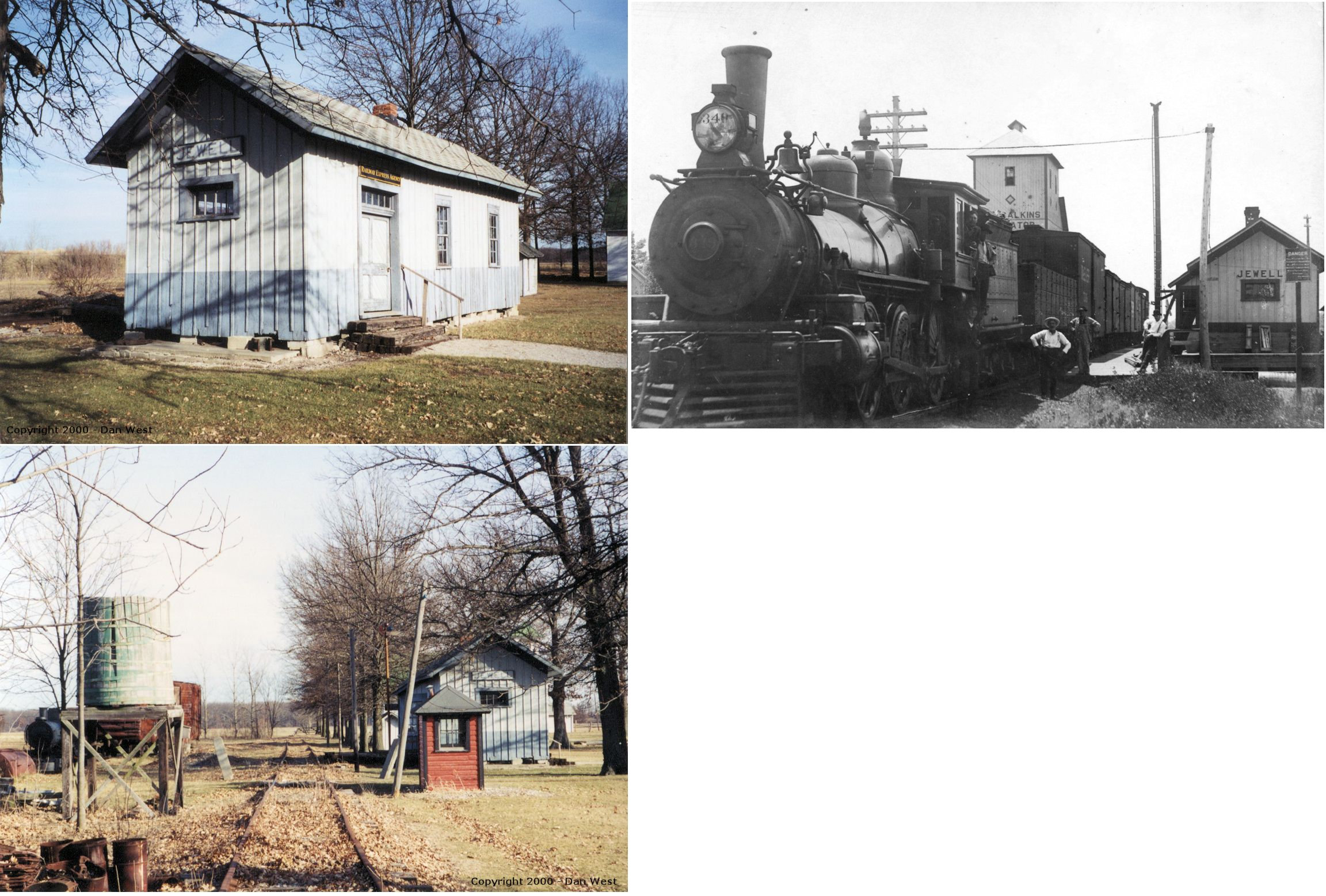
| Jewell | |
Auglaize Village at 12296 Krouse Road (GPS: 41.264439, -84.440628) |
P | Museum | ???? | None | Wood |
|
| STATIONS OF THE PAST | ||||||||
| Station Name |
Original Railroad |
Notes | ||||||
| Defiance |  AND |
Built in 1875, this union station was near where the tracks converge. It was on the east side of Deatrick Street SE of Harrison Avenue (GPS: 41.278008, -84.377669). The B&O frieght station was just to the NE at GPS: 41.278129, -84.377372. Although built by the B&O, the station had platforms on both sides to serve both the B&O and Wabash. | ||||||
| Defiance | |
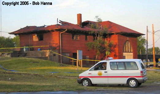
Built in 1917, this station sat on the SE side of Clinton Street at Davidson Street at GPS:41.279516, -84.369179. Was used as a MofW Base until it partially burned on 6/10/05 and finally demolished in march, 2006. Photo of burned station. There was a subway and stairs/elevator that lead to a platform between the elevated tracks. | ||||||
| Defiance | |
There was a freight station on Seminary Street/Seymor way at GPS: 41.280213, -84.366026. This served several siding tracks of the mainline. | ||||||
| Defiance | |
There was another freight station on Jacskson between Thurston and Worhtington Streets. The Wabash roundhouse was to the SW across the tracks. (GPS: 41.283946,-84.368284) | ||||||
| Delaware Bend | |
This station was on the west side of The Bend Road (formerly Bryan Street), on the south side of the tracks. (GPS: 41.282733,-84.51587) | ||||||
| Drake |  |
The CJ&M was a forerunner of the Cincinnati Northern. | ||||||
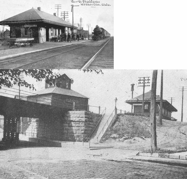
| Hicksville | |
This station was on the SE side of High Street (formerly Bryan Street), on the south side of the tracks. The road that ran along the tracks was formerly called B&O Railroad Avenue. (GPS: 41.296066,-84.757665) | ||||||
| Mark Center | |
The station was on the east side of Main Street, on the north side of the tracks (GPS: 41.289356,-84.630615). There was an early two-story frame station here that was replaced by a standard-plan B&O station in the early 1900s. | ||||||
| Ney (Georgetown) |
 |
This station was on the north side of West Main Street, on the east side of the tracks (GPS: 41.381937,-84.525901). According to NYC valuation records, a combination station was built here in 1898. | ||||||
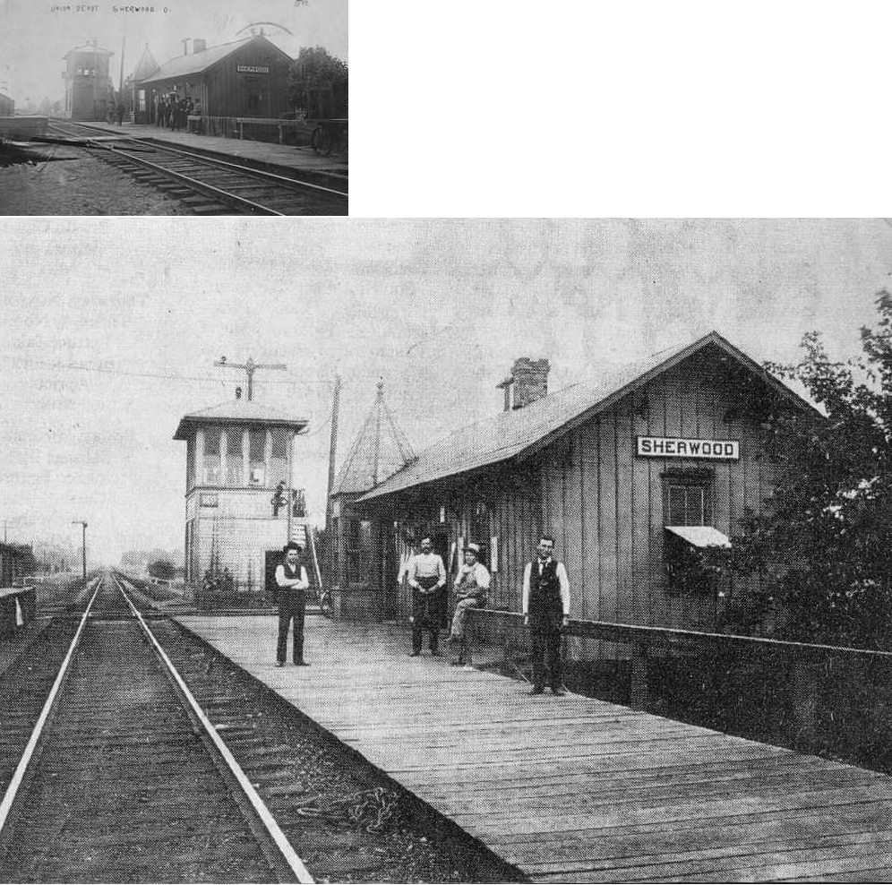
| Sherwood |
AND |
This station served both the B&O and Cincinnati Northern as a "union" station. The photo was taken in 1905. The depot burned in 1912. The tower in the photo was the original wooden tower. This was located on the north side of Pearl Street in the SW quadrant of the diamond. (GPS: 41.285554,-84.549413) | ||||||
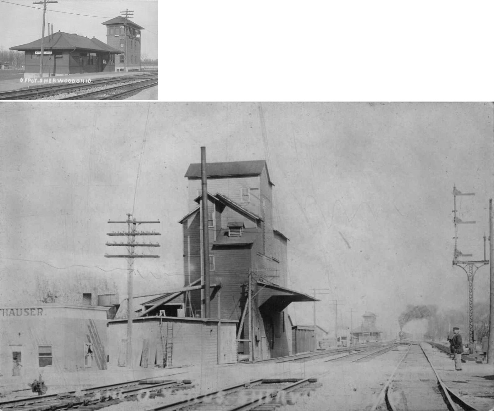
| sherwood | AND |
This newer union station which served the B&O and Cincinnati Northern appears to be of B&O design. The newer brick interlocking tower in this photo (that replaced the old wooden one) was demolished in 1979. This was located at the east end of Lawrence Street. According to CN valuation records, this station was built in 1916. | ||||||
| 1898 DEFIANCE COUNTY RAILROAD MAP | ||||||||
 |
||||||||
|
Notes About Existing Stations... Defiance (Wabash Passenger) - This station is shown on an 1888 maps of the town, so it is at least that old. The building was larger before the RR cut it down to size. Defiance (Wabash Freight) - Formerly the South Side Bar, now (2017) the Dos Amigos restaurant with another addition to the building. Tracks now operated by the Napoleon, Defiance & Western RR. Jewell (Wabash) - The original location of this depot was at the corner of CR-185 and Jewell Road (CR-55) (GPS: 41.325763,-84.28476). |
||||||||