 COUNTY COUNTY
|
|
||||||||
| EXISTING STATIONS | ||||||||
|---|---|---|---|---|---|---|---|---|
| Station Name |
Original Railroad | Current Location |
Type | Current Use |
Date Built |
Track Status |
Building Material |
More Info |
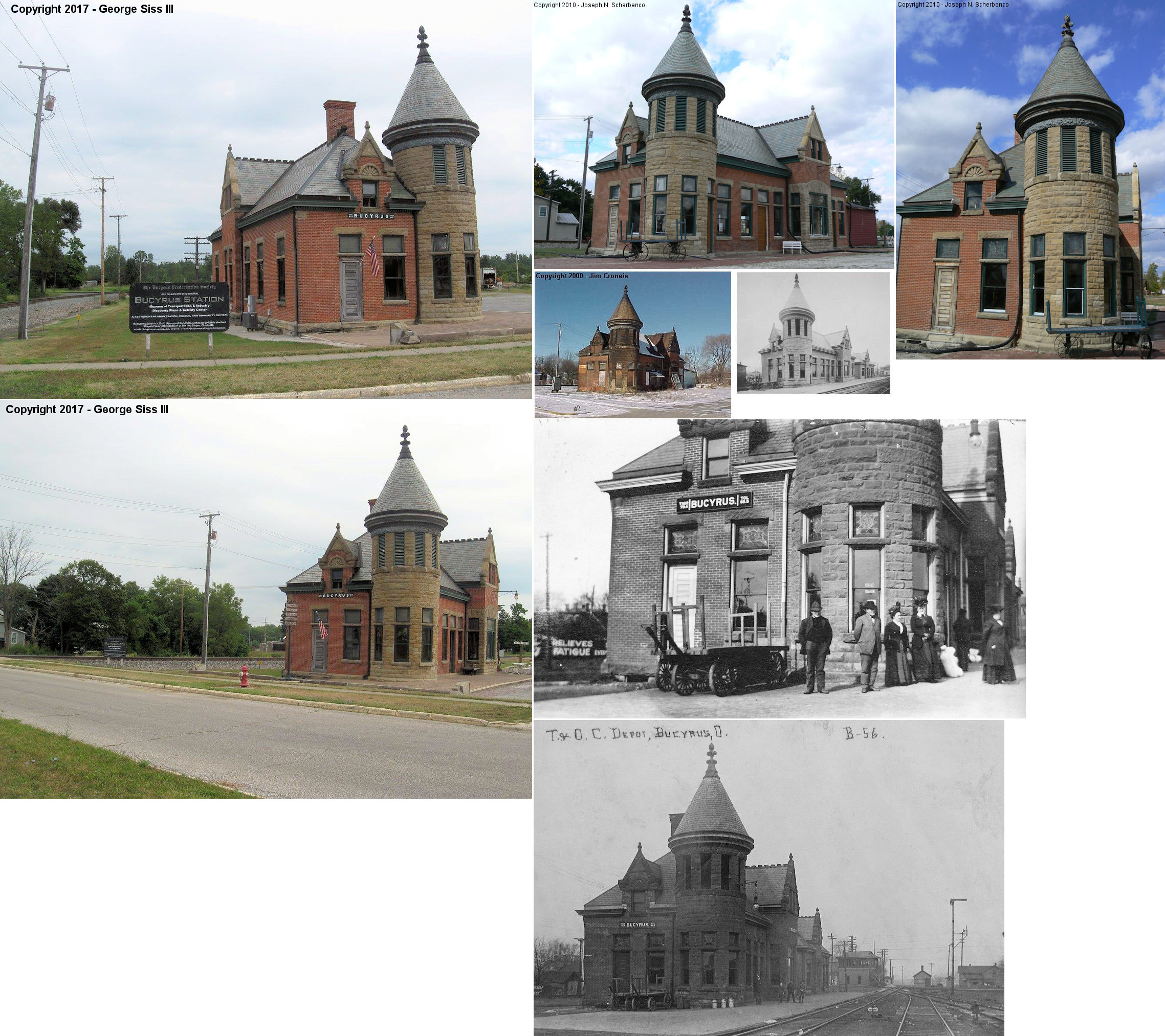
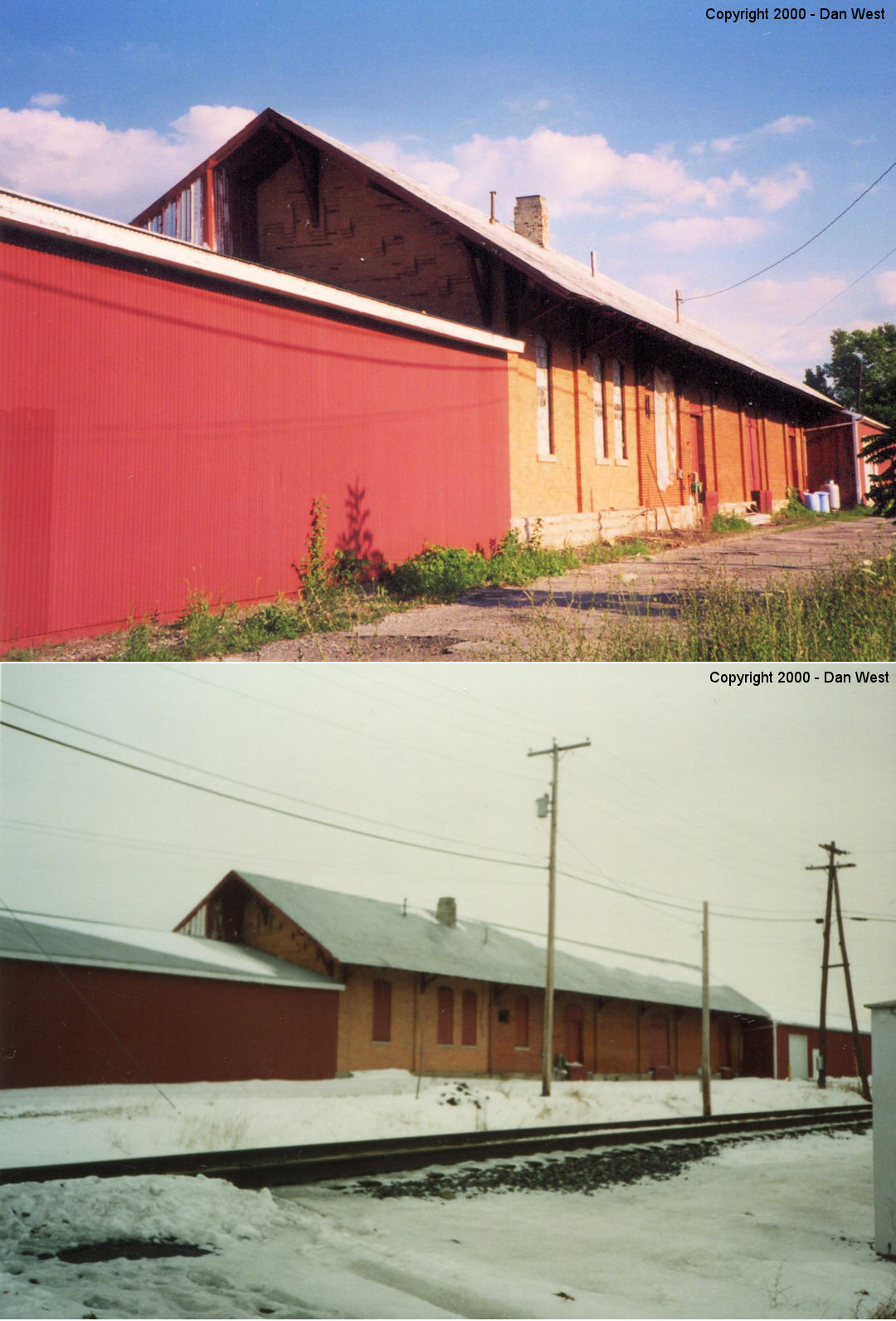
| Bucyrus |
 |
700 E. Rensselaer Street (GPS: 40.807886, -82.966838) |
P | Vacant | 1892 | In Use | Brick |
|
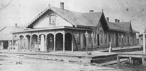
| Bucyrus |
|
East Rensselaer Street, near the station listed above. | P | Gift Shop | 1894 | In Use | Wood |
|
| Bucyrus |
 |
Walton Lake | P | Residence | 1893 | None | Wood |
|
| Crestline |
 |
Behind a residence on Leesville Road; first house west of Nazor Road (GPS: 40.798795, -82.766161) |
F | Storage | ???? | None | Wood |
|
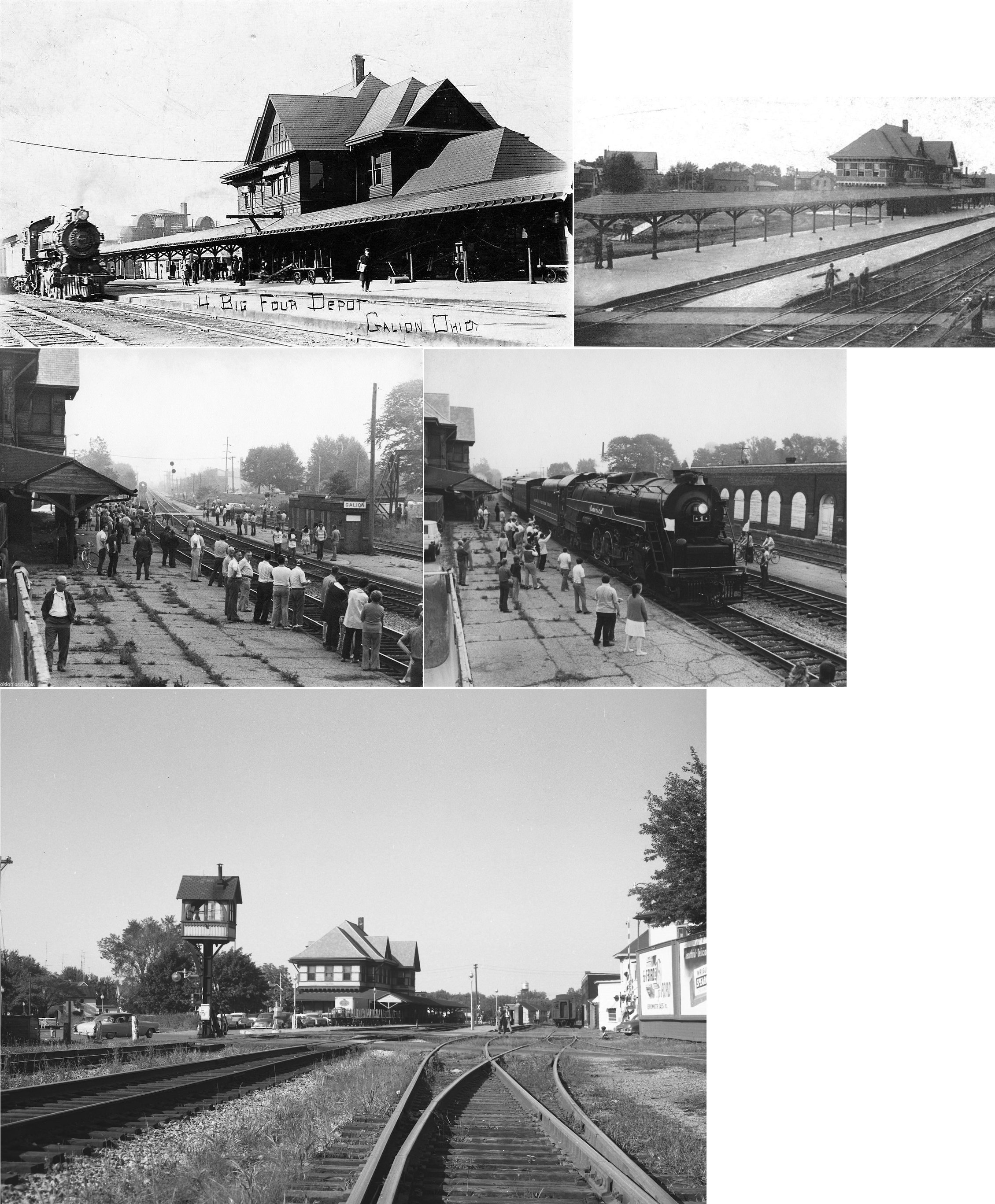
| Galion |
|
Hardin Way (Main Street) and North Washington | P | Vacant | 1900 | In Use | W/B |
|
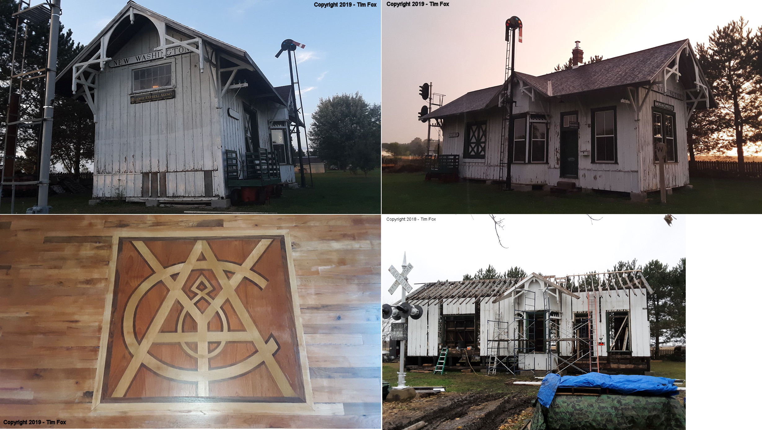
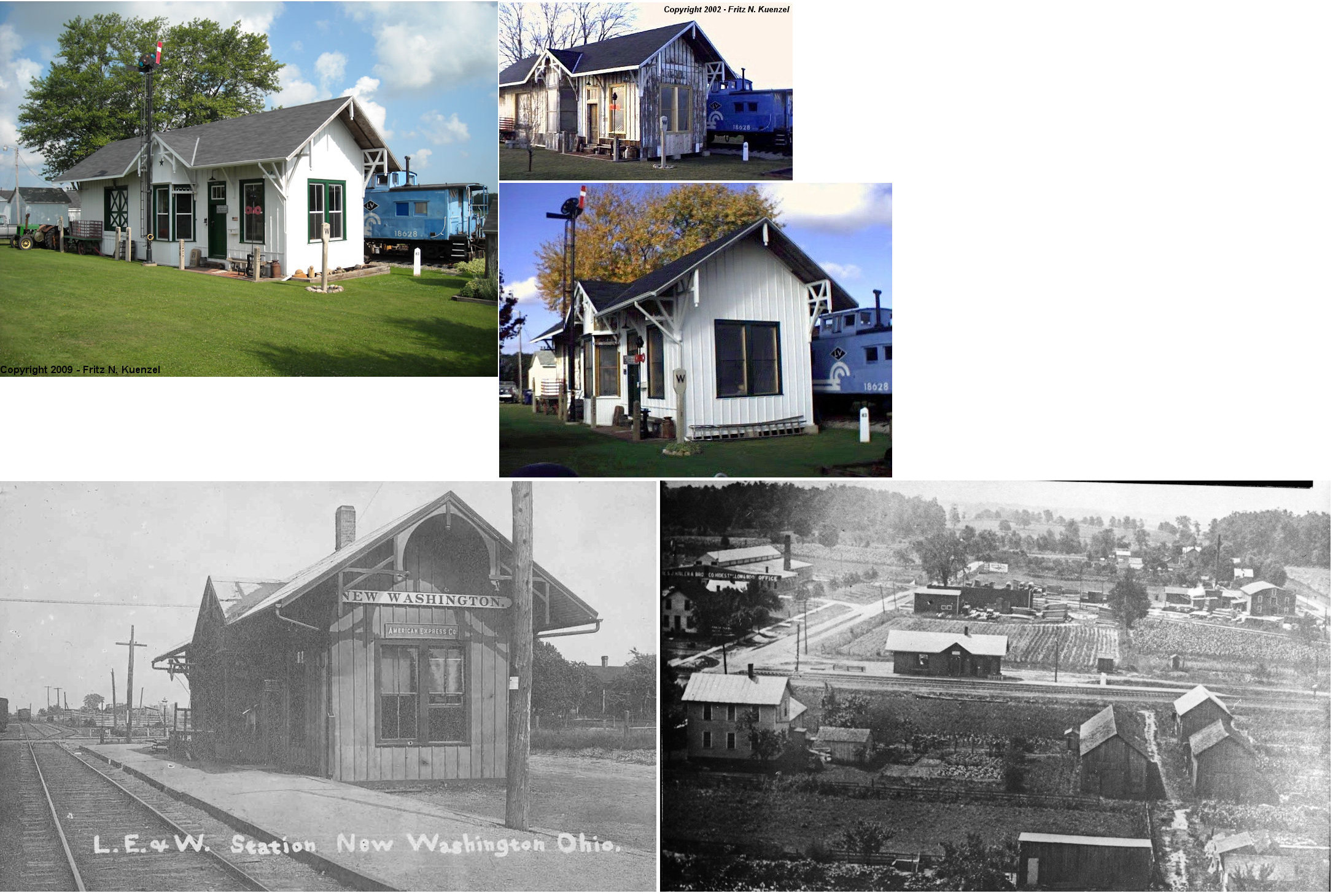
| New Washington |
 |
2578 Zenobia Road, Norwalk (Huron Co.) (GPS: 41.204133, -82.497275) |
C | Private | 1890 | In Use | Wood |
|
| STATIONS OF THE PAST | ||||||||
| Station Name |
Original Railroad |
Notes | ||||||
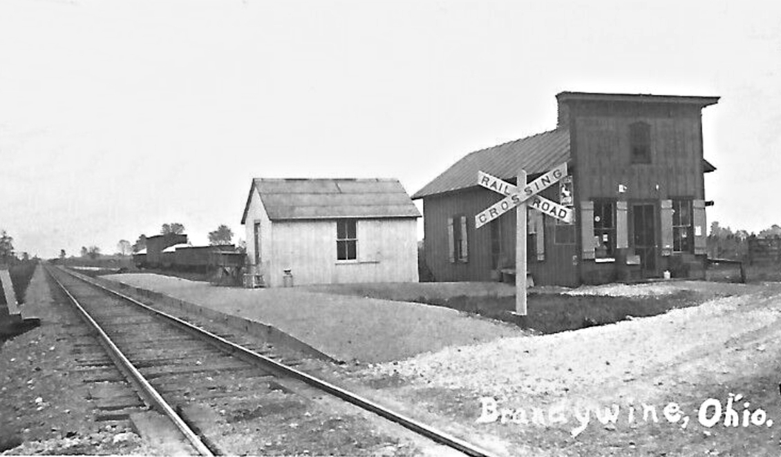
| Brandywine |
|
|||||||
| Bucyrus |
|
Sat across from the passenger station on the south side of Rensslaer St. Demolished by NS in 1998 to make room for the new connecting track between the NS Sandusky District and the CR Ft. Wayne Secondary. | ||||||
| Bucyrus |
 |
The first PFt.W&C station here burned down in 1883. | ||||||
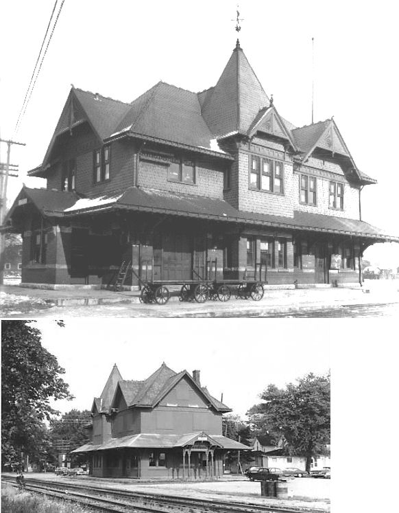
| Bucyrus |
|
There were two PRR stations in Bucyrus; a PFt.W&C station and a S&C Short Line station. The station pictured here is the PFt.W&C station that sat on East Railroad Street on the east side of North Lane Street. It was built in 1884 after the original station burned. There was a freight station directly across the tracks there as well. | ||||||
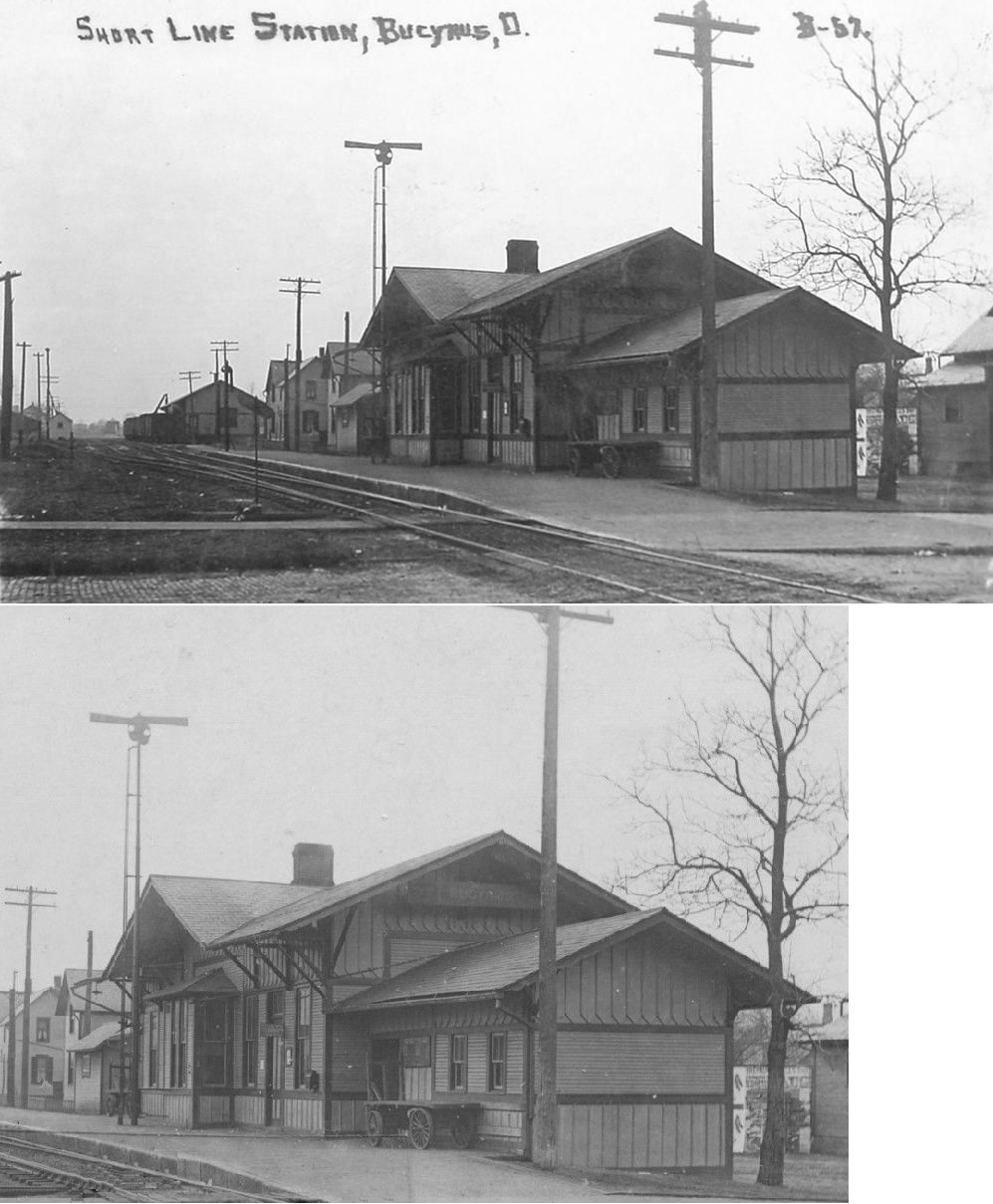
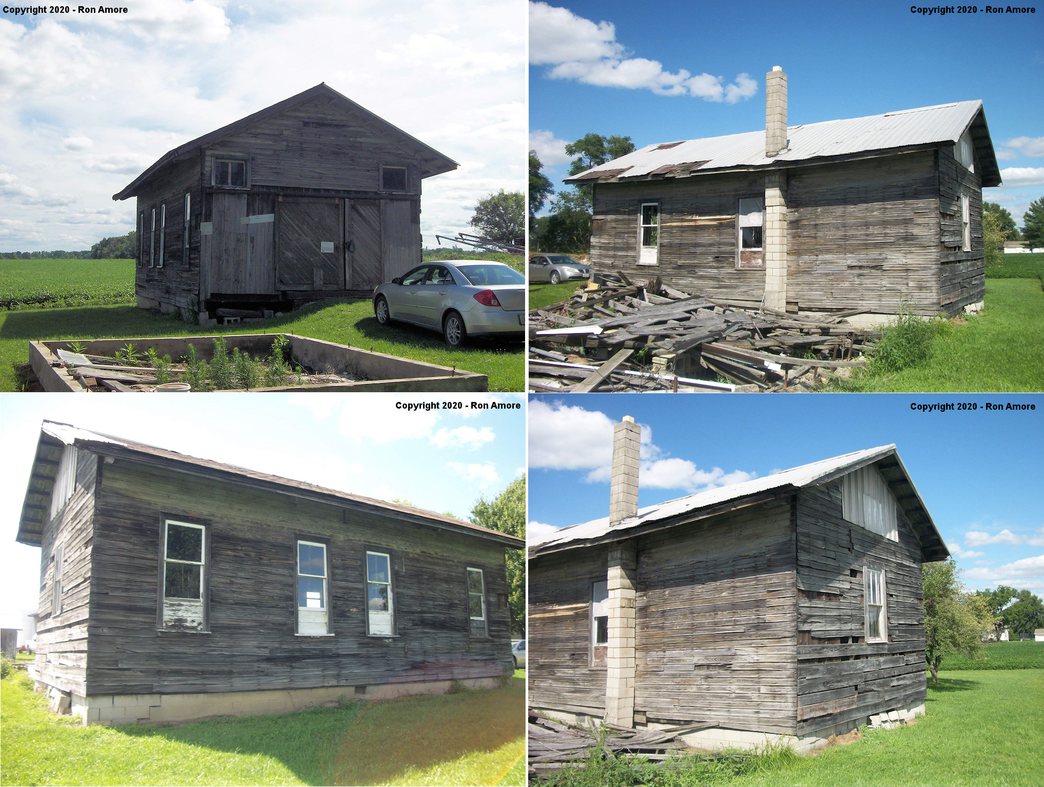
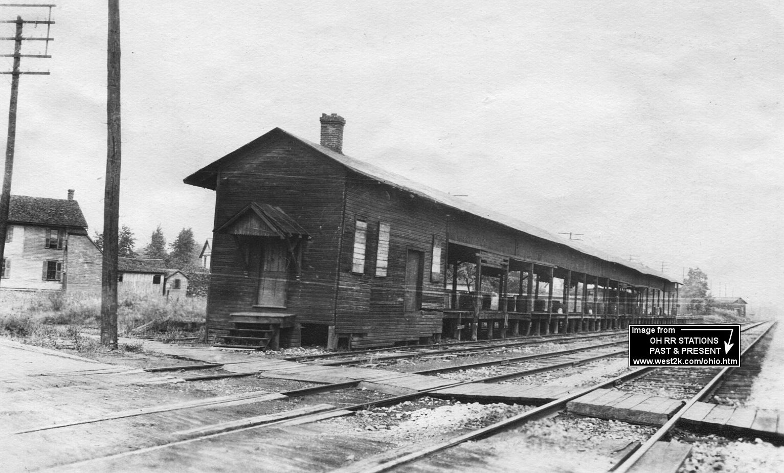
| Bucyrus |
|
There was also a Short Line freight station south of there on the south side of Warren Street. The freight station was closed in 1920 and freight operations were then consolidated at the main line (T&OC) freight station on North Lane Street. | ||||||
| Bucyrus (Mt. Gilead) |
|
This T&OC station was located on the east side of the tracks just west of the intersection of Hopley Avenue and East Southern Street at GPS: 40.797929, -82.964770. It was originally located in Mt. Gilead (Morrow County) on the east side of the tracks on north side of West High Street just east of the intersection with Marion Street at GPS: 40.549089, -82.843022. It was built in 1882, and taken out of service in the 1920s when it became redundant when the NYC leased both the T&OC and CCC&St.L. In 1924 all passenger service for Mt. Gilead shifted to the brick Mt. Gilead Shortline depot at Iberia & High Streets. This station was dismantled and moved to Bucyrus in 1929, modified somewhat, and served as an NYC yard office there. | ||||||
| Chatfield |
 |
This station served the Northern Ohio (AC&Y) Railroad and the Columbus, Sandusky & Hocking RR. It was east of Route 4 in the SW corner of the diamond at GPS: 40.957499, -82.938007. | ||||||
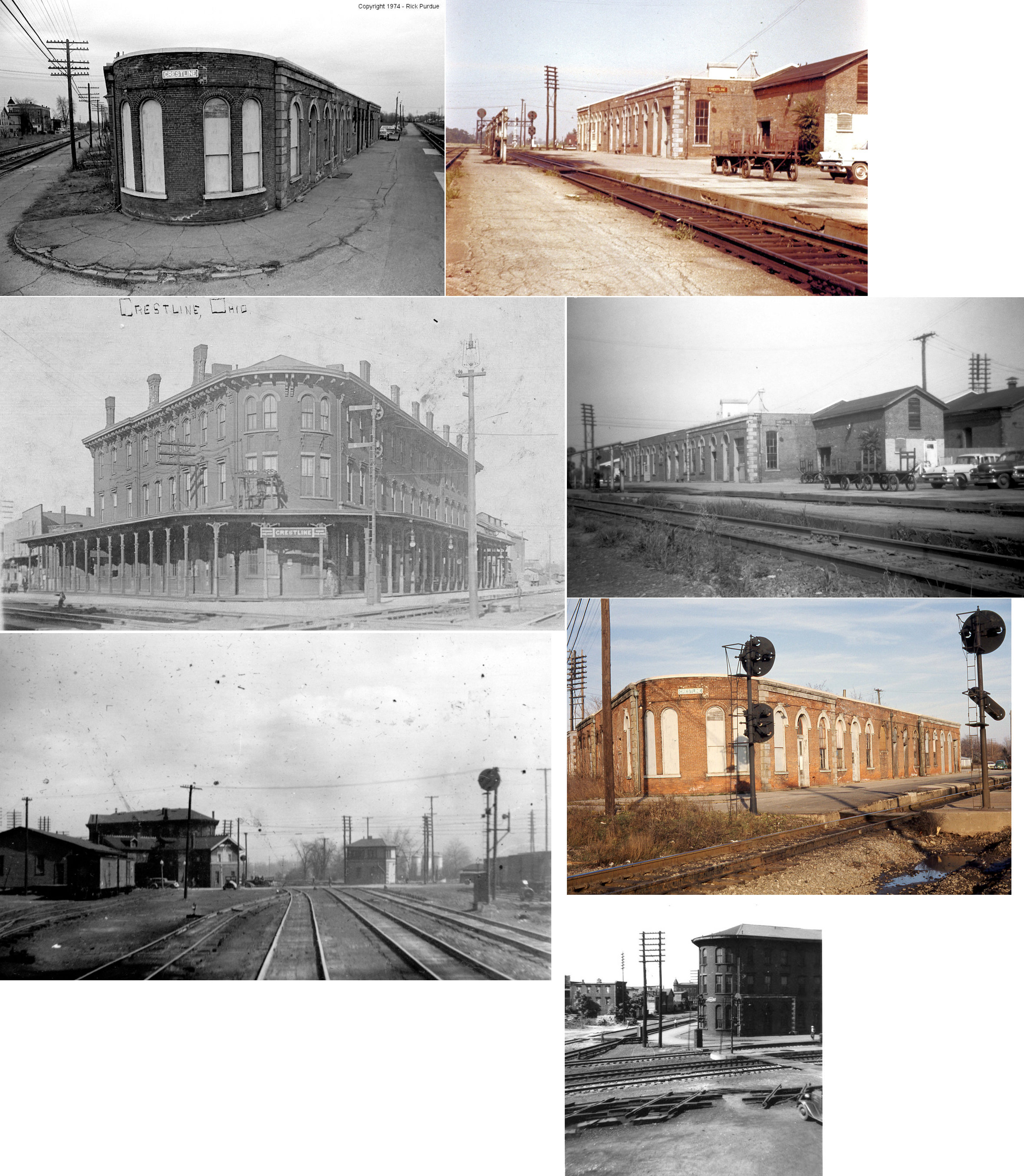
| Crestline |
|
Built 1854, this was the original Union Station predating the one listed below. It burned down in 1862 or 1863. | ||||||
| Crestline |
|
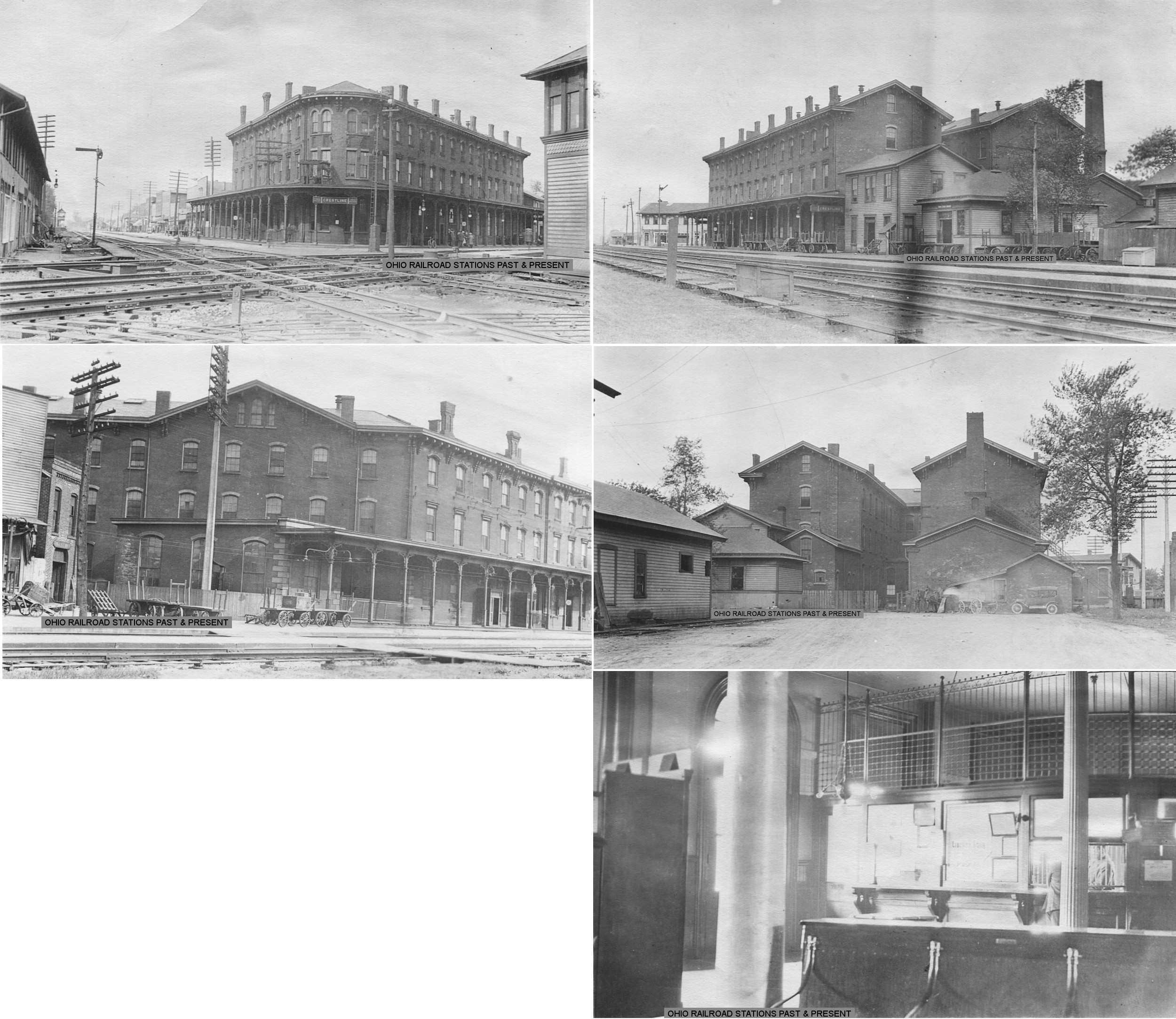
This station served the CCC&St.L and PFt.W&C. It was built in 1864, opened in 1865, and demolished 1980. The station sat in the Northeast quadrant of the PRR main line/NYC intersection off Route 61, Bucyrus Street and Crestline Street at GPS: 40.782571, -82.737538. This station also housed the Continental Hotel. At some point the top two floors were removed leaving it as a one-story structure. Here are some more photos from around 1916-1919. | ||||||
| Crestline |
 |
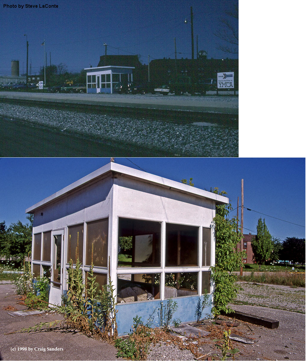
A small shelter was built at the site of the old Union station after that station was torn down in 1980. | ||||||
| Crestline |
AND |
There was a joint freight station on the east side of South Thoman Street on the south side of the connecting track at GPS: 40.781908, -82.737816. It had a two-story headhouse on the west end. The station was demolished (or burned) around 1917 and the NYC build a new, smaller, freight station at the same site (also with a two-story headhouse) while the PRR built a new station on the opposite side of the diamond. | ||||||
| Crestline |
 |
Sometime between 1910 and 1921 a new PRR freight station was built on the west side of South Thoman Street just south of Mansfield Street at GPS: 40.782509, -82.738571. | ||||||
| Crestline |
 |
|||||||
| Galion |
|
Prior to the 1900 station that is still standing, the CCC&I had a frame station in the same location at Main and North Washington. | ||||||
| Galion |
|
The freight station was located on the corner of East Walnut and South Liberty. | ||||||
| Galion |
 |
Built in 1891, this station sat on the west side of South Market Street. The freight station (a 200' frame structure which also served passengers prior to 1891) was on the east side of South Market. | ||||||
| Galion |
|
According to the 1888 NYLE&W Annual Report and later Erie RR valuation reports, a new freight transfer station was built here that year for a cost of $2,500. This long transfer station was on the east side of South Street and extended NE almost to Pierce Street. The head end was at approximately GPS: 40.730160, -82.783362. | ||||||
| Glenville |
|
|||||||
| Leesville |
|
This station was between Crestline and North Robinson. It was at the OH-598 corssing in the vicinity of GPS: 40.783039, -82.789628. | ||||||
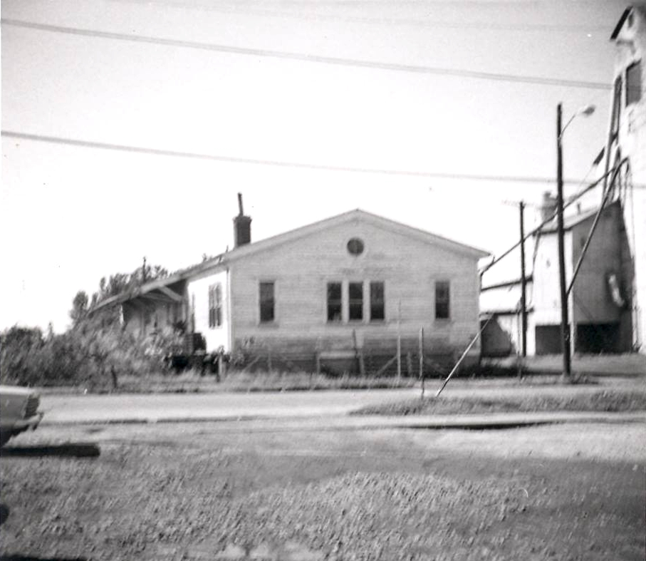
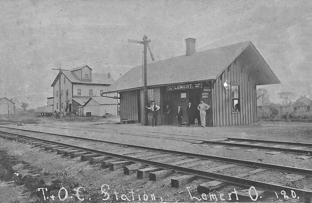
| Lemert |
|
The station was on Haines Road at approximately GPS: 40.893991, -83.090675. After it went out of service, the station became the office for the grain elevator. The grain elevator was destroyed by fire, but it is unclear whether the station burned then or was torn down later. | ||||||
| Monnett |
|
|||||||
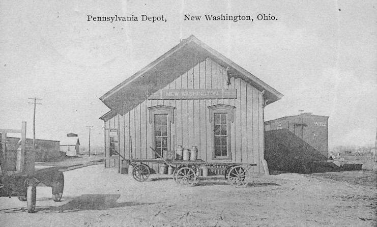
| New Washington |
 |
This station was off West Mansfield Street between Willacker and High. There was a street the depot sat off of called Depot Street that is no longer there. | ||||||
| New Winchester |
|
Was located southeast of Bucyrus on SR 100, just North of Monett-Chapel Road. After sitting vacant, it was torn down in late 2009. | ||||||
| North Auburn |
|
|||||||
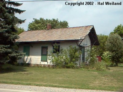
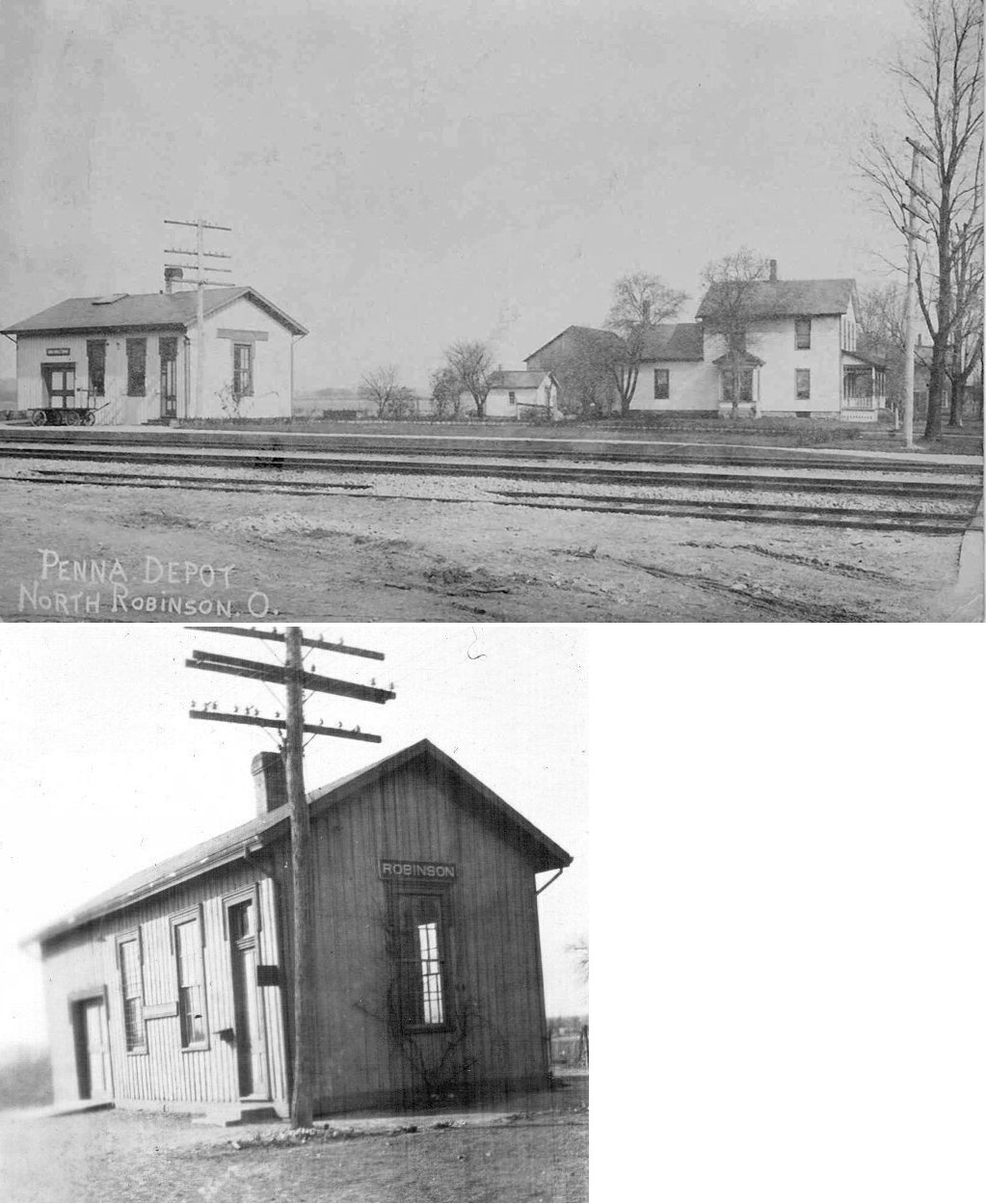
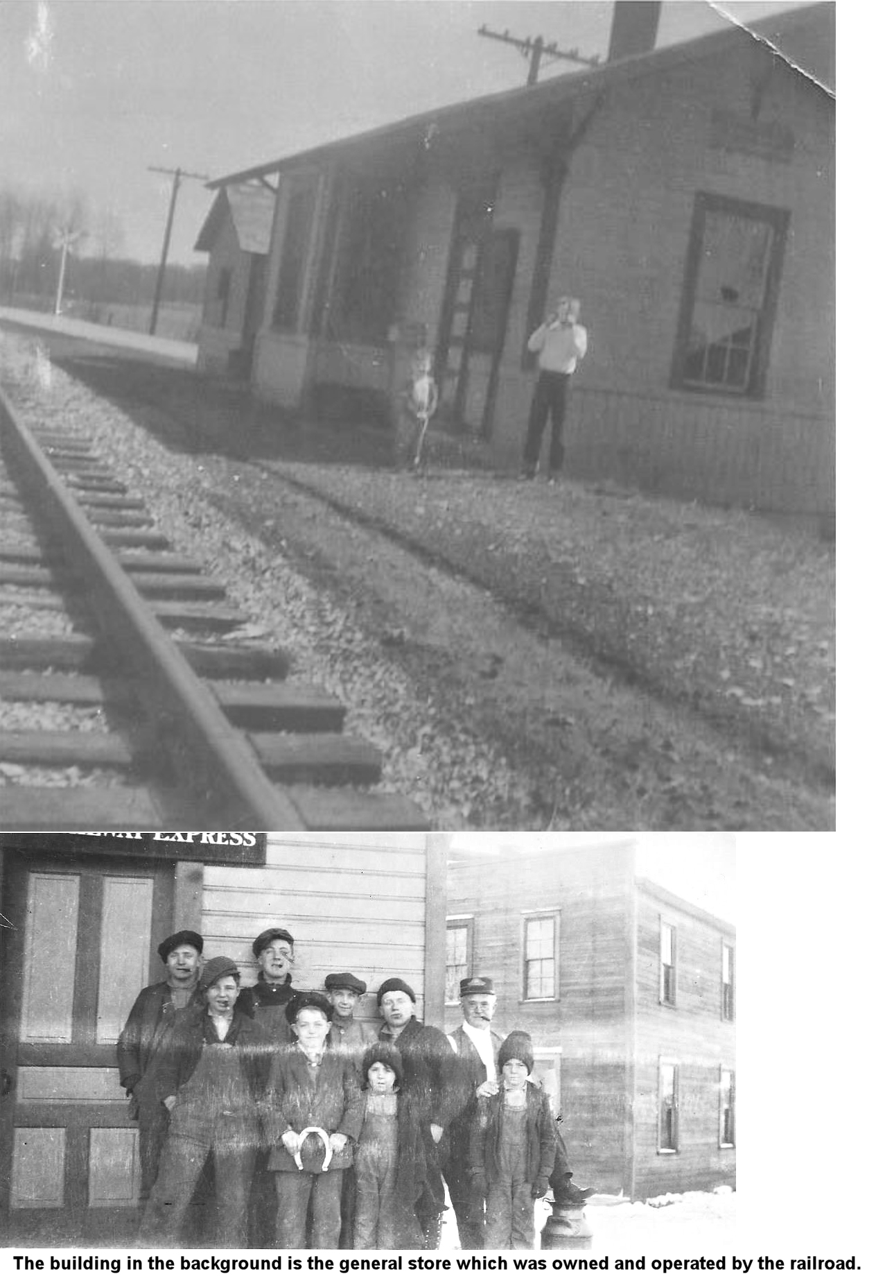
| N. Robinson (Robinson) |
|
|||||||
| Plankton |
|
|||||||
| Ridgeton |
|
|||||||
| Spore |
|
This station was a residence on Bethel Road about 1 mile north of US 30. It was moved there from its original location on Spore-Bradywine Road. The station became a victim of flooding in 2009 and was then torn down. | ||||||
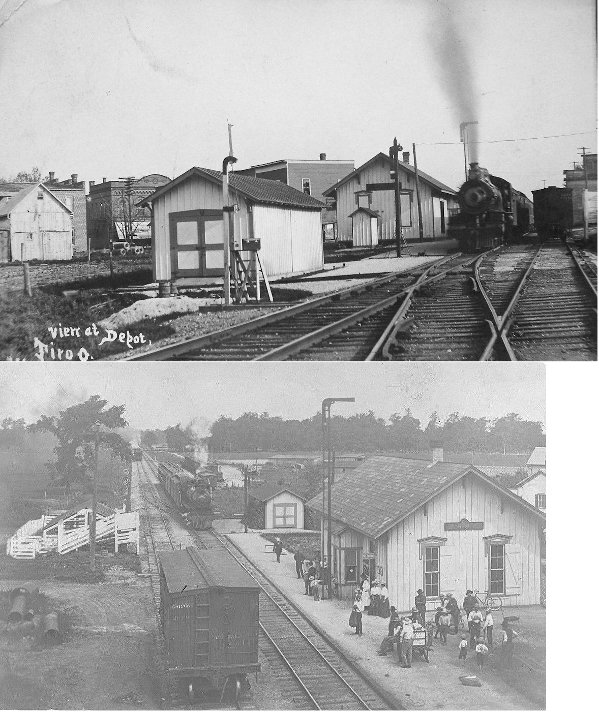
| Tiro |
|
|||||||
| 1898 CRAWFORD COUNTY RAILROAD MAP | ||||||||
 |
||||||||
|
Notes About Existing Stations... Bucyrus (T&OC) - On National Register of Historic Places. Will be an active visitors center and museum called Bucyrus Station under the Bucyrus Historical Society for one year, then on its own as a 501(3)c non-profit corporation. The society hopes to rebuild another building that was also on the site and rebuild a 140-foot platform and install new restrooms. It will also be used as a meeting hall, train watching place, and will use old dinette sets and kitchen furniture surrounded by bay windows facing both NS and CSX roads. The T&OC line is abandoned except for the 8-mile Spore Quarry line which diverged to a PRR spur. Old PRR tracks on two sides of the station. The T&OC Station, we find, has a missing ticket office, evidenced by marks on ceiling and floor that match those of the NYC ticket office. Old-timers told us that the PRR Sandusky short-line sold tickets here and operated their own wooden freight house station across the street until torn down. --Jim Croneis Bucyrus (T&OC) - Photo shows station in original location. This station was originally located at the corner of Plymouth St. and Lane St. in the northeastern area of Bucyrus. The station was used at the turn of the century as a cream stop and alternative for those living north of the Sandusky River when the river was un-passable. Over the years the station was used as a barber shop and residence. The Bucyrus Preservation Society relocated the station to an area near the T&OC Depot on E. Rensselaer Street. The station now serves as a gift shop for the complex and offices of the Bucyrus Preservation Society. Some have claimed that this was never a railroad station as it does not appear as such on ICC valuation maps. Bucyrus (Short Line) - This station originally sat on the south side of Rensselaer Street at GPS: 40.807426, -82.967250 just west of the T&OC freight station on the original Sandusky Short Line (later CS&H). The station was built in 1893 with the opening of the Short Line. Passenger service ended in 1934 and the depot was razed in 1935 after Minor Schroll purchased it from the PRR (Telegraph-Forum, 4-25-1935). Although the aforementioned article claimed that the lumber from the station was to be used for "various purposes," it was then apparently reassembled at Walton Lake. Walton Lake is off US 30 on the east side of Crestline in Richland Co. I believe the cottage is off Park Drive at GPS: 40.777130, -82.681131. Can someone provide a recent photo? Crestline (Big 4) - This is supposedly the second story of a freight station that was moved from Crestline in 1956. Of the freight stations in Crestline in 1956, the NYC freight house had a 2-story headhouse attached to a longer 1-story structure, but I don't know if that station was wood or brick. The PRR freight house was one-story, so it's not likely that. Both PRR and NYC records were found in the building, so this may very well be the post-1917 Big 4 freight house with the records having been moved from the old freight station into the "new" one around 1917. That seems to be the most plausible theory. Galion (CCC&St.L) - Undergoing restoration. On National Register of Historic Places. Here are some old photos of the station. New Washington (PA&W) - Station was on south side of tracks west of SR 602. until being dismantled. The current owner has moved it to Norwalk and is restoring it. The Pittsburgh, Akron & Western become part of the AC&Y. The original location of this station was the SW corner of Franklin and Center Streets. Here are some photos of the station in its previous locations. New Winchester (T&OC) - Moved. White frame house w/bay window. |
||||||||