 COUNTY
COUNTY
COUNTY
|
|
||||||||
| EXISTING STATIONS | ||||||||
|---|---|---|---|---|---|---|---|---|
| Station Name |
Original Railroad | Current Location |
Type | Current Use |
Date Built |
Track Status |
Building Material |
More Info |
| Cooperdale |
 |
SW side of SR 60 (GPS: 40.219023, -82.064679) |
C | Private | ???? | Gone | Wood |
|
| Coshocton |
 |
NE corner of 5th Street and Walnut Street (GPS: 40.272566, -81.863321) |
P | Railroad | 1930 | In Use | Brick |
|
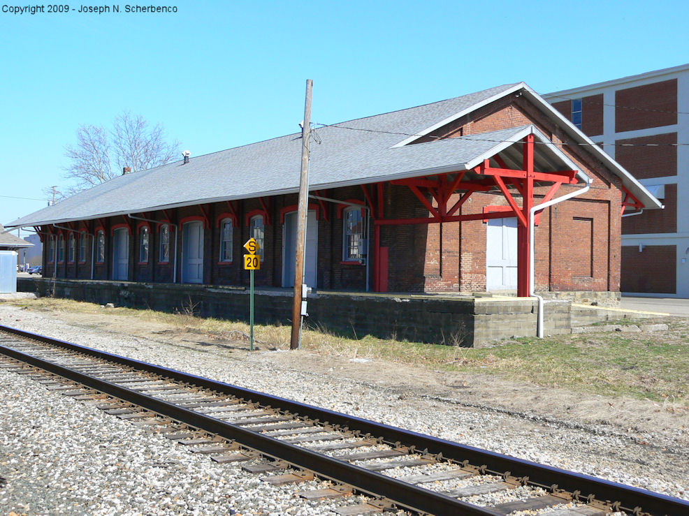
| Coshocton |
 |
SE corner of 5th Street and Walnut Street (GPS: 40.271923, -81.863349) |
F | Railroad | ???? | In Use | Brick | |
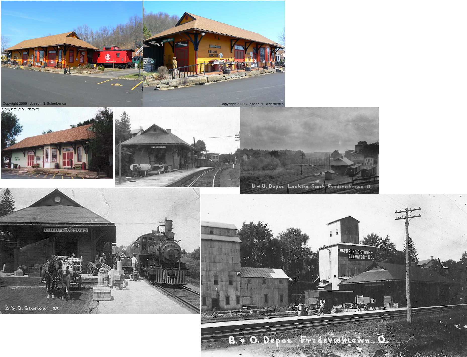
| Fredericktown |
 |
56310 US 36
in West Lafayette (GPS: 40.284786, -81.705213) |
C | Business | 1890 | None | Wood |
|
| West Lafayette |
|
21432 Township Road 156 (GPS: 40.264001, -81.770178) |
P | Private | 1899 | None | Wood |
|
| STATIONS OF THE PAST | ||||||||
| Station Name |
Original Railroad |
Notes | ||||||
| Avondale |
 |
See lisiting below for Fresno. | ||||||
| Bartlett |
|
|||||||
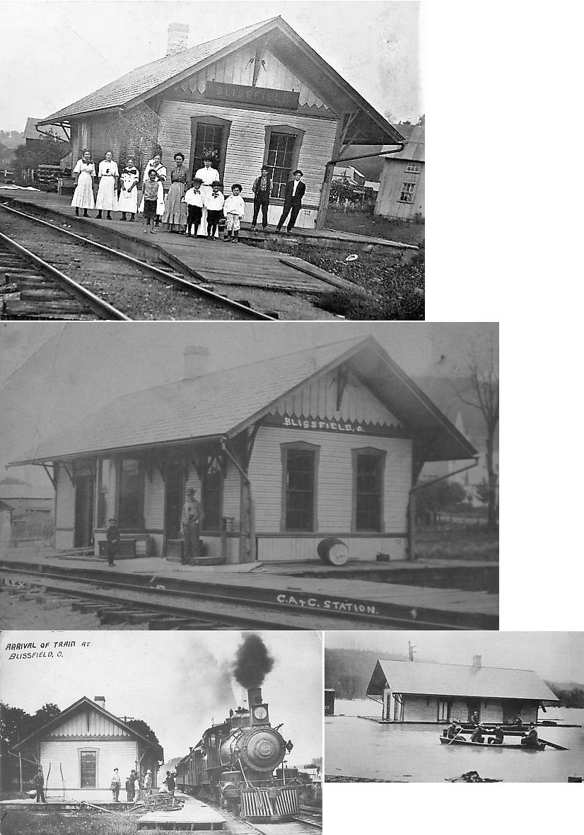
| Blissfield |
|
This station was built in 1889 according to the Coshocton Tribune of March 19, 1889. A station is shown here on the Dresden Branch on the 1923 PRR List of Stations & Sidings. | ||||||
|
Cavallo (Wintergreen) |
 |
A station is shown here on the 1923 PRR List of Stations & Sidings. | ||||||
|
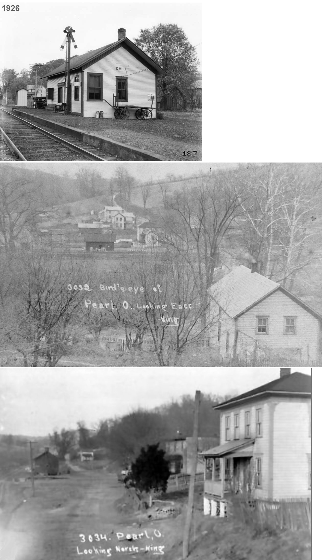
Chili Sta. (Pearl) |
|
The station was in Pearl, but called "Chili" by the railroad. | ||||||
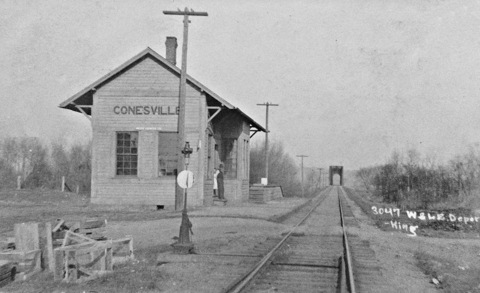
| Conesville |
|
This station was on the SW side of Marquand Avenue at GPS: 40.183684, -81.892299. The station was remodeled in 1912 (The Tribune, 1-6-1912). | ||||||
| Conesville |
 |
A new station was built in here in 1900 according to the Coshocton Democratic Standard of December 14, 1900. According to that article the foundation was finished in December 1900, so the station probably was finished in 1901. Just north of the station was the location of the connection with the 1.9-mile Conesville Branch (and the very short Cassingham Branch). The station here was closed in 1905 with no reason given by the railroad at the time (Coshocton Tribune, 11-28-1905), but later reopened. | ||||||
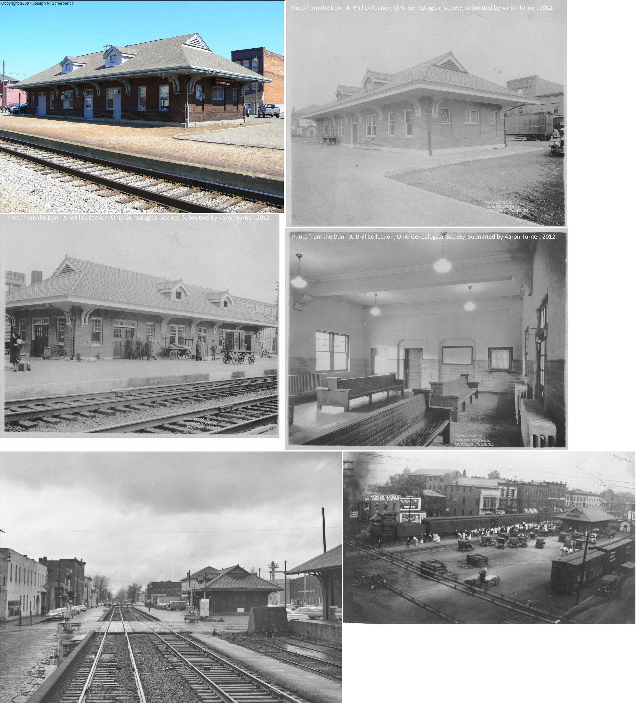
| Coshocton |
|
The earliest station here was likely a rented building in the 1850s for the Steubenville & Indiana RR (a predacessor of the PCC&St.L). That RR was always in financial trouble, so the first proper station wasn't built until the PCC&St.L days. | ||||||
| Coshocton |
AND  |
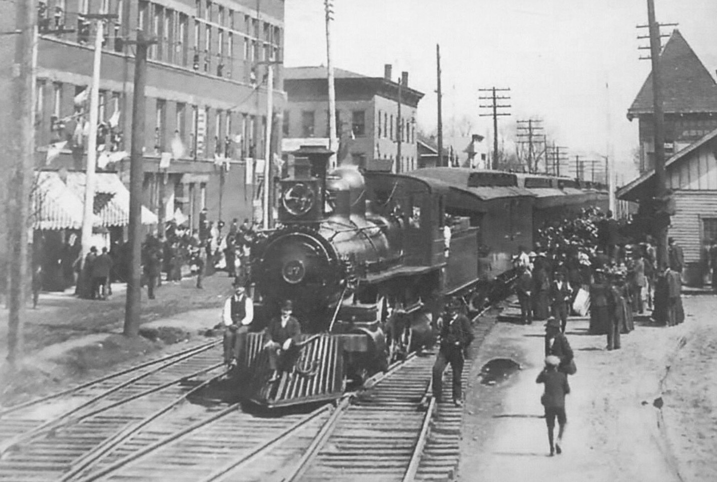
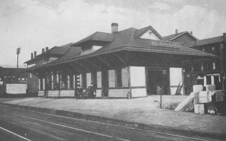
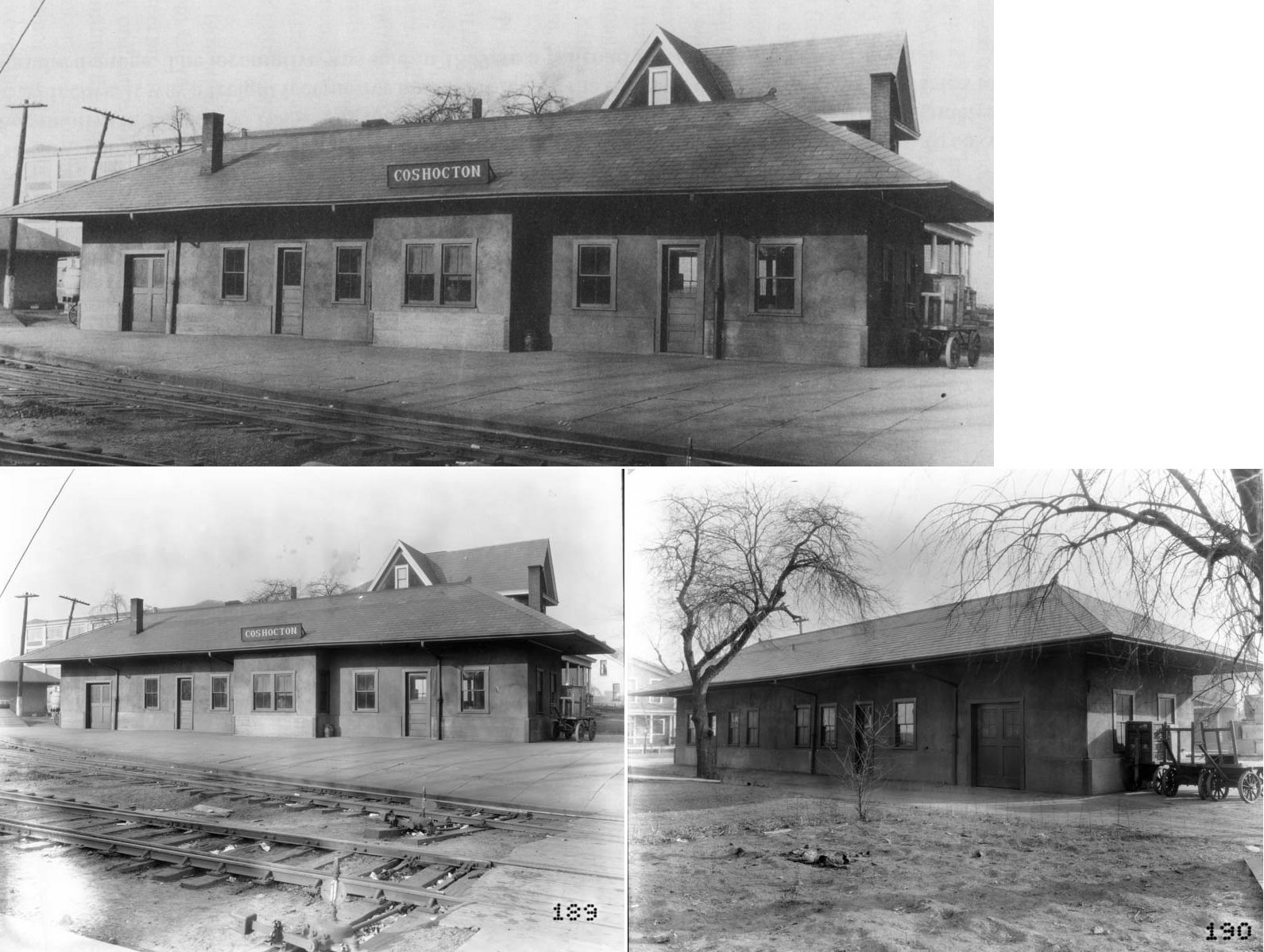
The original PCC&St.L station was at the same site as the existing station but a few feet to the north closer to Main Street. It was built in 1871 (according to the Coshocton Tribune of Oct. 27, 1871). This station also served the Connotton Valley RR beginning in 1883. There was a platform that led from the station SE to a platform along the Connotton Valley RR spur. On the 1905 Sanborn Fire map, this original station is gone and the "new" station is on the grounds. The new station was likely built around 1903. | ||||||
| Coshocton |
|
This wood frame station burned down in 1928. It was built in 1901 to replace the original PCC&St.L station. | ||||||
| Coshocton |
|
This station, built in 1910, was at the west end of Orange Street right at the northwest corner of Orange and 6th Streets (GPS: 40.271149, -81.861957). The tracks here were in the middle of Orange Street and ended near the PCC&ST.L line (the W&LE leased the land for its stations here from the PCC&St.L). Passenger service ended at this station in 1931 and then at the East Coshocton station in 1932. | ||||||
| Coshocton |
|
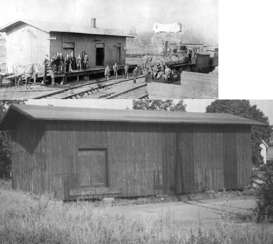
The Connotton Valley RR had a freight station at the west end of Orange Street near Hickory Street (GPS: 40.271114, -81.863354). It was built in 1886 and torn down in 1970 after serving a moving and storage company for many years prior. | ||||||
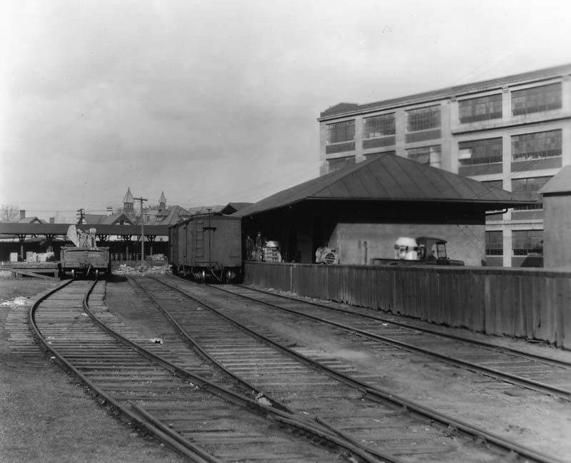
| Coshocton |
|
In 1910 a new, larger freight station was built by the W&LE near the SE corner of Walnut and Hickory Streets at GPS: 40.271898, -81.862745. This station and the track were removed in 1969. | ||||||
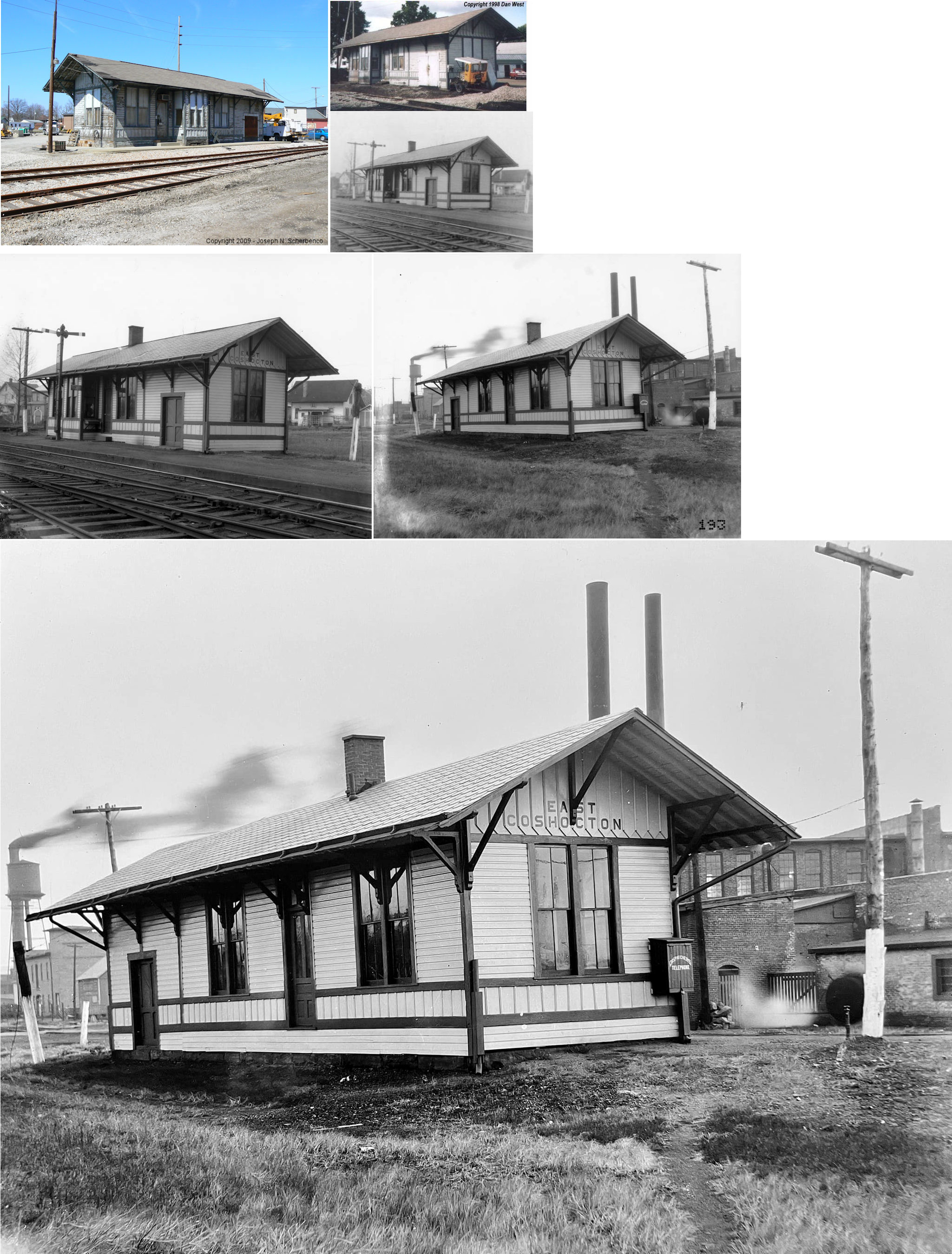
| Coshocton (E. COSHOCTON) (Hill Station) |
|
This station, built in 1883 (other sources say 1925), was at Cambridge Road & Orange Street (GPS: 40.270059, -81.852016). Originally known as Hill Station, it was moved south of its original location at GPS: 40.271621, -81.851145. It was torn down in 2016. | ||||||
| Daviston |
|
A passenger shelter is shown here on the Dresden Branch on the 1923 PRR List of Stations & Sidings. It was 2.8 miles south of Warsaw Junction and .2 of a mile from the Tyrone Colliery. | ||||||
| Franklin Station |
|
This early town is now gone. It was on TWP-279 just SE of SR-16 (south of Tyndall) where the trestle crosses the Muskingum River in the NE part of Franklin Township. It was on the SW side of the river there. At this location the PCC&ST.L connected with a horse-drawn RR that led to the coal mines to the NW (according to 1872 maps). By the early 1900s, the town was relocated a short distance to the NW and became Tyndall. | ||||||
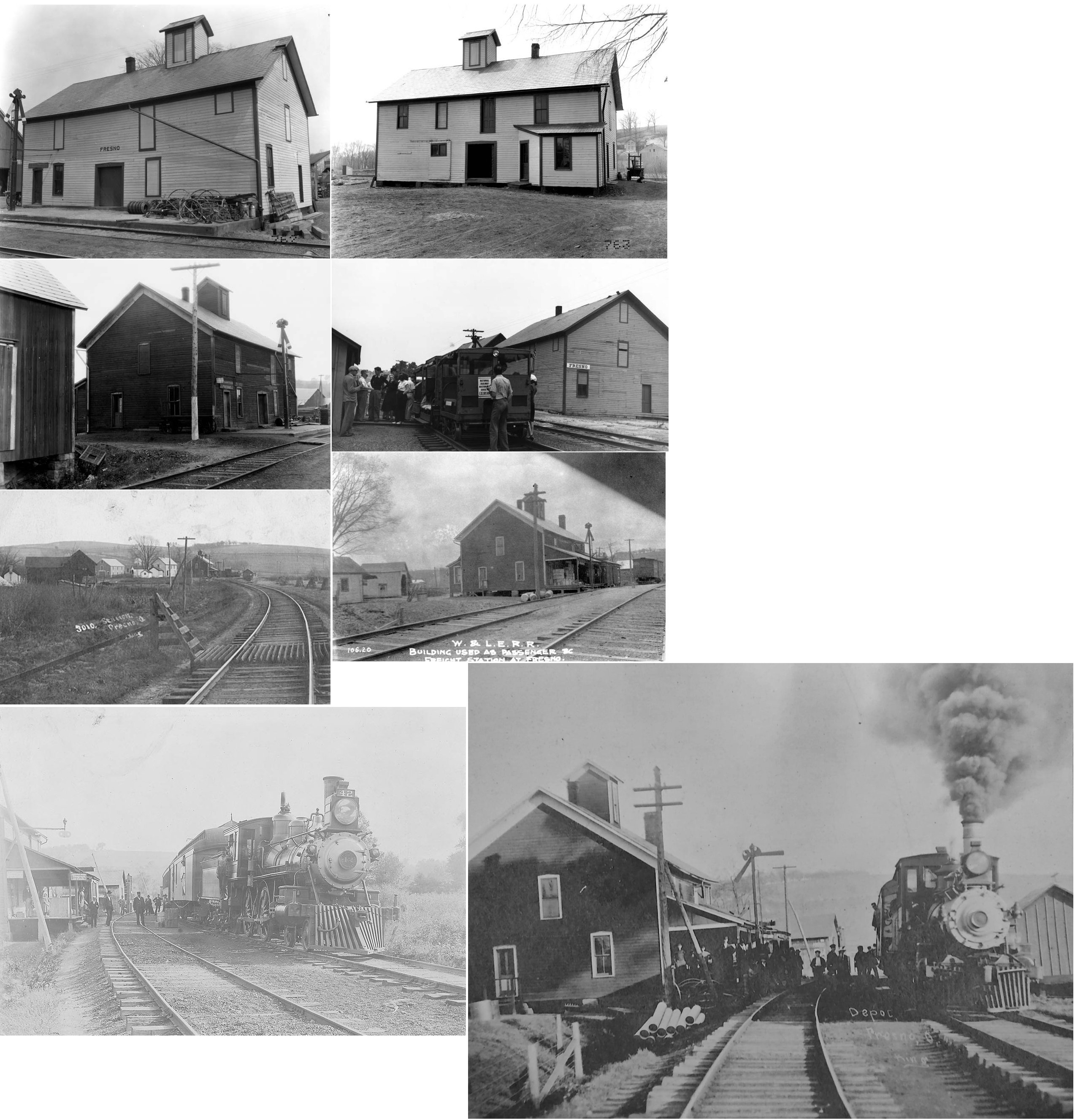
| Fresno (Avondale) |
|
The town was previously known as "Avondale" (among other earlier names), but to avoid confusing it with the Avondale in Hamilton County, the name was changed to "Fresno." There is also was an "Avondale" in Licking county as well. | ||||||
| Helmick Sta. |
|
Helmick station was north of Helmick where the tracks crossed TWP-25. A station is shown here on the Dresden Branch on the 1923 PRR List of Stations & Sidings. | ||||||
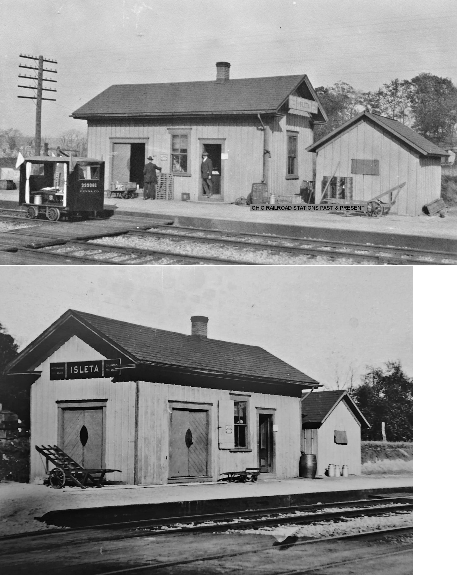
| Isleta (White Eye Plains) |
|
The 1872 map shows a station here when the stop was called White Eye Plains. According to PRR valuation records, a new station was built here in 1875 which was still standing in 1920. | ||||||
| Layland |
|
A station is shown here on the Dresden Branch on the 1923 PRR List of Stations & Sidings. | ||||||
| Metham |
|
A station is shown here on the Dresden Branch on the 1923 PRR List of Stations & Sidings. | ||||||
| Morgan Run |
|
A station is shown here on the 1923 PRR List of Stations & Sidings. This was also the location of "CB" tower and a connection with the W&LE. | ||||||
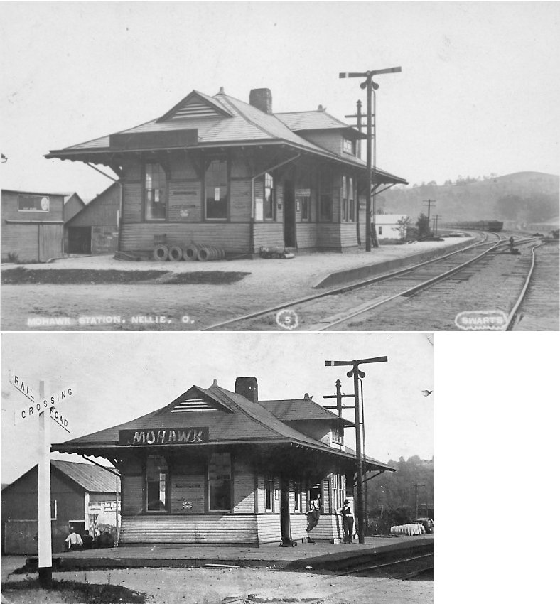
| Nellie (Mohawk) |
|
|||||||
| Pearl |
|
See listing above for Chili. | ||||||
| Pomerine (Pomerene) |
|
A station is shown here on the 1923 PRR List of Stations & Sidings. | ||||||
| Randles |
|
A station is shown here on the 1923 PRR List of Stations & Sidings. It was between Coshocton and Warsaw Junction on the Walhonding Branch. | ||||||
| Rock Run |
|
|||||||
| Tunnel Hill |
|
Station was dilapidated and fell over in the early 1980s. | ||||||
| Tyndall |
|
According to PRR valuation records, a passenger shelter was built here in 1895. A station is shown here on the 1923 PRR List of Stations & Sidings. This was the location of the mainline connection with the 2.7-mile Franklin Branch. | ||||||
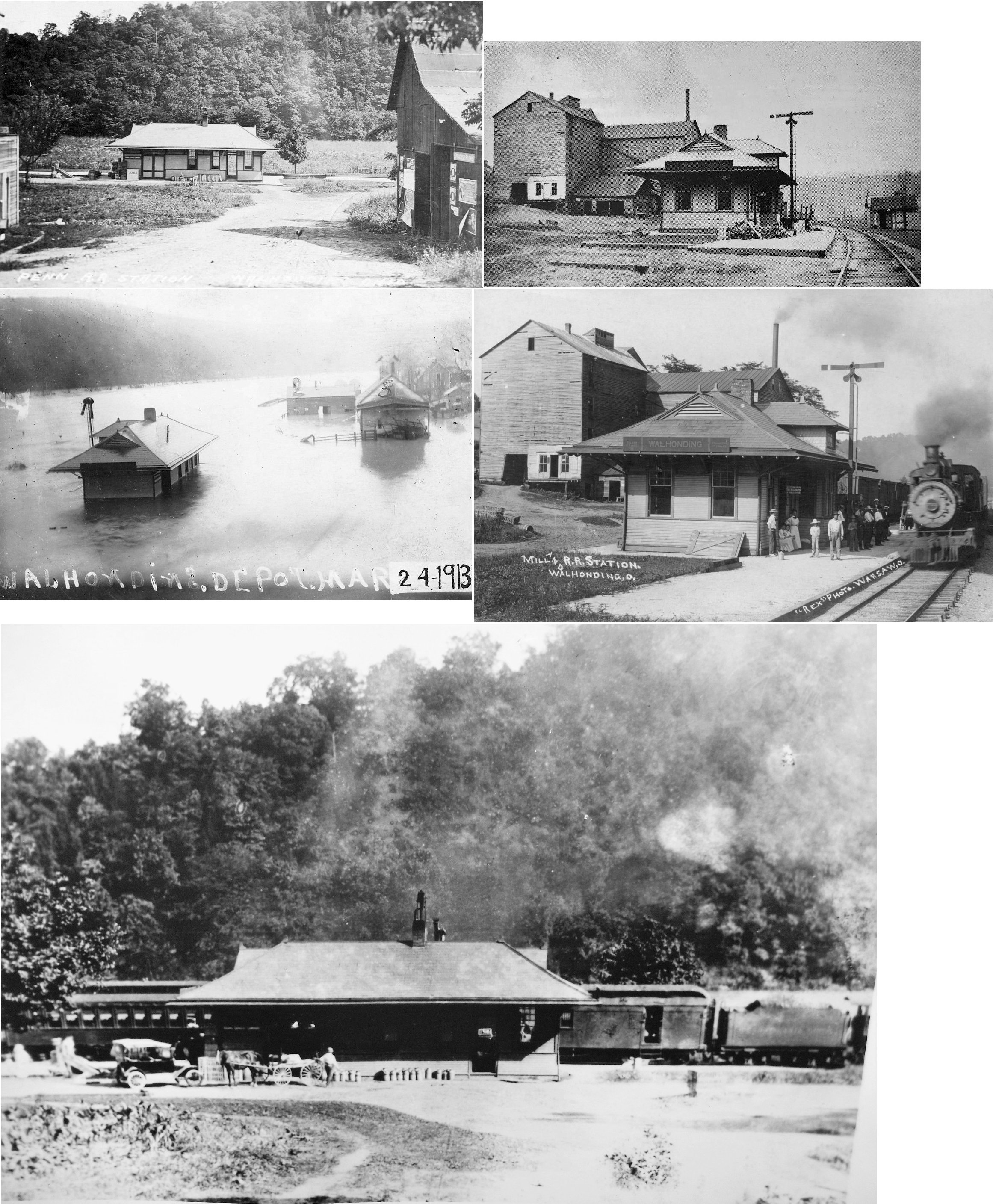
| Walhonding |
|
This was a Toledo, Walhonding Valley & Ohio station. | ||||||
| Wakatomika |
|
A passenger shelter is shown here on the Dresden Branch on the 1923 PRR List of Stations & Sidings. It was two miles south of the station at Cooperdale and 3.3 miles north of the station at Trinway. | ||||||
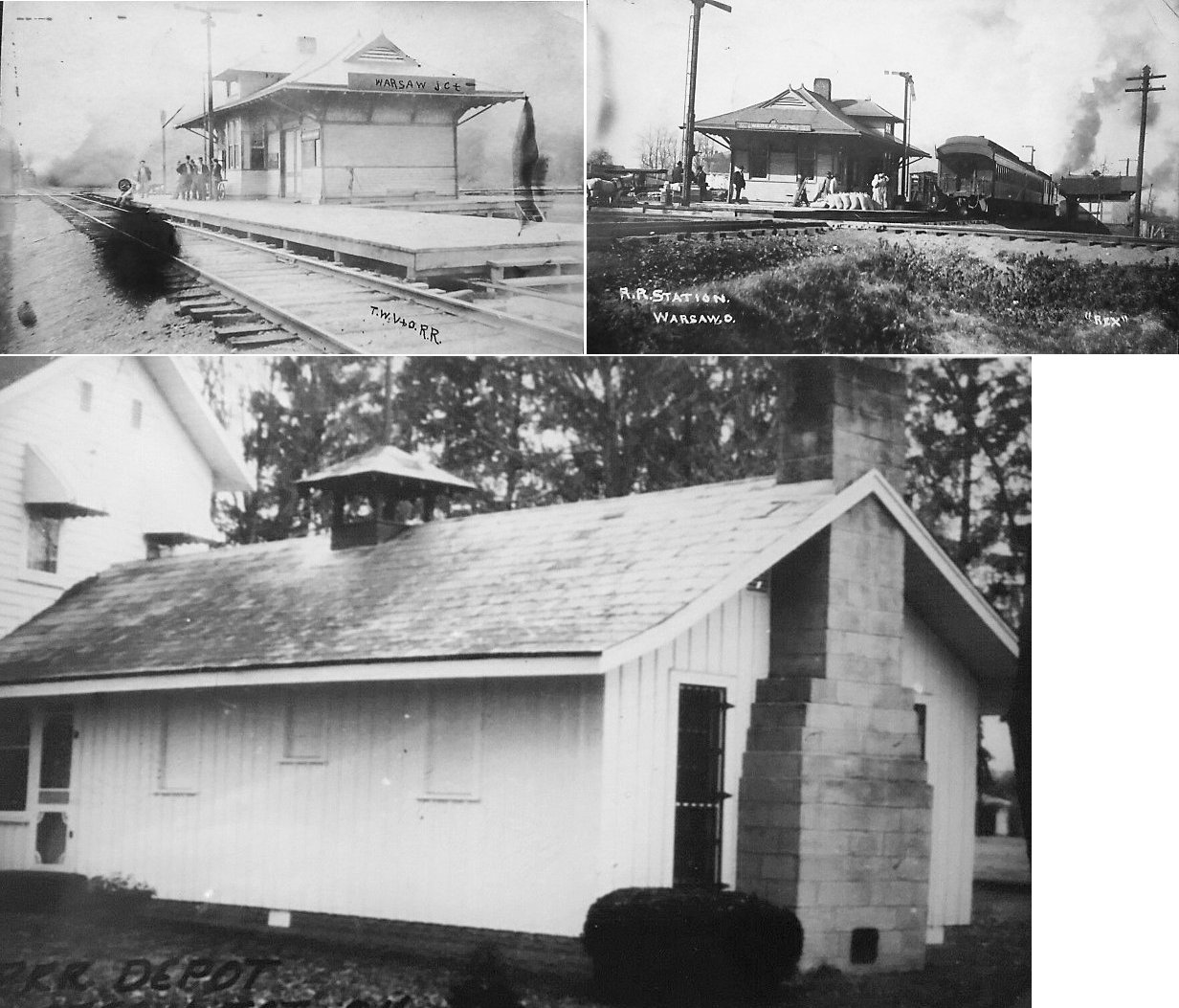
| Warsaw |
|
|||||||
|
Warsaw Junction (Harrington) |
AND |
Formerly known as Harrington, this is where the CA&C Dresden Branch junctioned with the Marietta Division (TWV&O). It appears that this station may have been moved, remodeled and annexed to a house. Does it still exist? | ||||||
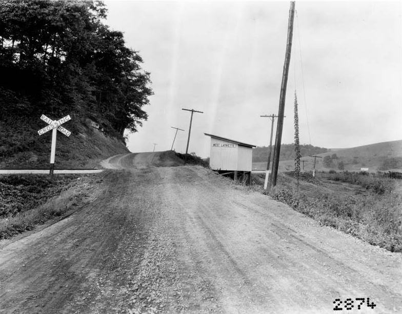
| West Lafayette |
|
This passenger shelter was at the old W&LE crossing of SR-93 just north of the 93 and 36 intersection. The crossing was moved a little to the north when RT 93 was rebuilt in the 1960s. The station was in the vicinity of GPS: 40.297025, -81.747340. | ||||||
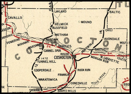
| 1898 COSHOCTON COUNTY RAILROAD MAP | ||||||||
 |
||||||||
|
Notes About Existing Stations... Cooperdale (CA&C) - Moved a short distance from its original location. Coshocton (PCC&St.L) - Used as operations center for Ohio Central. This was the third station at this site having replaced an earlier PCC&St.L frame depot that burned in 1928. Fredericktown (B&O) - Moved from Fredericktown in Knox County. The original location of this station was on Mill Street just east of Main Street in Fredericktown. West Lafayette (PCC&St.L) - This station's original location was on West Railroad Street just west of Kirk Street (SR-92) (GPS: 41.390622,-80.967943). According to PRR valuation records, this station was built in 1899. A section of the station (which remains) was moved out to the farm in 1966 by Vic Crouso. |
||||||||