 COUNTY COUNTY
|
|
||||||||
| EXISTING STATIONS | ||||||||
|---|---|---|---|---|---|---|---|---|
| Station Name |
Original Railroad | Current Location |
Type | Current Use |
Date Built |
Track Status |
Building Material |
More Info |
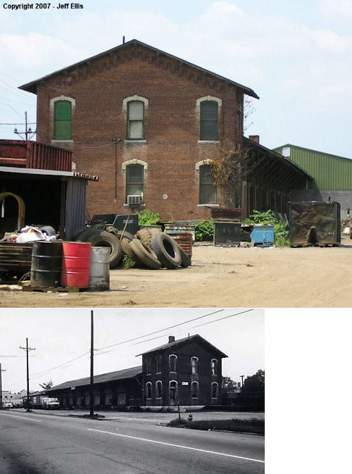
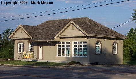
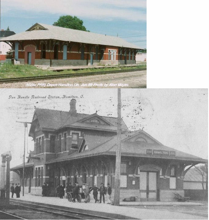
| Hamilton |
 |
432 MLK Jr. Highway (US-127) (GPS: 39.394154, -84.559030) (See Notes about location) |
P | Railroad | ???? | In Use | Brick |
|
| Hamilton |
 |
Maple Avenue between 8th & 9th Streets (GPS: 39.395880, -84.553327) |
F | Business | ??? | In Use | Brick |
|
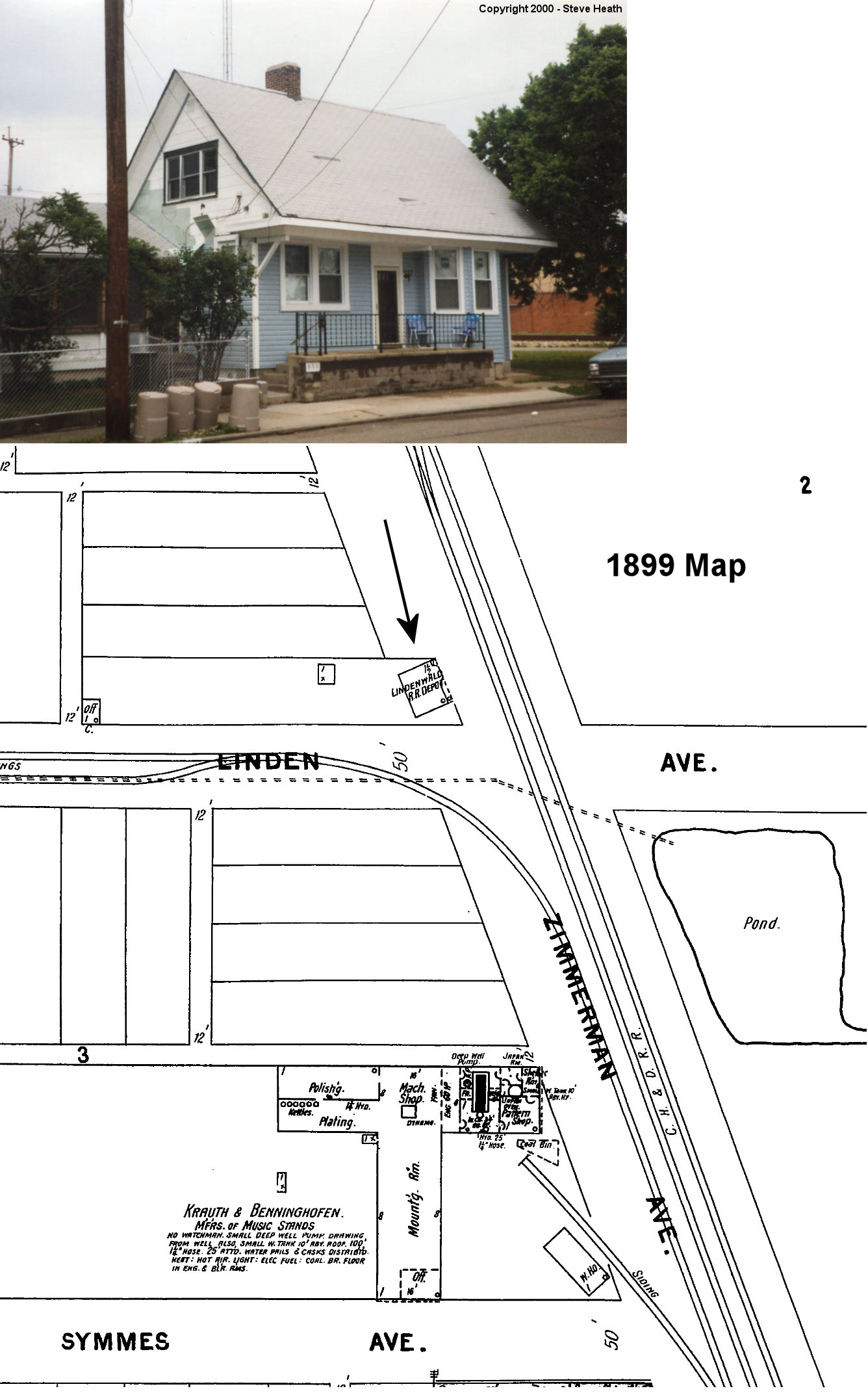
| Lindenwald (Hamilton) |
|
890 Williams Avenue (GPS: 39.373207, -84.551765) |
C | House | ???? | Gone | Wood |
|
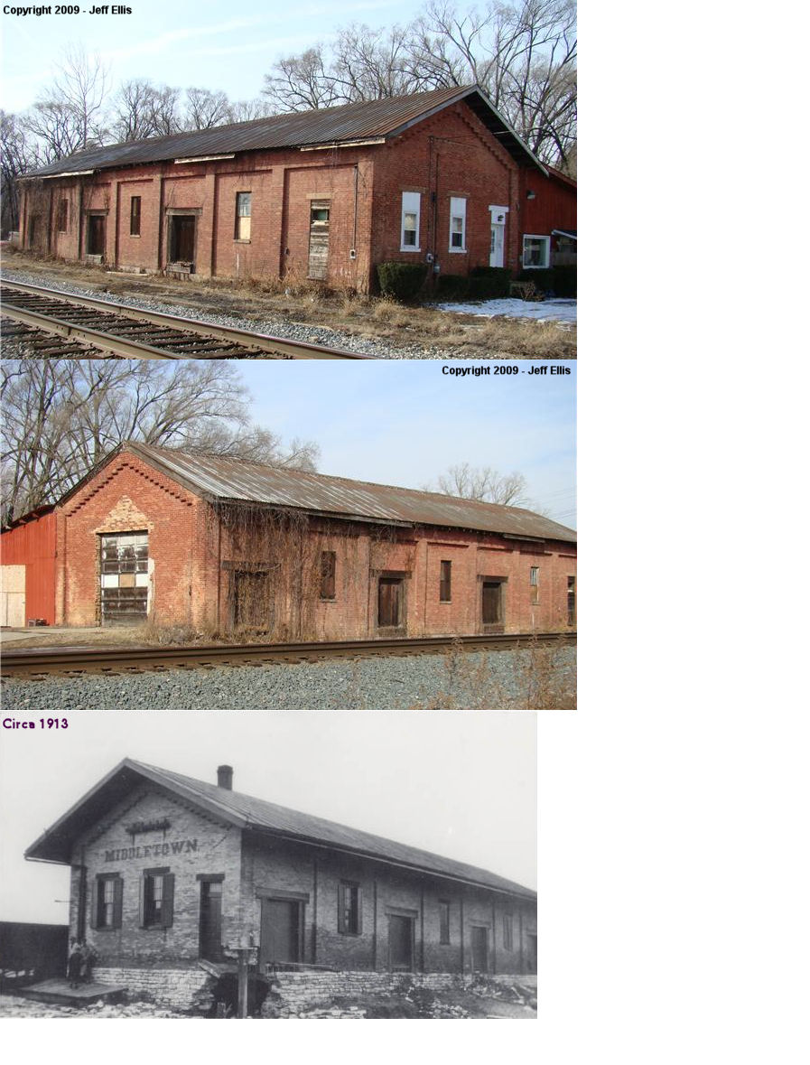
| Middletown |
 |
25 Charles St. near SR 122 (GPS: 39.513914, -84.392186) |
C | Business | 1909 | In Use | Brick |
|
| Middletown |
|
NW corner of Webster Street and Columbia Avenue (GPS: 39.518184, -84.399120) |
F | Unknown | ???? | Gone | Brick | |
| Oakland |
 |
995 North Main, Monroe (GPS: 39.462943, -84.349138) |
C | Business | ???? | In Use | Brick |
|
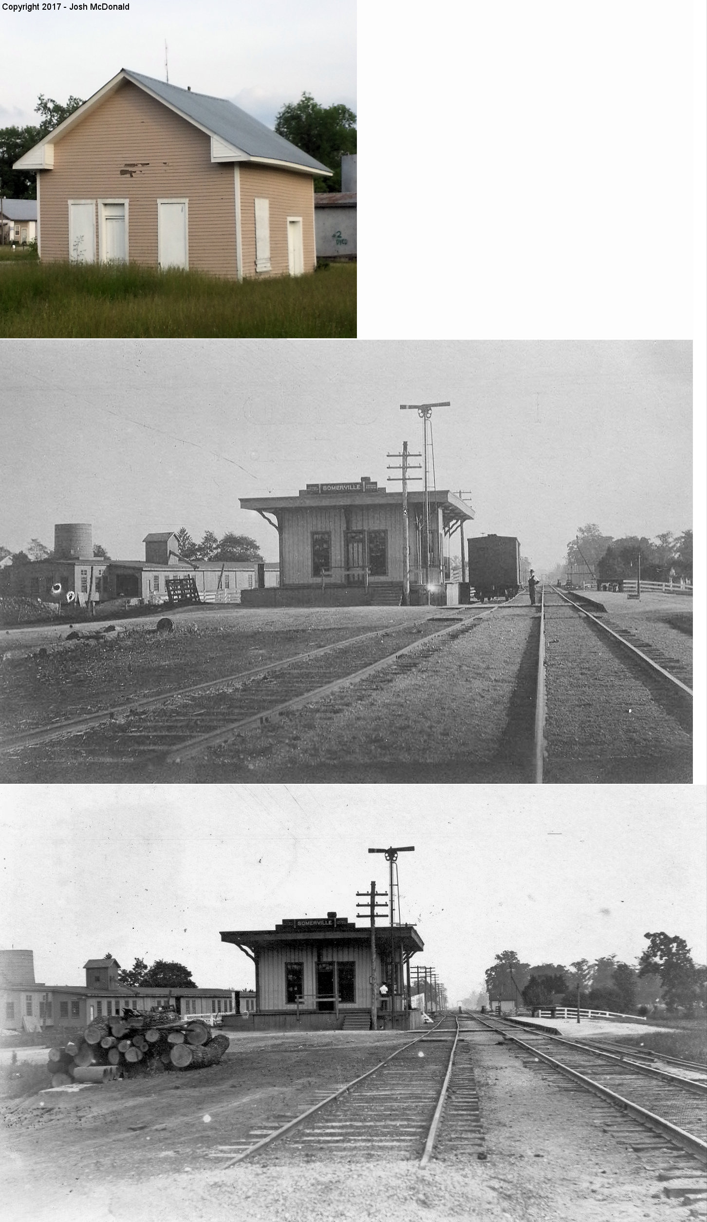
| Somerville |
 |
South of the west end of Mill Street (GPS: 39.562449, -84.643509) |
C | Vacant | ???? | None | Wood |
|
| West
Middletown (Madison City) |
|
South of Middletown-Eaton Road (OH-122) (GPS: 39.522533, -84.416629) |
F | Business | ???? | In Use | Brick |
|
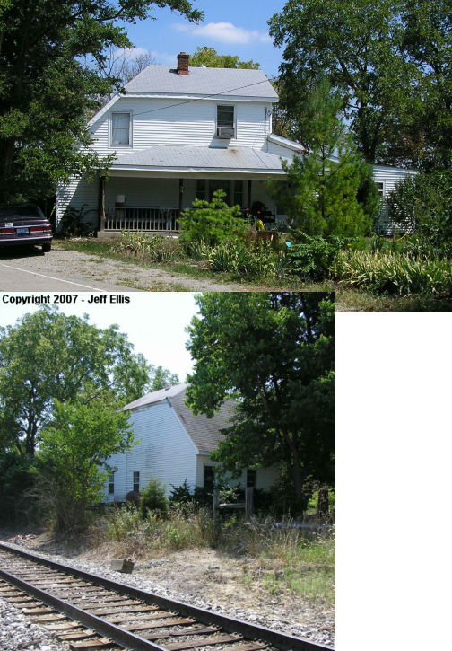
| Woods (REily Twp.) |
|
East side of South Law Road where it dead ends at tracks (GPS: 39.457625, -84.717182) |
P | Residence | 1871 | In Use | Wood |
|
| STATIONS OF THE PAST | ||||||||
| Station Name |
Original Railroad |
Notes | ||||||
| Amanda |
|
|||||||
| Busenbark |
|
This station was located in the NE corner of the crossing where Busenbark Road crossed the CH&D tracks. The road was taken out when the Miller Brewery was built there. | ||||||
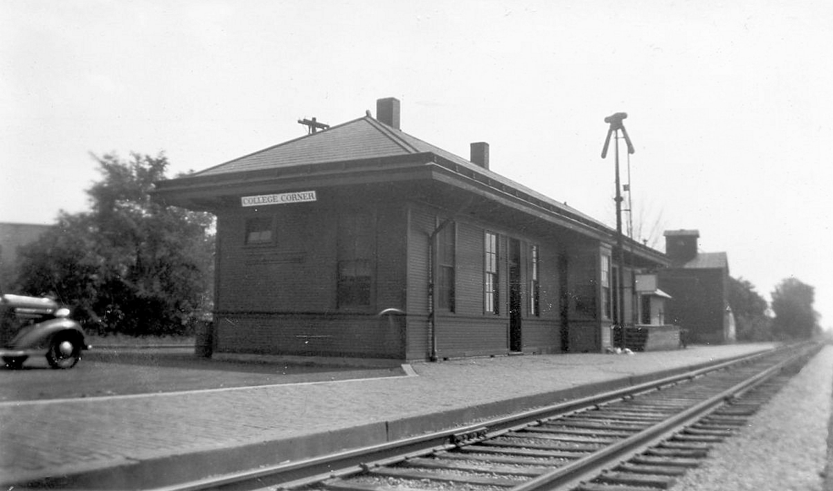
| College Corner |
|
The first station here was one where the train passed through the middle of the station. | ||||||
| College Corner |
|
The station for College Corner was on the Indiana side of the state line by about 15 feet. It was just a few feet east of the original station listed above. | ||||||
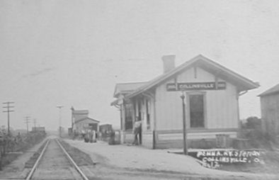
| Collinsville |
|
This station was at the end of Station Road. It was later moved by a pond on the Maple Leaf Farm on Hamilton-Eaton Road. Around 2000 it was burned for fire training because someone bought the land and wanted to build a cabin where the depot was. | ||||||
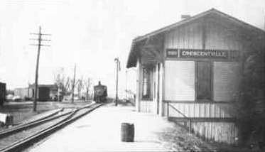
| Crescentville |
|
|||||||
| Excello |
|
|||||||
| Fairsmith |
|
This station was on Gilmore Road. | ||||||
| Flockton |
|
|||||||
| Gano |
|
This station was on the SE corner of where Gano Road crossed the tracks. | ||||||
| Hamilton |
|
The original CH&D station was on the NW corner of Heaton and North 4th Street at GPS: 39.403743, -84.556559. Three tracks ran down the middle of 4th Street here at the time. The station was closed by 1899, but the two-story building remained until at least 1950 and served as a dwelling. | ||||||
| Hamilton |
|
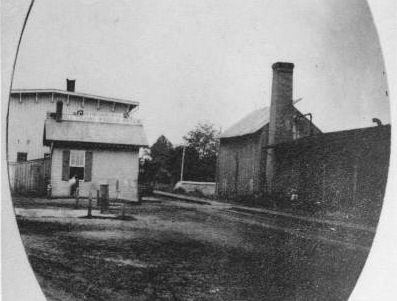
Originally, a smaller freight station was located on the south side of Canal Street (now Maple Street) near 4th Street at GPS: 39.397269, -84.559354. A larger freight station was later constructed by the CH&D near the same location around 1890. Later another station building was added to the east of the original building making for an inbound and outbound station that was shared by the B&O and the Cincinnati, Indianapolis & Western RR (which later became part of the B&O). | ||||||
| Hamilton |
|
A large CH&D freight house was also located southeast of the passenger station on the north side of Chestnut Street at GPS: 39.392773, -84.558020. That station was gone by 1892 as it is no longer shown on maps from that date. | ||||||
| Hamilton |
|
Built in 1889 by the PRR and torn down by the NS in 1991. It was located the west side of South 7th Street south of High Street at GPS: 39.397108, -84.555226. Passenger service ended on April 30, 1971. | ||||||
|
Hamilton (S. Hamilton) |
|
This station sat south of the former Columbia Carriage Company along Central Avenue. | ||||||
| Hanover |
 |
This station was on Morman Road in the SW corner of where the road crossed the tracks. | ||||||
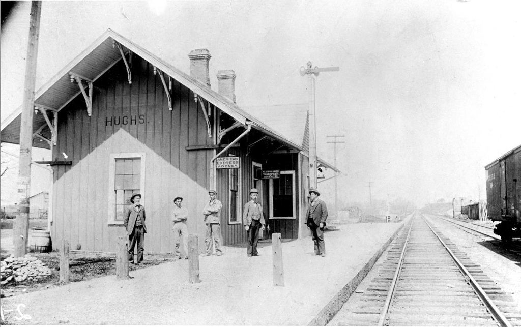
|
Hughs (HUGHES) |
|
This was just north of the Princeton Road underpass at GPS: 39.388273, -84.407742. | ||||||
| Ixworth |
|
This station was where Bobmeyer Road crosses the tracks on the south side of Hamilton just west of SR-4. | ||||||
| Jones Station |
|
See listing below for Stockton. | ||||||
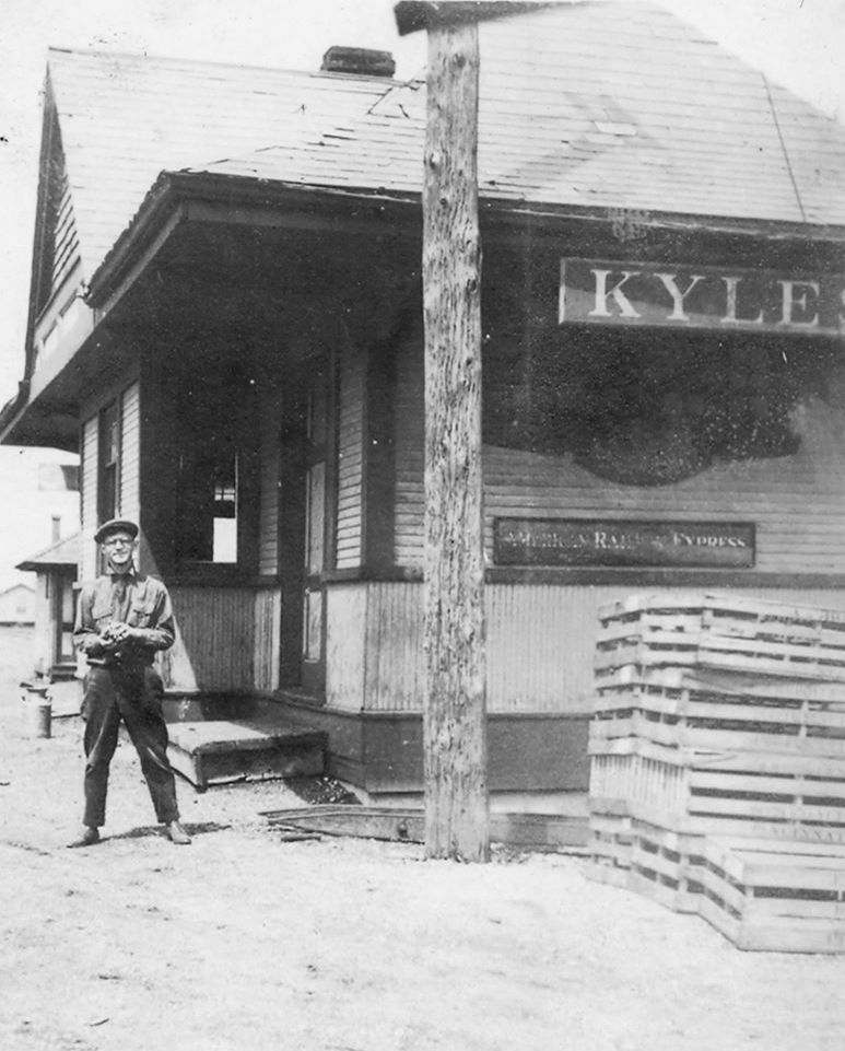
| Kyles Station |
|
This was just north of Kyles Station Road at the intersection with Maud Hughes Road at GPS: 39.416316, -84.407766. | ||||||
| LEsourdsville |
|
|||||||
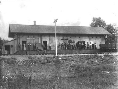
| McDonald |
|
McDonald was between Oxford and College Corner. | ||||||
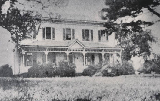
| McGonigle |
|
This is a photo of the Phillip McGonigle residence which also served as the Cincinnati, Hamilton & Indianapolis railroad station for this small town. McGonigle was contracted by the RR to build a mile of the line and the town sprang up around this house/station. | ||||||
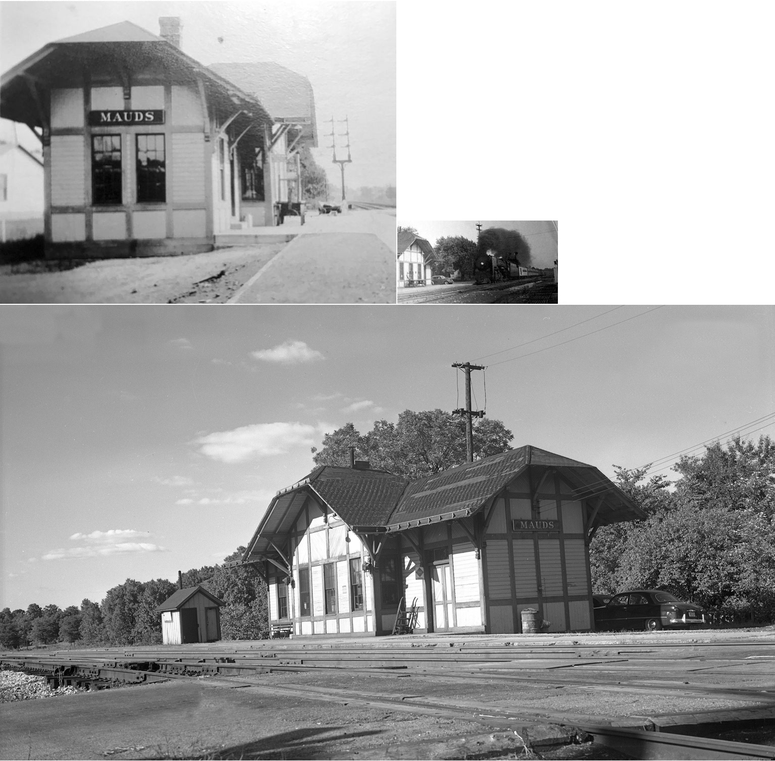
|
Mauds (Maudville) |
|
This station was on the south side of Tylersville Road (fromerly Mason Pike), on the east side of the tracks. | ||||||
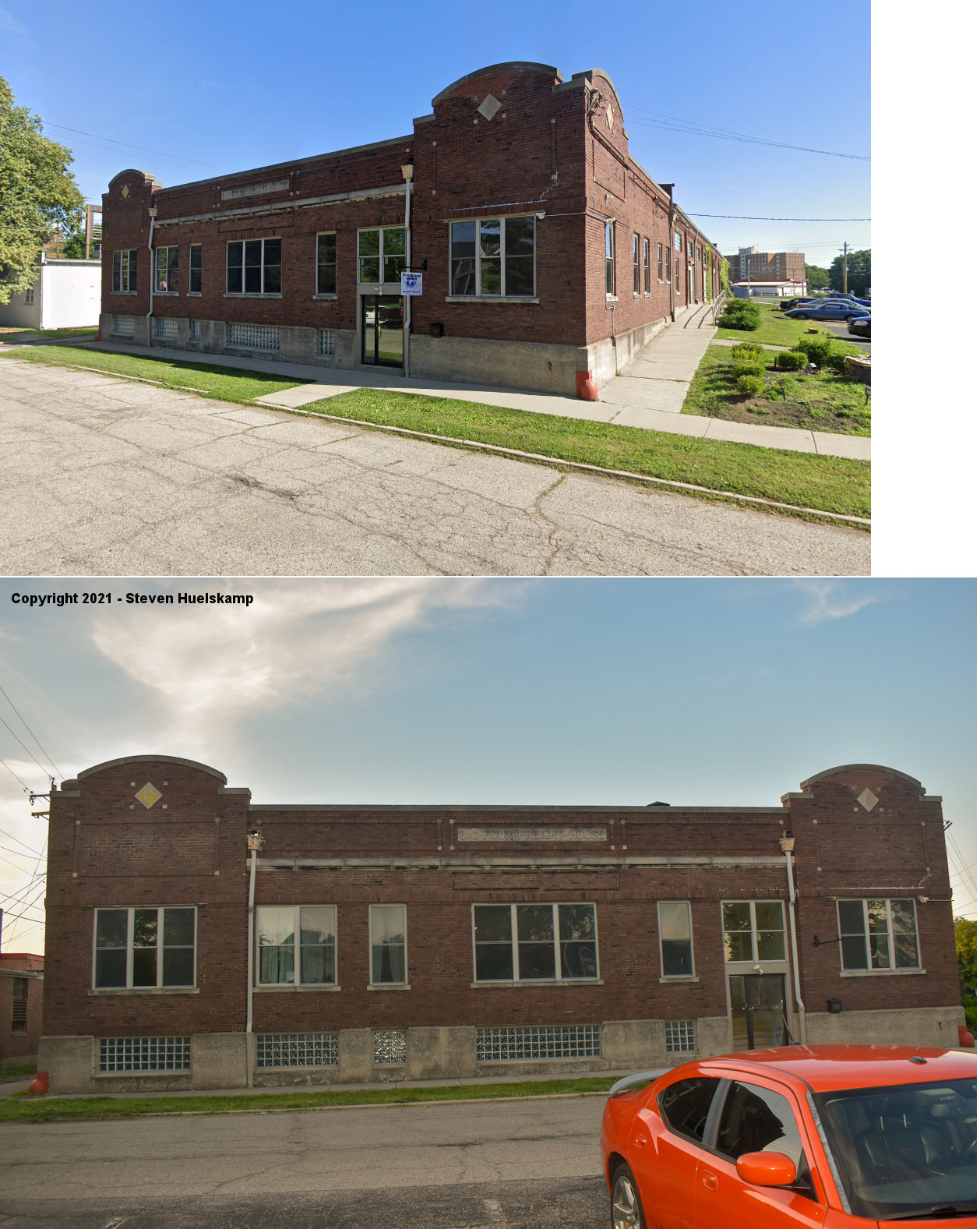
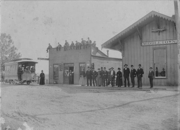
| Middletown |
 |
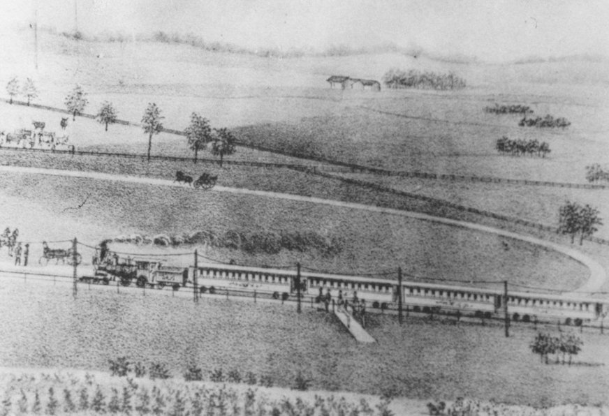
Built in 1872 by the Cincinnati & Springfield (later CCC&I), this was the first depot and it included a ticket office and freight warehouse. It was located at the track crossing on Third Street (which is now called Central Avenue). The station burned on March 12, 1884. Another depot was then built at this same location and remained in service until the Charles Street station went into service in 1909. The "Beeline" later became part of the Big Four. The old horse car in the picture used a set of tracks that ended in front of the depot. | ||||||
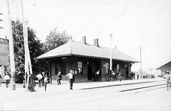
| MIddletown |
|
This station was on Central Avenue (formerly Third Street) and in service from 1884-1909. See notes for station above. The freight station was on the same side of the tracks, but on Second Street. | ||||||
| middletown |
 |
Built in 1892, the M&C was a 14-mile line that ran from Middletown to Middletown Junction in Warren County where is connected with the Little Miami Railroad. The M&C combination station in Middletown was located on South Clinton Street near the intersection with Canal Street. In 1902 it was bought by, and merged into, the Cincinnati, Lebanon & Northern railroad. Sometime between 1912-1920 the CL&N demolished the original station, extended the tracks northward one block and built a new station on the southeast corner of South Clinton Street and 4th Street (now 1st Avenue). This station was just four buildings to the west of the old Carnegie Library. Four sets of tracks ended at the back of the station with a long freight station running parallel to the eastern most track. | ||||||
| Middletown |
 |
Although the main station was in West Middletown (Hano), the CH&D did have a small station on the south side of East 4th Street (now 1st Avenue) where the CH&D paralleled the CCC&St.L. Sometime between 1912 and 1920 the B&O built a larger combination station at this location which saw freight-only service in its later years. | ||||||
|
Monroe Sta. (Lemon) |
|
This station was just south of Tod-Hunter Road. | ||||||
|
Moores Station (Hamilton) |
|
This station was located near the end of the stone arch viaduct across the Miami River. This is near what is today Arch Street at the west end of the Great Miami River Bridge. The depot of just to the east of the 3rd Street viaduct over the railroad. This station was most likely built by the Junction RR and may not have survived into the CH&D era. | ||||||
| Muhlhauser |
|
This station was on Muhlhauser Road. | ||||||
| Newkirk |
 |
This station was on Dunwoody Road. | ||||||
| Ogleton |
|
This station was on Stillwell-Beckett Road. | ||||||
| Okeana |
|
The Okeana depot was dismantled in 1950 and the lumber was used for a home. | ||||||
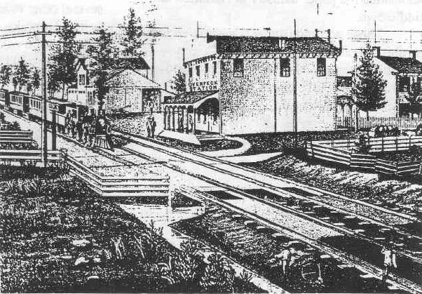
| Overpeck |
|
The original station in 1875 was also the residence and blacksmith shop of J. E. Overpeck. | ||||||
| Overpeck |
|
The newer station included a dispatcher's office. | ||||||
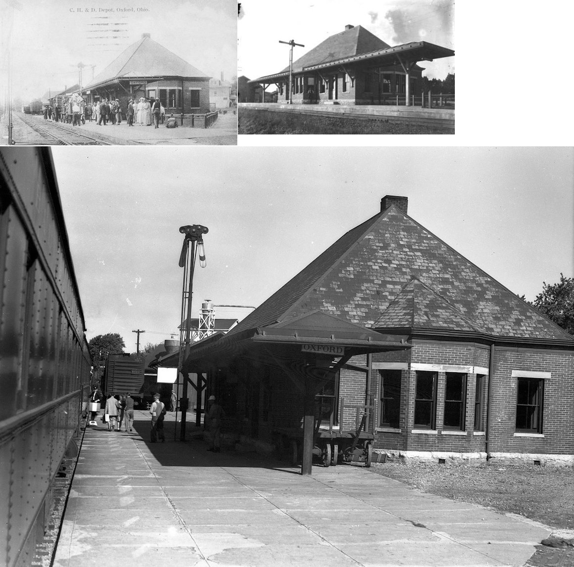
| Oxford |
|
This station, built in 1895, was on S. Elm and W. Spring St. It was on the National Register of Historic Places, but was torn down in 1994. | ||||||
| Oxford |
|
This was the original passenger station that sat on the SW corner at the intersection of West Collins and South Elm. It was built around 1860. After the new brick station was built in 1895, it served as the freight station. | ||||||
| Poast Town |
|
This station was located on the west side of Middletown road, on the north side of the tracks. | ||||||
| Port Union |
|
|||||||
| Rialto |
|
|||||||
| Schenck |
|
This station was where SR-4 goes under the CH&D. | ||||||
| Seven Mile |
|
The original location of the station was on the north side of West Ritter Street. | ||||||
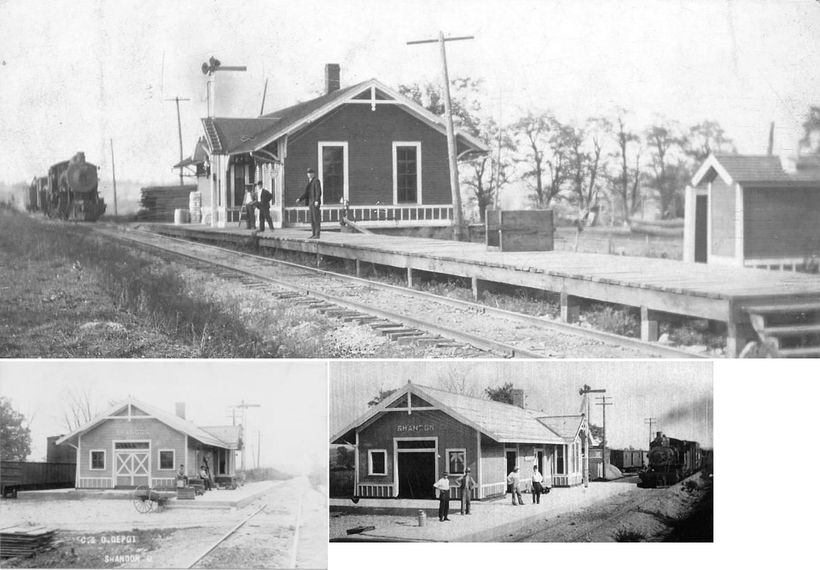
| Shandon |
|
This C&O depot was dismantled about 1955 and the lumber may have been used to build a home. The first depot in Shandon was built in 1903 for the Cincinnati, Richmond and Muncie Railroad. The first passenger train to arrive was in February 1904. In April 1907 service began between Cincinnati and Chicago. By 1908 it was known as the Chicago, Cincinnati and Louisville Railroad. The depot caught fire in April 1910 from a passing freight engine, but it was rebuilt. It became the Chesapeake and Ohio July 2, 1910 until the original depot was dismantled. | ||||||
| Sheleys |
|
Originally a station on the Louisville, Cincinnati, & Dayton (later CH&D), the now-dissolved town of Sheleys was slightly west of Headgates Road near the abandoned right-of-way at approximately GPS: 39.423949,-84.516201. Due to the abandonment of the line from Hamilton to Woodside Junction in the mid 1930's, little information about the station or its site can be found. | ||||||
| Smiths Station |
|
This station was on the Amor Smith Jr. farm which was on Holden Boulevard near Fairfield Senior High School. The large farm occupied the grounds where the school is now and an area north of the tracks for almost 300 acres total. Smith served as mayor of Cincinnati from 1885-1889. The station was likely no more than a platform. | ||||||
| Stockton (JOnes STA.) |
|
There were fatal wrecks here in November 1898 and May 1907. | ||||||
| Trenton |
|
This station was located on Railroad Street (which is now called Baltimore Avenue) near Center Street. It was closed by the B&O in 1935. | ||||||
| West Chester |
|
According to maps from 1914, this station was east of town on Station Road. | ||||||
|
West Middletown (HENO) |
|
This is the original West Middletown CH&D station. West Middletown was formerly known as Heno. Although it was located across the river in Madison Twp., it was known as the "Middletown" depot on the CH&D after the post office name of Heno was discontinued. This photo is from circa 1881. This station was later replaced by newer freight and passenger stations. | ||||||
| Woods |
|
This station was where Law Road used to cross the tracks between Garver-Elliot and Stillwell-Beckett Roads. | ||||||
|
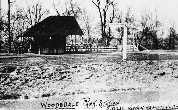
Woodsdale Park Station |
|
|||||||
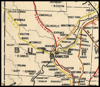
| 1898 BUTLER COUNTY RAILROAD MAP | ||||||||
 |
||||||||
|
Notes About Existing Stations... Hamilton (CH&D) - The original part of the station was the 1-story section which may date to 1851 when the railroad first started operations here. The two story addition was built between 1887-1892. B&O passenger service ended at this station on April 30, 1971 (the same day it ended at the PRR station due to the formation of Amtrak). Around 12 feet of the roof awning on the southwest side of the depot has been removed to allow clearance for doublestacks and autoracks on the CSX Indianapolis Subdivision. Station was moved in December 2022 to a new foundation at the corner of MLK Highway and Maple Street. Hamilton (PRR) - Located at Cohen Scrap and surrounded by fence. Last passenger train 1971. Brick has date built inscribed as 1870, but this cornerstone was part of an old German church that sat there before the depot. The railroad did not come through town until 1888. The railroad bought the church with the stipulation that the cornerstone remain there. Lindenwald (CH&D) - Lindenwald was not originally part of Hamilton and had its own station. When the town grew the station in town was used and this small station closed. The story goes that a railroad officer bought the station when it closed and moved it away from the tracks to an adjacent lot, turned it to face Williams Avenue (formerly Linden Avenue) and lived in it. It was originally at GPS: 39.373192, -84.551514 and sat pretty much in the middle of Zimmerman Avenue. Middletown (CCC&St.L) - Station discontinued passenger service in early 60's and was sold shortly thereafter. Station is restored/maintained brick with tile roof and wood trim and millwork. Gift Shop owner is knowledgeable about history of structure both as RR facility and as commercial property and is about preceding wood station destroyed by fire. Historic pictures of current structure in gift shop. Gift Shop is Whistle Stop Shop (513) 424-1909. Oakland (M&C) - Station has been moved. Now a dance academy. The tracks were originally built by the owner of the Sorg Paper Company to connect Middletown (at Middletown Junction) with the PRR. Somerville (PRR) - The former freight agent at the station bought it and moved it a few hundred yards and added a gabled roof. The original railroad through here was the Eaton & Hamilton which later become part of the PCC&St.L (PRR). The station's original location was on the south side of Mill Street, on the east side of the tracks. West Middletown (CH&D) - Served as passenger station until a new passenger station was built. This town was formerly known as Madison City. Post office here was known as Heno. Woods (CH&D) - Law road was closed off at Wood Station in 1995. This was due to lack of repair funds needed to keep the crossing in good condition. The station agent was George W. Gardner who had built the station and residence there. There were two daily eastbound and two daily westbound stops there. Riley Township relied on the station for supplies and transportation of livestock and agriculture to Cincinnati. Station was named after John Woods, a lawyer/politician that was involved in the building of the RR. |
||||||||