 COUNTY COUNTY
|
|
||||||||
| EXISTING STATIONS | ||||||||
|---|---|---|---|---|---|---|---|---|
| Station Name |
Original Railroad | Current Location |
Type | Current Use |
Date Built |
Track Status |
Building Material |
More Info |
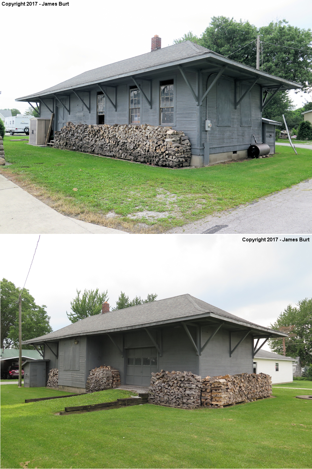
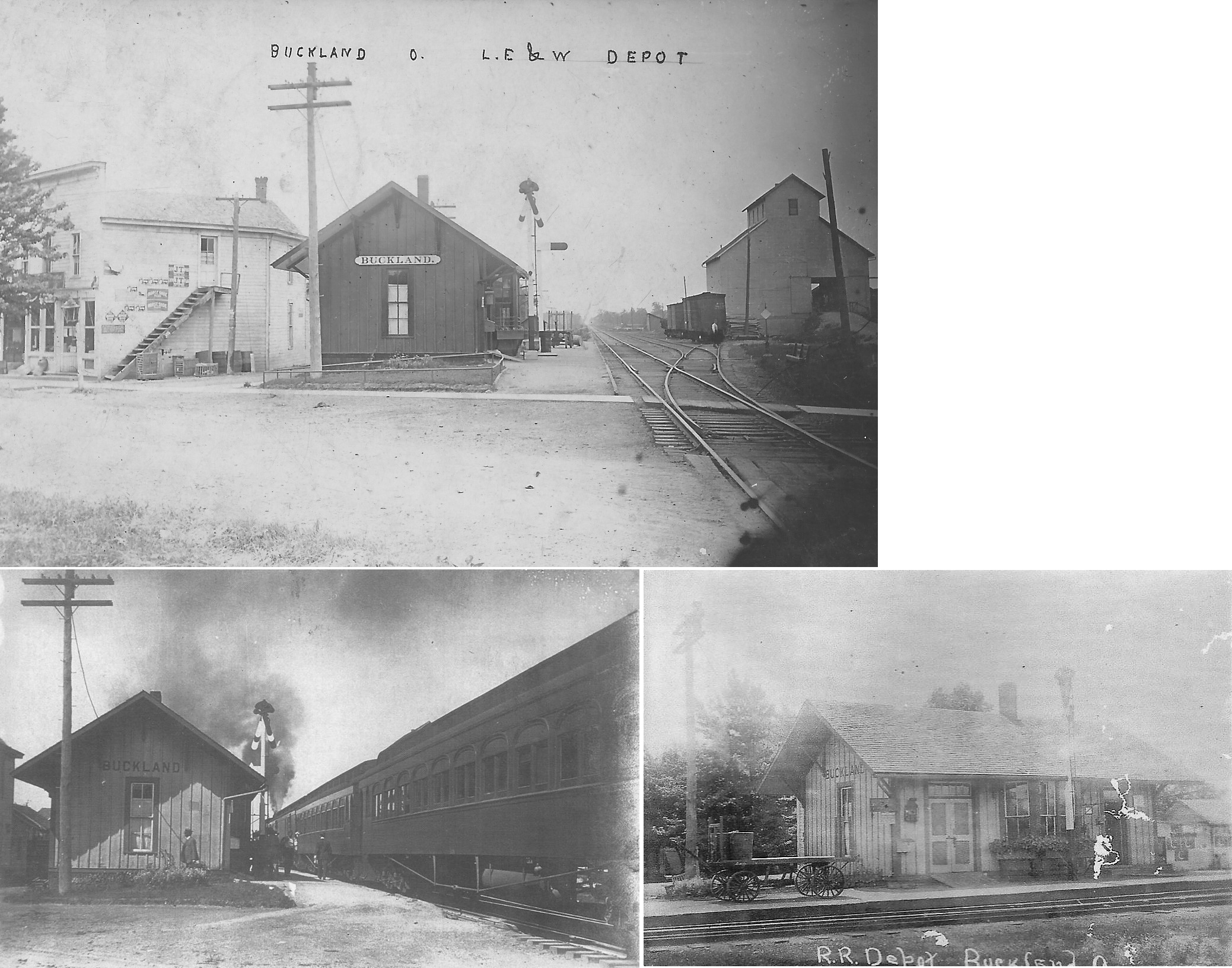
| Buckland |
 |
In an alley south of the intersection of Oak and High Streets (GPS: 40.625587, -84.259299). |
C | Storage | 1924 | None | Wood |
|
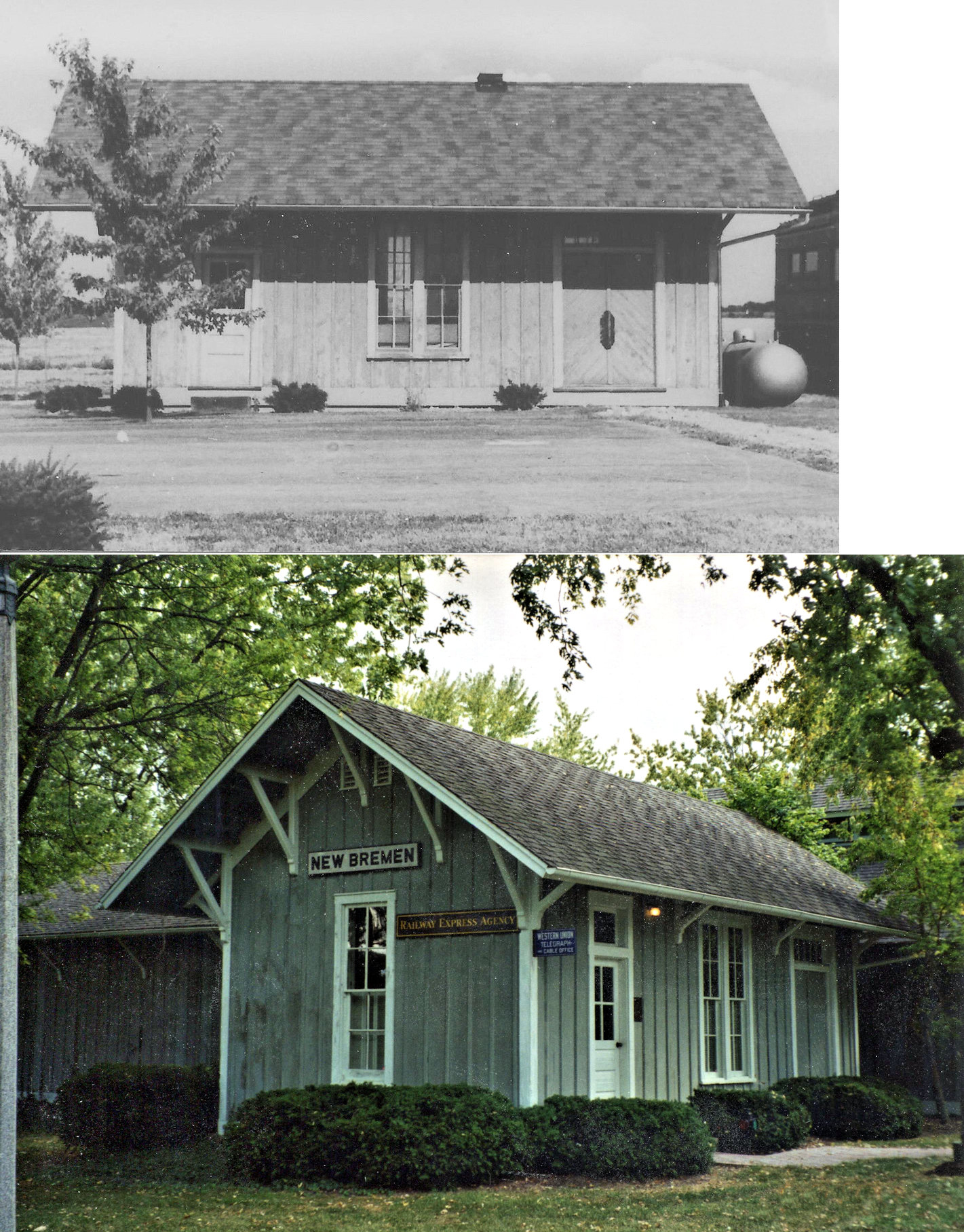
| New Bremen |
 |
Crown Controls Estate, east of town | P | Private | 1888 | None | Wood |
|
| St. Johns |
 |
Center Street (GPS: 40.555869, -84.078207) |
C | Storage | 1893 | In Use | Wood |
|
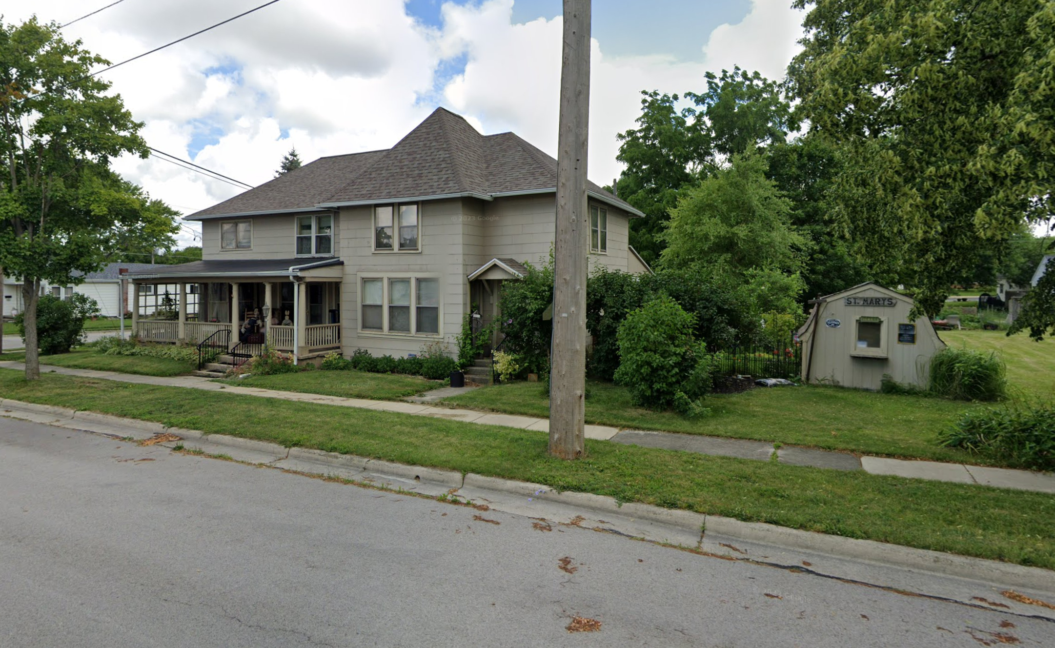
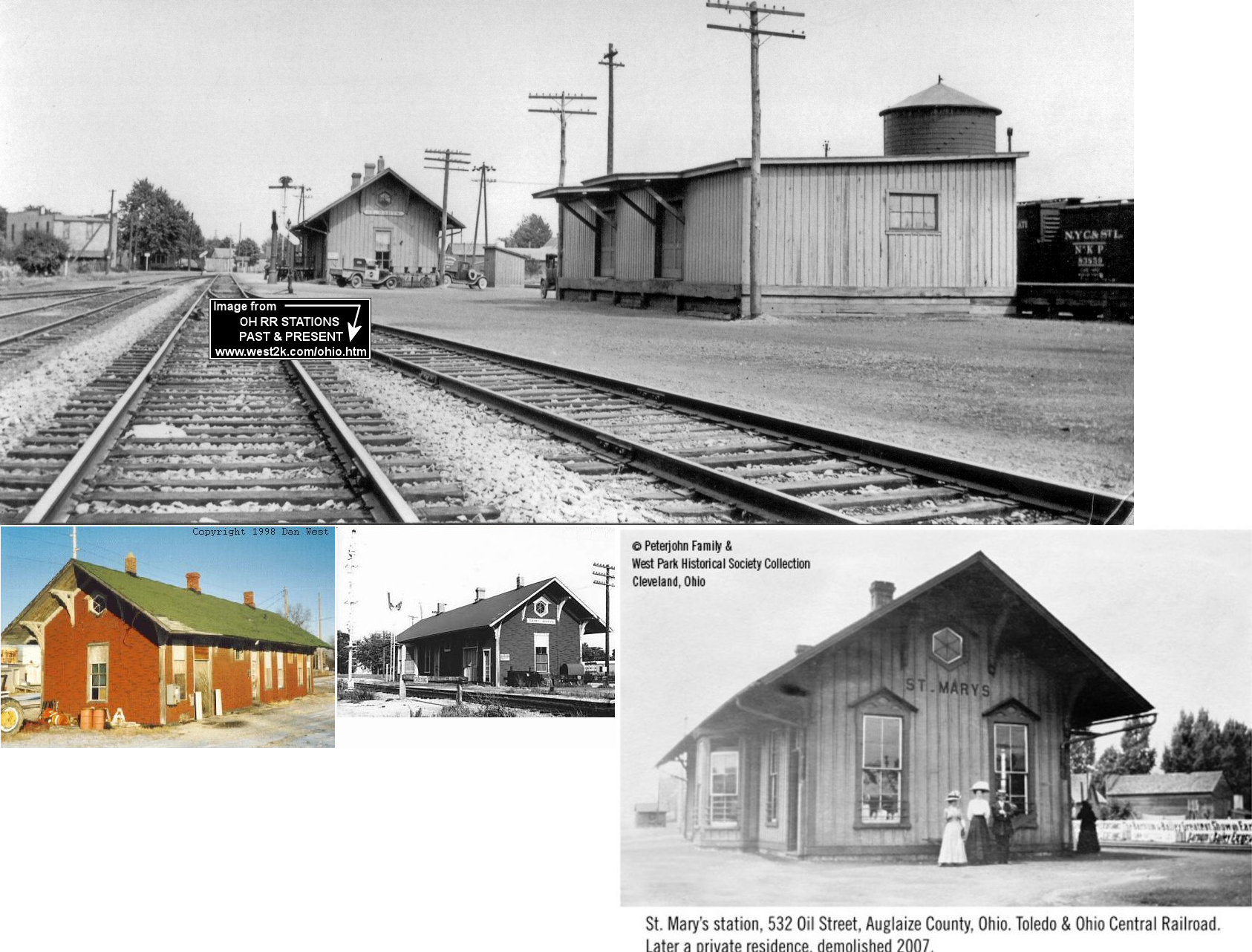
| St. Marys |
 |
604 Oil Street (GPS: 40.550036, -84.382285) |
C | Residence | ???? | None | Wood |
|
| Uniopolis |
|
Lincoln Park, off East Elm Street, Lima (GPS: 40.738184, -84.088975) |
P | Display | 1893 | None | Wood |
|
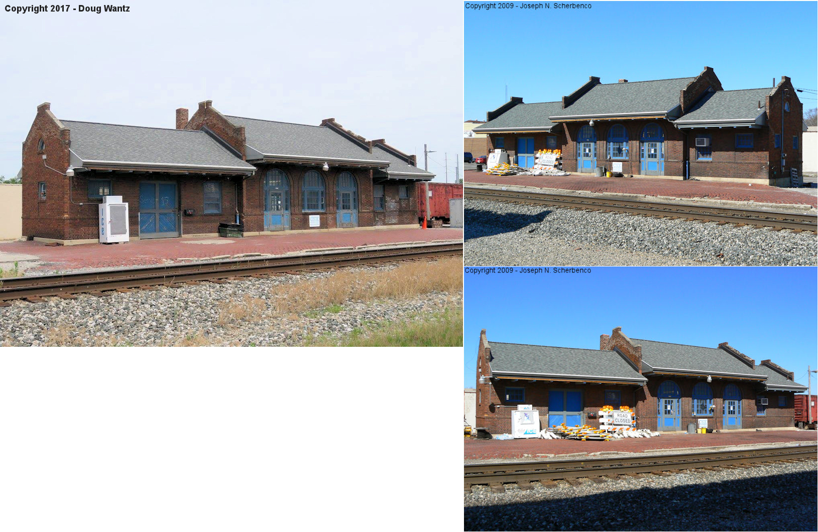
| Wapakoneta |
|
Auglaize County
Fairgrounds (GPS: 40.560575, -84.210020) |
F | Civic | 1898 | None | Wood |
|
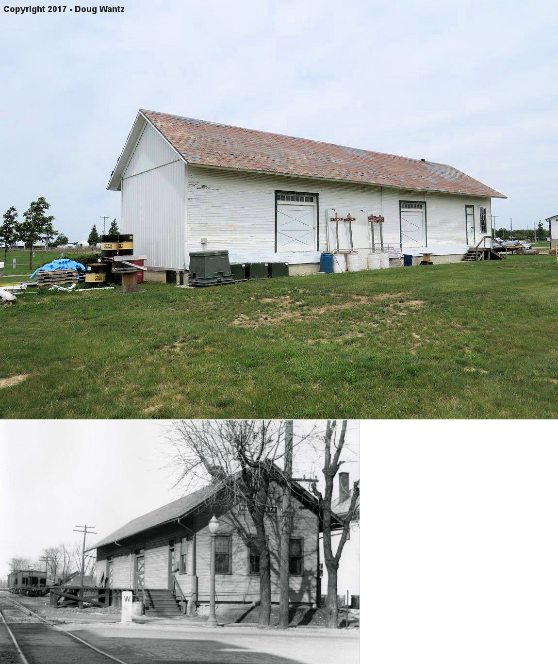
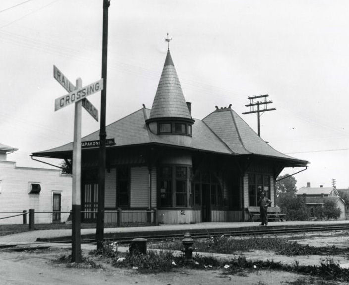
| Wapakoneta |
 |
North side of East Auglaize Street (GPS: 40.571261, -84.191267) |
P | Railroad | 1917 | In Use | Brick | |
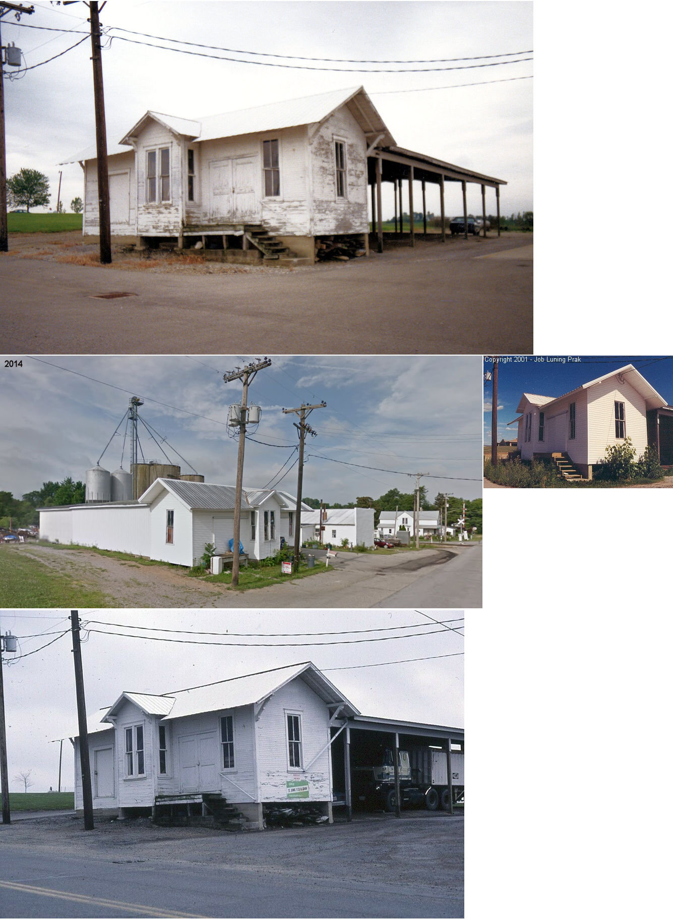
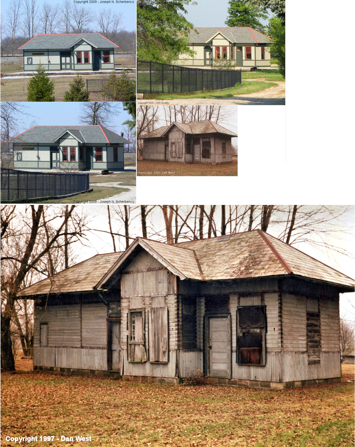
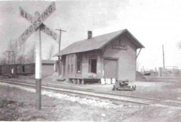
| Williamstown |
|
Behind house at 10241 Dixie Highway (CR 25A, North of Botkins). (GPS: 40.500367, -84.188171) |
P | Private | ???? | None | Wood |
|
| STATIONS OF THE PAST | ||||||||
| Station Name |
Original Railroad |
Notes | ||||||
| Buckland |
|
The LE&W station here was destroyed in a fire on March 24, 1923 (Marysville Journal Trubune, 3-26-1923). A baggage car served as the station for a few months while the new station was built. | ||||||
| Cridersville |
|
This station was on the north side of Main Street on the east side of the tracks. | ||||||
| Geyer |
|
This station was between High and Center Streets. | ||||||
| Glynnwood |
|
|||||||
| Gutman |
|
|||||||
| Minster |
|
This station was on the north side of of West 5th Street on the east side of the tracks. There was an engine house and turntable to the north. The station was gone from maps by the 1950s and Minster Machine expanded into the lot once occupied by the station. A freight station/express office was located on the south side of 5th Street. | ||||||
| Moulton |
|
The Moulton station was torn down in the 1940's and was located west of the switch connecting the Bellefonatine-St. Marys branch of the T&OC and the Detjen Grain Company. The building was torn down in the late 1940's and the tracks lasted until Conrail decided to abandon the line in the late 1970s or early 80's. | ||||||
| New Bremen |
|
There was a freight station about 75' to the south of the passenger station (still existing). The freight station can be seen on the 1933 Sanborn Map of New Bremen. | ||||||
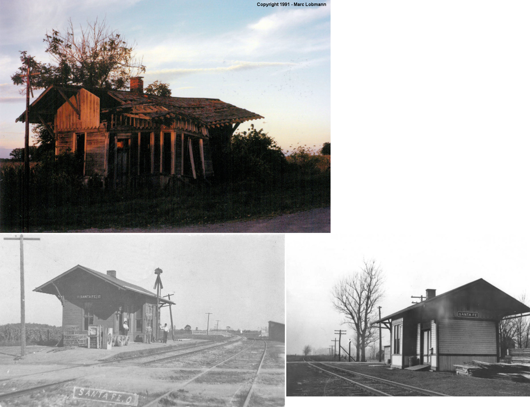
| Santa Fe |
|
The station was on Santa Fe Line Road on the north side of the tracks at GPS: 40.493998, -83.993554. | ||||||
| Slater |
|
Was moved to a farm south of the Slater crossing and stood until the early 1980s, when it just fell apart from neglect. It had been built in 1893 for the Ohio Southern Railroad, a photo of it appears on page 54 of Scott Trostel's DT&I book. | ||||||
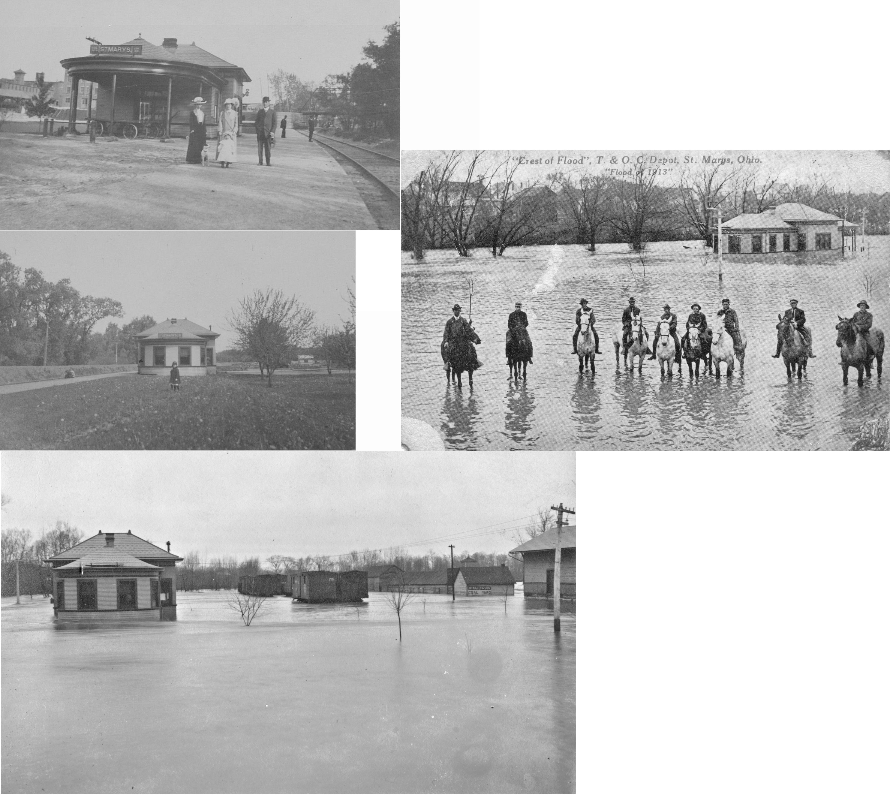
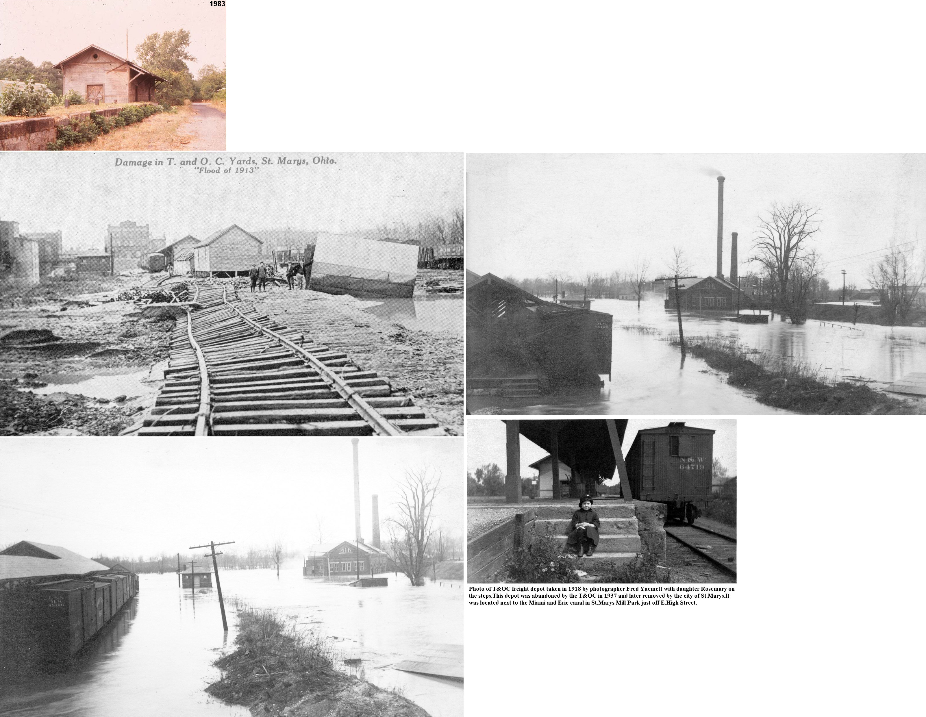
| St. Marys |
|
This station was built in 1870 and was located at Clinton and South Perry Streets. The depot was used by a roving agent by the Norfolk Western in the mid 1980's for the local serving St. Marys. As late as 1994 however, R. J. Corman used the facility as offices for the railroad he leased from the NS from Lima to Portland as well as the Minster branch. A few years ago R.J. Corman built a rail materials facilty between Celina and St. Marys and moved the offices there. The station was owned by the Western Ohio Rail Authority, controlled by a board comprised of citizens from New Bremen, Minster and St. Marys. In the 1990s-2000s, the station rapidly deteriorated and the station was finally demolished in late June of 2007 after failed attempts to procure and restore the building. The freight station was nearby and can be seen in the photo. | ||||||
| St. Marys |
|
This was the passenger station that was built around 1907 that replaced the older wooden station that is still standing on Oil Street. That older station was not in the same location as this newer brick station as the tracks were laid for the station. Some sources say the station was built in 1910, however it appears on the 1907 Sanborn map. It was located north of East High Street between the canal and the river on the east side of the tracks at GPS: 40.544879, -84.389640. There was also a freight station just to the east on a siding track. The passenger station was gone by 1949, but the freight station remained at that time. | ||||||
| St. marys |
|
This freight station was on the south side of West North Street, just east of the passenger station at GPS: 40.545078, -84.389130. | ||||||
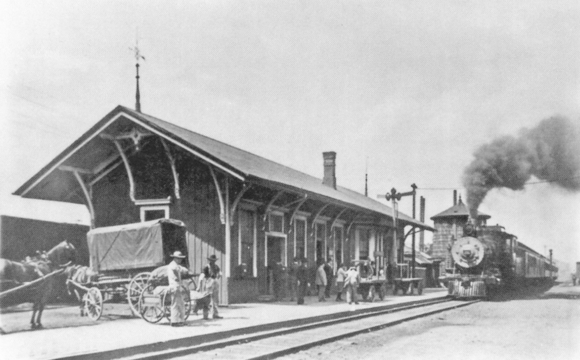
| Wapakoneta |
|
This station was on the east side of South Blackhoof Street between Vine and Plum Streets (the station used to sit on what was Race Street). It was on the north side of the tracks. The freight station (now at the Fairgrounds) was on the west side of Blackhoof Street. | ||||||
| Wapakoneta |
|
This was the earlier station that was replaced by the 1917 brick station that is still standing. | ||||||
| Wapakoneta |
|
There was a freight station on the east side of the tracks on the north side of Auglaize Street (across the tracks from the passenger station and closer to the street). It was on the west side of Depot Street. | ||||||
| 1898 AUGLAIZE COUNTY RAILROAD MAP | ||||||||
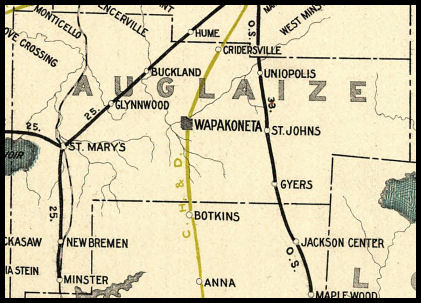 |
||||||||
|
Notes About Existing Stations... Buckland (LE&W) - The station was purchased by Pearl Bowsher in 1951 and moved from its original location to its current location (on property that Bowsher owned at the time) and restored. New Bremen (LE&W) - Around the mid 1970's, Crown Control owner James Dicke moved the ex-L.E.&W station from it's original Monroe Street location south of the Minster branch tracks to the Dicke Estate. Today, it is restored beautifully. This building is on private property and cannot be seen from any public road. Violators will be prosecuted as there is heavy security. However, arrangements can be made by inquiring at Crown's headquarters in downtown New Bremen. The station is located on the east side of New Bremen a few blocks south of New Bremen schools. The station was originally on the south side of Monroe Street on the east side of the tracks. St. Johns (Ohio Southern) - The station was relocated and turned facing east and west from the north south facing on the DT&I. The bay window faces north along old US 33. Inside, the walls are painted gray at the bottom and white above, a color scheme common to many way stations on the "Railroad that Henry Ford Built" Inside appearance is well preserved considering use and age of structure. Structure can be seen from US 33 bridge crossing Indiana and Ohio rails (former DT&I) looking south. --Daniel Meckstroth St. Mary's (T&OC) - This station was a rare two story T&OC station, built so that the station agent's private residence was on the second floor and the station offices were at ground level. Likely abandoned (sold) from railroad use prior to 1910, when new passenger station and freight house was built near downtown St. Marys along the Miami-Erie Canal. There is a possibility this station was built for the Columbus Northwestern Railroad at the time of the line's construction, though it cannot be confirmed (Scott Trostel). Uniopolis (Ohio Southern) - This station was moved from Uniopolis to Lima and is now on display in Lincoln Park near a steam engine also on display. Wapakoneta (T&OC Freight Station) - Moved from South Blackhoof Street in 1994. Williamstown (T&OC) - Moved in Summer 2002. Here is a photo after restoration. |
||||||||