 COUNTY COUNTY
|
|
||||||||
| EXISTING STATIONS | ||||||||
|---|---|---|---|---|---|---|---|---|
| Station Name |
Original Railroad | Current Location |
Type | Current Use |
Date Built |
Track Status |
Building Material |
More Info |
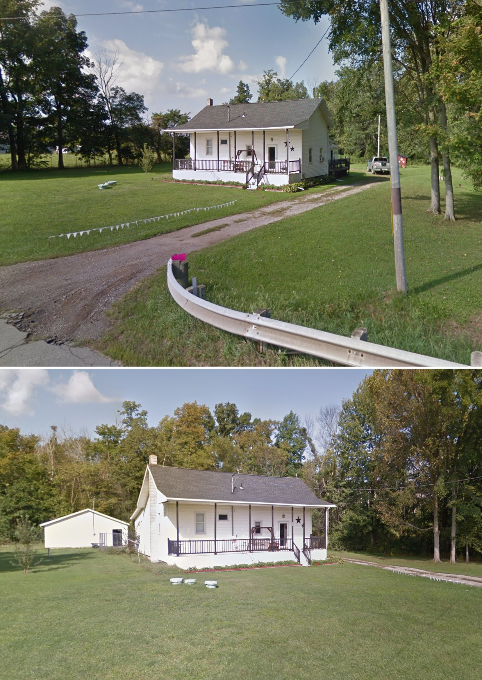
| Sullivan |
 |
78 State Route 58 (GPS: 41.052275, -82.221507) |
P | Residence | 1892 | In Use | Wood |
|
| STATIONS OF THE PAST | ||||||||
| Station Name |
Original Railroad |
Notes | ||||||
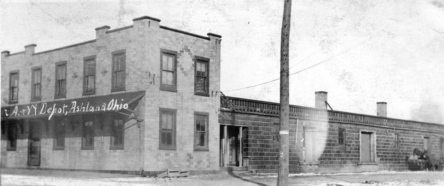
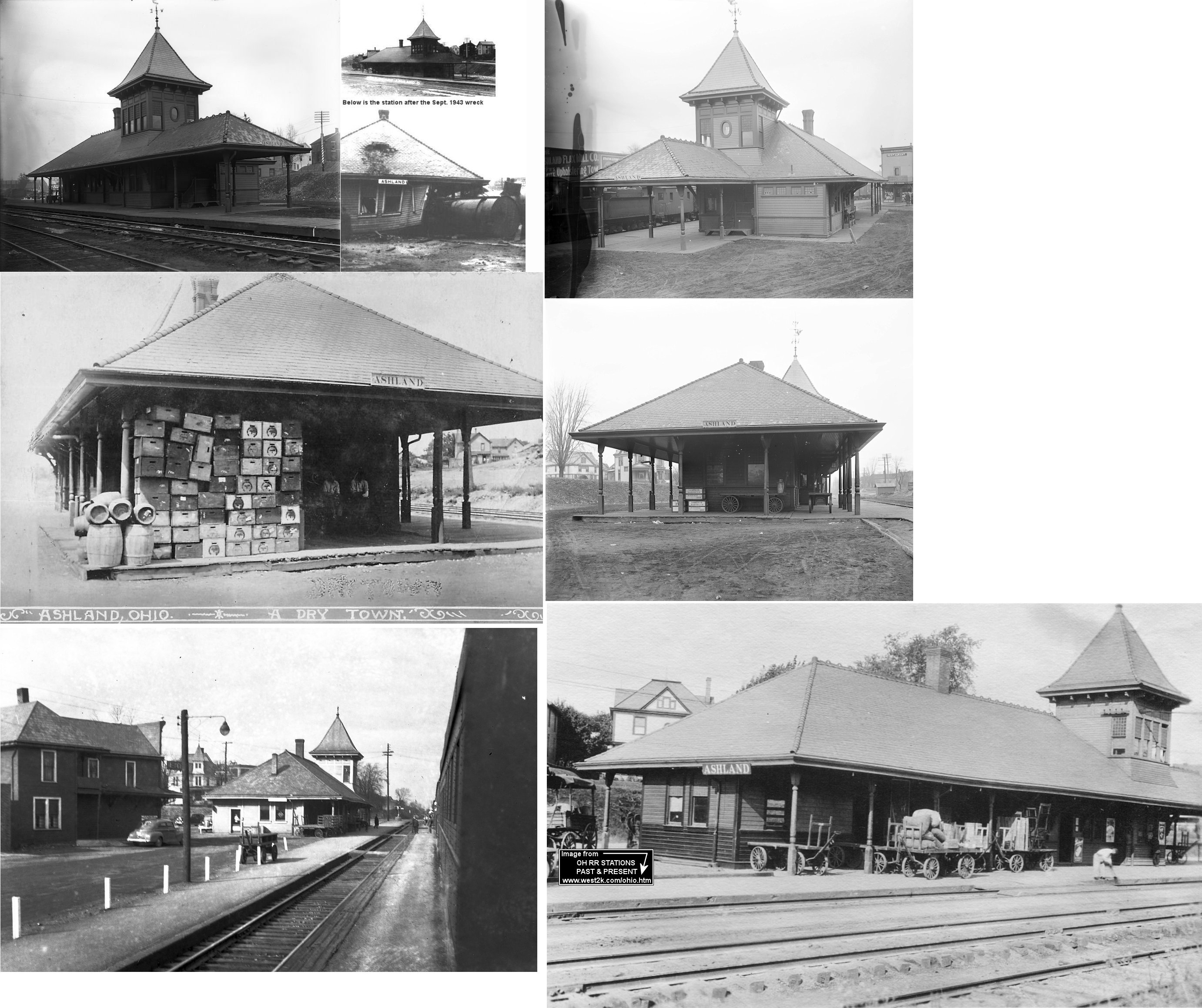
| Ashland |
 |
This large brick combination station was on the east side of Union Street between 4th and 5th (which is now 7th) at GPS: 40.871851, -82.312767. The Ashland & Wooster tracks ran parallel to the Erie tracks here. This building was later used as the PRR freight and passenger station. | ||||||
| Ashland |
 |
The first NYP&O passenger station here was on the west side of Orange Street at GPS: 40.872704, -82.315787. | ||||||
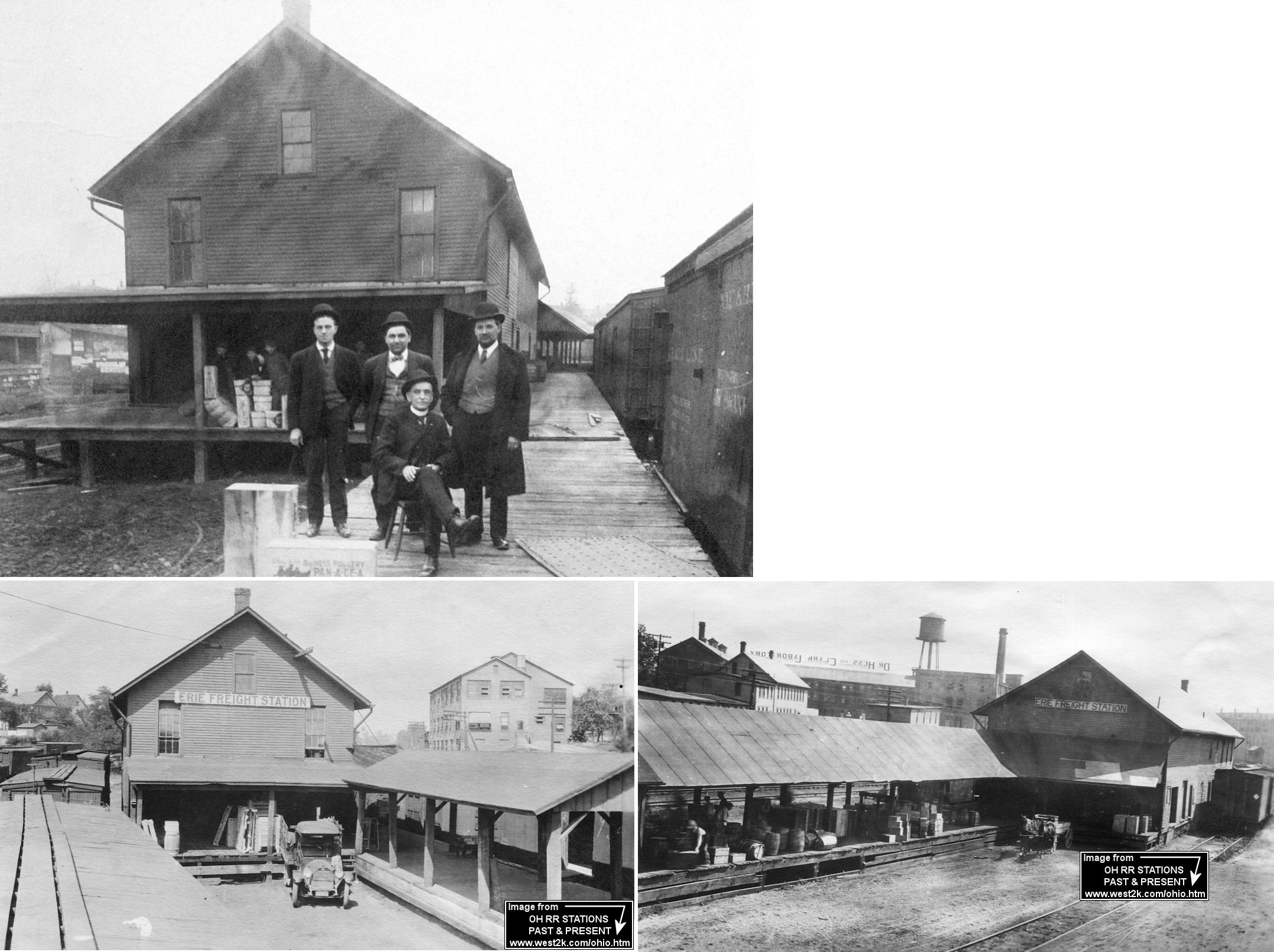
| Ashland |
|
This was the original frame freight station. According to Erie RR valuation records, the station was built in 1866. It was at the north end of Church Street at GPS: 40.873042, -82.316615. It was torn down in 1943 and replaced with a new brick passenger and freight depot following the demolition of the Erie passenger station in 1943. | ||||||
| Ashland |
 |
The passenger station was on Cottage Street at Prospect Street at GPS: 40.874508, -82.318468. According to Erie RR valuation records, the station was built in 1892. It was destroyed in a derailment in 1943. | ||||||
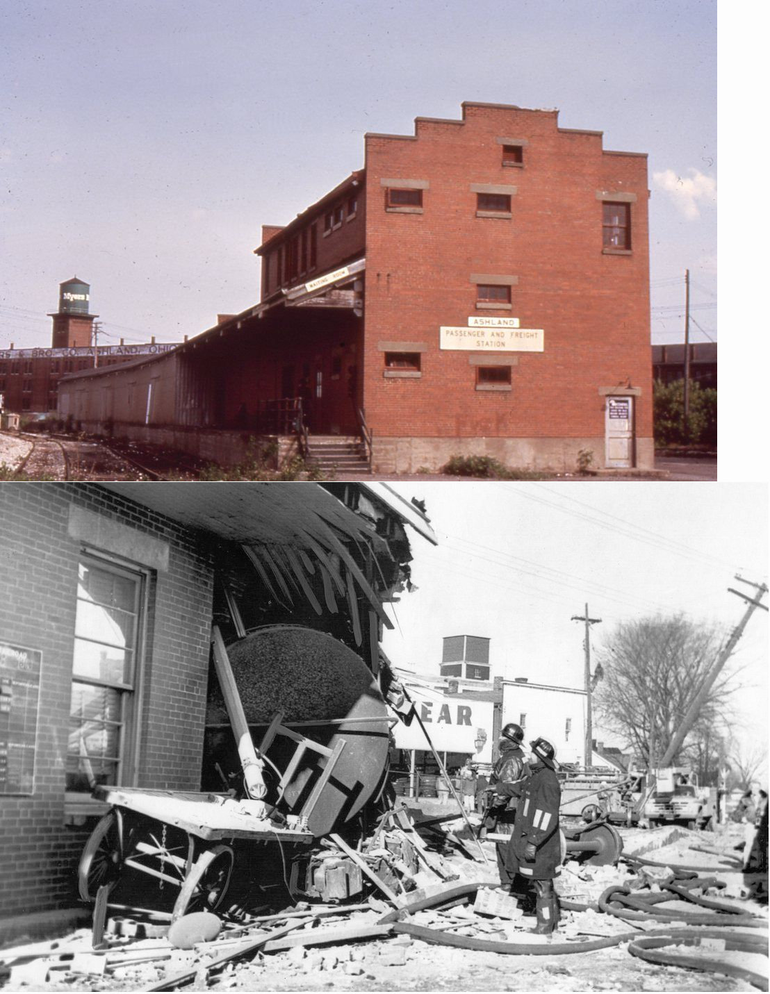
| Ashland |
|
The Erie freight depot was at the NE corner of Church and Pleasant Streets (the site of the original freight station) at GPS: 40.873042, -82.316615. After the passenger station was demolished in a 1943 derailment, this station was built to serve as a passenger and freight station. It was eventually damaged in another derailment in 1963 and subsequently demolished soon after. | ||||||
| Coulter |
 |
According to PRR valuation records, a shelter was built here in 1910. I beleive this station was just east of the county line in Ashland County on Twp-1075 in the vicinity of GPS: 40.693172, -82.337669. It was at same location as the Illinois Pipeline Company. Can anyone verify this location? Not sure which side of the county line this station was on. | ||||||
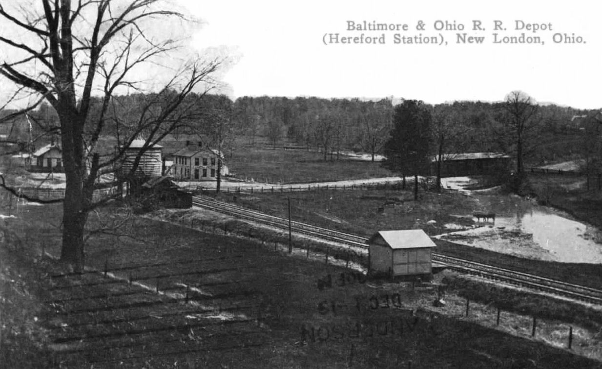
| Hereford (Herefork) |
|
This station was considered the B&O stop for New London as well. | ||||||
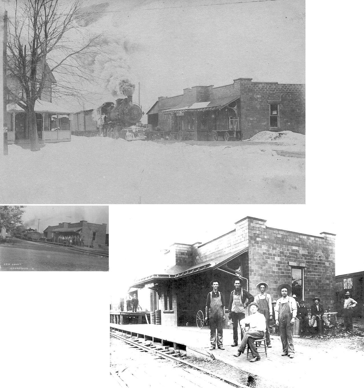
| Jeromesville |
|
This Ashland & Wooster station was on the north side of Main Street across the tracks from a hotel (which can be partially seen in the photo). The original name of this company was the Millersburg, Jeromesville and Greenwich Railroad Company, changed to the Ashland and Wooster Railway Company, by amendment to the Charter, March 2, 1897. The portion of the road from Ashland to Jeromeville, Ohio, 8.26 miles, was opened for operation September 6, 1899. The railroad was later part of the Lorain, Ashland & Southern. | ||||||
|
Loudonville (S. Loudonville) |
 |
This Toledo, Walhonding Valley & Ohio station was on Main Street just west of the river and next to the old Loudonville Electric Light Company. The TWV&O later became part of the PRR. A station is shown here on the 1923 PRR List of Stations & Sidings as "South Loudonville." | ||||||
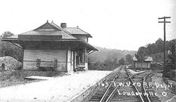
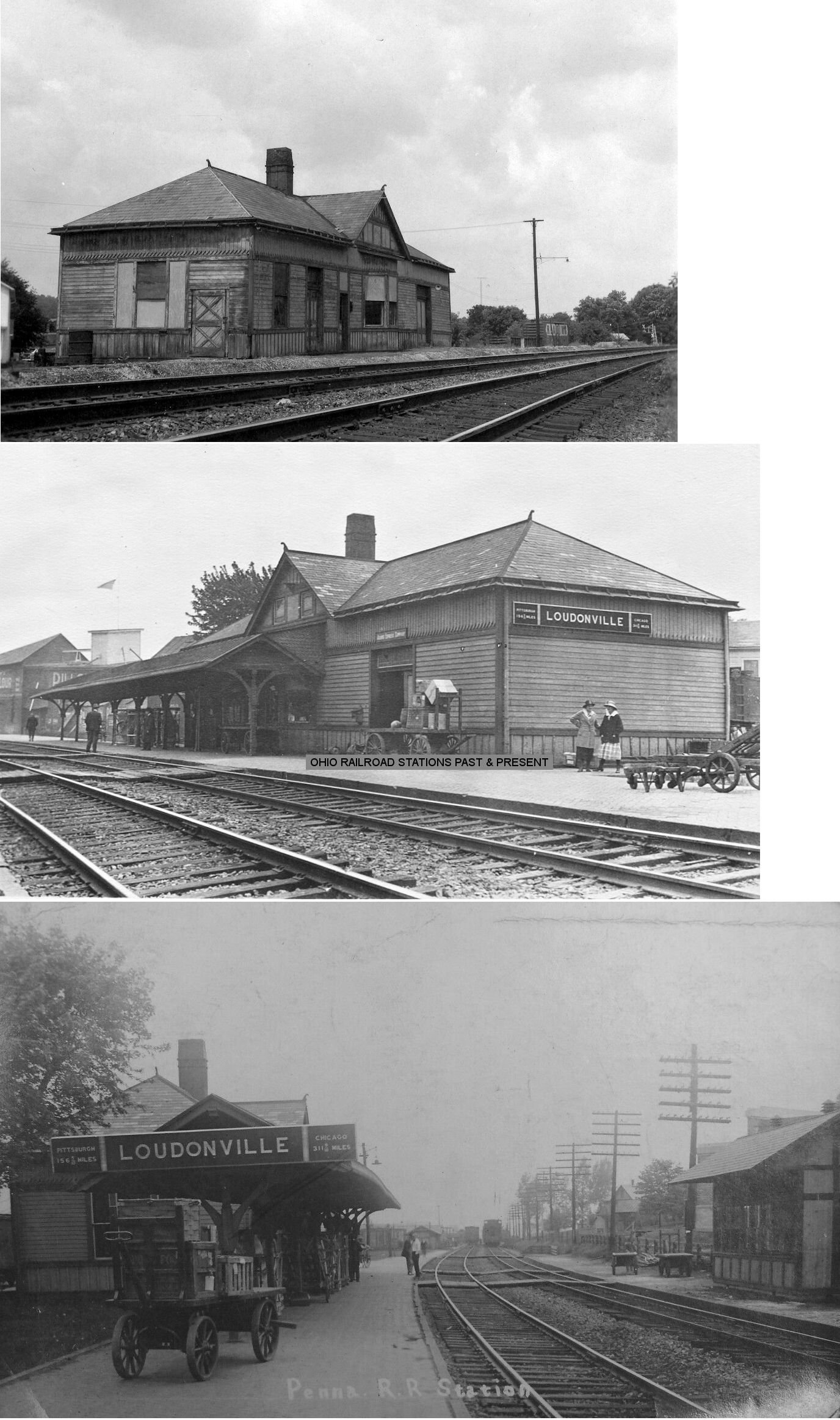
| Loudonville |
|
This station was on Water Street just north of Washington Street. According to PRR valuation records, this station was built in 1889. | ||||||
| Milton |
 |
|||||||
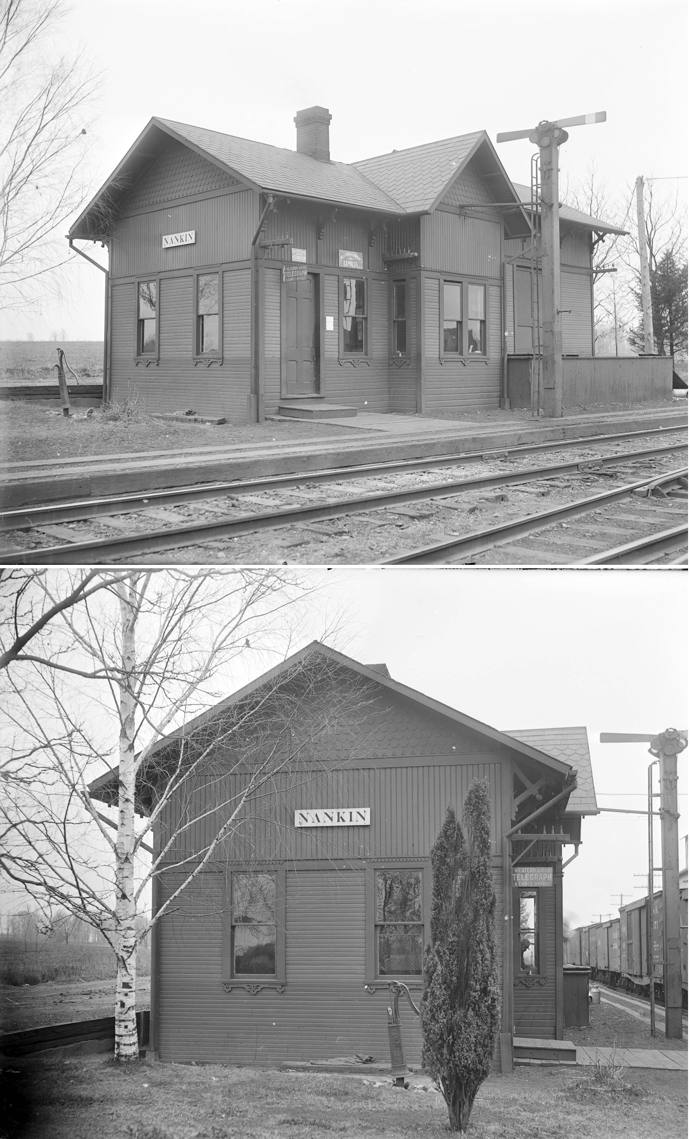
| Nankin |
|
According to the 1888 NYLE&W Annual Report, a new passenger station was built here that year. | ||||||
| Nova |
|
|||||||
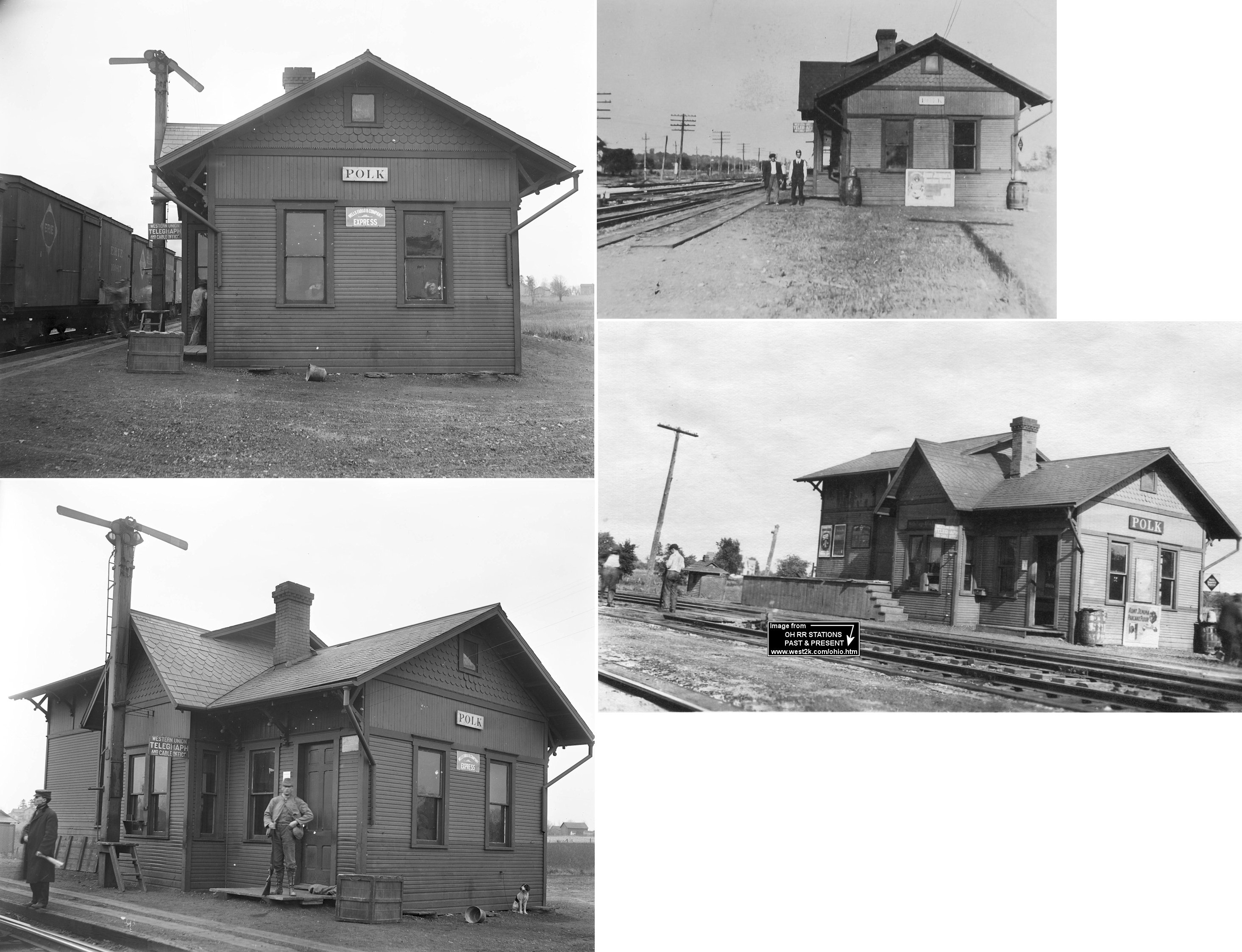
| Polk |
|
According to Erie RR valuation records, the station was built in 1887. | ||||||
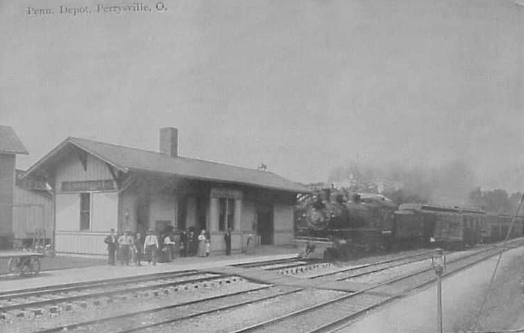
| Perrysville |
|
This station was located on the north side of Bridge Street next to the grain elevator. According to PRR valuation records, this station was built in 1902. | ||||||
| Ramey |
|
Ramey was near where Greenwich East Town Line Road and T-126 intersect in Ruggles Township. | ||||||
| Taylors Mills |
|
The 1874 map shows a siding branching north to a station (possibly a freight station at a farm). This was between CR 775 and the Black Fork River on the eastern edge of Section 35, Green Township, just NW of Loudonville. | ||||||
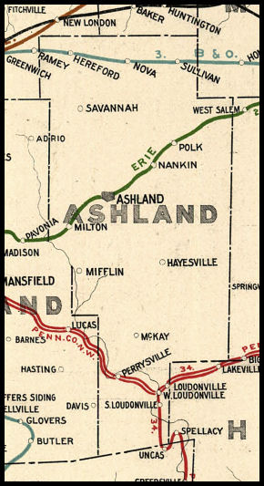
| 1898 aSHLAND COUNTY RAILROAD MAP | ||||||||
 |
||||||||
|
Notes About Existing Stations... Sullivan (B&O) - Approx 1.5 miles north of Sullivan, Ohio on S.R. 58. Has been converted to a house. This station was the first built on the original Akron & Chicago Jct. (B&O) line from Akron to Willard. The line once ran several hundred feet south of the present line in Sullivan. The station was moved north when the line was changed to avoid a significant grade between Sullivan and Lodi, Ohio. It is the only known railroad station still in existence in Ashland County. |
||||||||